
Pearce Point DEW Line Station, Canada
At a remote Arctic harbour, a small crew kept two Doppler warning paths operating between larger DEW Line stations.
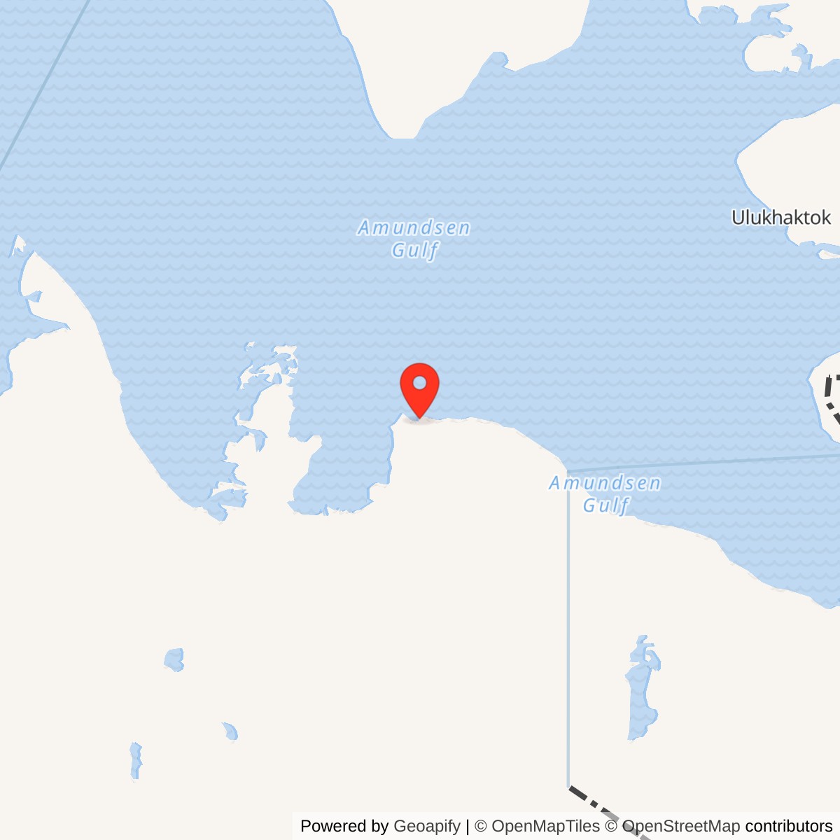
Longitude: -122.70694
Site Number: PIN-A
Current Role: Former DEW station site; Canadian records describe completed remediation and transfer to Inuvialuit lands.
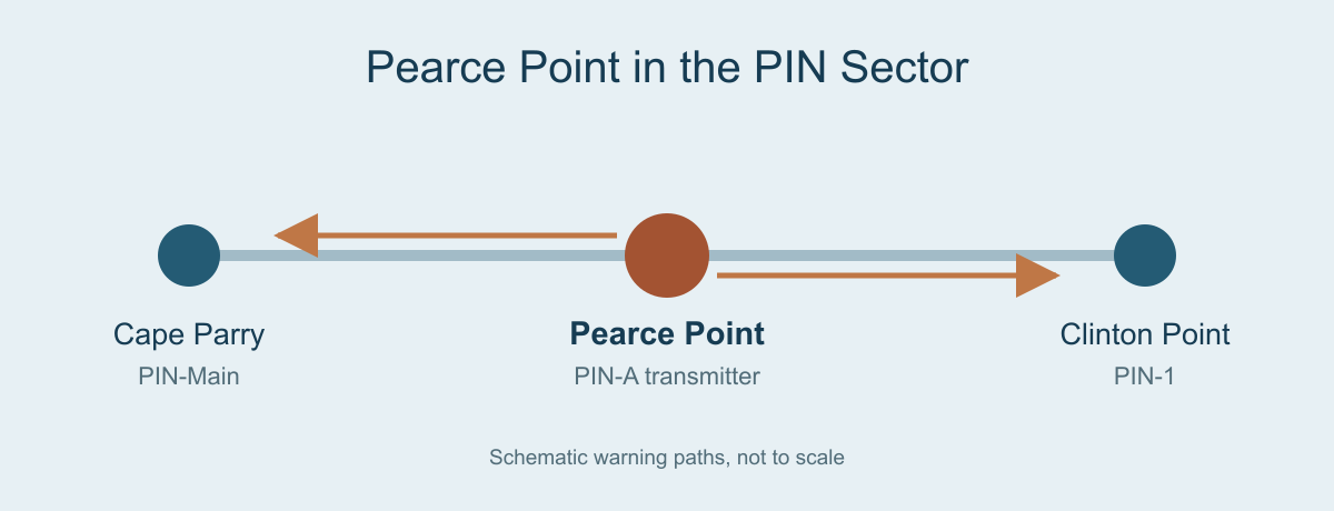
Pearce Point PIN-A was a small intermediate station on the Canadian DEW Line. It transmitted AN/FPS-23 Doppler warning paths between Cape Parry and Clinton Point from August 1957 until July 21, 1963. [1] [2] [5]
- DEW Line code
- PIN-A
- Role
- Intermediate Doppler warning station
- Equipment
- AN/FPS-23
- DEW service
- August 1957 to July 21, 1963
- Approximate location
- 69.80139, -122.70694
Building an Intermediate Station
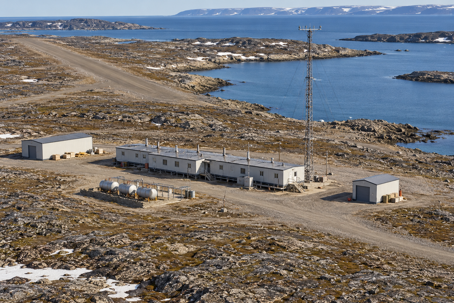
Pearce Point occupies a remote stretch of the western Canadian Arctic coast east of Cape Parry. Its sheltered harbour, low hills and nearby airstrip made it a workable, if difficult, place for an intermediate warning post. The station stood within the PIN sector between the Cape Parry Main station and Clinton Point auxiliary station. [1] [3] [8]
Western Electric's construction effort reached the point in 1955. A June aerial shows the old airstrip and harbour. Photographs from August record landing craft carrying materials ashore, while a Royal Canadian Mounted Police shack served as a temporary construction office. By August 1956, the connected module train was nearly complete and an Anson aircraft could use the strip. The shoreline landing and airfield were the two practical routes for heavy materials and personnel. [3] [7]
The station had the scale of an intermediate post, not a Main station. The connected prefabricated modules sheltered its equipment and basic living spaces. The usual intermediate arrangement also had a separate garage, warehouse, fuel storage and a tall antenna tower. The surviving construction pictures establish the local module train and transport routes; the other facilities follow the documented intermediate-site pattern. [3] [4] [5]
The Doppler Warning Mission
PIN-A entered DEW Line operation in August 1957 with AN/FPS-23 equipment. An intermediate station carried continuous-wave Doppler transmitters, aimed along the line toward the two larger neighbouring stations. Receivers at Cape Parry and Clinton Point watched for a crossing signal. This system was intended to warn of low-flying aircraft passing through coverage gaps between the long-range search radars. [1] [2] [5]
The station did not operate an AN/FPS-19 rotating search radar. Its job was to sustain the transmitted paths, power, heating and communications that allowed other stations to register a possible crossing. A warning from the Doppler fence still needed assessment by the staffed radar and data network before it could contribute to an air-defense response. [1] [2] [5]
The transmitters depended on a small crew. Veterans describe a typical intermediate site staffed by a radar technician, inside mechanic, outside mechanic and cook, with variations from station to station. The crew tended the generators and electronics, kept the airstrip and access routes usable, and maintained heat and supplies through long winter isolation. No surviving Pearce Point roster has been located, so that pattern describes the station class rather than an exact local headcount. [4] [5]
Resupply and Daily Life
A 1962 visitor described Pearce Point Harbour below the station and a beached LST 1072 with its bow doors open. Landing craft moved between ship and shore. The scene shows how the annual open-water season brought fuel, food and equipment that a small aircraft could not carry in sufficient quantity. The station's separate airstrip handled people, mail and urgent parts when weather permitted. [3] [6]
Living beside the radar equipment meant that technical and domestic routines were tightly linked. The modular building kept the crew near its watches, while work at the tower, garage, tanks and runway required going outside in severe wind and cold. The isolated post depended on trained mechanics as much as on the radar transmitter itself. [2] [4] [5]
Closure and Legacy
The intermediate Doppler concept performed less reliably than its planners hoped. Air Defense Command records describe missed low-level crossings and false alarms during testing. On July 21, 1963, the dedicated intermediate stations, including Pearce Point, ceased operation. Cape Parry and Clinton Point continued their separate DEW Line missions after PIN-A closed. [1] [2]
The former station later remained a recognizable site on the Arctic coast. Canadian archival records preserve a 1955 PIN-A file and a 1989 modernization file concerning Pearce Point, while photographs of a later North Warning System facility identify it as near, rather than the same as, the original intermediate site. The 1957-63 PIN-A station was never converted into a long-range radar post. [3] [7]
The Canadian government eventually completed cleanup and inspection tours at the former site. Its land was transferred to the Inuvialuit under the Inuvialuit Final Agreement. The military history of Pearce Point is therefore a short but distinct chapter: six years maintaining a Doppler warning path between larger stations, followed by the physical legacy of the abandoned post. [8] [9]
Chronology
- 1955: Construction work reaches Pearce Point; the airstrip, harbour landing and temporary office appear in photographs. [3] [7]
- August 1956: The modular station train is nearing completion. [3]
- August 1957: PIN-A begins operation with AN/FPS-23 Doppler equipment. [1]
- 1962: A visiting supply crew records the harbour, landing craft and LST 1072. [6]
- July 21, 1963: The intermediate station closes with the dedicated Doppler fence posts. [1] [2]
- By 2009: Canadian reporting records completed remediation, inspection and land transfer to the Inuvialuit. [9]
Related Sites
Information sources (9)
- PDFAerospace Defense Command, Historical Data of the Aerospace Defense Command, 1946-1973, DEW Line station table, p. 189
Station-specific PIN-A entry for the August 1957 opening, AN/FPS-23 and July 21, 1963 closure.
- PDFThomas W. Ray, A History of the DEW Line, 1946-1964, NORAD Historical Study No. 31
Primary operational history of the intermediate Doppler fence, its performance and the 1963 closures.
- WEBThe DEWLine, Pearce Point PIN-A station record and Markham Cheever construction photographs
Dated 1955-56 images of the airstrip, module train, shore landing, aircraft and temporary construction office.
- WEBThe DEWLine, Intermediate Site Layouts and operating account
Veteran descriptions of the standard small module train, warehouse, garage, Doppler tower and station crew.
- WEBThe DEWLine, A Brief Introduction, Intermediate Sites
Description of east and west Doppler transmitters, paired receivers at adjacent stations, crew pattern and supply runway.
- WEBJ. L. Ares, 1962 DEW Line radar sites, Pearce Point visit and photographs
Firsthand account of the harbour, beached LST 1072 and landing craft during a 1962 resupply visit.
- PDFLibrary and Archives Canada, accession 2009-00786-7, DEW Line Station PIN-A Pearce Point file 5-24-2-1
Archival finding aid identifying a 1955 Pearce Point station file and later 1989 modernization records.
- WEBGovernment of Canada, Northwest Territories Lands and Resources Devolution Agreement, schedules 7-17
Government entry identifying former PIN-A Pearce Point as site NM128, an Inuvialuit Annex R parcel, with approximate coordinates.
- PDFIndian and Northern Affairs Canada, Contaminated Site Remediation, 2009, Pearce Point entry
Records completion of remediation, transfer of the former site to the Inuvialuit and conclusion of inspection tours.