
Horton River DEW Line Station, Canada
A small Doppler warning post above the Malloch Hills cliffs served the DEW Line for six years. Decades later, a new short-range radar returned to the same coast.
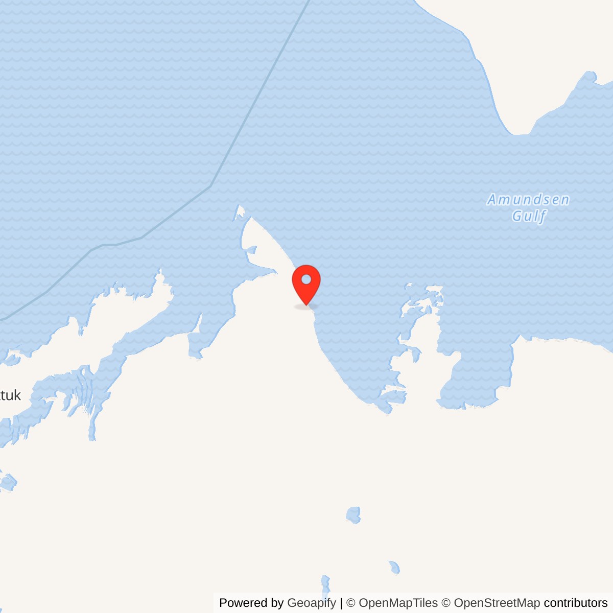
Longitude: -126.94309
Site Number: BAR-E
Current Role: North Warning System short-range radar established June 1991; successor installation documented in 2009 Canadian sailing directions.
Horton River, code BAR-E, was an intermediate station on the Canadian Distant Early Warning Line. Its AN/FPS-23 Doppler equipment entered service in August 1957, linking the warning fence between Nicholson Peninsula and Cape Parry. The original station closed on July 21, 1963. A North Warning System short-range radar site was established on the Malloch Hills coast in June 1991. [1] [2] [5] [6]
- DEW Line code
- BAR-E
- Other name
- Malloch Hills
- Original role
- Intermediate Doppler warning station
- Original equipment
- AN/FPS-23
- DEW service
- August 1957 to July 21, 1963
- Later use
- North Warning System short-range radar from June 1991
- Approximate location
- 70.01639, -126.94309
A Station Above the Arctic Coast
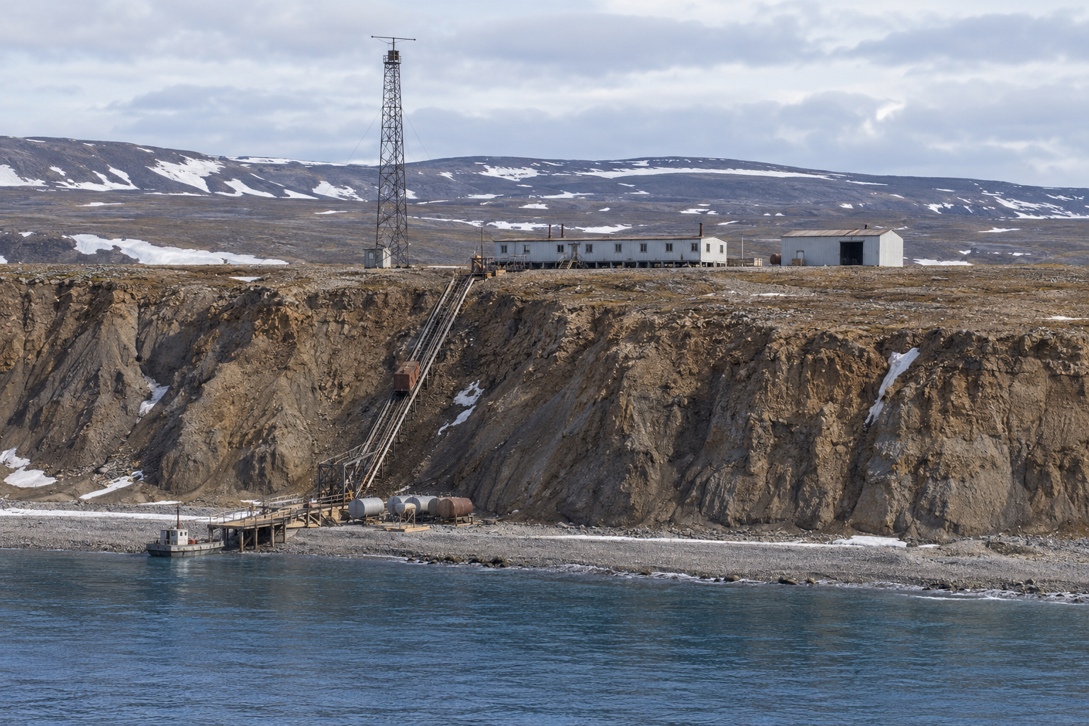
The original post stood above the Beaufort Sea near the Horton River mouth, in the area also called Malloch Hills. Its high coastal site gave the Doppler installation a clear path along the warning line. A 1962 visitor described steep cliffs with the radar buildings at the top and fuel storage at the shore. [4] [5]
The separate heights of the shore landing and station compound shaped every major delivery. Ships and landing craft could bring heavy fuel and equipment to the beach in the short open-water season. A mechanical cargo lift was reported on the cliff route, while the station also depended on its airstrip for personnel, mail and urgent parts. [4] [9]
Buildings, Equipment and Supplies
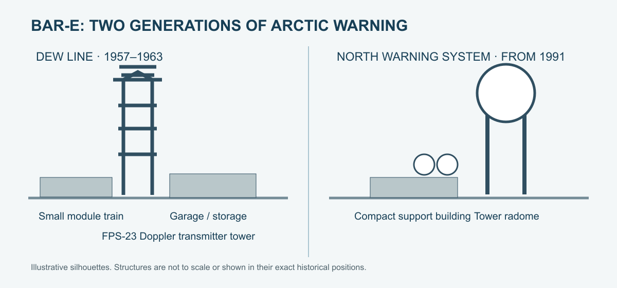
BAR-E was an intermediate station, much smaller than a main or auxiliary DEW Line post. A typical station of this class used an approximately 80-foot connected module train, a separate 40-by-30-foot warehouse, a garage of similar size and a tall antenna tower. The connected modules sheltered the technical equipment and essential living spaces from the weather. [3]
The AN/FPS-23 transmitted a continuous-wave signal across the gap between larger radar stations. Receivers at the neighboring stations watched for changes caused by aircraft crossing that path. BAR-E therefore had no large AN/FPS-19 search-radar radome in its original configuration. The tower, transmitter, generators, fuel storage and communications were the equipment needed to keep its part of the line working. [1] [2] [3]
Fuel was vital to the generators and heat during Arctic winter. The 1962 shoreline photographs show tanks below the cliff-top compound. Storage and transportation facilities mattered as much as the radar electronics: a missed delivery could leave a small crew with little local backup. [3] [4]
The Crew and Its Work
The intermediate sites were conceived as unmanned equipment posts, but the transmitters needed regular tuning and maintenance. At stations of this type, an initial two-person team of a radar technician and mechanic was later enlarged with a cook and a local heavy-equipment operator. [3]
Daily work centered on keeping the signal, power and heat steady, clearing snow, repairing machinery and receiving supplies. The crew lived close to the equipment, with few people to share watches or cover a failed generator. Work at the shore required travel between the landing and the exposed cliff-top station. Weather and ice governed when an aircraft or ship could reach them. [3] [4]
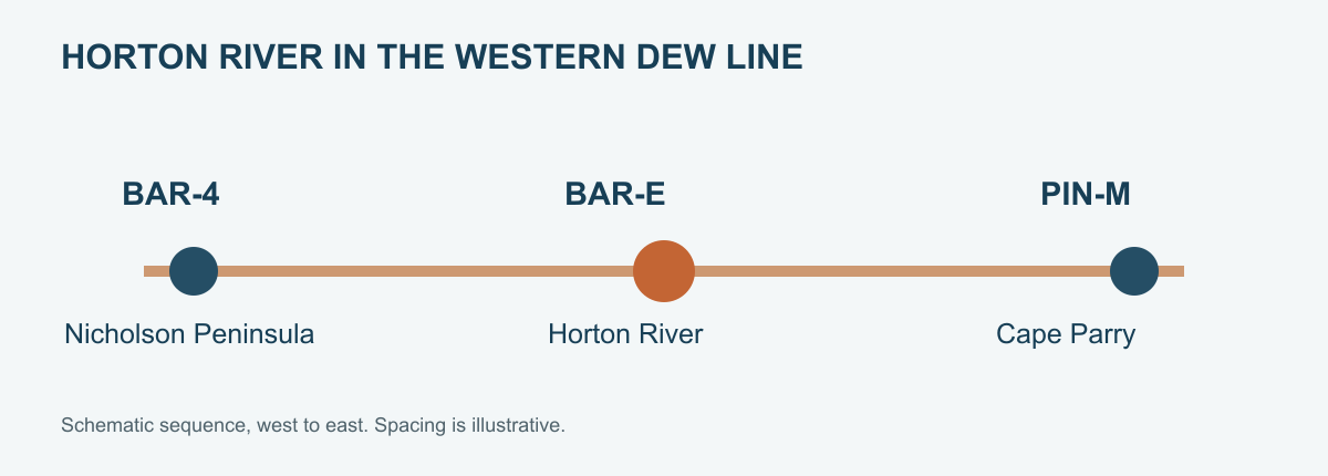
BAR-E was part of a warning network rather than a fighter base. Its Doppler path added low-altitude coverage between the long-range stations at Nicholson Peninsula BAR-4 to the west and Cape Parry PIN-Main to the east. An alarm had value only when it reached the staffed radar and communications system in time for further assessment. [1] [2] [5]
Closure and the Later Radar Site
The intermediate-station concept proved less dependable than planned. Air Defense Command tests recorded missed low-level crossings and many false alarms, and the command ultimately ended all 28 dedicated AN/FPS-23 intermediate stations on July 21, 1963. Horton River closed with that group. [1] [2]
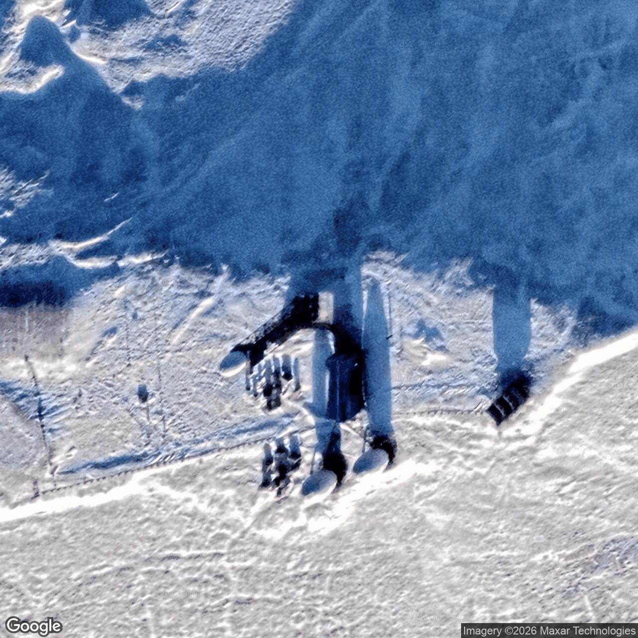
Horton River returned to the continental warning network when a North Warning System short-range radar site was established in June 1991. The new installation replaced the 1950s FPS-23 mission. A 2009 Canadian sailing guide describes a white radome on a tower, two domes at ground level and one nearby building. [5] [6] [7]
The abandoned DEW Line facilities were cleaned up in 1994, with later environmental monitoring. The original intermediate station and its successor show two very different approaches to the same Arctic warning corridor: a small resident crew maintaining a Doppler fence in the 1950s, followed decades later by a compact short-range radar site. [3] [6] [8]
Chronology
- 1955: Western Electric receives a BAR-E siting report covering the location and facilities planned for Horton River. [9]
- August 1957: BAR-E enters DEW Line service with AN/FPS-23 Doppler equipment. [1]
- 1962: A visiting sealift crew photographs the cliff-top compound and shoreline tanks. [4]
- July 21, 1963: BAR-E closes with the other dedicated AN/FPS-23 intermediate stations. [1] [2]
- June 1991: The North Warning System establishes a short-range radar site at Horton River. [5] [6]
- 1994: Cleanup of the former intermediate station is undertaken. [8]
- 2009: Canadian sailing directions describe the tower-mounted radome and smaller structures at the successor site. [7]
Related Sites
Information sources (9)
- PDFAerospace Defense Command, Historical Data of the Aerospace Defense Command, 1946-1973, DEW Line station table, p. 189
Station-specific record identifying Horton River BAR-E, August 1957 activation, AN/FPS-23 and July 21, 1963 closure.
- PDFNORAD and U.S. Northern Command, A History of the DEW Line, 1946-1964, Historical Study No. 31
Primary operational account of the Doppler gap-warning network, intermediate stations, tests and 1963 closure.
- WEBThe DEWLine, Auxiliary and Intermediate Site Layouts, by Clive Beckmann and Brian Jeffrey
Veteran account of the typical intermediate module train, garage, warehouse, tower and small contractor crew.
- WEBJ. L. Ares, 1962 DEW Line radar sites, Horton River BAR-E recollection and photographs
First-person 1962 visit describing the cliff-top compound, shoreline tanks and a reported cliff-side mechanical cargo lift.
- PDFArctic Institute of North America, The Distant Early Warning Line: A Bibliography and Documentary Resource List, station table, p. 19
Documents BAR-E as Horton River or Malloch Hills, intermediate site, 1963 closure and June 1991 North Warning System successor.
- PDFDefence Research and Development Canada, Survey of COTS-MOTS Lighter than Air Platforms and Communication Relays, CR 2012-076, Annex B, p. 119
Canadian government table confirming BAR-E coordinates, the original intermediate role and June 1991 short-range radar site.
- PDFCanadian Hydrographic Service, Sailing Directions and Small Craft Guide Corrections, Section 4, Edition 02/2010, p. 10
Describes the Malloch Hill North Warning System site as a tower-mounted white dome, two ground-level domes and one building.
- PDFIndian and Northern Affairs Canada, Contaminated Site Remediation, 2009, Horton River BAR-E entry
Identifies Horton River as a former intermediate station and summarizes the 1994 remediation and later monitoring.
- PDFThe DEW Line: An Annotated Bibliography, entry 248, 1955 BAR-E Siting Report
Identifies the original Western Electric/Spartan Air Services station-specific siting report and the facilities addressed in it.