
Cambridge Bay DEW Line Station, Canada
A central Arctic sector station linked long-range radar, communications, aircraft support and military command.
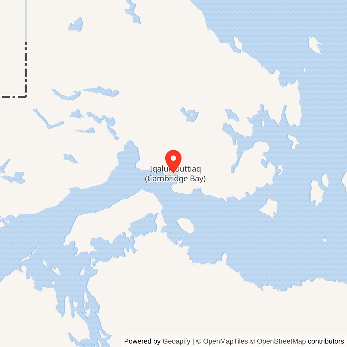
Longitude: -105.11912
Current Role: North Warning System long-range radar and logistics support site identified in the Canadian defence station inventory.
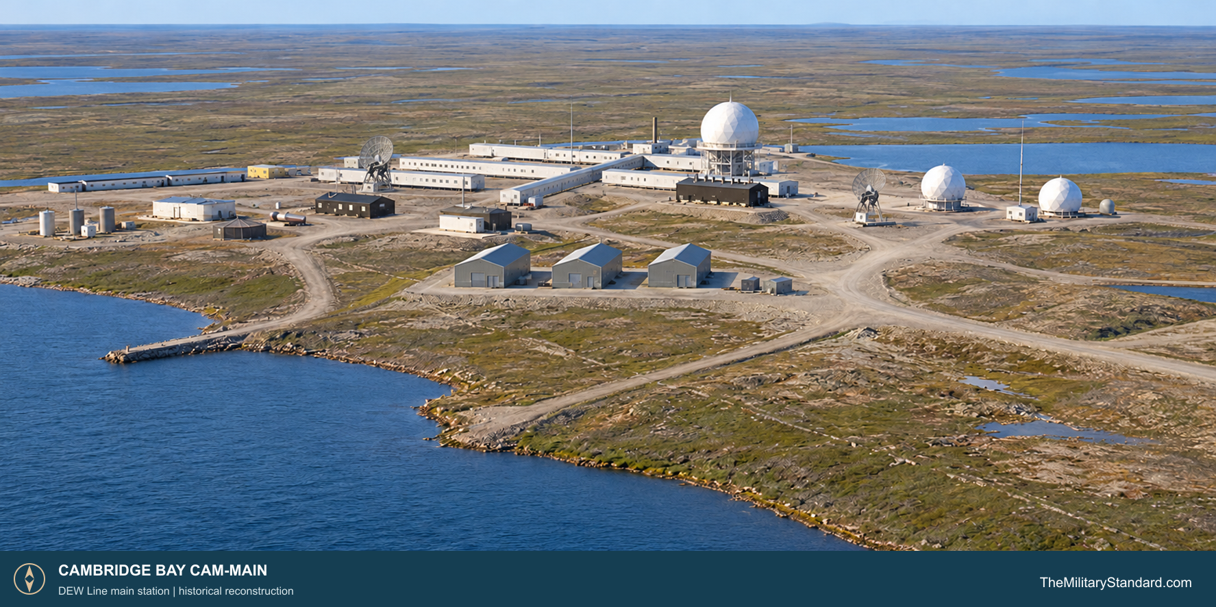
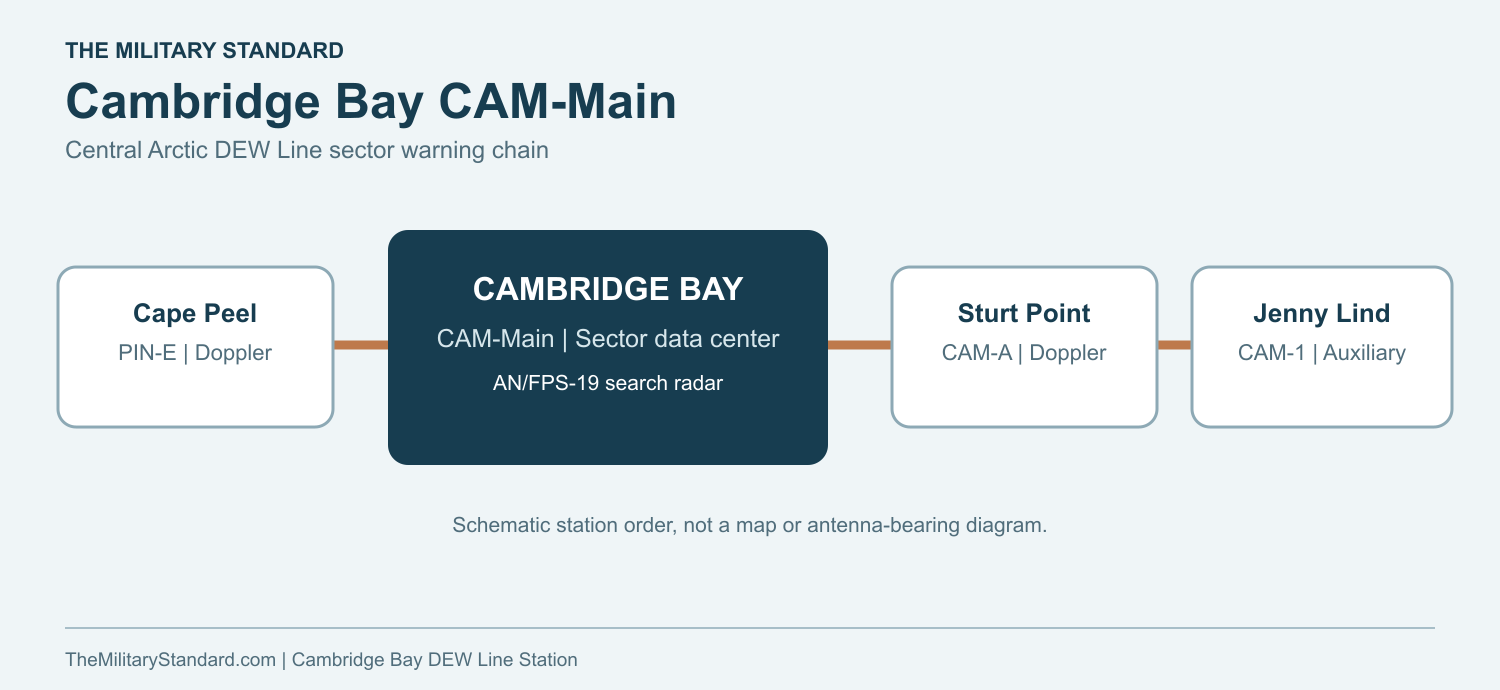
Cambridge Bay CAM-Main was a central Arctic sector main station of the original Distant Early Warning Line. It stood on the southern coast of Victoria Island, about three kilometers west of the Cambridge Bay community. Its long-range radar searched the northern approaches, while its data center received and assessed reports from smaller stations in the CAM sector. The neighboring chain included Cape Peel PIN-E to the west and Jenny Lind Island CAM-1 to the east. [1] [5] [6] [7]
- DEW Line code
- CAM-Main
- Original role
- Sector main radar and data center
- Original equipment
- AN/FPS-19 and AN/FPS-23
- Later equipment
- AN/FPS-117
- Opened
- August 1957
- Later role
- North Warning System long-range radar and logistics support site
- Location
- Near Cambridge Bay, Victoria Island, Nunavut
Cambridge Bay and the Central Arctic Warning Line
The station occupied a broad coastal tract on low tundra beside lakes and the western arm of Cambridge Bay. A contemporary site description placed the radar camp on a gently rising plateau above coastal cliffs. The setting offered clear radar and communications horizons but demanded its own water, fuel, electric power, roads and air access. The main station was substantially larger than the small Doppler transmitter camps between the search-radar sites. [3] [5]
Building the Main Station
Survey and construction work developed the station during the 1955 to 1957 DEW Line building campaign. Crews prepared foundations, roads, a runway and fuel facilities while prefabricated buildings and radar equipment arrived through the short Arctic transport season. The Cambridge Bay photo collection records a 1956 summer resupply unloading at about 11 p.m., an illustration of how continuous daylight helped crews use every available hour. [2] [3] [5]
On December 12, 1956, an informal ceremony at Cambridge Bay marked the transfer from Western Electric to the U.S. Air Force and then to Federal Electric, the operating contractor. Royal Canadian Air Force officers attended. The ceremony documented the shift from building the network toward running it, although final inspection and operational acceptance continued into 1957. Aerospace Defense Command records CAM-Main operating by August 1957. [1] [2]
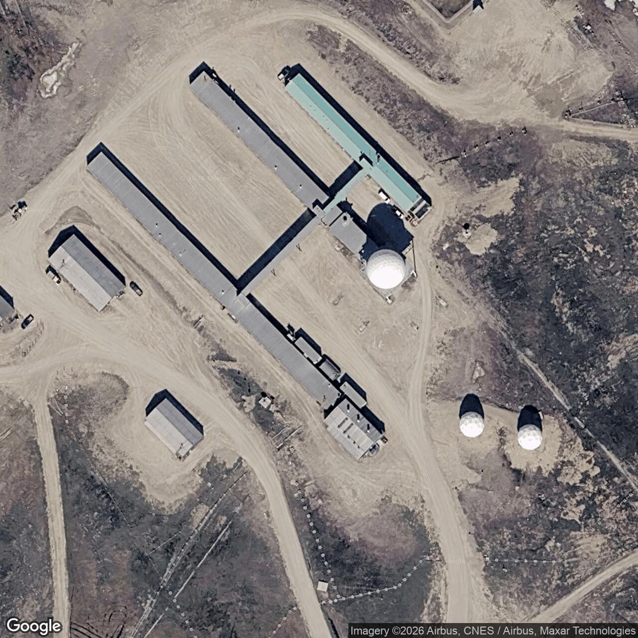
The completed site combined the radar and data center with a large connected building complex. A historic plan places the main module trains around the radar area and shows a separate power house, warehouse group, garage, air terminal, hangar, 5,000-foot runway, fuel storage, cargo beaching area, construction camp and lake-water supply. These were working parts of one remote military station, tied together by service roads and fuel lines. [3] [5]
Radar, Communications and Warning Operations
The original search set was the AN/FPS-19, a rotating long-range radar protected by a radome. CAM-Main also carried an AN/FPS-23 Fluttar receiver for low-altitude Doppler paths from intermediate transmitter sites. Search returns and Doppler alarms reached the main station, where watch personnel could correlate tracks and send warnings rearward. The two systems served different purposes: the FPS-19 watched a broad area, while the FPS-23 helped cover low flying aircraft between search radars. [1] [3]
A main site needed reliable links as well as radar. Voice and teletype circuits carried information along the DEW Line and to command centers, while ground-to-air radio let operators contact aircraft within range. The historic site plans identify multiple antenna positions, including tropospheric communications equipment. Those paths made Cambridge Bay a reporting and maintenance center for its sector, not only a local radar display. [3] [5]
Continuous operation depended on technicians keeping the radar, radome, radios, generators and fuel system serviceable in severe cold and wind. Radar operators watched for returns, checked them against flight information and passed significant tracks through the command chain. A surviving interior photograph shows Charles MacDonald working at racks of electronic equipment, while exterior photographs show the radar radome and large communications dishes that had to be maintained. Crews also worked outside at the antenna structures, vehicles, fuel facilities and runway. [3] [5]
Sector Command and the 1958 Test
Main stations were the focal points of the DEW Line sectors. At Cambridge Bay, the military CAM Sector data center handled warnings from subordinate stations, including the auxiliary site at Jenny Lind Island. In the original command arrangement, U.S. Air Force officers performed much of the military liaison at Canadian main sites while civilian contractors operated and maintained the equipment. [3] [4] [5] [6]
Project Red Sea tested this warning chain from May through September 1958. The exercise used the 13 stations between Cambridge Bay and Hall Beach, including auxiliary and intermediate posts. U.S. Air Force history records 73 penetrations by B-52 and KC-97 aircraft at heights from 2,000 to 45,000 feet; the radar chain detected all 73, 72 were reported rearward, and 71 reports reached the relevant combat operations centers. The result demonstrated both the value of the radar fence and the importance of passing its reports accurately through the network. [3]
In 1959, the RCAF Air Defence Command assumed the major military responsibilities at the four Canadian main stations, including Cambridge Bay. A Canadian military commander and staff then supervised each main site's military functions while civilian contractor personnel continued the day-to-day technical work under U.S. Air Force direction. By the 1970s the Canadian command chain ran through the 22nd NORAD Region at North Bay to NORAD headquarters. [4]
The network changed as the perceived bomber threat and surveillance requirements changed. In July 1963 the DEW Line closed its 28 intermediate AN/FPS-23 transmitter sites. CAM-Main remained a staffed search-radar and sector station after that reduction; the retirement of its associated Doppler fence did not close Cambridge Bay. [1] [3]
Buildings, Supply and Daily Life
The principal living and working rooms were linked in long prefabricated trains so crews could move between the data center, technical spaces, dining room and quarters without repeated trips into the weather. The historic plan also distinguishes a separate power house, heated vehicle storage, maintenance shop, warehouses and temporary housing areas. The three large warehouse buildings visible in later station photographs show how much equipment and seasonal stock a main station needed to keep available. [5]
Water was pumped from a nearby lake through a heated line. Photographs of the power house show multiple Caterpillar diesel generating sets, numbered control panels and the main switchboard that distributed electricity to the radar, communications and station buildings. Large fuel tanks and the beach supply area supported annual deliveries; the airstrip, terminal and hangar served personnel, mail, fresh food, urgent parts and travel to other stations. Cambridge Bay also became a northern air-service hub, with aircraft bringing supplies from the south and lateral flights carrying people and cargo along the Canadian line. [3] [5]
Military personnel and civilian workers shared the station. The Canadian Air Force history describes the libraries, films, music, games rooms and cooks that helped make DEW Line life tolerable during long postings. Cambridge Bay photographs record its kitchen staff in 1969, holiday gatherings, maintenance personnel and Inuit residents connected with the station. The work brought local employment and services, and it also changed the relationship between the nearby community and the military project. [5] [6]
The station was active through the winter as well as the brief summer resupply season. Crews faced deep cold, wind, drifting snow, limited daylight and the need to keep roads, vehicles and aircraft access open. In summer, thawing ground and lakes changed travel conditions again. Unlike a tiny intermediate post, CAM-Main had a wider mix of radar, communications, power, logistics and command work, but the same isolation made every working system important. [3] [5] [6]
North Warning System Conversion and Continuing Service
By the late 1980s the North Warning System was replacing the older DEW Line network with fewer long-range radars, short-range sites and remote monitoring. The CAM-Main station inventory dates the local transition to September 1989 and identifies the later AN/FPS-117 radar. The later government site account describes the former main station as converted to a North Warning System long-range radar and logistics support site. This was a continuation of the Cambridge Bay defense location with new equipment and a different operating arrangement. [7] [8] [9]
Cambridge Bay remained one of the five logistics support centers for the Canadian portion of the North Warning System. Its local personnel and facilities support radar sites across the Arctic, while sensor data and remote supervision run to North Bay, Ontario. A 2019 federal site report still described the Cambridge Bay radar and logistics installation as active and staffed throughout the year. [7] [8]
Chronology
- 1955 to 1957 Survey, construction, transport and equipment installation establish CAM-Main near Cambridge Bay. [2] [3] [5]
- December 12, 1956 Western Electric transfers the station through the U.S. Air Force to operating contractor Federal Electric in a ceremony attended by RCAF officers. [2]
- August 1957 Aerospace Defense Command records CAM-Main operating with AN/FPS-19 and AN/FPS-23 equipment. [1]
- May to September 1958 Project Red Sea tests the warning chain from Cambridge Bay to Hall Beach. [3]
- 1959 RCAF Air Defence Command assumes major military responsibilities at Cambridge Bay and the other Canadian main sites. [4]
- July 21, 1963 The network closes its intermediate FPS-23 transmitter sites while CAM-Main continues radar operations. [3]
- Around 1989 The North Warning System replaces the original CAM-Main radar equipment with a long-range AN/FPS-117 installation. [7] [9]
- 2019 A federal site report describes Cambridge Bay as an active, year-round staffed long-range radar and logistics support site. [7]
Related Sites
- DEW Line station directory
- DEW Line history
- Cape Peel PIN-E
- Jenny Lind Island CAM-1
- Hall Beach FOX-Main
- AN/FPS-19 search radar
- AN/FPS-23 Fluttar
- AN/FPS-117 long-range radar
Information sources (9)
- PDFAerospace Defense Command, Historical Data of the Aerospace Defense Command, 1946-1973, DEW Line station table
Official station table gives CAM-Main at Cambridge Bay, August 1957 operation, and AN/FPS-19 and AN/FPS-23 equipment.
- PDFCanada-U.S. DEW Line Coordinating Committee, meeting minutes, December 1956
Contemporary record of the December 12, 1956 Cambridge Bay turnover from Western Electric through the U.S. Air Force to Federal Electric, with RCAF attendance.
- PDFU.S. Air Force, A History of the DEW Line, 1946-1964
Contemporary program history covering main-station data centers, radar and communications, construction, Project Red Sea, and the 1963 retirement of intermediate sites.
- PDFRoyal Canadian Air Force, Voxair, June 8, 1977, p. 13
Contemporary Canadian account of the 1959 shift in military responsibility, Canadian main-site commanders, contractor operation, and NORAD reporting.
- WEBThe DEWLine, Cambridge Bay CAM-Main station photographs, historical description and site plans
Station-specific topography, military CAM Sector data center, heated lake-water line, runway and support-area plans, construction and operating-era photographs of the radar, communications equipment and power house.
- PDFDepartment of National Defence, 100 Objects for 100 Years: A History for the Royal Canadian Air Force Centennial, 2024, p. 117
Identifies Cambridge Bay as CAM sector primary base, links Jenny Lind Island CAM-1, and describes military and civilian life on Canadian DEW Line sites.
- PDFArcadis Canada for Public Services and Procurement Canada, CAM-M Long-Term Landfill Monitoring, 2019, sec. 1.1
Official site location and confirmation that the former main station was converted to an active, year-round staffed North Warning System long-range radar and logistics support site.
- WEBPublic Services and Procurement Canada, North Warning System project requirement, 2022
Official description of Cambridge Bay as one of five Canadian NWS logistics support sites and of remote radar monitoring from North Bay.
- WEBThe DEWLine, North Warning System station inventory
Station inventory identifies CAM-Main as an AN/FPS-117 long-range radar and logistics support site, with 1989 transition dates.