
Hat Island DEW Line Station, Canada
A small crew kept an Arctic low-altitude warning path working from Hat Island until the intermediate stations closed in 1963.
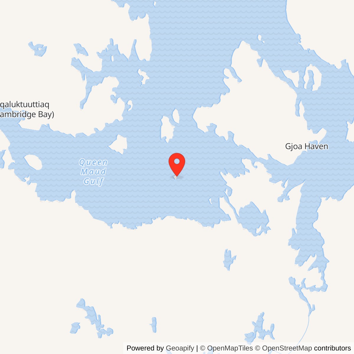
Longitude: -100.070278
Site Number: CAM-B
Current Role: North Warning System short-range radar on the CAM-B reserve; Canadian government confirmed operation in 2012. Current status requires separate check.
Hat Island CAM-B occupied a small island in Queen Maud Gulf, about 175 kilometers southwest of Gjoa Haven and 220 kilometers southeast of Cambridge Bay. It was an intermediate station of the original Distant Early Warning Line, the chain built across the Arctic to detect aircraft approaching North America. CAM-B filled an interval between the larger Jenny Lind Island CAM-1 and Gladman Point CAM-2 radar stations. It was a small warning post rather than a sector headquarters or fighter base. [1] [2] [4]
- DEW Line code
- CAM-B
- Original role
- Intermediate low-altitude warning station
- Original equipment
- AN/FPS-124 short-range radar
- Location
- Hat Island, Queen Maud Gulf, Nunavut
A Low-Altitude Post on Hat Island
The station code remained associated with Hat Island after the first post closed. A North Warning System short-range radar later operated at CAM-B. The 1950s Doppler station and the later radar belong to different equipment generations, separated by nearly three decades. [2] [7] [9]
Building a Station on an Arctic Island
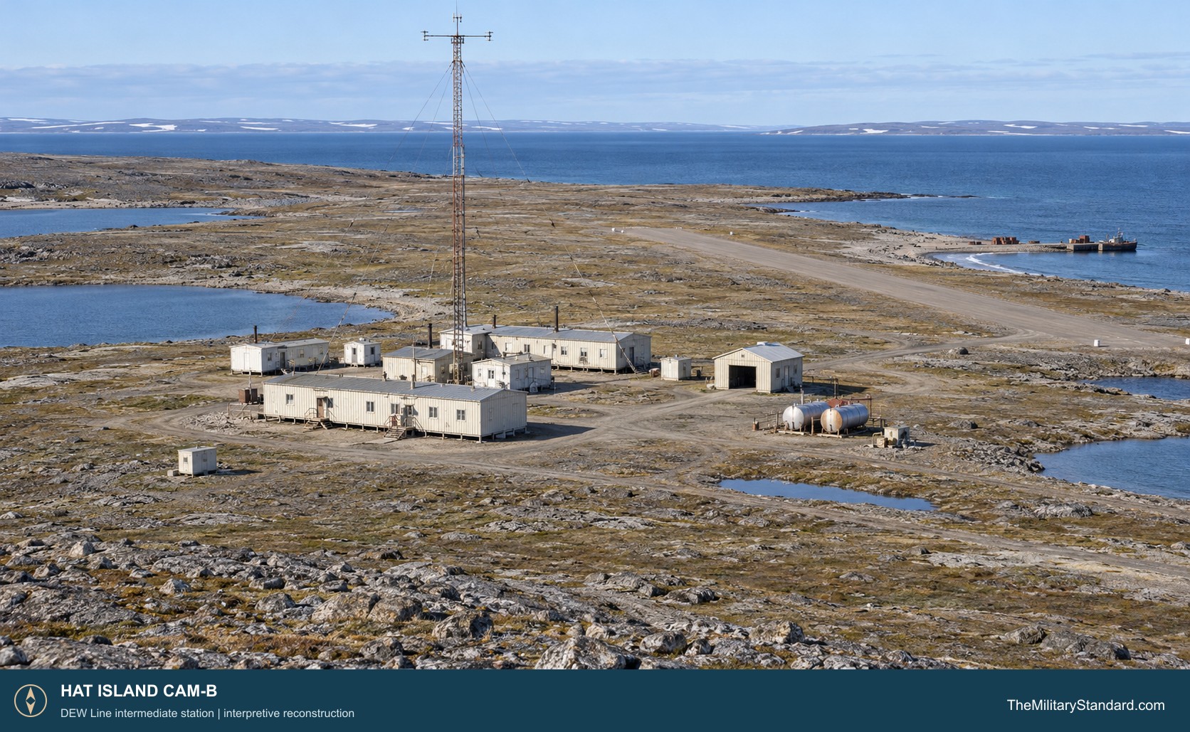
The mid-1950s DEW Line program required workers to bring prefabricated structures, fuel, power equipment and antenna materials to remote coastlines during a brief shipping season. Hat Island needed its own means of receiving cargo and people. The Canadian government identifies a cargo beaching area and airstrip along with the station buildings, radar tower and fuel storage. These transport facilities were essential to keeping an island station supplied after the builders left. [2] [4]
A construction collection identifies a Hat Island work crew in June 1955. A June 1956 image shows water in the excavation for the Doppler antenna tower foundation. The photograph gives a concrete example of the difficulties crews met while establishing reliable foundations in Arctic ground. Canada dates CAM-B construction and operation from 1956 through 1963, while Aerospace Defense Command records it operating by August 1957. [1] [2] [6]
The finished post was modest in scale. The documented building group housed the functions needed for continuous power, equipment service and a resident crew. A tower supported the warning equipment. Stored fuel, access to the strip and a cargo landing area made it possible to continue operations through periods when neither aircraft nor a vessel could reach the island. [2] [4] [5]
Western Electric led the original DEW Line construction program, and Federal Electric took responsibility for operating the completed network under military oversight. Hat Island therefore formed part of a large coordinated defense system even though day-to-day work at the post fell to a handful of civilian specialists. Cambridge Bay CAM-Main was the sector center to which the smaller CAM stations were connected. [4] [5]
The AN/FPS-23 Doppler Fence
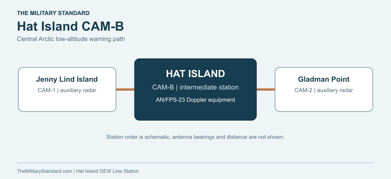
CAM-B carried AN/FPS-23 Fluttar equipment. This continuous-wave Doppler system was installed at intermediate stations to address aircraft flying below the useful reach of the rotating search radars at main and auxiliary sites. Intermediate sites typically carried a pair of fixed transmitters, one aimed toward the neighboring station to the west and the other toward the east. Receivers at those adjacent radar stations registered the Doppler change when an aircraft crossed a path. In this way, CAM-B helped extend low-altitude warning between larger stations; it did not perform the full search and control duties of a main station. [1] [4] [5]
The Hat Island tower and electronics depended on uninterrupted local power. Technicians had to watch transmitter performance, maintain generators and cables, and service equipment exposed to wind, cold and drifting snow. A fault at an intermediate station could remove one part of the low-altitude fence until repaired. Reports from the fence still had to pass through the DEW Line communications system for evaluation at the larger radar and control centers. [4] [5]
Jenny Lind Island CAM-1 lay to the west and Gladman Point CAM-2 to the east. CAM-B occupied the intervening sector of the original line. The path graphic shows this station order; actual radio paths depended on antenna siting and equipment configuration. [1] [4] [5]
Crew, Supply and Daily Work
Intermediate stations carried much smaller complements than main DEW Line stations. A firsthand line-wide account describes a typical crew of roughly four people, including radio and mechanical specialists and a cook, with a technical worker acting as station chief. The exact number assigned to Hat Island at a particular date is not recorded in the sources used here. Its residents nonetheless had to keep the station staffed around the clock. [5]
The small crew lived close to the machinery it maintained. Daily work combined monitoring and repairing electronics with the practical chores of heating, fuel, power, food and transport. The diesel plant mattered as much as the antenna: without electricity the Doppler equipment and its communications could not provide an alarm. Weather could turn a routine outdoor repair into a difficult trip even across a compact station compound. [4] [5]
The airstrip and beach landing area connected Hat Island to the larger logistics network. Aircraft brought personnel, mail and urgent supplies when conditions allowed. The short summer shipping season permitted heavier deliveries. Between visits, the crew relied on its fuel and stores, maintained its own equipment and kept the local communications link functioning. Isolation and a limited crew made technical versatility part of ordinary station life. [2] [4] [5]
The 1963 Intermediate-Station Closure
By the early 1960s, NORAD and CONAD concluded that improved coverage from the larger search-radar sites and changes in the assessed bomber threat reduced the value of the AN/FPS-23 intermediate fence. The Canadian government concurred in the retirement of its intermediate stations. The 28 sites stopped operations together at 0001Z on July 21, 1963. Aerospace Defense Command gives that date for Hat Island CAM-B. [1] [3]
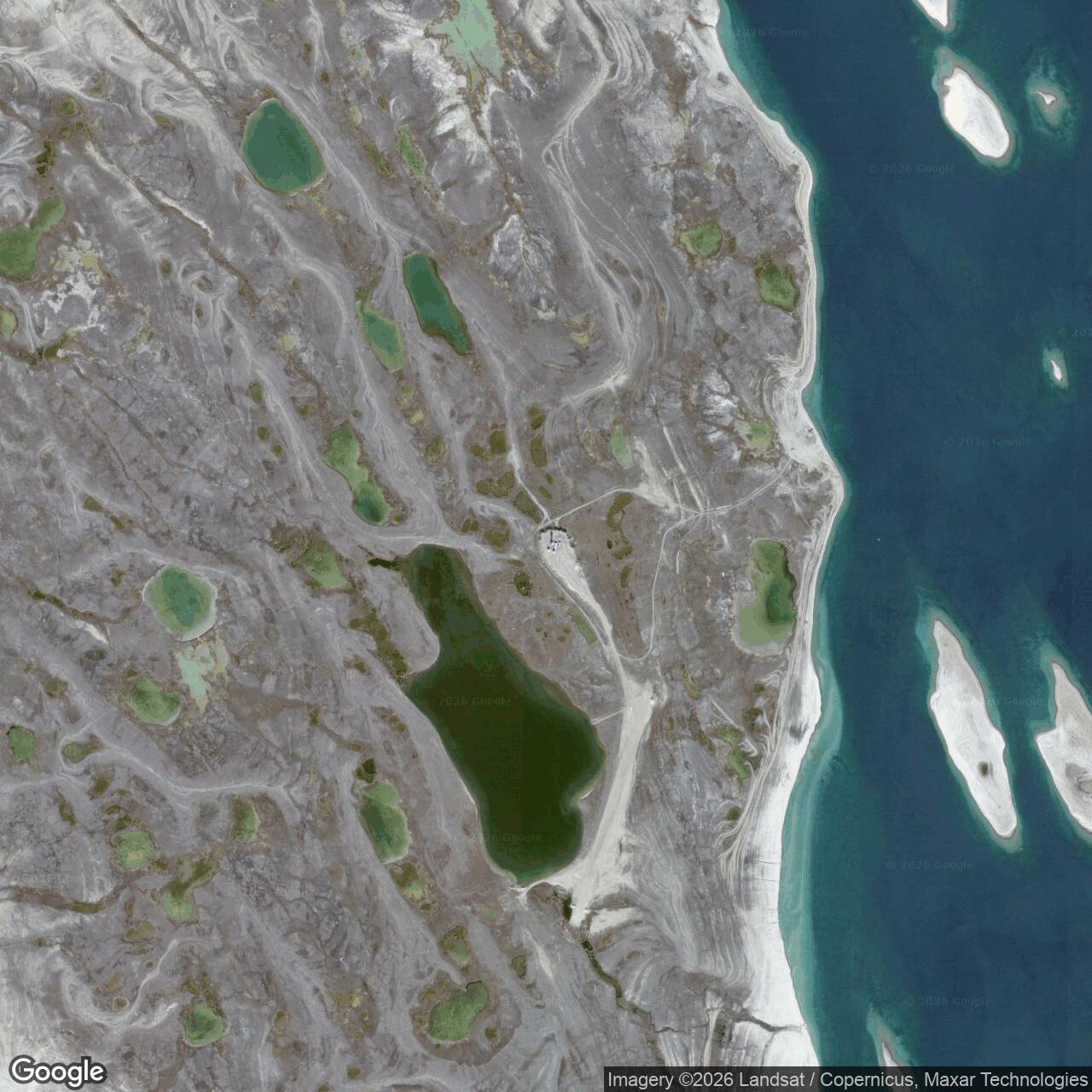
The post no longer needed a resident DEW Line crew after the shutdown. Canada reports that most of its buildings had been dismantled by 1990. The radar tower, fuel area, airstrip and beaching facility remain important to understanding the original installation even though the site changed substantially after the military-era station closed. [2]
The North Warning System Era
A new short-range radar was established at Hat Island in September 1991 as part of the North Warning System, which replaced the original DEW Line network. The later station used AN/FPS-124 equipment. Canadian government records describe the new radar as occupying the former CAM-B site, and a federal remediation protocol identifies the two station eras as co-located within the original reserve. This was a new automated radar mission rather than a continuation of the old FPS-23 fence. [2] [7] [9]
The Government of Nunavut records later Department of National Defence parcels at Hat Island for the radar site, runway, road, beachhead, fuel-transfer line and waterlot. Those facilities show that maintaining the remote radar still depended on the same broad categories of access and support as the first station. A 2012 Canadian report stated that the short-range radar continued to operate at CAM-B. [2] [8]
Chronology
- June 1955 A construction-era collection identifies workers at Hat Island CAM-B. [6]
- 1956 The Canadian government dates construction and operation of the intermediate station from this year; a June image shows tower-foundation work. [2] [6]
- August 1957 Aerospace Defense Command records CAM-B operating with AN/FPS-23 equipment. [1]
- July 21, 1963 CAM-B closes with the other 27 intermediate stations at 0001Z. [1] [3]
- By 1990 Most buildings of the original station have been dismantled. [2]
- September 1991 The later North Warning System short-range radar is established at Hat Island. [7]
- 2012 Canada reports that the CAM-B short-range radar remains in operation. [2]
Related Sites
- DEW Line station directory
- DEW Line history
- Jenny Lind Island CAM-1
- Gladman Point CAM-2
- AN/FPS-23 Fluttar
- AN/FPS-124 short-range radar
Information sources (9)
- PDFAerospace Defense Command, Historical Data of the Aerospace Defense Command, 1946-1973, DEW Line station table
Official CAM-B identification, AN/FPS-23 equipment, operating status by August 1957 and closure on July 21, 1963.
- PDFGovernment of Canada, The Big Picture: Contaminated Sites in Nunavut, 2012, Hat Island, p. 10
Station location, 1956-1963 period, documented facilities, removal of buildings and later short-range radar at CAM-B.
- PDFNORAD and CONAD, Historical Summary, January to June 1963
Contemporary account of the decision to retire 28 intermediate stations and their coordinated July 21, 1963 shutdown.
- PDFU.S. Air Force, A History of the DEW Line, 1946-1964
DEW Line construction, logistics, contractor operation, radar functions and the broader intermediate-station closure.
- WEBThe DEWLine, A Brief Introduction
Firsthand description of intermediate-site Doppler equipment, small crews, maintenance and everyday service on the original line.
- WEBThe DEWLine, Hat Island CAM-B station page
Contemporary construction-collection captions documenting the 1955 crew and June 1956 water-filled tower-footing excavation.
- WEBThe DEWLine, North Warning System station inventory
Lists CAM-B as a later AN/FPS-124 short-range radar installation established in September 1991.
- PDFGovernment of Nunavut, Nunavut Lands and Resources Devolution Agreement, 2024
Official identification and approximate coordinate for former CAM-B, and Department of National Defence parcels for the later CAM-B radar, runway, beachhead and access infrastructure.
- PDFIndian and Northern Affairs Canada, Abandoned Military Site Remediation Protocol, 2005
Identifies the North Warning System site as co-located with the original Hat Island DEW Line reserve.