
Jenny Lind Island DEW Line Station, Canada
A remote island radar crew kept watch through Arctic winters until a new North Warning System site took over.
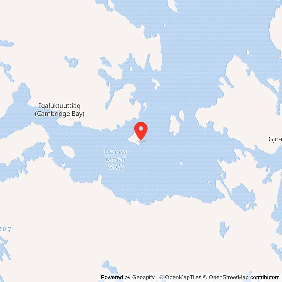
Longitude: -101.75
Site Number: CAM-1
Current Role: Former DEW Line station parcel; a separate North Warning System radar serves Jenny Lind Island.
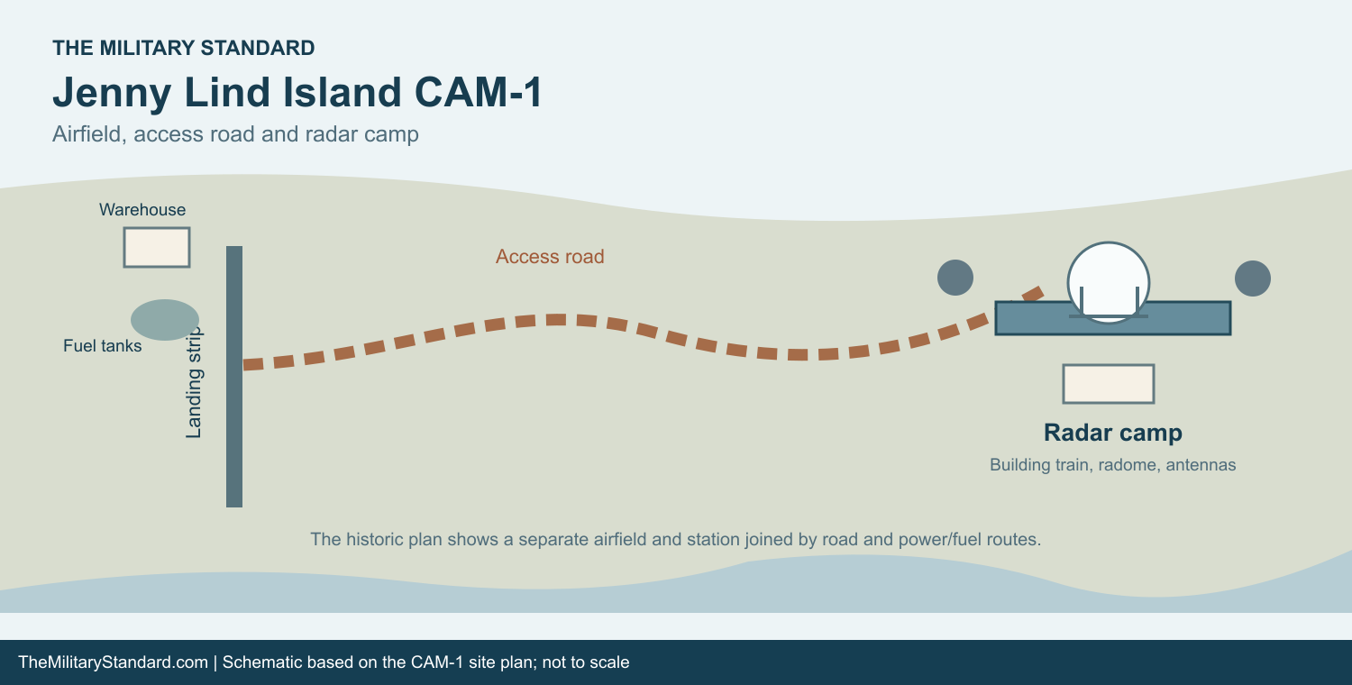
Jenny Lind Island CAM-1 was a staffed auxiliary station of the Distant Early Warning Line in the Canadian Arctic. Its search radar watched the northern air approaches, while its operators and communications equipment passed warning information to the wider air-defense network. CAM-1 was a satellite of Cambridge Bay CAM-Main, the main station for this sector. It stood between Sturt Point CAM-A and Hat Island CAM-B in the original station sequence, with Gladman Point CAM-2 farther east. [1] [2] [3]
- DEW Line code
- CAM-1
- Station role
- Auxiliary search-radar station
- Principal radar
- AN/FPS-19
- Operating period
- 1957 to 1992
- Location
- Jenny Lind Island, Nunavut
An Arctic Warning Station on Jenny Lind Island
The station occupied the crown of a low peninsula on Jenny Lind Island, or Qikiqtaryuaq. A contemporary description gives a selected area of 3,220 acres and places the site about 100 feet above sea level. The surrounding island had shallow relief, flat-shored beaches, ponds, marshes, and a slowly winding river. The modest elevation still gave the rotating search antenna a useful view over the otherwise flat terrain. [4] [5]
Siting and Construction
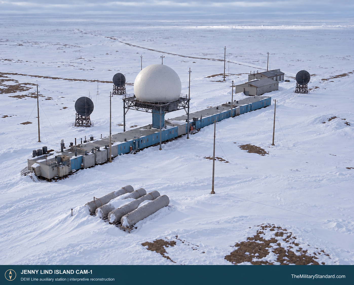
Site selection and construction were underway by 1955. An October 1955 siting report for CAM-1 survives in the Air Force historical record, and construction photographs from that month show crews fabricating radome trusses. Another photograph records wreckage from a C-124 transport near the station, a stark reminder of the aircraft risk involved in building remote Arctic sites. [4] [5]
CAM-1 was part of the hurried construction of a continuous northern warning chain. Heavy materials had to reach a small island during the limited shipping and flying seasons. Contractors prepared a landing area and access routes, erected the prefabricated station buildings, installed fuel and electrical systems, and built the elevated structure for the enclosed search radar. Radar and communications equipment could then be fitted and tested before the line entered service in 1957. [4] [5] [6] [7]
The site also required a dependable water supply. The historical station description records a one-mile round-trip haul for potable water in summer and winter. That repeated journey, together with moving fuel, food, parts, and mail from the landing area, made vehicles and a usable road as important to the crew as the radar itself. [4] [7]
Radar, Doppler Fence, and Communications
As an auxiliary station, CAM-1 used the DEW Line AN/FPS-19 long-range search radar. Its two opposed antenna faces rotated under a radome, protecting the mechanism from ice and wind. Operators watched the displays for aircraft returns, established useful tracks, and passed alerts through the sector. The search set supplied range and bearing information that the smaller intermediate stations could not provide on their own. [1] [6] [8] [9]
The original network also used AN/FPS-23 Fluttar continuous-wave paths to help detect low-flying aircraft between search-radar sites. Sturt Point CAM-A lay to the west of CAM-1 and Hat Island CAM-B lay to the east. An intermediate transmitter and the receiving equipment at its neighboring auxiliary stations created a crossing alarm. At CAM-1, that alarm prompted the watch crew to examine the search-radar display and report a possible approach. [3] [6] [8] [9]
Long-distance communications joined the radar sites into a warning system. The auxiliary-station equipment plan included eastward and westward tropospheric-scatter links, air-ground radio, teletype, and telephone circuits. Radar, radio, and power technicians had to keep those systems operating together: an aircraft detection at an isolated island mattered only if a warning could reach the main station and onward control centers. [6] [8] [9]
Buildings and Daily Work
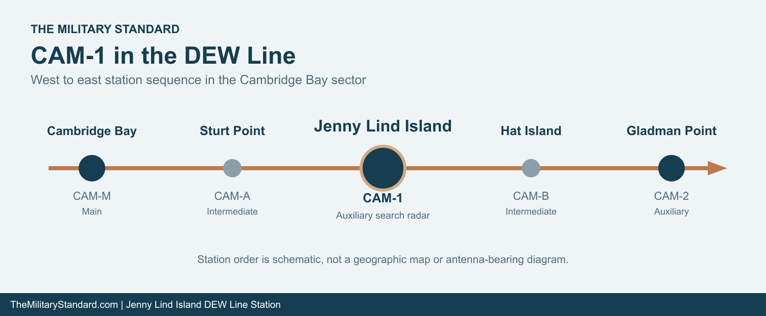
The standard auxiliary-station plan joined 25 heated prefabricated modules into a building train about 400 feet long. Its restricted technical end held generators, an electronics workshop, transmitters, receivers, a surveillance and communications room, and the search-radar equipment room. Other modules provided offices, food storage, kitchen and dining facilities, bedrooms, laundry, sanitation, and recreation space. CAM-1 photographs show the long enclosed station form characteristic of that design. [4] [8] [9]
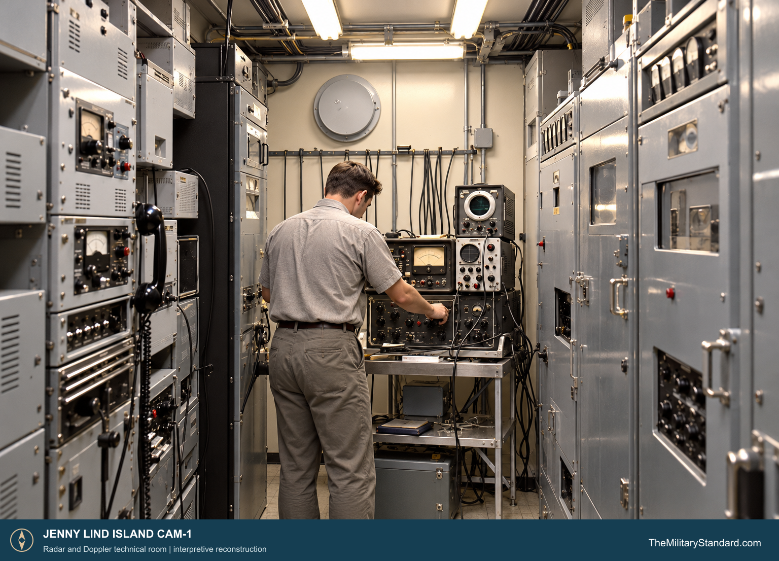
Aerial photographs of the completed CAM-1 camp show the long straight train, the large radome rising near its middle, and several smaller dish antennas set beside it. Photographs dated September 1960 show a technician in the Doppler equipment room and the search-radar equipment room, surrounded by densely packed cabinets, test instruments, and cabling. The station was a working electronics plant as much as a shelter. [4] [9]
Outside the train were the radar platform and radome, antenna towers, fuel storage, utility structures, and facilities for vehicles and cargo. Diesel generators supplied the electrical power that kept the radar, radios, lights, heat, and water systems running through the Arctic winter. Crews inspected engines, repaired electronics, cleared snow, hauled water, handled deliveries, and maintained the landing area and road while the radar watch continued around the clock. [4] [7] [8] [9]
An early auxiliary-station staffing plan called for 12 workers, most of them radio and radar technicians. The operating station also needed mechanics, cooks, equipment operators, and other support staff, and the complement could change with contracts and season. Canadian DEW stations combined military personnel with civilian employees; some civilians remained at their stations for years while military members rotated. CAM-1 was therefore a small, continuously occupied community as well as a radar post. [2] [7] [8]
The crew lived inside the heated train, close to the equipment it had to tend. Station libraries, movies, music, games, and a cook helped make long off-duty hours bearable across the line. A surviving CAM-1 Christmas 1962 dinner menu gives the island station a more personal trace of that life. Outside, winter cold and darkness, wind-driven snow, and interruptions to flying could make an ordinary repair or delivery into a demanding job. [2] [4] [7]
Resupply and the Long Cold War Watch
Cambridge Bay CAM-Main acted as the principal support and reporting center for this part of the line. Aircraft moved personnel, mail, food, and spare parts laterally from the larger stations to their auxiliaries. Sea and air deliveries of fuel and heavy equipment had to be planned around the short Arctic operating season. Once supplies reached Jenny Lind Island, the crew still had to move them from the landing area to the radar camp. [2] [7]
CAM-1 continued its search-radar and communications mission after the original intermediate Doppler sites ceased operating in 1963. Equipment and procedures evolved during the following decades, but the station still required a staffed watch, working power plant, maintained air access, and serviceable communications. In 1985 Canada and the United States agreed to replace the aging DEW Line with the more automated North Warning System. [2] [3] [6] [7]
Closure and the CAM-1A Successor
The later Jenny Lind Island CAM-1A short-range radar was established in October 1990 at a different location on the island. CAM-1 remained the original auxiliary DEW station. A Royal Canadian Air Force history dates its replacement to September 18, 1992 and preserves a sign left when the old station was shut down. The new radar belonged to the North Warning System, whose remote sites required a different pattern of staffing and support. [1] [2] [10]
The old CAM-1 buildings later became a former military site, while CAM-1A retained its own radar, access, beachhead, and service parcels. The distinction matters to the island story: the 1950s staffed radar camp and the later short-range radar occupied different places and represent successive stages of the northern warning mission. [2] [10]
Chronology
- 1955 CAM-1 siting and construction work is documented; October photographs show radome-truss fabrication. [4] [5]
- 1957 The original DEW Line enters service with CAM-1 as an auxiliary search-radar station. [1] [2] [6]
- Christmas 1962 A surviving CAM-1 holiday dinner menu records station life. [4]
- 1963 The original intermediate Doppler sites close while CAM-1 remains in operation. [3] [6]
- 1985 Canada and the United States agree to modernize the northern warning chain. [2] [6]
- October 1990 The separate CAM-1A North Warning System short-range radar site is established. [1]
- September 18, 1992 CAM-1 is replaced and the original DEW station shuts down. [2]
Related Sites
- DEW Line station directory
- DEW Line history
- AN/FPS-19 search radar
- AN/FPS-23 Fluttar radar
- Cambridge Bay CAM-Main
- Sturt Point CAM-A
- Hat Island CAM-B
- Gladman Point CAM-2
- Jenny Lind Island CAM-1A
Information sources (10)
- PDFP. Whitney Lackenbauer, Matthew J. Farish, and Jennifer Arthur-Lackenbauer, The Distant Early Warning (DEW) Line: A Bibliography and Documentary Resource List, Arctic Institute of North America, 2005
Identifies CAM-1 as an auxiliary DEW station, gives its approximate location, and distinguishes CAM-1A as an October 1990 North Warning System short-range radar site.
- PDFRoyal Canadian Air Force, 100 Objects for 100 Years, 2024, p. 117
Identifies CAM-1 as a Cambridge Bay satellite, describes personnel and station life, and dates its replacement to September 18, 1992.
- WEBThe DEWLine, DEWLine Stations table
Places CAM-1 between Sturt Point CAM-A and Hat Island CAM-B, with Cambridge Bay CAM-M and Gladman Point CAM-2 as the adjacent major search-radar stations.
- WEBThe DEWLine, Jenny Lind Island CAM-1 station page
Reprints the historical station description and provides construction-era and later photographs and a 1962 Christmas menu.
- WEBU.S. Army Corps of Engineers, Annotated Bibliography: Distant Early Warning System, Alaska
Identifies the original October 1955 CAM-1 siting report and summarizes contemporary DEW Line technical and construction records.
- PDFU.S. Air Defense Command, A History of the DEW Line, 1946-1964
Contemporary history of the DEW Line construction program, original search-radar and Doppler warning missions, communications, and station operations.
- WEBDEWLine Museum, Operations
Describes resupply, lateral air service, winter maintenance, power, water, and staffing of the DEW Line.
- WEBThe DEWLine, Auxiliary and Intermediate Site Layouts
Describes the typical 25-module auxiliary building train, technical rooms, living facilities, and initial staffing plan.
- WEBThe DEWLine, Life of a Radician
Details the normal auxiliary-station radar room, surveillance room, Doppler receivers, transmitters, power plant, and watchkeeping work.
- PDFGovernment of Nunavut, Nunavut Lands and Resources Devolution Agreement, 2024, former military sites schedule
Lists the original CAM-1 former military site separately from the later CAM-1A North Warning System radar, beachhead, road, runway, and associated parcels.