
Gladman Point DEW Line Station, Canada
A staffed Arctic radar camp became a remotely watched warning site.
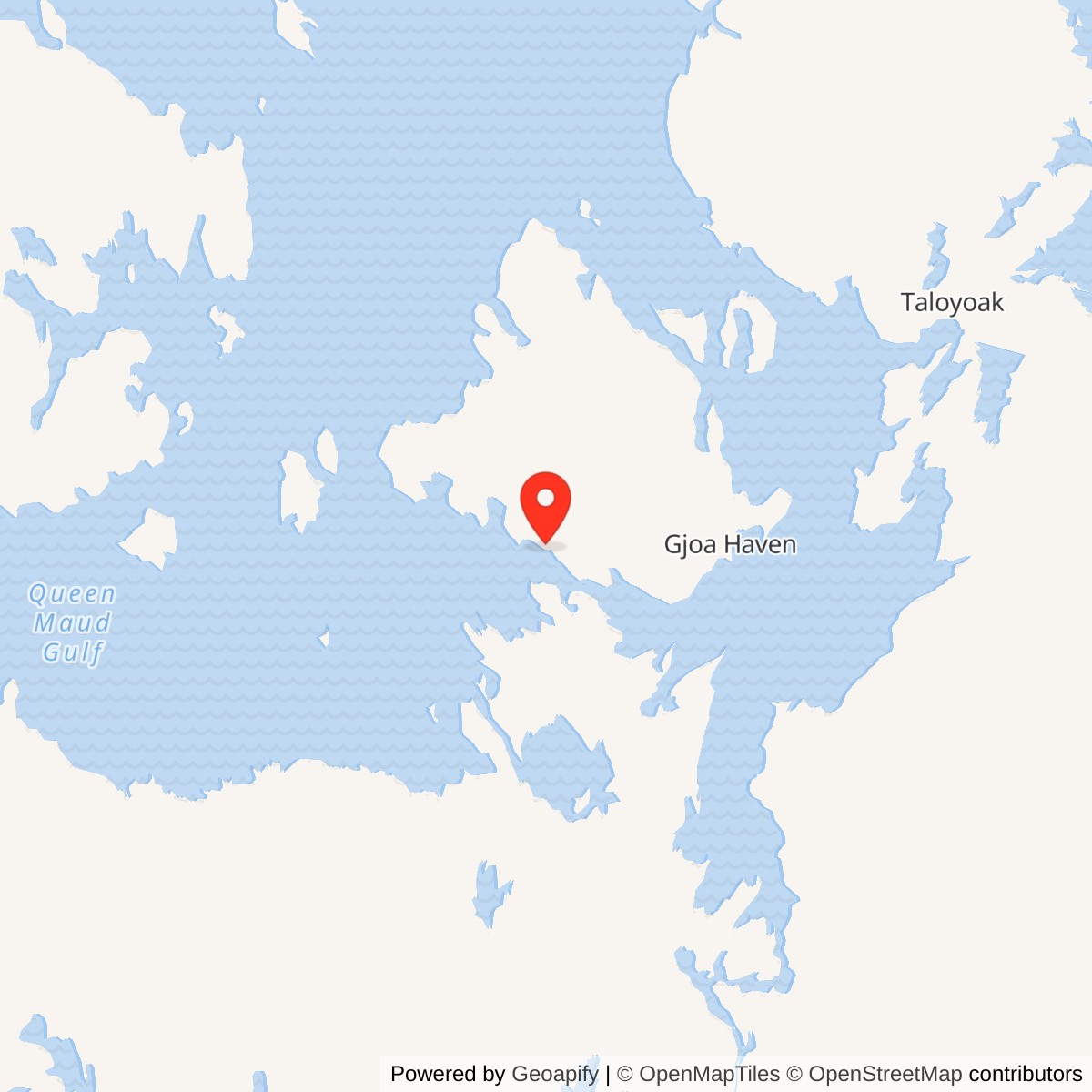
Longitude: -97.80333
Site Number: CAM-2
Current Role: North Warning System short-range radar and support parcels at Gladman Point.
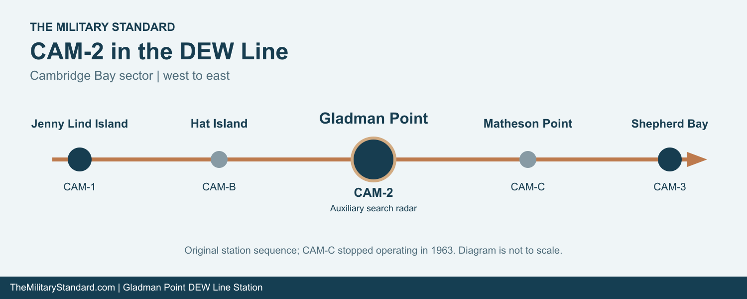
Gladman Point CAM-2 was a staffed auxiliary radar station on the Canadian part of the Distant Early Warning Line. Its search radar watched the northern air approaches to King William Island, and its communications circuits carried warning information toward Cambridge Bay CAM-Main and the wider North American air-defense system. In the original west-to-east station sequence, Hat Island CAM-B lay to the west and Matheson Point CAM-C to the east. [1] [2] [3]
- DEW Line code
- CAM-2
- Station role
- Auxiliary search-radar station
- Original search radar
- AN/FPS-124
- DEW Line service
- 1957 to 1992
- Location
- Gladman Point, King William Island, Nunavut
A Radar Watch at Gladman Point
The station stood on a low glacial ridge near Simpson Strait on the south side of King William Island. The period description places the selected site about 40 to 50 feet above sea level, amid elongated drumlinoid hills, swampy ground and shallow drainage. The Canadian government allotted about 1,648 acres for the installation. Its modest elevation mattered because the radar had to see beyond a low, largely featureless horizon. [4]
Siting and Arctic Construction
Spartan Air Services prepared a CAM-2 siting report for Western Electric in September 1955. The survey considered the radar position, communications, buildings, water, sewage, fuel, roads, airstrip, local materials and land. By October, crews had a construction camp at Gladman Point and were assembling prefabricated modules into the long station building. Dated photographs show the modules before and during assembly, a nearly completed garage, and workers heating gravel and concrete materials in freezing weather. [4] [5]
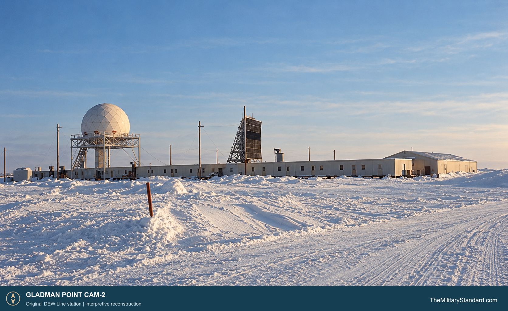
The site plan places the building train, garage and warehouse northwest of the gravel runway. It also records two 65,000-gallon diesel tanks near the camp, a separate drum-storage pad, a water-supply lake to the west, and a hangar by the runway. The runway extended eastward toward the cargo beach and additional fuel facilities. Power, communications and fuel routes linked these parts of the installation across the tundra. [6]
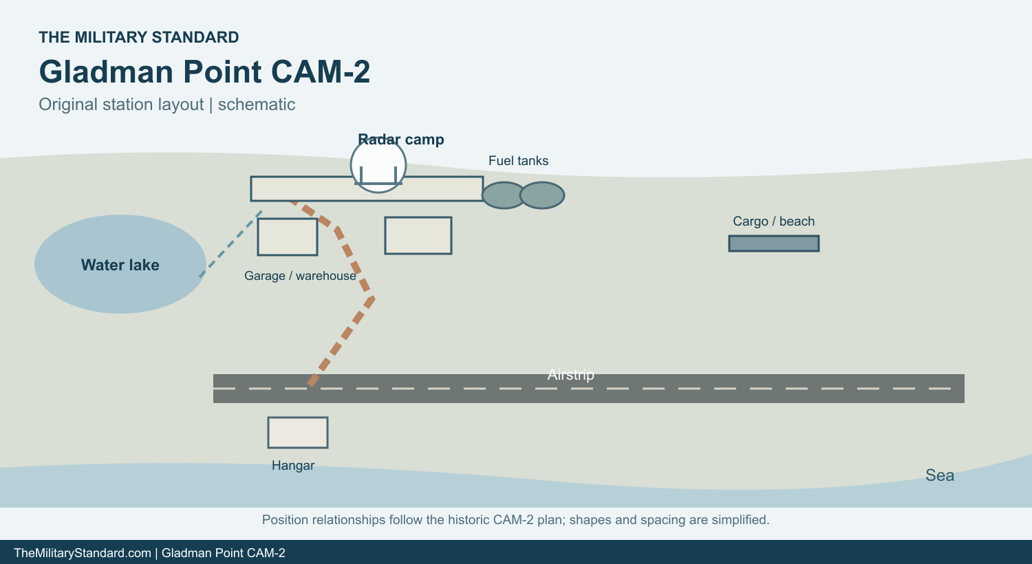
Much of the equipment had to be landed or flown in during the short Arctic construction season, then moved over prepared tracks to the camp. The photographed construction train shows modules raised on supports above the frozen ground. Crews still had to finish the radar platform, antenna facilities, heated interiors, fuel plant and communications before the station could sustain a continuous watch. The completed DEW Line entered service in 1957. [2] [4]
Search Radar, Doppler Warning and Communications
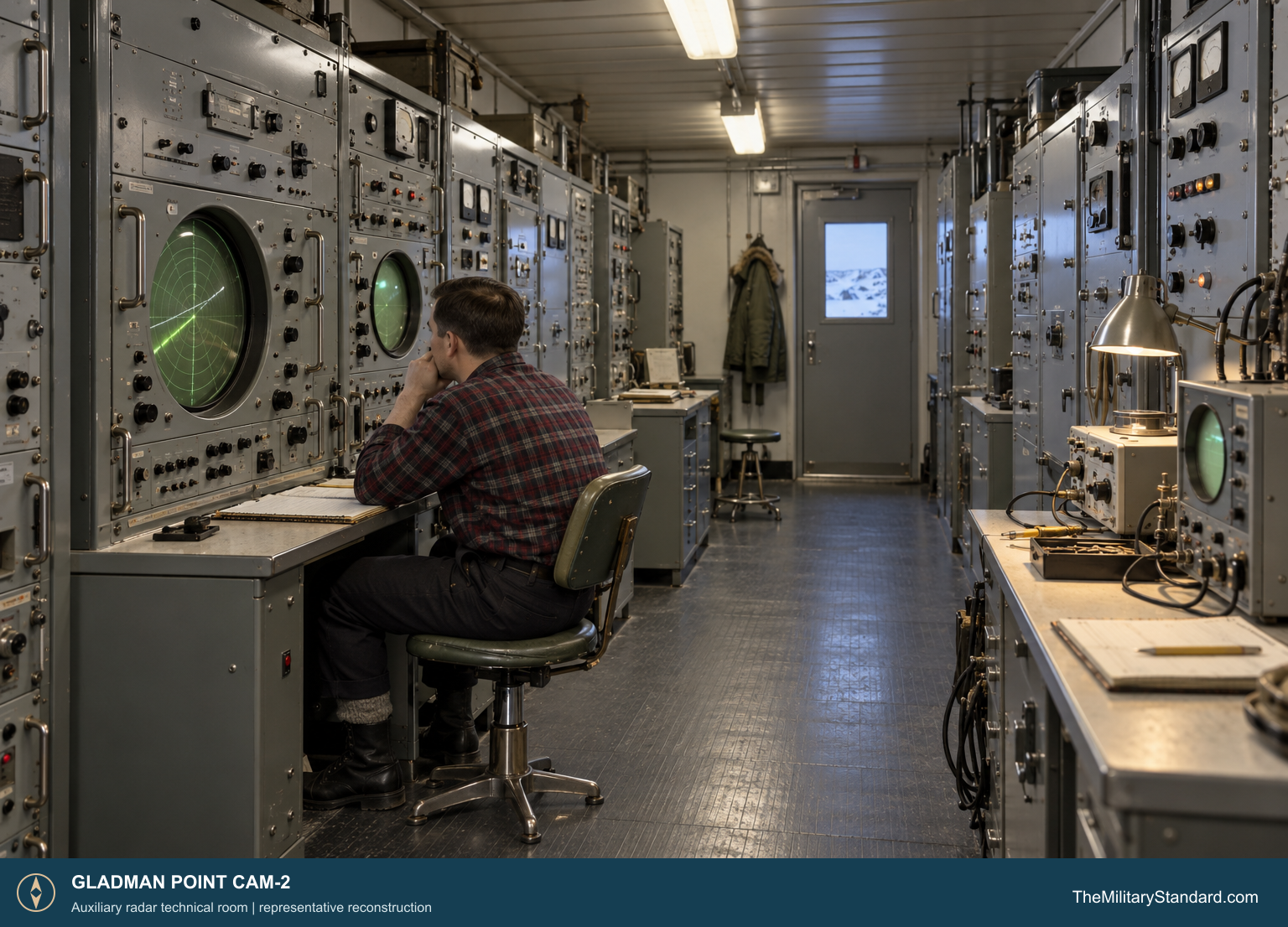
CAM-2 operated as an auxiliary search-radar station in the original DEW network. Its AN/FPS-19 used a pair of opposed scanning antennas enclosed by a protective radome. The rotating radar gave range and bearing for aircraft returns approaching the Arctic coast. A watch crew evaluated the displays, maintained tracks, and passed reports into the sector network for further identification and action. [1] [2] [7] [8]
The original line also used AN/FPS-23 Fluttar continuous-wave equipment to detect low-flying aircraft in the gaps between search-radar stations. Matheson Point CAM-C was the intermediate station east of Gladman Point; Hat Island CAM-B was the intermediate site to the west. A Doppler alarm called for the neighboring search-radar crew to check its scopes. The intermediate Fluttar stations were withdrawn in 1963, while CAM-2 remained a staffed search-radar post. [2] [3]
Long-distance radio circuits connected CAM-2 to the next stations and to Cambridge Bay. The auxiliary-station equipment plan included tropospheric-scatter, telephone, teletype and air-ground facilities as well as the radar and Doppler gear. Radar technicians, radio technicians and power-plant staff therefore worked on one linked warning process: detection at Gladman Point had to be communicated reliably before it could assist a defense response. [2] [7] [8]
Buildings, Crew and Daily Life
The prefabricated building train gave the crew a heated route between most of its working and living spaces. A standard auxiliary-station design used about 25 modules and placed generators, radar and communications rooms, an electronics shop and offices near sleeping rooms, kitchen, dining and recreation facilities. Construction photographs show the long Gladman Point train raised above the frozen ground. [4] [7]
The CAM-2 plan also identifies a garage, warehouse, hangar, fuel tanks, water point and cargo facilities outside the train. Diesel generators had to supply uninterrupted electricity for the radar and radios while also sustaining light and heat. Vehicles and a maintained road served the airfield, water source, storage pads and beach. A 1.5-mile round-trip potable-water haul continued in summer and winter. [4] [6] [9]
An early auxiliary-station staffing plan called for 12 workers, predominantly radar and radio technicians. Operating crews also needed mechanical, cooking and transport support, with numbers changing over time. At a place as isolated as Gladman Point, watchkeeping, generator maintenance, snow clearing, receiving cargo and hauling water were part of the same daily routine. The heated train also gave the crew a place to eat, sleep and spend long off-duty hours while flights and resupply depended on weather. [7] [9]
The surrounding climate made ordinary tasks demanding. The period station description records temperatures from about 56 degrees below zero to 72 degrees Fahrenheit and an average of roughly five inches of precipitation a year. Wind, fog, snow and seasonally soft ground affected vehicles and aircraft. October 1955 photographs already show hoar frost on the construction camp wires. [4] [9]
Cold War Service and Replacement
CAM-2 continued its Arctic warning mission after the intermediate stations stopped operating in 1963. The aging DEW Line remained in service as radar, communications and support practices changed. A 1987 Canadian survey specifically examined Gladman Point for a planned North Warning System short-range radar, part of the joint Canadian-American program to replace the older staffed network. [1] [2] [3] [10]
The North Warning System radar at Gladman Point was established in October 1990. Its AN/FPS-124 short-range radar served the same broad warning mission with unattended operation and remote monitoring. The original staffed DEW station continued briefly during the changeover and ceased operations in 1992. The later radar occupies the Gladman Point CAM-2 complex, with dedicated radar, road, runway, apron, beachhead, water and fuel-transfer parcels. [1] [3] [11] [12] [13]
By 2010 Canadian sailing directions described the North Warning System station as unattended, with a radome, two smaller ground-level domes and an emergency shelter. Gladman Point thus spans two generations of radar warning, from an occupied Cold War camp to a remotely operated short-range site. [1] [14]
Chronology
- September 1955 A CAM-2 siting report is prepared for Western Electric. [5]
- October 1955 Photographs record the construction camp, garage and assembly of the raised building train. [4]
- 1957 The completed DEW Line enters service with CAM-2 as an auxiliary radar station. [1] [2]
- 1963 Original intermediate Doppler stations close; CAM-2 continues its search-radar watch. [2] [3]
- 1987 A detailed survey studies Gladman Point for the North Warning System. [10]
- October 1990 The Gladman Point North Warning System short-range radar is established. [1] [3]
- 1992 The staffed CAM-2 DEW Line station ceases operations. [1] [3]
Related Sites
- DEW Line Station Directory
- DEW Line History
- AN/FPS-19 Search Radar
- AN/FPS-23 Fluttar Radar
- AN/FPS-124 Short-Range Radar
- Cambridge Bay CAM-Main
- Hat Island CAM-B
- Matheson Point CAM-C
- Jenny Lind Island CAM-1
Information sources (14)
- PDFP. W. Lackenbauer, M. J. Farish and J. Arthur-Lackenbauer, The Distant Early Warning (DEW) Line: A Bibliography and Documentary Resource List, 2005
Identifies CAM-2 as an auxiliary station, gives a station coordinate, and dates the NWS replacement and end of DEW operations.
- PDFU.S. Air Defense Command, A History of the DEW Line, 1946-1964
Contemporary account of construction, the AN/FPS-19 and AN/FPS-23 systems, operating arrangements, and the 1963 intermediate-station closure.
- WEBThe DEWLine, DEWLine Stations table
Places CAM-2 between Hat Island CAM-B and Matheson Point CAM-C and records the 1990 to 1992 transition.
- WEBThe DEWLine, Gladman Point CAM-2 station page
Preserves the period site description and dated October 1955 construction photographs.
- WEBU.S. Army Corps of Engineers, Annotated Bibliography: Distant Early Warning System, Alaska, item 251
Identifies the September 1955 CAM-2 siting report, Air Force Historical Research Agency K243.0482-16, and its subject matter.
- WEBThe DEWLine, CAM-2 site layout
Original station plan showing the building train, garage, water point, runway, hangar, fuel storage, cargo beach and utility routes.
- WEBThe DEWLine, Auxiliary and Intermediate Site Layouts
Describes the typical auxiliary-station module train, technical rooms, living facilities and initial staffing plan.
- WEBThe DEWLine, Life of a Radician
Describes radar and Doppler equipment rooms and the work of an auxiliary-station technician.
- WEBDEWLine Museum, Operations
Background on staffed station operation, supply, water, power, recreation and Arctic maintenance.
- PDFLibrary and Archives Canada, Short Range Radar Facilities Zone 2 Detailed Survey Report, Volume 7, CAM-2, 1987, archival catalogue
Identifies the 1987 Gladman Point survey for North Warning System short-range radar construction.
- PDFGovernment of Nunavut, Nunavut Lands and Resources Devolution Agreement, 2024, Department of National Defence schedule
Lists the Gladman Point NWS CAM-2 radar, road, beachhead, water, runway, apron and fuel-transfer parcels.
- PDFNorth Warning System Airlift, Appendix 1, Approximate Site Locations
Official logistics listing gives the Gladman Point CAM-2 short-range radar location.
- WEBThe DEWLine, North Warning System site table
Lists the Gladman Point successor radar as AN/FPS-124 and dates its establishment to October 1990.
- PDFFisheries and Oceans Canada, Sailing Directions and Small Craft Guide Corrections, October 2010
Describes the Gladman Point NWS station as unattended and identifies its radome, ground domes and emergency shelter.