
Keith Bay DEW Line Station, Canada
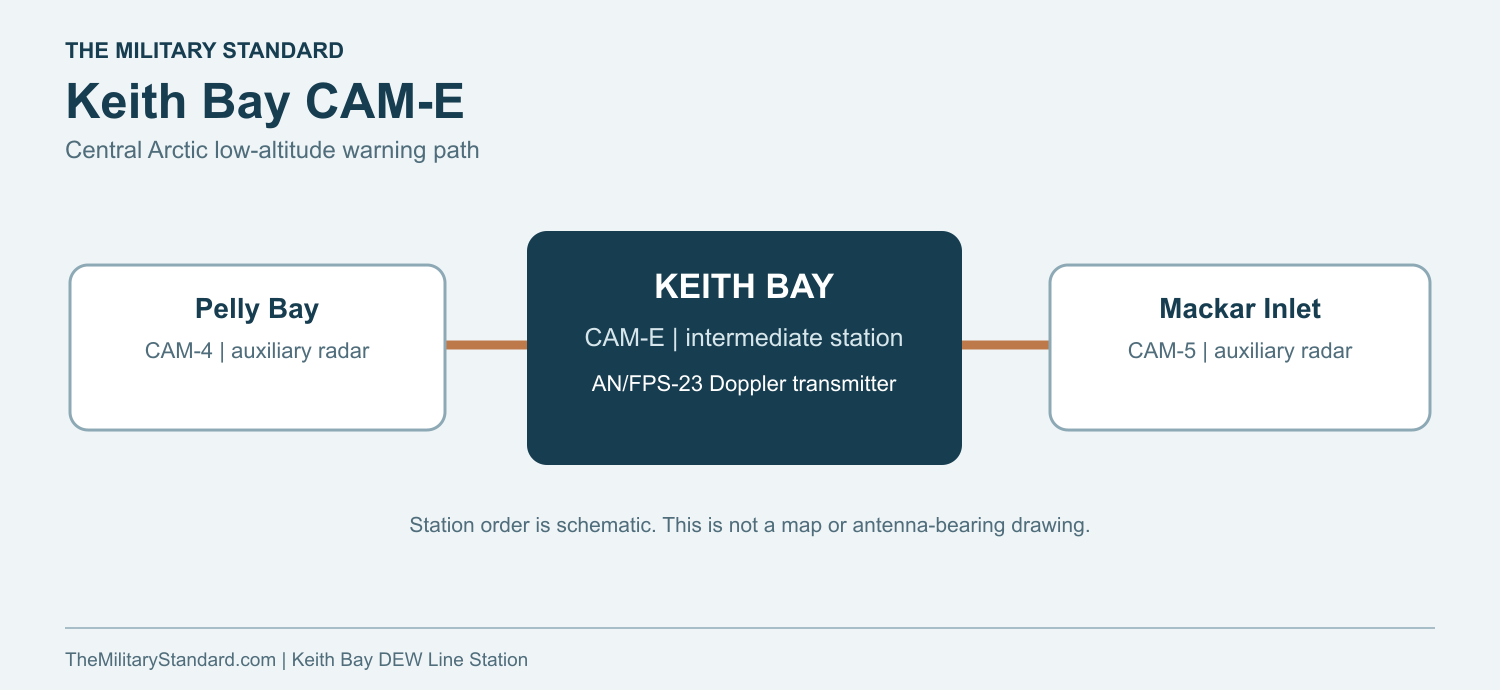
A small staffed station kept the low-altitude warning path open between Pelly Bay and Mackar Inlet.
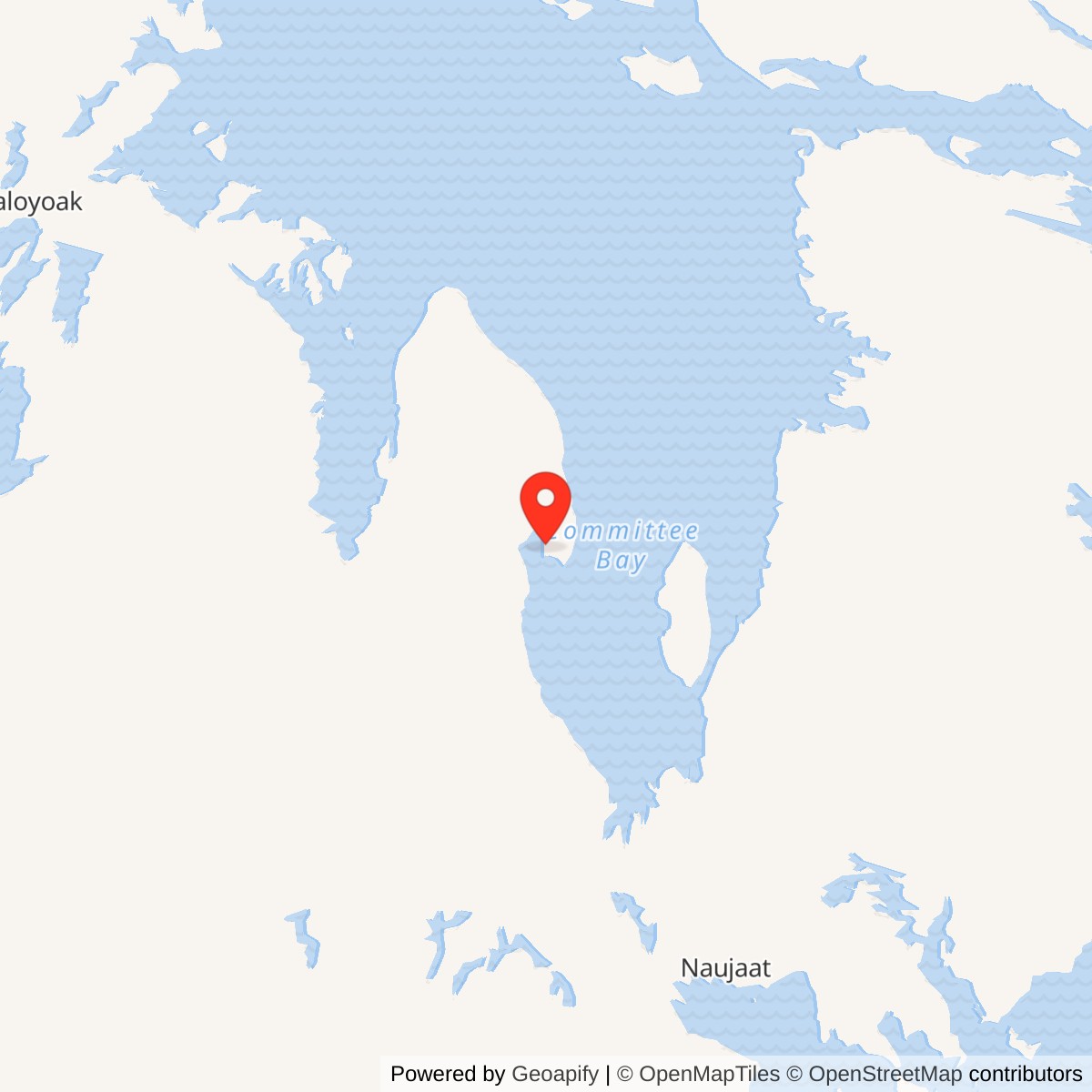
Longitude: -88.116642
Site Number: CAM-E
Current Role: Former station area with foundations remaining after most buildings were removed; no later North Warning System site at Keith Bay.
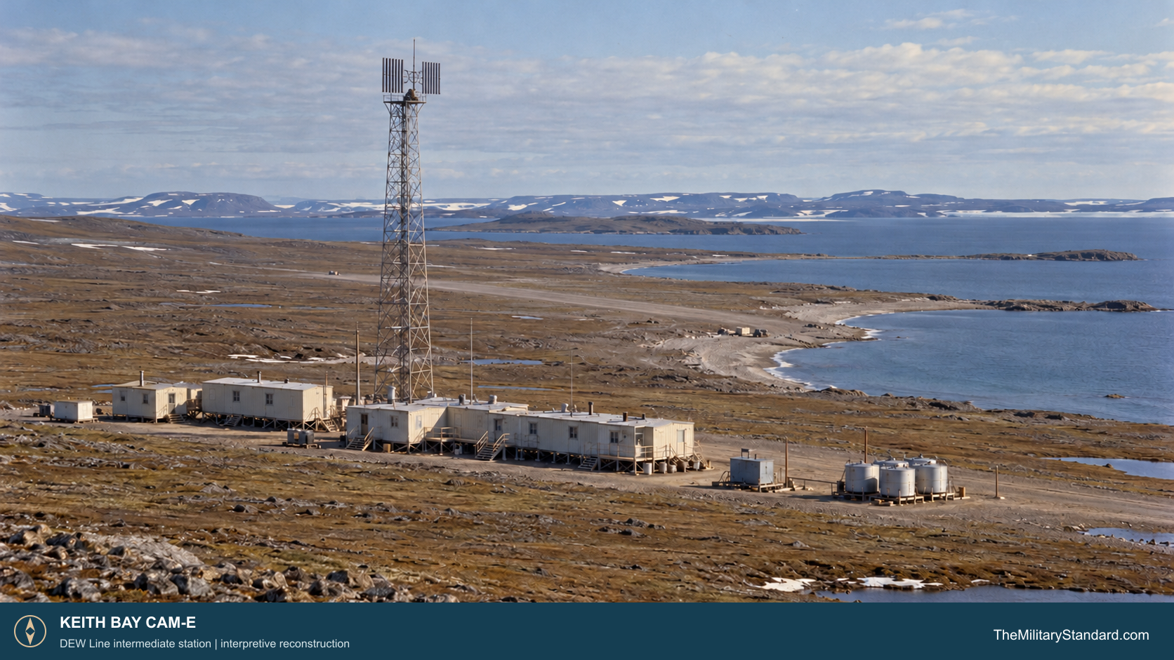
Keith Bay CAM-E was a staffed intermediate station in the Canadian section of the Distant Early Warning Line. It stood at Keith Bay on the Simpson Peninsula, about 60 kilometers east of Kugaaruk. Its low-altitude warning link occupied the interval between the larger Pelly Bay CAM-4 and Mackar Inlet CAM-5 radar stations. CAM-E was a dedicated Doppler transmitter post, not a search-radar or command station. [1] [2] [4] [8]
- DEW Line code
- CAM-E
- Role
- Intermediate low-altitude warning station
- Equipment
- AN/FPS-23 Fluttar
- Operating period
- By August 1957 to July 21, 1963
- Location
- Keith Bay, Simpson Peninsula, Nunavut
A Small Post at Keith Bay
The line was built to give North American air-defense commanders earlier warning of aircraft approaching over the Arctic. Main and auxiliary stations supplied rotating search radar and reporting facilities. Smaller intermediate stations carried equipment intended to sense an aircraft crossing the low-altitude gap between those search sites. This division of work explains why a modest camp such as Keith Bay mattered to the original 1950s design. [1] [4] [8]
Construction and Physical Plant
The Canadian government dates the Keith Bay station to the 1956 to 1963 period. An August 1956 construction photograph shows workers preparing to bury Styroflex cable between a transmitter module and the antenna, while two other workers are on the tower. Aerospace Defense Command lists CAM-E as operating by August 1957. That sequence places the physical installation during the 1956 building campaign and confirms the radar was in service the following year. [1] [2] [5]
The documented installation comprised buildings, a radar tower, fuel storage, an airstrip and a cargo beaching area. The antenna and technical equipment were thus only the center of a larger support system. Fuel, power, shelter and access had to be established on the coast before the radar could be operated continuously. The beach served seasonal cargo delivery, while the strip provided an aircraft connection to the rest of the line. [2] [4] [5]
Intermediate stations generally used a compact linked module train. The standard arrangement included technical, power and living space for a four or five person crew. At Keith Bay, the photographed cable route from transmitter module to tower gives a specific glimpse of that arrangement: the electronic equipment and elevated antenna were separate elements connected below ground. [5] [6] [7]
The AN/FPS-23 Fluttar Link
Keith Bay operated AN/FPS-23 Fluttar equipment. This continuous-wave Doppler system formed a radio fence between stations. An aircraft crossing the path disturbed the signal received at a neighboring main or auxiliary station. It was designed to supplement the AN/FPS-19 search radars, whose coverage was limited for very low-flying aircraft between widely spaced stations. [1] [4] [6]
The intermediate post housed AN/FPT-4 transmitters as part of the distributed AN/FPS-23 system. A standard intermediate technical module held two working transmitters and two standby units for the paths in opposite directions. Neighboring stations had the receivers and operators who interpreted the alarm. CAM-E therefore depended on its westward and eastward neighbors for the complete warning chain. [4] [6]
Fluttar indicated a crossing rather than providing the range and bearing track of a rotating search radar. Technicians had to keep transmitter output, antenna alignment, the cable between equipment and tower, local power and communications working. Arctic weather and radio interference made that maintenance demanding. The line-wide system developed a reputation for false alarms and difficult interpretation of recorded traces. [4] [5] [6]
Crew and Daily Operation
A typical intermediate station had a very small crew, usually four or five people, with radio and mechanical maintenance duties and a cook. This scale of staffing put the burden of a 24-hour electronic watch on only a few workers at a remote post with no nearby town or road network. [4] [6] [7]
Daily work joined technical care to basic survival. Operators checked the transmitters and communications, while mechanics kept generators, heat, fuel systems and vehicles serviceable. The crew also managed food, water, sleeping space and snow or ice around the station. The short navigation season made stored supplies and the beach landing important, and the airstrip offered another route for personnel and urgent parts. [2] [4] [6] [7]
When the transmitter or its local power failed, the problem affected the low-altitude fence beyond the camp itself. The small crew had to locate faults and restore the link while nearby main and auxiliary stations continued their wider search and reporting missions. Keith Bay was therefore both an isolated living place and a continuously serviced component of a larger electronic system. [4] [6] [7]
1963 Closure and Later Remains
By the early 1960s, commanders had judged the AN/FPS-23 intermediate fence too costly and unreliable for the value it added to the improved search-radar network. NORAD and CONAD coordinated the retirement of 28 intermediate sites. Aerospace Defense Command records July 21, 1963 as the closure date for Keith Bay CAM-E. The main and auxiliary search stations on either side continued to serve the DEW Line. [1] [3] [4]
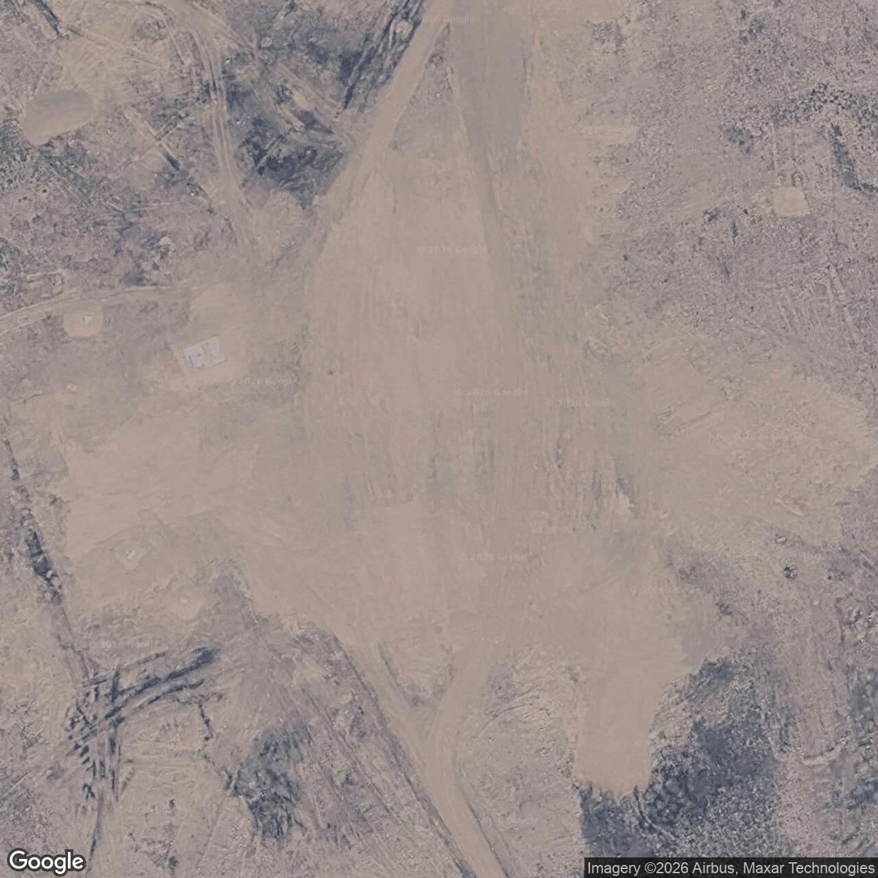
The original installation was abandoned after the intermediate program ended. A 2012 Canadian government account says most buildings had been removed and foundations remained. Keith Bay did not receive a North Warning System radar replacement. [2] [8] [9]
Chronology
- 1956 Keith Bay CAM-E is constructed during the original DEW Line program. [2] [5]
- August 1956 A construction photograph records work on the transmitter-to-antenna cable and tower. [5]
- August 1957 Aerospace Defense Command lists CAM-E as operating with AN/FPS-23 equipment. [1]
- July 21, 1963 Keith Bay closes with the other DEW Line intermediate stations. [1] [3]
- By 2012 Most station buildings have been removed, leaving foundations at the former site. [2]
Related Sites
- DEW Line station directory
- DEW Line history
- Pelly Bay CAM-4
- Mackar Inlet CAM-5
- AN/FPS-23 Fluttar
- AN/FPS-19 search radar
Information sources (9)
- PDFAerospace Defense Command, Historical Data of the Aerospace Defense Command, 1946-1973, DEW Line station table
Identifies Keith Bay CAM-E, AN/FPS-23 equipment, August 1957 operation and July 21, 1963 closure.
- PDFGovernment of Canada, The Big Picture: Contaminated Sites in Nunavut, 2012, p. 13
Keith Bay location, 1956 to 1963 station period and documented buildings, radar tower, fuel storage, airstrip, beach cargo area and surviving foundations.
- PDFNORAD and CONAD, Historical Summary, January to June 1963, intermediate-site reduction
Contemporary account of the decision to retire the AN/FPS-23 intermediate sites and their coordinated July 21, 1963 shutdown.
- PDFU.S. Air Defense Command, A History of the DEW Line, 1946-1964
Original DEW Line construction, contractor operation, radar and communications architecture and Fluttar operating problems.
- WEBThe DEWLine, Keith Bay CAM-E station page
Identifies the Keith Bay installation and the August 1956 construction photograph of cable installation and tower work.
- WEBThe DEWLine, Auxiliary and Intermediate Site Layouts
Representative five-module intermediate-station design, transmitter positions, local power and crew arrangement.
- WEBThe DEWLine, A Brief Introduction
Firsthand overview of intermediate-station staffing, isolation, operations and seasonal supply.
- PDFDEWLine Museum, Distant Early Warning Line Bibliography and Documentary Resource List
Station sequence, CAM-E intermediate classification, approximate historical location and lack of a North Warning System successor at Keith Bay.
- PDFGovernment of Nunavut, Nunavut Lands and Resources Devolution Agreement, 2024, former site C1003001
Official later identification of the former CAM-E Keith Bay military site and approximate federal parcel location.