
Pelly Bay DEW Line Station, Canada
CAM-4 kept an Arctic radar watch from a rocky ridge above its airstrip, with a contractor crew living alongside the equipment they maintained.
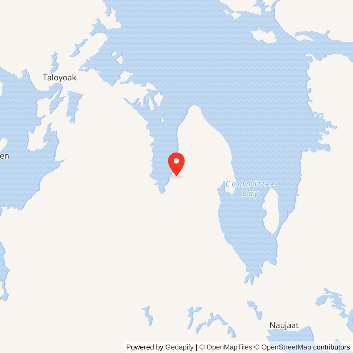
Longitude: -89.725406
Site Number: CAM-4
Current Role: Former DEW Line station area separately identified in federal land records; later North Warning System radar is on a separately listed parcel.
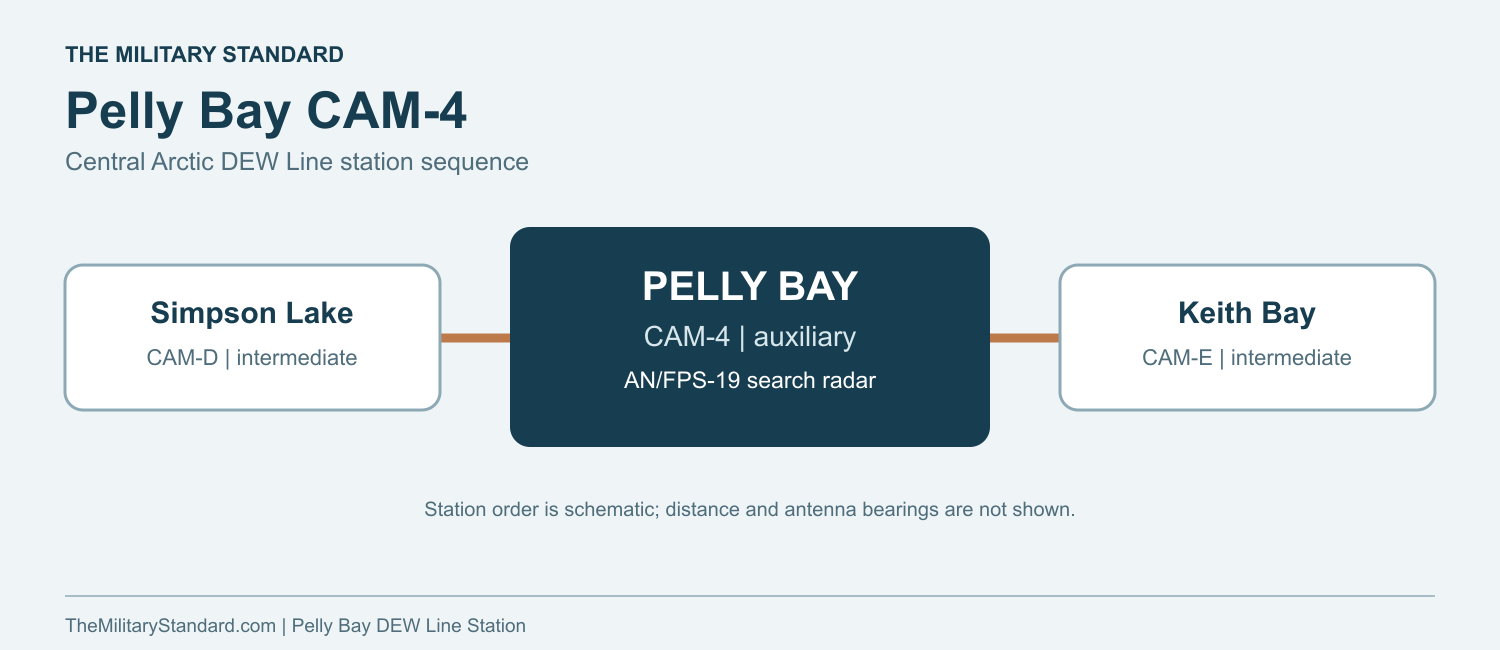
Pelly Bay CAM-4 was a staffed auxiliary station on the Canadian Arctic section of the Distant Early Warning Line. It occupied high ground on the southwestern Simpson Peninsula, west of several lakes and inland from the Pelly Bay settlement, now Kugaaruk. To the west was Simpson Lake CAM-D; Keith Bay CAM-E continued the line to the east. Cambridge Bay CAM-Main was the sector main station. The high site gave the rotating search radar a clear northern horizon, while the airstrip and water points lay below it. [1] [2] [8]
- DEW Line code
- CAM-4
- Role
- Staffed auxiliary radar station
- Search radar
- AN/FPS-19
- Operating period
- 1957 to 1992
- Location
- Southwestern Simpson Peninsula, Nunavut
A Radar Watch on the Simpson Peninsula
Auxiliary stations watched the air approaches between the larger main stations. At CAM-4, personnel monitored radar returns, checked possible tracks and sent warnings and operational messages along the line. It was a military warning mission carried out by civilian contract operators under the U.S. and Canadian air-defense arrangement. [1] [3] [4] [8]
Construction and the Station Layout
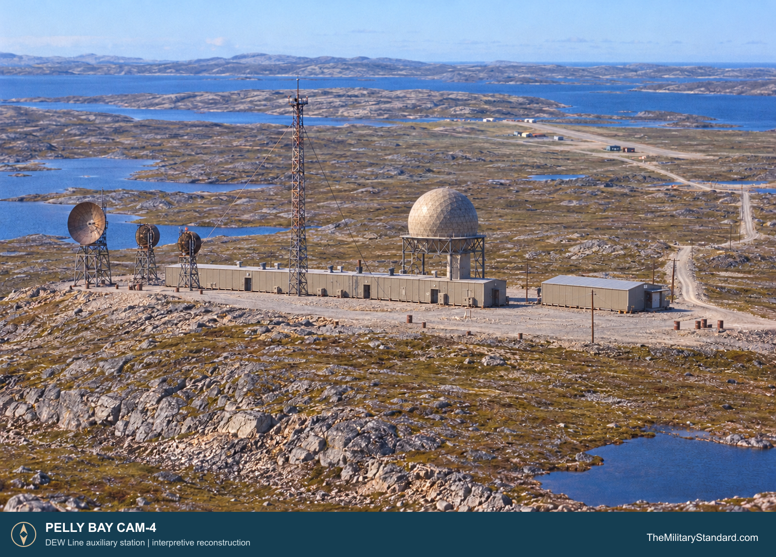
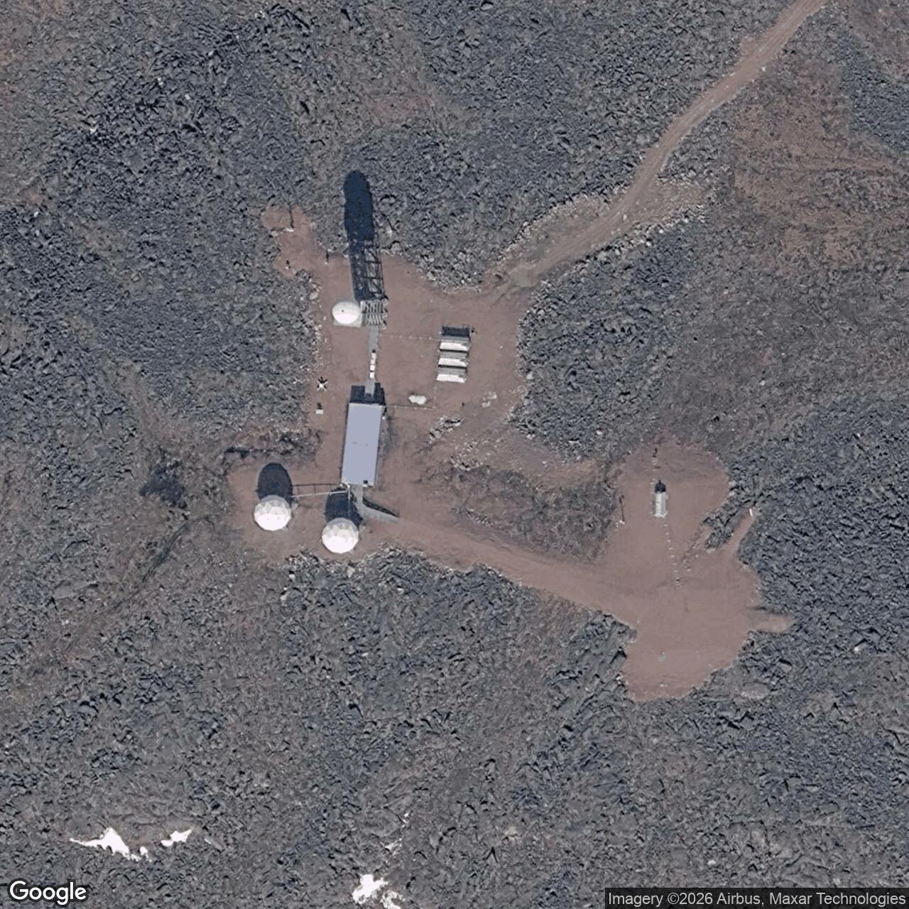
Western Electric built the original DEW Line in the mid-1950s. Construction and 1956 photographs show a rocky, wind-exposed compound supplied through a lower landing area. The line entered service in 1957, and CAM-4 became one of the continuously staffed auxiliary posts. A contemporary station plan puts the principal building train, radar, antenna positions, garage, warehouse and fuel storage together on the high station ground. [1] [2] [9]
The plan identifies two 65,000-gallon diesel tanks, a 150,000-gallon rubber fuel tank, separate POL storage pads and a 30-foot antenna. A 1956 exterior view also shows the elevated radome above the connected modules, a tall guyed communications mast and three dish antennas on separate steel frames. The long modular building sheltered much of the working and living space, so a crew could move between essential rooms without going outside in severe weather. [2] [3] [9]
The lower airfield had a 110-by-3,520-foot runway, apron, 16-by-24-foot warehouse, 24-by-48-foot garage, a 65,000-gallon diesel tank and emergency shelters. Roads connected it to the upper compound. The site plan also marks lakes used for summer and winter water supply and a gravel source. Air transport was essential for relief crews, mail, food and critical parts; vehicles then brought loads uphill to the watch station. [3] [9]
Radar and Communications Equipment
The main search set was the AN/FPS-19, the dual-channel radar associated with DEW Line auxiliary stations. Its antenna rotated inside a large radome to protect it from ice and wind. Radar operators at CAM-4 watched the display and worked with adjacent posts to maintain a coherent warning picture. Technicians had to keep the radar, generators, radios and heating plant in service through long periods without outside repair support. [2] [3] [8]
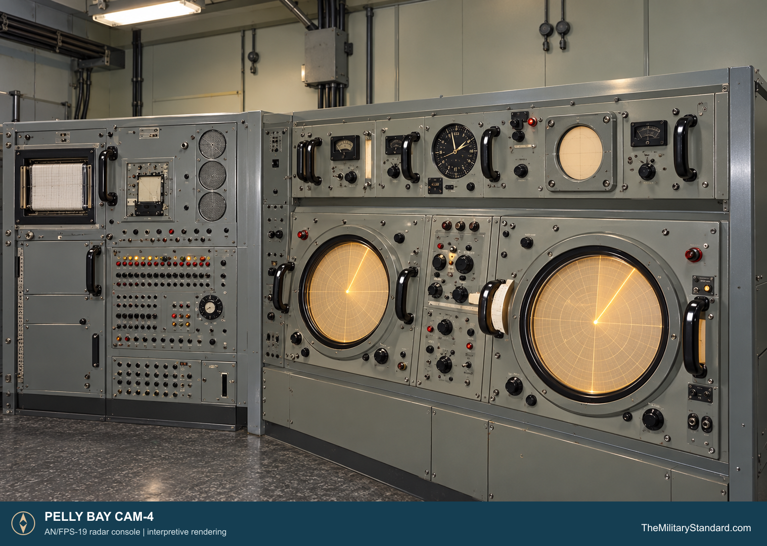
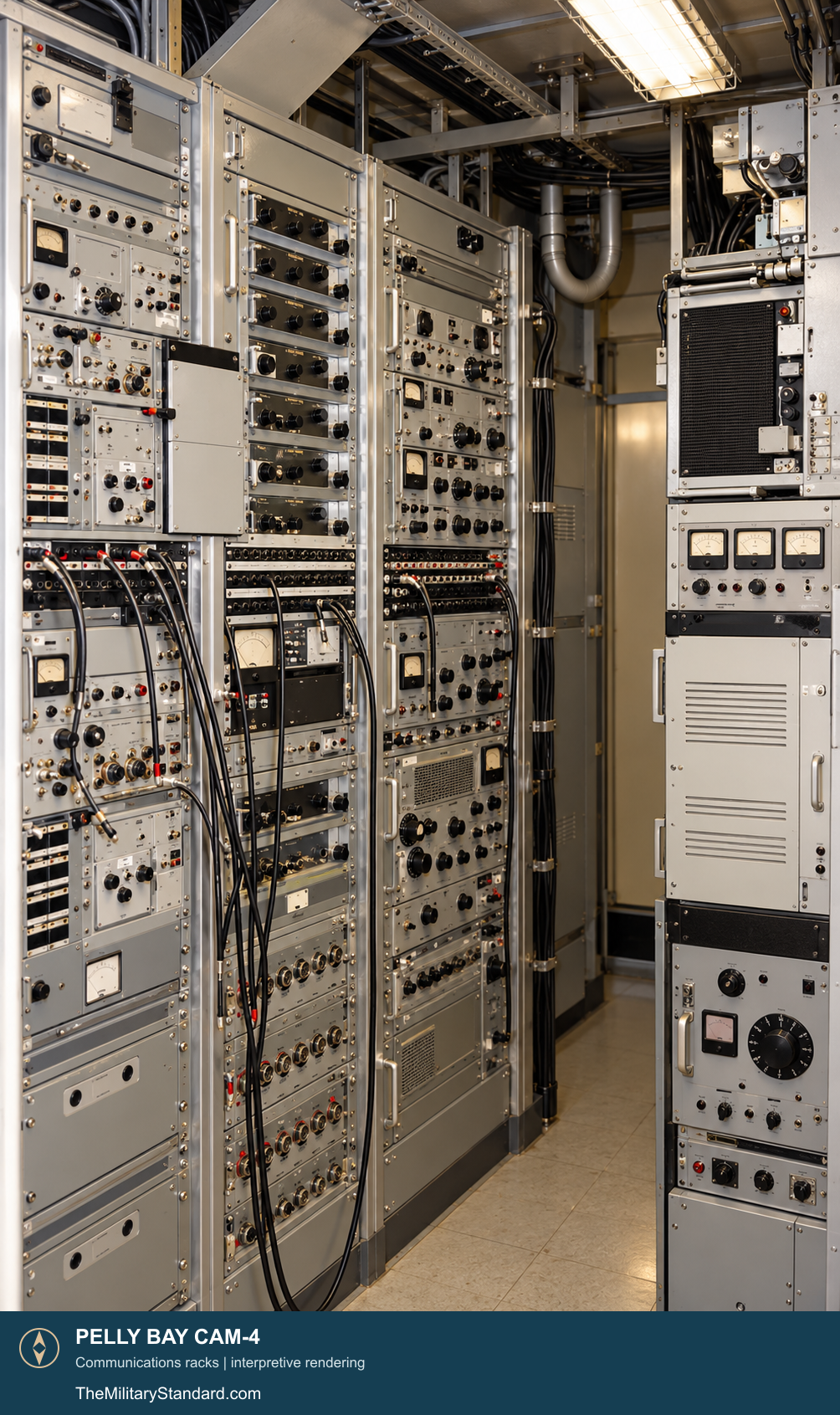
A CAM-4 technician photographed in 1961 is identified with the AN/FPS-19. The station gallery also identifies an AN/FRC-45 lateral troposcatter installation. Brian Simon, a radio technician stationed at Pelly Bay in 1960 and 1961, described VHF and UHF ground-to-air radios, a local vehicle and intermediate-site radio net, a low-frequency air-navigation beacon and emergency long-range radio equipment. These systems supported aircraft, the station crew and the warning line as well as the radar itself. [2] [3]
Simon identified the air-ground frequencies as 122.2 and 121.5 MHz on VHF and 236.6 and 243 MHz on UHF. He recalled Collins 242F3 transmitters and 51N2B receivers for VHF, AN/GRT-3 and AN/URR-35 sets for UHF, GE VO-38 equipment for the local net, and a Wilcox 99C beacon. His account also describes a Collins 431B1 emergency transmitter and 51J-4 receiver. These are a documented 1960 to 1961 communications snapshot, rather than a claim that every set remained in use for the station's entire life. [3]
Personnel, Logistics and Daily Life
CAM-4 was a lived-in station as well as an electronics site. Simon arrived from Hall Beach in August 1960 aboard an aircraft carrying personnel, mail and films. He names station chief Rudy Hubner, lead radio technician Gaetan Chapeau, cook Red Chenil, technician Tom Billowich and console operator Doug Wright among people at the post during his tour. Contractors staffed the watch, maintained the equipment and ran the power plant, kitchen, transport and supply functions. [3] [4]
The station plan shows why support work occupied so much of the crew's time. Drinking water was hauled from lakes, with a longer summer trip and shorter winter route as conditions changed. Drivers, mechanics and technicians had to keep the road, runway, vehicles, fuel system and generators working. Weather could delay flights and leave the crew waiting for people or parts. A 1957 station account describes the first aircraft arrival after six weeks without a flight. [2] [3] [9]
Inside the modules, meals and recreation helped divide a winter of long watches. Simon remembered films, cards and a small social room, as well as a Christmas gathering in 1960. The contractor station operated through extreme darkness, cold and isolation, with a small crew depending on each other for both the radar mission and ordinary daily needs. Summer brought more aircraft and maintenance activity, while winter could make the airstrip and water haul difficult. [2] [3] [4]
Later Service and Replacement
The original auxiliary station remained part of the DEW Line after the 1963 retirement of many smaller intermediate posts. In the 1980s, CAM-4 was among the difficult-to-supply locations that relied on an annual fuel airlift. Its staffed radar watch continued while Canada and the United States built a replacement system with unattended short-range sites and a smaller number of long-range stations. [4] [7]
A North Warning System short-range radar at Pelly Bay was established in September 1991, and the original DEW Line operation ended in 1992. Federal land schedules separately name the former DEW Line area and the later CAM-4 radar parcel, with runway and road parcels for the successor installation. The later radar carried forward the Arctic warning mission at Pelly Bay without the continuously staffed auxiliary station of the 1950s and 1960s. [5] [6] [7]
Chronology
- Mid-1950s Western Electric builds the Pelly Bay auxiliary station and supporting airstrip. [1] [2]
- 1956 Exterior and aerial photographs record the station during construction. [2]
- 1957 The DEW Line enters service with CAM-4 as a staffed auxiliary radar station. [1] [2]
- 1960 to 1961 Brian Simon serves as a CAM-4 radio technician and records the station's equipment and daily routines. [2] [3]
- Mid-1980s CAM-4 is among the remote stations supplied by annual fuel airlift. [4]
- September 1991 The replacement CAM-4 North Warning System short-range radar is established. [7]
- 1992 The original DEW Line operation ends at Pelly Bay. [7]
Related Sites
- DEW Line station directory
- DEW Line history
- Simpson Lake CAM-D
- Keith Bay CAM-E
- Cambridge Bay CAM-Main
- Pelly Bay North Warning System Site
- AN/FPS-19
Information sources (9)
- PDFU.S. Air Force, A History of the DEW Line, 1946-1964
Military planning, Western Electric construction, the 1957 network opening and contractor operation.
- WEBThe DEWLine, Site CAM-4: Pelly Bay
CAM-4 site setting, historic equipment captions, exterior photographs and station personnel.
- WEBBrian Simon, DEW Line Adventures, Arctic station memoir
First-person account of CAM-4 radio duties, crew, supplies, accommodation and life during 1960 and 1961.
- WEBDEW Line Museum, Operations
Auxiliary station organization, module trains, garage, radar watch and the CAM-4 fuel airlift.
- PDFGovernment of Nunavut, Nunavut Lands and Resources Devolution Agreement, 2024
Separate former DEW Line CAM-4 area and later North Warning System radar, road and runway parcels.
- PDFNorth Warning System Airlift, Appendix 1: NWS Site Locations
CAM-4 North Warning System location and present-day site code.
- PDFDEW Line Museum, DEW Line Bibliography and Documentary Resource List, 2005
CAM-4 auxiliary and successor short-range radar listing, September 1991 successor date and 1992 DEW closure.
- PDFU.S. Aerospace Defense Command, Historical Data of the Aerospace Defense Command, 1946-1973
CAM-4 station code, auxiliary role and AN/FPS-19 equipment.
- WEBThe DEWLine, DEW Line Site Plans, CAM-4
Station and airstrip layout, building and fuel-tank labels, runway dimensions and water points.