
Clinton Point DEW Line Station, Canada
For 36 years, a small crew kept a long-range search radar on watch above the Amundsen Gulf coast.
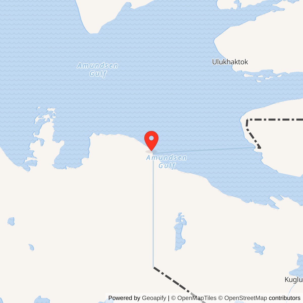
Longitude: -120.74611
Site Number: PIN-1
Current Role: Former station, module train and radome demolished by 2002.
Clinton Point PIN-1 was a staffed auxiliary station on the Canadian DEW Line. It began operation in August 1957 with AN/FPS-19 search radar and AN/FPS-23 Doppler equipment, and remained in service until September 3, 1993. [1] [2]
- DEW Line code
- PIN-1
- Role
- Auxiliary search-radar station
- Equipment
- AN/FPS-19; AN/FPS-23
- DEW service
- August 1957 to September 3, 1993
- Approximate location
- 69.58333, -120.74611
Building the Auxiliary Station
Clinton Point PIN-1 stood on a coastal rise about five miles northwest of the point itself, overlooking Amundsen Gulf in the present-day Northwest Territories. A historical site description placed the station roughly 300 feet above sea level within a 2,939-acre reservation. The surrounding cliffs, gravel beaches and poorly drained tundra shaped the road, airstrip and utility work needed to keep the post supplied. [3] [6]
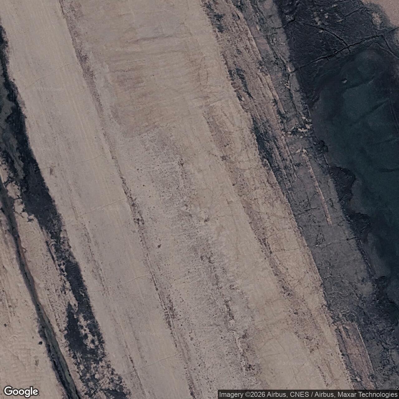
A station-specific siting file dates to 1955, and the federal reserve was established in 1956. A construction photograph from March 1956 shows workers clearing snow from the road to the airstrip. The airstrip connected the otherwise isolated station to personnel, mail and urgent equipment deliveries; seasonal marine supply brought much heavier cargo to the Arctic coast. [3] [6] [8]
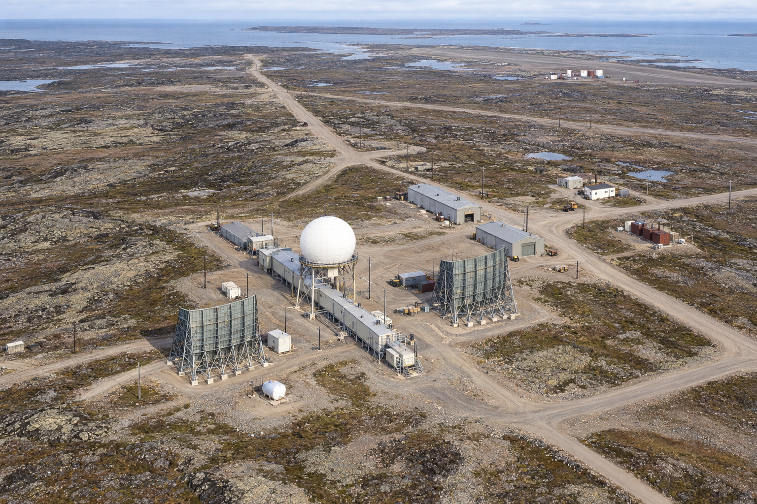
Clinton Point was an auxiliary radar station, larger than the five-module intermediate Doppler posts on either side of it. The standard auxiliary design used a single train of 25 connected prefabricated modules, approximately 400 feet long, elevated on pilings above the permafrost. Technical rooms, generators, offices, kitchen, dining room, recreation space, laundry and sleeping quarters shared that protected corridor. The AN/FPS-19 antennas turned inside a radome above a raised platform. A station plan places the garage, warehouses, fuel storage and two antenna positions near the module train, with a separate airstrip and large fuel tank near the shore. [1] [3] [4] [11]
The layout demanded several kinds of maintenance. Diesel generators provided power and heat; mechanics tended vehicles, tanks and the road; radar technicians worked in the restricted electronic rooms. The historical Clinton Point description records a two-mile round trip to haul potable water in summer and winter. Water supply was therefore part of routine station work, not simply a construction problem. [3] [4]
Radar Watch and Reporting
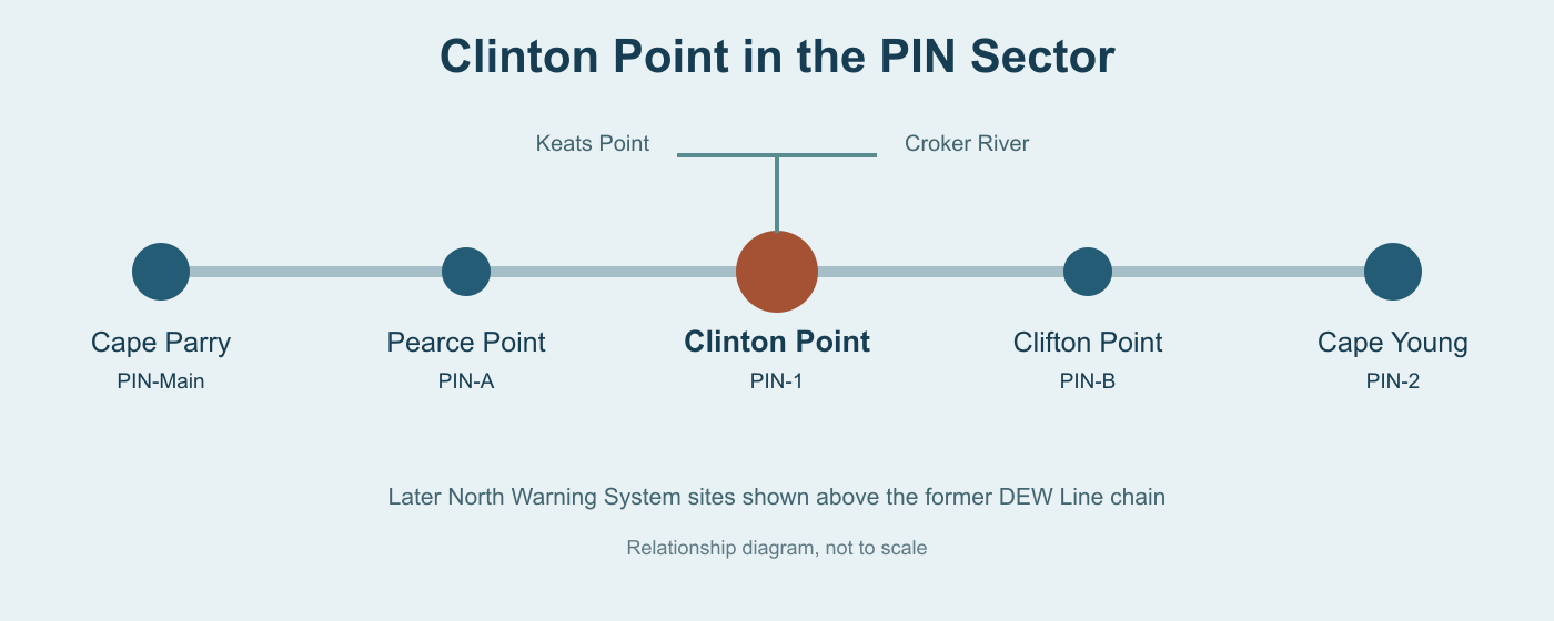
Clinton Point began DEW Line operation in August 1957 with AN/FPS-19 search radar and AN/FPS-23 Doppler equipment. The rotating, dual-beam search radar provided the station's broad aircraft surveillance. Its Doppler receivers also watched paths from Pearce Point PIN-A to the west and Clifton Point PIN-B to the east. Those small intermediate stations transmitted the continuous-wave signals that formed a low-altitude crossing fence between the larger radar posts. [1] [4] [5]
The operating crew did more than watch a screen. When an aircraft appeared, operators checked its movement and identity and passed contact reports to the Cape Parry PIN-Main sector data centre, where military controllers compared reports with flight information and coordinated the warning chain. Voice radio and teletype carried the reports. A veteran station call-sign list records Bank Fog as Clinton Point's tactical call sign. [5] [10]
The intermediate Doppler stations proved unreliable and closed in 1963, including Pearce Point and Clifton Point. Clinton Point remained on watch as a staffed auxiliary search-radar station for three more decades. Its AN/FPS-19 and its reporting crew were part of the continuing DEW Line even after the original Doppler fence ceased operation. [1] [2] [5]
People and Daily Life
The original design called for about 12 people at a typical auxiliary station, but the operating complement commonly grew to about 20 to 25. A veteran account describes seven radar technicians and a lead technician, with mechanics, cooks and other support workers maintaining the rest of the site. These are auxiliary-station patterns rather than a surviving Clinton Point roster. Construction photographs from 1955 and 1956 do preserve names and faces of some workers who helped build this particular post. [3] [4] [5]
The connected module train made winter work possible without crossing the tundra for every meal or shift. Its technical end held generators, workshops, radio transmitters and receivers, surveillance consoles and radar sets; the other modules held food storage, kitchen and dining rooms, recreation, a bar and library, laundry, showers and bedrooms. Outside jobs still meant exposure to wind and severe cold, including runway maintenance, fuel handling and the regular water haul. [3] [4]
Clinton Point depended on the larger Cape Parry sector for specialist support while retaining enough local skill to run an around-the-clock watch. Air supply was vulnerable to weather, and the brief summer shipping season governed heavy resupply. The small crew had to keep the machinery, airstrip and living spaces functioning together through long periods of isolation. [3] [4] [5]
Closure and the Later Radar Network
By 1987, a Canadian government land report still described PIN-1 as an active auxiliary station but recorded plans for its abandonment. The North Warning System brought different, minimally attended short-range sites to Keats Point in July 1991 and Croker River in August 1991. They were separate installations at different locations, not replacement equipment installed in the Clinton Point module train. [2] [8]
Clinton Point's DEW Line operation ended on September 3, 1993. Canadian archival property files preserve the United States Air Force transfer documentation and as-built plans for the former installation. A 1996 bilateral agreement included Clinton Point among the sites to be cleaned and restored after their return to Canada. [2] [7] [9]
Photographs dated 2002 show the radar dome being demolished after the module train had already been removed. The sequence shows the dome on its four-legged raised platform before it was lowered to the ground. The clearing of the old station closed the physical chapter of a radar post that had operated through the Cold War and into the North Warning System transition. [3]
Chronology
- 1955: A station-specific PIN-1 siting file is prepared. [6]
- 1956: The Clinton Point federal reserve is established; construction photographs show the airstrip road being cleared of snow. [3] [8]
- August 1957: PIN-1 begins DEW Line service with AN/FPS-19 search radar and AN/FPS-23 Doppler equipment. [1]
- 1963: The neighbouring intermediate Doppler posts close; Clinton Point continues as an auxiliary search-radar station. [1] [5]
- 1987: A Canadian government land report describes PIN-1 as active but scheduled for abandonment. [8]
- July-August 1991: Separate North Warning System short-range radars are established at Keats Point and Croker River. [2]
- September 3, 1993: Clinton Point ends DEW Line operation. [2]
- 2002: The former station radome is demolished after removal of the modular building train. [3]
Related Sites
Information sources (11)
- PDFAerospace Defense Command, Historical Data of the Aerospace Defense Command, 1946-1973, DEW Line station table, p. 189
Station-specific PIN-1 entry for the August 1957 opening and AN/FPS-19 and AN/FPS-23 equipment.
- PDFDefence Research and Development Canada, Canadian Arctic radar site chronology, 2012, pp. 119-120
Identifies Clinton Point as a DEW auxiliary in the Northwest Territories, its coordinates and September 3, 1993 closure; distinguishes Keats Point and Croker River North Warning System sites.
- WEBThe DEWLine, Clinton Point PIN-1 station record
Reproduces the historical site description, location, acreage, climate, water haul and captions for construction and 2002 demolition photographs.
- WEBThe DEWLine, Auxiliary and Intermediate Site Layouts
Veteran account of the standard 25-module auxiliary train, technical and living spaces, radome, support buildings and planned staffing.
- WEBPaul Kelley, A Brief Introduction to the DEW Line, The DEWLine
Firsthand explanation of auxiliary radar and Doppler operations, staffing, airstrip logistics and reporting to the sector Main station.
- PDFLibrary and Archives Canada, DEW Line Station PIN-1 Clinton Point file, 1955
Finding aid for the 1955 site file in accession 2009-00786-7.
- PDFLibrary and Archives Canada, Department of National Defence property files for Clinton Point PIN-1
Finding aid describing station as-built plans, property records and a United States Air Force to Canadian Department of National Defence transfer file.
- PDFIndian and Northern Affairs Canada, 1987 Inuvialuit land-use report, p. 79
Identifies the Clinton Point reserve as established in 1956 and records the contemporary plan to abandon the auxiliary site.
- WEBGovernment of Canada, 1996 Agreement on the Cleanup and Restoration of DEW Line Sites
Lists Clinton Point PIN-1 among the former Canadian DEW Line sites returned by the United States and covered by the bilateral cleanup settlement.
- WEBThe DEWLine, DEW Line Tactical Call Signs
Veteran-preserved station communications list identifying Clinton Point PIN-1 tactical call sign Bank Fog.
- WEBThe DEWLine, PIN-1 Clinton Point Site Plan
Station-specific plan showing the module train, antenna positions, garage, warehouses, fuel storage, water sources and separate airstrip.