
Simpson Lake DEW Line Station, Canada
A small crew kept a Doppler warning station working on the Ross Hills until the original Arctic intermediate posts closed in 1963.
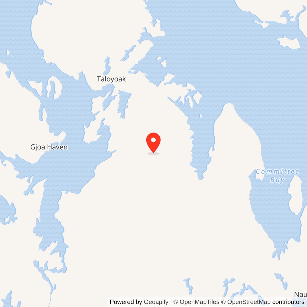
Longitude: -91.956916
Site Number: CAM-D
Current Role: Former station area remediated in 2011 and subsequently monitored; later NWS radar is on adjacent, separately listed ground.
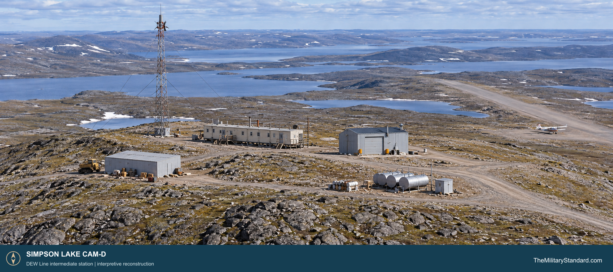
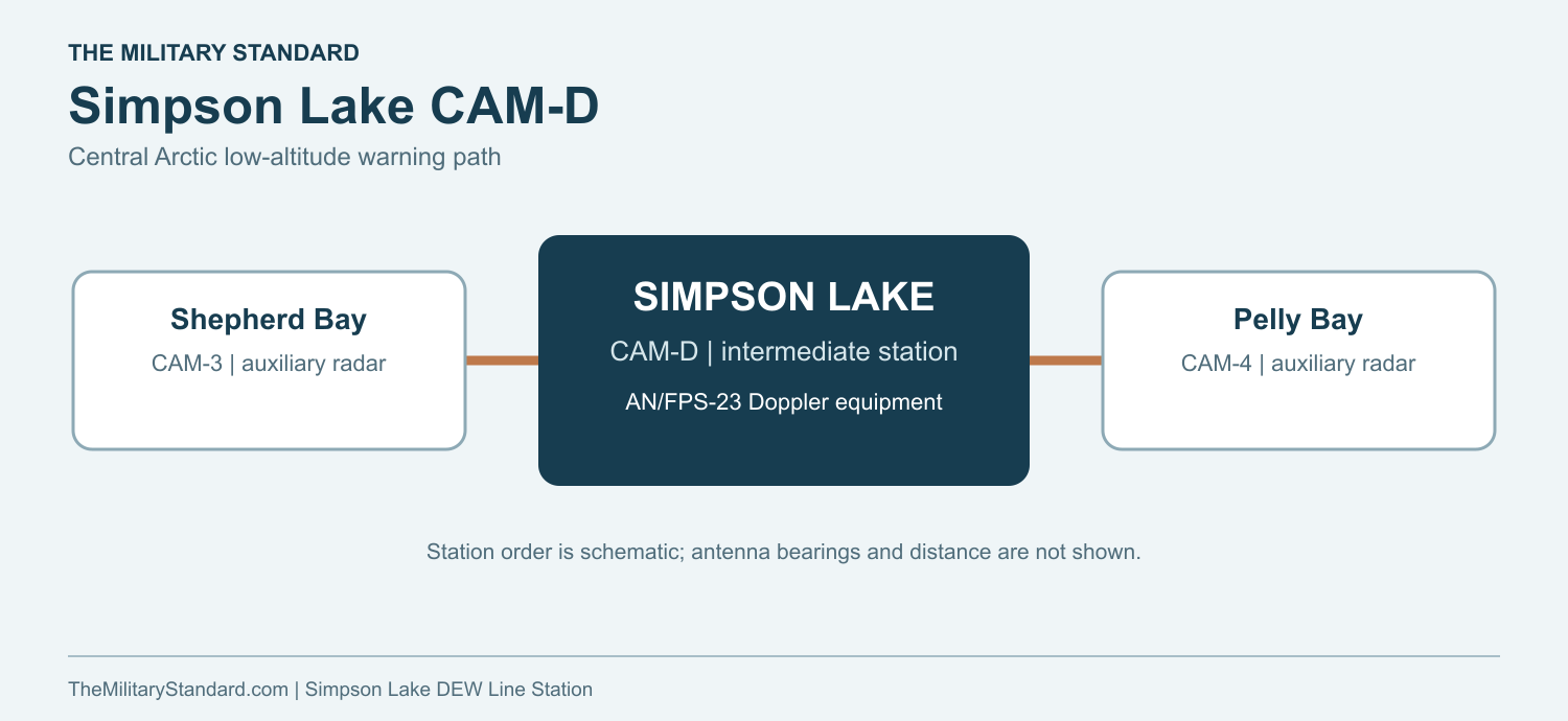
Simpson Lake CAM-D was one of the Distant Early Warning Line intermediate stations across Arctic Canada. Its original compound stood on the Ross Hills, about 120 kilometers southeast of Taloyoak, between Shepherd Bay CAM-3 and Pelly Bay CAM-4. The elevated ground placed a compact warning post above a surrounding landscape of lakes, tundra and low hills. [2] [3]
- DEW Line code
- CAM-D
- Role
- Intermediate low-altitude warning station
- Equipment
- AN/FPS-23 Fluttar; AN/FRT-4 transmitters pictured in 1961
- Operating period
- 1956 or 1957 to 1963
- Location
- Ross Hills, Boothia Peninsula, Nunavut
An Intermediate Station on the Boothia Peninsula
The station guarded a low-altitude interval in the northern warning line. It was a detection and relay post, while the larger auxiliary and main stations performed broad radar search, communications and sector coordination. Cambridge Bay CAM-Main anchored this central Arctic sector. [1] [5]
Building CAM-D and Keeping It Supplied
Construction began in 1956 as Western Electric assembled the DEW Line under U.S. military direction. The remote location demanded an airstrip, fuel storage, prefabricated shelter and an all-season power supply before the station could work as a dependable part of the network. The DEW Line became operational in 1957. [2] [5]
The main station on the Ross Hills included a connected module train, a separate warehouse and garage, Quonset huts, fuel tanks and storage pads. Canadian records also identify an Inuit house, a freshwater-lakes area, a Simpson Lake area and a borrow area. The airstrip was a substantial part of the installation, not merely a temporary building aid. [3]
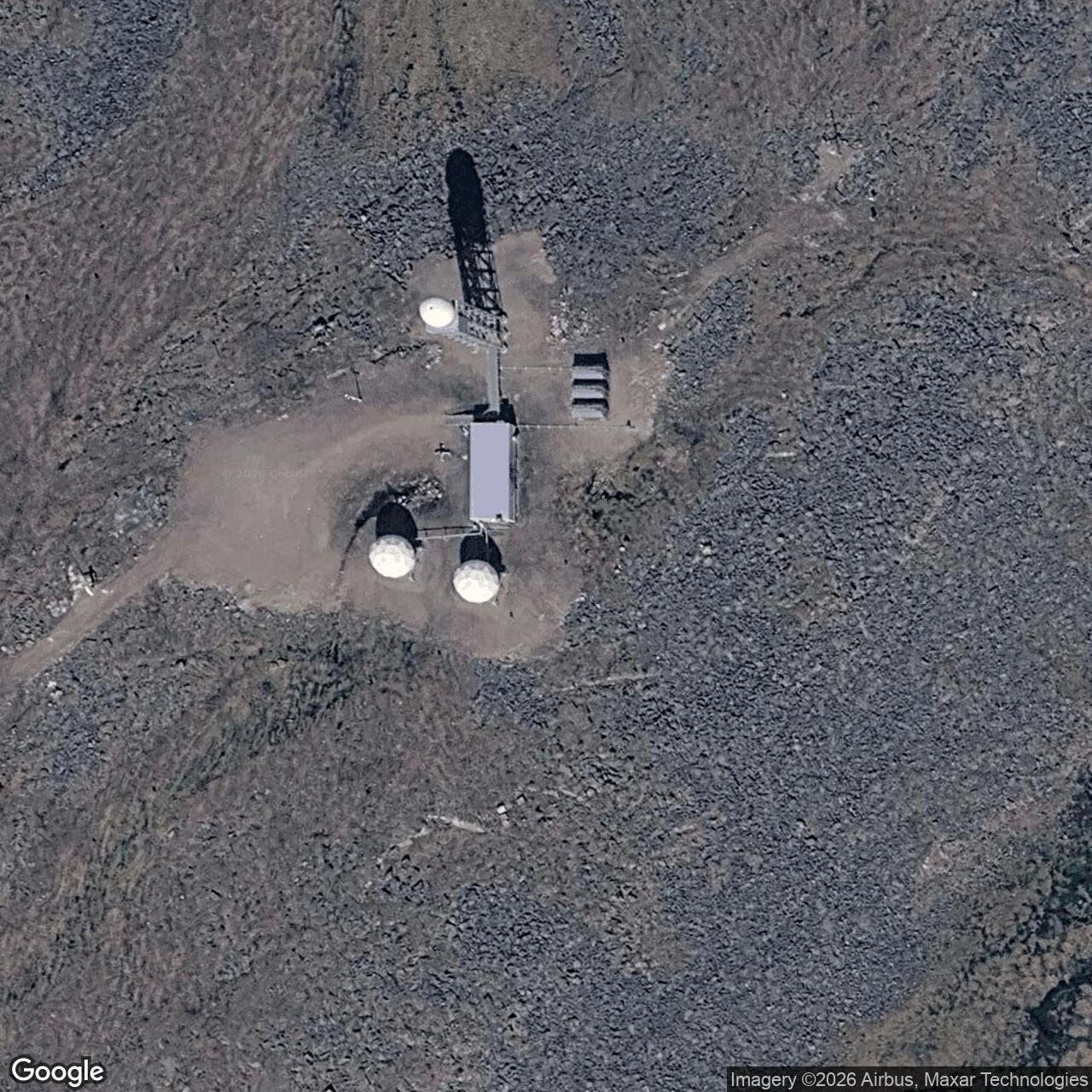
A 1956 photograph shows the narrow module train and large-doored garage below a tall, guyed lattice antenna tower. A later close-up aerial shows the compact main compound. These images make the station smaller and plainer than a large DEW Line auxiliary site: its essential structures were clustered around the electronics, living space and service buildings. [3] [4]
Aircraft carried personnel, urgent parts, food and mail. Maintaining a usable strip and enough stored fuel mattered to the continuity of the warning watch, especially when weather delayed flights. [3] [5]
The AN/FPS-23 Warning Task
CAM-D used AN/FPS-23 Fluttar equipment, a continuous-wave Doppler system designed to detect aircraft that crossed the radio path between stations. The intermediate post maintained its section of the low-altitude fence between Shepherd Bay and Pelly Bay. The equipment complemented, rather than duplicated, the rotating search radars at the larger stations. [1] [5]
A 1961 CAM-D electronics-room photograph identifies AN/FRT-4 transmitters behind a technician monitoring the power panel. The transmitters, receiving path, antenna tower and power system all had to remain stable for a crossing to register. A signal change could trigger a warning for evaluation and onward reporting through the DEW Line network. [4] [5]
The mast and outdoor wiring were exposed to ice and wind; the transmitter and heating plant depended on generator fuel. Technicians had to inspect electrical equipment, restore failed circuits and keep the site warm as well as watch the warning apparatus. Loss of power or a damaged antenna path directly threatened the post's mission. [3] [4] [5]
People and Daily Life at Simpson Lake
CAM-D was a staffed contractor-operated post. Photographs identify a cook, R. Cote, in its kitchen and an electronics technician, Brian Simon, at the equipment panel in 1961. Another station photograph names Ray Dawes, Bert Colepaw and Lyal LaLonde at CAM-D in 1961. A photograph labeled "Our Quarters" shows tented accommodation during that year. [4]
The connected modules housed the station kitchen and electronics, while some personnel used tented quarters. The separate garage and warehouse housed vehicles, parts and supplies. Daily duties included cooking, generator and heating maintenance, electronics checks, snow clearance, fuel handling and communication with other posts. [3] [4] [5]
Winter isolation made routine tasks consequential. A delayed flight could postpone a rotation or a needed part; fuel, food and repair stock had to bridge such gaps. The site's kitchen, runway and garage were therefore as important to the continuing watch as its antenna tower. [3] [4] [5]
Closure and the Later Short-Range Radar
The original intermediate station operated until 1963. NORAD and CONAD planned a coordinated July 21 shutdown for 28 intermediate posts, including this part of the line. CAM-D then ceased its DEW Line watch, and federal authorities later took responsibility for the abandoned station. [1] [2] [8]
The former compound was used as a scientific research station in 1977. Later surveys recorded collapsed buildings, the fallen tower, old vehicles, tanks and material at the former main station. The Canadian government completed a major cleanup of the original station area in 2011, with later monitoring of the remediated ground. [2] [3] [9]
In 1989 the Canadian Department of National Defence constructed an automated short-range radar near the former CAM-D station. The Simpson Lake North Warning System Site carried the warning mission into a new era, decades after the staffed intermediate station had closed. [2] [6] [7]
Chronology
- 1956 Construction of the Simpson Lake intermediate station begins. [2] [4]
- 1957 The original DEW Line opens with CAM-D on the central Canadian route. [1] [2] [5]
- 1961 Station photographs document personnel, the kitchen and AN/FRT-4 transmitters. [4]
- July 21, 1963 The original CAM-D warning post closes during the intermediate-site shutdown. [1] [2] [8]
- 1977 The former station is converted to a scientific research station. [9]
- 1989 Canada constructs an adjacent automated short-range radar facility. [2]
- 2011 Major remediation of the original station area is completed. [2] [3]
Related Sites
- DEW Line station directory
- DEW Line history
- Shepherd Bay CAM-3
- Pelly Bay CAM-4
- Cambridge Bay CAM-Main
- Simpson Lake North Warning System Site
- AN/FPS-23 Fluttar
- AN/FPS-124
Information sources (9)
- PDFU.S. Aerospace Defense Command, Historical Data of the Aerospace Defense Command, 1946-1973, DEW Line station table
CAM-D identification, intermediate-station role, AN/FPS-23 equipment, manual operation and 1963 closure.
- PDFAboriginal Affairs and Northern Development Canada, The Big Picture: Contaminated Sites in Nunavut, 2012, p. 12
Original 1956 to 1963 station, location, adjacent 1989 automated radar construction and surviving physical evidence.
- PDFAboriginal Affairs and Northern Development Canada, Northern Contaminated Sites Program Performance Report 2011-2012, pp. 18-19
Ross Hills main station, module train, warehouse, garage, Inuit house, Quonset huts, tanks, airstrip and surrounding operating areas.
- WEBThe DEWLine, Site CAM-D: Simpson Lake
Identified original-station photographs showing the 1956 tower and buildings, 1961 electronics module and kitchen, and separate later radar site.
- PDFU.S. Air Force, A History of the DEW Line, 1946-1964
Military purpose, Western Electric construction program, contractor operation and the coordinated 1963 intermediate-site retirement.
- PDFGovernment of Nunavut, Nunavut Lands and Resources Devolution Agreement, 2024, Schedules 6 and 7
Separate federal listings and area coordinates for former CAM-D and the later CAM-D short-range radar parcel.
- PDFNorth Warning System Airlift, Appendix 1: NWS Site Locations
Official current-era listing and approximate coordinate for the CAM-D short-range radar site.
- PDFU.S. Northern Command, NORAD and CONAD Historical Summary, January to June 1963
Contemporary account of the planned July 21, 1963 shutdown of the intermediate-station group.
- WEBCrown-Indigenous Relations and Northern Affairs Canada, CAM-D Simpson Lake Remediation Project
1977 research-station reuse and subsequent site assessment.