
Lady Franklin Point DEW Line Station, Canada
An Arctic radar outpost became a key communications gateway, then a North Warning System site shaped by a devastating fire.
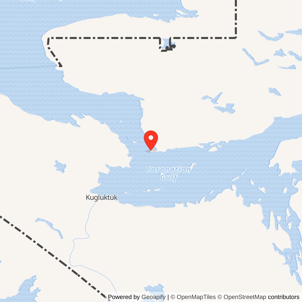
Longitude: -113.22556
Current Role: NWS long-range radar site; verify current operating status.
Lady Franklin Point PIN-3 stood on a low peninsula at the western edge of Victoria Island, about 100 kilometres northeast of today's Kugluktuk, Nunavut. It was an auxiliary radar station in the Distant Early Warning Line, between Bernard Harbour PIN-C to the west and Ross Point PIN-D to the east. Its radar watched the northern air approach while communications carried its reports into a larger warning network. [1] [2] [3]
- DEW Line code
- PIN-3
- Role
- Auxiliary long-range radar and communications gateway
- Radar
- AN/FPS-19; later AN/FPS-117
- Original operation
- August 1957 to June 1989
- Approximate location
- 68.47917, -113.22556
Lady Franklin Point and the PIN Sector
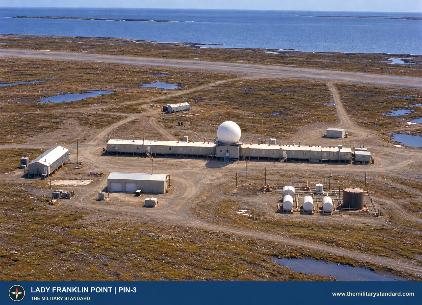
The operating area occupied a tableland roughly 50 feet above sea level on a narrow, peat-covered peninsula. A protected building train, radar tower, power plant and fuel system had to function through long winters and a short shipping season. The original installation eventually became a North Warning System site at the same point. [2] [3] [4]
Construction and Opening
Western Electric's DEW Line program selected PIN-3 during the mid-1950s buildout across Arctic Canada. Construction photographs show the connected modules, water tank and boiler shelter taking shape in 1956. The modules were hauled from an erection tent on rails and set on elevated foundations suited to frozen ground. [3] [4]
Aerospace Defense Command records place Lady Franklin Point in manual operation in August 1957. Its listed equipment included the AN/FPS-19 long-range search radar and AN/FPS-23 Doppler gap-filler equipment. The July 1957 opening of the continental line made PIN-3 part of an active, staffed surveillance chain rather than an isolated experimental outpost. [1] [5]
Workers also had to build the gravel landing strip, shore fuel landing and roads that kept the station supplied. Its position near the sea eased summer delivery, but peat, permafrost, ice and the limited open-water season shaped the entire construction and maintenance plan. [3] [5] [11]
Radar Watch and Communications
The AN/FPS-19 under the radome scanned for approaching aircraft and gave operators range and bearing. Its two-channel design allowed continued use when one channel needed attention. At the surveillance console, operators evaluated returns and sent reports through DEW Line communications to adjoining stations and control centers. PIN-3 also received the Doppler signals from intermediate stations on either side, including Bernard Harbour PIN-C. [1] [4] [5]
The FPS-23 system sought to alarm on low aircraft crossing a fixed path between the larger radars. It did not replace the search radar. The intermediate Doppler network was withdrawn in 1963, while Lady Franklin Point's search-radar station continued to operate. This change removed one layer of low-altitude gap coverage without closing PIN-3. [1] [5]
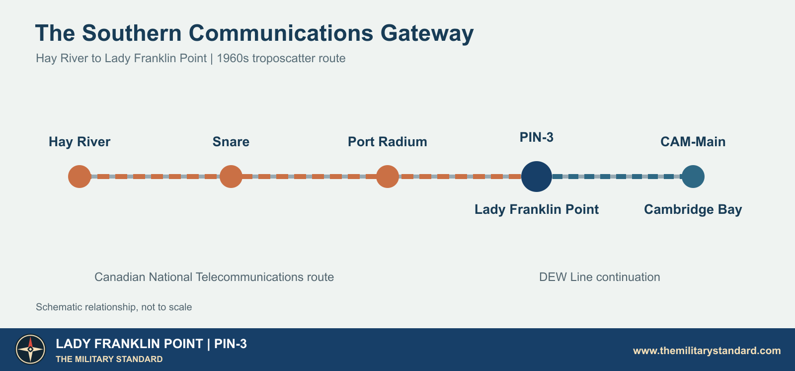
Communications became an especially distinctive part of the site. A Canadian National Telecommunications tropospheric-scatter route brought circuits north from Hay River through Snare and Port Radium to Lady Franklin Point. A 1962 NORAD history described the defence route extending onward to Cambridge Bay. The 1969 Canadian survey gives the Hay River route a capacity of 72 two-way telephone circuits and says 24 were then in service. It identifies the terminal at PIN-3 as the western southern connection into the DEW Line communications system. [6] [7]
The troposcatter link used large fixed reflectors that sent radio signals beyond the horizon toward the next relay. Those antennas were communications equipment, distinct from the rotating AN/FPS-19 radar and from the smaller Doppler system. Canadian National Telecommunications owned and operated the route, which also supported public communications in northern communities. [6] [7]
Buildings, Water, Fuel and Supply
The original auxiliary station's connected building train housed much of the working and domestic life in one weather-protected structure. The standard 25-module arrangement placed generators, radio and radar rooms, a surveillance and communications center, station offices, cold storage, a kitchen and dining room, recreation space, laundry and sleeping rooms along an internal corridor. A photograph identified as PIN-3 shows the long train and radar tower together. The garage and warehouse stood separately. [3] [4]
The radome platform rose about 30 feet above ground. The elevated train and its supports limited heat transfer to the permafrost. Near the operating buildings, tanks stored fuel for electrical generation and heat. The runway and the beach landing formed separate parts of the supply route: aircraft brought people, mail and urgent parts, while seasonal sealift brought heavy cargo and bulk fuel. [3] [4] [5] [11]
The original site plan labels a 4,350-foot runway, aircraft parking and service area, hangar, two main diesel tanks, smaller fuel pads, a heated water tank, warehouses and a garage. Roads linked the working camp to the runway, water point and cargo beach. The plan also marks a 200-foot antenna tower as unused, so the tower should not be treated as part of the station's active radar watch. [13]
A nearby shallow lake supplied drinking water in summer by a roughly half-mile round-trip haul. For winter, the station used an exterior tank of about 65,000 gallons, with circulating hot water to prevent freezing. This was a daily operating concern, not merely a construction detail: a radar shift still depended on water, heat and diesel power. [3]
Canada's later sailing directions describe anchorage about 0.4 mile off the landing beach. Cargo was lightered ashore, and surf, ice and onshore wind could interrupt the operation. The same publication calls the airstrip abandoned today, but its gravel surface was an essential part of the station's staffed-era logistics. [11]
The People at PIN-3
A typical auxiliary site had about 20 to 25 regular personnel, including an eight-person radar technician team, mechanics, radio and power specialists, cooks and other support staff. The surviving PIN-3 material does not give a complete named roster, so that figure describes the auxiliary-station pattern rather than an exact PIN-3 headcount. Federal Electric Corporation operated the line for the Air Force after opening. [4] [5]
The building train put a work shift, meals and a sleeping room within an enclosed walk. Its plan included a recreation room, bar or library, laundry and transient quarters. Outside, crews still maintained antennas, generators, vehicles, fuel, the runway and the water haul in severe weather. Inuit workers and families also contributed to DEW Line operations, particularly heavy-equipment and outside-plant work at auxiliary stations. [4] [5]
PIN-3 photographs preserve more than its machinery. They show a hockey game in 1968 and a "Polar Bear Club" swim in 1967, small glimpses of how people made a social life at a remote Arctic post. Summer brought more maintenance and resupply activity; winter concentrated the station on round-the-clock watch and keeping its utilities working. [3] [5]
North Warning System and the 2000 Fire
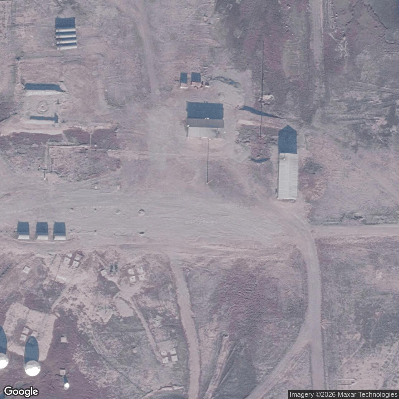
The staffed DEW Line era ended as the North Warning System took over. Canadian defence tables date the NWS long-range radar at Lady Franklin Point to June 1989 and give the same month for the end of the DEW function. The replacement system used an AN/FPS-117 three-dimensional radar with remote monitoring and far fewer people routinely on site. The United States and Canada subsequently recorded PIN-3 among the former DEW properties returned to Canada. [2] [9] [12]
On January 10, 2000, a fire devastated the NWS station. A contemporary report said roughly 90 percent of the facility, including electrical, radar and generating equipment, was destroyed. Technicians flown from Cambridge Bay found the fire still burning. A 2004 Canadian Forces College paper described a coverage gap after the loss and said a replacement FPS-117 had not yet been obtained. [8] [9]
A June 1999 aerial shows the NWS radome at the center of the long building train, with detached buildings and fuel facilities nearby. Reconstruction remained a defence project in the next decade. Defence Construction Canada reported managing work at PIN-3 in 2010-2011. The 2025 Canadian Hydrographic Service describes Lady Franklin Point as an unmanned North Warning System station with some former DEW buildings still standing and an abandoned airstrip. [3] [10] [11]
Chronology
- 1955-1956 Siting and Arctic construction establish the auxiliary station and its protected module train. [3] [4]
- August 1957 PIN-3 enters manual operation with AN/FPS-19 and AN/FPS-23 equipment. [1]
- Early 1960s The Hay River-Lady Franklin Point troposcatter route connects the station to a southern communications network. [6] [7]
- 1963 The FPS-23 intermediate Doppler network is withdrawn; PIN-3 continues its search-radar mission. [1] [5]
- June 1989 North Warning System long-range radar succeeds the staffed DEW station. [2]
- January 10, 2000 Fire destroys most of the NWS radar station. [8] [9]
- 2010-2011 Defence Construction Canada manages a PIN-3 reconstruction project. [10]
- 2025 Canadian sailing directions continue to identify an unmanned NWS station and abandoned airstrip at the point. [11]
Related Sites
Information sources (13)
- PDFAerospace Defense Command, Historical Data of the Aerospace Defense Command, 1946-1973, DEW Line station table, p. 189
PIN-3 opening, original AN/FPS-19 and AN/FPS-23 equipment.
- PDFDefence Research and Development Canada, Survey of COTS-MOTS Lighter than Air Platforms and Communication Relays, 2013, Appendix B
PIN-3 coordinates and June 1989 transition from DEW Line to North Warning System long-range radar.
- WEBThe DEWLine, Lady Franklin Point PIN-3 site profile and historical photographs
Station-specific topography, water supply, 1956 construction views, social photographs and 1999 aerial. Original photos are research references pending reuse rights.
- WEBClive Beckmann and Brian Jeffrey, DEWLine Auxiliary and Intermediate Site Layouts
Auxiliary module-train arrangement, rooms, radar tower and site photograph identified as PIN-3.
- WEBPaul Kelley, A Brief Introduction to the DEW Line
Auxiliary station staffing, radar operation, contractor work and the Arctic supply system.
- PDFGovernment of Canada, 1969 Telecommunications Survey, section 8.4, Hay River-Lady Franklin Point System
Canadian National Telecommunications ownership, route, repeater sites, capacity and connection to the DEW Line.
- PDFNorth American Air Defense Command, Historical Summary, July-December 1962, Central Canada Tropo Route
Defence requirement for voice route from Cambridge Bay through PIN-3 and Port Radium to Hay River.
- WEBThe DEWLine, Nunatsiaq News report reproduced on PIN-3 page, January 2000
Contemporary account of the January 10 fire and damage to the NWS radar site.
- PDFColonel D. S. Higgins, Pragmatic Partnership, Canadian Forces College, June 4, 2004, pp. 36-37
Post-fire coverage gap and lack of a replacement radar as of the 2004 paper.
- PDFDefence Construction Canada, Annual Report 2010-2011, p. 12
Documented reconstruction management at PIN-3 in 2010-2011.
- PDFCanadian Hydrographic Service, ARC 400: General Information, Northern Canada, 2025, p. 5-7
Present-day description of the unmanned NWS site, abandoned airstrip and shore landing.
- WEBCanada-United States Exchange of Notes on Environmental Issues, 1996, appendix
Lady Franklin Point PIN-3 among DEW Line sites returned to Canada between 1989 and 1993.
- WEBThe DEWLine, PIN-3 historical and later station plans
Original runway length, hangar, fuel and water facilities, building train, and later North Warning System layout.