
Sarcpa Lake DEW Line Station, Canada
A small Arctic Doppler watch station between the Mackar Inlet and Hall Beach radar sites.
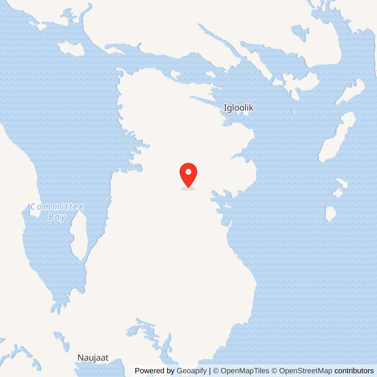
Longitude: -83.319909
Site Number: CAM-F
Current Role: Former station; not an active radar site.
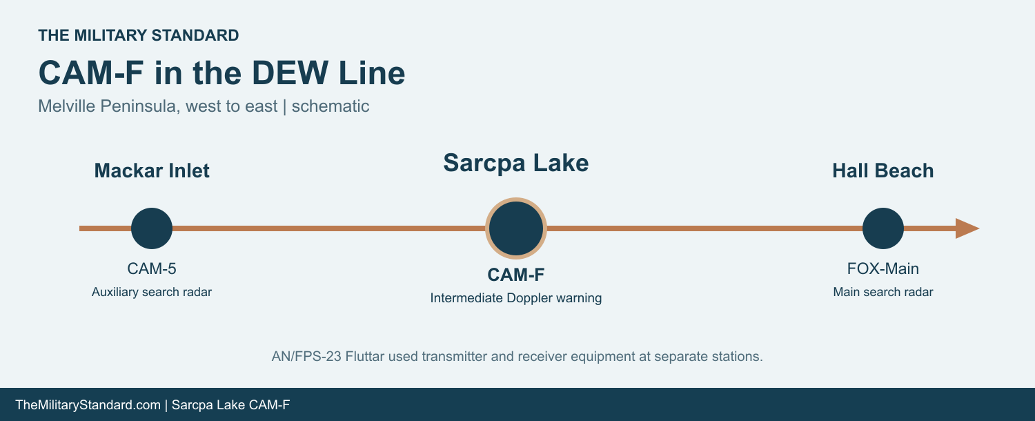
Sarcpa Lake CAM-F was a small, staffed intermediate station on the Distant Early Warning Line in what is now Nunavut. The station occupied a hill north of Sarcpa Lake on the Melville Peninsula. Mackar Inlet CAM-5 lay to the west and Hall Beach FOX-Main to the east. Its low altitude Doppler equipment helped watch the gap between those larger search radar stations. [1] [2] [3]
- DEW Line code
- CAM-F
- Station role
- Intermediate low altitude warning station
- Radar system
- AN/FPS-23 Fluttar
- Service
- August 1957 to July 21, 1963
- Location
- Melville Peninsula, Nunavut
An Intermediate Station on the Central DEW Line
The name appears as Sarcpa Lake in the 1980 Canadian station report and the Air Defense Command station table. Some later lists spell it Scarpa Lake. CAM-F identifies the same original DEW installation in either spelling. The station operated from August 1957 until July 21, 1963, a comparatively short military life within the longer history of the line. [1] [2]
Construction and Site Layout
Crews built CAM-F during the rapid expansion of the DEW Line across the Canadian Arctic in the mid-1950s. The hilltop, about 300 meters above sea level and roughly two kilometers north of the lake's west arm, offered a clear radio path. The construction effort had to bring prefabricated building sections, fuel storage, communications equipment and vehicles to a location without a road connection to southern Canada. [2] [3]
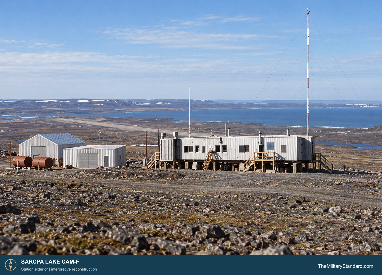
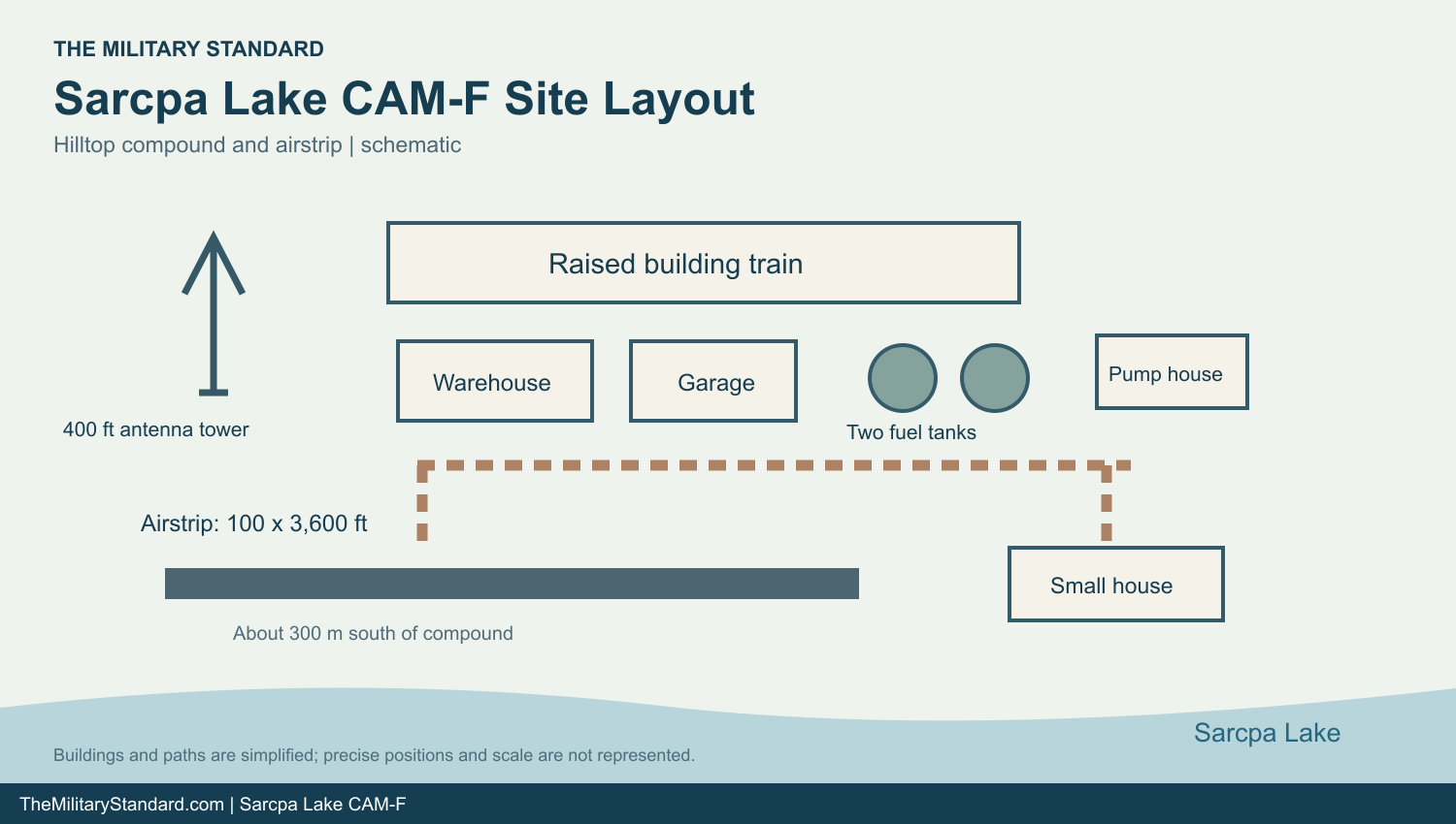
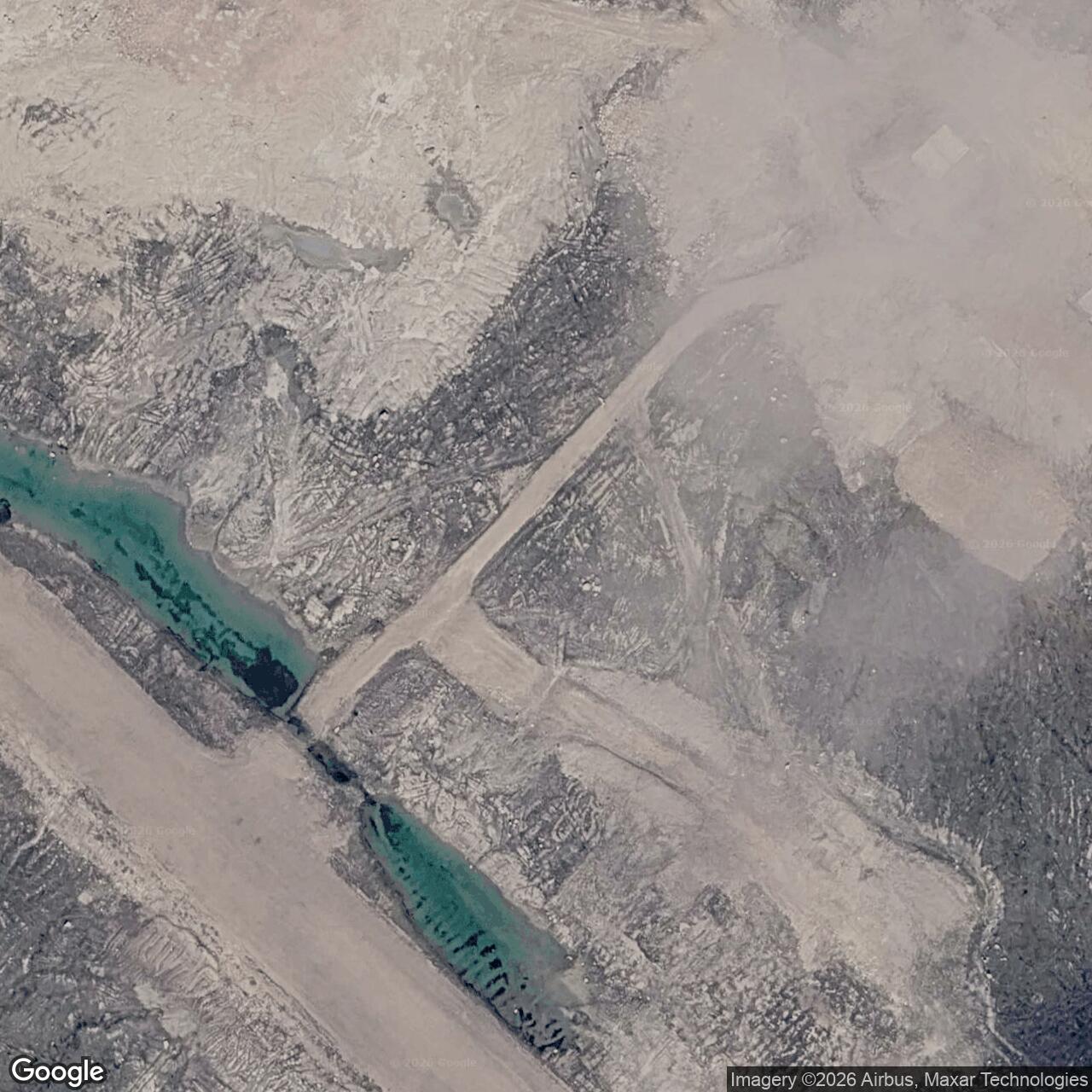
The main compound held a short raised building train, a separate warehouse and garage, two bulk fuel tanks and a pump house. A 400-foot antenna tower was one of the station's most visible structures. A small house stood about 200 meters southeast along the water road. The 100-by-3,600-foot airstrip ran northwest to southeast about 300 meters south of the hilltop compound. Roads linked the runway, station and lake-side construction and water areas. [2]
The original building plan divided the train into rooms for water storage and snow melting, transient sleeping quarters, regular living quarters, a kitchen and dining room, an equipment room, and a power and heat room. Raising the connected modules above the gravel and bedrock kept essential work and living areas together in a compact heated structure. The warehouse and garage held the supplies and vehicles needed to maintain that isolated post. [2]
Low Altitude Radar and Communications
CAM-F belonged to the intermediate class rather than the main search radar class. Its AN/FPS-23 Fluttar system worked as a Doppler warning fence: a continuous radio signal passed between an intermediate station and receivers at neighboring stations, and a crossing aircraft could disturb the signal enough to trigger an alarm. The system was designed to cover low altitude gaps between the larger AN/FPS-19 search radars. It did not give the CAM-F crew a rotating search display that plotted an aircraft's range and bearing. [3] [4]
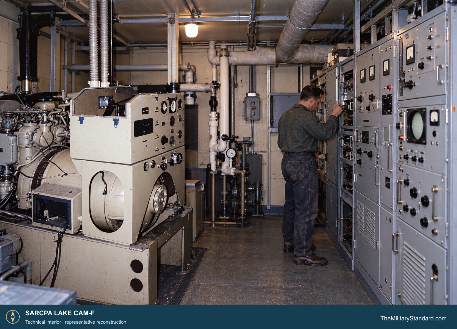
At intermediate sites, AN/FPT-4 transmitter equipment formed part of the distributed AN/FPS-23 system; receivers were placed at neighboring main or auxiliary stations. Reports from the line depended on communications as well as detection. CAM-F's equipment room housed electronics for the station's warning work, while communications circuits connected it to the wider Arctic chain. [2] [3]
The Fluttar warning concept faced demanding Arctic operating conditions and limitations in distinguishing aircraft crossings from other disturbances. Maintaining a useful fence required stable power, tuned electronics, working antennas and clear links to the adjoining posts. CAM-F's generator and fuel plant were therefore part of the air defense mission, not simply conveniences for the crew. [2] [3] [4]
Buildings and Daily Life
The original plan shows how a small station combined work and domestic life. Staff slept and ate within the train, close to the radio equipment and power plant. The water storage and snow melting room supplied a basic necessity where pipes and outdoor tanks were difficult to maintain. Diesel generators provided electricity and heat, while the kitchen, dining room and sleeping rooms allowed a rotating watch to remain on site through the winter. [2]
A crew at CAM-F had to monitor equipment, maintain generators and communications, tend the fuel system, clear snow, and keep vehicles and the runway usable when weather allowed flights. Supplies arrived by charter aircraft and were stored for periods when access became uncertain. The small airstrip was essential to routine relief, parts deliveries and emergencies; it was not a fighter base. [2] [3]
The 1980 inspection found the raised train, warehouse, garage, two fuel tanks, airstrip and access roads still identifiable. Its description also records the 400-foot mast lying on the ground northwest of its former base. Those surviving structures and as-built plans preserve a unusually specific picture of the station's military arrangement even though much of its original technical equipment had already been removed. [2]
Closure and Later Use
The Air Defense Command table records CAM-F's final day of DEW Line operation as July 21, 1963. The wider network retired its intermediate Fluttar stations that year while the larger main and auxiliary search radar sites continued. Sarcpa Lake ceased to be an operating military warning post. [1] [3]
The abandoned station was later used for seasonal scientific work. By the 1980 inspection, York University researchers occupied and adapted parts of the train, including former water and equipment rooms. Canadian records describe research use from the late 1970s into the 1980s. A later federal cleanup program addressed the former site and was completed by 2008. The original CAM-F station is no longer an operating radar site. [2] [5] [6]
Chronology
- Mid-1950s Crews construct the intermediate station and its airstrip on the hill north of Sarcpa Lake. [2] [3]
- August 1957 CAM-F begins DEW Line service. [1]
- July 21, 1963 CAM-F closes as the intermediate Fluttar posts are withdrawn. [1] [3]
- Late 1970s to 1980s The former station supports seasonal scientific research. [2] [5]
- 1980 A Canadian inspection records the surviving buildings, plans and fallen antenna mast. [2]
- 2007 to 2008 Federal cleanup work at the former site concludes. [6]
Related Sites
- Mackar Inlet CAM-5
- Hall Beach FOX-Main
- AN/FPS-23 Fluttar Radar
- DEW Line Station Directory
- DEW Line History
Information sources (6)
- PDF[1] U.S. Air Defense Command, Historical Data, 1946-1973, DEW Line station table
Lists CAM-F Sarcpa Lake as operating from August 1957 until July 21, 1963.
- PDF[2] D. E. Rodger, CAM-F (Sarcpa Lake) DEW Line Station Condition Report, September 1980
Contemporary site description, coordinates, 400-foot mast, 3,600-foot airstrip, photographs and as-built building plans.
- PDF[3] U.S. Air Defense Command, A History of the DEW Line, 1946-1964
Documents the original line, intermediate Fluttar stations, the AN/FPS-23 system and the 1963 changes.
- WEB[4] MIT Lincoln Laboratory, SAGE and the Distant Early Warning Line
Explains development of the Fluttar low-altitude Doppler warning system.
- PDF[5] Government of Canada, 2007-2008 Arctic Contaminants Program report, CAM-F Sarcpa Lake entry
Records subsequent scientific use of the station and surviving structures after DEW service.
- PDF[6] Government of Canada, 2012 former DEW Line sites overview
Identifies the former CAM-F site and its completed cleanup program.