
Hall Beach DEW Line Station, Canada
FOX-Main linked radar warning, Arctic communications and air supply across a wide sector of the DEW Line.
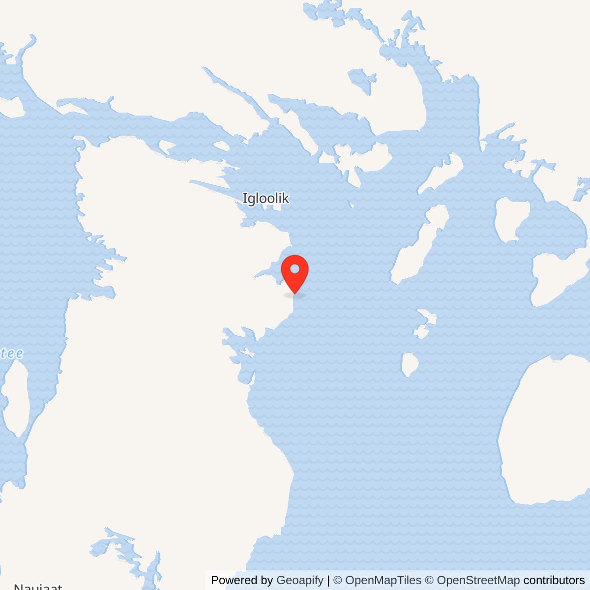
Longitude: -81.226306
Current Role: Staffed North Warning System long-range radar and logistics support site.
Hall Beach FOX-Main was the command and support center for the FOX sector of the Distant Early Warning Line. It stood beside the present community of Sanirajak on the Melville Peninsula, facing Foxe Basin. Its search radar watched northern approaches to North America, while the station collected reports from neighboring posts and passed warnings south. The station also supplied and administered roughly eight to ten auxiliary and intermediate sites. [1] [2] [3]
- DEW Line code
- FOX-Main
- Station role
- Main radar, sector control and logistics hub
- Original radar
- AN/FPS-19
- Later radar
- AN/FPS-117
- Location
- Near Sanirajak, Nunavut
A Main Station on the Arctic Warning Line
Canada and the United States built the DEW Line during the 1950s to gain warning time against a possible bomber attack over the polar region. Construction of FOX-Main began in 1955. Its principal buildings were erected in 1955 and 1956, and the line was declared operational in July 1957. Hall Beach became one of four Canadian main stations, with a larger staff and broader responsibilities than an auxiliary or intermediate post. [4] [1] [3]
Construction and Site Layout
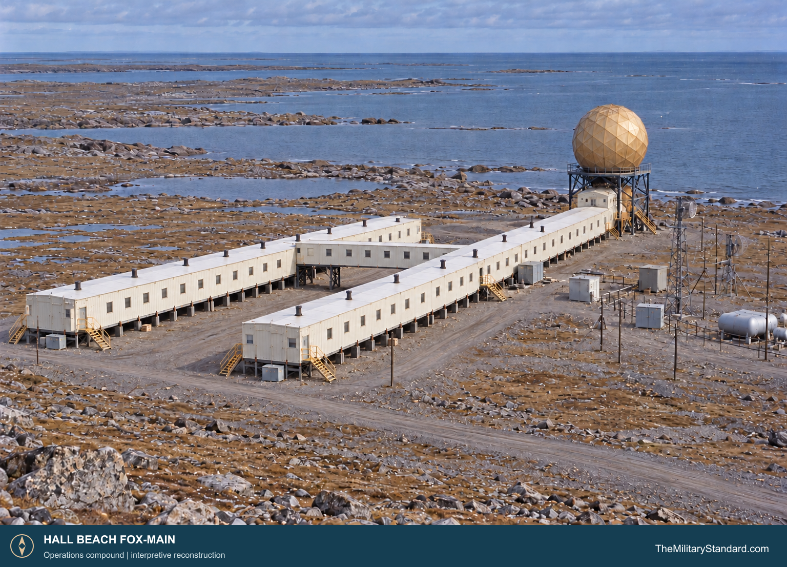
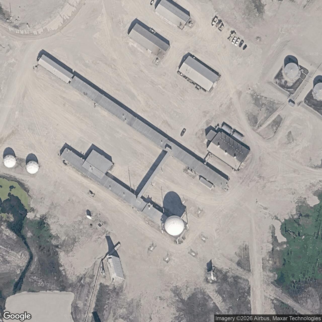
Western Electric directed the standardized construction program. Crews brought prefabricated modules, steel, fuel and technical equipment to an isolated coastal plain, then placed the station on gravel pads that separated buildings from permafrost. The operations compound held the parallel A and B module trains, the radar dome, a garage, power facilities and fuel tanks. A separate antenna field lay to the west, while the hangar and terminal served the airfield sector. [1] [3] [6] [10] [17]
Module Train A formed the working core. Its original 24 prefabricated sections were each about 24 feet long and 18 feet wide, set end to end on a timber deck about five feet above the ground. Radar and communications rooms and offices occupied this train. The radome rose above one end, giving technicians protected access to the rotating radar equipment. A heated service bridge joined A to the parallel accommodation train. [1]
Module Train B contained 26 prefabricated sections of similar size. It provided sleeping and common rooms for the station staff and transient personnel. A 75-foot gable-roof extension was added at the west end in the 1970s. The parallel trains and their raised foundations made movement between work and quarters possible in severe weather while allowing drifting snow to pass beneath the buildings. [3] [1]
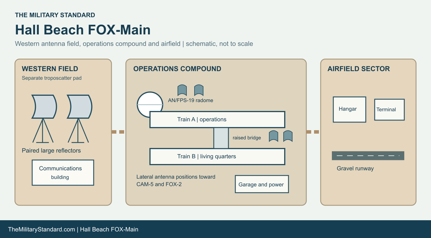
The airfield sector included a large 1955-1956 steel-frame hangar, about 115 feet square, with sliding aircraft doors and an emergency siren tower. A separate air terminal was built in 1960 for avionic equipment and office work. The terminal and hangar stood together on the airfield gravel pad. Warehouses, service buildings, fuel storage and an access road supported the flow of people and supplies between runway and radar compound. [6] [7] [8]
Radar, Communications and Sector Control
The original main search set was the AN/FPS-19, a rotating surveillance radar sheltered by the geodesic radome. Radar technicians watched its displays for aircraft tracks, checked reported traffic against expected flights and reported unidentified contacts. Hall Beach was a sector data center as well as a local radar site: operators received information from other FOX stations and sent warning traffic through the communications network. [2] [4] [5]
The AN/FPS-23 Fluttar system provided low-altitude gap warning between the larger search radar stations. Transmitters at intermediate posts and receivers at adjoining sites formed radio paths that could register an aircraft crossing. FOX-Main also had a tall Doppler antenna tower. The main radar and Fluttar equipment served different jobs, so a Fluttar alarm had to be evaluated alongside search radar reports. [4] [2] [10]
The communications plant extended beyond the radar compound. A separate western field held a troposcatter building and paired large reflectors. Lateral antennas near the module trains served routes toward CAM-5 and FOX-2; a 1957 station photograph shows two west-facing 60-foot reflectors. The fixed antennas carried signals over the horizon across the Arctic. Communications operators and encryption staff handled the reports and messages that made a radar contact useful to air-defense headquarters. Voice radio supported aircraft contact, while teletypes carried traffic between stations and command centers. [10] [17] [2] [5]
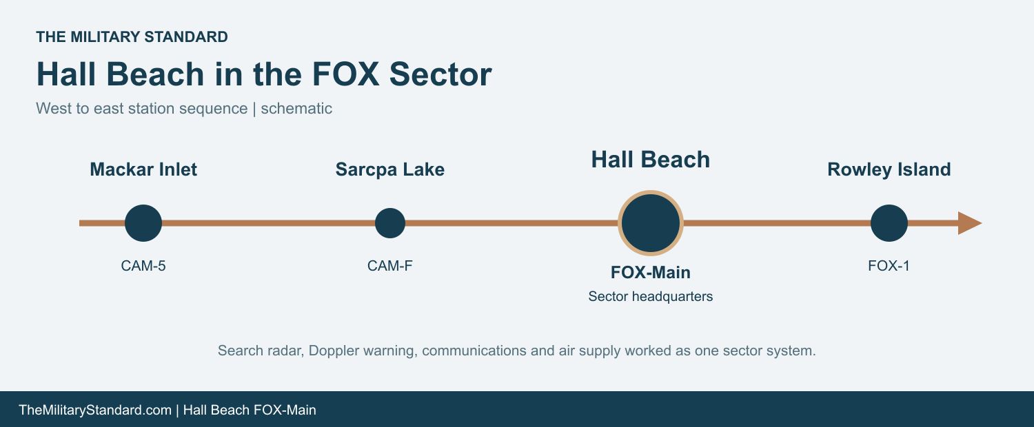
The FOX sector stretched west toward Mackar Inlet and Sarcpa Lake and east toward Rowley Island and more distant Baffin Island stations. FOX-Main provided technical help, supplies and administration across that span. Main-site specialists could travel to another station when a failure exceeded its local crew's ability to repair it. [3] [5]
Project Red Sea tested this section of the completed warning line from May through September 1958. Thirteen stations between Cambridge Bay and Hall Beach participated as Strategic Air Command aircraft made 73 penetration flights at varying altitudes. The radar chain detected every flight; 72 warnings were sent rearward, and 71 reached the designated defense centers. The exercise tested the reporting and communications chain as well as radar coverage. [4]
The People and Daily Work
The main station combined civilian contract workers with military command and liaison personnel. Radar technicians, communications operators, mechanics, power-plant staff, supply workers, cooks, aircraft crews and managers kept the post functioning. In the late 1960s, about 100 people worked for the station, airline and weather service organizations based at FOX-Main. Seven permanent Inuit employees lived at the site with their families. [16] [9]
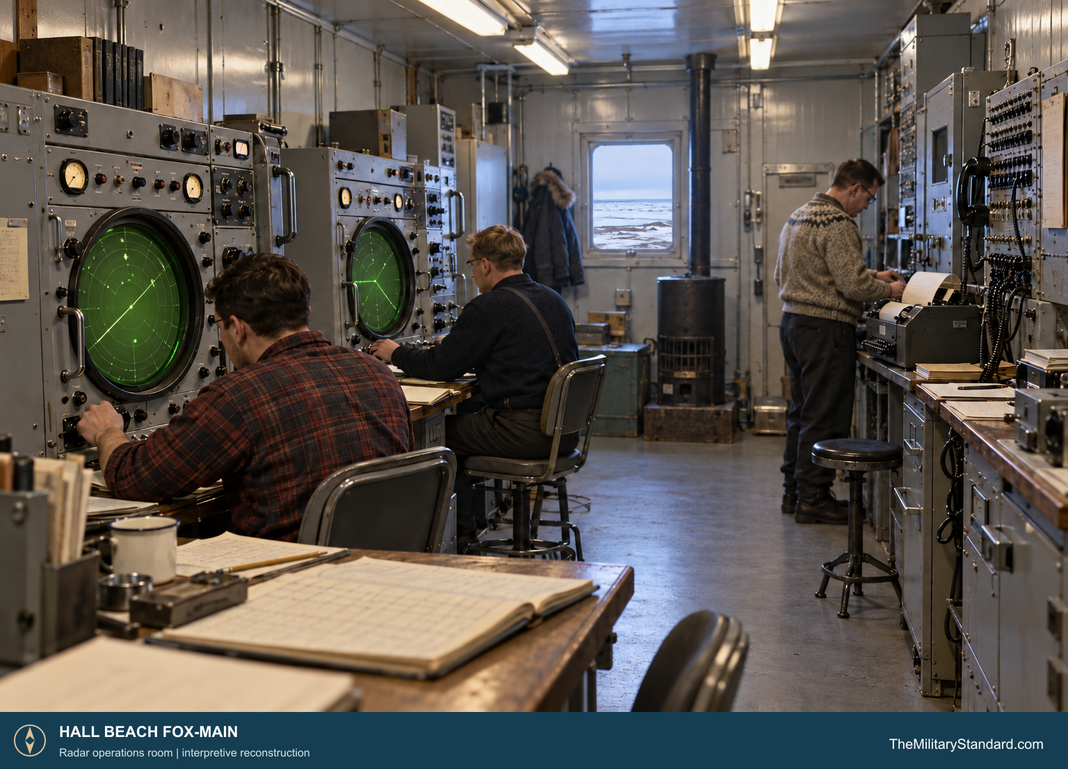
Radar and communications work ran around the clock. One technician watched the scope while another maintained equipment; operators compared tracks with flight plans and passed unresolved contacts to the south. Generator checks, antenna path tests, fuel handling, vehicle repair and snow removal were equally important to keeping the warning circuit available. The power plant supplied heat and electricity, and waste heat from the electronics could be circulated through the module trains. [2] [1] [3]
The accommodation train offered bedrooms and shared rooms close to the working train. That arrangement reduced outdoor exposure, but winter still confined personnel to a narrow enclosed world for long stretches. Meals, recreation and routine maintenance shaped life between shifts. The garage kept vehicles ready; the airfield received relief staff, mail, parts and emergency traffic when weather permitted. [3] [8] [9] [5]
Hall Beach was also a transport hub. Contract aircraft connected Winnipeg with FOX-Main, and lateral flights carried personnel and cargo onward to other Canadian DEW stations. The hangar and 1960 terminal gave this air service a permanent home, while sea docking supported bulk supplies. The station helped draw settlement and employment to nearby Hall Beach, now Sanirajak, where Inuit workers and families experienced major changes alongside the military project. [5] [6] [7] [16] [14]
Canadian Command and Later Radar Service
At the beginning of DEW operations, United States Air Force liaison officers performed much of the military role at Canadian main stations. The Royal Canadian Air Force assumed the principal military responsibilities at Hall Beach and the other Canadian main sites in 1959. A Canadian commander and staff then supervised the military warning function while civilian contractors continued much of the operation and maintenance. [9]
The original DEW Line equipment was progressively altered as radar and communications technology changed. FOX-Main remained a major Arctic warning site until its DEW-era mission ended in September 1989. The North Warning System then established a long-range radar and logistics support function at Hall Beach. The later radar is identified as an AN/FPS-117; the modern system sends data by satellite to the Canadian Air Defence Sector at North Bay. [11] [12] [15]
Hall Beach remains one of the staffed long-range radar and logistics locations in the Canadian North Warning System. Several original structures, including the parallel module trains, airfield buildings, radome setting and communications reflectors, have remained recognizable within the modern station. Their survival makes FOX-Main an unusually clear example of how a Cold War main station was arranged. [13] [1] [3] [6] [7]
Further Viewing
Watch the Hall Beach video on Vimeo.
Chronology
- 1955 Construction begins at FOX-Main; crews erect principal modules and the hangar. [1] [6] [10]
- 1956 The main radome and operations compound take shape. [10]
- July 31, 1957 The DEW Line is declared operational, including the Hall Beach main station. [4]
- May-September 1958 Project Red Sea tests thirteen stations between Cambridge Bay and Hall Beach. [4]
- 1959 The RCAF assumes major military responsibilities at the Canadian main stations. [9]
- 1960 The air terminal is built beside the hangar. [7]
- 1970s Module Train B receives a 75-foot extension. [3]
- September 1989 FOX-Main transitions from DEW Line operations to the North Warning System. [11]
- 2019-2022 Canadian records identify Hall Beach as a staffed long-range radar and logistics support site. [13] [12]
Related Sites
Information sources (17)
- WEB[1] Parks Canada, Module Train A, FOX-M Hall Beach, Federal Heritage Buildings Review Office
Original operations train, 24 modules, radome, raised foundation, link to Train B and regional role.
- WEB[2] Diefenbunker, Fading Signal: Eyes on the Skies at FOX-MAIN
Station-specific equipment, 24-hour operations, personnel account and 1960s site features.
- WEB[3] Parks Canada, Module Train B, FOX-M Hall Beach, Federal Heritage Buildings Review Office
Original accommodation train, 26 modules, living facilities and 1970s extension.
- PDF[4] U.S. Air Defense Command, A History of the DEW Line, 1946-1964
Construction, 1957 activation, main-station data centers and the Fluttar system.
- PDF[5] DEW Line Operations Handbook, reproduced by the DEWLine Museum
Sector organization, warning and communications procedures, and Winnipeg-to-Hall Beach air service.
- WEB[6] Parks Canada, Hangar, FOX-M Hall Beach, Federal Heritage Buildings Review Office
1955-1956 airfield hangar construction, form and aviation role.
- WEB[7] Parks Canada, Air Terminal Building, FOX-M Hall Beach, Federal Heritage Buildings Review Office
1960 air terminal, avionic office, airfield arrangement and later use.
- WEB[8] Parks Canada, Garage, FOX-M Hall Beach, Federal Heritage Buildings Review Office
Operations-sector vehicle and equipment maintenance building.
- PDF[9] Royal Canadian Air Force, Voxair, June 8, 1977, DEW Line feature
Military command responsibilities at the four Canadian main stations from 1959 and conditions of service.
- WEB[10] Brian Jeffrey, The DEWLine, FOX-Main Hall Beach station gallery
Site-specific 1955-1957 construction and later photographs, layout, antenna and power plant descriptions. Photographs are used for research only.
- PDF[11] DEW Line Bibliography and Documentary Resource List, FOX-M site table
Station coordinate and reported September 1989 DEW-to-North Warning System transition.
- WEB[12] Government of Canada, North Warning System support and logistics report, 2022
Hall Beach logistics support site and remotely monitored radar network.
- WEB[13] Government of Canada, National Defence committee briefing, 2019-2020
Hall Beach and Cambridge Bay identified as the two staffed Canadian North Warning System long-range radar sites.
- WEB[14] Government of Nunavut, Sanirajak community profile
Community name, location and origin alongside the DEW Line station.
- WEB[15] U.S. Air Force procurement attachment, AN/FPS-117 site locations
Lists Hall Beach FOX-M as an AN/FPS-117 long-range radar location.
- PDF[16] Keith J. Crowe, A Cultural Geography of Northern Foxe Basin, Department of Indian Affairs and Northern Development, 1969, pp. 91-92
Contemporary FOX-Main staffing, Inuit employees, airline and weather personnel, sea-docking facilities and the neighboring community.
- WEB[17] The DEWLine, FOX-Main site plans, courtesy Lynden T. Harris
Station plan separating the western troposcatter field, operations compound, lateral antenna routes and airfield facilities.