×
![]()
Titan II 533-7 Missile Silo McConnell AFB Kansas
Titan II 533-7
Wing: 533rd SMW
Squadron: 381st SMS
Date Activated: August 1st 1962
Date Deactivated: November 1st 1985 (8/24/1978 accident took it out of service until deactivated)
Air Force Base: McConnell
State: Kansas
Nearest Town: Rock
Coordinates:
Latitude: 37°24'28.42"N
Longitude: 96°59'57.01"W
Decimal:
Latitude: 37.407894
Longitude: -96.999169
GPS:
Latitude: 37 24.4736666666667
Longitude: -96 59.9501666666667
Longitude: 96°59'57.01"W
Decimal:
Latitude: 37.407894
Longitude: -96.999169
GPS:
Latitude: 37 24.4736666666667
Longitude: -96 59.9501666666667
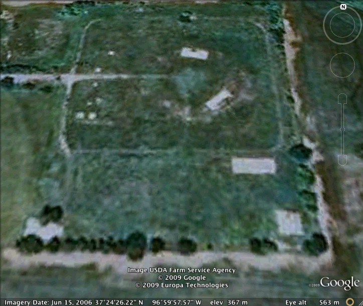
The two largest oxidizer spills that occurred in the Titan II program occurred at this site 14 years apart. The second accident, in 1978, caused the death of two men and the evacuation of the nearby town of Rock. Details of that accident can be found here.
View the satellite image of the intact Titan II silo at the museum to see what this site would have looked like when operational
Read about the Titan II at McConnell AFB
List of all Titan II site Coordinates