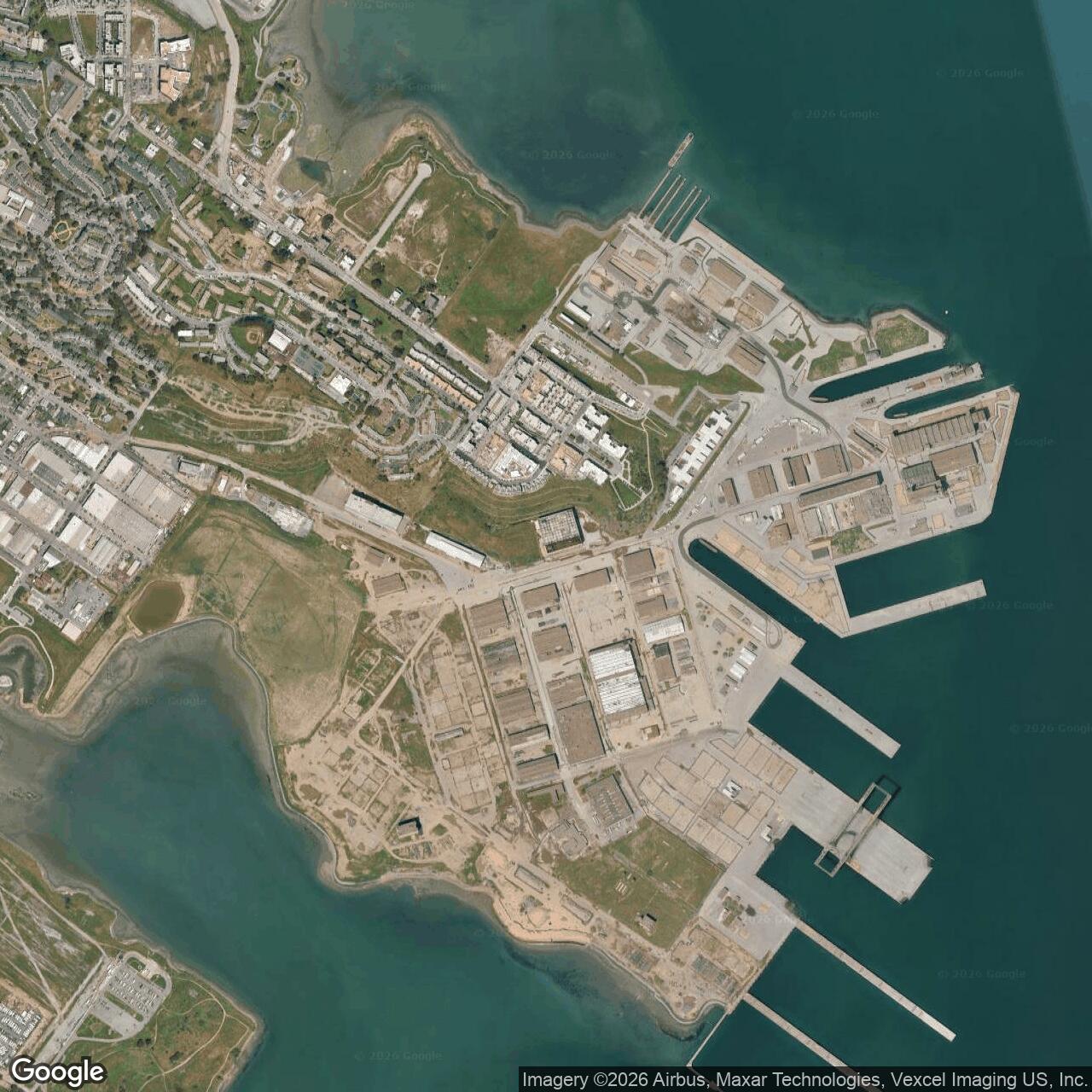
Hunters Point Naval Shipyard, San Francisco California
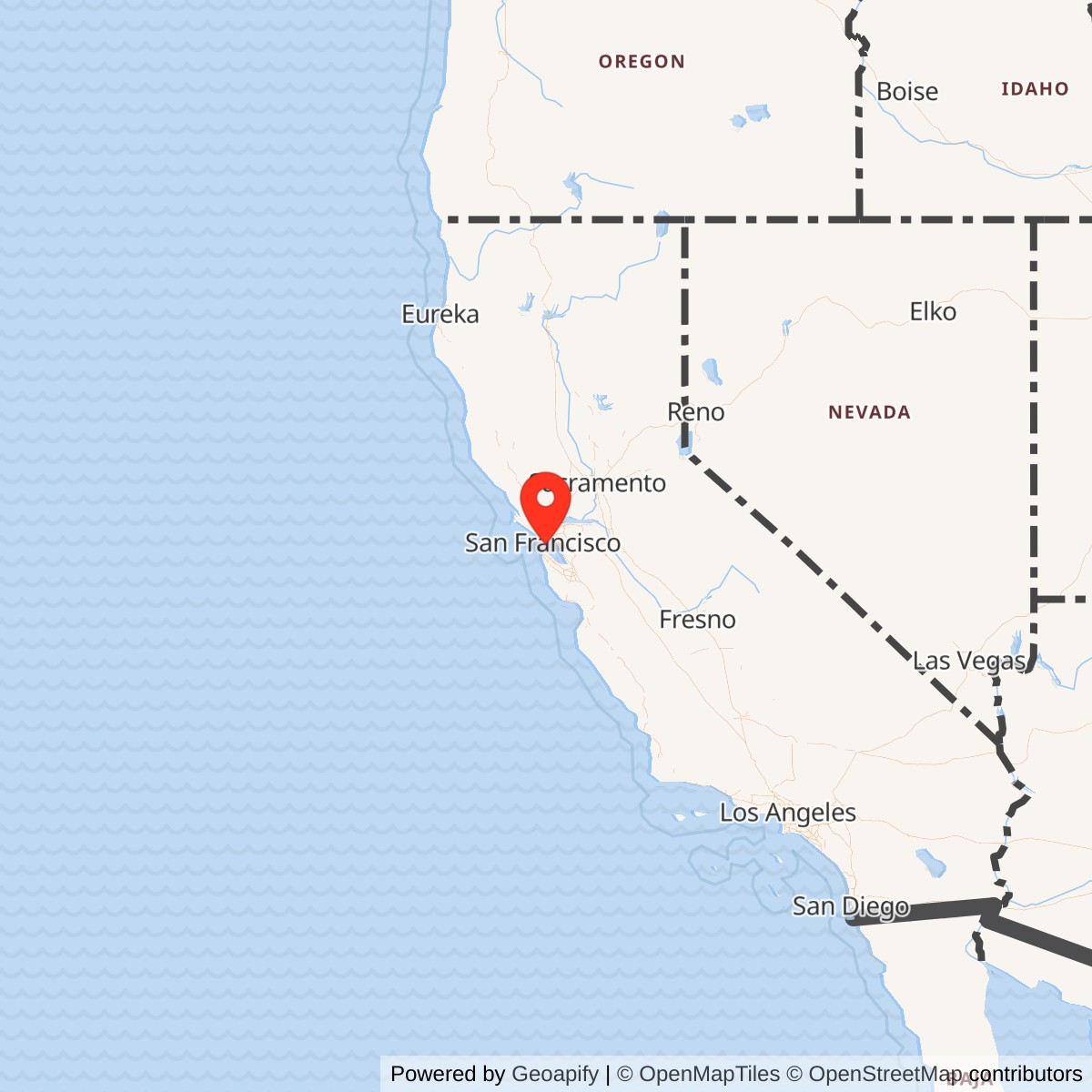
Longitude: -122.3689417
Current Role: Former naval shipyard; Parcel A transferred for housing, parks, and commercial reuse; remaining parcels under Navy cleanup, monitoring, demolition, and phased transfer planning; portions support artist studios, redevelopment activity, and controlled-access environmental work.
At Hunters Point, San Francisco's edge became one of the Navy's hardest-working industrial front doors to the Pacific. Ships came in broken, burned, outdated, radioactive, or simply exhausted from war; the shipyard's job was to turn them around and send them back to sea. That work made the peninsula strategically valuable during World War II and the Cold War, but it also left behind one of the most difficult military-cleanup stories in California. Few former Navy sites combine so much in one landscape: nineteenth-century commercial dry docks, wartime ship repair, the Bay Area home front, postwar radiological research, a massive gantry crane, BRAC disposal, artist studios, Superfund controversy, and a still-unfinished redevelopment future.
Hunters Point Naval Shipyard occupied a filled and reshaped peninsula in the southeastern corner of San Francisco, extending into San Francisco Bay and bordered on the landward side by Bayview-Hunters Point. Its deep water and hard serpentine bedrock made the site useful for graving docks long before the U.S. Navy owned it. Commercial drydock work began in the nineteenth century, and by the early twentieth century the Hunters Point dry docks had become one of the Bay Area's most important ship-repair facilities. The Navy purchased the property on December 29, 1939, as the United States prepared for the possibility of a major Pacific war. By the wartime period the shipyard had become an enormous naval-industrial complex, with hundreds of buildings, major dry docks, miles of rail, and a workforce that helped transform Bayview-Hunters Point.
The installation should be understood as both a naval shipyard and a larger wartime and Cold War support reservation. The official Navy BRAC summary describes Hunters Point as a commercial dry dock facility from 1869 until the Navy purchased it in 1939, then a Navy repair facility primarily from 1945 until 1974. Other historical sources emphasize that Navy control and wartime expansion were already underway in 1940-1941, as the facility became known as the San Francisco Naval Shipyard and then Hunters Point Naval Shipyard. The open date of 1939-12-29 reflects the documented Navy purchase, while the site's intensive military shipyard role developed during 1941-1945.
Acreage figures vary depending on whether submerged land, fill, redevelopment parcels, and cleanup boundaries are being counted. Navy BRAC identifies the former facility as about 934 acres, including about 443 acres of submerged land. EPA identifies the Superfund site as 866 acres. San Francisco planning documents describe the shipyard peninsula itself as a roughly 493-acre landfill peninsula. The difference is not an error; it reflects the way a shipyard, a cleanup site, and an urban redevelopment area are measured for different purposes. The historical Navy site included shoreline, piers, dry docks, submerged lands, industrial parcels, radiological areas, and later BRAC parcels.
Mission Evolution
Hunters Point began as a commercial maritime-industrial site rather than a federal naval station. In 1866, land and submerged rights at Hunters Point were granted for drydock construction, and the California Dry Dock Company opened the original drydock in the late 1860s. The location was chosen because it offered deep water and rock suitable for graving-dock foundations. Over the next decades the shipyard became part of the commercial and industrial growth of San Francisco Bay. Union Iron Works and later Bethlehem-related interests expanded the drydock system, and the site gained a reputation for handling large vessels that could not be served easily elsewhere on the West Coast.The Navy's interest in Hunters Point grew from geography and engineering. Mare Island, the Navy's older Bay Area yard, was indispensable but constrained by the navigation limits of the Napa River channel. Hunters Point offered deep-water access on San Francisco Bay itself. During World War I and the interwar years, the Navy used the private docks when needed and considered the site's value for permanent naval use. By the late 1930s, as Japan expanded in Asia and the United States looked toward Pacific defense, Hunters Point became too important to remain only a commercial facility.
The Navy purchase in 1939 and wartime expansion changed the site's mission completely. What had been a commercial drydock complex became a naval ship-repair and industrial-support yard serving the Pacific war effort. After Pearl Harbor, the yard's value increased sharply. San Francisco Bay became a major embarkation, repair, supply, and shipbuilding region, and Hunters Point occupied a critical place in that system. The Navy expanded the site with fill, acquired surrounding land, displaced existing homes and businesses, and created a wartime industrial plant that could berth, repair, modify, and support combatant and auxiliary vessels.
During World War II, the shipyard's mission was speed. Damaged vessels had to be repaired quickly; alterations had to be made under wartime pressure; and the Pacific Fleet needed a West Coast repair point that could handle large ships. Hunters Point's dry docks, machine shops, rail system, piers, power, and labor force made it a major Navy yard. By 1945, San Francisco Heritage describes the facility as having grown to 979 acres of filled and unfilled tidal land, six dry docks ranging from 420 feet to 1,092 feet, about 200 buildings, five miles of berthing space, and 17 miles of railroad tracks. Those figures show the scale of the transformation from commercial drydock to wartime naval-industrial installation.
After World War II, the mission shifted but did not disappear. Hunters Point remained a ship repair and maintenance yard, but it also became a Cold War scientific and radiological site. The Naval Radiological Defense Laboratory operated at Hunters Point after the war and studied radiation effects, ship shielding, radiological detection, radioactive-waste handling, animal research, nuclear-test contamination, and ship decontamination. NRC states that NRDL was established in 1946 and operated until 1969; Navy BRAC material describes NRDL activity from 1948 to 1969. Both point to the same broad reality: the shipyard became deeply tied to the Navy's atomic-age research and decontamination mission.
The Navy ceased shipyard operations in 1974. The property then entered a confusing but important transition period: industrial reserve, private leasing, partial commercial ship repair, artist and small-business occupation, environmental investigation, and later BRAC disposal. From May 1976 to June 1986, Triple A Machine Shop leased most of the property and operated commercial ship repair in the former yard. The site was also considered in the 1980s for strategic homeporting connected to the reactivated battleship USS Missouri and became associated for a time with Naval Station Treasure Island's Hunters Point Annex identity. That late Cold War reuse did not restore the shipyard to its wartime role, and the BRAC process eventually moved the property toward cleanup and disposal.
World War II Role
The wartime Hunters Point story begins with urgency. The Navy needed a large Bay Area ship-repair facility with deep water, dry docks, machine shops, piers, and rail connections. Hunters Point had those qualities, and the Navy built outward fast. The War Powers Act and wartime condemnation allowed the Navy to acquire surrounding land. San Francisco Heritage states that over 535 acres were condemned and purchased within weeks, and that initial Navy actions displaced homes and businesses before additional wartime expansion displaced more people. The military logic was direct: the Pacific Fleet needed ships repaired faster than civilian property and neighborhood continuity could be preserved.The shipyard's daily mission was industrial war support. Ships came into the yard for hull work, machinery repair, combat-damage repair, alterations, equipment upgrades, and support work needed to keep the fleet operating. Dry docks allowed major underwater repairs; piers and berths allowed simultaneous work on multiple ships; rail and shops moved parts, steel, tools, and supplies through the yard; and the workforce converted military urgency into physical output. Unlike a training station or fleet homeport, Hunters Point's operational value was measured in ships returned to service.
That work depended on labor. Wartime shipyard employment at Hunters Point helped transform Bayview-Hunters Point and the Third Street corridor. Workers came from across the country during the second Great Migration and the broader wartime movement of labor to West Coast defense industries. San Francisco Heritage notes that by August 1945 Black workers made up more than one-third of a total shipyard workforce of 18,235. The Navy yard therefore shaped not only naval operations but also San Francisco's demographic and social history. The neighborhoods around Hunters Point became home to defense workers, military families, and industrial communities tied directly to the shipyard's wartime rhythm.
The shipyard also belonged to a larger Bay Area naval and maritime system. Mare Island, Alameda, Treasure Island, Richmond, Oakland, Sausalito, Stockton, and other Bay Area shipbuilding, repair, supply, and training locations together made the region one of the most important maritime-industrial landscapes in the United States. Hunters Point's particular advantage was its deep-water drydock capacity and repair function. The yard did not stand alone; it was one component of a regional war machine that moved ships, troops, cargo, and repair work across the bay.
The physical plant grew to match that mission. The large wartime dry docks included Drydock 4, completed in 1942, and smaller wartime dry docks completed in 1944. Together with older Drydocks 2 and 3, they gave the yard capacity across vessel sizes. The dry docks, piers, shops, power systems, warehouses, tracks, and support buildings formed a dense industrial grid along the waterfront. The scale of the yard explains why its closure decades later had such a severe economic impact on Bayview-Hunters Point: the shipyard had become a primary employer and spatial anchor for the area.
Cold War and the Atomic-Age Mission
After 1945, Hunters Point entered the Cold War with two linked identities: shipyard and radiological laboratory. The Navy still needed ship repair and maintenance, but atomic warfare introduced a new problem: how to understand, measure, decontaminate, and survive radioactive contamination. Hunters Point became one of the places where the Navy tried to answer that problem.The Naval Radiological Defense Laboratory is central to that story. NRC identifies Hunters Point as a complex decommissioning site and states that the Navy established NRDL in 1946 to study effects and countermeasures associated with nuclear weapons. NRC describes NRDL work including ship shielding, radioactive waste for deep-sea disposal, animal research, radiation detection instrumentation, and other laboratory studies. It also states that NRDL decontaminated and disposed of some ships involved in nuclear weapons tests in the Marshall Islands. Navy BRAC's Parcel A page similarly notes that part of Hunters Point was used to decontaminate ships exposed to atomic weapons testing and to conduct research on radiation effects from 1948 to 1969.
That work gave Hunters Point national significance but also shaped its environmental legacy. NRDL activities, ship repair, fuel use, industrial solvents, heavy metals, PCBs, pesticides, petroleum products, and other shipyard operations left contamination in soil, dust, sediment, surface water, and groundwater. EPA's Superfund site profile explicitly connects the shipyard and NRDL history to contamination by petroleum fuels, pesticides, heavy metals, PCBs, volatile organic compounds, and radionuclides. The same science that made Hunters Point valuable to Cold War defense later made the site one of the most contested military cleanups in the country.
The shipyard also gained one of San Francisco's most visible naval-industrial landmarks: the enormous gantry crane. Built after World War II, the crane became a symbol of the yard's ability to handle battleship-scale and carrier-scale work. It was used for heavy lifts and later became part of missile-test infrastructure, including Polaris and Poseidon-related work. Even after much of the base became restricted or vacant, the crane remained visible across the southeastern waterfront and became one of the most recognizable physical reminders of the shipyard's naval era.
The Pacific Reserve Fleet also tied Hunters Point to Cold War readiness. Former combat ships could be placed in reserve, maintained, reactivated, or disposed of as needed. In that role, the shipyard was part of the Navy's postwar capacity to hold ships against future emergencies. Some reserve ships from the broader system were reactivated for later conflicts, including the Korean War and Vietnam War. The presence of reserve vessels reinforced the yard's continuing importance even as active ship repair and radiological work became the main story.
Facilities and Physical Layout
Hunters Point's physical layout was dictated by water, rock, fill, and industrial function. The old peninsula and adjacent baylands were reshaped into a working waterfront. Dry docks occupied the deep-water edge. Piers and berths lined the shoreline. Machine shops, pump houses, plate shops, warehouses, power buildings, laboratories, offices, rail yards, roads, and support buildings spread inland from the waterfront. The site was not designed as a ceremonial naval station. It was designed to move ships and heavy material through an industrial repair process.The commercial drydock area is one of the most historically important parts of the site. The Hunters Point Commercial Drydock Historic District recognizes the long pre-Navy and Navy-era development of the drydock complex. Older dry docks show the nineteenth- and early twentieth-century commercial foundations of the yard. Wartime dry docks show how the Navy expanded the site to serve global conflict. The district's importance lies in continuity: the same physical advantages that supported commercial drydock work also made the site valuable to the Navy.
Drydock capacity is the clearest measure of that continuity. The site eventually included Drydock 2, Drydock 3, Drydock 4, and smaller wartime dry docks. Drydock 3, associated with early twentieth-century expansion, was large enough to accommodate major ships of its time. Drydock 4, completed during World War II, reached battleship and carrier scale. The smaller dry docks gave the yard flexibility for destroyers, auxiliaries, and smaller vessels. Together they created an industrial repair plant whose purpose was not simply to dock ships, but to keep naval force structure operating.
The rail system mattered almost as much as the dry docks. San Francisco Heritage notes 17 miles of railroad tracks at the wartime yard. Those tracks connected piers, shops, warehouses, and work areas, allowing heavy parts, plates, machinery, and supplies to move through the installation. In a shipyard, rail was not background infrastructure. It was part of the production line.
Buildings changed over time as the mission changed. Wartime repair buildings served ship work. Laboratories and support facilities served NRDL and radiological programs. Storage, security, offices, shops, barracks-like support spaces, and later lease areas filled the site. By the late twentieth century, many buildings stood vacant, underused, contaminated, or occupied by artists and small businesses. In the BRAC era, the same buildings became cleanup, demolition, historic-preservation, redevelopment, and community-dispute subjects.
Community and Labor Impact
Hunters Point Naval Shipyard was a military installation, but it was also a city-changing labor engine. Wartime expansion pulled thousands of workers to southeastern San Francisco. The workforce included large numbers of Black workers who came as part of the second Great Migration, as well as women and other industrial workers who entered defense employment during the war. Those jobs helped build a wartime middle class for many families while also exposing workers to discrimination, hazardous materials, and the long instability of defense employment.The shipyard's presence reshaped Bayview-Hunters Point. New housing was built to meet wartime demand. Local businesses grew around workers and sailors. Transportation, schools, churches, social networks, and politics all changed. The yard helped make Bayview-Hunters Point one of San Francisco's most important Black neighborhoods, while also placing that community next to heavy industry and later environmental contamination. The history is therefore inseparable from questions of labor opportunity, racial migration, urban planning, and environmental justice.
Closure in 1974 was economically devastating. San Francisco planning documents describe the loss of about 5,100 jobs when shipyard operations ceased and note that the closure was a major blow to Bayview-Hunters Point. That job loss was not just a base-closure statistic. For a community built around shipyard wages and defense-industry work, closure meant household instability, loss of skilled trades, weakened local businesses, and a long struggle over what redevelopment should provide in return.
The post-shipyard artist community became one of the site's most distinctive reuse stories. Artists began occupying former shipyard spaces in the late 1970s and early 1980s, creating what became one of the largest artist communities in the country. This did not erase the site's military or environmental history, but it gave the former yard a cultural life during the decades when full redevelopment remained stalled. The artist studios also complicate the story of cleanup, because artists and small businesses occupied parts of a former industrial military site while surrounding parcels remained under investigation or restricted access.
Closure, BRAC, and Cleanup
The Navy ceased shipyard operations at Hunters Point in 1974 and placed the property in industrial reserve. Most of the yard was then leased for commercial ship repair from 1976 to 1986. The site briefly returned to a more military-oriented future in the 1980s when the Navy considered using Hunters Point as part of the strategic homeporting program connected to the USS Missouri battle group. That plan did not restore the yard to permanent active use.Environmental discovery and base-disposal policy then took over the narrative. EPA placed Hunters Point on the National Priorities List in 1989. The Department of Defense identified the property for BRAC closure in 1991. Navy BRAC now manages the site as a former installation undergoing cleanup, property transfer, and redevelopment coordination. EPA is the lead regulatory agency, and California regulatory agencies also oversee cleanup actions.
The cleanup is complex because the contamination is complex. EPA states that the Navy is the lead agency responsible for investigation and cleanup, while EPA and California EPA oversee and enforce cleanup actions. The site is divided into parcels to organize cleanup, regulatory decision-making, and eventual conveyance. Parcel A, the first major transfer, was conveyed to San Francisco in 2004 for housing, parks, and commercial redevelopment. The remainder of the site is to be conveyed parcel by parcel after cleanup is complete.
The cleanup has also been controversial. Concerns over radiological contamination, sampling reliability, contractor conduct, community trust, and long-term protectiveness have shaped public debate for decades. EPA's profile notes continuing cleanup, operation and maintenance, monitoring, and institutional controls. NRC's site summary explains that under Superfund law the Navy remains responsible for cleanup and that EPA and state regulators provide oversight under a Federal Facilities Agreement. Recent Navy public releases show that cleanup and demolition work continued into 2025 and 2026, including final soil cleanup at a former battery and electroplating warehouse site and the demolition of six buildings under CERCLA requirements.
Current Status
Hunters Point Naval Shipyard is closed as a Navy shipyard, but it is not simply abandoned. It is a former naval installation in BRAC cleanup, partial redevelopment, and phased property transfer. Parcel A has been transferred and redeveloped for housing, parks, and commercial uses. Other parcels remain under Navy cleanup, testing, monitoring, demolition, institutional control, or transfer planning. The site contains former industrial buildings, dry docks, piers, historic resources, artist studios, redevelopment parcels, restricted cleanup zones, and submerged lands.The Navy BRAC office identifies the former facility as about 934 acres and states that it is divided into multiple parcels to expedite cleanup and transfer. EPA identifies an 866-acre Superfund site and states that cleanup, operation and maintenance, and monitoring are ongoing. San Francisco planning material frames the shipyard and nearby Candlestick Point as a major long-term redevelopment area intended to create housing, parks, jobs, shoreline access, and mixed-use neighborhoods. Those goals depend on cleanup progress and public confidence.
The current condition is therefore mixed. Some land has been reused. Some buildings and areas remain under environmental control. Some historic features survive. The artist community remains an important part of the former yard's identity. Redevelopment continues to move forward unevenly, shaped by regulatory findings, community concern, construction economics, and the Navy's parcel-by-parcel cleanup process.
Chronology
- 1866 Land and submerged rights at Hunters Point were granted for development of a major drydock facility.
- 1867-1869 Commercial drydock operations began at Hunters Point under the California Dry Dock Company / early drydock interests.
- 1903 Drydock 2 was completed, reflecting early twentieth-century expansion to handle larger commercial and naval vessels.
- 1907 Hunters Point's large drydock capacity helped make the site nationally visible as a West Coast ship-repair location.
- 1916-1919 Major drydock expansion continued, including facilities capable of servicing large warships and passenger vessels.
- 1939-12-29 The U.S. Navy purchased the Hunters Point commercial drydock property.
- 1940-1941 The Navy took wartime control of the shipyard landscape and began converting the facility into a major Navy repair yard.
- 1941 Navy wartime operations began at the site as the United States moved into World War II.
- 1942 Drydock 4 was completed, expanding the yard's capacity for major warship repair.
- 1944 Smaller wartime dry docks were completed, adding flexibility for repair of smaller vessels.
- 1945 By the end of World War II, Hunters Point had become a large naval-industrial complex with six dry docks, hundreds of buildings, extensive berthing, and a large rail network.
- 1945-1974 The Navy predominantly used Hunters Point as a ship repair and maintenance facility.
- 1946 NRC identifies the establishment of the Naval Radiological Defense Laboratory at Hunters Point.
- 1948-1969 Navy BRAC sources identify NRDL activity at Hunters Point during this period, including ship decontamination and radiation-effects research.
- 1947 The giant Hunters Point gantry crane was completed, becoming a major visual and industrial landmark.
- 1950s-1960s Hunters Point supported Cold War repair, reserve-fleet, radiological, and missile-related testing missions.
- 1969 NRDL operations ended.
- 1974 The Navy ceased shipyard operations and placed the property in industrial reserve.
- 1976-1986 Triple A Machine Shop leased most of the property and operated commercial ship repair.
- 1983 The Point artist community began to take shape in former shipyard buildings.
- 1986-1989 The Navy considered and partially reactivated the site in connection with strategic homeporting / Treasure Island-Hunters Point Annex planning.
- 1989 EPA placed Hunters Point Naval Shipyard on the National Priorities List as a Superfund site.
- 1991 The Department of Defense identified Hunters Point for BRAC closure and disposal.
- 1992 A Federal Facilities Agreement established the framework for Navy cleanup with EPA and state regulatory oversight.
- 1997 San Francisco adopted the Hunters Point Shipyard Redevelopment Plan.
- 2004 The Navy transferred Parcel A, about 75 acres, to San Francisco for redevelopment.
- 2008 San Francisco voters approved broader Candlestick Point / Hunters Point redevelopment planning through Proposition G.
- 2015 The first residents began moving into new homes on transferred Parcel A redevelopment land.
- 2025-06-25 The Navy announced final soil cleanup at the former battery and electroplating warehouse site on Parcel B-1, including removal of about 5,000 cubic yards of contaminated soil.
- 2026-03-05 The Navy announced abatement and demolition work for six buildings at the former shipyard under CERCLA cleanup oversight.
- Present Hunters Point Naval Shipyard remains a closed Navy shipyard, former BRAC installation, Superfund cleanup site, partial redevelopment area, and nationally significant naval-industrial landscape.