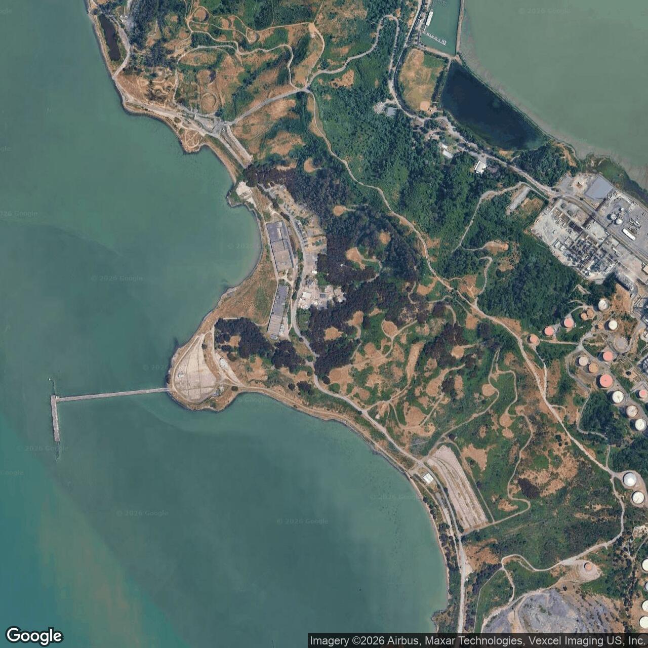
Naval Fuel Depot Point Molate, Richmond California
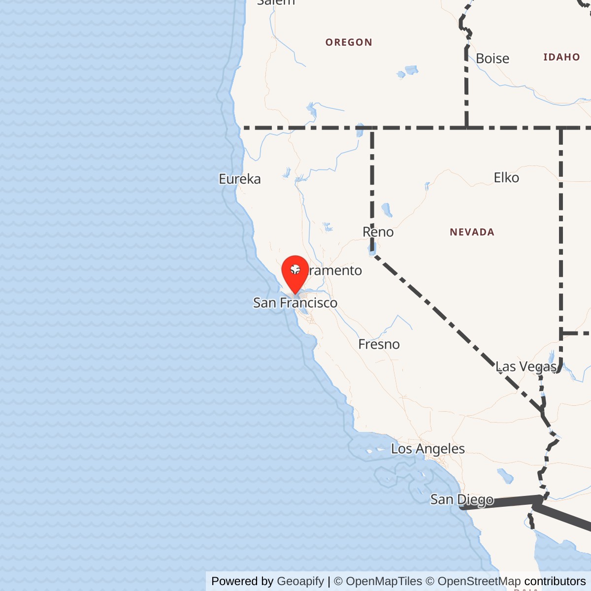
Longitude: -122.415708
Current Role: Former Navy fuel storage and transfer depot at Point Molate; most property transferred to the City of Richmond for cleanup and reuse, with the Winehaven Historic District and shoreline/open-space reuse as major post-Navy features.
Naval Fuel Depot Point Molate occupied one of the most distinctive pieces of military real estate on San Francisco Bay: a partly isolated shoreline and hillside industrial landscape at Richmond, tucked between deep water, steep ridges, the Richmond-San Rafael Bridge approach, and the massive petroleum infrastructure of the East Bay. It was not a shipyard, not an air station, and not a conventional training base. Its military value came from fuel. During World War II the Navy needed protected fuel storage, waterfront transfer capacity, and a secure location close to the great naval, shipbuilding, transport, and industrial network of the Bay Area. Point Molate gave the Navy all of those things in one place.
The depot was built over an older industrial community, Winehaven, the brick, castle-like winery complex of the California Wine Association. Winehaven had been constructed between 1907 and 1919 and, during its brief operating life, was one of the largest wineries in the world. Its massive storage buildings, workers' village, houses, pier setting, and relative isolation made it unusually adaptable when war came. In 1941 the Navy bought roughly 400 acres at Point Molate, including Winehaven, and converted the site into a Naval Fuel Storage and Supply Depot. The hillsides were cut for large tanks, drums of fuel were stored in the old winery buildings, pipelines were laid, and a new pier was built. By 1942 Point Molate was operating as a Navy fuel storage and transfer facility.
Mission Evolution
The first mission was wartime petroleum support. San Francisco Bay was one of the most important naval logistics regions in the United States during World War II. The Bay Area contained major shipyards, repair yards, embarkation and supply ports, naval air stations, training sites, ordnance facilities, fuel terminals, and industrial contractors. Ships entering, leaving, loading, repairing, and deploying from the region needed fuel in large quantities, and the Navy required specialized places where fuel could be received, stored, protected, and moved without relying only on commercial waterfront space.Point Molate's prewar physical plant helped the Navy move quickly. Winehaven's huge storage and shipping buildings could be reused for barrels, drums, depot functions, and personnel support. The old hotel became barracks and mess space for a period. Workers' houses were renovated for Navy personnel, and the commanding officer used the former superintendent's house on the bluff. At the same time, the Navy did not merely occupy the old winery. It transformed the landscape. Tanks were tucked into the slopes, pipelines connected storage to transfer points, and a new pier gave the depot direct water access.
After World War II, activity at Point Molate declined, but the mission did not disappear. The site continued as a fuel storage and supply center. The Korean War increased the demand for naval readiness and logistics, and the Vietnam War later did the same. NPS and National Register documentation both preserve the essential arc: the Navy continued to operate the depot through the Korean and Vietnam War eras before decommissioning it in 1995. That makes Point Molate a Cold War fuel depot as well as a World War II facility.
The final mission phase was closure, cleanup, transfer, and reuse. The 1995 Base Realignment and Closure process directed the Navy to close the depot and dispose of the property. By then the site consisted of hundreds of acres of land, underground storage tanks, support buildings, the Winehaven Historic District, and a shoreline setting with major environmental and public-access implications. The City of Richmond became the Local Reuse Authority, while the Navy, state regulators, and local government worked through disposal, environmental cleanup, historic preservation, and redevelopment alternatives.
Operational Role
Point Molate's operating role was practical and material. It existed to hold and move fuel. A fuel depot of this kind received petroleum products, stored them in tanks and other containers, and transferred them to ships, smaller craft, vehicles, or other distribution systems. At Point Molate, the deep-water shoreline and pier were central to that mission. The hillside tanks, pipelines, drum storage, and support buildings were not isolated parts. Together they made a transfer system that connected waterfront operations to secure storage.The World War II conversion was rapid and physical. The Navy bought the former Winehaven property, adapted the old industrial buildings, added petroleum infrastructure, and used the isolated peninsula setting to support wartime fuel logistics. The old winery's scale mattered. A small building complex could not have absorbed Navy fuel-depot functions so quickly. Winehaven's large warehouses and fire-resistant industrial construction made it unusually useful for a fuel storage and supply mission, even though the Navy had to add the tanks, piping, pier, security, and military operating systems that a fuel depot required.
Point Molate also supported the larger rhythm of San Francisco Bay naval operations. Ships did not fight from Point Molate, and aircraft did not train there, but ships, aircraft, bases, and shipyards depended on fuel. The depot belonged to the material underside of naval power. It made possible the movement, readiness, and endurance of naval forces through stored fuel and waterfront transfer capacity. In that sense, it was a quiet installation with strategic consequences. If the Bay Area was a fleet-support machine, Point Molate was one of its fuel organs.
The depot's peacetime and Cold War role was one of maintained readiness. National Register documentation states that after World War II activity diminished, then increased again during the Korean and Vietnam Wars. That pattern matches the logic of a support depot. Demand rose and fell with fleet activity, mobilization needs, and overseas operations. The depot remained useful because the military requirement for fuel did not end with 1945.
There were also non-operational events that shaped the historical record. A 1967 fire destroyed the depot administration building, causing the loss of records that might otherwise have preserved a fuller institutional history. That loss matters because Point Molate's surviving public history is unusually dependent on environmental documents, preservation records, local reuse records, historic-building surveys, and scattered Navy disposal materials rather than a single comprehensive Navy narrative history.
Facilities and Physical Layout
The former Naval Fuel Depot Point Molate covered roughly 405 to 419 acres, depending on the source and how land, shoreline, submerged lands, and transfer parcels are counted. A 2008 San Francisco Bay Regional Water Quality Control Board fact sheet describes the former depot as approximately 405 acres. A 1997 Federal Register notice describes the BRAC property as 419 acres on the northeast shoreline of San Pablo Bay. More recent park-planning material describes the broader Point Molate site as about 420 acres. These figures all point to the same order of scale: Point Molate was a large shoreline fuel installation, not a minor warehouse site.The depot's layout can be understood in four parts. The first was the historic Winehaven core. HABS documentation describes Winehaven as a collection of 35 buildings constructed between 1907 and 1919, occupying about 27 acres within the larger Naval Fuel Depot. The complex included major winery buildings, residences, support buildings, and company-town features. During Navy use, some of these structures became barracks, mess, housing, storage, and administrative or support spaces.
The second part was the fuel-storage landscape. The Navy cut tanks into the hill slopes and used the topography to conceal, protect, and separate storage facilities. That hillside storage was essential to the fuel-depot mission. The ridge and slope land gave the Navy more security and separation than a flat urban waterfront would have provided.
The third part was the waterfront transfer system. The depot relied on pipelines and a new Navy pier. The pier gave Point Molate direct access to San Pablo Bay and the broader San Francisco Bay shipping network. The combination of tank storage and waterfront transfer capability is what made the site a depot rather than just a storage yard.
The fourth part was the support and access system. Roads, security, utilities, administrative buildings, maintenance areas, housing, and open space made it possible to run the fuel plant. Point Molate's isolation helped the Navy control access, but it also made the road, bridge, and peninsula geography important. After the Richmond-San Rafael Bridge was built in 1956, the National Register nomination observed that the peninsula was effectively cut off from through traffic, leaving most traffic on the road to people doing business with the Navy, the refinery, or other Point San Pablo peninsula activities.
Units, Organizations, and Administrative Context
Point Molate was not a unit-posting installation in the way an air station or training center was. Its important organizations were supply, fuel, facilities, environmental, and reuse entities. HABS documentation identifies the present owner at the time of survey as the U.S. Navy, Fleet and Industrial Supply Center, Oakland, with the present use as Naval Fuel Depot. That relationship is critical. Point Molate functioned inside the Navy's Bay Area supply and logistics system, with Oakland as the major supply-center node and Point Molate as a specialized fuel depot.The local depot command maintained the fuel-storage and transfer mission, while Navy public works and supply organizations managed the underlying infrastructure. After closure, the organizational story shifted to the Navy BRAC process, Naval Facilities Engineering Command / NAVFAC environmental and disposal work, the City of Richmond as Local Reuse Authority and owner of transferred parcels, the San Francisco Bay Regional Water Quality Control Board for cleanup requirements, and later East Bay Regional Park District for future park planning on a portion of the broader Point Molate property.
Role in the Wider Military Network
Point Molate's importance comes from its position inside the San Francisco Bay naval logistics network. During World War II, the Bay Area was one of the country's great naval-industrial regions. Mare Island Naval Shipyard, Hunters Point, Treasure Island, Alameda, Oakland, Richmond shipbuilding, Bay Area ports, coastal defense sites, naval aviation fields, and Army port operations all formed an interconnected wartime system. Fuel was a common requirement across that system. Point Molate did not need to be famous to be essential. It supplied one of the basic materials without which ships, tenders, patrol craft, service vessels, aircraft support systems, and base vehicles could not operate.Its relationship to Oakland is especially important. Fleet and Industrial Supply Center Oakland / Naval Supply Center Oakland was a large Navy logistics institution. Point Molate gave that system a specialized fuel-storage and waterfront transfer component away from the congested inner harbor. The depot's Richmond location placed it close enough to the main Bay Area network to be useful, but isolated enough to support a hazardous petroleum mission.
The site also had a broader national role after closure. Its disposal became part of the post-Cold War BRAC transformation of American military infrastructure. The Navy's 2002 Record of Decision for disposal and reuse of the Fleet Industrial Supply Center, Naval Fuel Depot Point Molate, evaluated reuse alternatives that combined industrial, commercial, historic, open-space, recreational, and no-action possibilities. Point Molate therefore became one example of a larger national problem: how to convert specialized military landscapes with contamination, historic resources, shoreline habitat, and local redevelopment pressure into civilian use.
Closure, Cleanup, and Reuse
The depot closed on September 30, 1995 under the Base Realignment and Closure process. The closure did not instantly produce a finished reuse landscape. Fuel depots leave behind difficult questions: underground tanks, petroleum contamination, pipelines, industrial structures, piers, fill, shoreline resources, and historic buildings. Point Molate had all of these, plus the unusually prominent Winehaven Historic District.The City of Richmond's Point Molate page states that a 45-member Blue Ribbon Advisory Committee developed a reuse plan approved in 1997. In 2002 the Navy announced its decision to dispose of the property. In September 2003, about 364 acres, roughly 85 percent of the site, were transferred to the City of Richmond under a Finding of Suitability to Transfer. The remaining 41 acres were held back while cleanup decisions were resolved. The 2008 Water Board fact sheet explained that cleanup requirements would apply to the entire 405-acre fuel depot site, while recognizing that most of the land had already moved into city ownership.
Reuse planning has been unusually contested because Point Molate combines valuable shoreline, rare open space, historic architecture, Native American and Chinese fishing-camp history, environmental cleanup needs, and development pressure. Over time proposals included commercial, industrial, residential, casino, park, and mixed-use concepts. The major long-term trend has moved toward public access, open space, and preservation. In August 2025, the East Bay Regional Park District acquired 82 acres within the broader Point Molate area for a future regional park, while the City of Richmond retained the remaining 338 acres of the 420-acre site identified in park-planning materials. A 2.5-mile Bay Trail extension is under construction, with public access and planning expected to develop over years.
Current Status
Point Molate is no longer an active Navy installation. The former depot landscape is a mixed post-military site in transition. It includes city-owned property, park-district-owned shoreline and open-space acreage, the Winehaven Historic District, former fuel-depot infrastructure, cleanup obligations, and areas planned for future public access. East Bay Regional Park District describes the future park planning process as long term, with public engagement, technical assessment, safety work, stabilization, and funding strategies still needed.The current landscape is historically legible because the Navy did not erase Winehaven. The old winery buildings and village survive as one of the strongest visual anchors of the site. At the same time, the hillside tanks, pier, shoreline, environmental records, and disposal documents preserve the Navy fuel-depot story. Point Molate is therefore both an industrial wine-history site and a military logistics site. The two histories are physically interwoven.
Chronology
- 1907-1919 Winehaven was constructed by the California Wine Association at Point Molate. The complex eventually included major winery buildings, residences, and support buildings.
- 1919 Winehaven's wine-production era ended around the time Prohibition halted the business.
- 1941 The U.S. Navy bought roughly 400 acres at Point Molate, including Winehaven, and began converting the site into a Naval Fuel Storage and Supply Depot.
- 1942 Point Molate began operating as a U.S. Navy fuel storage and transfer facility.
- World War II The Navy adapted Winehaven buildings for storage, barracks, mess, housing, and support uses, while adding tanks, pipelines, and a new pier for fuel operations.
- 1950-1953 Korean War activity increased the depot's operational relevance as Navy fuel and logistics demands grew.
- 1956 Completion of the Richmond-San Rafael Bridge altered the access pattern of the Point San Pablo Peninsula, reinforcing Point Molate's relative isolation from ordinary through traffic.
- 1967 A fire destroyed the administration building of the Naval Fuel Depot, resulting in loss of records important to Point Molate's institutional history.
- Vietnam War era Fuel-depot activity increased again during the Vietnam War, reflecting the depot's continued Cold War logistics role.
- 1978 Winehaven was listed in the National Register of Historic Places.
- 1995 The BRAC process directed closure of Naval Fuel Depot Point Molate. The depot closed on September 30, 1995.
- 1997 Richmond's Local Reuse Authority process produced a Point Molate reuse plan.
- 2002 The Department of the Navy issued its Record of Decision to dispose of Fleet and Industrial Supply Center, Naval Fuel Depot Point Molate.
- 2003 Approximately 364 acres were transferred to the City of Richmond under a Finding of Suitability to Transfer, while roughly 41 acres remained unresolved for cleanup decision-making.
- 2008 The San Francisco Bay Regional Water Quality Control Board issued a cleanup activity fact sheet describing the former depot as a 405-acre former Navy fuel storage depot that operated from 1942 to 1995.
- 2025 East Bay Regional Park District acquired 82 acres at Point Molate for a future regional park, while Bay Trail extension work moved forward.
- Present Point Molate remains a former Navy fuel depot landscape in transition, with historic preservation, cleanup, public access, shoreline habitat, and long-term park and reuse planning all shaping the site.