
Fort Yukon Air Force Station / Fort Yukon Long Range Radar Site, Alaska
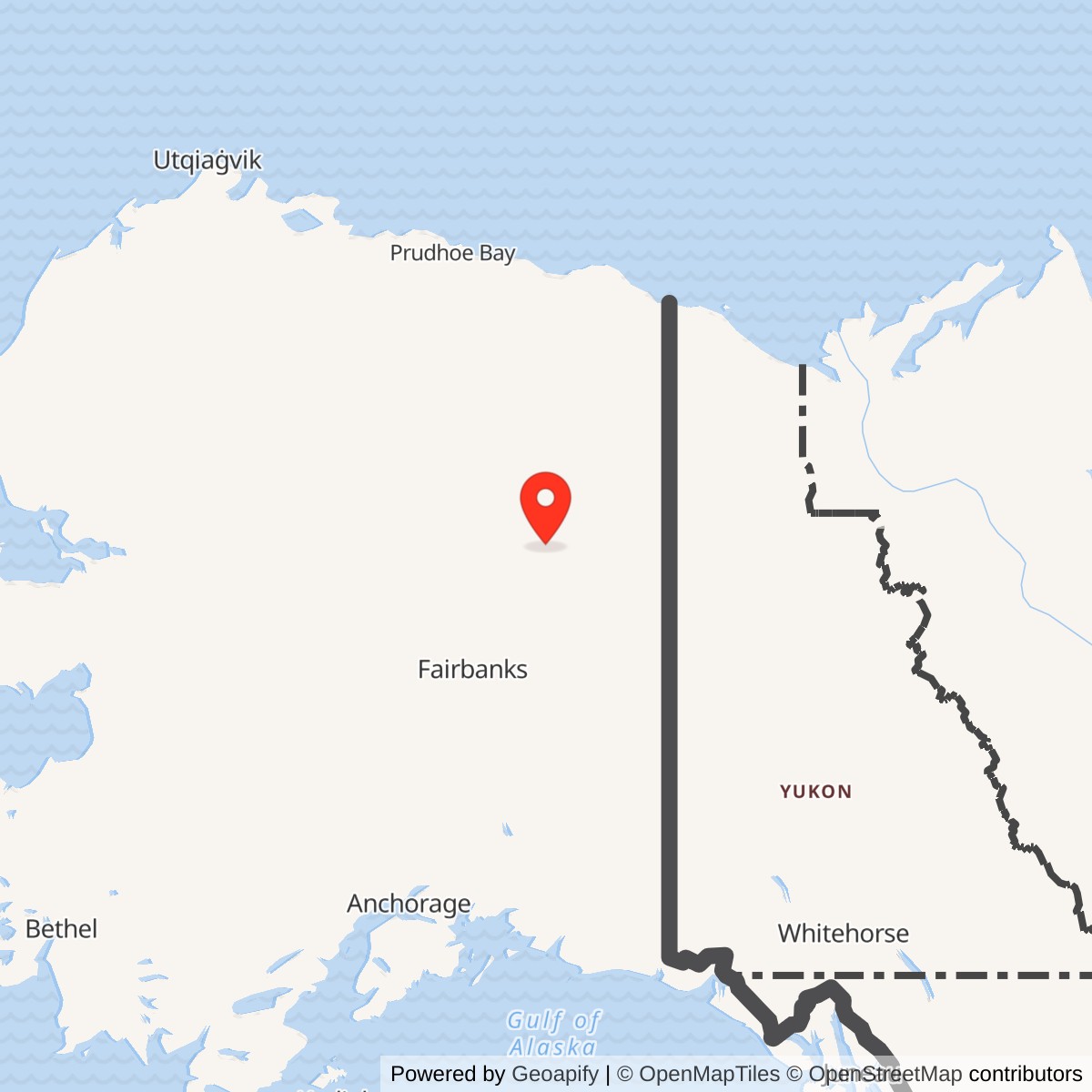
Longitude: -145.210491
Official Base Website: Fort Yukon Long Range Radar Site
Current Role: Continuing Fort Yukon Long Range Radar Site in the Alaska Radar System, included in 2025 Air Force support procurement. The precise 2026 radar hardware configuration was not independently verified. Former White Alice OT05 is cleanup complete; that determination is not installation-wide.
Coordinate note: 66.560677 N, 145.210491 W is the Alaska DEC WGS84 point for the former power-plant environmental area SD03. It is not a surveyed radar position, White Alice antenna, station centroid, or property boundary.
- Radar role
- Aircraft warning and ground-controlled interception from 1958; continuing long-range radar surveillance.
- White Alice role
- Tropospheric communications to Pedro Dome from 1957, then Barter Island from 1961-62; inactivated 1980.
- Local unit
- 709th Aircraft Control and Warning Squadron, activated 1957 and inactivated 1983.
- Radar equipment
- Originally AN/FPS-3 and AN/FPS-6; later AN/FPS-93, AN/FPS-90 and AN/FPS-117. Intermediate AN/FPS-20 is secondarily attested.
- Current identity
- Fort Yukon Long Range Radar Site. The exact 2026 hardware configuration is not independently verified.
Overview
Fort Yukon Air Force Station brought ground-controlled interception and aircraft warning to Alaska's Yukon Flats, a region whose distance, climate, and limited transportation made both radar operation and communications unusually demanding. The 709th Aircraft Control and Warning Squadron operated the staffed station after its April 1958 radar opening. A Barter Island on the Arctic coast. White Alice ended in July 1980, but the radar mission continued through the 1983 shift to remote control and an AN/FPS-117 modernization in 1984-85. The radar and White Alice histories therefore belong together without treating one mission as a footnote to the other. Fort Yukon remains listed in recent Air Force support procurement as a long-range radar site. [1] [2] [3] [4] [8]
Installation Identity and Setting
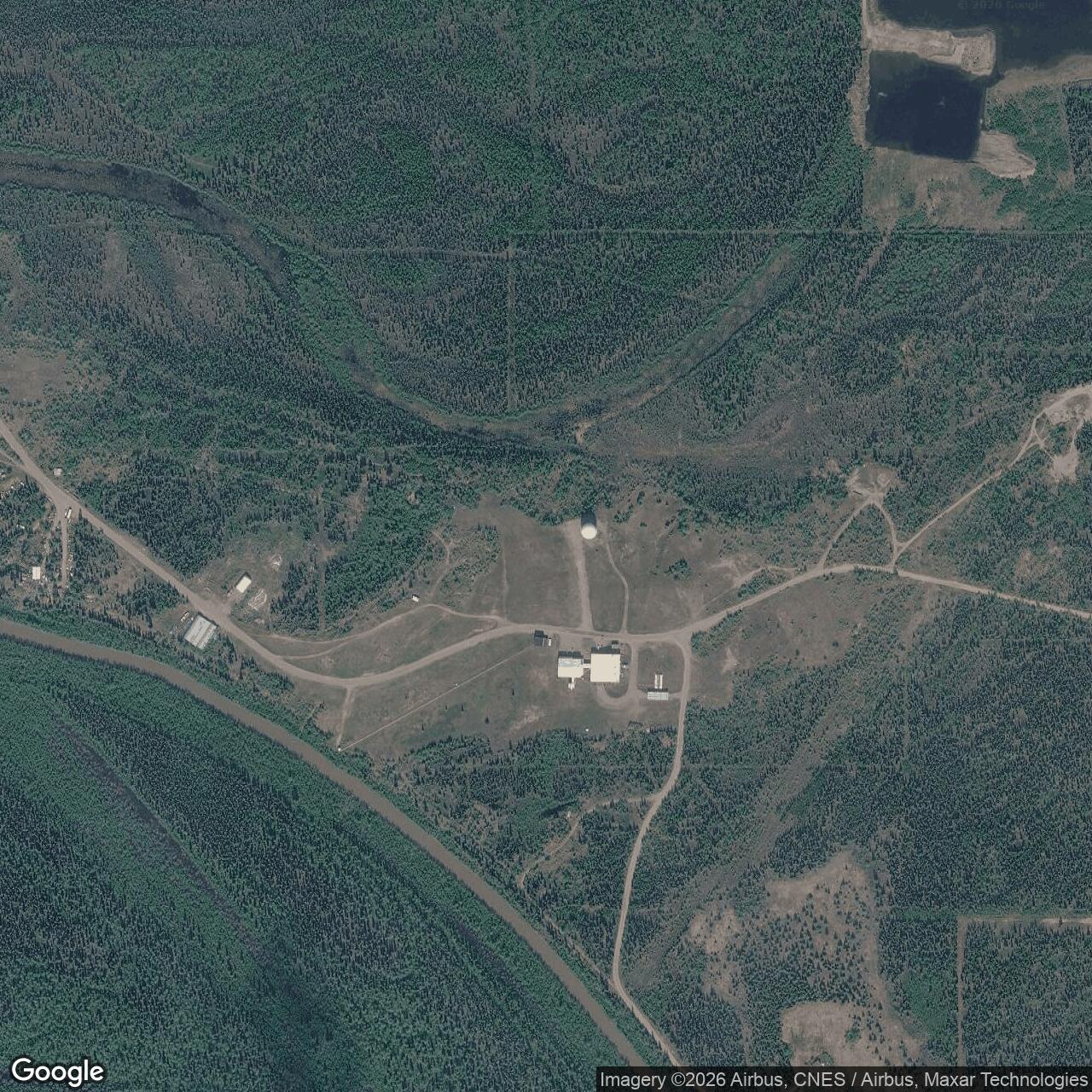
The White Alice station was a component of the Fort Yukon Air Force Station, not an independently established second installation. The National Park Service's original-network roster marks Fort Yukon as co-located, and Alaska's environmental inventory identifies the former White Alice area as OT05 within Fort Yukon Long Range Radar Site. The radar compound lies roughly a mile east of the Fort Yukon community on low Yukon Flats terrain, with access historically dependent on aircraft and seasonal river transport. An Alaska historic study describes a 205-acre installation, but that is a study-era figure rather than a newly surveyed 2026 parcel boundary. One sentence in that study says west of town; the state's site records and coordinates support east. [1] [2] [5]
The representative coordinate 66.560677 N, 145.210491 W is the Alaska Department of Environmental Conservation's WGS84 point for the former power plant environmental area SD03. It locates a documented component of the former station, not the radar antenna, White Alice antenna, property centroid, entrance, or legal boundary. DEC separately gives 66.559722 N, 145.210278 W in NAD83 for the White Alice OT05 environmental record. Fort Yukon Airport and the community are separate from the radar compound. [5] [6]
Origins and Construction
The Air Force expanded Alaska's aircraft-control-and-warning network in the 1950s to cover approaches that earlier radar stations could not adequately watch. Construction at Fort Yukon began in June 1955 and the main radar facility was completed in February 1958. An Argonne National Laboratory history, prepared for Alaska's historic-preservation program, attributes the work to Manson-Osberg Construction Company and gives a construction cost of $5,068,139. The 709th Aircraft Control and Warning Squadron activated in January 1957 to prepare for and run the installation. Radar operations began in April 1958, several months after White Alice communications had been activated. Conflating those dates would obscure the order in which the two capabilities came on line. [2]
The station's position on the Yukon Flats imposed logistical costs that a map of radar coverage alone cannot show. The Air Force sent bulk supplies by an annual river movement known first as Mona Lisa and later as Cool Barge. Personnel, perishables, and urgently needed items moved by air. Diesel power, heating, water supply, sewage, storage, and housing were not incidental comforts at an isolated Alaskan post; they made year-round radar surveillance and communications possible. The White Alice installation had a 4,960-square-foot equipment and power building, three smaller structures, a septic system, and four petroleum-storage tanks. The printed HAER capacity for those tanks contains an apparent numerical error, so no total gallon capacity is repeated here as certain. [1] [2]
The 1950s expansion that produced Fort Yukon added new Alaskan warning stations after the first postwar radar line had been established. The new site was not simply a communications stop: its radar operators had to detect aircraft, estimate their position and height, and pass usable information to the control system in time for a fighter response. Fort Yukon's flat, road-poor setting differed from the high-mountain stations whose radars and camps occupied separate elevations. That setting shaped a compact installation where a radar mission, local support buildings, and a major White Alice communications component shared the same Air Force host. The 205-acre figure in the later Alaska historic study describes the installation at that study's date; the surviving record does not establish the exact 1955 acquisition boundary or a current legal parcel. [1] [2] [4]
Radar Mission and Equipment
Fort Yukon's initial radar equipment was an Galena, AN/FPS-93 search and AN/FPS-90 height-finding equipment. A secondary station account also names intermediate AN/FPS-20 service, but the located Alaska historic study does not date each intermediate conversion, so the precise FPS-3-to-FPS-20-to-FPS-93 sequence is not presented as a day-by-day local chronology. [2] [15]
The separate search and height-finding sets explain the original station's staffing and physical needs. Search radar could locate a return in distance and direction, but operators still needed a height measurement and a control decision before an interceptor could be steered intelligently. Radar shelters, operations space, reliable electrical power, communications circuits, and maintenance personnel formed one working system. A failure in any of those elements could interrupt the warning chain even if the antenna itself remained intact. The sources establish the principal radar types and operating mission, but they do not supply a defensible Fort Yukon-specific detection range, antenna rotation rate, or complete day-by-day equipment log. [2]
Radar reports initially moved through manual voice and control procedures. The AN/FYQ-9 semiautomatic data system entered operation in 1965, changing how radar information was processed and shared with the wider Alaskan air-defense system. By 1982, Joint Surveillance System data equipment enabled radar tracks to move by satellite to the Regional Operations Control Center at Elmendorf. This was an operational transformation rather than a simple new antenna: local radar detection remained important, but the interpretation and control functions were increasingly consolidated away from the remote station. The 709th's 1983 inactivation therefore marked the end of the permanently staffed AC&W squadron, not the end of radar surveillance at Fort Yukon. [2]
Fort Yukon was identified as F-14 in the staffed AC&W network and later as A-01 in the Alaska/JSS long-range-radar inventory. These are successive network identifiers for the same host installation, not evidence of a second radar parcel. The 1982 data equipment and later minimally attended radar altered the work done on site: continuous local surveillance remained necessary, while track interpretation and regional control could be concentrated at Elmendorf. Some secondary accounts give 1 November 1983 for the squadron and station transition, but the primary Alaska historic study supports 1983 without proving a day-level date. [2] [3]
White Alice Communications
Fort Yukon belonged to the 31-station original White Alice network. The Air Force used tropospheric scatter because the aurora, extreme distance, and limited line-of-sight paths made older high-frequency and conventional microwave links inadequate for a dependable Alaskan command network. Construction of the Fort Yukon White Alice facilities occurred in 1956-57, and a Corps of Engineers management study gives activation as 25 November 1957. The original path ran approximately 124 miles south to Pedro Dome through a pair of 60-foot billboard antennas. These were paired communications reflectors, not radar search antennas; separating the two systems is essential to understanding what the station did. The two functions reinforced one another: radar tracks and control traffic needed dependable transmission, while White Alice had no aircraft-detection mission of its own. [1] [3] [4]
In 1961-62, two 120-foot billboard antennas were added for a roughly 250-mile tropospheric path toward the separate Barter Island DEW Line main station. The long hop brought the north-coast warning network into the White Alice communications web through Fort Yukon and Pedro Dome. HAER describes this as a 50-kilowatt-class link, but that system description should not be read as proof of the instantaneous power or channel configuration on every circuit at every date. HAER's system overview places the northward addition in the Bluegrass discussion, while its Fort Yukon entry calls it part of Stretchout. The link, antenna size, and construction period are well supported; the conflicting program label is not resolved here by choosing one passage over the other. The original network was built by Western Electric and the Army Corps of Engineers. RCA Services entered Fort Yukon's later support history; it did not build all 31 original stations. [1] [3] [4] [7]
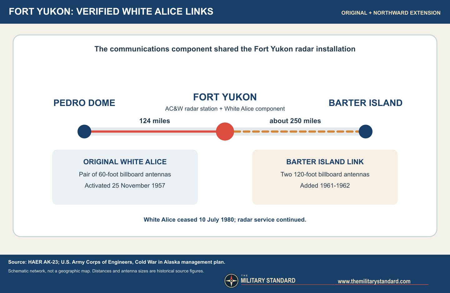
White Alice required more than its four conspicuous billboard structures. HAER records a 4,960-square-foot Fort Yukon equipment and power building, three smaller outbuildings, septic facilities, and fuel storage. The paired 60-foot reflectors served the Pedro Dome circuit, and the later paired 120-foot reflectors served Barter Island; their different dimensions reflected different path demands. The shared-site arrangement did not make the billboard antennas part of the AN/FPS-3 or later radar sets. Nor does a 2023 image of the surviving radar dome prove that White Alice antennas survived alongside it. The site-specific arrangement of the historic WACS equipment building and every antenna foundation still needs a surveyed as-built plan before a scaled footprint diagram can be claimed. [1] [10] [12] [13]
Role in the Wider Military Network
Fort Yukon combined an active sensor with communications that carried information beyond the local post. Radar operators could contribute aircraft tracks and interception control over northeastern Alaska. White Alice tied that station to Pedro Dome and, after the northern expansion, to Barter Island's DEW Line sector. Pedro Dome in turn served multiple Alaska communications paths, while the later Elmendorf control center collected radar data for regional command decisions. Barter Island was a separate DEW Line radar installation, not another antenna parcel belonging to Fort Yukon. The Fort Yukon-to-Barter path therefore illustrates an inter-installation link, not a shared-site identity. [1] [2] [3] [4]
Organizations and Transition
The 709th Aircraft Control and Warning Squadron was the principal local radar organization. A 1977 Air Force support contract with RCA Services reduced military positions at Fort Yukon by 69; the 27 remaining military positions were primarily operational according to the Corps management study. This contractor transition preceded, and should not be confused with, the shutdown of White Alice. The Corps dates Fort Yukon White Alice inactivation to 10 July 1980, when an Alascom-owned satellite earth terminal replaced its terrestrial communications role. The study calls Fort Yukon the last White Alice site inactivated. This did not close Fort Yukon Air Force Station or stop its radar mission. [2] [3]
After Joint Surveillance System equipment and the Elmendorf control center changed how tracks were handled, the 709th was inactivated in 1983 and Fort Yukon became a long-range radar site under a smaller contractor-supported operating model. The Alaska historic study dates the Seek Igloo AN/FPS-117 modernization to August 1984; the earlier Corps account describes a MAR installation in 1985. These may reflect work and completion milestones rather than mutually exclusive histories, so the defensible period is 1984-85 unless a site acceptance record supplies a more exact sequence. The new radar combined search and height-finding functions, while a new composite building supported the reduced on-site complement. [2] [3]
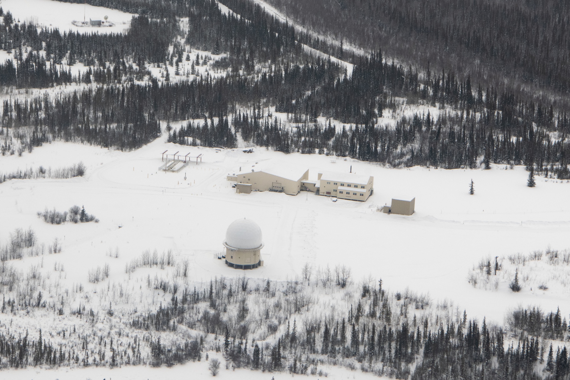
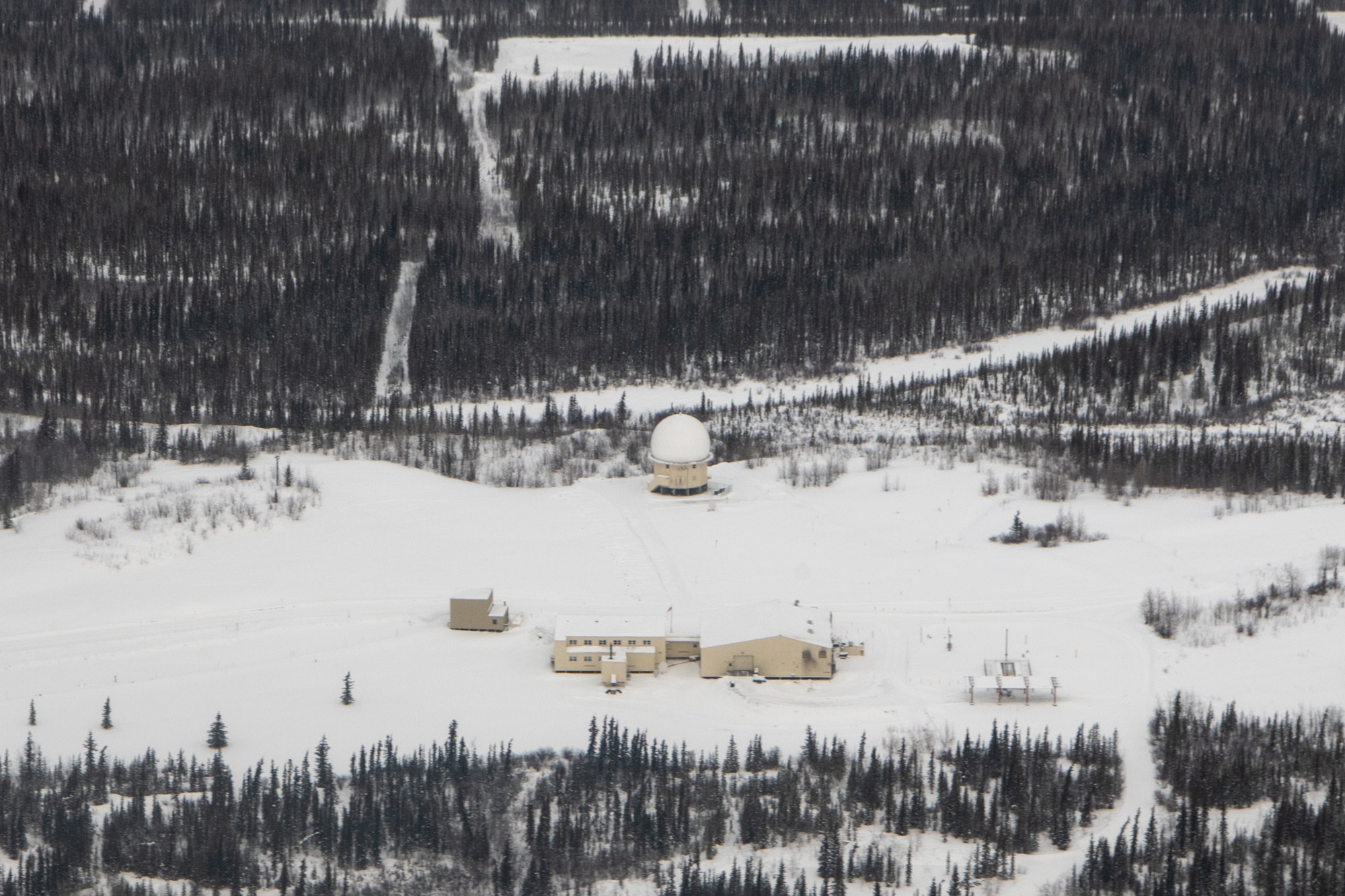
The 1980 White Alice shutdown and the 1983 radar reorganization were separate events with separate consequences for the station. Satellite communications displaced the large tropospheric installation first. The radar then entered a regional system that could pass digitized tracks to Elmendorf and maintain a smaller local workforce. The later AN/FPS-117 was not just another search-set replacement: its three-dimensional measurement consolidated range, bearing, and height in the long-range-radar mission that earlier Fort Yukon crews supported with separate search and height-finding sets. The 2023 photographs document a single prominent radome and a compact group of support buildings, but the photos alone do not identify the electronics inside the dome or prove that every historic building had vanished. [2] [3] [10] [12] [13] [16]
Preservation, Environment, and Present Use
The historic AC&W buildings did not all survive modernization. The Corps study observed substantial older fabric still standing in the mid-1990s and considered the station potentially eligible for National Register treatment. A 1997 memorandum of agreement provided for HABS Level III documentation before major changes. The later Alaska historic study reports extensive demolition in 1999 and lists five surviving early features as of its study period: a water-supply building, pump station, radome tower, gymnasium, and road system. That dated inventory must not be converted into an unsupported claim that every listed structure still stands in 2026. Likewise, an Alaska heritage survey's demolished designation concerns the historic AC&W fabric, not the continuing long-range-radar mission shown in the 2023 Air Force photographs. The continuing radar installation is distinct from the removed White Alice equipment and older barracks. [2] [3] [4] [10] [12] [13]
Environmental closure must also be read by area. Alaska DEC marks the former White Alice OT05 record cleanup complete, with a 1995 no-further-action decision. Its broader Fort Yukon record includes a separate former power-plant area, SD03, where petroleum contamination required bioventing and later review; DEC recorded a cleanup-complete determination for SD03 in 2010. Neither determination means every environmental concern on the 205-acre historic station was resolved on the same date. A 2024 Defense Environmental Restoration Program table still listed Fort Yukon as an active installation with other restoration-site accounting, and 2025 Air Force procurement named it among the radar facilities requiring support. [5] [6] [8] [9]
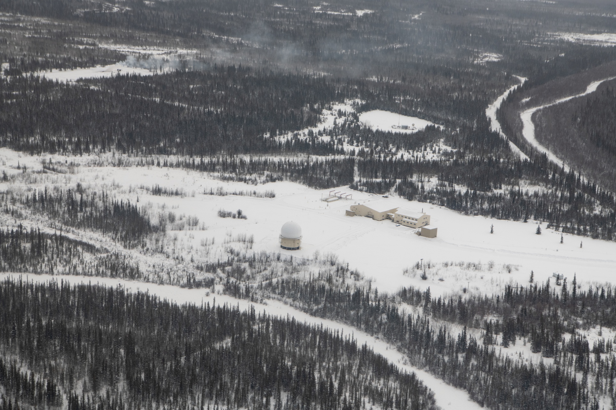
Three U.S. Air Force photographs dated 1 March 2023 show the radome, support buildings, and surrounding terrain from different aerial positions. Their captions identify Fort Yukon Long Range Radar Site, but do not identify an AN/FPS-117 from the photograph alone or show White Alice billboard antennas in operation. The University of Alaska Anchorage holds a separately credited September 1956 construction photograph and marks its copyright as held by the archives; that image is linked for research, not reproduced here without permission. An Anchorage Museum catalog also identifies an August 1958 Fort Yukon aerial of a White Alice/radar site with radomes. [10] [11] [12] [13] [14]
Chronology
- June 1955 Construction of the Fort Yukon radar installation begins. [2]
- 1956-1957 Original White Alice buildings and the Pedro Dome tropospheric path are built. [1]
- January 1957 The 709th Aircraft Control and Warning Squadron activates for Fort Yukon service. [2]
- 25 November 1957 Fort Yukon White Alice enters service according to the Corps management study. [3]
- February 1958 Main radar-installation construction is completed. [2]
- April 1958 Fort Yukon begins operational ground-controlled-interception radar service. [2]
- 1961-1962 Two 120-foot antennas add the long path toward Barter Island. [1]
- 1965 AN/FYQ-9 semiautomatic radar-data processing enters operation. [2]
- 1 October 1977 RCA Services assumes part of remote-site support under the Alaskan Air Command contract. [3]
- 10 July 1980 Fort Yukon White Alice is inactivated and its role passes to an Alascom satellite terminal. [3]
- 1982 JSS data equipment supports satellite transmission of radar tracks to Elmendorf. [2]
- 1983 The 709th is inactivated as the staffed AC&W era ends; Fort Yukon continues as a long-range radar site. [2]
- 1984-1985 Seek Igloo AN/FPS-117 modernization and supporting composite-building work occur. [2] [3]
- 1997 A preservation agreement calls for HABS Level III documentation of affected historic facilities. [2]
- 1999 Extensive demolition removes much of the older station fabric. [2]
- 2010 DEC records cleanup complete for the former power-plant environmental area SD03. [6]
- 1 March 2023 Three Air Force photographs document the continuing long-range radar installation. [10] [12] [13]
- 2025 Air Force support procurement includes Fort Yukon LRRS among the facilities in scope. [8]
Information sources (16)
- PDFNational Park Service, Historic American Engineering Record AK-23, Rabbit Creek White Alice Site
Source for: Original 31-station roster, Fort Yukon co-location, 60-foot Pedro Dome path, 120-foot Barter Island addition, buildings, and White Alice network context.
- PDFArgonne National Laboratory and Alaska Office of History and Archaeology, History of the Aircraft Control and Warning System in Alaska: Air Defense of Arctic Skies
Source for: Fort Yukon radar construction, 205-acre study-era extent, 709th squadron, equipment, logistics, 1980s modernization, preservation, and demolition.
- PDFU.S. Army Corps of Engineers, The Cold War in Alaska: A Management Plan for Cultural Resources
Source for: Exact Fort Yukon White Alice activation and inactivation dates, Alascom replacement, RCA Services support transition, and mid-1990s physical condition.
- PDFAlaska Office of History and Archaeology, The Coldest Front: Cold War Military Properties in Alaska
Source for: Original White Alice network classification, purpose, contractors, and later network changes.
- WEBAlaska Department of Environmental Conservation, Fort Yukon LRRS White Alice OT05, hazard ID 784
Source for: Former White Alice environmental-area identity, NAD83 reference coordinate, cleanup-complete status, and 1995 no-further-action action.
- WEBAlaska Department of Environmental Conservation, Fort Yukon LRRS Power Plant SD03, hazard ID 741
Source for: Representative WGS84 station-component point, distinct power-plant contamination and bioventing, and 2010 cleanup-complete decision.
- PDFAlaska Department of Environmental Conservation, Barter Island LRRS decision document
Source for: Barter Island as a separate DEW Line main radar installation with a later White Alice communications facility and continuing radar use.
- WEBU.S. Air Force, Alaska Radar System support solicitation, 2025
Source for: Fort Yukon LRRS inclusion in current Air Force support procurement, not proof of a particular radar model in 2026.
- PDFU.S. Department of Defense, Defense Environmental Restoration Program status table, FY2024
Source for: Installation-wide restoration accounting that is separate from the White Alice OT05 and power-plant SD03 decisions.
- WEBDefense Visual Information Distribution Service, Fort Yukon Long Range Radar Site, photograph 7659406
Source for: Public-domain U.S. Air Force photograph taken 1 March 2023 showing the active radar facility; not a historic White Alice image.
- WEBUniversity of Alaska Anchorage, Leland A. Olson papers, Fort Yukon construction photograph, uaa-hmc-1064-s698
Source for: Rights-restricted September 1956 historic construction photograph and archival credit information.
- WEBDefense Visual Information Distribution Service, Fort Yukon Long Range Radar Site, photograph 7659404
Source for: Public-domain 1 March 2023 aerial showing the radome, main support-building cluster, and site setting; not historic White Alice equipment.
- WEBDefense Visual Information Distribution Service, Fort Yukon Long Range Radar Site, photograph 7659405
Source for: Public-domain 1 March 2023 alternate aerial of the radar dome and support buildings; not proof of the radar model inside.
- WEBAnchorage Museum archives, George Oakley slide collection guide, Fort Yukon August 1958 aerial listing
Source for: Catalog evidence of an early aerial covering the radar and White Alice era.
- WEBFortWiki, Fort Yukon Air Force Station
Source for: Secondary local equipment account naming an intermediate AN/FPS-20 search radar; not used to establish an exact installation date.
- WEBU.S. Air Force, Radar upgrades ensure situation awareness
Source for: AN/FPS-117 as a three-dimensional long-range radar type used in Alaska; not independent proof of the precise radar electronics visible in the 2023 Fort Yukon radome.