
Gulkana Air Force Station / Tolsona Radio Relay Site, Alaska
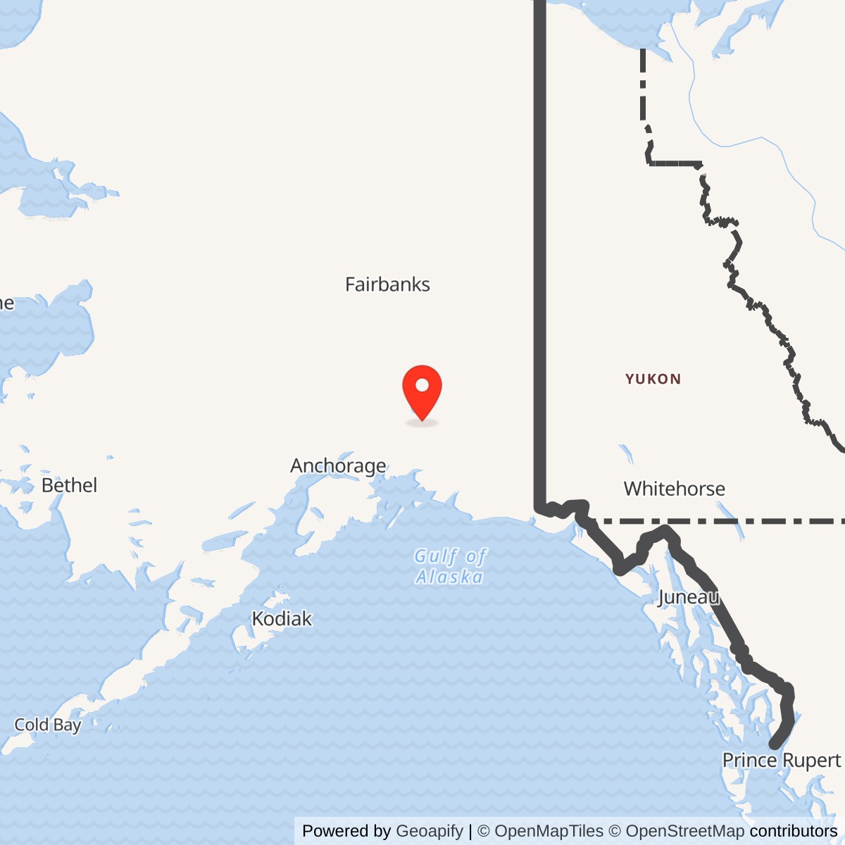
Longitude: -146.175672
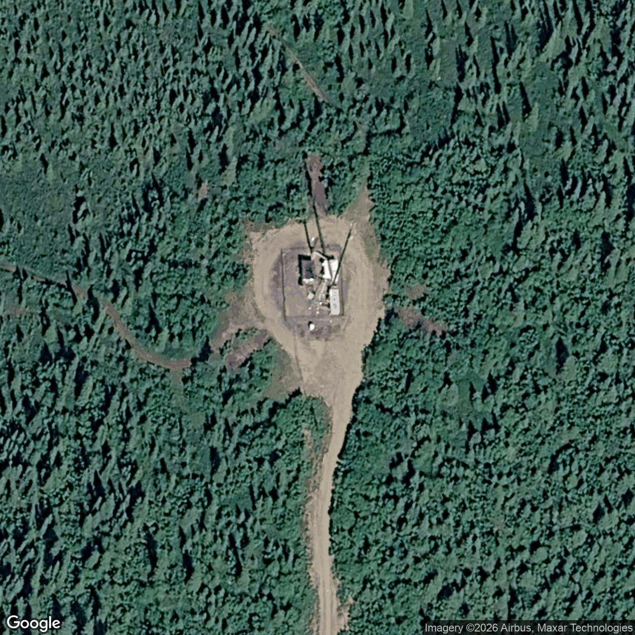
The Air Force called this Tolsona Ridge installation Gulkana, Atlasta House and Tolsona Air Force Station in succession. Its White Alice microwave relay later carried communications on the A Route linked to Tahneta Pass. Tolsona relayed signals; it was not itself a radar station. [1] [2] [3]
- Air Force Station names
- Gulkana, later Atlasta House and Tolsona.
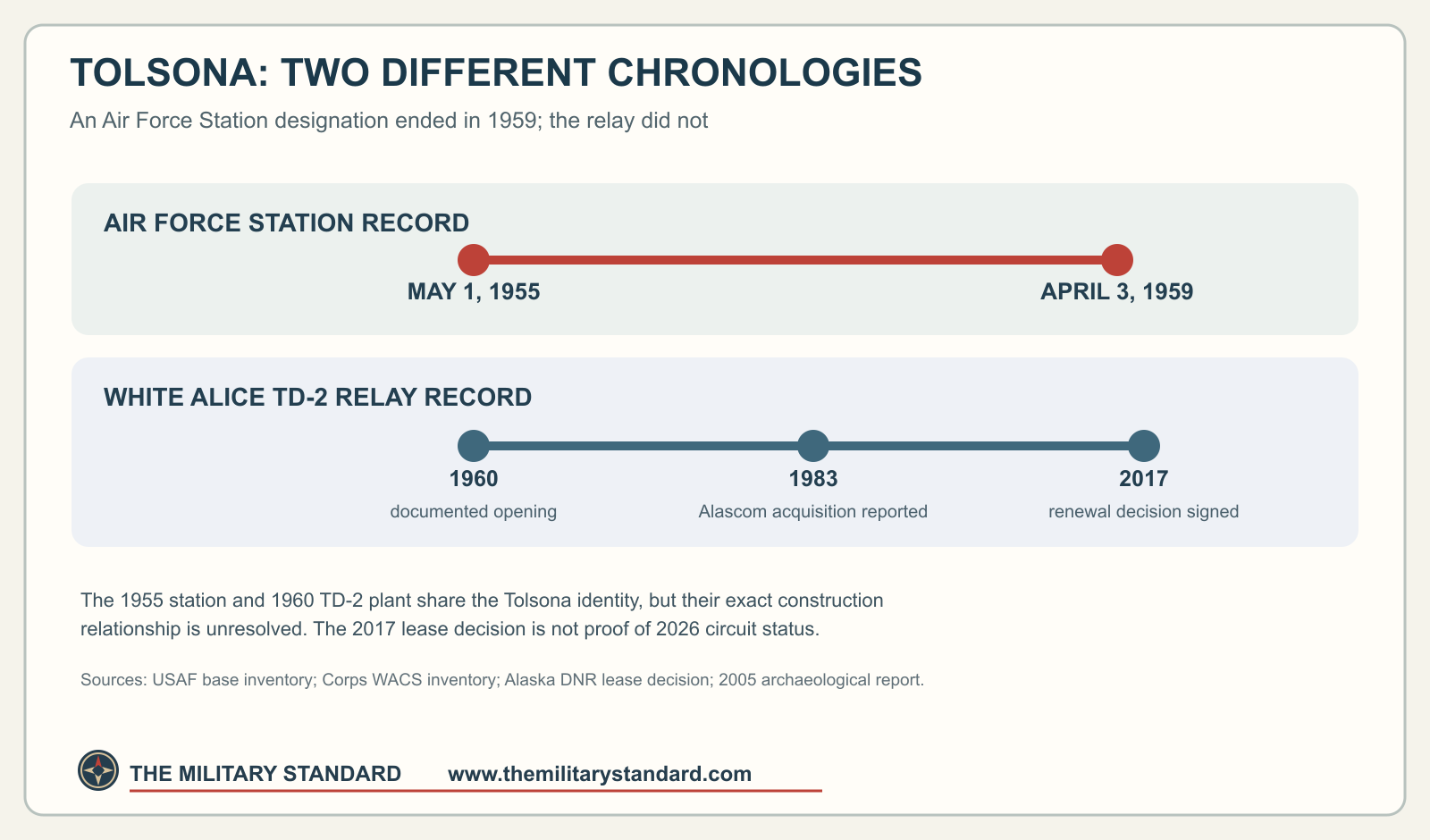
- Station inventory dates
- May 1, 1955, activation; April 3, 1959, inactivation. These are not a final relay-service interval.
- White Alice role
- Unattended two-way TD-2 microwave repeater on the Clear BMEWS A Route, documented opening year 1960.
- Direct links
- Glennallen, 20 radio miles; Tahneta Pass, 42 radio miles.
- Coordinate reference
- Approximately 62.1082 N, 146.1756 W is a modern Tolsona Ridge communications-site listing point, not a surveyed original Air Force tower or boundary.
- Later lease
- Alaska ADL 216287 covers 1.08 acres. This is a later Alascom lease tract, not verified original military acreage.
Names and Location
The Air Force installation inventory lists Gulkana AFS later redesignated Atlasta House AFS and Tolsona AFS. A State of Alaska filing in an access-road dispute calls the road's destination "Tolsona Air Force Station." Alaska's archaeological inventory labels the White Alice resource GUL-124 and records a nearby RCA station as GUL-093. The RCA site's physical relationship to the Air Force compound has not been established. [1] [5] [6]
The Air Force's 1983 study places the relay near Glenn Highway milepost 166; the State filing says about mile 165; and a 2017 Alaska Department of Natural Resources (DNR) decision locates the Tolsona Ridge Road entrance at milepost 165.9. DNR describes a 1.5-mile gravel road to the site. A modern communications listing gives approximately 62.1082 N, 146.1756 W for Tolsona Ridge. That listing point is not a surveyed position for the original TD-2 tower or historic Air Force boundary. [3] [4] [5] [7]
Two Chronologies at One Site
The Air Force inventory records station activation on May 1, 1955, and inactivation on April 3, 1959. In a later access dispute, the State said the Air Force relay and road were built in the mid-1950s. The Corps dates the BMEWS rearward TD-2 group to construction and opening around 1960; the archaeological inventory gives Tolsona a 1960 opening year. [1] [2] [5] [6]
The 1955-1959 Air Force Station record and the 1960 TD-2 relay record thus describe different stages of the Tolsona site. It is not yet clear whether the later microwave installation reused the earliest buildings or replaced them. The 1959 administrative inactivation did not mark the end of communications: DNR describes Air Force relay operation into the late 1970s or early 1980s before Alascom took over management. [1] [2] [4]
The White Alice BMEWS A Route
The Tahneta Pass, 42 radio miles. The Air Force sale study independently calls Tolsona an unattended two-way microwave repeater between the same stations. These figures are radio-link distances, not road mileage. [2] [3]
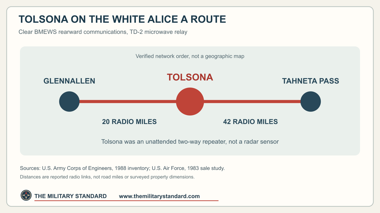
The ridge location supported line-of-sight microwave communication. A relay failure could interrupt this segment even while Clear's radar remained functional. Tolsona was a communications hop, not a BMEWS sensor. Its military-period channel count, frequencies and tower dimensions have not been established. [2] [3]
Equipment and Site Plant
The GUL-124 archaeological record describes Tolsona's relay building, chain-link fence, two heating-fuel tanks and communications tower. DNR's later lease decision describes a microwave antenna tower, relay building, fenced perimeter, underground diesel tank and backup generators within the building. These descriptions reflect the site at different times; they do not establish that every 1960 component survived into 2017. [2] [4] [6]
"Unattended" in the Air Force's 1983 description meant the relay was not continuously staffed. Road access, inspection, repair, fuel deliveries and backup power remained necessary for its operation. [3] [4]
Property, Access and Civilian Transfer
Alaska's later lease ADL 216287 covers 1.08 acres in the northeast quarter of Section 29, Township 4 North, Range 5 West, Copper River Meridian. This is the later Alascom lease tract, not the original Air Force station's full acreage. DNR says BLM issued an Air Force right-of-way permit in the late 1950s, gave Alaska tentative approval of selected land in 1982, and the State issued Alascom a lease in July 1987. [4]
The Air Force's 1983 study includes Tolsona among TD-2 transfer sites and recounts a land-selection question involving Alaska. The archaeological compilation says Alascom acquired the station in 1983. DNR describes continued Air Force relay operation into the late 1970s or early 1980s before Alascom management. The precise end of military traffic is unknown. [3] [4] [6]
A 1988 State court filing reports an access dispute along the former Air Force road. The State argued that it retained access rights and said a private owner had intermittently blocked the road; the filing does not establish the final ruling. DNR approved a proposed 20-year Alascom lease renewal in 2017 and described an existing, maintained radio-relay site. Its decision does not itself establish the final lease execution date or which circuits remain active today. [4] [5]
Later Site Record
Alaska's archaeological inventory described the Tolsona relay as in use and in good condition in 2005. DNR likewise described continued radio-relay use in 2017. EPA lists Tolsona Radio Relay Site as not on the National Priorities List; that does not establish a completed cleanup. The site's cleanup outcome remains unconfirmed. [4] [6] [8]
Historical Photographs
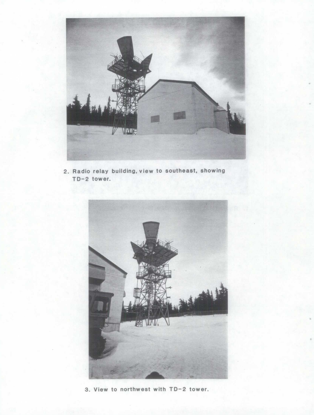
The photograph below shows the separate Rabbit Creek White Alice site, not Tolsona. It illustrates a TD-2 tower and relay building of the same equipment family. The Rabbit Creek history includes additional Historic American Engineering Record views. No authenticated Tolsona-era photograph is available here. [2] [9]
Chronology
- May 1, 1955 Air Force inventory records activation of Gulkana Air Force Station, later Atlasta House and Tolsona Air Force Station.
- Mid-1950s A later State filing says the Air Force relay site and access road were built.
- April 3, 1959 Air Force inventory records inactivation of the named Air Force Station, not final relay closure.
- 1960 Corps dates the BMEWS TD-2 build to this period, and the archaeological inventory gives Tolsona a 1960 opening year.
- Late 1970s to early 1980s DNR describes continued Air Force relay operation before Alascom management; exact changeover day is unverified.
- 1982 BLM grants Alaska tentative approval of selected site land, creating a question in the Air Force sale process.
- 1983 Archaeological compilation reports Alascom acquisition of Tolsona.
- July 1987 State issues a 30-year lease to Alascom, according to its later renewal decision.
- 1988 State litigation describes the relay-road access dispute and calls the destination Tolsona Air Force Station.
- November 2005 Archaeological report documents GUL-124 and describes the relay as in use at that time.
- December 26, 2017 DNR signs a decision approving a proposed 20-year renewal for the 1.08-acre lease tract.
Information sources (9)
- PDFU.S. Air Force, Air Force Bases Within the United States, Elmendorf detached-installations list
Source for Gulkana, Atlasta House and Tolsona Air Force Station name sequence and 1955 and 1959 administrative dates.
- PDFU.S. Army Corps of Engineers, Historical Overview and Inventory of the White Alice Communications System, 1988
Source for BMEWS rearward TD-2 network, A Route membership, 1960-1961 group chronology and direct links of 20 and 42 radio miles.
- PDFU.S. Air Force, A Special Study of the White Alice Communications System Sale, October 1983
Source for Tolsona's unattended two-way role, Glenn Highway milepost 166 and 1982 transfer/property issue.
- WEBAlaska Department of Natural Resources, Tolsona Radio Relay Site Lease Renewal Decision, ADL 216287, signed December 26, 2017
Source for later 1.08-acre lease, legal description, access, land-status and ownership account, site infrastructure, Alascom use and renewal decision.
- PDFState of Alaska, memorandum of law in White v. State of Alaska, case 3AN-88-8404, 1988
Source for State's account of the mid-1950s access-road and relay construction, Tolsona Air Force Station name, adjoining federal interests and road dispute; this is a party filing.
- PDFAlaska Natural Gas Development Authority, Glennallen to Palmer Gas Spurline Archaeological Studies, November 2005
Source for AHRS GUL-124, 1960 opening, unattended relay, site structures, 1983 Alascom acquisition and 2005 use and condition; GUL-093 is separately described.
- WEBSBA Communications, Tolsona Ridge site AK16837-A
Source for approximate modern communications-site coordinate and mile-165 address, not for an original military tower or boundary.
- WEBU.S. Environmental Protection Agency, Superfund Site Profile, Tolsona Radio Relay Site, AKSFN1002211
Source for Not NPL listing and unavailable site-status fields; does not establish cleanup completion or absence of contamination.
- WEBLibrary of Congress, Historic American Engineering Record, Rabbit Creek White Alice Site Radio Relay Station, HAER AK-23-A
Source for representative TD-2 historical photographs at another station, not images of Tolsona.