
Rabbit Creek White Alice Communications Site, Alaska
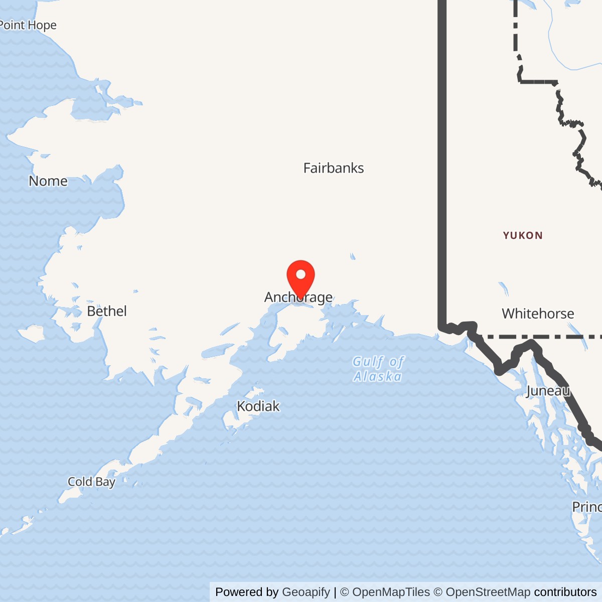
Longitude: -149.736639
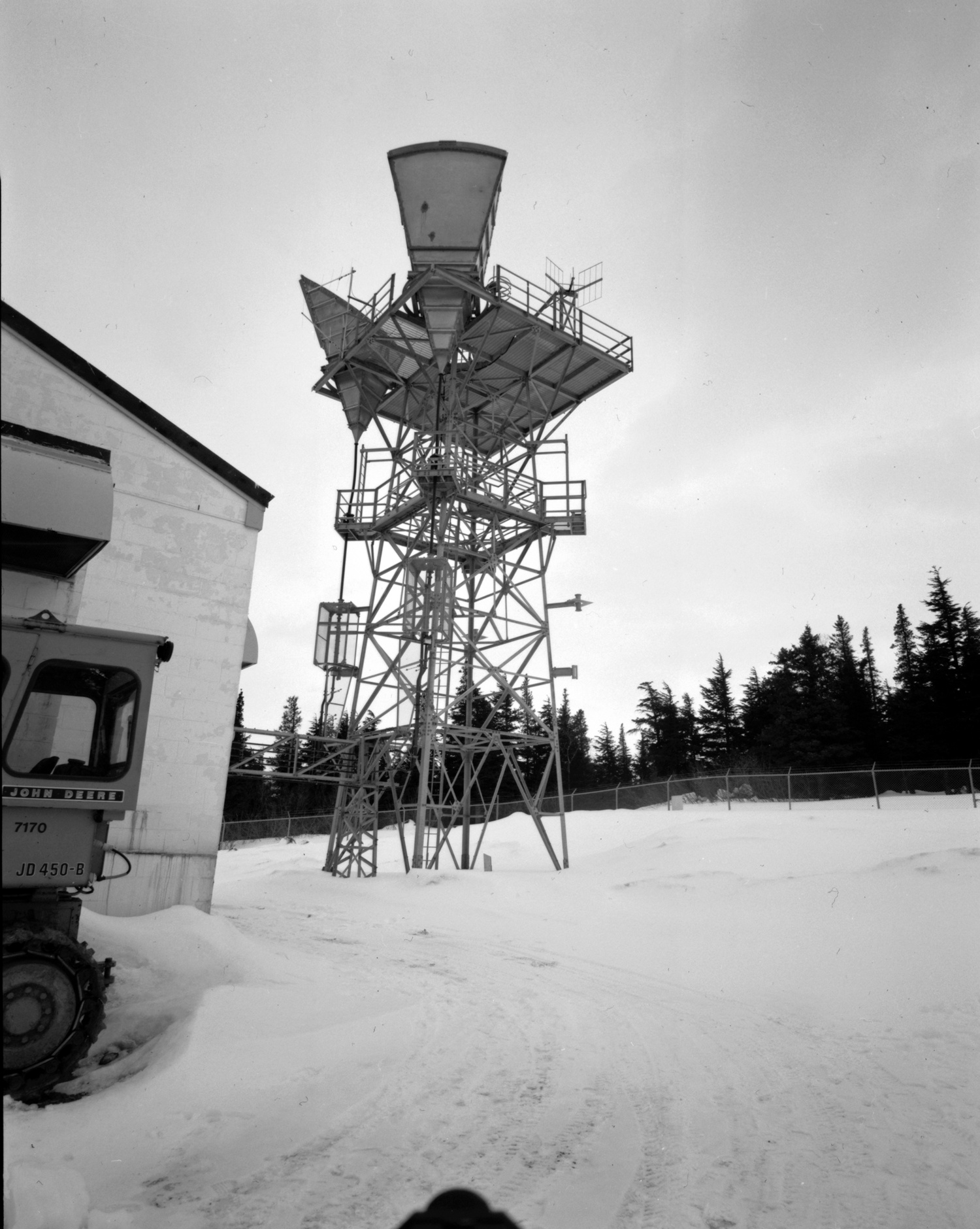
Rabbit Creek was a small but consequential link in the original White Alice Communications System. Its unattended TD-2 microwave repeater carried traffic between the Anchorage communications network and Naptowne on the Kenai Peninsula. The U.S. Army Corps of Engineers dates construction to 1955-1956 and opening to January 18, 1957. Unlike the remote White Alice stations known for immense tropospheric-scatter billboards, Rabbit Creek used a 53-foot tower with two directional cornucopia antennas and a compact concrete-block equipment building. The station later passed to Alascom and remained an active microwave facility when the Corps surveyed it in 1988 and assessed it again in 1994. Its present operation and original-fabric survival have not been established.
- Role
- Original White Alice TD-2 microwave repeater, also called Anchorage R1-S or Potter R1-S.
- Opened
- January 18, 1957, following construction in 1955-1956.
- Historic plant
- 53-foot tower, approximately 1,200-square-foot concrete-block building, standby 20-kilowatt generator, diesel tank, latrine, and fenced compound.
- Original links
- Elmendorf R1-N, about 12 miles north; Naptowne, about 48 miles south. By the 1988 survey the north-facing antenna served the Anchorage toll center.
- Later radio point
- 61.089167 N, 149.736639 W in a 2010 FCC notice for Alascom WBA919. This is a licensed radio point, not a surveyed historic tower or parcel.
- Condition
- Active as an Alascom microwave facility in the 1988 and 1994 Corps records. Present use and original-fabric survival unverified.
Identity, Location, And The R1-S Name
Rabbit Creek was a discrete communications installation, not a radar station, an Air Force base, or simply a piece of equipment inside Elmendorf Air Force Base. The Corps' Rabbit Creek station survey, the Library of Congress Historic American Engineering Record (HAER AK-23 and AK-23-A), and the 1994 Corps cultural-resources plan document it as a separate facility. The plan assigns it Alaska Heritage Resources Survey number ANC-651. The Air Force study also calls it Anchorage R1-S; the earlier Corps inventory gives Potter and R1-S as alternate names. These names identify the same Rabbit Creek repeater, not additional installations.
The 1983 Air Force study placed the repeater off Rabbit Creek Road, southeast of Anchorage. One passage approximates it as nine miles south of Anchorage; another calls it about fifteen miles southeast of the city and describes access from the Seward Highway followed by about three miles on Rabbit Creek Road. These are period route descriptions with different reference points, not conflicting surveys of the compound. The study described the station land as school-district property, flat with some ledge rock and without permafrost. That statement should not be converted into a present ownership claim or a parcel boundary.
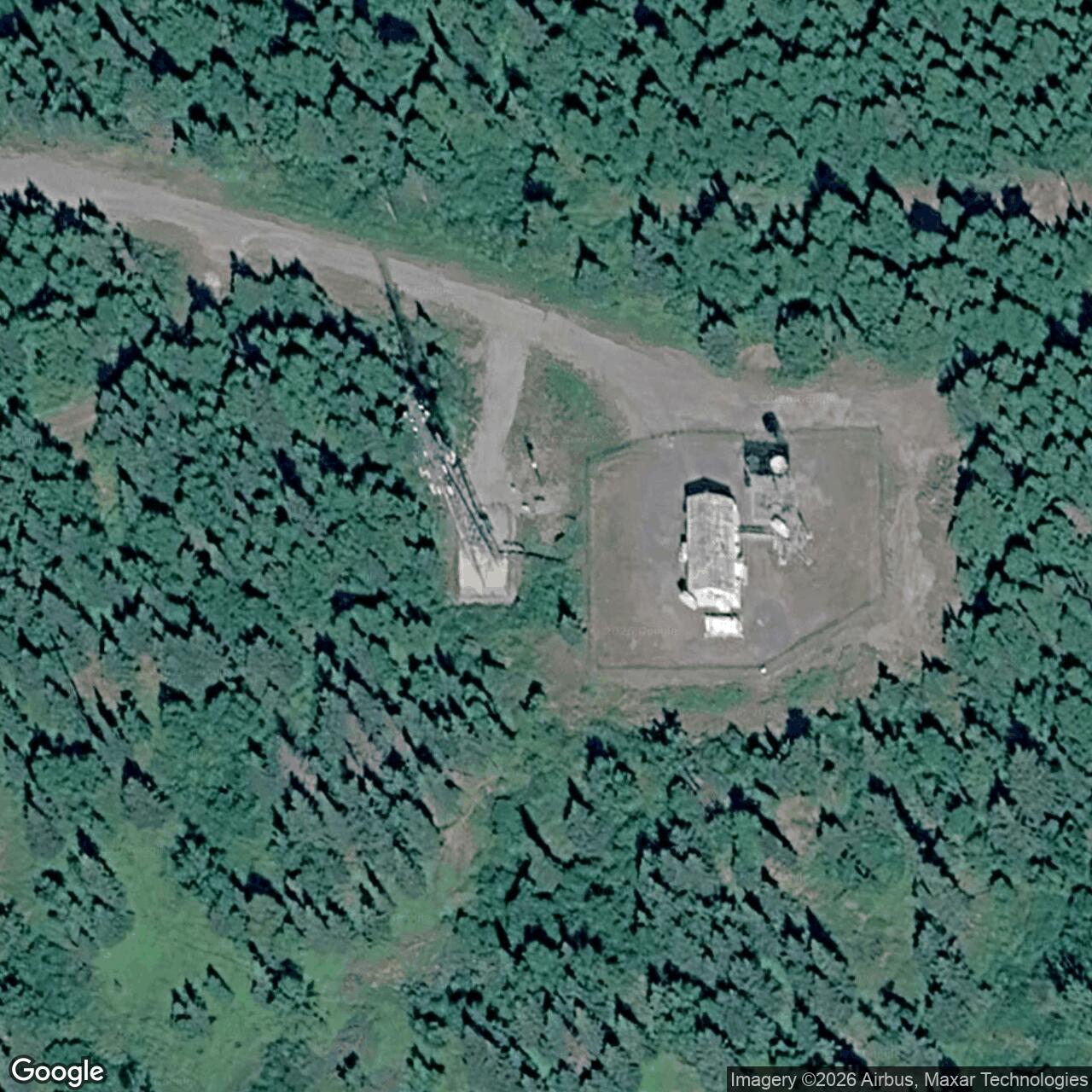
An FCC notice dated September 30, 2010 lists an Alascom microwave facility under call sign WBA919 at 61-05-21.0 N, 149-44-11.9 W, approximately 61.089167 N, 149.736639 W. The notice calls its city Anchorage rather than Rabbit Creek. The point is a later licensed radio-facility coordinate with no datum stated in the notice. It is not a surveyed 1957 tower footing, fenced compound centroid, or legal boundary.
Why The Relay Was Built
White Alice was created to connect Alaska's far-flung air-defense radars, command facilities, airfields, and communications centers across terrain that made conventional wire networks impractical. The original network combined long tropospheric-scatter hops with shorter line-of-sight microwave routes. Rabbit Creek belonged to the original 31-station system and to its six-station microwave group. Its path was a road-corridor communications link, not a local warning radar. It did not detect aircraft or issue fighter-intercept orders.
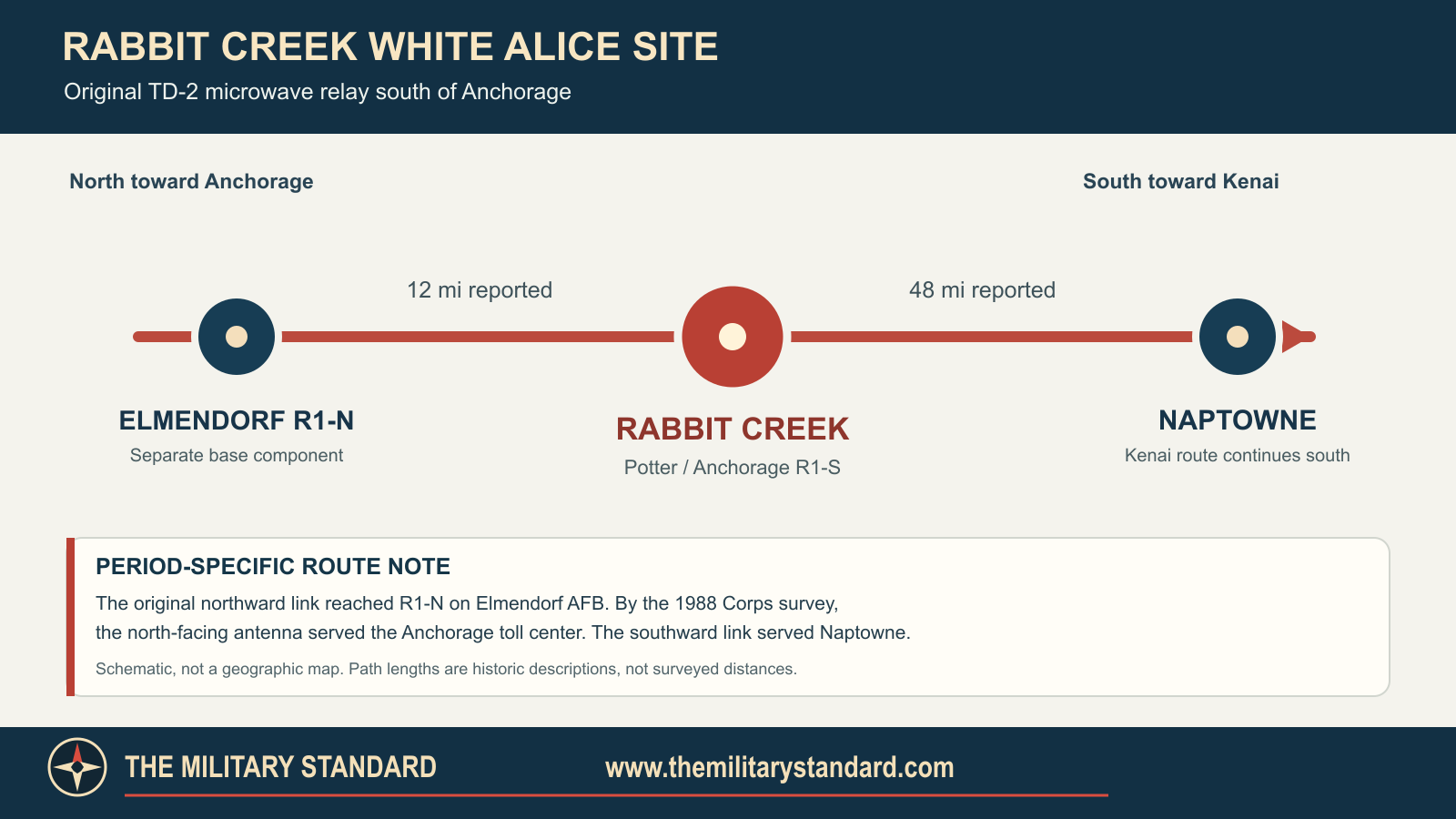
The original northward leg ran about 12 miles to R1-N on Elmendorf Air Force Base. The southward leg ran about 48 miles to Naptowne. Beyond Naptowne, the Kenai route continued through Soldotna, Clam Gulch, and Starisky Creek toward Diamond Ridge. The Air Force's 1983 sale study described Rabbit Creek as a two-way unattended microwave repeater between Anchorage and Naptowne. The 1988 Corps survey gives a crucial operational nuance: by the survey date, the north-facing antenna served the Anchorage toll center, while the station had first received its north-side signal from Elmendorf R1-N. This distinction prevents a route diagram for one period from being misrepresented as an unchanging 1957-to-present circuit plan.
Design And Construction
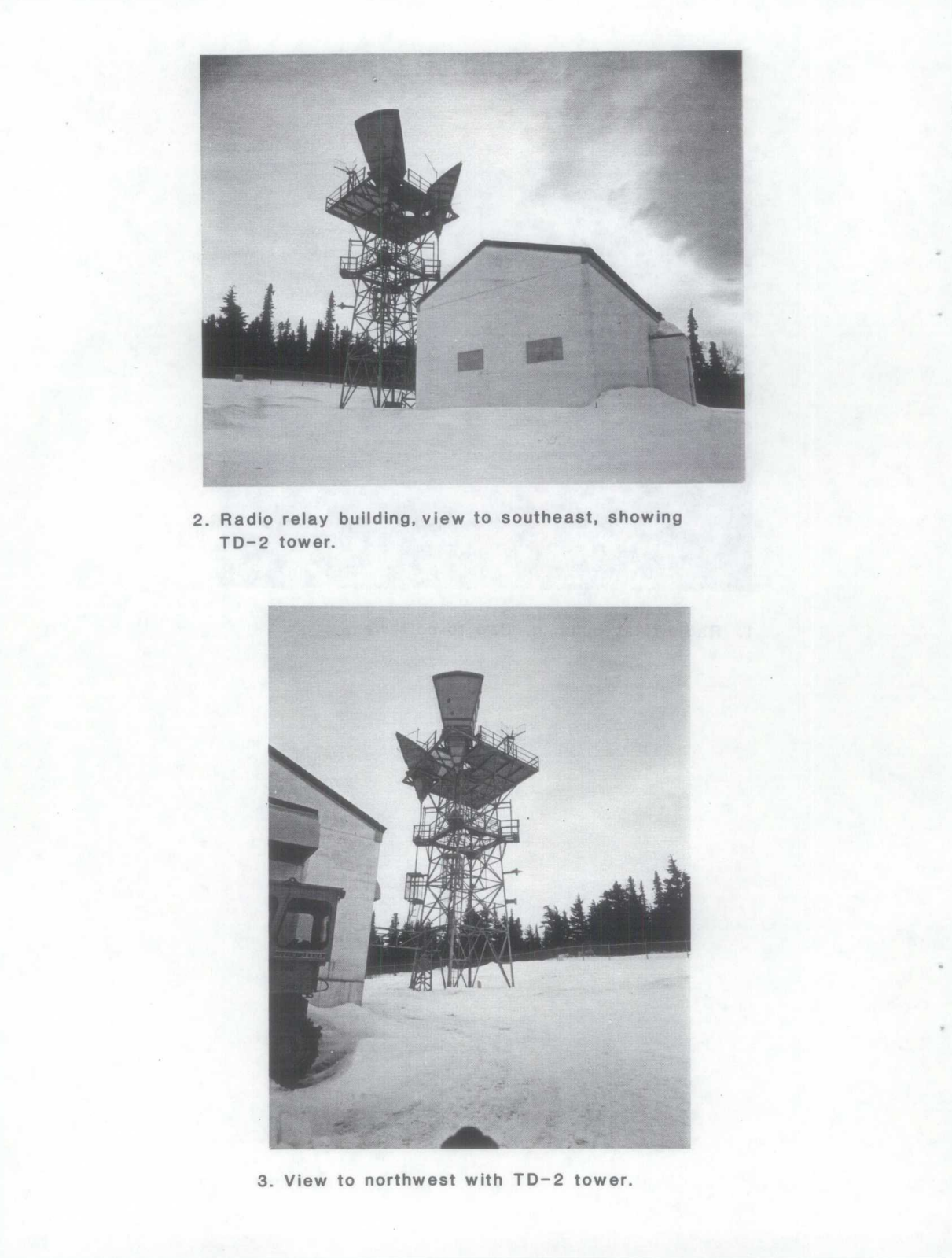
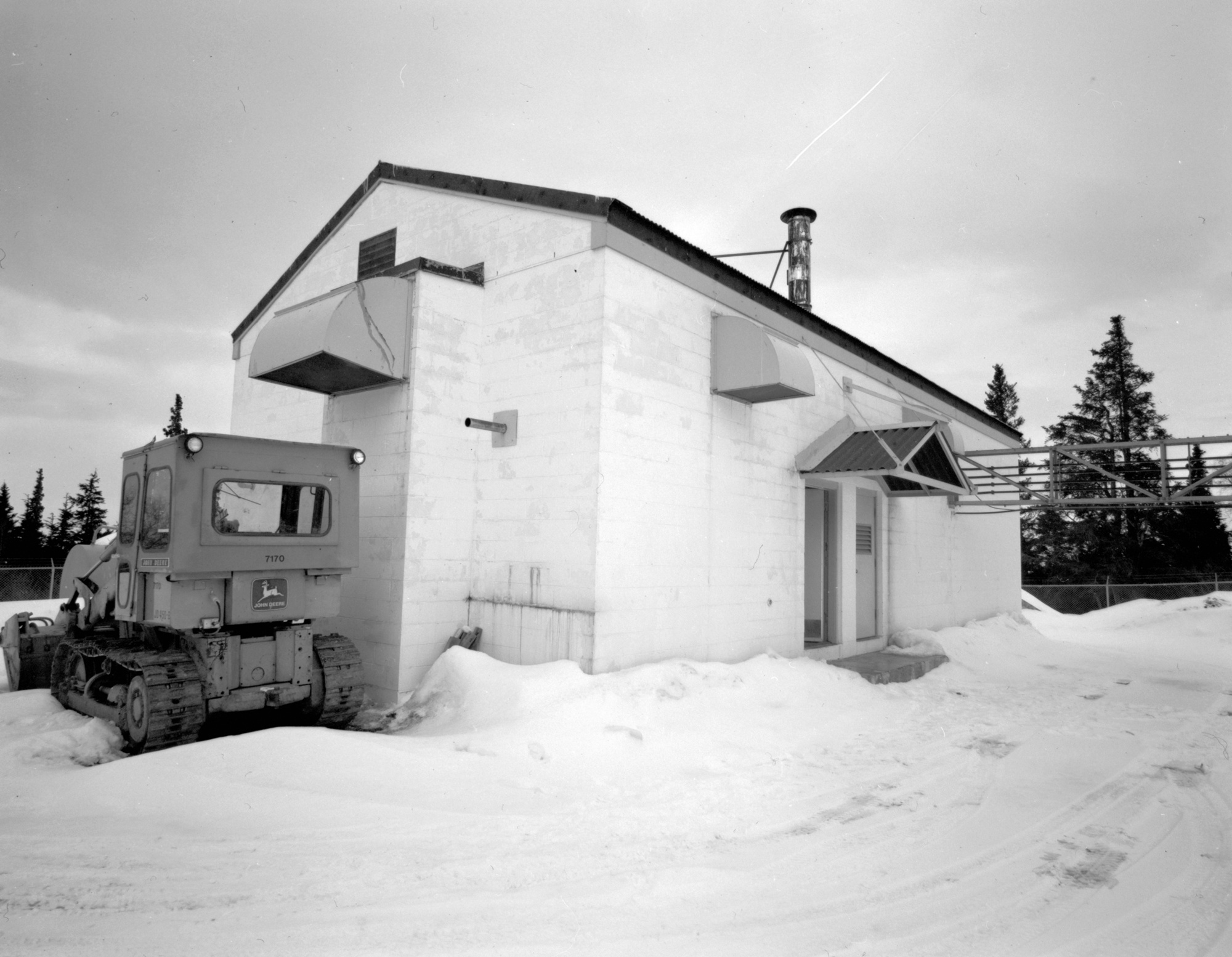
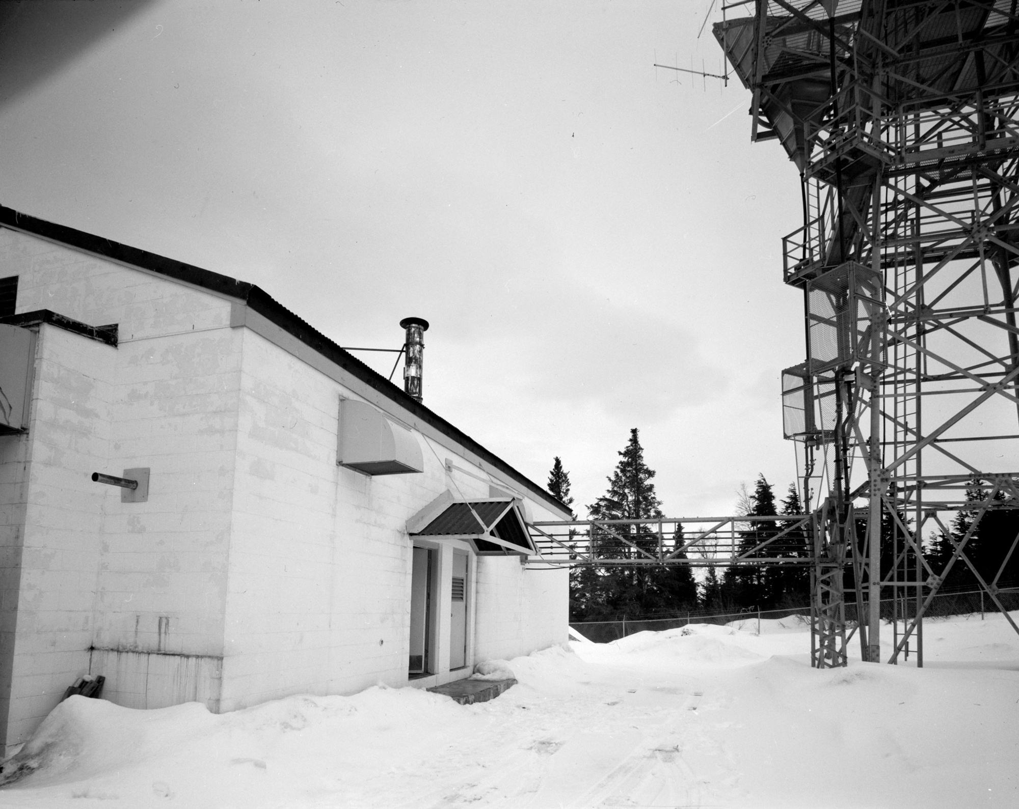
The Corps records construction during 1955 and 1956 and an opening on January 18, 1957. The 1988 survey quotes a 1978 property inspection that measured the building at approximately 24 by 51 feet, or 1,246 square feet. Elsewhere the Corps rounds it to 1,200 square feet. Those are compatible descriptions of a building, not two different station buildings or a land acreage. The concrete-block, steel-frame structure had a concrete slab, steel-truss roof support, corrugated roof, no windows, and no plumbing. A forced-air oil furnace heated it. A room housed the radio equipment; a separate room held emergency power.
The physical plant included the 53-foot TD-2 microwave tower, one 100-barrel diesel tank, a 16-square-foot sanitary latrine, a vehicle-parking area measured at 213 square yards, and 543 linear feet of eight-foot chain-link fence with three strands of barbed wire. The oil tank served the standby diesel generator through a pipeline. The 1978 inspection reported the building in good condition, well maintained, with little deferred maintenance. These measurements come from a dated inspection; they do not establish the present condition or legal extent of the site.
Rabbit Creek illustrates the standardized small concrete-block White Alice design. The 1994 Corps plan groups it with Clam Gulch, Naptowne, and Starisky Creek as four approximately 1,200-square-foot microwave stations, contrasting them with the much larger staffed tropo complexes. The more Corps station history dates the site's 1955-1956 construction and January 1957 opening.
How The Microwave Repeater Worked
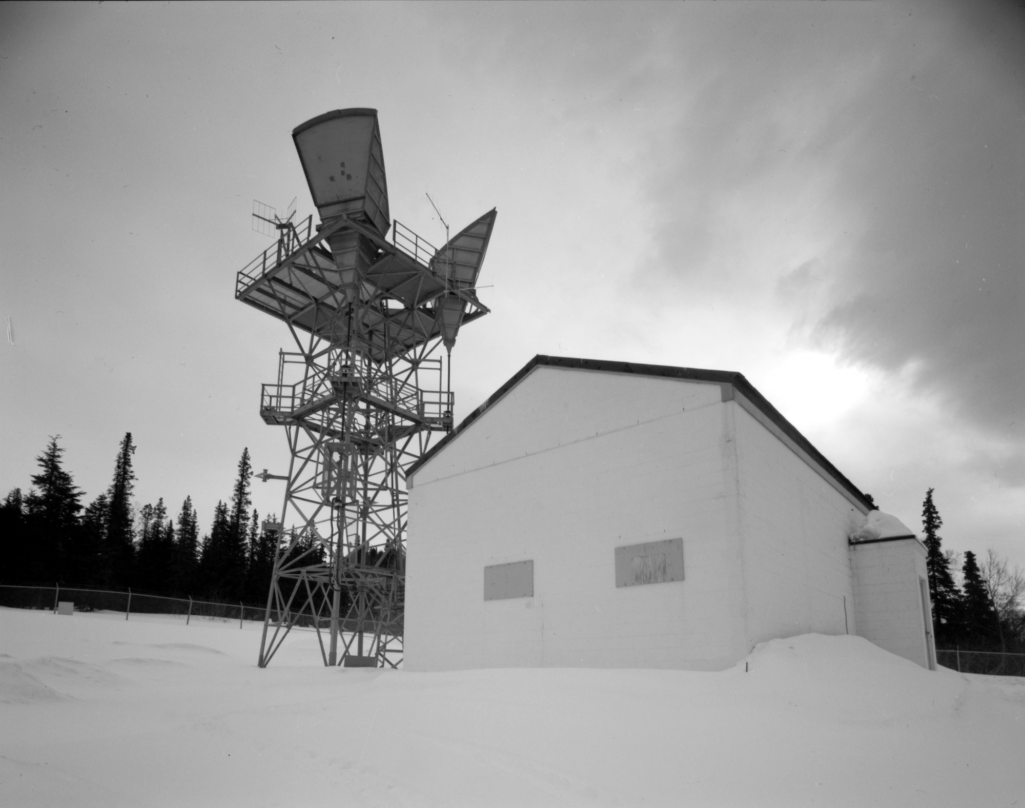
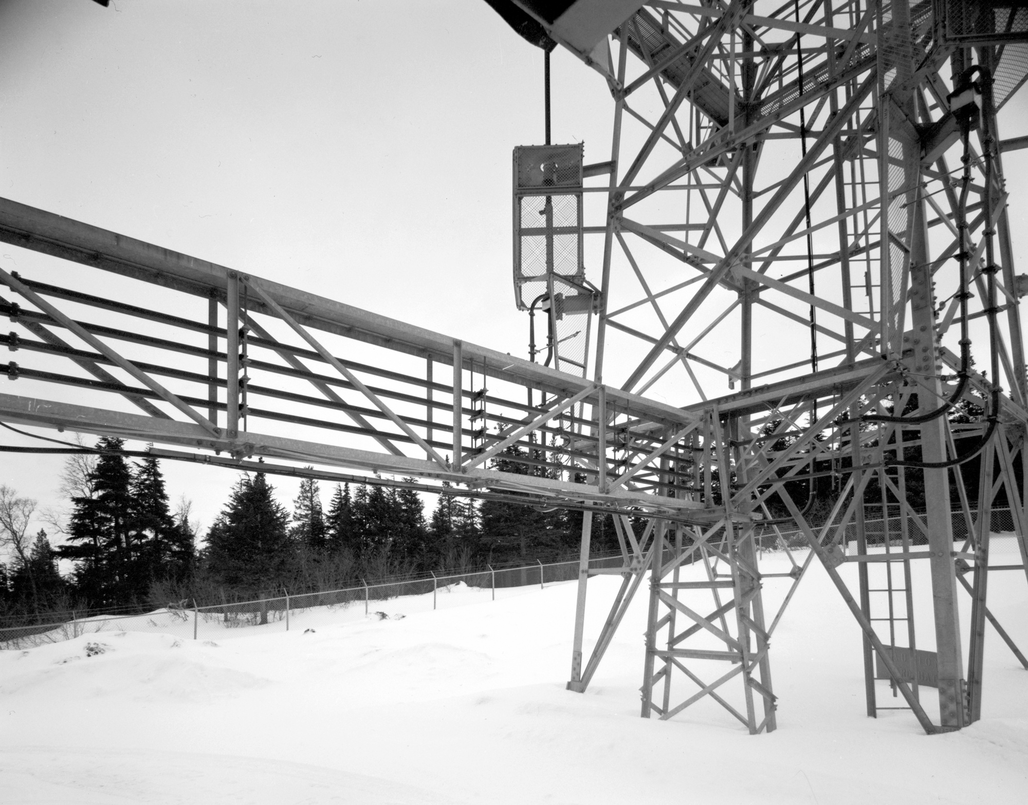
Two directional, cornucopia-shaped antennas sat on the 53-foot tower. The 1988 HAER narrative says one faced Naptowne and one faced the Anchorage toll center at the time of documentation. Each path used a receive waveguide and a transmit waveguide, for four waveguides entering the building. Straight sections were copper; curved portions were rubber-coated, with copper inside. This equipment is visible in the actual Rabbit Creek photographs reproduced in the Corps report. It is not a generic rendering of another White Alice site.
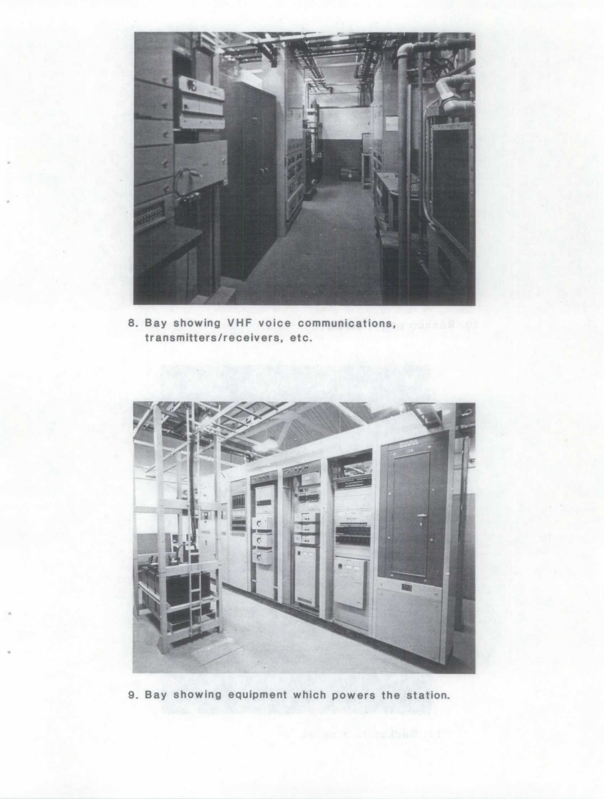
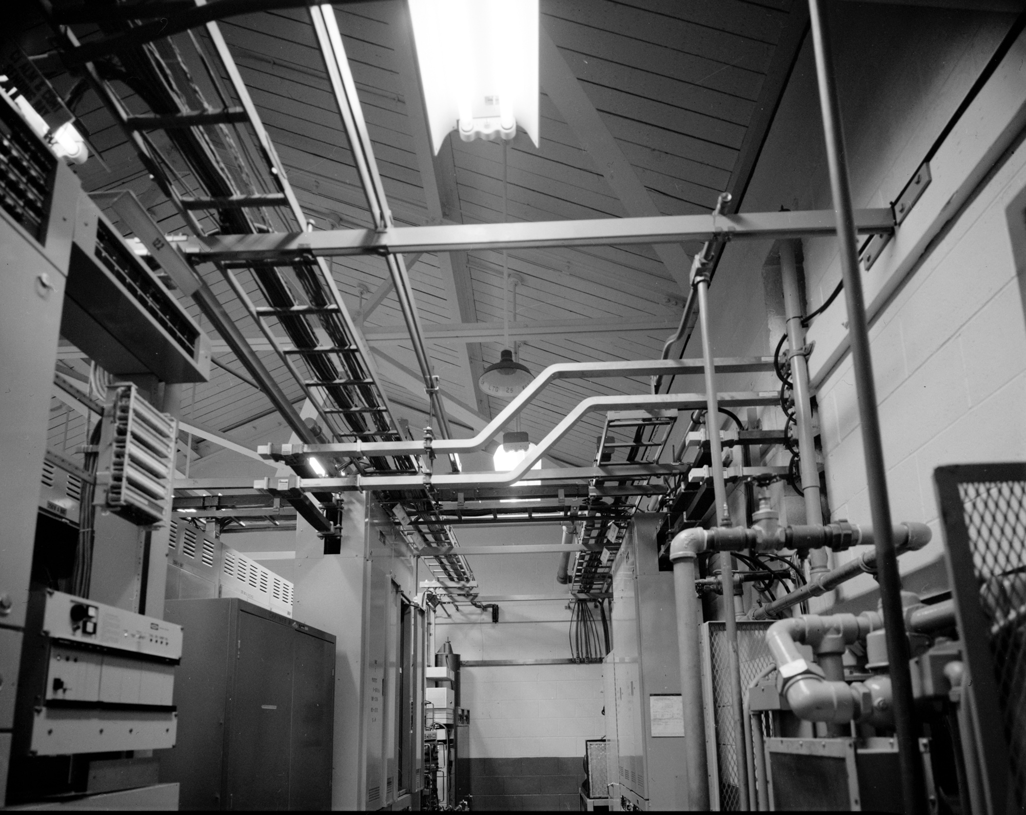
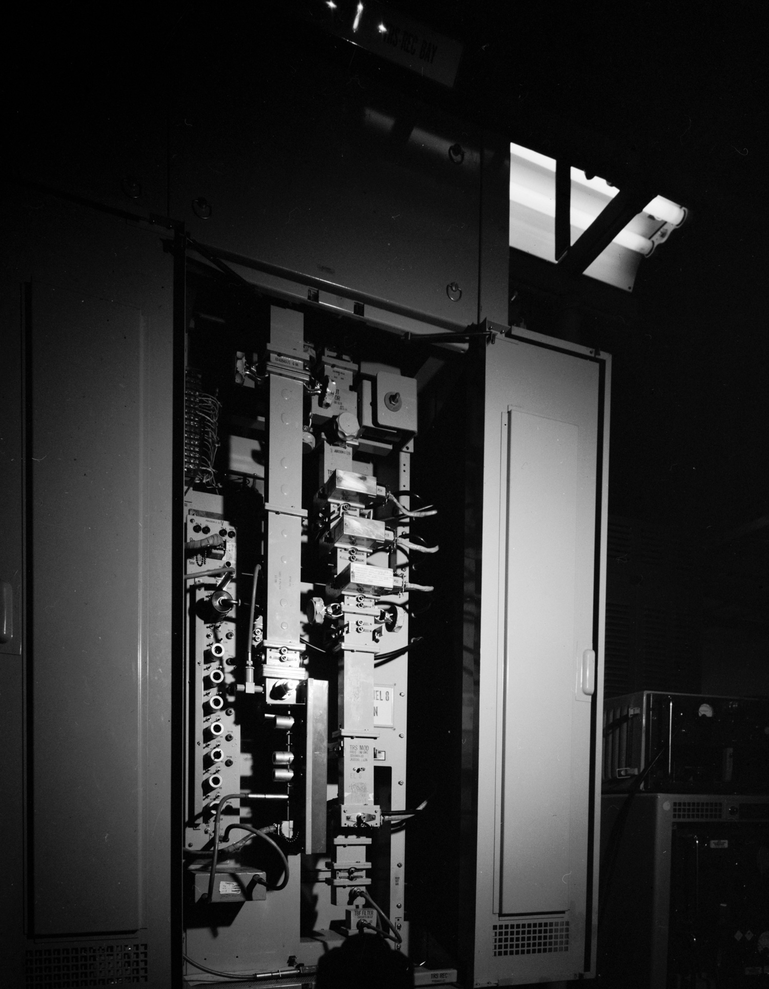
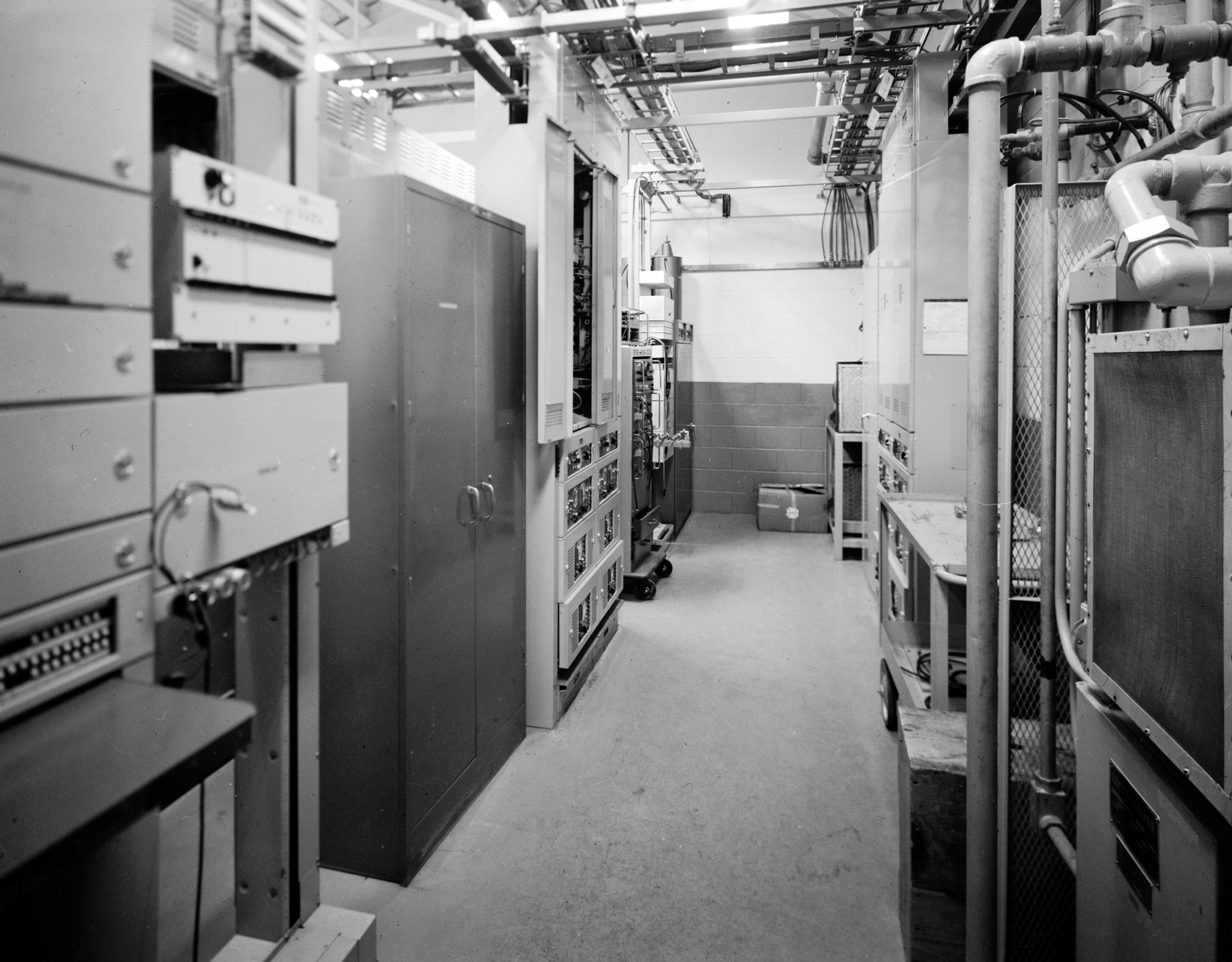
Inside, the incoming signal passed through a receiver and processing equipment before retransmission toward the next station. The Corps' 1988 walk-through identifies the Anchorage toll TD-2 receiver and transmitter, the corresponding Naptowne set, test banks, an original VHF service radio, cooling apparatus, and a later alarm system. A "protect" cabinet duplicated each transmitter/receiver complex so another set could take over on failure. The report says the switch could be initiated from Soldotna or the Anchorage toll center, and specifically contrasts Naptowne, which did not have the same switching capability. This is a documented operational distinction, not an assumption that every small TD-2 site was identical.
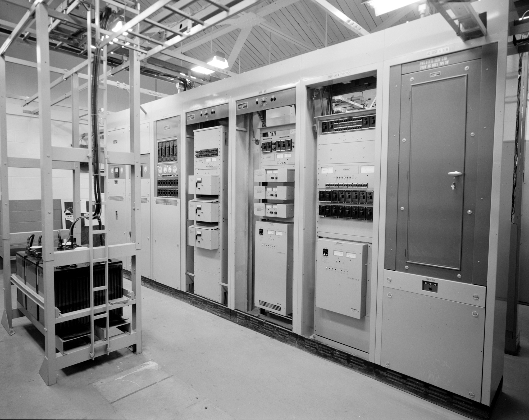
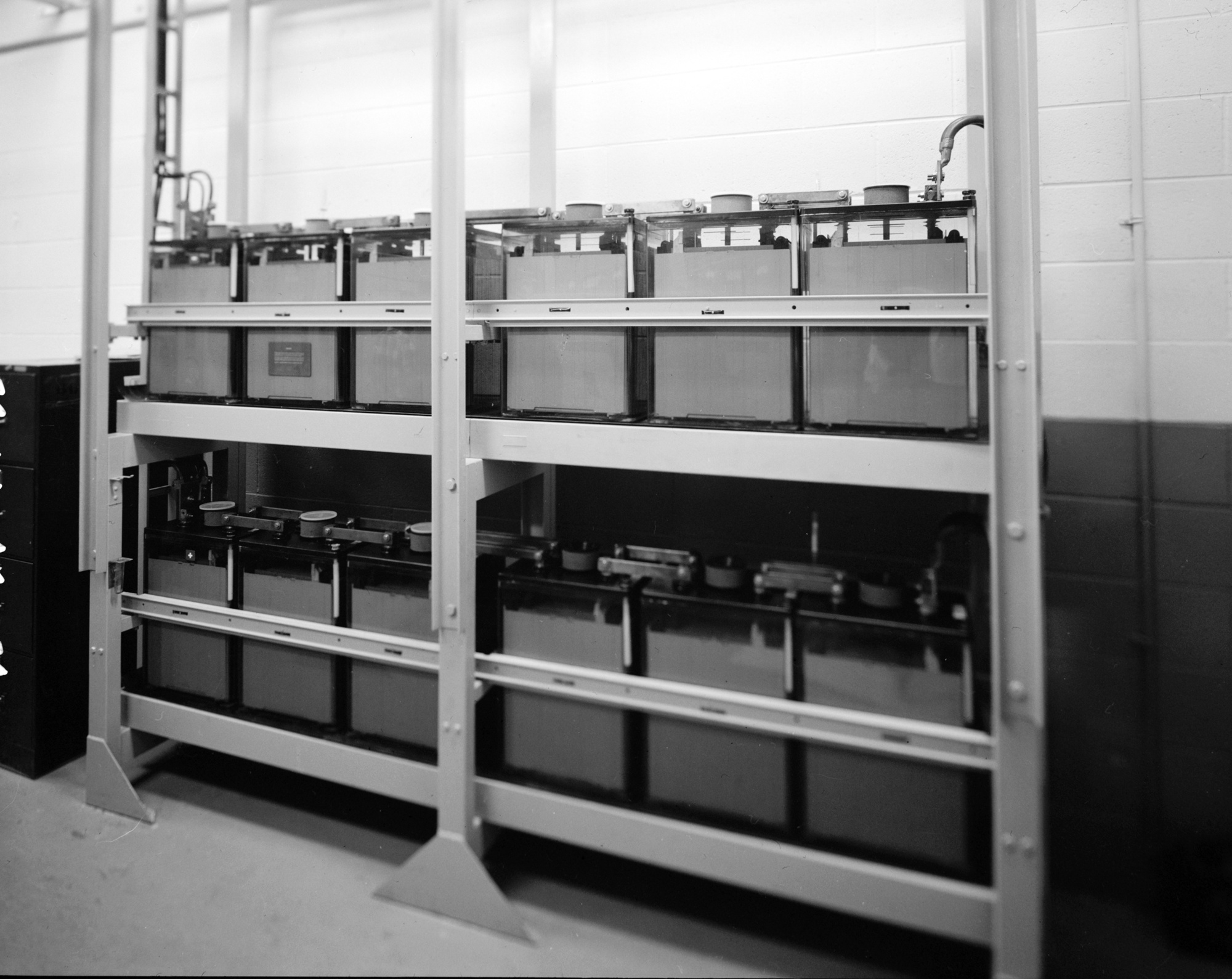
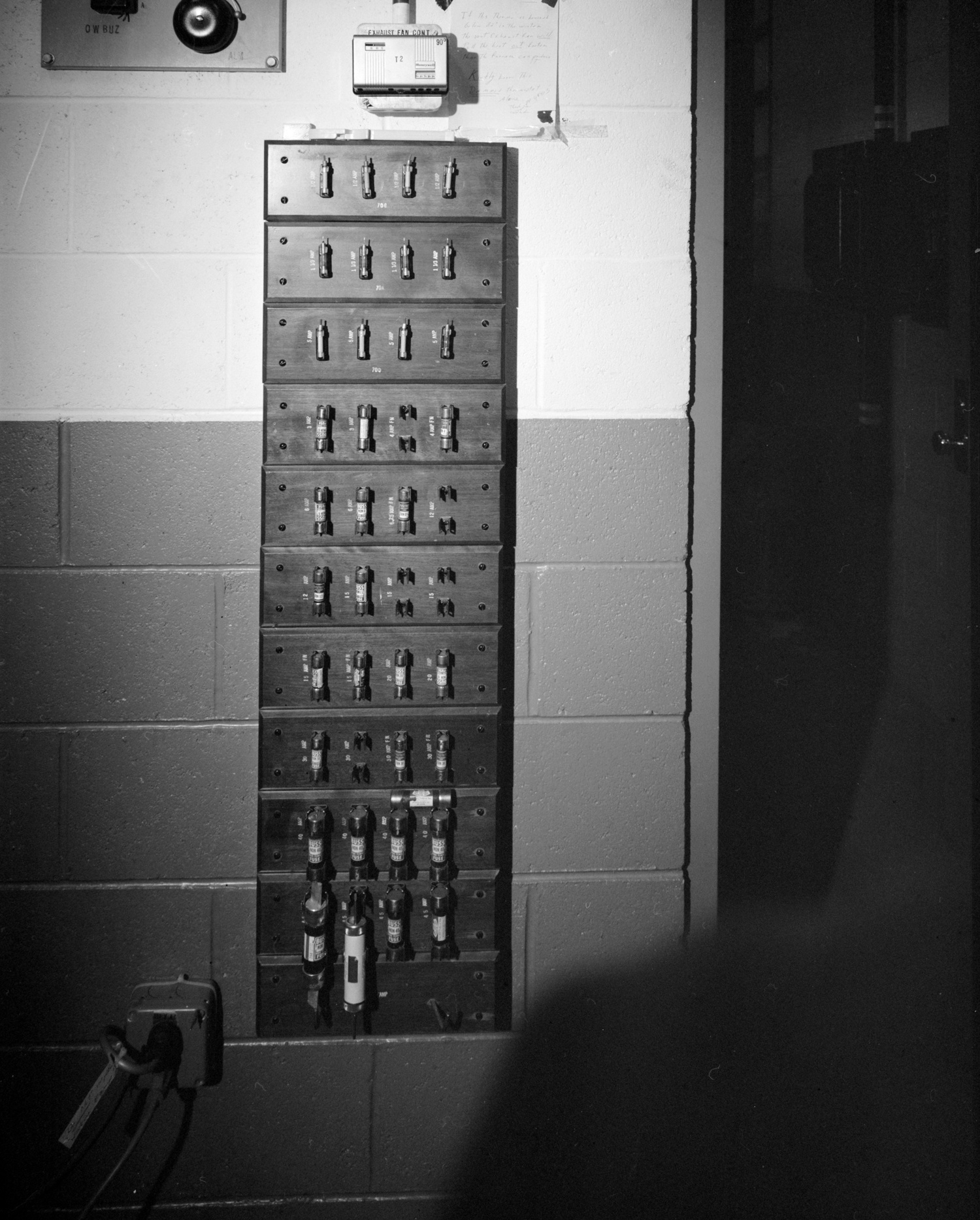
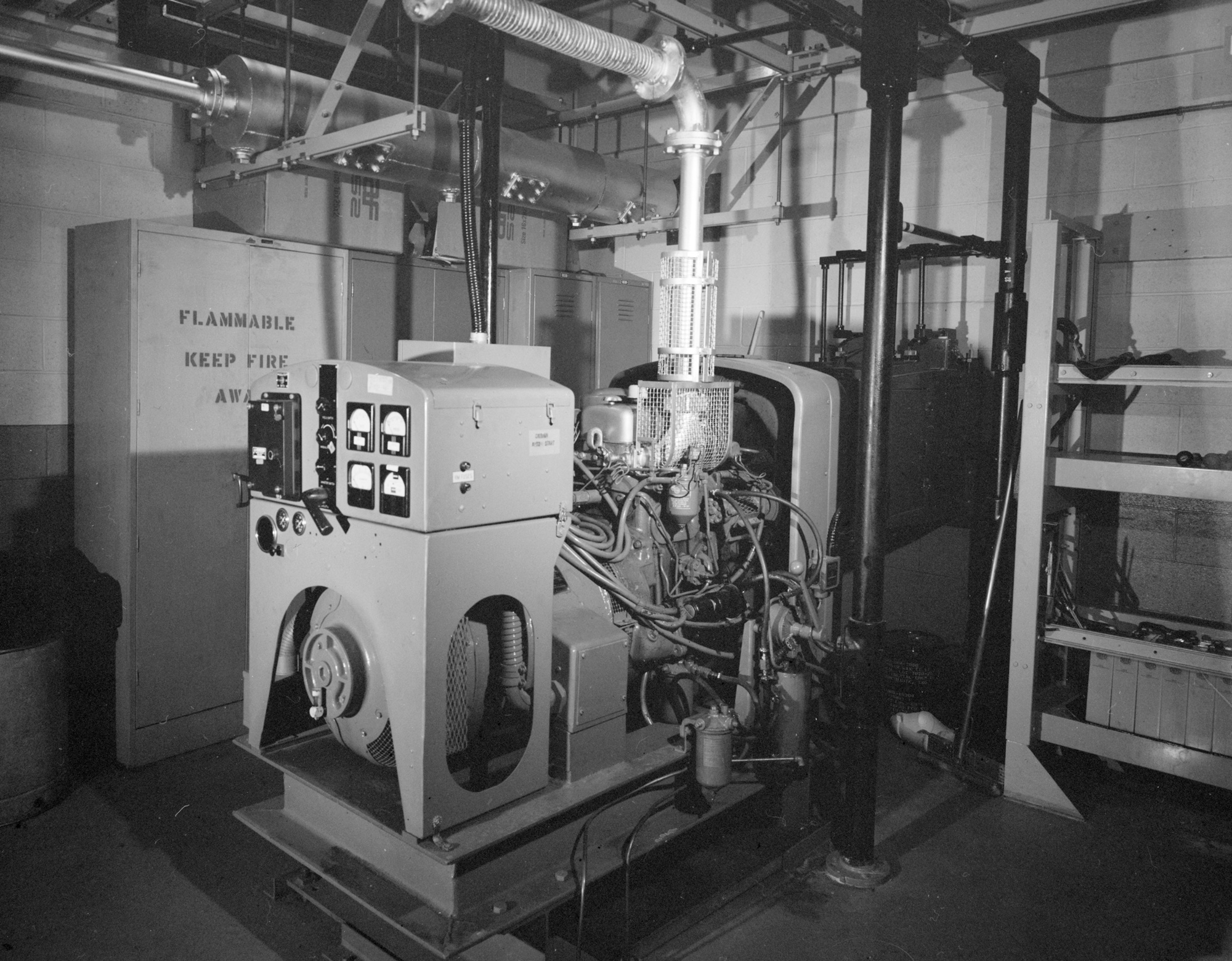
Electric service was supported by an AC power panel, converters, rectifiers, fuse panel, and banks of 12- and 24-volt batteries. The emergency room housed a two-cylinder General Motors diesel engine and 20-kilowatt Delco generator. The Corps says the generator was the original one when photographed, could run the station for several hours if other power failed, and was serviced twice monthly. These details describe the documented late-1980s equipment arrangement. They do not prove that every cabinet and circuit had been present without change since January 1957.
The Corps supplied a genuine Rabbit Creek site sketch and interior floor plan. It expressly warned that the Rabbit Creek as-built file was too incomplete to stand alone, so it included Sawmill and Cathedral drawings as representative TD-2 examples.
Operations, Personnel, And Communications Role
The Air Force called Rabbit Creek an unattended, two-way repeater, with maintenance personnel traveling from Anchorage. "Unattended" does not mean no one ever entered the building: the generator was serviced, fuses changed, and radio equipment inspected. The historical record does not establish a resident squadron, garrison, on-site barracks, or a 24-hour local crew. The absence of a dormitory is consistent with that operating model, but it should not be turned into an unsupported staffing count.
The repeater enabled continuity between the Anchorage network and the Kenai Peninsula White Alice route. The 1988 description makes clear that military-era, Alascom-era, and toll-center configurations should be distinguished. It does not list every traffic circuit, military message, call, data stream, frequency, or day-by-day changeover. The known role is the TD-2 transport path. A failure of this relay could break that path, even though the station itself performed no radar surveillance.
Lease, Sale, And Post-Military Continuity
The White Alice transition was not a single instant. The 1983 Air Force communications history describes a July 1, 1976 lease of White Alice facilities and circuits to RCA Alascom. In 1977 RCA Alascom identified TD-2 properties it wished to buy. A 1978 appraisal table names Rabbit Creek within the microwave properties under review. Some other stations were explicitly marked for personal-property-only purchase with the land to be leased; Rabbit Creek was not so marked. That is evidence of appraisal and proposed disposition scope, not a copy of a recorded deed.
The Air Force study records a system sales contract signed August 25, 1983 and delivery of deeds and bills of sale with final payment on October 14, 1983. These dates are system-wide milestones. The Corps' 1988 Rabbit Creek account states that Alascom acquired the station in 1983 and that the repeater still functioned. The 1994 Corps management plan calls it an active Alascom microwave facility retaining the integrity of a microwave operation and identifies Alascom as owner. Neither source supplies a present-day chain of title. The 1983 acquisition is also not a verified retirement date for the TD-2 route; in fact the later Corps observations demonstrate continued microwave use.
Later Licensing And Current Condition
The FCC's September 2010 public notice lists Alascom call sign WBA919 at the Rabbit Creek-area coordinates and several microwave frequencies. It is evidence of a later radio-license record, not proof that original 1957 TD-2 electronics remained in the building. The later disposition of that license and any successor licenses were not verified against a current primary FCC record. A license action should not be treated as a definitive station closing date in any event. The last directly verified site-specific physical-condition statement reviewed here is the Corps' 1994 assessment.
No current operator visit, dated ground photograph, building survey, property record, tower inspection, or environmental closure document was located. The archive plates show the station during the 1988 recordation, not what survives in 2026.
Historic Preservation, Photographs, And Environment
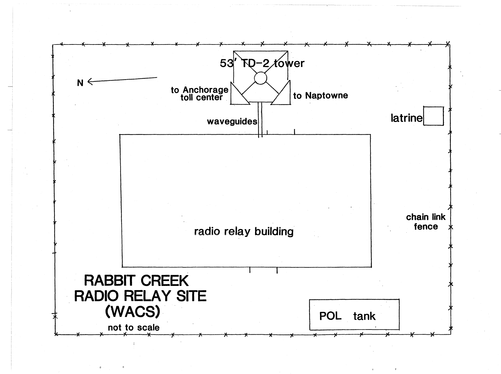
Rabbit Creek was chosen for National Park Service-standard photographic recordation because the 1988 Corps team found much original equipment and unusually good maintenance. Photographer James E. Stuhler documented twelve views: the relay building and tower, antenna/waveguide connections, radio bays, backup batteries and power equipment, fuse panel, and generator. HAER AK-23-A at the Library of Congress indexes those photographs. The 1988 Corps report reproduces the plates and supplies a Rabbit Creek-specific site sketch and floor plan. Its wider description and nearby Sawmill/Cathedral drawings must be read with their separate labels intact.
The 1994 management plan says Rabbit Creek retained integrity as an active communications facility, gives it AHRS ANC-651, and recommended notifying Alascom of its potential historic character. Its broad statement that the White Alice system was National Register listed should not be paraphrased as proof that Rabbit Creek individually was listed in the National Register. The plan itself treated continued active use as a reason that physical preservation work was not urgent then. That is a 1994 assessment, not a current preservation clearance or access policy.
The station had a diesel tank, generator, and other ordinary communications-site materials that warrant care in any modern land-use or cleanup study. However, no site-specific DEC contamination case, signed Rabbit Creek cleanup decision, or present environmental condition was verified in the sources used here. No contamination should be asserted simply because other White Alice sites had documented cleanup problems; neither should the absence of an identified case be described as proof the property is clean. The current deed, parcel boundary, public access rules, and environmental condition remain open research questions.
Chronology
- 1955-1956 The original Rabbit Creek TD-2 relay is constructed as part of White Alice.
- 1957-01-18 The Corps dates the station's opening.
- 1976-07-01 The Air Force history dates a system-level White Alice lease to RCA Alascom; this is not a Rabbit Creek deed date.
- 1977-05-20 RCA Alascom submits a list of real and personal TD-2 property it wishes to purchase.
- 1978 A property inspection describes Rabbit Creek's building, generator, tank, fence, and good condition; a separate system appraisal includes the station.
- 1983-08-25 The Air Force signs the system sales contract; a site-specific recording date is not established.
- 1983-10-14 System deeds and bills of sale are delivered with final payment; the Corps later says Alascom acquired Rabbit Creek in 1983.
- 1988 The Corps documents the active repeater, actual equipment, site plan, floor plan, and twelve HAER photographs.
- 1994 The Corps describes an active Alascom microwave site with historic integrity and assigns AHRS ANC-651.
- 2010-09-30 An FCC notice lists Alascom microwave call sign WBA919 at a Rabbit Creek-area licensed radio point.
- 2026 Current operating status, surviving original components, parcel boundaries, and environmental condition remain unverified in this audit.
Information sources (5)
- PDFThe White Alice Communications System: A Historic Overview and Inventory, U.S. Army Corps of Engineers, Alaska District, April 1988
Source for: original-network identity, construction and opening, routes, detailed building and equipment walk-through, 1978 inspection quotation, 1988 station condition, photographs, site sketch, and floor plan.
- PDFA Special Study of the Sale of the White Alice Communications System, 1931st Communications Wing and Office of Air Force History, October 1983
Source for: Anchorage R1-S identity, Rabbit Creek Road access, unattended maintenance model, lease and appraisal context, and system-level 1983 transfer chronology.
- PDFThe Cold War in Alaska: A Management Plan for Cultural Resources, U.S. Army Corps of Engineers, Alaska District, August 1994
Source for: small concrete-block design class, Alascom-era active status, preservation assessment, and AHRS ANC-651.
- WEBRabbit Creek White Alice Site, Radio Relay Station, HAER AK-23-A, Library of Congress
Source for: twelve indexed actual-station photographs, historic identity, opening summary, and qualified image rights advisory.
- PDFFCC Public Notice DOC-301909A1, September 2010
Source for: Alascom call sign WBA919 and its later licensed radio point. This is not a historic site survey or proof of current operation.