
Coyote Wells Gap Filler Annex / P-76D / Z-76D Radar Site, Coyote Wells California
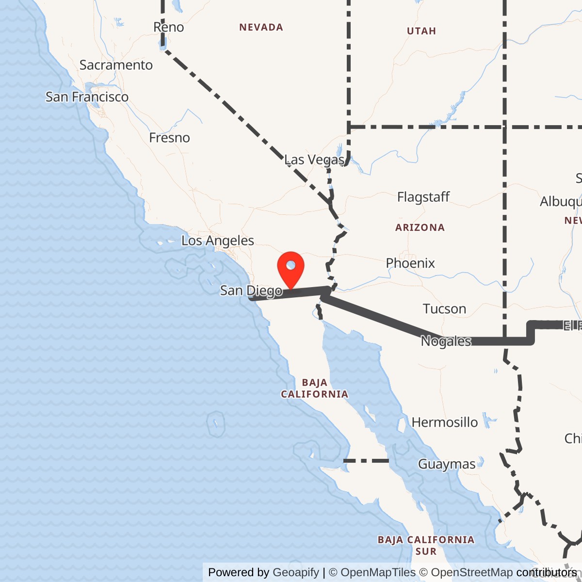
Longitude: -115.88938
Site Number: P-76D; Z-76D
Current Role: No active DoD mission verified. The former radar building and tower superstructure are demolished; rubble, slabs, and radar-tower footings remain. A 2011 NAF El Centro history asks visitors to respect property owners, but current deed-level title was not independently verified.
Installation Identity
Coyote Wells Gap Filler Annex was a small, detached U.S. Air Force Air Defense Command radar property in Imperial County. Its operational identifier was P-76D. Headquarters Aerospace Defense Command records identify Coyote Wells as an AN/FPS-14 gap-filler site that entered manual operation in April 1958. It was not a separate air force station, direction center, or permanently manned radar squadron headquarters. Its purpose was to fill a low-altitude surveillance gap in the larger southern California radar network by placing a short-range search radar where terrain and radar-horizon effects limited coverage from the high-elevation parent stations.
The annex existed in Air Force real-property and installation listings before the radar became operational. The 1 July 1956 USAF Installations Directory includes COYOTE WELLS GAP FILLER ANNEX P-76D among Air Defense Command installations, and the 31 March 1957 directory again lists the annex in the Mount Laguna installation group. Those entries establish that site acquisition, construction, or administrative activation preceded the April 1958 operational date. They also help distinguish the Air Force annex from the earlier Navy flying field activity associated with the broader Coyote Wells area.
Coyote Wells had more than one military use, and the different properties should not be merged casually. Naval Air Facility El Centro historical material describes an earlier Navy outlying landing field in the Coyote Wells area and states that the gap-filler annex was constructed after the flying field closed. The Air Force radar site therefore represents a later Cold War use of the locality, not a continuation of the Navy airfield mission under a new name. The available sources do not establish that the Air Force radar parcel and every portion of the former Navy field were legally identical.
Strategic Setting
The site was selected because of the geometry of radar coverage in southern California. Mount Laguna Air Force Station occupied a commanding mountain position west of the Imperial Valley, but even a high-power long-range radar could not see every aircraft close to the ground. The Earth's curvature, intervening ridges, and the abrupt descent from the Laguna Mountains toward the desert created areas in which low-flying aircraft could remain below the line of sight of a distant search radar. Air Defense Command's gap-filler program addressed those blind areas with smaller radars positioned closer to the terrain they were intended to watch.
Coyote Wells was especially useful because it sat on the desert side of the mountain barrier. From that position, an AN/FPS-14 could watch low-altitude airspace over western Imperial County and the approaches between the mountain front, the Imperial Valley, and the international border region. The annex did not duplicate Mount Laguna's long-range warning and ground-controlled-interception functions. It supplemented them by providing local search coverage where a target could be hidden from the main-site radar by terrain or radar horizon.
Construction and Operational Opening
The exact construction contract, contractor, parcel-acquisition instrument, and construction-completion date have not been recovered. The installation-directory evidence shows that the Air Force recognized Coyote Wells as P-76D by July 1956, more than twenty months before Headquarters ADC credited the site with an operational radar. That gap is consistent with the national gap-filler program's sequence of site selection, property control, building and tower construction, equipment installation, communications work, testing, and acceptance, but no Coyote-specific contract file was located to establish the exact sequence.
An ADC history covering the last half of 1957 creates an important administrative puzzle. Its station-report table lists P-76D Coyote Wells in the 27th Air Division and associates it with squadron 864, while P-76A Tecate is associated with squadron 751. The site was not yet operational at that point. By the January-June 1958 NORAD/CONAD equipment table, Coyote Wells is explicitly assigned to unit 751, the Mount Laguna squadron, with AN/FPS-14 search radar and no height-finder. The safest interpretation is that the 1957 entry reflects a pre-operational reporting or support relationship that changed before activation, but no transfer order has been located and the discrepancy should remain visible rather than being silently normalized.
Headquarters Aerospace Defense Command provides the strongest operational date. Its Historical Data of the Aerospace Defense Command, 1946-1973 lists P-76D Coyote Wells with a Manual Ops Date of April 1958 and AN/FPS-14 equipment. The same official tables leave the SAGE Ops Date blank. Radomes' Mount Laguna and Coyote Wells site records give December 1960 as the inactivation month.
Mission and Operational Role
Coyote Wells' mission was continuous low-altitude air surveillance in support of continental air defense. The AN/FPS-14 was designed specifically for the gap-filler role. It was a fixed S-band two-dimensional search radar operating in the 2700-2900 MHz range. Source-controlled equipment data give a 460-kW peak transmitter, a handbook maximum radar range of 70 nautical miles, and an antenna rotation rate of approximately 5.33 revolutions per minute. Those figures describe the radar set, not a guaranteed detection range for every target in the Coyote Wells terrain.
The operational value of the AN/FPS-14 came from placement rather than raw range. A short-range radar close to a terrain shadow could detect aircraft that a more powerful distant radar could miss at the same altitude. The radar provided range and azimuth information but did not independently measure precise altitude. The 1958 NORAD/CONAD table confirms this by listing FPS-14 at P-76D and showing no height-finder. Altitude determination, identification, track correlation, warning decisions, and fighter-control functions belonged to the broader air-defense system rather than to a separate height-finding crew at the annex.
Units, Staffing, and Maintenance
The principal operational unit relationship was with the 751st Aircraft Control and Warning Squadron at Mount Laguna Air Force Station. The January-June 1958 NORAD/CONAD equipment table assigns both Mount Laguna P-76 and Coyote Wells P-76D to unit 751, while listing the gap filler's AN/FPS-14 without a height-finder. The 751st was responsible for operating and maintaining the installed electronic and associated equipment needed for air defense in its assigned sector. Coyote Wells was one remote sensor within that larger squadron mission.
Gap-filler stations were designed to operate with little or no continuous on-site staffing, with parent-station technicians dispatched for scheduled maintenance or equipment faults. Specialist histories of the Mount Laguna network describe remote monitoring, diesel-generator control, and maintenance teams as part of the gap-filler concept. That system-level description is consistent with the physical remains at Coyote Wells.
The 751st's organizational history also helps define what Coyote Wells was not. The parent squadron did not become the 751st Radar Squadron (SAGE) until 1 May 1961, several months after the December 1960 closure attributed to Coyote Wells. The annex therefore belonged to the 751st during its Aircraft Control and Warning Squadron period. Later BUIC, missile-warning, Joint Surveillance System, and FAA missions at Mount Laguna occurred after P-76D had left service.
Communications and SAGE Status
The communications history requires careful qualification. Air Defense Command developed AN/FST-1 coordinate-data transmission equipment and AN/FSW-1 remote-monitoring arrangements for the gap-filler network, and secondary Mount Laguna histories associate Coyote Wells with AN/FST-1 equipment. Those systems allowed radar target data and equipment-status information to move from unattended annexes toward parent stations and SAGE facilities. They are important context for understanding how the national gap-filler program worked.
Coyote Wells, however, presents a source-control problem. Headquarters ADC's own gap-filler table places April 1958 under Manual Ops Date and leaves SAGE Ops Date blank. Mount Laguna's main station did not enter SAGE operation until 1961, after Coyote Wells had closed according to the accepted December 1960 chronology. No site-specific primary equipment schedule recovered independently confirms that P-76D achieved a formal SAGE configuration before closure. AN/FST-1 should therefore remain a reported or network-standard association, not a fully verified Coyote Wells equipment entry equivalent in certainty to the AN/FPS-14.
The designation Z-76D requires the same caution. Radomes and later specialist compilations preserve Z-76D as a SAGE-era or NORAD cross-reference for Coyote Wells. Yet the annex was already inactive by December 1960, while Mount Laguna's main-site identifier changed from P-76 to Z-76 on 31 July 1963. No primary record located here shows Coyote Wells operating while designated Z-76D. The correct historical treatment is to preserve Z-76D as an associated later identifier while recognizing P-76D as the verified active-period code.
Facilities and Physical Layout
The former site was compact and functional rather than a miniature air station. An unattended gap-filler installation needed a radar tower, radar and electronics space, electrical generation, fuel and utility support, communications equipment, access, and enough secure ground to keep the system operating. It did not require barracks, family housing, dining halls, medical facilities, or the extensive support plant found at Mount Laguna. That compact architecture matched the mission: operate one local surveillance radar and send useful information into the larger network.
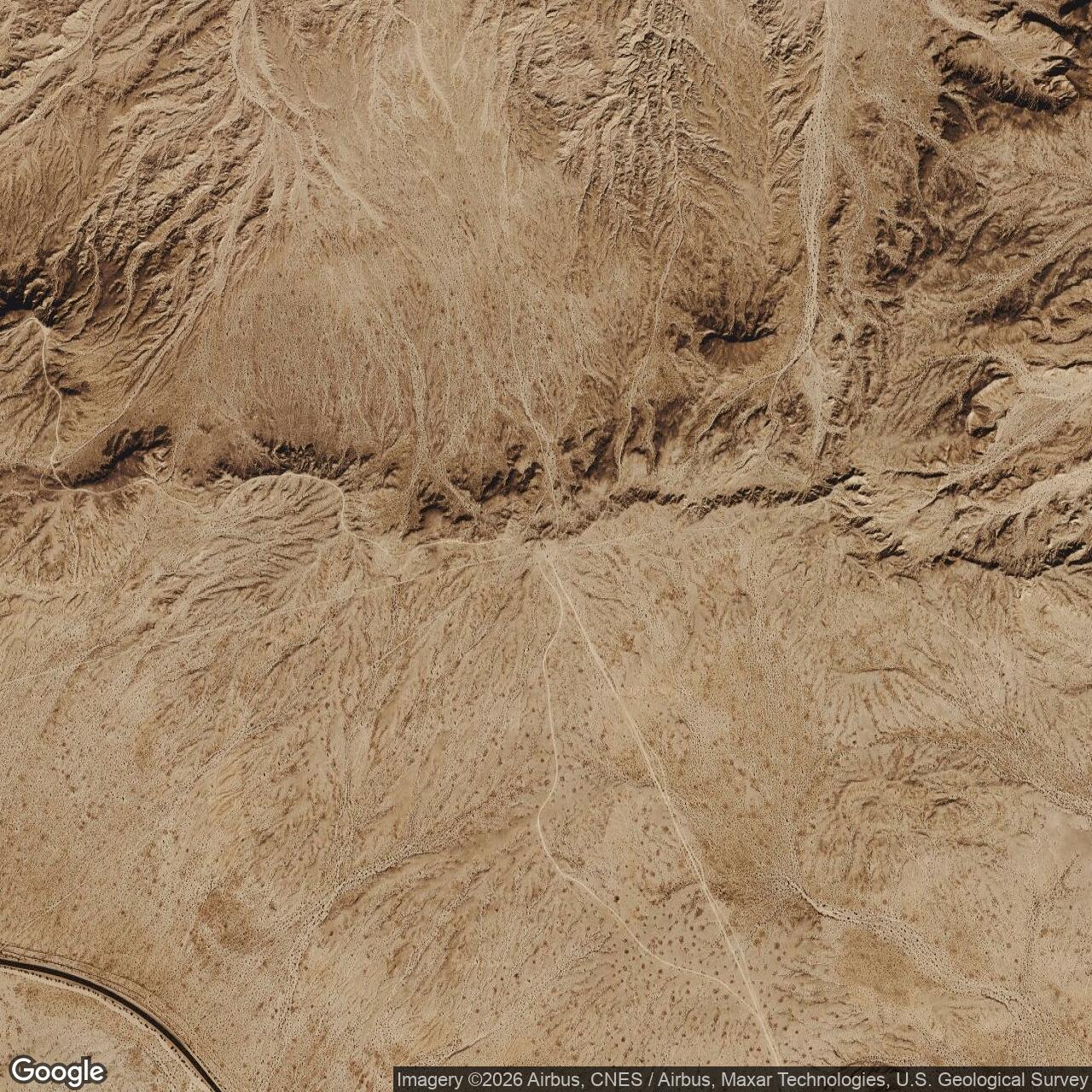
Modern site photographs preserve unusually useful physical evidence even though the principal building has been destroyed. Radomes' Coyote Wells photo captions identify the former diesel-generator wing at the south end of the structure and the radar-tower foundations to the east. Three tower foundations or footings remain visible, including anchor hardware, while the building itself survives only as rubble and slabs. These remains make the original functional relationship legible: power generation and equipment space were concentrated in the low building, while the radar antenna stood on a separate tower immediately beside it.
The photographic evidence also demonstrates why surviving-site descriptions must be time-qualified. Naval Air Facility El Centro's February 2011 Sandpaper history (link to PDF in Sources & References section at the bottom of this page) stated that the annex had been shut down and demolished at an unknown date but that remains of the old structure could still be seen. Radomes' current site record likewise describes the property as demolished, and its photo set shows rubble, slabs, and tower footings rather than an intact operational building. These statements are compatible. The site had been demolished, but substantial structural remains still marked the former radar location.
Closure and Post-Air Force Use
Radomes records December 1960 as Coyote Wells' inactivation month. No primary closure directive has been located, and the available evidence does not establish why this particular annex was withdrawn after less than three years of operational service. It would be speculative to attribute the closure to SAGE integration, budget reduction, technical performance, a change in threat, or a specific coverage realignment without a supporting order or engineering study.
The property did not remain an active Air Force radar installation after closure. No later Air Force radar mission, FAA radar operation, or separate military unit has been identified at the P-76D location. The 2011 Navy history describes the remains in the context of the old Coyote Wells locality and asks visitors to respect property owners, indicating a civilian property context rather than an active DoD reservation. Current deed-level ownership was not independently verified.
Environmental Restoration and FUDS Record
Coyote Wells appears in the Formerly Used Defense Sites program under property number J09CA0314 and federal facility identification number CA99799F542200. The official FUDS name is COYOTE WELLS GAP FIL AX P76B. That P76B suffix conflicts with the Air Force and ADC historical record, which identifies Coyote Wells as P-76D and separately identifies San Ysidro as P-76B. The FUDS name should therefore be preserved exactly as an environmental-program administrative label but treated as a code error, not as evidence that Coyote Wells and San Ysidro were the same installation.
Federal restoration tables show one Installation Restoration Program site and no Military Munitions Response Program site for the Coyote Wells property. A 2001 GAO FUDS status table listed J09CA0314 as an ongoing conventional hazardous-waste project in remedial design. A Department of Defense environmental table then listed Coyote Wells among properties with Response Complete at all sites as of 30 September 2002. Later DoD final-response tables continued to list FFID CA99799F542200 with one IRP site, zero MMRP sites, and total recorded IRP costs rising to approximately $214,000 as reporting matured.
Current Status and Legacy
Coyote Wells Gap Filler Annex is closed and demolished. The radar, tower superstructure, operating equipment, and intact support building are gone. The site is still identifiable through rubble, concrete slabs, and the surviving radar-tower foundations documented in modern photographs. There is no verified active military mission at the property. Access and ownership should be treated cautiously because available local history refers to property owners, while no current deed was examined.
Chronology
- 1956-07-01 The USAF Installations Directory lists COYOTE WELLS GAP FILLER ANNEX P-76D as an Air Defense Command installation, establishing the site administratively before radar operations began.
- 1957-03-31 The USAF Installations Directory again lists Coyote Wells Gap Filler Annex P-76D within the Mount Laguna group of Air Defense Command properties.
- 1957-10 to 1957-12 An ADC station-report summary lists P-76D Coyote Wells in the 27th Air Division and associates it with squadron 864, a pre-operational attribution that differs from the later operational assignment.
- 1958-04 Headquarters Aerospace Defense Command records P-76D Coyote Wells entering manual operation with an AN/FPS-14 search radar.
- 1958-01 to 1958-06 The NORAD/CONAD equipment table assigns P-76D to unit 751 and lists AN/FPS-14 search radar with no height-finder.
- 1959-10-01 The 751st Aircraft Control and Warning Squadron transferred into the Los Angeles Air Defense Sector organization while Coyote Wells remained operational.
- 1960-06-30 Coyote Wells remained part of the continental AN/FPS-14 gap-filler inventory during the period in which ADC counted 61 operational continental FPS-14 gap fillers.
- 1960-12 Coyote Wells Gap Filler Annex was inactivated according to the accepted radar-site chronology.
- 1961 Mount Laguna entered SAGE operation after Coyote Wells had closed.
- 1961-05-01 The 751st Aircraft Control and Warning Squadron was redesignated the 751st Radar Squadron (SAGE), after the Coyote Wells operational period.
- 1963-07-31 Mount Laguna's main-site code changed from P-76 to Z-76. Coyote Wells was already inactive, so Z-76D is retained only as a later historical cross-reference unless primary evidence establishes active use of that designation.
- 2001 GAO listed COYOTE WELLS GAP FIL AX P76B, J09CA0314, as a FUDS conventional hazardous-waste project in remedial design.
- 2002-09-30 Department of Defense reporting listed Coyote Wells, FFID CA99799F542200, as Response Complete at all sites.
- 2008-01 California Water Boards FUDS coordination records included a Joint Execution Plan for Coyote Wells and later closeout-documentation tasks despite the earlier federal Response Complete classification.
- 2011-02 Naval Air Facility El Centro's Sandpaper history described the former gap-filler annex as demolished at an unknown date with structural remains still visible and asked visitors to respect property owners.
- 2015 The U.S. Army Corps of Engineers FUDS inventory continued to list COYOTE WELLS GAP FIL AX P76B as J09CA0314 in Imperial County.
- 2022 Department of Defense final-response reporting continued to list CA99799F542200 with one IRP site, no MMRP site, and final response complete.
- Present The former P-76D radar property has no verified active military mission; rubble, slabs, and radar-tower foundations identify the demolished site.
Information sources (17)
- PDFHeadquarters Aerospace Defense Command, Historical Data of the Aerospace Defense Command, 1946-1973
Official ADC statistical history used for P-76D manual operational date, AN/FPS-14 equipment, the blank SAGE operational-date field, and continental gap-filler context.
- PDFU.S. Air Force, Installations Directory, 1 July 1956
Official installation directory establishing Coyote Wells Gap Filler Annex P-76D as an Air Defense Command property before operational activation.
- PDFU.S. Air Force, Installations Directory, 31 March 1957
Official installation directory confirming Coyote Wells Gap Filler Annex P-76D during the pre-operational construction and preparation period.
- PDFHeadquarters Air Defense Command, History, July-December 1957
Official ADC historical station-report summary used for the pre-operational 27th Air Division and squadron 864 attribution that conflicts with the later 751st operational assignment.
- PDFNORAD / CONAD History, January-June 1958
Official equipment table assigning P-76D Coyote Wells to unit 751 and identifying AN/FPS-14 search radar with no height-finder.
- PDFAir Force Lineage and Honors, 751 Radar Squadron (SAGE)
AFHRA-derived unit history used for the 751st's Mount Laguna assignment, mission, 1959 Los Angeles Air Defense Sector transfer, and 1961 redesignation.
- WEBDavid F. Winkler, Searching the Skies: The Legacy of the United States Cold War Defense Radar Program
Air Force-sponsored historical study used for Mount Laguna and national gap-filler context and for the transition from manual radar networks toward SAGE.
- PDFTM 11-487C-1, Military Standardization Handbook: United States Radar Equipment
Technical source used for source-controlled AN/FPS-14 frequency, power, range, antenna, scan, transmitter, receiver, and electrical characteristics.
- WEBRadomes, Coyote Wells, California
Site-specific radar-history record used for precise representative coordinates, P-76D/Z-76D cross-reference, AN/FPS-14, April 1958 opening, December 1960 inactivation, demolition status, photographs, maps, and aerial imagery.
- WEBRadomes, Mount Laguna Air Force Station, California
Specialist radar-history compilation used to cross-check Coyote Wells within the Mount Laguna gap-filler network.
- WEBFortWiki, Mount Laguna Air Force Station
Secondary system-history source used for unattended gap-filler operating concepts, parent-station maintenance, FST-1/FSW-1 context, and the distinction between the gap-filler network and later SAGE/BUIC/JSS operations.
- PDFNaval Air Facility El Centro, The Sandpaper, Issue 6, February 2011
Official Navy installation newspaper used to distinguish the earlier Coyote Wells outlying field from the later Air Force gap-filler annex and to document surviving post-demolition remains and property-owner caution.
- WEBU.S. General Accounting Office, Defense Environmental Restoration Program, California FUDS Status
Federal cleanup table identifying COYOTE WELLS GAP FIL AX P76B as J09CA0314 and documenting the 2001 remedial-design status.
- PDFDepartment of Defense, Defense Environmental Restoration Program, Status of Installations With Response Completed at All Sites as of September 30, 2002
Official table identifying CA99799F542200 and documenting Response Complete at all sites by the end of FY2002.
- PDFCalifornia State Water Resources Control Board, DSMOA Semiannual Report, 2010
State-federal cleanup coordination record listing Coyote Wells FUDS J09CA0314 and related closeout and documentation activity.
- PDFU.S. Army Corps of Engineers, FUDS Inventory, California
Official FUDS inventory identifying COYOTE WELLS GAP FIL AX P76B as J09CA0314 in Imperial County.
- PDFDepartment of Defense, DERP Table 9, Final Response Complete Before FY2023
Later official environmental table confirming CA99799F542200 has one IRP site, zero MMRP sites, and final response complete.