
Mount Laguna Air Force Station Radar Site, Mount Laguna California
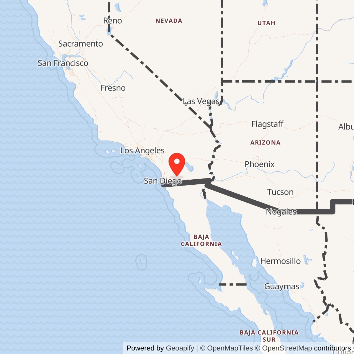
Longitude: -116.41500
Site Number: P-76; Z-76; J-30
Current Role: Active FAA ARSR-4 long-range radar site at location code QRW and Joint Surveillance System site J-30; former Air Force cantonment largely removed, with selected radar-era structures and foundations surviving.
Mount Laguna Air Force Station was a Cold War continental air-defense radar station whose location turned one of the highest accessible ridges in eastern San Diego County into a military sensor platform. The station began as a permanent replacement for temporary postwar radar coverage and ultimately became much more than a search-radar outpost. It served ground-controlled interception, long-range surveillance, SAGE reporting, Backup Interceptor Control, submarine-launched ballistic-missile warning, and joint Air Force-Federal Aviation Administration surveillance. The Air Force staffed station closed in 1981, but the radar mission did not disappear. A modern FAA ARSR-4 at the same mountain site remains part of the Joint Surveillance System as J-30, preserving the basic surveillance value that led the Air Force to occupy Mount Laguna in the first place.
The main installation should be distinguished from several detached properties associated with its mission. The Air Force maintained a separate Ground Air Transmit Receive communications property, later documented in FUDS records as MT LAGUNA (GATR), J09CA0032, and historical public-land records also identify a Mount Laguna Communication Facility Annex. The Mount Laguna radar network additionally included or planned six low-altitude gap-filler sites at Tecate, San Ysidro, Tierra del Sol, Coyote Wells, Moreno, and Joshua Tree. Those were physically separate properties and are not included in the 132.44-acre main-station figure. Their identities are preserved separately because distance, land control, environmental history, and current condition can differ substantially from the mountain-top parent station.
Strategic Setting and Site Selection
Mount Laguna offered the Air Force a rare combination of elevation, line of sight, and proximity to an important Pacific Coast metropolitan area. The station sat at roughly 6,300 feet on the eastern side of San Diego County, where the terrain falls sharply toward the Borrego and Imperial desert regions. From this crest, radar could look east and southeast across approaches that low coastal sites could not cover as effectively because of the mountainous terrain. The same altitude also created an operational burden. The squadron's own history emphasized winter winds and snow, which meant that radar reliability depended not only on electronics but also on roads, generators, heating plants, maintenance crews, and the ability to keep a small military community functioning in severe mountain weather.
The land relationship was unusual enough to matter to the installation's later history. A federal environmental record states that the 132.44-acre site was obtained from the U.S. Forest Service under a special-use permit dated 1949-12-07. The Air Force therefore did not create a conventional fee-owned base carved from a large military reservation. It built a radar station within national-forest land under federal land-use authority, a structure that later shaped excess, cleanup, demolition, and restoration decisions. The permit predates operational radar service by more than two years and helps reconcile different dates in secondary sources. Property acquisition and construction activity began in the 1949-1950 period, while the permanent Mount Laguna radar mission became operational in 1952.
Construction and Opening
The 751st Aircraft Control and Warning Squadron was activated at Port Hueneme in November 1950 while construction at Mount Laguna proceeded. Its surviving lineage compilation states that the squadron continued operating from Port Hueneme until the mountain installation was ready for full-scale operations, and that Mount Laguna became the permanent home of the squadron on 1952-02-29. Radar operations at the peak began in April 1952. This chronology separates organizational movement from operational opening, which is important for a station built while the national permanent radar network was still expanding under Korean War pressure.
Within about two months of opening, Mount Laguna assumed regional coverage previously carried by the temporary Minter Field lashup radar. One surviving 751st lineage compilation calls that predecessor L-34, while the separately researched Minter Field or Shafter Lashup Radar Site is established as L-39 in the current installation inventory. Because the dedicated Minter research supports L-39, this history treats the L-34 reference as a likely transcription or compilation error rather than inventing a second Minter lashup site. The important operational point is not the conflicting code. Mount Laguna was built to replace temporary emergency coverage with a permanent high-elevation radar station capable of sustained twenty-four-hour continental air defense.
Early Ground-Controlled Interception Mission
The first Mount Laguna radar set combined an AN/FPS-3 search radar with an AN/CPS-4 height-finding radar. That pairing reflected the requirements of manual ground-controlled interception. Operators needed to detect an aircraft, establish range and bearing, determine altitude, identify whether the track was friendly or unknown, and pass usable information to control personnel who could direct interceptor aircraft. The station was therefore both a sensor site and an operational decision point. Radar scopes, identification procedures, plotting, communications circuits, and weapons-control techniques converted raw returns into an air-defense picture that could support fighter interception over southern California and adjacent sectors.
The 751st did not exist merely to keep antennas turning. Its own unit history defined the mission as operating and maintaining installed electronic and associated equipment required for air-defense operations within the Los Angeles Air Defense Sector and adjacent sectors when directed. That wording captures the station's dual burden. Operations personnel had to sustain continuous surveillance and tactical reporting, while maintenance personnel kept transmitters, receivers, antennas, height finders, communications gear, power systems, and environmental equipment serviceable. A radar outage created a real surveillance gap, so preventive maintenance, spare parts, generator readiness, and rapid troubleshooting were operational tasks rather than background support.
Radar Equipment Evolution
Mount Laguna's equipment changed repeatedly as Air Defense Command moved from early postwar radar sets toward more accurate, higher-powered, and increasingly automated systems. An AN/FPS-8 replaced the AN/CPS-4 in 1955 and was converted to the AN/GPS-3 configuration in 1956. An AN/FPS-6 height finder arrived in 1956, and the GPS-3 was removed by 1960. By 1962 the station was operating an AN/FPS-7 family search radar with AN/FPS-6 and AN/FPS-6B height finders. The AN/FPS-6B was upgraded to AN/FPS-90 configuration in 1963. These changes were not cosmetic modernization. They improved detection, altitude determination, reliability, and the station's ability to feed an increasingly computerized regional command system.
A further change in 1964 brought an AN/FPS-26A frequency-diversity height finder. Around 1966 that radar was modified into the AN/FSS-7, a specialized ballistic-missile detection and warning radar. That conversion altered the meaning of one of Mount Laguna's towers. A structure originally associated with measuring aircraft altitude now contributed to strategic warning against submarine-launched ballistic missiles, while other radar equipment continued the air-surveillance mission. Mount Laguna thus carried overlapping Cold War functions: detection and control against crewed aircraft, backup control if regional command centers failed, and warning of missile attack. Its equipment lineage mirrors the broader shift from the bomber-focused 1950s air-defense problem toward a mixed bomber and missile threat.
SAGE Integration
Mount Laguna entered the Semi-Automatic Ground Environment system in 1961. SAGE linked remote radars, direction centers, communications circuits, computers, and interceptor-control functions into a more integrated regional network. Mount Laguna's radar data was fed into the southern California SAGE structure, with contemporary and later compiled histories identifying the Norton Air Force Base direction center as the principal regional destination. The 751st was redesignated the 751st Radar Squadron (SAGE) on 1961-05-01. The redesignation reflected a genuine operational change because station information increasingly became an input to a computerized command-and-control system rather than a purely local manual control picture.
SAGE also changed the relationship between Mount Laguna and other installations. The station's value depended on data links and communications as much as on the radar itself. A remote radar return had to travel reliably to a direction center where computers and controllers fused it with reports from other sites, identification data, flight plans, and interceptor status. If an unknown track required action, the response could involve fighter-interceptor units based elsewhere in California or the Southwest. Mount Laguna therefore became one node in a distributed weapons system. Its mountain top supplied coverage, but the final air-defense effect depended on direction centers, communications annexes, fighter bases, and command headquarters working together.
Backup Interceptor Control
Mount Laguna later became a Backup Interceptor Control site, commonly described as BUIC. BUIC was designed to preserve fighter-control capability if a SAGE direction center was disabled or cut off. This mattered in nuclear-war planning because large, fixed direction centers were obvious strategic targets and communications could be disrupted even without a direct hit. A BUIC-capable radar station could assume a greater share of local surveillance and weapons-control responsibility, allowing interceptor operations to continue under degraded conditions. Mount Laguna's BUIC role explains why the station was more than an ordinary reporting radar and why the Air Force elevated its organization during the 1970 reorganization of key backup-control sites.
On 1970-03-01 the 751st Radar Squadron was replaced by the 751st Air Defense Group. The Aerospace Defense Command organizational handbook identifies Mount Laguna's 751st as one of the Air Defense Groups created that day and assigned to the 26th Air Division. The group structure was intended for selected BUIC sites with broader command responsibilities than a standard radar squadron. As the threat from crewed bombers declined and the air-defense system contracted, that organization proved temporary. The group was redesignated back to the 751st Radar Squadron in January 1974, returning Mount Laguna to squadron-level organization while preserving its surveillance mission.
Los Angeles Sector and Higher Headquarters
The 751st's command relationships changed as Air Defense Command repeatedly reorganized the western air-defense system. The squadron moved under the 27th Air Division in February 1952, transferred to the Los Angeles Air Defense Sector on 1959-10-01, returned to the 27th Air Division in 1966, and was assigned to the 26th Air Division in November 1969. These changes reflected regional command restructuring rather than relocation of the station. Mount Laguna remained on the same mountain while the headquarters that received, interpreted, and acted on its data changed around it. This is a common feature of long-lived radar stations, where organizational lineage can change several times even when the physical mission remains continuous.
The station's air-defense geography made it particularly useful to southern California. It watched approaches east of San Diego and supplemented other radar sites around California, Arizona, Nevada, and the Pacific coast. Its higher headquarters could use its coverage to support identification and interception decisions affecting civilian and military airspace near one of the nation's largest coastal population centers. The station also sat near the international border, where normal civil aviation, military training, and cross-border traffic created a demanding radar environment. The historical record located for this pass does not document a Mount Laguna directed combat intercept or hostile aircraft engagement. Its operational significance lies instead in continuous homeland surveillance and readiness throughout the Cold War.
Gap-Filler Radar Network
Mountain radar coverage was powerful but not perfect. Terrain could mask low-flying aircraft, especially in valleys and behind ridgelines, so Air Defense Command developed unattended or lightly attended gap-filler radars to feed lower-altitude coverage into the larger network. Mount Laguna was associated with six planned or operational gap-filler properties. Tecate P-76A and Z-76A operated an AN/FPS-14 from November 1957 through June 1961. Coyote Wells P-76D and Z-76D operated an AN/FPS-14 from April 1958 through December 1960. Joshua Tree P-76F, later also shown as P-59C, operated an AN/FPS-18 from September 1960 through June 1961. Each was a separate remote property whose purpose was to fill a specific low-altitude blind area.
Three additional planned Mount Laguna gap fillers never became normal operational radar sites. San Ysidro P-76B was planned first for AN/FPS-14 and later AN/FPS-18 equipment, and surviving site research reports that its building remained extant. Tierra del Sol P-76C, also known as Hipass, likewise progressed as a physical gap-filler property but never activated operationally. Moreno P-76E was planned for AN/FPS-14 service and is recorded as never operational. Their existence is still historically important because a built or acquired military property can have a real land and environmental history even if the intended radar mission never reached activation.
Joshua Tree deserves special caution because the site-code record overlaps the Mount Laguna and Boron networks. Historical SAGE maps and compiled radar records show the Copper Mountain site as P-76F and later P-59C, while Boron histories also associate P-59C with that same physical property. This history therefore preserves Joshua Tree as one distinct gap-filler installation with a changing or shared administrative relationship rather than creating duplicate physical sites.
GATR and Communications Annex
SAGE and BUIC operations required reliable two-way communications with aircraft, direction centers, and other command nodes. Mount Laguna therefore had a detached Ground Air Transmit Receive communications property separate from the 132.44-acre main radar station. The U.S. Army Corps of Engineers FUDS inventory lists MT LAGUNA (GATR), J09CA0032, in San Diego County, while Defense Environmental Restoration Program tables identify FFID CA99799F524800. A 1977 California public-land inventory separately listed Mount Laguna Air Force Station Z-76 and Mount Laguna Communication Facility Annex, supporting treatment of the communications property as a distinct real-estate identity rather than a building inside the main cantonment.
The surviving records located establish the GATR property's existence and environmental identity more clearly than its exact boundary. A federal cleanup inventory shows one Installation Restoration Program site and no munitions-response site, with response complete status achieved before the early 2010s. Recent site photography identifies the route toward the former GATR area and reports that the facility itself is no longer extant.
Missile Warning Mission
The conversion of the AN/FPS-26A to AN/FSS-7 configuration added a strategic-warning mission distinct from ordinary aircraft surveillance. The AN/FSS-7 was designed to detect and track sea-launched ballistic missiles and could also contribute to satellite tracking. During the 1970s Mount Laguna became one of the dispersed sites supporting the 14th Missile Warning Squadron. Detachment 4 at Mount Laguna operated the modified radar as part of a warning network intended to provide rapid indication of submarine-launched missile attack. This was a national strategic mission, not a local San Diego air-traffic function, and it gave the station a direct role in the nuclear-warning system during some of the most tense years of the Cold War.
The 14th Missile Warning Squadron was activated in 1972, and its unit history identifies Mount Laguna among the locations equipped with the modified FSS-7 system. The network's primary purpose was detection and tracking of ballistic missiles, with satellite tracking as a secondary capability. Detachment 4 continued into 1980, when the missile-warning squadron was inactivated and the aging FSS-7 network was being retired. The Mount Laguna missile-warning mission overlapped with the 751st's air-defense work rather than replacing it. For several years the same station supported warning against both aircraft and ballistic-missile threats, a combination that underscores the site's unusually broad Cold War operational significance.
FAA Joint Use
Mount Laguna became a joint Air Defense Command and Federal Aviation Administration radar facility around 1965. Joint use reflected the fact that a high-quality long-range search radar could serve both military air defense and civil air-traffic control. Instead of maintaining completely separate national radar networks everywhere, the federal government increasingly shared sensors and data. Civil controllers gained valuable coverage over difficult terrain in southern California, while Air Defense Command retained access to the same surveillance picture for military warning and identification. This joint-use arrangement was the bridge between the staffed Air Force station and the modern FAA-operated Joint Surveillance System site.
The FAA relationship also helps explain why the radar mission survived the contraction of Air Defense Command. As the strategic bomber threat declined and SAGE-era organizations were reduced, the mountain still provided excellent civil surveillance. An NTSB factual report later described Los Angeles Center radar coverage in the area as coming from the Mount Laguna ARSR-4 and characterized the coverage as excellent. FAA documentation identifies the Mount Laguna radar with location code QRW. The continued value of the site to civil air traffic meant that closure of the Air Force garrison did not make the radar position obsolete.
Personnel, Commanders, and Station Life
The 751st was a relatively small technical organization, but it supported the full life of an isolated station. The lineage compilation names Lieutenant Colonel Raymond A. Algren as commander in 1954. A documented 1967 change-of-command ceremony records Colonel Jack L. Krout assuming command and shows that station ceremony, unit formation, and community life continued alongside the radar mission. The ceremony had to use a basketball court because level ground large enough for the formation was scarce on the mountain. That detail illustrates how topography shaped even ordinary military routine at Mount Laguna.
Air Force personnel records also place future Brigadier General John R. Lasater with the 751st Aircraft Control and Warning Squadron from July 1960 through December 1961. His later career does not make Mount Laguna historically important by itself, but the assignment illustrates the range of officers who passed through the station's operational system. The 751st also included radar operators, maintenance technicians, communications specialists, power-production personnel, administrative staff, food-service workers, vehicle operators, supply personnel, and other support specialties.
Life at the station reflected both isolation and community. Local newspaper material from the early 1960s records squadron picnics, swimming, and family activities, showing that the installation functioned as a residential community rather than only a radar compound. Recent photographs and site documentation identify family housing, barracks, a dining hall, a mail room, and recreation areas. These facilities mattered because personnel had to remain near the radar in all weather and could not depend on daily commuting from San Diego. The Air Force therefore built the social and domestic infrastructure necessary to keep a technical workforce stationed on a remote mountain.
Facilities and Physical Layout
The main operations area centered on radar towers, the operations and SAGE building, power generation, communications, and support buildings. Later photographic documentation identifies Building 201 as the operations and SAGE building, Building 202 nearby, and Building 203 as an underground fallout-shelter entrance. Building 221 served as a power plant and reportedly housed six generators before the equipment was removed. The station also had boiler facilities, a dining hall, barracks identified in photographs as Bravo and Delta, headquarters or administration space, family housing, and utility structures. This was a compact technical base designed around keeping radar and communications operating continuously.
Emergency power was especially important. A mountain radar station could not allow a commercial power interruption to eliminate air-defense coverage, so dedicated generators and fuel systems were part of the weapons system in a practical sense. Heating was equally important because high winds, snow, and cold threatened both equipment and people. Radar antennas and towers occupied the most visually prominent positions, but the less dramatic power plant, boiler rooms, maintenance spaces, and roads determined whether those antennas could function through bad weather. The physical layout therefore reflected redundancy and sustainment as much as surveillance.
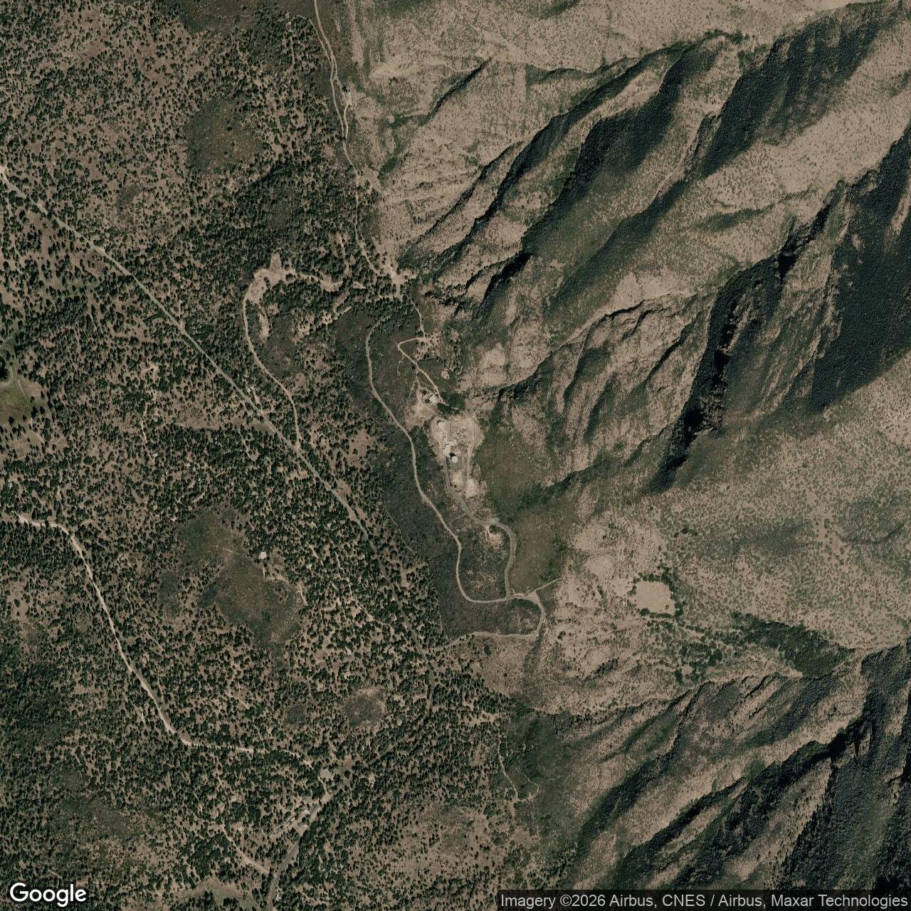
The FSS-7 and former FPS-26 tower became one of the station's most distinctive surviving features. After the missile-warning mission ended, the tower remained as a visible Cold War structure while FAA radar equipment occupied the continuing operational area nearby. Recent photographs also show an older radar tower reused for communications antennas, illustrating how the physical plant evolved after active Air Force staffing ended. The exact survival status of every Cold War structure changed substantially during cleanup and demolition, so photographs from the 1990s and 2000s should not be interpreted as a complete picture of the site in 2026.
1979 Reorganization and Air Force Drawdown
In 1979 the inactivation of Aerospace Defense Command shifted Mount Laguna into the Tactical Air Command structure associated with ADTAC. The change was administrative but symbolized the shrinking independent air-defense establishment. The 751st Radar Squadron remained until 1981-09-30, when it was inactivated. That date is used as the closing date for the staffed Air Force station because it marks the end of the principal resident radar organization. It does not mean every Air Force technical function stopped instantly. The FAA assumed greater control of search surveillance while the Air Force retained responsibility for a height-finder capability for several additional years.
During the 1980s the FAA replaced the AN/FPS-7E search radar with an ARSR-3. The Air Force's residual height-finding role eventually used an AN/FPS-116, which compiled histories place in service until approximately 1988. That lingering technical responsibility is why the history distinguishes station closure from final Air Force radar-equipment withdrawal. A simple 1981 closure statement would erase several years of transitional joint use. By the late 1980s the Air Force role had largely disappeared, but the FAA continued the long-range surveillance mission from the same mountain.
Environmental Restoration and Disposal
Federal environmental records treat the former station as FUDS property J09CA1008, FFID CA99799F590900. The Defense Environmental Restoration Program identifies two Installation Restoration Program sites and no Military Munitions Response Program site at the main station, with reported costs of about $881,000 in earlier status tables. The record indicates that the former Air Force property achieved response-complete status before fiscal year 2013. The absence of an MMRP site is consistent with Mount Laguna's radar and communications mission rather than weapons-range use, but it does not mean the installation had no environmental concerns. Fuel, utilities, building materials, generators, and industrial support systems all created potential cleanup issues.
The property-return process also involved the Forest Service because the station had been established on national-forest land. A federal environmental description states that after the Air Force determined the facility excess in 1981, the General Services Administration controlled it and that some buildings continued to be used by the FAA, California Institute of Technology, and other entities. The Forest Service sought removal of unwanted buildings, electrical distribution equipment, and debris. This layered ownership and use history explains why the old cantonment persisted for decades after military staffing ended even while the radar area remained active.
By 2009 the abandoned residential and administrative portions of the former Air Force station had deteriorated substantially. Contemporary reporting and later historic-resource documentation describe a federal stimulus-funded Forest Service demolition program that removed barracks, administration, mess, and other obsolete station buildings around 2009-2010. The goal was not to erase the active radar function but to remove derelict former-garrison structures on national-forest land. The demolition sharply changed what survives for historians. Earlier site photographs therefore have particular value because they document the barracks, power plant, operations buildings, family housing, fallout shelter, and other features before major removal.
Current Status
Mount Laguna remains an active federal radar location in 2026, but it is no longer an Air Force station in the organizational sense. The FAA operates an ARSR-4 at location code QRW, and the site is identified in Joint Surveillance System references as J-30, associated with the Western Air Defense Sector. FAA procurement documentation from the 2020s continues to identify Mount Laguna as an ARSR-4 location, and Department of Transportation procurement planning has included environmental cleanup support for the QRW site. The same mountain that once fed manual and SAGE air-defense systems now supports a joint civil-military surveillance architecture built around modern long-range radar and digital data distribution.
The present mission is therefore a direct technological descendant of the Cold War station even though the garrison, command structure, and much of the cantonment are gone. Mount Laguna still provides surveillance over difficult southern California terrain, supports civil air-traffic control, and contributes radar data to national air-defense awareness. The transition from AN/FPS-3 and AN/CPS-4 equipment to ARSR-4 illustrates nearly three quarters of a century of radar modernization at the same strategic location. The site's continued use also validates the original geographic logic. Radar technology changed repeatedly, but the mountain remained an exceptionally valuable place from which to watch the airspace east of San Diego.
Chronology
- 1949-12-07 The U.S. Forest Service special-use permit documented in the FUDS record established the 132.44-acre Mount Laguna radar property.
- 1950-11-20 The 751st Aircraft Control and Warning Squadron was activated at Port Hueneme while construction proceeded at Mount Laguna.
- 1952-02-06 The 751st transferred to the 27th Air Division as the permanent radar network in southern California expanded.
- 1952-02-29 The unit-history compilation identifies Mount Laguna as the permanent home of the 751st.
- 1952-04 Permanent radar operations began at Mount Laguna with AN/FPS-3 and AN/CPS-4 equipment.
- 1952-06 Mount Laguna assumed coverage previously provided by the temporary Minter Field lashup radar.
- 1954 Lieutenant Colonel Raymond A. Algren is documented as commander of the 751st.
- 1955 An AN/FPS-8 replaced the AN/CPS-4.
- 1956 The AN/FPS-8 was converted to AN/GPS-3 configuration, and an AN/FPS-6 height finder arrived.
- 1957-11 Tecate Gap Filler Annex P-76A began AN/FPS-14 operations.
- 1958-04 Coyote Wells Gap Filler Annex P-76D began AN/FPS-14 operations.
- 1959-10-01 The 751st transferred to the Los Angeles Air Defense Sector.
- 1960 The AN/GPS-3 was removed from Mount Laguna.
- 1960-09 Joshua Tree Gap Filler Annex P-76F began AN/FPS-18 operations on Copper Mountain.
- 1960-12 Coyote Wells Gap Filler Annex ended operations.
- 1961-05-01 The 751st was redesignated the 751st Radar Squadron (SAGE).
- 1961-06 Tecate and Joshua Tree gap-filler operations ended during contraction and reorganization of the gap-filler network.
- 1961 Mount Laguna became integrated into the SAGE system.
- 1962 The station operated an AN/FPS-7 family search radar with AN/FPS-6 and AN/FPS-6B height finders.
- 1963 The AN/FPS-6B height finder was upgraded to AN/FPS-90 configuration.
- 1963-07-31 Mount Laguna's NORAD site identity was redesignated Z-76 in the SAGE-era system.
- 1964 An AN/FPS-26A frequency-diversity height finder entered the radar configuration.
- 1965 Mount Laguna became a joint Air Defense Command and Federal Aviation Administration radar facility around this period.
- 1966 The AN/FPS-26A was modified to AN/FSS-7 configuration for submarine-launched ballistic-missile detection and warning.
- 1966-04-01 The 751st transferred from the Los Angeles sector structure back to the 27th Air Division.
- 1967 Colonel Jack L. Krout assumed command of the 751st in a documented Mount Laguna change-of-command ceremony.
- 1969-11-19 The 751st transferred to the 26th Air Division.
- 1970-03-01 The 751st Radar Squadron was replaced by the 751st Air Defense Group as Mount Laguna carried BUIC responsibilities.
- 1972-07-08 The 14th Missile Warning Squadron was activated, with Detachment 4 at Mount Laguna supporting the FSS-7 missile-warning network.
- 1974-01 The 751st Air Defense Group was redesignated back to squadron organization as the bomber-defense structure contracted.
- 1979 Mount Laguna passed under Tactical Air Command jurisdiction with the reorganization of Aerospace Defense Command functions.
- 1980 The 14th Missile Warning Squadron era ended, terminating the dedicated FSS-7 strategic-warning organization.
- 1981-09-30 The 751st Radar Squadron was inactivated, ending the staffed Air Force station era and leaving the FAA with increasing control of the surveillance mission.
- 1980s The FAA replaced the AN/FPS-7E search radar with an ARSR-3, while the Air Force retained a residual height-finder responsibility.
- 1988 The remaining Air Force AN/FPS-116 height-finder capability was removed around this time.
- Late 1990s The FAA replaced the ARSR-3 with an ARSR-4 long-range surveillance radar.
- 2009-2010 Forest Service demolition removed much of the abandoned former cantonment, including barracks, administration, and mess facilities.
- Before FY2013 Defense Environmental Restoration Program tables show response-complete status for the main Mount Laguna AFS and the detached GATR FUDS properties.
- 2024-2025 Department of Transportation procurement planning identified environmental cleanup support for the active FAA QRW Mount Laguna radar site.
- 2026 The Mount Laguna ARSR-4 remains an active FAA/JSS radar location supporting civil air-traffic surveillance and national air-defense awareness.
Information sources (17)
- PDFU.S. Air Force Lineage and Honors, 751 Radar Squadron (SAGE)
Source for unit lineage, assignments, mission, commanders, station geography, radar equipment, SAGE integration, FAA joint use, and 1979-1980s transition.
- PDFA Handbook of Aerospace Defense Organization, 1946-1980
Source for the 751st Air Defense Group activation, BUIC-era organizational structure, and January 1974 redesignation.
- WEBU.S. Air Force Biography, Brigadier General John R. Lasater
Source for Lasater's July 1960 through December 1961 assignment to the 751st Aircraft Control and Warning Squadron at Mount Laguna.
- WEBRadomes, Mount Laguna AFS, California
Source for site codes P-76, Z-76 and J-30, radar equipment chronology, operational dates, BUIC status, gap-filler network, FAA transition, and current ARSR-4 use.
- WEBRadomes, Recent Photographs of Mount Laguna AFS
Source for documented site layout, operations and SAGE building, power plant, barracks, dining hall, family housing, fallout shelter, radar towers, GATR route, and ARSR-4.
- WEBRadomes, Mount Laguna 1967 Change of Command
Source for Colonel Jack L. Krout's 1967 assumption of command and details of the station change-of-command ceremony.
- PDF14th Missile Warning Squadron / 14th Test Squadron Unit History
Source for the FSS-7 submarine-launched ballistic-missile warning mission, 14th Missile Warning Squadron organization, and Mount Laguna detachment relationship.
- WEBRadomes, 14th Missile Warning Squadron
Source for Detachment 4 at Mount Laguna and the modified AN/FPS-26A to AN/FSS-7 missile-warning mission.
- PDFUSACE FUDS Inventory, California
Source for Mount Laguna Air Force Station J09CA1008 and the separate MT LAGUNA (GATR) property J09CA0032.
- PDFDefense Environmental Restoration Program, FUDS Status Tables
Source for FFID CA99799F590900 for the main station, FFID CA99799F524800 for the GATR property, IRP/MMRP counts, and response-complete status.
- PDFCalifornia Public Utilities Commission, Environmental Database Appendix
Source for the 132.44-acre former station property, 1949-12-07 Forest Service special-use permit, 1949-1981 Air Force use, excess action, and post-Air Force federal building use.
- PDFPage & Turnbull, Former Almaden Air Force Station Historic Resource Study
Source for comparative Air Defense Command history and a concise Mount Laguna radar, SAGE, FAA, FSS-7, ARSR-3, ARSR-4, and 2009-2010 demolition summary.
- WEBNational Transportation Safety Board, LAX04FA205 Factual Report
Source for confirmation that the Mount Laguna ARSR-4 provided Los Angeles Center radar coverage over the region.
- PDFFederal Aviation Administration ARSR-4 Documentation Distribution Record
Source for the FAA location identifier QRW and the continuing Mount Laguna ARSR-4 association with the San Diego surveillance environment.
- WEBU.S. Department of Transportation Procurement Forecast, EOSH-QRW Mount Laguna
Source for recent FAA environmental cleanup planning at the active QRW Mount Laguna radar location.
- WEBRadomes, Joshua Tree Gap Filler Annex
Source for the P-76F and P-59C code history, AN/FPS-18 equipment, September 1960 to June 1961 operation, Copper Mountain location, and later site condition.
- WEBU.S. General Accounting Office, FUDS California Listing
Source for the separate MT LAGUNA (GATR) J09CA0032 property and historical response action record.