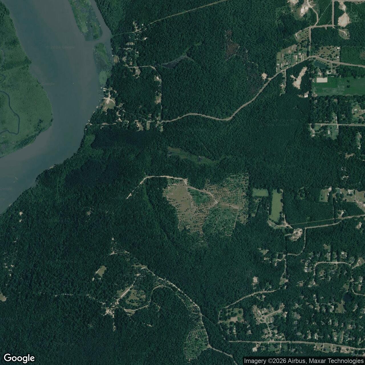
Fort Blakeley Army Base, Bay Minette Alabama

Longitude: -87.911067
Official Base Website: https://www.blakeleypark.com/
Current Role: Historic Blakeley State Park; preserved Confederate and Union Civil War earthworks, battlefield trails, USCT Heritage Trail, old Blakeley town site, and Mobile-Tensaw Delta natural/cultural landscape.
Fort Blakeley was not a stone harbor fort like Fort Morgan or Fort Gaines, and it was not a long-lived peacetime Army post. It was a Civil War field-fortification system: a Confederate-built line of earthworks, redoubts, batteries, rifle pits, and obstructions thrown across the high ground north of Spanish Fort to defend Mobile from a Federal advance along the eastern shore of Mobile Bay. Its physical form matters. Fort Blakeley was a fort, but not a compact masonry fort. It was a three-mile defensive arc anchored by nine redoubts and supported by artillery, infantry positions, abatis, felled trees, telegraph-wire obstacles, and primitive land mines. The installation was built for one immediate wartime purpose: to hold open the last major Confederate port city still in operation and to delay the U.S. Army's final approach to Mobile.
Fort Blakeley was Confederate-built and Confederate-garrisoned, it was the object of a major U.S. Army siege and assault, was captured by Federal forces on April 9, 1865, and survives today as one of the best-preserved Civil War battlefield landscapes associated with U.S. Army operations in the Mobile Campaign. The site is significant not merely because Confederate troops occupied it, but because the U.S. Army's Army of West Mississippi and associated Federal columns fought their way into its lines, captured the garrison, and opened the way for the occupation of Mobile on April 12, 1865. Fort Blakeley therefore sits at the boundary between Confederate installation history and U.S. Army campaign history.
The location was strategic long before the fighting. Blakeley had been an early Alabama river town and county-seat community on the eastern side of Mobile Bay, positioned near river, road, and delta transportation routes. By the Civil War the old town had declined, but the ground still mattered militarily. The defensive position stood along high ground near a deep-water river approach and near the intersection of road routes leading toward Mobile. That combination of terrain, river access, and road control made Blakeley useful to Confederate engineers trying to block a Federal army from moving down the eastern side of the bay. The same ground that once promised commercial access to the Mobile-Tensaw Delta became a wartime barrier.
The site today is preserved within Historic Blakeley State Park. The park encompasses thousands of acres of historic town site, battlefield, Native American occupation areas, riverfront, delta habitat, Confederate lines, and Union siege works. The preserved landscape includes miles of breastworks, rifle pits, redoubts, gun emplacements, and siege approaches. That is unusually important because many Civil War fieldworks disappeared under farms, roads, timbering, or suburban development. Fort Blakeley is different: enough of the earthwork system survived to make the battlefield legible on the ground.
Mission Evolution
Fort Blakeley's military mission emerged from the long Federal effort to close Mobile. Mobile was one of the Confederacy's most important remaining Gulf ports, a transportation and supply center whose bay and landward approaches were defended by multiple layers of fortifications, batteries, river obstructions, mines, and fieldworks. U.S. forces had considered operations against Mobile earlier in the war, but only after the Union victory in Mobile Bay in August 1864 and the capture of Forts Morgan and Gaines did a final land operation against the city become possible.
The Confederate mission after the fall of the lower bay was delay and defense. The Navy had closed the main harbor approach, but Mobile itself remained in Confederate hands. To prevent the U.S. Army from taking the city by land, Confederate commanders strengthened the eastern approaches. Spanish Fort and Fort Blakeley became the two major strongpoints facing Federal movement from the direction of the eastern shore and the Pensacola road network. Spanish Fort guarded bluffs farther south. Fort Blakeley, about five miles to the north, guarded high ground near the old town and river access. Together they formed the landward shield protecting Mobile from an eastern advance.
Fort Blakeley's construction reflected the urgency and coercive labor system of late-war Confederate defense. Encyclopedia of Alabama identifies the earthwork as having been constructed under the direction of Major General Dabney H. Maury by Confederate soldiers and enslaved men pressed into service. The finished defensive line was not a single bastion. It was an arcing system of entrenchments, nine redoubts, artillery positions, and connecting works. The fort's mission was to force any Federal advance into a siege, slow the final approach to Mobile, and impose enough casualties and delay to preserve Confederate control for as long as possible.
By spring 1865 the mission had become almost hopeless but still operationally important. Major General Edward R. S. Canby's forces were closing from the south and west, while Major General Frederick Steele's column moved from Pensacola toward Fort Blakeley from the rear. Spanish Fort held out until April 8. Its fall allowed Canby to shift greater strength against Fort Blakeley. Confederate Brigadier General St. John R. Liddell then faced an overwhelming Federal concentration, with roughly 16,000 attackers against a garrison of about 3,500 Confederates. The fort's mission was no longer to win a campaign. It was to hold long enough to delay Mobile's final collapse.
The mission ended abruptly on April 9, 1865. Federal troops launched the final assault late that afternoon, only hours after Robert E. Lee surrendered the Army of Northern Virginia at Appomattox Court House. The news had not reached the soldiers fighting at Blakeley. Across a nearly three-mile front, U.S. troops surged from siege trenches toward the Confederate line, crossed obstacles and mine-strewn ground, and broke into the works. Within roughly thirty minutes of close fighting, the Confederate position collapsed. The fall of Fort Blakeley, combined with the fall of Spanish Fort, rendered remaining eastern defenses untenable and led directly to Mobile's surrender to U.S. military forces on April 12.
Operational Role
Fort Blakeley's operational role was to convert geography into delay. The Confederate high command could no longer protect Mobile by relying only on the lower bay forts. After Farragut's victory in Mobile Bay and the capture of Fort Morgan and Fort Gaines, the city's defenders needed landward works to stop or slow a Federal army moving from the east. Fort Blakeley served that role. Its line commanded the approaches through old Blakeley, the river routes, and the road network that linked the eastern shore to Mobile. The fortification forced Federal commanders to invest the position rather than simply march past it.
The siege began when Steele's column arrived outside Fort Blakeley on April 1, 1865. Federal engineers and infantry then began the practical work of siege warfare: digging approach trenches, constructing parallel lines, emplacing artillery, probing the Confederate defenses, and moving troops closer to the final assault positions. This was an old form of warfare adapted to the terrain and technology of the Civil War. The Union army did not simply charge at once. It pressed the Confederate line methodically, used artillery and field engineering, and reduced the distance between attacking troops and the fort's defenders.
Fort Blakeley's Confederate defenses were formidable for a temporary earthwork. The line extended for roughly three miles and included nine redoubts, around forty artillery pieces, abatis, felled-tree obstructions, and mines. The position also benefited from high ground and riverine geography. Defenders could use artillery and small arms to cover approaches, while the obstacles and mines forced attackers into predictable paths. At the same time, the line was vulnerable because the Federal army had greater numbers, greater siege resources, and the ability to coordinate pressure after Spanish Fort fell.
The U.S. Army assault on April 9 was one of the final large infantry assaults of the Civil War. About 16,000 Federal troops attacked the position. Included in the assault force were thousands of United States Colored Troops. Historic Blakeley State Park emphasizes that more than 4,000 African American soldiers, many of them formerly enslaved, fought in the Federal army besieging Fort Blakeley from April 1 to April 9, and Encyclopedia of Alabama places the USCT presence among the heaviest concentrations of African American soldiers in any Civil War battle. Their role gives Fort Blakeley national significance beyond the local Mobile Campaign. The assault was not only a late-war Federal victory; it was a major battlefield action in which African American soldiers helped break one of the Confederacy's final defensive lines.
The fighting at Redoubt 4 became especially intense. Historic Blakeley State Park's battlefield tour identifies Redoubt 4 as the center of the Confederate defensive line and describes it as one of the most open and heavily contested sections of the battlefield. Approximately 2,500 Union soldiers converged there between about 5:30 and 6:00 p.m. on April 9, meeting resistance from veteran Confederate defenders in a brief but fierce fight. Three Medals of Honor were later awarded for actions at that point. Because Redoubt 4 is preserved and interpreted today, it is one of the clearest places where visitors can understand Fort Blakeley as an actual military work rather than as an abstract battle name.
The operational result was decisive. Once Federal troops entered the Confederate line, the defense quickly unraveled. Some defenders surrendered; others fought in close quarters; a small number escaped by river. Most of the garrison was captured. Encyclopedia of Alabama estimates Confederate dead at roughly seventy-five and Union losses for the siege and assault at about 150 killed and around 650 wounded, while noting that exact casualty numbers remain uncertain. Mine-related casualties and post-assault confusion added to the violence. The capture of Fort Blakeley was not a long tactical battle by duration, but it was a hard-fought climax to a week of siege operations and months of strategic pressure against Mobile.
Units, Commands, and Military Systems
Fort Blakeley's Confederate side belonged to the defense system of Mobile. Major General Dabney H. Maury oversaw the broader Confederate defense of the Mobile area. Brigadier General St. John R. Liddell commanded the garrison at Fort Blakeley during the final siege and assault. The defenders included veteran Confederate troops, artillerymen, and supporting forces tied to the eastern defenses. Their task was to hold one of the last major defensive works shielding Mobile from the U.S. Army.
On the Federal side, the operation was part of Major General Edward R. S. Canby's Mobile Campaign and the larger Army of West Mississippi system. Canby's XIII and XVI Corps moved along the eastern shore of Mobile Bay against Spanish Fort, while Major General Frederick Steele's column advanced from Pensacola toward Fort Blakeley. After Spanish Fort fell, Federal strength shifted to the northern position. This convergence shows why Fort Blakeley mattered operationally: it was the point where multiple Federal columns and corps-level operations came together to complete the reduction of Mobile's eastern defenses.
The United States Colored Troops are central to the Fort Blakeley story. Their presence was not token or incidental. More than 4,000 African American soldiers participated in the siege and battle according to the park's USCT Heritage Trail materials, and other summaries place the number near 5,000. These troops dug approaches, occupied siege positions, and took part in the final assault. Fort Blakeley therefore preserves not only Confederate earthworks but also Federal siege lines and USCT-associated trenches. The modern USCT Heritage Trail highlights portions of three distinct lines of earthworks dug by USCT units, along with connecting approach trenches. That surviving landscape makes the fort an unusually strong physical record of African American military service in the final days of the Civil War.
The U.S. Navy and riverine / bay system also mattered even though the final assault was a ground battle. Mobile was a port city, and the campaign against it depended on the earlier naval victory in Mobile Bay. Confederate gunboats and river connections supported the eastern defenses, while Federal naval pressure and control of the lower bay shaped the campaign environment. Fort Blakeley did not stand alone; it was part of a combined land-and-water struggle over Mobile's final supply and defense network.
The fort's post-battle military meaning was short-lived but consequential. With Blakeley and Spanish Fort in Federal hands, Batteries Huger and Tracy were effectively outflanked and abandoned. Mobile surrendered three days later. Fort Blakeley therefore functioned as the last land barrier to the city's occupation. It is historically associated with the endgame of the Civil War in the Gulf South rather than with a long garrison period.
Facilities and Physical Layout
Fort Blakeley was a field fortification system, and its layout should be read as terrain engineering. It consisted of an arcing line roughly three miles long, built on high ground and reinforced by redoubts, trenches, batteries, and obstacles. The nine redoubts gave the line strongpoints for artillery and infantry. Connecting breastworks and rifle pits tied those strongpoints together. In front of the line, defenders used abatis, felled trees, and mines to slow an attack. Behind and around the line, the old town site, river approaches, and roads shaped the defensive geometry.
The Confederate work was matched by Federal siege works. During the April 1-9 siege, U.S. engineers and infantry dug parallel lines and approach trenches that moved progressively closer to the Confederate position. These works were not afterthoughts. They were the means by which the U.S. Army reduced the distance, sheltered its attacking troops, positioned artillery, and prepared the final charge. Historic Blakeley State Park preserves both Confederate and Union lines, which is one reason the site is so valuable for understanding Civil War siege operations.
Redoubt 4 is the best-known surviving feature because it sits near the center of the defensive line and witnessed some of the heaviest final fighting. Other redoubts and segments of breastworks remain visible across the park landscape. The earthworks are not ruins in the same way masonry walls are ruins. They are shaped ground: mounds, ditches, gun positions, rifle pits, approach lines, and scars in the landscape. Their survival depends on protection from erosion, development, timber disturbance, and visitor damage.
The broader Historic Blakeley landscape includes much more than the military line. It preserves the old town of Blakeley, riverfront environments, Native American archaeological resources, homestead traces, cemetery and street remnants, and the Mobile-Tensaw Delta setting. That broader context matters because the fort was built over and around a preexisting town and port landscape. In 1865, the battlefield was not empty wilderness; it was a militarized version of an older settlement and transportation site.
Role in the Wider Military Network
Fort Blakeley belonged to the final campaign network for Mobile. Its meaning cannot be separated from Fort Morgan, Fort Gaines, Spanish Fort, Batteries Huger and Tracy, Mobile Bay, the eastern-shore road system, and the Federal army and navy forces converging on the city. Forts Morgan and Gaines controlled the lower bay until their fall in 1864. Spanish Fort and Fort Blakeley then became the key eastern land defenses in 1865. Once those two fell, Mobile could no longer be held in the same way. Fort Blakeley was therefore not an isolated redoubt; it was the final hinge in the collapse of Mobile's Confederate defense system.
The fort also belonged to the broader story of late Civil War field fortification. By 1864-1865, both Confederate and Federal armies had become highly skilled at entrenchment. Fort Blakeley's lines, redoubts, obstructions, and mines reflected a war that had moved far beyond open-field maneuver alone. The U.S. siege lines reflected the same reality from the attacking side. Fort Blakeley shows how the Civil War's final campaigns relied on earth, timber, artillery, engineering, and disciplined infantry assault.
Its national significance is heightened by the role of the United States Colored Troops. The battle was one of the largest concentrations of African American soldiers in any Civil War action. These troops fought at the edge of slavery's collapse, helping capture a Confederate stronghold just as the war's eastern armies were surrendering. The preserved USCT siege works and interpreted trails connect Fort Blakeley to emancipation, military citizenship, and the role of formerly enslaved men in the destruction of Confederate power.
Fort Blakeley also connects directly to the end of the Civil War. The assault occurred on the same day as Lee's surrender at Appomattox. The soldiers at Blakeley did not know the symbolic war-ending event had already occurred in Virginia. Their fight therefore captures one of the war's final paradoxes: surrender in one theater did not instantly stop violence in another. The capture of Fort Blakeley opened Mobile, and Mobile's surrender on April 12 was one of the final major Union occupations of the conflict.
Current Status
Fort Blakeley is closed as a military installation and preserved as part of Historic Blakeley State Park in Baldwin County, Alabama. The park's public address is 34745 State Highway 225, Spanish Fort, Alabama. Historic Blakeley State Park describes the grounds as containing the site of the last major battle of the Civil War, several miles of Confederate and Union fortifications, the old town of Blakeley, colonial-era homesteads, and evidence of Native American habitation. Encyclopedia of Alabama describes the park as covering 3,800 acres along the Tensaw River near Spanish Fort and preserving a majority of both Confederate and Union lines associated with the Battle of Fort Blakeley.
The current site is significant because the military landscape is still readable. Visitors can walk trails through surviving breastworks, rifle pits, gun emplacements, redoubts, and siege works. The park's USCT Heritage Trail interprets the role of African American troops and passes portions of earthworks dug by USCT units during the siege. The self-guided battlefield tour interprets key points such as Redoubt 4 and Union battery positions. These features make the park not just a commemorative property but an outdoor military-history archive.
Chronology
- 1814 The town of Blakeley was chartered by the Mississippi Territory legislature and began developing as an early Alabama river and port community.
- 1820s Blakeley reached its height as a commercial rival to Mobile and served as an important Baldwin County community before disease and economic decline reduced its population.
- 1864 After the Union victory in Mobile Bay and the fall of Forts Gaines and Morgan, Confederate attention shifted to strengthening the landward defenses of Mobile, including Spanish Fort and Fort Blakeley.
- 1864-1865 Confederate soldiers and enslaved laborers constructed Fort Blakeley's earthwork defensive system under the direction of Major General Dabney H. Maury.
- 1865-03 Federal columns moved against Mobile's eastern defenses as part of the final Mobile Campaign.
- 1865-04-01 Major General Frederick Steele's column arrived before Fort Blakeley and began siege operations.
- 1865-04-01 to 1865-04-09 U.S. forces besieged Fort Blakeley, constructing siege lines, approach trenches, artillery positions, and parallel works.
- 1865-04-08 Spanish Fort fell, allowing Major General Edward R. S. Canby to concentrate greater Federal strength against Fort Blakeley.
- 1865-04-09 Robert E. Lee surrendered the Army of Northern Virginia at Appomattox Court House; the news had not reached the forces fighting at Blakeley.
- 1865-04-09, about 5:30 p.m. Federal troops launched the final assault across a nearly three-mile front against Fort Blakeley.
- 1865-04-09, evening U.S. forces overran the Confederate line in roughly thirty minutes of close fighting; Brigadier General St. John R. Liddell's garrison surrendered.
- 1865-04-12 Mobile surrendered to U.S. military forces after the fall of Spanish Fort and Fort Blakeley made further defense untenable.
- 1868 Baldwin County's county seat was moved from Blakeley to Daphne, reflecting the old town's postwar decline.
- Late 1800s The town of Blakeley was effectively abandoned, helping preserve much of the battlefield from intensive development.
- 1974 The 3,800-acre Blakeley Historic Site was placed on the National Register of Historic Places.
- 1976 Local civic leaders formed the private nonprofit Historic Blakeley Foundation to acquire land and promote preservation.
- 1981 The Alabama Legislature established the Historic Blakeley Authority as a state agency to develop and operate Historic Blakeley State Park.
- 2000s-2020s Preservation, interpretation, and battlefield-land protection continued, including focused work on USCT-associated areas and additional battlefield acreage.
- Present Fort Blakeley survives as a preserved Civil War earthwork battlefield inside Historic Blakeley State Park, with Confederate and Union lines, redoubts, artillery positions, rifle pits, and USCT siege works interpreted for the public.