Old Spanish Fort Defensive Works, Spanish Fort Alabama
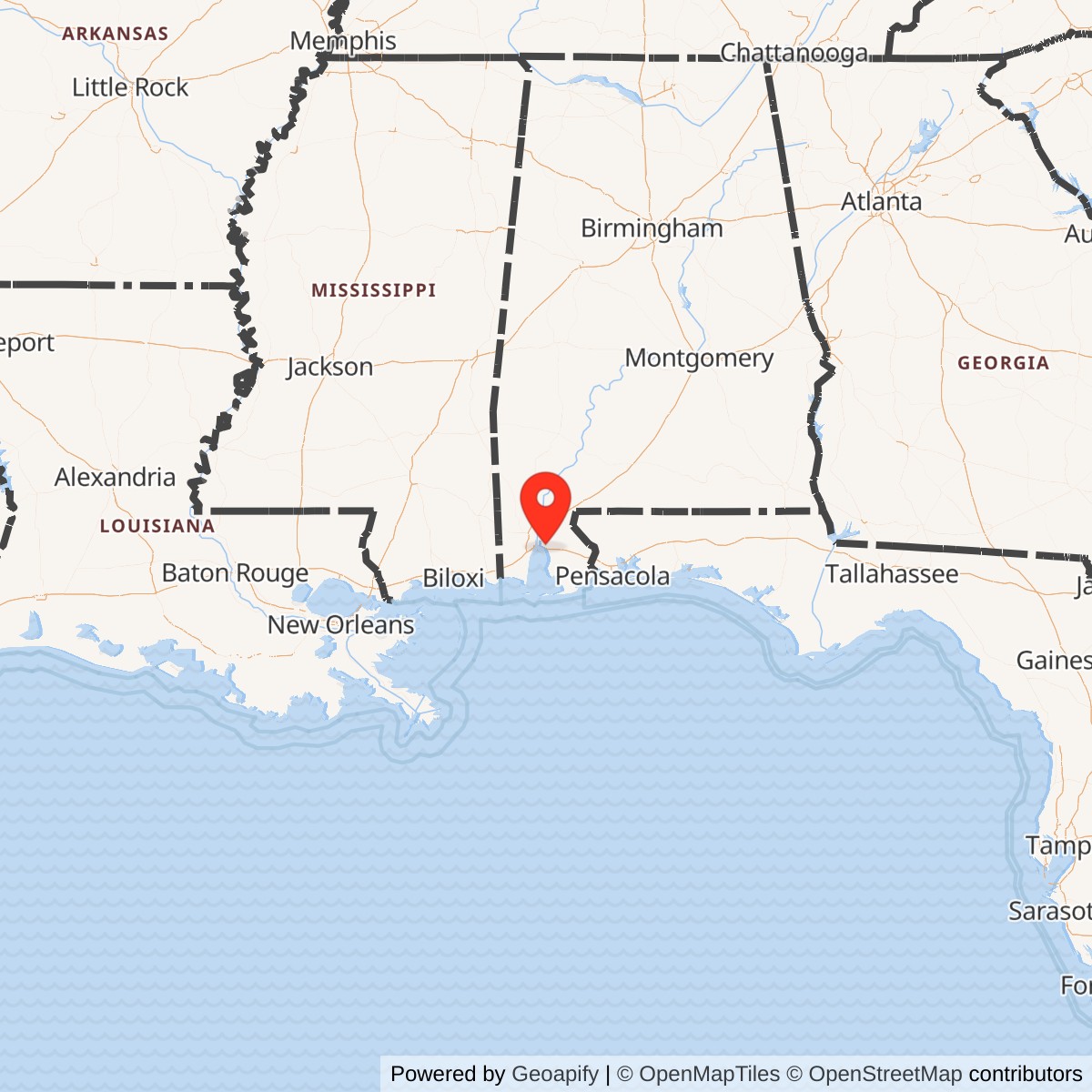
Longitude: -87.916375
Official Base Website: https://www.cityofspanishfort.com/history
Current Role: City of Spanish Fort suburban, municipal, residential, and commercial landscape; limited historical markers/waysides and surviving earthwork traces, including Fort McDermott; CWSAC also identifies publicly accessible protected land within the broader study area at Mobile-Tensaw Delta Wildlife Management Area.
Spanish Fort was not a permanent masonry Army post, and it was not a compact single fort in the way Fort Morgan or Fort Gaines were. It was a Civil War defensive landscape: a Confederate-built system of earthworks, redoubts, batteries, trenches, river-facing guns, and supporting positions on the eastern side of Mobile Bay. Its purpose was blunt and immediate. After the Union Navy forced the lower bay in August 1864, Mobile was still Confederate-held. Spanish Fort was one of the landward locks on the city. If U.S. forces wanted Mobile from the east, they had to break through Spanish Fort and Fort Blakeley.
Spanish Fort was Confederate-built and Confederate-garrisoned, but it was the object of a major U.S. Army siege and capture during the Mobile Campaign. The National Park Service classifies Spanish Fort as Civil War battle AL005, a Union victory in the Mobile Campaign. Major General Edward R. S. Canby's U.S. XIII and XVI Corps advanced along the eastern shore of Mobile Bay, enveloped Spanish Fort by April 1, 1865, and captured or forced the evacuation of the position on April 8. The fall of Spanish Fort, followed by Fort Blakeley on April 9, opened the way for Mobile's surrender on April 12. Its significance therefore lies less in long-term Army administration than in its role as a U.S. Army siege objective and captured defensive system.
The name itself carries older layers. The City of Spanish Fort traces the place-name to a French trading-post tradition beginning in the early eighteenth century and to a Spanish military work built after Spanish control of Mobile during the Revolutionary War era. Encyclopedia of Alabama also notes colonial-era French and Spanish occupation at the site of later Civil War fortifications. The Civil War defensive system, however, was a different construction episode. By 1864-1865 Confederate engineers and commanders transformed the bluffs, roads, and river approaches into a modern earthwork position intended to delay Canby's army and preserve Confederate control of Mobile as long as possible.
Spanish Fort is best understood as a fortified zone rather than one isolated structure. Contemporary and modern summaries identify a cluster of named works associated with the position, including Old Spanish Fort, Fort McDermott or Battery McDermott, Red Fort, Fort Alexis, and the related island and river batteries Fort Huger and Battery Tracey. Some guns looked west toward Mobile Bay and the river channels; others faced landward toward the Federal siege lines. The earthworks sat on high ground with a broad view over the surrounding terrain, but they were also shaped by swamps, bayous, river edges, and high water that made some approaches difficult and others strategically decisive.
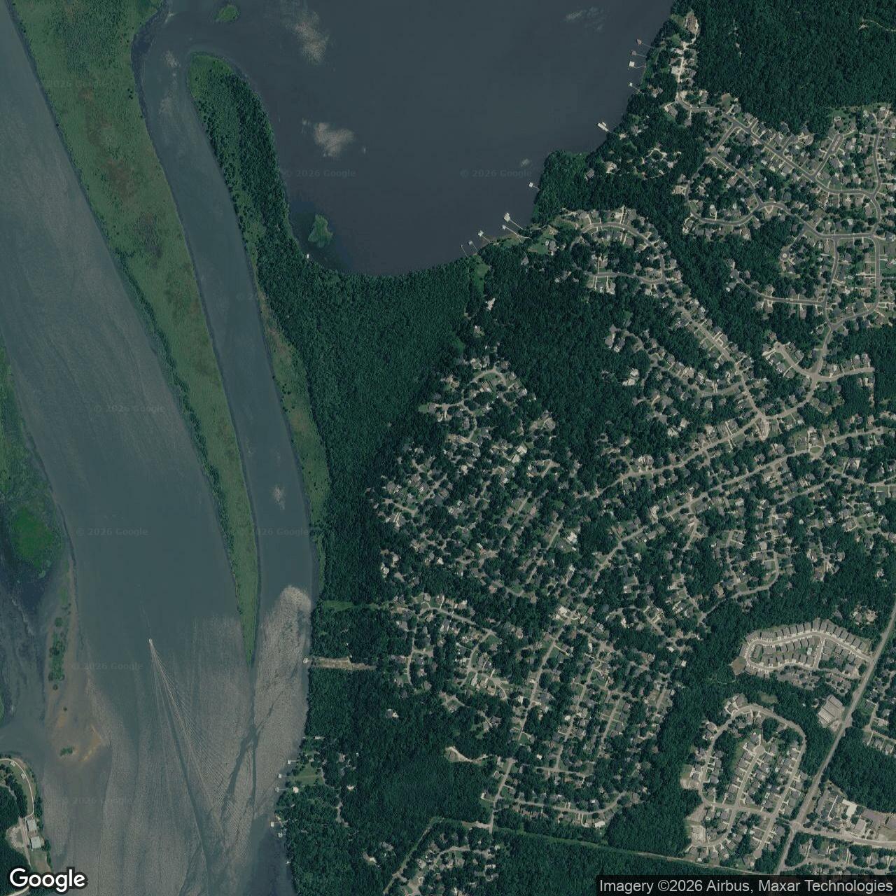
Most of that battlefield is no longer an intact military landscape. Encyclopedia of Alabama states that the battlefield lies north of modern U.S. Highway 31 and west of State Highway 225 and that housing developments now cover most of the original battlefield. The NPS Civil War Sites Advisory Commission update reported that the Spanish Fort landscape had been altered beyond recognition as a historic landscape and listed no Potential National Register Lands, though it also identified a 3,742.16-acre study area and 347.22 acres of protected/publicly accessible land in the broader Mobile-Tensaw Delta Wildlife Management Area setting. What remains today is a mix of municipal streets, residential yards, local markers, traces of earthworks, and overgrown or interpreted pieces of the old defensive line, especially around Fort McDermott.
Mission Evolution
Spanish Fort's Civil War mission grew out of the collapse of the lower Mobile Bay defense system. Before August 1864, Confederate Mobile relied heavily on the bay forts, obstructions, torpedoes, and naval forces that controlled the water approach. Fort Morgan, Fort Gaines, and Fort Powell were central to that system. After Rear Admiral David G. Farragut's victory in the Battle of Mobile Bay and the fall of those lower-bay works, Mobile's port was effectively closed to blockade-running traffic, but the city itself remained in Confederate hands. The next problem for U.S. commanders was not simply naval access. It was how to capture Mobile by land.
Confederate commanders responded by strengthening the eastern approaches. Major General Dabney H. Maury commanded the Mobile garrison, while Confederate engineer officers and subordinate commanders organized fieldworks to protect the city from a Federal advance along the eastern shore. Spanish Fort occupied the bluffs directly across the upper bay from Mobile. Fort Blakeley stood roughly five to eight miles north, depending on the route and source, guarding the northeastern approach. Together they forced Canby's army to conduct siege operations rather than simply march into Mobile.
The Civil War defensive mission was to delay, not to defeat the United States outright. By early 1865 the Confederacy's strategic position was collapsing. Sherman's campaigns had cut through the interior. Hood's Tennessee campaign had failed. Farragut had already shut the lower bay. Mobile was one of the last major Confederate Gulf positions still held, and Spanish Fort became a place where Confederate soldiers could buy time, tie down Federal troops, and protect the evacuation route and remaining defense network around the city. Its guns, earthworks, trenches, and supporting river batteries existed to force the U.S. Army into days of digging, artillery preparation, and costly approach work.
In early 1865 Canby assembled the force to do exactly that. Encyclopedia of Alabama states that on March 17, 1865, 32,000 troops of XIII and XVI Corps, Army of West Mississippi, began moving by steamboat from Fort Gaines and overland from Fort Morgan toward a staging area on the Fish River, while another Federal column of about 13,000 men advanced from Pensacola toward the railroad and Fort Blakeley. This movement tied Spanish Fort to the larger Mobile Campaign. It was not an isolated engagement. It was one strongpoint in a coordinated operation involving infantry corps, naval transport, river movement, coastal approaches, and a converging Federal column from Florida.
By March 27, 1865, Canby's forces had begun the siege. The mission of Spanish Fort shifted from deterrence to direct defense. The Confederate garrison under Brigadier General Randall L. Gibson withdrew into the works as Federal troops closed around the landward side. The Federal mission became equally clear: envelop the position, avoid a bloody frontal assault if possible, dig forward, mass artillery, crack the weak northern edge, and force the Confederates either to surrender or evacuate. The siege ended on April 8, when U.S. forces broke into the first line of works and Gibson withdrew most of his command toward Mobile and Fort Blakeley. Spanish Fort was no longer a threat.
Operational Role
Spanish Fort's operational role was to turn terrain into time. Its high ground, steep sides, river access, and semi-circular earthworks made it a difficult position to storm. Encyclopedia of Alabama describes the fort as sitting on a high hill with a large flat top, with steep sides and access to the bay by way of the Blakeley River, giving the site broad visibility over the surrounding terrain. The Confederate line extended in a semi-circle roughly two miles long and about 1,000 yards wide between Minette Bay and D'Olive Bay. Fort McDermott guarded the southern land approaches, while Old Spanish Fort at the northern end covered river approaches.
The Confederate garrison had real firepower. Encyclopedia of Alabama identifies 47 artillery pieces, although 14 were aimed toward the bay rather than toward the Federal siege lines. The defenders included six Louisiana infantry regiments under Brigadier General Randall L. Gibson and five Alabama infantry regiments under Brigadier General James T. Holtzclaw. Their position was helped by swamps, bayous, and high water in some areas, but those same conditions also shaped weaknesses. The northern end of the defenses was less developed because the wet ground made construction harder. That weaker sector would matter on April 8.
Canby's army chose siege rather than immediate assault. On March 27, U.S. forces advanced, came under fire, and by sunset had encircled the landward approaches along a front about half a mile from the Confederate line. Canby understood that a direct frontal attack against prepared works would be expensive. Federal soldiers therefore dug successive trenches parallel to the Confederate line, then pushed saps and approaches forward under sharpshooter and artillery fire. This was laborious, dangerous work. Spanish Fort became a battle of shovels as much as rifles.
The siege also had a naval and riverine dimension. Confederate naval officer Ebenezer Farrand moved the armored gunboats CSS Huntsville, CSS Nashville, and CSS Morgan up the Tensaw River between Spanish Fort and Blakeley. From there they shelled Federal positions and supported the Confederate garrisons until ammunition shortages limited their usefulness. Forts Huger and Tracey, island and river batteries tied to the same defensive system, also supported the larger effort to protect the approaches behind Spanish Fort and Blakeley. The fighting at Spanish Fort therefore belonged to the amphibious and river-connected world of Mobile Bay, not merely to a land battle on a hill.
By April 8 the U.S. Army had brought decisive pressure to bear. Federal sappers had established positions immediately in front of the Confederate works, and Canby had about 90 guns positioned against the defenders. Artillery fire shook the battlefield throughout the day. Late that afternoon, the 8th Iowa Infantry under Colonel James Geddes broke into the weak northern portion of the Confederate line and entered the first line of breastworks. Gibson recognized that the position could not withstand a continued Federal attack. By dusk he ordered evacuation. The Confederates spiked guns, destroyed gun carriages, and withdrew toward Fort Huger, Mobile, and Fort Blakeley.
The tactical result was a U.S. victory, but not a complete annihilation of the garrison. Many Confederates escaped; approximately 1,000 were sent or made their way to Fort Blakeley; and U.S. forces captured about 500 prisoners along with artillery shells and gunpowder. NPS lists estimated casualties at 1,398 total, with 657 U.S. and 741 Confederate casualties. Encyclopedia of Alabama gives a closely similar Confederate estimate of 744. The numbers are less important than the operational consequence: Spanish Fort ceased to block Canby's army. Fort Blakeley became the final major eastern position, and Mobile was nearly lost.
Units, Commands, and Military Systems
On the U.S. side, Spanish Fort belonged to Major General Edward R. S. Canby's Army of West Mississippi and the Military Division of West Mississippi. The principal Federal formations at Spanish Fort were XIII Corps and XVI Corps. These corps moved along the eastern shore of Mobile Bay and forced the Confederate defenders back into their works. Their approach linked Fort Morgan, Fort Gaines, the Fish River staging area, Danley's Ferry, the eastern-shore road network, and the final siege lines outside Spanish Fort.
Canby's operation also coordinated with Major General Frederick Steele's column advancing from Pensacola. Steele's force was directed toward Fort Blakeley and the railroad connections that could support or threaten Mobile. This two-column movement was essential. Spanish Fort and Fort Blakeley supported one another as defensive positions; Federal forces likewise had to operate against them as parts of one campaign system. When Spanish Fort fell, Federal pressure shifted northward and helped complete the reduction of Fort Blakeley the next day.
On the Confederate side, Spanish Fort was part of Major General Dabney H. Maury's defense of Mobile. Brigadier General Randall L. Gibson commanded the Spanish Fort garrison during the final siege, while Brigadier General James T. Holtzclaw commanded Alabama troops identified within the defensive force. The garrison represented the kind of late-war Confederate force that had to hold fixed defenses even as mobility, supplies, and strategic options shrank. It was supported by artillery, earthworks, nearby river batteries, and Confederate naval vessels operating in the Mobile-Tensaw river system.
Named works within or associated with Spanish Fort included Old Spanish Fort, Fort McDermott, Red Fort, Fort Alexis, Fort Huger, and Battery Tracey. These names can be confusing because some were individual batteries or redoubts, some guarded river approaches, and some were part of a larger defensive complex rather than separate long-lived installations.
The U.S. Army engineer system is also central to the story. Spanish Fort was captured through formal siege methods: reconnaissance, artillery siting, trench construction, sapping, counter-sharpshooting, and final penetration of a weak point. The 1866 map of siege operations, reproduced by Encyclopedia of Alabama and listed by the University of Alabama's Historical Map Archive as a U.S. Army Engineer Department product from the 39th Congress, shows the relationship between Confederate defenses and Federal works. That map is one of the most important visual sources for understanding Spanish Fort because it makes clear that the battle was not a single charge but a built military system of lines, batteries, headquarters, and approaches.
Facilities and Physical Layout
Spanish Fort's physical layout was a product of topography and emergency field engineering. The core position occupied high ground above the Blakeley River and eastern Mobile Bay. The location gave defenders observation over land and water approaches and allowed guns to cover both inland routes and river/bay movement. At the same time, the position had to be stretched across a complex landscape of bluffs, wetlands, bayous, and river edges. The result was a defensive arc rather than a compact fort.
The Confederate line included trenches, rifle pits, redoubts, batteries, and connecting earthworks. The position is commonly described as having a two-mile semi-circular line, about 1,000 yards wide, stretching between Minette Bay and D'Olive Bay. Fort McDermott stood near the southern end and guarded land approaches. Old Spanish Fort stood near the northern end and covered river approaches. Red Fort, Fort Alexis, and other named features contributed to the larger defensive complex. Forts Huger and Tracey, located in the river and island defense system, supported both Spanish Fort and Fort Blakeley by covering water routes and Confederate movement.
The earthwork design reflected late Civil War defensive practice. Trenches and redoubts protected infantry and guns. Artillery positions were sited for both landward and water-facing missions. Obstacles, difficult terrain, and covered approaches shaped the battle. Unlike a masonry fort, the structure was not meant to stand for generations. It was meant to hold against a specific campaign. Earth, timber, field guns, and manpower were the materials of defense.
The Federal works were just as important. During the siege, U.S. forces built successive parallels and forward approaches. The Federal line wrapped around the landward side of Spanish Fort and pushed closer day by day. Artillery batteries were emplaced to batter the Confederate position, and by April 8 Canby had assembled roughly 90 guns. The historic map of siege operations shows the density of U.S. works, headquarters, and gun positions. That Federal construction was the temporary physical plant of the U.S. Army at Spanish Fort.
The postwar physical legacy is fragmented. Unlike Fort Blakeley, where large areas of battlefield earthworks remain preserved within Historic Blakeley State Park, Spanish Fort was heavily overtaken by residential and suburban development. Encyclopedia of Alabama notes that housing developments now cover most of the original battlefield, while traces of earthworks and trenches can still be seen in yards and at an overgrown Fort McDermott section along Main Street. Local markers, interpretive panels, and surviving earthwork fragments are therefore important because they are among the few visible reminders of a much larger 1865 defensive system.
Role in the Wider Military Network
Spanish Fort only makes sense as part of Mobile's layered defense system. The lower bay forts, Fort Morgan, Fort Gaines, and Fort Powell, guarded the sea approach until the Battle of Mobile Bay in August 1864. After those works fell or were neutralized, Mobile still had to be defended against land attack. Spanish Fort and Fort Blakeley became the major eastern strongpoints. Forts Huger and Tracey supported the river and island approaches between them. The Confederate gunboats in the Tensaw and Blakeley river system added a naval layer behind the earthworks. Together, these positions formed the final shield protecting Mobile from Canby's army.
For the U.S. Army, Spanish Fort belonged to a coordinated late-war campaign network. Troops moved from Fort Gaines by steamboat and from Fort Morgan by land to Fish River. Canby's XIII and XVI Corps advanced up the eastern shore. Steele's column moved from Pensacola toward Blakeley and the railroad. Engineers, artillery, infantry, and naval transport all supported the operation. Spanish Fort was the first major eastern-shore defensive position to fall in the final approach to Mobile.
The site also belongs to the broader history of Civil War siege warfare. By 1865, field fortification was not a temporary expedient but a central part of American warfare. Spanish Fort was built from earth and armed with dozens of guns; the U.S. Army answered with earthworks of its own. The fight became a contest of engineering, artillery, endurance, and timing. The fall of the weak northern line on April 8 demonstrated the same lesson seen in other late-war campaigns: even strong earthworks could be reduced by systematic siege methods when the attacker had manpower, guns, and time.
Spanish Fort also sits in the final military sequence of the Civil War. It fell one day before Fort Blakeley and one day before Lee's surrender at Appomattox. Fort Blakeley fell on April 9. Mobile surrendered on April 12. Maury's remaining Confederate forces surrendered to Canby at Citronelle on May 4. Spanish Fort therefore occupies a powerful place in the closing rhythm of the war: not the last battle, not the most famous battle, but a decisive breach in one of the Confederacy's final defended port systems.
Current Status
Spanish Fort is closed as a military site. It is now a city and suburban landscape in Baldwin County, Alabama, with streets, houses, municipal facilities, commercial development, markers, and limited earthwork remnants occupying portions of the old battlefield. The modern City of Spanish Fort interprets the Civil War history in its public history materials and identifies the old defensive system as including Fort Huger, Fort Tracey, Fort McDermott, Fort Alexis, Red Fort, and Old Spanish Fort.
The battlefield's preservation condition is poor compared with Fort Blakeley. The NPS CWSAC update listed Spanish Fort's study area at 3,742.16 acres but identified 0.00 acres of Potential National Register Lands. The same update recorded 347.22 protected and publicly accessible acres within the broader study area at Mobile-Tensaw Delta Wildlife Management Area, but its condition statement was blunt: the landscape and terrain have been altered beyond recognition, and Spanish Fort has lost integrity as a historic landscape.
Chronology
- 1712 A French trading-post tradition begins at or near the later Spanish Fort locality in the colonial Mobile region, according to local history and Encyclopedia of Alabama summaries.
- 1780 A Spanish military fortification is associated with the site after Spanish control of Mobile during the Revolutionary War era.
- 1781 British forces from Pensacola attempt unsuccessfully to retake the Spanish-held position around Spanish Fort.
- 1813-1815 The Mobile Bay region passes into United States control during the War of 1812 era, ending the colonial military context that gave Spanish Fort its name.
- 1864 Confederate commanders strengthen Mobile's eastern defenses, including Spanish Fort, after the lower bay becomes increasingly threatened.
- 1864-08-05 U.S. naval forces win the Battle of Mobile Bay, closing the port to blockade-running traffic and setting conditions for a later land campaign against Mobile.
- 1865-01 Major General E. R. S. Canby begins assembling the forces needed to capture Mobile by land from the east.
- 1865-03-17 Approximately 32,000 troops of XIII and XVI Corps, Army of West Mississippi, begin moving by steamboat from Fort Gaines and overland from Fort Morgan toward the Fish River staging area; another Federal column advances from Pensacola toward the railroad and Fort Blakeley.
- 1865-03-24 Canby's forces arrive at the Fish River area south of Spanish Fort.
- 1865-03-25 Federal forces begin marching north toward Spanish Fort.
- 1865-03-27 U.S. forces rendezvous at Danley's Ferry and immediately begin siege operations against Spanish Fort.
- 1865-04-01 Union forces envelop Spanish Fort, while Confederate troops remain inside the defensive works.
- 1865-04-08 Federal artillery and infantry pressure break the northern part of the Confederate line; Brigadier General Randall L. Gibson evacuates Spanish Fort, and U.S. forces capture the position.
- 1865-04-09 Fort Blakeley falls to U.S. forces, leaving Mobile's eastern defenses broken.
- 1865-04-12 Mobile surrenders without a fight after the fall of Spanish Fort and Fort Blakeley.
- 1865-05-04 Major General Dabney H. Maury surrenders remaining Confederate forces in the Mobile area to Canby at Citronelle.
- 1993 Spanish Fort is incorporated as a city, while the older battlefield landscape remains largely absorbed into suburban development.
- 2011 The NPS CWSAC update for Alabama identifies Spanish Fort's study area at 3,742.16 acres, with 0.00 Potential National Register Lands and a condition statement that the landscape has been altered beyond recognition.
- 2024 Paul Brueske publishes Digging All Night and Fighting All Day, a dedicated study of the siege of Spanish Fort and the 1865 Mobile Campaign, reflecting renewed scholarly attention to the site.
- Present Spanish Fort remains a city and fragmented battlefield landscape with limited surviving earthwork traces, markers, and interpretive resources rather than an intact fort or preserved military reservation.