
Murray Field, Eureka / Wartime Army Air Forces Antisubmarine Patrol Field, California
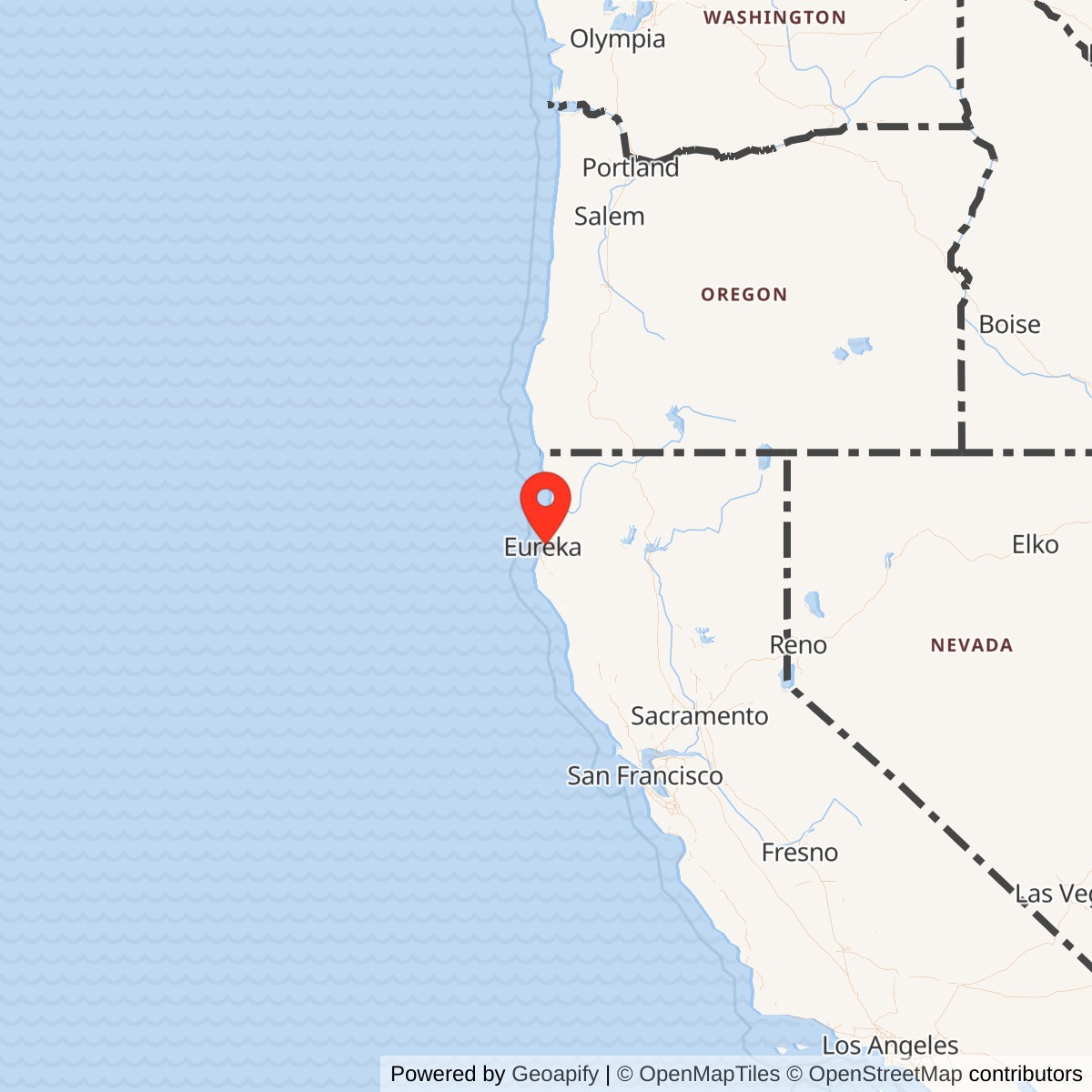
Longitude: -124.1158350
Official Base Website: Murray Field Airport
Current Role: Active Humboldt County general-aviation airport supporting private and business aviation, transient aircraft, parcel carriers, weather-diversion operations, medical flights, and aircraft maintenance.
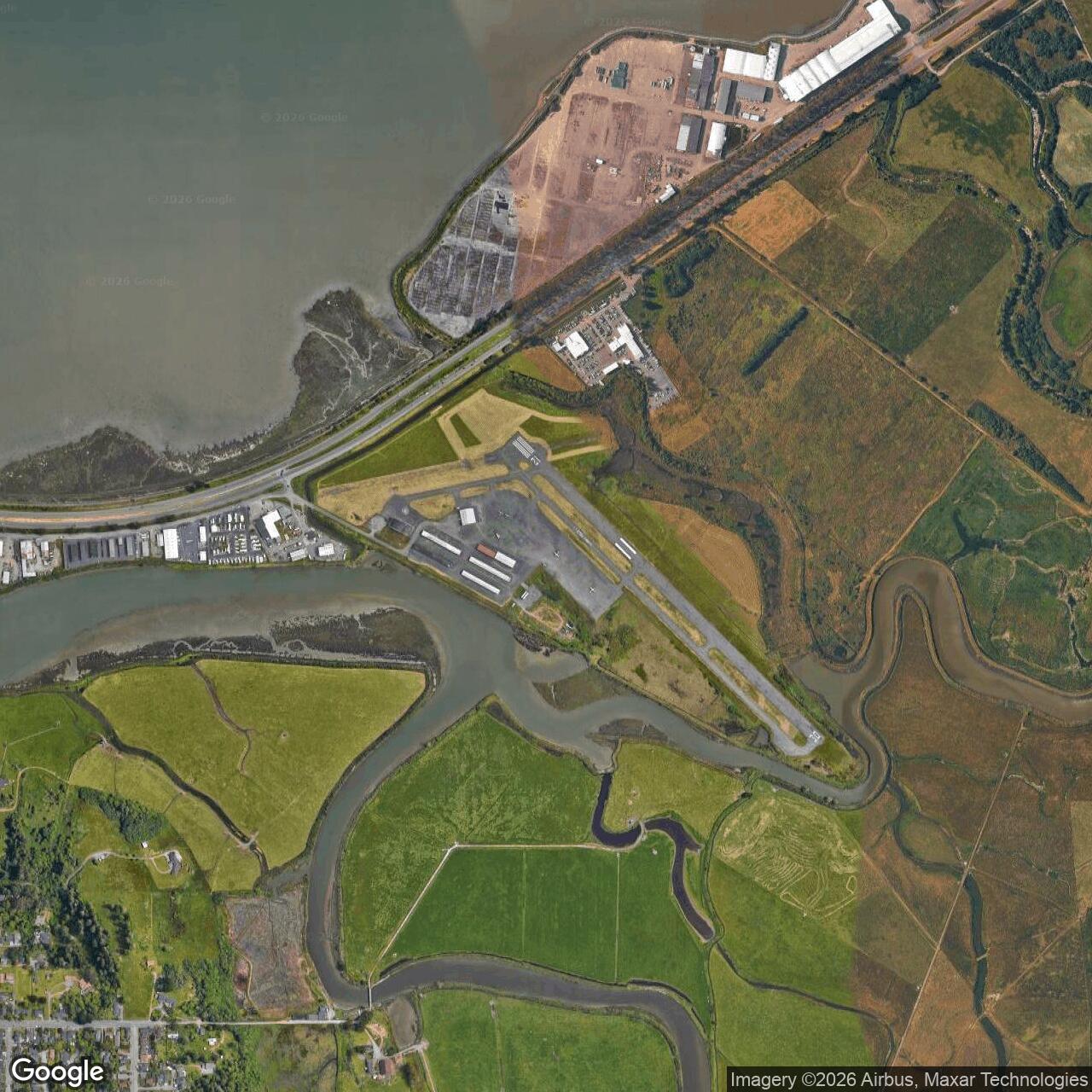
Murray Field lies on low, filled ground at the north end of Eureka beside Humboldt Bay, between U.S. Highway 101, Eureka Slough, Fay Slough, and open agricultural land. The current airport address is 4102 Jacobs Avenue.
The installation identity requires unusual care because a frequently cited historical page places the parenthetical names Murray Field and Eureka Auxiliary Field beneath a broader title covering several Navy properties. Its narrative, however, clearly separates the places. It states that the Army flew antisubmarine patrols from Murray Field northeast of Eureka, while the Navy built a section base, seaplane facility, and lighter-than-air field on the Samoa Peninsula and a heavier-than-air station at McKinleyville.
Murray Field therefore was not Naval Auxiliary Air Facility Eureka. The commissioned Navy facility was the Samoa Peninsula airship field already represented separately in the Navy inventory. Murray Field was an established civilian airport temporarily used by the Army for coastal patrol operations. This distinction changes both its service routing and the way its military history must be written.
The field also must not be confused with another wartime Murray Field in Kings County. Army Air Forces directories identify that separate Central Valley landing field as an auxiliary of Lemoore. The Eureka property was a Humboldt Bay civil airport. Shared names in military airfield directories create a real risk of transferring the wrong unit, parent station, or construction history to the north-coast site.
Civil Aviation Origins
Humboldt County aviation began with exhibitions, local experimenters, and the Humboldt Aero Club rather than with federal construction. The Humboldt County Historical Society credits former Army Air Corps lieutenant Dayton Murray with leading the club and promoting practical aviation after World War I. His flights and local demonstrations helped convert aviation from a spectacle into a transportation project for an isolated region with difficult roads and frequent coastal weather.
The historical society states that Murray Field officially opened in 1929 after local advocates evaluated several possible sites. The selected tract lay between Eureka and Arcata, close enough to serve the county's urban center but on flat ground that could be developed as an airfield. The airport's name preserved Dayton Murray's role in creating a permanent local aviation facility.
A later California Coastal Commission report describes the airport as established in 1938. That date conflicts with the documented 1929 opening and probably reflects a later county acquisition, formal development phase, or the physical form of the present airport. No deed or airport-board record was located that fully reconciles the two dates. The safest conclusion is that aviation began at Murray Field in 1929 and that the current county airport property was formalized or substantially developed during the 1930s.
Before the war, the field was a modest grass airport rather than a large paved military base. That physical condition shaped its later wartime role. It could accept patrol aircraft and provide a local operating point quickly, but it lacked the extensive barracks, fuel farms, paved mats, mooring circles, shops, and permanent command facilities that the Navy later built elsewhere around Humboldt Bay.
War Reaches the Humboldt Coast
Pearl Harbor transformed Murray Field's strategic setting overnight. Northern California had seemed distant from the principal theaters, yet Japanese submarines soon operated off the coast. On December 20, 1941, the tanker Emidio was attacked off Cape Mendocino by the Japanese submarine I-17. Five crewmen were killed, and survivors reached the Humboldt Bay area after a long ordeal in small boats.
The Emidio attack gave local defense planning an immediate and visible purpose. Humboldt Bay was the only substantial harbor and airfield complex along a long, mountainous section of the northern California coast. Lumber shipping, coastal traffic, harbor facilities, and the geographic gap between the San Francisco Bay area and Oregon made the region important even though it was not a major fleet base or industrial metropolis.
Ground, maritime, and air defenses accumulated rapidly. An activated Mississippi National Guard cavalry organization arrived on the Samoa Peninsula. The Coast Guard expanded beach patrol activity. Civilian aircraft-warning volunteers watched the skies. The Navy began developing section-base and seaplane facilities, while the Army used Murray Field as an immediate aerial patrol point before purpose-built naval facilities were complete.
This emergency sequence explains why Murray Field's military use did not resemble a normal Army airfield activation. The Army did not first acquire a large reservation, build a standardized cantonment, and assign a permanent base unit. It used an existing civil field because aircraft could operate from it during the vulnerable months when the west coast defense system was still being assembled.
Army Antisubmarine Patrol Mission
The most direct site-specific source states that the Army began operating antisubmarine patrols from Murray Field, then a grass field northeast of Eureka. The wording is important. It identifies the service and mission, but it does not name a resident squadron, aircraft type, detachment commander, patrol sector, or exact beginning and ending date. Those missing details should not be supplied from unrelated west-coast unit histories.
Army Air Forces antisubmarine operations were part of a broader emergency mission in the American Theater. Army aircraft searched coastal approaches, escorted or covered shipping, investigated submarine reports, and reinforced the visible defense of ports and industrial areas. On the Pacific coast, these flights occurred amid genuine Japanese submarine activity but also frequent false alarms, uncertain sightings, and rapidly changing command priorities.
At Murray Field, the likely operational value was geographic rather than infrastructural. Aircraft based or staged at Eureka could reach the Cape Mendocino and Humboldt Bay approaches without flying the entire distance from the San Francisco Bay area. A local grass field also provided an emergency landing and refueling point along a coast where fog, terrain, sparse airfields, and limited communications complicated patrol planning.
No surviving public source located states how many patrols departed Murray Field or whether aircraft remained overnight in a formal detachment. The field may have supported intermittent staging, temporary deployment, or a small rotating element rather than a permanently assigned squadron. The history therefore describes an operating location, not an unsupported resident command.
No confirmed submarine contact, attack, depth-charge release, convoy escort, or rescue mission can be attributed specifically to a Murray Field sortie from the evidence located. Japanese submarines unquestionably operated off northern California, and the Army unquestionably used the field for antisubmarine patrols, but those two facts do not prove that aircraft from Murray Field engaged an enemy submarine. A future patrol-log or mission-report discovery could change that conclusion, but the present record does not support a combat claim.
The mission was probably concentrated in 1942, when fear of coastal attack was highest and purpose-built Navy facilities were still under development. After the Battles of Coral Sea and Midway reduced the invasion danger, the Army began drawing down static west-coast defenses. The increasingly complete Navy patrol network around Humboldt Bay also made prolonged Army use of the small civil field less necessary. No exact Murray Field stand-down order has been found.
Command Relationships and Supporting Organizations
Murray Field belonged operationally to the Army's west-coast defense effort, which was directed through Western Defense Command and Fourth Air Force arrangements. Those commands provide the appropriate strategic framework, but no order located identifies the exact Murray Field reporting chain.
The California military-history account includes a note that Army records suggest the facility may also have served as an auxiliary field for Hamilton Field in San Rafael. That possibility is plausible because Hamilton was a major Fourth Air Force installation supporting northern California air defense. It remains a qualified possibility, not a confirmed parent relationship, because the underlying order or station list was not available in the public record examined here.
Published histories of the 22d Bombardment Group and 70th Reconnaissance Group document west-coast antisubmarine missions by Army Air Forces units during the same emergency period. They demonstrate what Army coastal patrol operations could involve, but they do not place either organization at Murray Field. Their histories are used for network context only and are not treated as a Murray Field station list.
Local support almost certainly mattered. County airport personnel, fuel suppliers, mechanics, law-enforcement agencies, telephone operators, aircraft-warning volunteers, and harbor authorities formed the civilian infrastructure around a small temporary operating site. The available sources do not preserve a formal roster of those relationships, so this history does not convert likely support into named military assignments.
No separate Army garrison, quartermaster detachment, medical unit, military police section, crash crew, weather detachment, or communications squadron has been verified at the field. Temporary aircrew and support personnel may have used local facilities, but the evidence does not support describing Murray Field as a self-contained cantonment. Its importance came from access to a runway and a strategically placed civil-airport community.
Facilities and Physical Layout
The wartime field was described as grass, which sharply distinguishes it from the Navy's later paved airship mat and runway on the Samoa Peninsula. No wartime Army construction plan, building inventory, fuel-storage schedule, or lease map for Murray Field was located. The Army may have added temporary operating equipment, but the scale and ownership of any such work remain unverified.
The modern airport occupies approximately 131 acres according to California Coastal Commission and Humboldt County planning documents. That figure describes the present county airport, not a measured wartime Army-use parcel.
Current facilities include a paved runway, taxiways, hangars, aircraft parking, lighting and visual approach equipment, fueling infrastructure, and support buildings. Humboldt County describes Murray Field as its most utilized general-aviation airport, with 56 county-owned hangars, transient parking, parcel-carrier support, weather-diversion value, and on-site aircraft maintenance.
The airport stands on fill beside Humboldt Bay and is surrounded by sloughs, dikes, wetlands, open land, and highway and former rail alignments. These conditions help explain both the original appeal and continuing limitations of the site. The land is flat and close to Eureka, but low elevation, wetlands, wildlife hazards, fog, and drainage constraints complicate development and flight operations.
Distinction from the Navy Installations
Murray Field's most important interpretive task is to keep four Humboldt-area properties separate. Murray Field was the civil grass airport used by the Army. The Navy Section Base and uncommissioned seaplane facility occupied the Samoa side of Humboldt Bay. Naval Auxiliary Air Facility Eureka was the commissioned lighter-than-air field on the Samoa Peninsula. Naval Auxiliary Air Station Arcata was the heavier-than-air station at McKinleyville.
The Navy's Samoa complex was much larger and more specialized than Murray Field. The commissioned airship facility contained a paved blimp operating mat, mooring circles, an asphalt runway, barracks, support buildings, and fuel facilities. The adjacent section and seaplane functions supported harbor patrol and Vought OS2U Kingfisher operations. Those facilities cannot be used to describe Murray Field's physical plant.
Arcata likewise had a separate purpose and site. The Navy built the McKinleyville station for heavier-than-air operations and landing-aids experimentation in fog. It later became the county's principal commercial airport and now hosts Coast Guard aviation. Its runway, buildings, and postwar lineage do not belong to Murray Field even though both airports serve the Eureka-Arcata region.
The title of the California military-history page is the principal source of confusion because it places Murray Field and Eureka Auxiliary Field in parentheses under a broader discussion. The narrative resolves the issue by naming the Army at Murray Field and the Navy on Samoa.
Operations, Incidents, and Human Experience
The available record does not identify a named exercise, formal alert drill, combat interception, or patrol log from Murray Field. The mission itself would have required repeated takeoffs over low coastal terrain, navigation through fog and marine weather, visual search of broad ocean sectors, and recovery to a small field with limited support. Those demands made routine sorties operationally serious even when no enemy contact occurred.
The people who operated from Murray Field remain largely anonymous in the public sources. No roster of pilots, observers, mechanics, radio operators, guards, or county airport employees has been found. Their missing names are a reminder that temporary wartime sites often disappear from formal station histories even when they performed real work during the most anxious months of the war.
End of Military Use and Postwar Continuity
No exact Army departure date has been located. The evidence supports early wartime use beginning in 1942, followed by diminishing need as the invasion threat receded and Navy facilities became operational in 1943.
Murray Field did not undergo the dramatic surplus and disposal process associated with purpose-built wartime bases. Its basic identity remained civilian. Any Army license, lease, or operating agreement could expire without transferring a large federal reservation because the military had used an existing airport rather than created a complete installation from undeveloped land.
The airport continued serving Humboldt County after the war and gradually acquired the facilities expected of a modern general-aviation field. County ownership and aviation management preserved the site as transportation infrastructure. This continuity means that the most significant surviving feature of the wartime site is the airfield function itself rather than a preserved military cantonment.
Commercial and passenger aviation increasingly centered on the larger McKinleyville airport, but Murray Field retained a distinct local role. It supported private and business flying, aircraft maintenance, parcel deliveries, medical flights, training, and weather-diversion needs. Its survival reflects practical utility within a regional airport system rather than commemoration of the Army patrol mission.
Environmental Setting and Current Status
Murray Field is now the active, county-owned KEKA public-use airport. Humboldt County identifies it as the county's most utilized general-aviation airport. It remains a working aviation property rather than an abandoned military site, and access to operational areas is controlled for aviation safety rather than military security.
California Coastal Commission records describe approximately 131 acres of airport and landside facilities. The field includes one principal runway, hangars, parking, taxiways, lighting, fueling and navigation equipment, and administrative or service buildings. The current acreage is useful for understanding the modern airport but is not evidence of Army ownership or exclusive wartime use of the full tract.
The environmental setting is unusually important. The airport occupies filled former tidal marsh near Eureka and Fay sloughs. Commission records identify estuarine, palustrine, and riverine wetlands, seasonal depressions, drainage channels, salt marsh, grassland, and wildlife hazards. Modern improvements therefore require careful permitting, wetland avoidance, drainage management, and protection against animal incursions onto the runway.
Chronology
- 1919 Local aviation enthusiasts organized the Humboldt Aero Club under the leadership of Dayton Murray.
- 1929 The Humboldt County Historical Society states that Murray Field officially opened between Eureka and Arcata.
- 1930s Humboldt County developed or formalized the civil airport property during the decade after the field opened.
- 1938 A later California Coastal Commission report identifies the present Murray Field Airport as established in this year, creating a date discrepancy with the documented 1929 opening.
- 1939 The Navy acquired separate land north of McKinleyville for the future Arcata station, not Murray Field.
- 1941-12-07 Japan attacked Pearl Harbor, bringing the United States into World War II.
- 1941-12-20 Japanese submarine I-17 attacked the tanker Emidio off Cape Mendocino, killing five crewmen and intensifying defense activity around Humboldt Bay.
- Late 1941 National Guard and expanded Coast Guard forces moved into the Humboldt Bay area while local aircraft-warning and blackout measures increased.
- Early 1942 The Army began antisubmarine patrol operations from Murray Field, then described as a grass field northeast of Eureka.
- 1942 The Navy developed a separate section base and seaplane facility on the Samoa side of Humboldt Bay.
- 1942-1943 winter Fleet Air Wing 8 Headquarters Squadron 3 operated OS2U Kingfishers from the separate Samoa seaplane facility.
- 1942-05-06 to 1942-06-07 The Battles of Coral Sea and Midway reduced the immediate danger of a Japanese carrier-supported attack on the west coast.
- 1942-1943 The Army began reducing temporary west-coast defenses and redirecting forces toward training and overseas operations.
- 1943-07 The Navy commissioned the separate Naval Auxiliary Air Station Arcata at McKinleyville.
- 1943-08-06 The Navy commissioned the separate Naval Auxiliary Air Facility Eureka lighter-than-air field on the Samoa Peninsula.
- 1943 Murray Field's provisional Army patrol role likely diminished as the local Navy air and harbor-defense network became operational, but no exact Army departure order has been located.
- 1945-09-02 World War II ended formally with Japan's surrender.
- 1945-10-15 The Navy closed the separate Samoa Peninsula NAAF Eureka facility.
- Post-1945 Murray Field continued as a civilian airport rather than entering a large federal surplus-disposal program.
- 2005-2025 Humboldt County's airport master-planning horizon guided modernization of the current field.
- 2008 California Coastal Commission review described Murray Field as an approximately 131-acre county airport with runway, hangars, support facilities, and extensive wetland constraints.
- 2008-2009 Airport improvements included planning for wildlife fencing, lighting replacement, navigation-system upgrades, and additional hangars.
- 2021 The Humboldt County Historical Society published a local aviation overview affirming Murray Field's 1929 opening and distinguishing it from the McKinleyville Navy airport.
- 2026 Humboldt County continued to identify KEKA as its most utilized general-aviation airport and planned additional runway-guidance improvements.
- Present Murray Field remains an active county-owned public-use airport; no active military mission is assigned to the property.
Information sources (16)
- WEBHistoric California Posts: Naval Auxiliary Air Facilities and Section Base, Eureka
Source for the explicit distinction between Army patrol operations at Murray Field and the Navy facilities on the Samoa Peninsula and at Arcata.
- WEBHumboldt County Historical Society, Aviation in Humboldt County
Source for the Humboldt Aero Club, Dayton Murray, the 1929 opening of Murray Field, and the separate McKinleyville Navy airport.
- WEBHumboldt County, Murray Field Airport KEKA
Source for current ownership, airport address, hangars, general-aviation use, parcel-carrier support, weather-diversion role, and aircraft maintenance.
- PDFCalifornia Coastal Commission, Murray Field Airport development permit report
Source for the current approximately 131-acre airport, facilities, 1938 establishment statement, fill history, wetlands, wildlife hazards, and environmental setting.
- PDFFederal Aviation Administration, National Plan of Integrated Airport Systems Appendix A
Source for Murray Field's continuing public-use general-aviation classification and airport identifier.
- WEBU.S. Army Center of Military History, World War II American Theater
Source for the Army Air Forces' national antisubmarine patrol mission in the American Theater.
- PDFU.S. Army Center of Military History, Defense of the Americas
Source for west-coast defense mobilization, Japanese submarine activity, and the 1942-1943 drawdown of temporary continental defenses.
- WEBNaval History and Heritage Command, S.S. Emidio photographs
Source for the December 1941 Japanese submarine attack on the tanker Emidio and its human cost.
- WEBCalifornia Office of Historic Preservation, S.S. Emidio
Source for the December 20, 1941 attack off northern California and its significance as an early Japanese submarine action.
- WEBDepartment of the Air Force History, 70th Intelligence Wing lineage
Source for general context on Army Air Forces west-coast antisubmarine operations, not evidence of assignment to Murray Field.
- WEBDepartment of the Air Force History, 22d Operations Group lineage
Source for general context on Army west-coast antisubmarine patrol activity, not evidence of assignment to Murray Field.
- WEBNational Archives, Records of the Army Air Forces
Source for the archival record group likely to contain field orders, station records, accident reports, and unit documentation not available in the public sources used here.
- WEBNational Archives at San Francisco, Army Air Forces holdings guide
Source for regional archival context and the limitations of currently digitized west-coast Army Air Forces installation records.
- WEBHumboldt County, Flying Around Humboldt Airports report
Source for the current 131-acre airfield, fill elevation, hangar capacity, aircraft repair, medical flights, and parcel-delivery activity.
- WEBLost Coast Outpost and Humboldt Historian, When Blimps Once Dotted the North Coast
Source for local wartime aviation context and the Navy lighter-than-air patrol network around Humboldt Bay.
- WEBCalifornia Military Museum, Naval Auxiliary Air Station Arcata
Source for comparison with the separate heavier-than-air Navy station at McKinleyville.