Oroville Army Air Field, Oroville California
Longitude: -121.6219878
Airport ICAO ID: KOVE
Official Base Website: https://www.orovilleca.gov/307/Oroville-Municipal-Airport
Current Role: Oroville Municipal Airport, an active public-use general aviation airport owned by the City of Oroville, with two paved runways and public-safety, business, experimental-aircraft, and general-aviation use.
Oroville Army Air Field was one of the small but important fighter-training airfields that turned Northern California into a wartime aviation landscape. It did not begin as a purpose-built permanent Air Force base. It began as Oroville's municipal airport, a Depression-era civic aviation project that the War Department absorbed during the emergency expansion of the Army Air Forces. That origin explains both the field's modest scale and its importance. The Army did not need Oroville to become a giant bomber base. It needed another usable runway complex in the Sacramento Valley and northern Sierra foothill region where fighter groups could train, disperse, stage, and move through the final phases of preparation before deployment.
The City of Oroville traces the airport's origin to 1936, when the city acquired 188 acres for a municipal airport. During the run-up to the war, the field was improved, and in 1942 it became Oroville Army Airfield for U.S. Army fighter training. The city's own airport history states that the field returned to city control in 1948 and expanded to 810 acres, while the present airport comprises 877 acres. That public-airport continuity is a key part of the site's identity. Oroville Army Air Field closed as a military installation, but the runways, aviation use, and local connection to flying did not disappear.
Physical Setting and Site Design
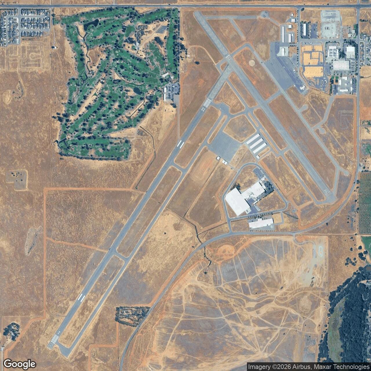
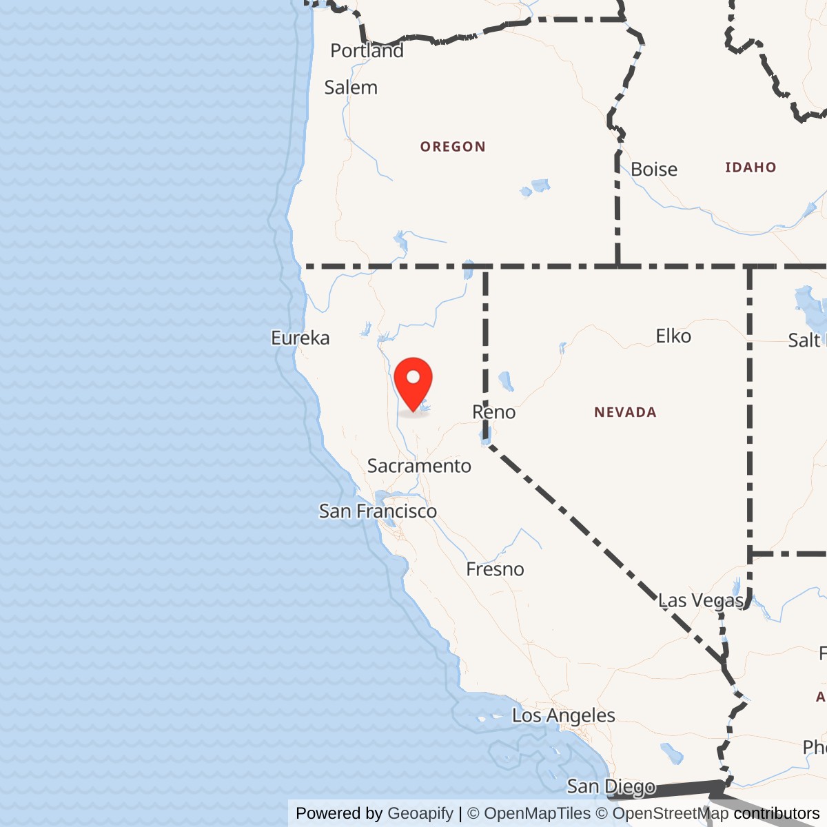
Oroville's military value came from geography that was practical rather than spectacular. The airport sat southwest of the city, near the Feather River valley and open agricultural land, with enough flat ground for runways, taxiways, aprons, fuel areas, maintenance space, and cantonment facilities. It was close enough to Oroville and regional roads to support workers, supplies, and utilities, but far enough from dense urban development to accommodate wartime flight training.
The Army expanded a civilian airport rather than starting from untouched ground. Local airfield history records that the War Department leased the municipal airport in 1942 and acquired additional land for expansion and cantonment. The combined wartime and return footprint is best treated as about 810 acres, matching the city's postwar return figure.
The wartime layout included two runway axes that survive in modernized form at the present airport. Today Runway 02/20 is 6,020 by 100 feet, and Runway 13/31 is 3,540 by 100 feet. Current taxiway patterns are not a perfect duplicate of the wartime layout, but the continued two-runway airport pattern makes the former Army field unusually legible compared with many temporary World War II airfields that were abandoned, plowed under, or fully redeveloped.
Airfield-history accounts also describe wartime support features that are easy to overlook when looking only at the present airport. Plans and later reports refer to a bomb storage area west of the runways, a skeet range between the southern portions of the runways, fueling pit boxes along former taxiways, and earth revetments used for bomb storage. Those details show that Oroville was more than an emergency landing strip. It was a working Army Air Forces training station with the operational support infrastructure needed to handle armed fighter training, aircraft fueling, dispersal, maintenance, and squadron-level activity.
Mission Evolution
The mission evolved in three stages. First, Oroville was a municipal airport. The city built it before the war as a local aviation asset, and the Works Progress Administration-era improvements fit a broader national pattern in which local airports became ready-made military resources when the United States mobilized.
Second, Oroville became a World War II Army Air Forces fighter-training field. In 1942, the War Department took over the municipal airport and renamed it Oroville Army Air Field. Its core wartime mission was fighter training, especially the rotation of fighter groups through the field as they prepared for follow-on assignments. The field's active military period was short, but it fell during the intense 1943-1944 period when the Army Air Forces was trying to produce, organize, train, and deploy fighter units fast enough to meet global requirements.
Third, the field returned to civilian use after the war. Oroville was not retained as a long-term Regular Air Force base. The Army Air Forces had many temporary and auxiliary wartime airfields that no longer fit postwar force structure. Oroville was listed as temporarily inactive in 1945, transferred into disposal channels, and returned to civil authorities. The city's public history uses 1948 as the return-to-city-control milestone, and later accounts note the War Assets Administration's role in ending the Army lease and returning the airport to local control.
World War II Operations and Units
Oroville's wartime story is mainly a fighter-group training story. The field was associated with Fourth Air Force and the Northern California fighter-training and staging network that included Hamilton Field, Marysville Army Air Field, Chico Army Air Field, Santa Rosa Army Air Field, and other Sacramento Valley and Bay Area aviation sites. In that system, Oroville provided another runway complex where squadrons could train, disperse, and prepare before moving onward.
The 357th Fighter Group is the most famous unit associated with the field. The group had trained earlier at Hamilton Field, Tonopah Army Air Field, and Santa Rosa Army Air Field before moving to Oroville in August 1943. Its Oroville period came shortly before the group moved toward overseas deployment. The 357th later became one of the best-known P-51 Mustang fighter groups in the European Theater, serving with the Eighth Air Force and becoming associated with pilots such as Chuck Yeager and Clarence "Bud" Anderson. Oroville was not where the group earned its combat record, but it was part of the stateside training chain that helped move the group from formation to deployment readiness.
The 369th Fighter Group also trained at or through Oroville. Its squadrons were part of the Army Air Forces replacement and operational training system. Sources describe the 369th using Bell P-39 Airacobras, with the 400th Fighter Squadron moving to Oroville before the group and other elements joined or passed through during early 1944. That placement makes Oroville part of the system that trained individual pilots and fighter units for a wartime demand that was constantly changing.
The aircraft associated with the field included the Bell P-39 Airacobra and, in later or related accounts, P-51 Mustang and possibly A-36 Apache activity. The P-39 was especially important in the domestic training environment. It was not the fighter that made the 357th famous in Europe, but it was a major training and transition aircraft for fighter groups in the United States. An airfield like Oroville therefore carried a practical, workaday mission: it absorbed aircraft, instructors, mechanics, armament personnel, ground crews, administrative staff, and pilots who were still being shaped into deployable combat formations.
The training mission also involved risk. Fighter training in 1943 was dangerous across the United States. High-performance aircraft, newly trained pilots, rapid unit expansion, unfamiliar terrain, weather, night flying, formation work, and operational pressure all created accident hazards. Oroville's aviation landscape should be understood in that context. The field's role was to make combat aviation possible, and that preparation carried danger before anyone reached a combat theater.
Role in the Wider Military Network
Oroville Army Air Field was a small node in a large system, and that system is the reason the field mattered. Fourth Air Force had two overlapping responsibilities on the West Coast: air defense and the organization or training of combat units before deployment. Northern California's airfields formed a distributed network that could train fighter groups, disperse aircraft, relieve congestion at larger bases, and provide geographic variety for operational flying.
The field's relationship with nearby aviation sites is especially important. Hamilton Field was a major Army air base north of San Francisco Bay. Chico Army Air Field began as an Army flying school and later shifted toward fighter training. Marysville and Santa Rosa were also part of the fighter-training and staging environment. Oroville fit among these fields as an additional site where squadrons and groups could train without overloading a single installation. Its significance was not permanent garrison status. Its significance was the capacity it added to the wartime air-training network at a moment when capacity was everything.
The site also belonged to a larger national pattern. Across the United States, the Army Air Forces leased, expanded, and built hundreds of airfields to support training. Some became major postwar Air Force bases. Many did not. Oroville represents the second category: a temporary Army Air Forces installation that accomplished its wartime mission, passed through surplus or disposal procedures, and returned to civil aviation. That path is one of the commonest outcomes for World War II Army airfields and is historically important because it explains why so many American civilian airports still carry military-era runway geometry, property boundaries, and local memory.
Closure, Disposal, and Current Status
By 1945, Oroville Army Air Field no longer had the same wartime urgency. The Army Air Forces had reduced many stateside training requirements, and the field was listed as temporarily inactive. It moved through the postwar surplus and War Assets Administration process. By the late 1940s, the airport had returned to local civilian control.
Oroville Municipal Airport remains active today. AirNav identifies it as KOVE / Oroville Municipal Airport, open to the public, three miles southwest of Oroville. The City of Oroville describes the current airport as an 877-acre general aviation, business, public-safety, and experimental-aircraft facility. Its two paved runways and three principal taxiways preserve the essential aviation character of the former Army field.
Chronology
- 1936 The City of Oroville acquired 188 acres for a municipal airport southwest of the city.
- 1941 The city and public-works programs improved the airport and expanded the airport land base before wartime military use.
- 1942 The War Department leased the Oroville Municipal Airport and the field became Oroville Army Air Field for U.S. Army fighter training.
- 1942 The Army acquired additional land for expansion and cantonment use, enlarging the military airport landscape.
- Spring 1943 Oroville Army Air Field entered its main fighter-group training period.
- 1943-08 The 357th Fighter Group moved to Oroville during its final stateside training and staging sequence before overseas deployment.
- 1943-10 The 357th Fighter Group moved onward from Oroville toward later staging and overseas deployment.
- Late 1943 to early 1944 Elements of the 369th Fighter Group and its squadrons used Oroville as part of the Army Air Forces fighter replacement and operational training system.
- Early summer 1944 Oroville's main fighter-group training period wound down as Army Air Forces training requirements changed.
- 1945 Oroville Army Air Field was listed as temporarily inactive and moved toward postwar disposal.
- 1946 The War Assets Administration assumed custody of many surplus wartime airfield properties, including airfields like Oroville that were no longer required for Army Air Forces operations.
- 1947-05-21 Local airfield history records termination of the Army lease and return of the airport to civil authorities.
- 1948 City airport history identifies this year as the return-to-city-control milestone and notes the expanded 810-acre airport.
- Present Oroville Municipal Airport remains an active public-use airport, ICAO KOVE, with two paved runways and an 877-acre current airport footprint.