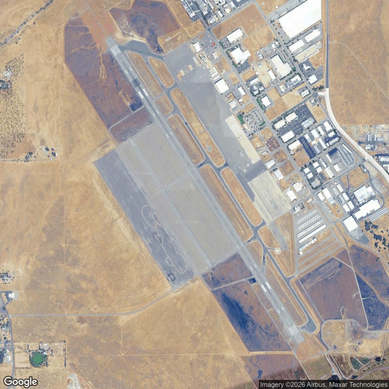
Chico Army Airfield, Chico California
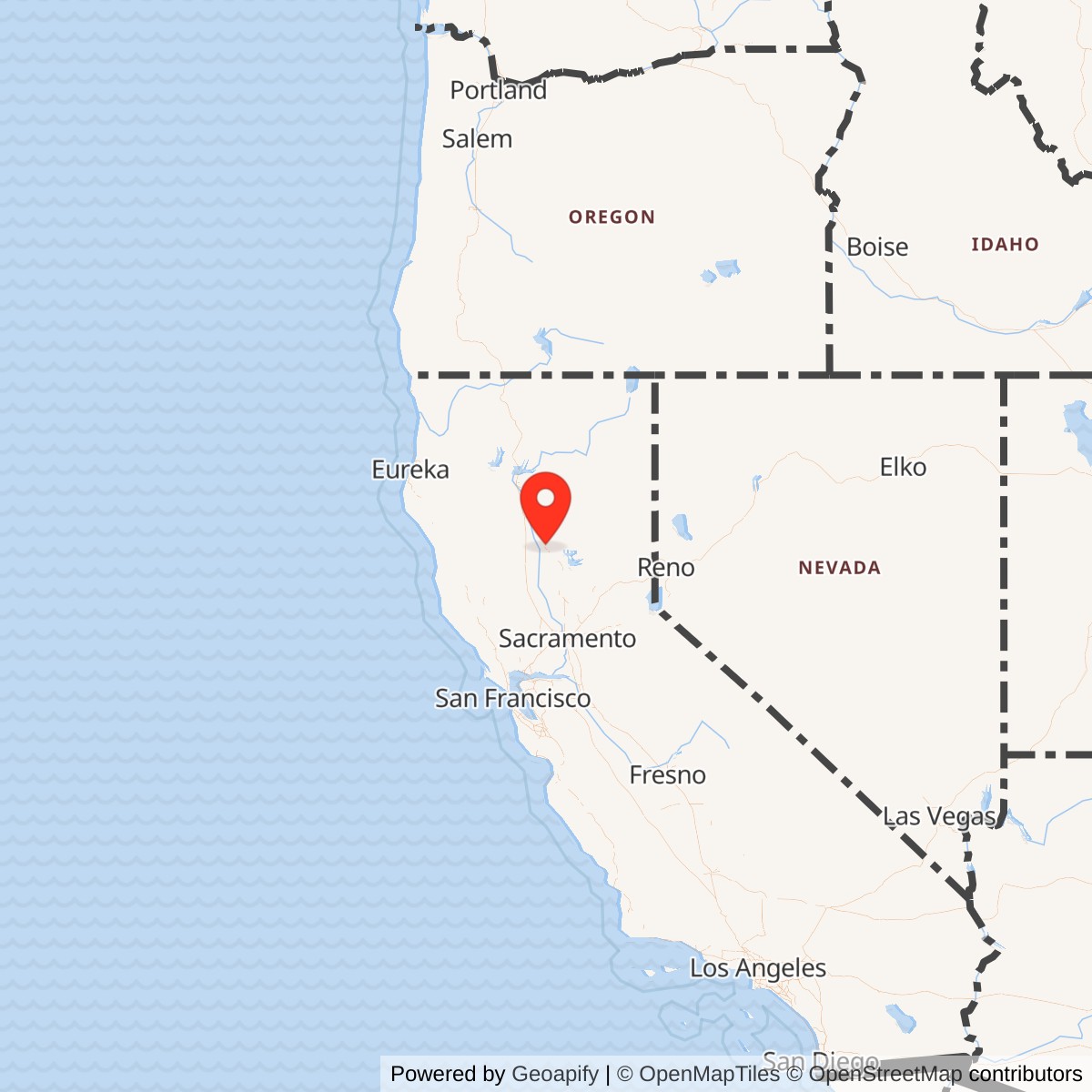
Longitude: -121.8584167
Airport ICAO ID: KCIC
Official Base Website: Chico Regional Airport
Current Role: Chico Regional Airport; Chico Air Museum in a World War II Army Air Corps hangar; CAL FIRE Chico Air Attack Base; general aviation, airport business, emergency-response aviation, and public airport uses.
Chico Army Airfield was a World War II U.S. Army Air Forces training, fighter-transition, and staging installation on the north side of Chico in Butte County, California. It began as a local municipal airport, was expanded rapidly under War Department lease after the United States moved toward full mobilization, and became one of the northern California fields used to train and process pilots, aircraft, and ground personnel for the wartime Army Air Forces. Its Army life was short, concentrated, and transformative: the field opened in April 1942, operated through the wartime emergency, and closed at the end of 1945.
The site should be understood as an Army Air Forces installation rather than a later Air Force base. Chico Army Airfield did not become a permanent post-1947 Air Force base. It returned to municipal control after the war and survives primarily as Chico Regional Airport, with surviving Army-era buildings and a local aviation museum preserving part of the field's military memory. That distinction matters because the same broad airport landscape later intersected with other Cold War and aviation stories, including aerial firefighting and a nearby Beale AFB Titan I missile complex north of the airport. Those later uses should not obscure the World War II identity of the base: Chico Army Airfield was a wartime Army Air Forces flying school and operational training field.
Chico was useful to the Army because it combined open northern Sacramento Valley flying conditions, a preexisting municipal airport, city willingness to lease and support the property, distance from dense coastal urban congestion, and enough surrounding rural land to support auxiliary landing fields and military expansion. The base was located about five miles north of Chico, giving the Army room to construct runways, aprons, buildings, roads, and training facilities while still benefiting from the labor, housing, utilities, and civic support of the city. In a mobilization system that needed pilots quickly, an expandable municipal airport in good flying country was valuable.
The City of Chico operates Chico Regional Airport as a certified Part 139 airport with two parallel runways, a helipad, aviation services, and ongoing air-service-development efforts. The Chico Air Museum occupies a World War II Army Air Corps hangar and uses the surviving wartime setting to interpret aviation history. CAL FIRE's Chico Air Attack Base, built in 1969, gives the airport a continuing public-safety aviation mission. The Army Airfield therefore no longer exists as a military post, but the runway landscape and selected wartime buildings remain part of Chico's active aviation infrastructure.
Mission Evolution
Chico's aviation site predated the Army airfield. The city developed a small airport north of town before World War II, and by 1941 the national defense buildup had turned that local facility into a candidate for rapid military expansion. The City Council of Chico leased the airport area to the War Department through the U.S. Army Corps of Engineers in September 1941, and construction began during the winter of 1941-1942. The original civil airport was no longer sufficient for wartime training. The Army needed longer runways, larger aprons, aircraft maintenance space, barracks, mess halls, classrooms, administrative buildings, utilities, roads, and the support infrastructure of a military post.
The first mission was flight training. The Chico Army Air Field Collection identifies the installation as Chico Army Air Field or Chico Army Flying School, located about five miles north of Chico, and records that it opened in April 1942. The school instructed more than 5,000 cadets and officers in basic and advanced flight training before the Army departed. That training mission placed Chico inside the broader Army Air Forces Training Command system, which was trying to convert civilians and partially trained cadets into military pilots at unprecedented speed.
The training mission changed as the air war changed. Chico began as a flying-school field, but in 1944 the installation shifted toward fighter training. Pilots who had already completed earlier phases of training came to Chico for combat-oriented fighter instruction. The field moved from the Western Flying Training Command orbit into a Fourth Air Force / fighter-command role and used aircraft such as P-63 Kingcobras and P-38 Lightnings for tactical and transition training. In 1945 the field also intersected with the Army Air Forces' final-war staging and processing system, handling personnel and aircraft tied to overseas movement and late-war air operations.
That sequence reflects a common World War II pattern. Many AAF fields began as schools, then changed missions as training pipelines matured and combat needs shifted. Chico's early cadet work was about teaching pilots to fly military aircraft. Its later fighter work was about turning trained pilots into combat-ready airmen able to operate high-performance aircraft and understand fighter tactics. Its final staging and processing role reflected the late-war need to move men and aircraft through an enormous logistical system while the Pacific war still demanded airpower.
The Army mission ended quickly after victory. Chico Army Airfield closed on December 31, 1945, and the city took over the property after the war. The former Army base became Chico Municipal Airport and later Chico Regional Airport. Its postwar life was civilian rather than military, though the field's long runways and military-built infrastructure continued to shape the airport's development.
World War II Operations
What actually happened at Chico Army Airfield was the transformation of a small municipal airport into a military flying school and fighter-training station. That required construction before training could happen at scale. The Army and its contractors expanded the field with runways, aprons, service roads, aircraft maintenance areas, barracks, classrooms, administrative facilities, and support buildings. By the time the field was operating fully, it functioned as a temporary military town built around aviation.
The first permanent troops arrived in April 1942, and the first cadets arrived later that month. Early student pilots had already passed through earlier training phases elsewhere, including Moffett Field, before coming to Chico. The basic flying phase demanded constant aircraft operations: takeoffs, landings, pattern work, formation flying, navigation, emergency procedures, instrument practice, maintenance cycles, classroom instruction, inspections, and physical training. Even routine training created risk. Aircraft engines, weather, mechanical failures, student judgment, and the tempo of wartime instruction made Army flying schools hazardous places even when no enemy aircraft were present.
Chico's training pipeline involved both pilots and ground personnel. A flying school could not function with pilots alone. Mechanics, armorers, fuel handlers, weather personnel, tower and communications specialists, supply personnel, clerks, medical staff, mess crews, military police, drivers, instructors, and civilian employees formed the base's operating system. Aircraft had to be fueled, inspected, repaired, armed or prepared for training configurations, parked, dispatched, recovered, and recorded. Cadets and officers required housing, food, medical care, discipline, recreation, and administrative processing. Chico Army Airfield's military contribution was therefore the output of an entire base community, not just the airborne time of the cadets.
The airfield also relied on a satellite training geography. Chico AAF had auxiliary fields around the region to absorb the volume of takeoffs, landings, and emergency practice required by large-scale flight training. Auxiliary fields reduced congestion at the main field and allowed instructors to spread student traffic over a wider area. They also gave student pilots more realistic experience with cross-country navigation, unfamiliar approaches, and alternate landing locations. The Chico system was part of a broader northern California AAF training network that also included other fields and subfields whose exact command relationships changed over time.
By 1944 Chico's mission was no longer only basic flying training. The field shifted toward fighter training under the Fourth Air Force system. This change made the base more directly connected to the tactical air war. Fighter-transition work required pilots to master faster, heavier, more powerful aircraft, including high-performance propeller fighters. Bell P-63 Kingcobras and Lockheed P-38 Lightnings represented a different level of performance and complexity than basic trainers. Training included aircraft handling, gunnery preparation, formation, tactical procedures, and the discipline required for combat fighter operations.
The late-war use of Chico also included staging and processing. As the European war ended and the Pacific war continued, the Army Air Forces still had to move personnel and aircraft through a global deployment system. In 1945 Chico was associated with units responsible for processing aircraft and crews for overseas assignment. The arrival of B-29 Superfortress processing in late 1945 shows how the field's final operational role differed from its original basic-training mission. Chico became part of the machinery that moved men and machines toward the final phase of the air war rather than only a school for new fliers.
The base's population and social history were also significant. At its peak, Chico Army Airfield supported thousands of personnel. The field included enlisted men, officers, civilian workers, women in uniform, and segregated African American military personnel. Women's Army Corps personnel arrived in October 1943, and Women Airforce Service Pilots delivered aircraft to the field. Local accounts also identify African American service members and a separate black WAC housing area across Cohasset Road. These details matter because they place Chico inside the larger social history of World War II military service: expansion, segregation, women's military labor, and home-front community change all occurred at the airfield.
Chico itself was changed by the base. Soldiers, cadets, instructors, civilian workers, and their families entered the city's economy and social life. Local housing, restaurants, transportation, recreation, churches, shops, and newspapers all experienced the sudden presence of a wartime airfield. The post exchange, base newspaper, photographs, yearbooks, training literature, and memorabilia now preserved in the Chico Army Air Field Collection show how the base developed a distinct wartime culture in addition to its official military function.
Units, Organizations, and Systems
Chico Army Airfield belonged first to the Army Air Forces training system. Its basic and advanced flying-school role placed it within the larger pipeline that began with civilian selection and primary flight training and continued through basic, advanced, transition, and combat-unit training. The Army Air Forces could not build combat airpower simply by producing aircraft. It had to produce trained pilots and the ground organizations that sustained them. Chico contributed to that manpower pipeline.
The field was associated with the AAF West Coast Training Center and the Western Flying Training Command during its early school mission. The command system provided the curriculum, standards, aircraft allocations, personnel structure, inspections, and training flow that made the base part of a national program rather than a local flying club. Chico's local instructors and base personnel mattered, but they operated inside a standardized Army Air Forces training architecture.
In 1944 the field's mission changed under Fourth Air Force and fighter-command control. This transition connected Chico to continental air-defense and combat-training systems rather than purely cadet instruction. Fourth Air Force installations in California and the West trained and organized fighter and bomber units, protected the coast, and prepared personnel for deployment. Chico's fighter-transition work and later staging role made it a component of that tactical and operational pipeline.
The units and organizations at Chico included the base operating unit, instructor and training organizations, airfield maintenance personnel, medical and administrative detachments, WAC personnel, military police, and support sections. A field of this type operated less like a single regiment and more like an aviation factory: its product was trained people and operationally ready aircraft. The base's organizational life therefore centered on squadrons, school detachments, base units, maintenance shops, operations offices, and support departments rather than on infantry battalions or field artillery batteries.
The auxiliary-field system was also part of Chico's organizational identity. Orland/Haigh Field, Kirkwood, Vina, Campbell, Oroville, and other associated fields or landing areas supported Chico's training mission at different times or in different command relationships.
Site Design and Facilities
Chico Army Airfield's physical layout followed the standard logic of a World War II AAF training base. The flight line was the operational center. Runways, taxiways, aprons, hangars, maintenance shops, fuel storage, control facilities, and aircraft parking areas supported the flying mission. Administrative, housing, mess, medical, recreation, warehouse, motor-pool, and training buildings formed the cantonment and support side of the field. Roads and utilities linked the airfield to Chico and to the surrounding training landscape.
The Army lease and disposal history indicates that the wartime airfield involved roughly 1,045.3 acres leased from the city, with total disposal accounting for approximately 1,056.27 acres after the war. That acreage should be read as the main airfield leasehold and disposal footprint, not as the entire regional training system. Auxiliary landing fields, approach zones, off-base housing, and support relationships extended the practical military geography beyond the main property.
The base ultimately contained a large number of buildings. Later summaries based on the city redevelopment plan report that approximately 140 buildings, plus runways, aprons, and service roads, were constructed for the military use. These were mostly functional wartime structures: hangars, barracks, mess halls, classrooms, supply buildings, shops, offices, and support facilities. They were designed for speed and utility rather than permanence, but some survived long enough to shape the postwar airport.
The surviving aviation-museum setting is one of the clearest physical links to the Army airfield. The Chico Air Museum first opened in a small World War II Army Airfield building at Chico Municipal Airport and later moved into a large World War II Army Air Corps hangar. That hangar had been built and used during the war and now houses historic aircraft and displays. The museum therefore preserves a tangible portion of the Army Airfield landscape even though the installation is no longer a military post.
The current Chico Regional Airport preserves the broad spatial logic of the former base. It has two parallel runways, including a primary runway long enough for modern regional and firefighting operations, and it remains a controlled aviation facility. The field also supports a helipad, aircraft businesses, private and charter activity, flight services, and public-airport operations. The layout has changed since 1945, but the reason the airport has such a substantial footprint and runway system is inseparable from the Army's wartime expansion.
Postwar Closure and Reuse
Chico Army Airfield closed on December 31, 1945. The end of the war left the Army Air Forces with far more domestic fields than it could justify in peacetime. Like many training bases, Chico was declared excess and returned to civilian use. The city took over the property after the Army's departure, and the military improvements became part of Chico's airport inheritance.
The postwar airport carried several names and roles. It operated for decades as Chico Municipal Airport and was later renamed Chico Regional Airport to emphasize the broader area it serves. Although commercial airline service has come and gone, the airport remains an important general aviation, emergency-response, training, charter, and public-use facility for the northern Sacramento Valley and surrounding foothill region. The City of Chico continues to operate it and has sought to restore commercial passenger service.
The Chico Air Attack Base added a major public-safety mission in 1969. It is a CAL FIRE air attack base supporting rapid initial attack against vegetation fires. Current Butte County material identifies the base as home to an OV-10A air attack aircraft and an S-2T air tanker, with drive-through retardant pits capable of loading aircraft quickly and supporting large air-tanker operations during major fires. This is not an Army continuation, but it is a direct reuse of a military-expanded airfield for another form of public service aviation.
The Chico Air Museum gives the former Army airfield its strongest interpretive presence. Founded by local residents concerned that aviation history was being lost, the museum opened to the public in 2005 and moved in 2015 into a large World War II Army Air Corps hangar. Its exhibits, aircraft, photographs, artifacts, and research materials connect the current airport to the wartime field. For visitors, the museum is the easiest way to encounter Chico Army Airfield as a preserved historical subject rather than simply as an airport name.
Current Status
The former Chico Army Airfield is now Chico Regional Airport, owned and operated by the City of Chico. The city describes it as a certified Part 139 airport serving the Northern California region, with aviation facilities and services available year-round and ongoing efforts to restore commercial passenger air service. It has two parallel runways, a helipad, air-traffic control functions during operating hours, and airport businesses serving private, charter, training, maintenance, and related aviation needs.
The airport also supports emergency-response aviation. The Chico Air Attack Base remains an active CAL FIRE facility and contributes to the region's wildfire response system. Its presence is especially important in a region repeatedly affected by major wildfires, where fast tanker loading and air attack coordination can be decisive in the first minutes of a fire.
Historically, the site remains legible because the airfield itself continues to function and because World War II structures survive. The Chico Air Museum's use of a wartime hangar is particularly important. Many temporary AAF fields vanished almost completely after 1945. Chico retained its aviation use, and that continuity preserved enough of the physical plant and community memory for the Army Airfield story to remain accessible.
Chronology
- Late 1930s Chico develops a small municipal airport north of the city.
- 1941-09-11 Chico leases airport land to the War Department through the U.S. Army Corps of Engineers for military use.
- 1942-01 Construction begins on the expanded wartime Army airfield.
- 1942-04 The first permanent Army Air Forces cadre arrives at Chico.
- 1942-04-14 The Chico Army Air Field Collection finding aid records the base opening on this date.
- 1942-04-15 Some summaries identify this as the opening of Chico Army Flying School / the arrival of the permanent operating cadre.
- 1942-04-25 The first cadets arrive from Moffett Field for training at Chico.
- 1942-07-28 Basic flying training begins at Chico.
- 1942-08 African American military personnel are assigned to the field, reflecting the segregated wartime Army.
- 1943-10 Women's Army Corps personnel arrive at Chico Army Airfield.
- 1944-04 The mission shifts from cadet basic flying training toward fighter-pilot training.
- 1944-04-24 Chico transfers from Western Flying Training Command orbit to the Fourth Air Force / IV Fighter Command system.
- 1944-1945 Chico supports fighter-transition and combat-oriented instruction using aircraft such as P-63 Kingcobras and P-38 Lightnings.
- 1945-05 Jet familiarization or training activity is reported with P-59 aircraft.
- 1945-07 P-51 Mustang training activity is reported at Chico.
- 1945-08-25 IV Fighter Command is replaced at the field by the 21st Bombardment Wing for staging and processing functions.
- 1945-10 The 21st Bombardment Wing mission is redesignated as First Staging Command, with late-war aircraft and personnel processing functions.
- 1945-12-31 Chico Army Airfield closes as an Army Air Forces installation.
- 1948-06-08 The main Army lease on 1,045.3 acres is terminated, with government-built improvements transferred to the City of Chico.
- 1949-01-28 Additional acreage is transferred to the City of Chico by deed, completing the disposal of the wartime Army property.
- 1969 Chico Air Attack Base is built at the airport for aerial firefighting operations.
- 2005 Chico Air Museum opens to the public in a small World War II Army Airfield building at Chico Municipal Airport.
- 2015 Chico Air Museum moves into a large World War II Army Air Corps hangar at the airport.
- 2022-11-15 Chico City Council acts to rename Chico Municipal Airport as Chico Regional Airport.
- Present The former Army airfield operates as Chico Regional Airport, with the Chico Air Museum, aviation businesses, and CAL FIRE air attack operations preserving and repurposing the wartime aviation landscape.