
Semi-Tropic Auxiliary Field No. 5 / Minter Auxiliary A-5, Wasco California
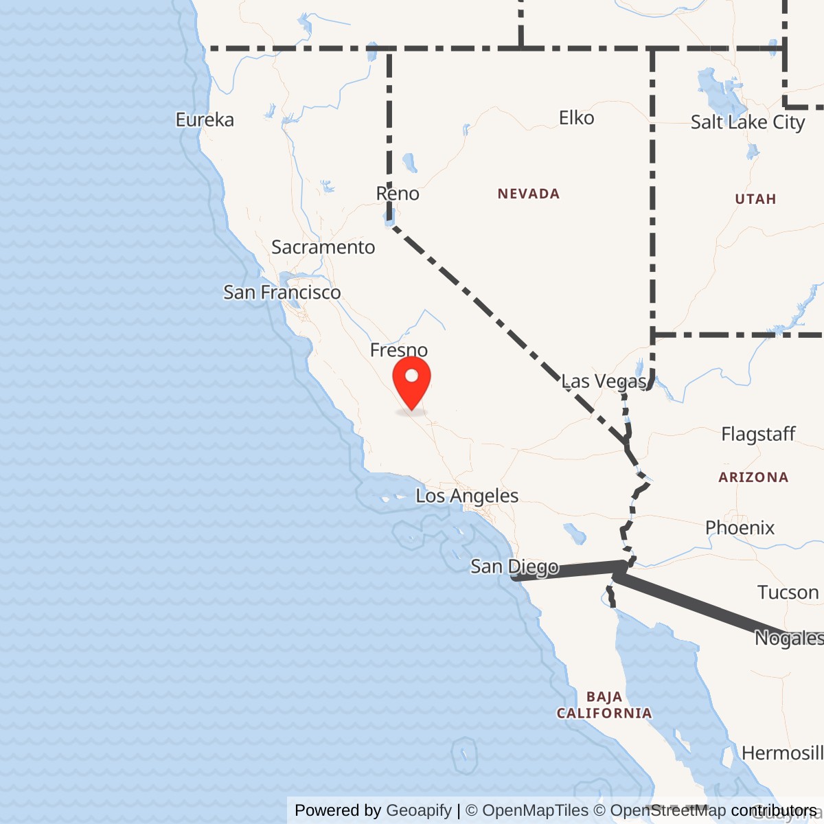
Longitude: -119.4847220
Official Base Website: Former Semi-Tropic Auxiliary Field No. 5 site
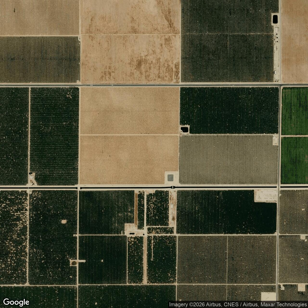
Current Role: Agricultural land west of Wasco; later aerial imagery shows no recognizable landing-mat trace. Exact 2026 parcel ownership of the former wartime assemblage was not independently established.
Semi-Tropic Auxiliary Field No. 5 was a deliberately sparse satellite landing field built for the Army Air Forces training system centered on Minter Field near Shafter. It was not a separate flying school, depot, combat station, or fully developed air base. Its purpose was to give Minter's training traffic another landing surface away from the crowded parent field, allowing basic-training aircraft to conduct local flying work without requiring every approach and landing to use Minter's main runways. The field is also found as Semi-Tropic Field, Semitropic Field, Minter Field Auxiliary No. 5, Minter Auxiliary Army Airfield A-5, and Minter Auxiliary A-5.
The installation occupied agricultural land west of Wasco in the flat southern San Joaquin Valley. The January 1945 Army Air Forces directory placed it 8.6 airline miles west of Wasco, at an elevation of about 265 feet. Paul Freeman's later reconstruction places the former field southwest of State Route 46 and Rowlee Road. Those two descriptions agree closely. A widely repeated online coordinate near 35.7569 north is inconsistent with the period directory, the highway location, and the eight-mile relationship to Wasco and is therefore not used here.
The property's legal history is unusually well documented for a small auxiliary field. A U.S. Army Corps of Engineers Los Angeles District history dated 1992 states that the government assembled 601.2 acres from eleven landowners rather than taking a single preexisting airport tract. The first major action was the lease of 556.7 acres in March 1942. A 1.2-acre noncontiguous easement followed in May 1942 for a drainage ditch, and 43.3 acres were acquired in fee in March 1943. The mixed lease, easement, and fee arrangement explains why later disposal was more complicated than simply returning one parcel to one owner.
Acquisition, Construction, and Opening
The Army Corps history states that improvements were made between 1942 and 1945 while the property remained under War Department control. The field was certainly in operating condition by July 22, 1943, when an Army aerial photograph showed the landing mat and its southern extension, and it was formally listed as an auxiliary of Minter Field in the May 15, 1944 AAF Installations Directory.
The Army did not build a cantonment around the airfield. The Corps history identifies a crash-truck shelter, stage house, latrine, landing mat, runway or extension, fence, and the drainage work. That limited plant is consistent with a satellite field designed for repeated flying periods rather than independent station life. Cadets, instructors, maintenance organizations, fuel stocks, medical services, administration, housing, and most other support remained at Minter Field or in nearby communities. Semi-Tropic needed enough infrastructure to support aircraft movements and immediate emergency response, but it did not duplicate the institutional structure of its parent base.
The January 1945 directory makes the austerity even clearer. It recorded no hangars and no shops at the airport. Gasoline and oil were not available on the field, although both were available in the vicinity at Minter Field. No radio range, control tower, ground-to-air radio, instrument approach procedure, or airport lighting was reported. Transient personnel accommodations were also absent at the field, with nearby accommodations identified at Wasco. The directory did record a wind cone, showing that even a minimalist auxiliary field still required basic visual wind information for pilots working repeated approaches and landings.
Site Design and Landing Surface
Semi-Tropic's defining feature was its broad all-direction landing surface. The January 1945 directory described an irregular 600-acre property containing a road-mix landing mat 3,000 feet north-south by 3,000 feet east-west. A 1,384-foot by 100-foot extension projected from the south side. The May 1944 installations directory likewise listed Semi-Tropic Auxiliary Field No. 5 as an auxiliary of Minter Field under Western Flying Training Command and recorded an all-way landing area with a 3,000-foot longest dimension. Period aerial photographs show the square mat clearly enough that the field can be recognized even without conventional intersecting runways.
A square landing mat offered operational flexibility that a single narrow runway could not. In the San Joaquin Valley, instructors could select a landing direction that better matched the wind and could distribute repeated training approaches across a broad prepared surface. The design was especially well suited to basic flying instruction, where students needed frequent practice in takeoffs, approaches, landings, go-arounds, and traffic-pattern judgment. The sources do not preserve a Semi-Tropic operating manual, so the exact local pattern rules and daily sortie procedures are unknown, but the physical design and the field's auxiliary status make its training purpose unmistakable.
The 1,384-foot southern extension gave the otherwise square mat a distinctive outline visible in the 1943 and 1944 aerial photographs. The Corps history separately describes a mat and runway, while the 1945 directory calls the feature a 100-foot-wide extension on the south end. These descriptions are compatible rather than contradictory. The broad square was the principal all-way landing surface, and the narrower southern element extended the prepared landing system beyond it. The images also show access paths and the small support area, but not the dense building pattern expected at a self-contained Army airfield.
Drainage was a practical concern. The 1945 directory described natural drainage as inadequate, an unsurprising problem on flat agricultural land where a broad road-mix surface could be affected by standing water and soft shoulders. The government therefore obtained a separate 1.2-acre easement specifically for a drainage ditch. That tiny detached parcel is important to the installation boundary because it shows that Semi-Tropic was not simply the visible square landing mat. Its wartime property system included land required to make the flying surface usable and to manage water beyond the main tract.
Mission and Training Role
Semi-Tropic belonged to the network of auxiliary fields surrounding Minter Field, which opened in 1941 as an Army flight-training center. The May 1944 AAF directory placed Semi-Tropic under Western Flying Training Command and identified its activity simply as "AUX-MINTER FIELD." That classification captures the command relationship better than later attempts to describe the field as an independent base. Operational authority, instructors, students, aircraft, maintenance, and most logistics originated at Minter. Semi-Tropic was a piece of Minter's training plant physically separated from the parent station.
Minter's principal wartime basic trainer was the Vultee BT-13 Valiant, and Semi-Tropic has unusually strong site-specific evidence tying that aircraft type to the field. Two 324th Basic Flying Training Squadron accidents occurred within two miles of the auxiliary field, one in October 1943 and one in March 1944. Those records are more useful than simply listing every aircraft type known to have visited Minter because they demonstrate actual Semi-Tropic-area operations by a named Minter training organization. No equally strong evidence was found placing UC-78s, AT-6s, B-25s, or P-38s at Semi-Tropic itself.
The auxiliary field reduced pressure on Minter's main runways by distributing repetitive local training. A basic flying program generated constant circuits of departures, climbs, maneuver work, approaches, and landings, and placing satellite fields around the parent base increased the number of useful landing opportunities within the local flying area. The February 1944 sectional chart annotated by wartime users and the surviving "Local Flying Area of Minter Field" map both show Semi-Tropic as one component of that surrounding network. Its value came from being close enough for repeated training periods while far enough away to separate traffic from the parent field.
The 324th Basic Flying Training Squadron is directly documented as an operating user through the accident record, but the squadron's home station was Minter Field. This distinction matters. Aircraft and instructors could use Semi-Tropic routinely without the squadron being "stationed" there, and the history does not convert operating use into a permanent assignment without supporting orders.
The 324th Basic Flying Training Squadron and Documented Operations
The strongest unit-level link comes from October 24, 1943. Aviation Archaeological Investigation and Research indexes a Vultee BT-13A, serial 41-1575, assigned to the 324th Basic Flying Training Squadron at Minter Field, in a fatal accident one mile north of Semi-Tropic Auxiliary Field. The pilot, Otto Piepenbrink, was killed. The database classifies the event with the code KCRGC, defined as killed in crash ground collision. Because the accident occurred just outside the field rather than on the documented 601.2-acre property, it should be treated as a Semi-Tropic training-area event, not as an on-installation crash unless a future accident report reconstructs the exact impact point.
The second directly documented event occurred on March 10, 1944. A BT-13A, serial 42-1457, also of the 324th Basic Flying Training Squadron at Minter, was lost two miles west of Semi-Tropic. The Aviation Archaeology index records pilot Leroy E. Carpenter, although the index renders his first name as "Leory," and uses the code BOSSP. The site's code glossary defines BOSSP as "Bailed Out due to Stall/Spin." Paul Freeman's airfield history likewise states that Carpenter bailed out. This event again places a named Minter training squadron and the BT-13 directly in Semi-Tropic's local operating environment.
Together, the two accidents illustrate why auxiliary fields mattered to the training system. Basic flying instruction demanded high repetition from relatively inexperienced pilots, often close to the aerodynamic limits encountered during turns, approaches, and slow flight. The accidents do not establish that Semi-Tropic was unusually dangerous, and the available evidence is far too limited to calculate a site-specific accident rate. They do show that the airfield was embedded in an active training circuit where stall and spin hazards had immediate consequences and where a nearby prepared landing surface was part of the safety and training infrastructure.
No combat operations occurred from Semi-Tropic, and no evidence was found that it hosted an operational combat unit, bombing range, gunnery range, ammunition storage area, or depot activity. Its military significance was indirect but real. The field supported the process that turned aviation cadets into military pilots. Those pilots and instructors belonged to a national training pipeline supplying the wartime Army Air Forces, but Semi-Tropic itself remained a local training facility rather than a deployment or combat base.
Inactivation, Surplus, and Disposal
By January 1945 the AAF airfield directory described Semi-Tropic as inactive. That gives a firmer operational endpoint than the generic statement that the field closed after World War II. No exact inactivation order has been located. The distinction between operational inactivation and property disposal is important because the War Department continued to control the property after flying activity had ended.
The Army Corps real-property history states that Semi-Tropic was declared surplus to the War Assets Administration on November 15, 1945. That action came months after the field was already listed inactive. Surplus declaration meant the Army no longer required the property for its mission, but it did not instantly transfer title or terminate every interest. The installation included leases, an easement, and fee-owned land, each of which could require different disposal action. The leases also reserved the government's right to remove or dispose of improvements before expiration.
Custody and accountability for the improvements passed to the War Assets Administration on November 20, 1946. Some secondary summaries have turned that date into a simple statement that "the land was sold," but the Corps history is more precise. It says the date and conditions of disposal of the War Department-owned property were unknown. The 1946 date therefore marks the documented WAA custody transition, not a proven sale of every acre. This correction prevents the property history from appearing more exact than the surviving evidence permits.
Postwar Landscape and Current Status
The agricultural landscape quickly absorbed the former airfield. Semi-Tropic was no longer shown on the 1953 USGS topographic map. By the 1994 USGS aerial photograph, the former landing mat had been returned to farming and no recognizable airfield trace remained. An August 27, 2012 aerial image likewise showed agricultural fields crossing the former site without an obvious surviving square mat. The disappearance was more complete than at auxiliary fields whose concrete runways or later civilian aviation use preserved visible remnants.
The 1992 Army Corps history reported that the property was then in agricultural use and divided among three private owners. That statement is useful historical evidence but should not be repeated as a 2026 title determination. Parcel ownership can change, and no current deed-level ownership reconstruction was completed. The defensible current-status statement is therefore that the former airfield landscape remains agricultural in later aerial documentation, with no recognizable wartime landing surface, while exact present legal ownership of the former 601.2-acre assemblage has not been independently established.
Semi-Tropic also appears in older FUDS inventory material under property number J09CA0625, but the legacy listing indicates no active project. More importantly, the official USACE California FUDS inventory dated September 30, 2015 does not list Semi-Tropic among the state's then-current project sites, while it does list neighboring former properties such as Famosa Auxiliary Field and Dunlop Auxiliary Field with MMRP sites. The omission should not be treated as proof that every environmental question has been resolved.
Chronology
- 1941-06 Minter Field opened as an Army flight-training center, creating the parent installation whose expanding flying program would use Semi-Tropic and the other local auxiliary fields.
- 1942-03 The U.S. Government leased 556.7 acres from private landowners for Semi-Tropic Auxiliary Field No. 5, establishing the main wartime property.
- 1942-05 The government acquired a 1.2-acre noncontiguous easement for a drainage ditch serving the auxiliary field.
- 1942 Construction and improvement of the auxiliary field began during the period of War Department control.
- 1943-03 The government acquired an additional 43.3 acres in fee, bringing the documented total acquisition or control to 601.2 acres from eleven landowners.
- 1943-07-22 An Army aerial photograph showed the completed square landing mat and southern extension.
- 1943-10-24 Otto Piepenbrink of Minter Field's 324th Basic Flying Training Squadron was killed in the crash of BT-13A 41-1575 one mile north of Semi-Tropic.
- 1944-02 A Los Angeles Sectional Chart annotated by wartime users marked Semi-Tropic Auxiliary Field as part of Minter's local auxiliary network.
- 1944-03-10 Leroy E. Carpenter of the 324th Basic Flying Training Squadron bailed out of BT-13A 42-1457 after a stall/spin event two miles west of Semi-Tropic.
- 1944-05-15 The AAF Installations Directory listed SEMITROPIC AUX FLD #5, 17.5 miles north-northwest of Bakersfield, as AUX-MINTER FIELD under Western Flying Training Command.
- 1944 A surviving aerial photograph depicted the 3,000-foot-square landing mat and narrow southern extension in operational-era configuration.
- 1945-01 The Army Air Forces directory gave the field's period coordinates, approximately 600-acre size, 3,000-foot-square road-mix mat, 1,384-foot southern extension, sparse facilities, private ownership, and Army Air Forces operation, and described the field as inactive.
- 1945-11-15 Semi-Tropic Auxiliary Field No. 5 was declared surplus to the War Assets Administration.
- 1946-11-20 The War Assets Administration assumed custody and accountability for improvements on the property. The surviving Corps history does not establish this as the sale date for all property interests.
- 1953 Semi-Tropic was no longer depicted on the USGS topographic map.
- 1992-09-04 The U.S. Army Corps of Engineers Los Angeles District completed the property history later reproduced by California Military History Online.
- 1994 USGS aerial imagery showed the former airfield returned to agriculture with no recognizable landing-mat trace.
- 2012-08-27 Aerial imagery again showed agricultural use and no recognizable surviving airfield surface.
- 2015-09-30 The official USACE California FUDS project inventory did not list Semi-Tropic among then-current California project sites.
- 2026 The former airfield remains documented as an erased agricultural military landscape; exact current parcel ownership of the former wartime assemblage has not been independently established.
Information sources (9)
- WEBU.S. Army Corps of Engineers Los Angeles District History, "Semitropic Auxiliary Field No. 5," reproduced by California Military History Online
Primary property-history source for acquisition acreage, land interests, facilities, surplus declaration, WAA custody, and 1992 land use.
- PDFArmy Air Forces Installations Directory, 15 May 1944
Contemporary directory source identifying SEMITROPIC AUX FLD #5 as AUX-MINTER FIELD under Western Flying Training Command.
- WEBArmy Air Forces Directory of Airfields, January 1945, Semi-Tropic extract
Contemporary directory image for period coordinates, elevation, landing-mat dimensions, facilities, ownership, operator, transportation, and nearby support.
- WEBAbandoned and Little-Known Airfields, Bakersfield Area, Semi-Tropic Field
Source for historical aerial interpretation, Minter auxiliary-network mapping, 1945 inactive status, accident context, and later agricultural landscape.
- WEBAviation Archaeological Investigation and Research, USAAF Accident Reports, October 1943
Accident-index source for Otto Piepenbrink, BT-13A 41-1575, the 324th Basic Flying Training Squadron, and the location one mile north of Semi-Tropic.
- WEBAviation Archaeological Investigation and Research, USAAF Accident Reports, March 1944
Accident-index source for Leroy E. Carpenter, BT-13A 42-1457, the 324th Basic Flying Training Squadron, and the location two miles west of Semi-Tropic.
- WEBAviation Archaeological Investigation and Research, Abbreviations, Acronyms and Codes
Source for interpretation of the KCRGC and BOSSP accident codes used in the accident indexes.
- PDFU.S. Army Corps of Engineers, Formerly Used Defense Sites Per State, California, 30 September 2015
Official historical FUDS inventory used to check whether Semi-Tropic appeared among then-current California environmental or munitions-response project sites.
- WEBMinter Field Airport District, "Our History"
Current parent-airfield history source for Minter Field's 1941 Army training origin and the scale of the wartime parent installation.