
Dunlap Auxiliary Field No. 4 / Jasmin Landing Field, California
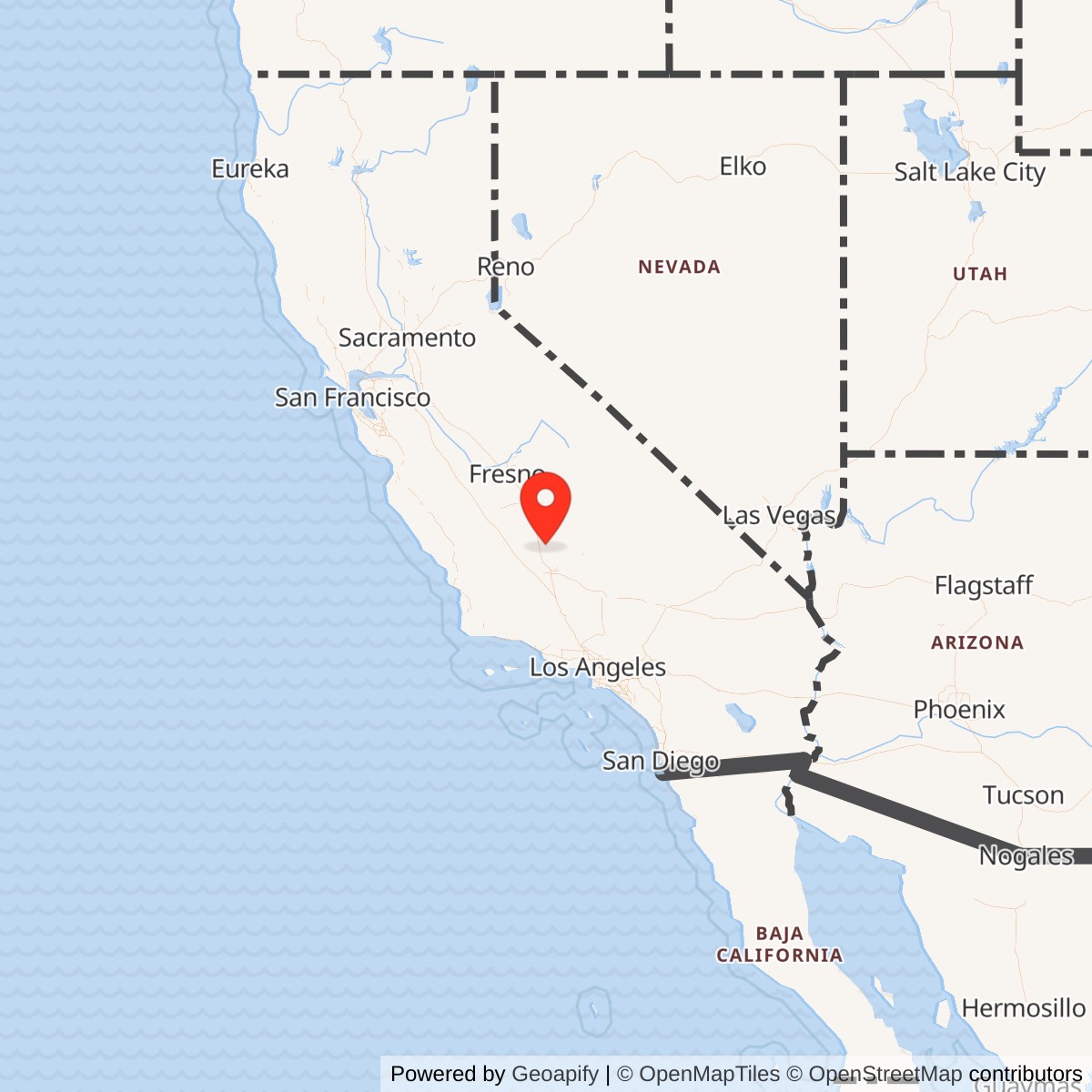
Longitude: -119.1220000
Official Base Website: Former Dunlap Auxiliary Field / Jasmin Landing Field site
Current Role: Agricultural land northwest of Hart Avenue and Quality Road in Kern County; no active airfield or surviving military installation identified at the wartime footprint. Exact 2026 parcel ownership was not independently reconstructed.
Dunlap Auxiliary Field No. 4 was a small Army Air Corps and Army Air Forces satellite landing field built to support the basic flying program at Lerdo Field, later Minter Field, in Kern County's southern San Joaquin Valley. Wartime and postwar references also call it Dunlap Field, Minter Field Auxiliary Field No. 4, Minter Auxiliary Army Airfield A-4, and, in later civilian mapping, Jasmin Landing Field. It was not a separate flying school, combat base, depot, or full-service subpost. Its military purpose was to give Minter instructors and students another landing surface away from the parent field.
The distinction between an auxiliary field and an independent base is central to the history. Minter provided the cadet program, instructors, aircraft, fuel, maintenance, medical support, administration, and command structure. Dunlap supplied a broad landing area within the local flying network. That arrangement let the school distribute repetitive takeoff, landing, traffic-pattern, and emergency-landing practice across several sites rather than concentrate every student aircraft over Minter's main runway system. Dunlap's small physical plant and lack of hangars are therefore evidence of the intended operating model rather than evidence that the field was unimportant.
The field lay in an agricultural landscape northeast of Minter and east of Delano, near the communities of Jasmin and Richgrove. The representative point at 35.737, -119.122 places the former square landing area northwest of Hart Avenue and Quality Road. A wartime Minter local flying-area map places Dunlap at the northeastern edge of the school's auxiliary-field network. Straight-line measurement from the modern Minter Field reference point is about 16 miles, so a frequently repeated statement that Dunlap lay only three nautical miles from Minter is geographically inconsistent.
Opening, Property Control, and Date Evidence
The exact day on which the War Department obtained the Dunlap property has not been recovered from a primary lease or deed in the reviewed sources. Later secondary compilations place the field's opening in 1941 and describe a 210.22-acre site. That year is consistent with the rapid construction of Minter and its satellite system after the parent field opened in 1941.
The first firmly dated evidence of operational use is the 1942-04-08 accident of Vultee BT-13 serial 41-9665 from Minter Field's 327th School Squadron at Dunlap. That event proves the auxiliary field was part of the active Minter training system by early April 1942. It also provides better evidence of actual use than the absence of Dunlap from regional sectional charts, because local military auxiliaries were not always plotted on standard civilian aeronautical charts. The field's military identity is further confirmed by the 1943 aerial, 1944 local flying map, 1944 aerial photograph, and the 1945 Army Air Forces directory.
The 1945 directory described Dunlap as privately owned and operated by the Army Air Forces. No reviewed primary document establishes whether Army control rested on a lease, permit, easement, or another temporary real-estate instrument. That distinction matters because temporary wartime control could end without a large federal disposal proceeding of the kind associated with fee-owned bases.
The 1945 directory gives a 200-acre square field, which is a defensible contemporary operational measure. Later summaries give 210.22 acres, a level of precision that probably reflects a real-estate record, but the underlying record has not been located.
Site Design and Physical Layout
Dunlap's defining feature was a 2,640-foot by 2,640-foot road-mix landing mat set within the approximately 200-acre field. The 1943 and 1944 aerial photographs show the broad square surface plainly. Instead of several narrow runways, the installation presented pilots with a large prepared area that could accommodate approaches from different directions as wind and local traffic required. The mat occupied roughly 160 acres by simple geometric calculation, leaving a modest margin around the operational surface within the directory's 200-acre field.
The Army Air Forces directory reported no hangars at Dunlap. No reliable evidence located identifies barracks, a mess hall, hospital, permanent maintenance shop, fuel farm, ammunition magazine, control tower, or developed administrative cantonment. Secondary summaries sometimes state that no improvements were built at all, but that wording is broader than the evidence available here.
The lack of hangars and heavy support buildings kept the field dependent on Minter. Aircraft could arrive for practice, complete repeated landings and takeoffs, and return to the parent base for fuel, inspection, repair, and servicing. Personnel likewise remained part of the Minter organization rather than forming a permanent Dunlap garrison. This distributed design reduced congestion at the parent school without duplicating expensive infrastructure at every satellite. The auxiliary field was essentially a specialized training surface embedded in a larger base system.
A 1944 local flying-area map is particularly useful because it shows Dunlap in relation to the other Minter auxiliaries, including Wasco, Pond, Famoso, Semi-Tropic, Poso, and Lost Hills. The February 1944 Los Angeles Sectional did not formally depict Dunlap, but a contemporary or later annotation on a surviving copy marks the field together with the other auxiliaries. These maps show why civilian chart absence cannot be used as proof of inactivity. Dunlap belonged to a military local-flying network whose operational geography was more detailed than the standard sectional chart.
Mission and Training Operations
Dunlap's principal military mission was to support Minter Field's basic pilot-training program. Minter opened in 1941 under the Defense Landing Area Program and eventually supported thousands of personnel. Basic flying demanded high sortie rates and repeated practice rather than one-time exercises. Students needed to fly patterns, judge approaches, land in varying winds, recover from imperfect approaches, take off again, navigate among known reference points, and learn how to use alternate fields when the parent base was congested or an aircraft problem made a nearby landing desirable.
The Vultee BT-13 Valiant is the strongest aircraft type tied directly to Dunlap. Minter used the BT-13 as its principal basic trainer, and the 1942 accident of serial 41-9665 at the auxiliary field confirms that type's presence in Dunlap operations. Later secondary summaries also associate Boeing-Stearman trainers with the square mat, but no independent Dunlap-specific primary evidence located here proves regular Stearman use.
The North American AT-6C Texan is also directly tied to the site through the 1945-07-23 accident of serial 42-3911. The indexed accident record associates the airplane with the 3008th Army Air Forces Base Unit at Minter Field and places the accident at Dunlap Auxiliary Field, eight miles east of Delano. The AT-6 was an advanced trainer, so its appearance at Dunlap shows that the airfield could be encountered or used by aircraft beyond the BT-13 basic-training stream. The record does not, however, prove that Dunlap had become a separate advanced-training school.
The field's broad mat was well suited to the repetitive nature of training. A student could enter the local pattern, make an approach, land, take off again, and repeat the sequence without tying up Minter's main runway for every iteration. The installation also provided a recognizable alternate surface in a region where training aircraft routinely operated away from the parent field. That emergency utility was inherent in an auxiliary-field network, but no evidence found here supports additional missions such as bombing, aerial gunnery, depot maintenance, troop transport, or combat-unit staging at Dunlap.
Units and Organizations
No independently assigned Dunlap garrison, squadron headquarters, or field commander has been identified. Command and administration remained at Minter Field. The physical evidence supports that arrangement because the auxiliary field lacked the barracks, headquarters buildings, shops, and fuel infrastructure expected at a separately staffed station. Dunlap was a shared operating location used by organizations from the parent school rather than a base where those organizations were permanently stationed.
The 327th School Squadron can be associated with Dunlap more specifically than the rest of Minter's early unit roster. Aviation Archaeological Investigation and Research indexes BT-13 serial 41-9665 to the 327th School Squadron, Minter Field, in the 1942-04-08 Dunlap accident. A later accident chronology identifies the crew as instructor Lt. William B. Raabe and aviation cadet Irel W. Crowe and reports both men killed. The accident is therefore a direct link between an identifiable Minter training squadron and the auxiliary field.
By 1945 Minter's flying-school organization had been consolidated into the 3008th Army Air Forces Base Unit, identified in Army Air Forces Training Command station lists as a Pilot School, Basic organization. The July 1945 accident index assigns AT-6C serial 42-3911 and pilot Kay L. Nelson to that base unit and places the accident at Dunlap. Again, this does not make the 3008th a resident Dunlap unit. It shows that the reorganized Minter training establishment still had a documented operational connection to the location late in the war.
The 1942 BT-13 Accident
The first major documented Dunlap incident occurred on 1942-04-08. The Army Air Forces accident index records Vultee BT-13 serial 41-9665 of the 327th School Squadron, Minter Field, at Dunlap Auxiliary Field. A secondary chronology based on the accident record identifies the occupants as instructor Lt. William B. Raabe and aviation cadet Irel W. Crowe and reports that both were killed. The event occurred only months after Minter's rapid wartime expansion, showing how quickly the auxiliary system became part of the high-risk daily flying program.
Training accidents were an unavoidable part of the wartime effort to create pilots at unprecedented speed. The BT-13 exposed students to a heavier and more demanding airplane than primary trainers, and basic training required repeated takeoffs, landings, stalls, turns, navigation, and emergency procedures. The surviving index does not provide enough information here to reconstruct the accident sequence, weather, mechanical condition, or official cause of the Dunlap crash.
The crash also explains why auxiliary-field safety cannot be judged simply by the site's sparse infrastructure. A field with no hangars or hospital still participated in operations involving young cadets, instructors, fuel, engines, and aircraft moving through repeated low-altitude phases of flight. The auxiliary network reduced congestion and provided alternatives, but it could not remove the inherent risk of training. Dunlap's history is therefore not only a story of pavement and maps. It includes the human cost of accelerated pilot production.
Late-War Status and the 1945 AT-6C Accident
The 1945 Army Air Forces Airfield Directory introduces an apparent contradiction. It describes Dunlap as privately owned, Army Air Forces operated, and "inactive." If read too literally, that label would imply the military flying role had already ended. Yet the accident index records an AT-6C from Minter's 3008th AAF Base Unit at Dunlap on 1945-07-23. The two records can be reconciled only by recognizing that "inactive" was an administrative or directory status, not necessarily proof that the surface was immediately abandoned, physically unusable, or removed from every training or emergency-flight context.
The July accident does not prove that Dunlap had returned to full regular operations after being listed inactive. An aircraft could have used an inactive auxiliary as an alternate, landed there during a training sortie, or encountered the site for another operational reason. The available accident index does not explain the circumstances. It does establish that the field remained a recognized place in the Minter flying area in July 1945 and that the military relationship was not as simple as an early-1945 directory label followed by immediate disappearance.
Later secondary property summaries place final closure or disposal on 1946-10-08, and another aviation compilation broadly lists Dunlap as operating from 1941 to 1946. The underlying War Department disposal instrument for the exact October date has not been independently located.
Closure, Disposal, and Jasmin Landing Field
After the war, Dunlap quickly disappeared from normal aeronautical mapping. Researchers report that it was absent from the 1949 Los Angeles Sectional and the 1953 USGS topographic map. That absence fits the broader contraction of the wartime training system, as Minter's satellite network lost its purpose once mass pilot production ended. The field's private ownership also made agricultural reversion easier than at a large fee-owned Army base with extensive buildings and utilities.
The later name Jasmin Landing Field complicates the postwar story. A 1991 USGS topographic map labels a "Jasmin Landing Field" at the same general location and depicts a gravel runway. This is meaningful evidence that aviation use may have returned to the old Dunlap footprint or immediately adjacent ground. It is not proof of continuous use from the 1940s, and it is not evidence of renewed military control. The field is absent from cited 1949 and 1953 mapping, leaving a substantial gap in which the exact chronology of any civilian reuse remains unresolved.
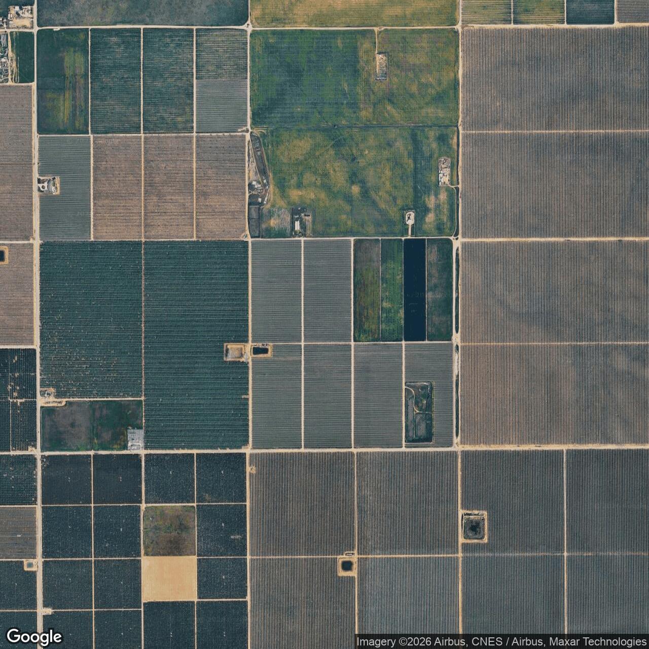
By the 1994 aerial imagery reviewed by airfield historians, the Jasmin field location had been taken over by agriculture and no recognizable airfield trace remained. An annotated 2006 aerial outlines the former wartime square within cultivated parcels, but the historical geometry is visible chiefly because the researcher superimposed it. The modern agricultural grid has overwritten the landing mat. Roads and field boundaries now make more sense as farming infrastructure than as surviving elements of the Army Air Forces installation.
No evidence located shows a post-World War II military unit assigned to Dunlap or Jasmin Landing Field, and no Korean War, Vietnam War, Cold War operational, homeland-defense, or later contingency mission is documented for the property. The possible postwar aviation use was civilian.
Current Status
The former Dunlap auxiliary field is now an agricultural landscape in Kern County. Historical imagery and maps place the square landing mat northwest of Hart Avenue and Quality Road, while later aerial interpretation shows cultivated parcels occupying the footprint. No active airport matching the wartime field was found at the site in current mapping, and the 1991 Jasmin Landing Field depiction had disappeared from later aerial evidence. The former military surface is not readily recognizable on the ground from ordinary modern mapping.
Chronology
- 1941 Later secondary property and aviation summaries place the opening of Dunlap Auxiliary Field No. 4 in this year; an exact acquisition or first-operation day has not been independently verified.
- 1941 Minter Field opens as an Army flight-training center in Kern County and develops a network of auxiliary landing fields.
- 1942-04-08 Vultee BT-13 serial 41-9665 of Minter Field's 327th School Squadron crashes at Dunlap Auxiliary Field; later accident chronologies identify instructor Lt. William B. Raabe and aviation cadet Irel W. Crowe as killed.
- 1943-07-22 An Army Air Forces aerial later reproduced with the 1945 Airfield Directory shows Minter Field Auxiliary #4 as a developed square landing mat.
- 1944-02 A surviving Los Angeles Sectional copy is annotated with Dunlap and the other Minter auxiliary fields even though the field was not formally plotted on the sectional.
- 1944 A Minter local flying-area map depicts Dunlap at the northeastern side of the school's auxiliary-field network.
- 1944 A U.S. Army aerial photograph records the square Dunlap landing mat in wartime configuration.
- 1945-01 The Army Air Forces Airfield Directory describes Dunlap as a 200-acre square field with a 2,640-foot square road-mix landing mat.
- 1945-01 The same directory reports no hangars and lists the privately owned, Army Air Forces-operated field as inactive.
- 1945-02-01 Army Air Forces Training Command station documentation identifies Minter Field's 3008th AAF Base Unit as a Pilot School, Basic organization.
- 1945-07-23 AT-6C serial 42-3911 of the 3008th AAF Base Unit, piloted by Kay L. Nelson, is indexed in an accident at Dunlap Auxiliary Field, eight miles east of Delano.
- 1946 Later secondary property histories place final military closure or disposal on 1946-10-08; the original disposal instrument has not been independently located.
- 1949 Dunlap is no longer depicted on the cited Los Angeles Sectional Chart.
- 1953 The former military field is not depicted as an airfield on the cited USGS topographic map.
- 1991 A USGS topographic map depicts Jasmin Landing Field at the same general location, suggesting postwar civilian aviation reuse without proving continuous operation.
- 1994 Aerial imagery reviewed by airfield historians shows the former field under agriculture with no recognizable airfield trace.
- 2006 An annotated aerial outlines the former Dunlap square, but no surviving runway or landing-mat surface is readily visible.
- 2010-09-30 Department of Defense restoration reporting places Dunlap among properties with response complete at all listed sites.
- 2015-09-30 The U.S. Army Corps of Engineers California FUDS inventory lists DUNLOP AUXILIARY FIELD, J09CA0249, with one MMRP site.
- Before FY2021 Department of Defense reporting lists DUNLOP AUXILIARY FIELD / CA99799F537500 among FUDS properties achieving Final Response Complete before fiscal year 2021.
- 2026 The former Dunlap and Jasmin field area is an agricultural landscape with no active military or aviation installation identified at the wartime footprint.
Information sources (9)
- WEBAbandoned & Little-Known Airfields, Bakersfield Area, Dunlap Field / Jasmin Landing Field
Source for representative coordinates, wartime aerials and maps, 1945 Army Air Forces directory data, accident references, postwar mapping, and modern landscape interpretation.
- WEBMinter Field Airport District, Our History
Current parent-airport source for Minter Field's 1941 opening, wartime training role, scale, and postwar transition.
- WEBAviation Archaeological Investigation and Research, April 1942 USAAF Accident Reports
Source for BT-13 serial 41-9665, the 327th School Squadron, Minter Field, and the Dunlap Auxiliary Field accident entry.
- WEBAviation Archaeological Investigation and Research, July 1945 USAAF Accident Reports
Source for AT-6C serial 42-3911, the 3008th AAF Base Unit, Kay L. Nelson, and the Dunlap Auxiliary Field accident entry.
- PDFHeadquarters Army Air Forces Training Command, Station List, 1945-02-01
Source for the late-war identification of the 3008th AAF Base Unit at Minter Field as a Pilot School, Basic organization.
- PDFU.S. Army Corps of Engineers, Formerly Used Defense Sites Per State, California
Official source identifying DUNLOP AUXILIARY FIELD as FUDS property J09CA0249 with one MMRP site.
- PDFDepartment of Defense, Status of Active Installations, BRAC Locations, and FUDS Properties Achieving Final Response Complete Before FY21
Official source for Dunlap's FUDS identifier CA99799F537500 and Final Response Complete status before fiscal year 2021.
- PDFDepartment of Defense, IRP/MMRP Status of Installations with Response Completed at All Sites as of 2010-09-30
Official historical restoration-program source showing response-complete status for Dunlap Auxiliary Field.
- WEBAerofiles, Air Force Flying Fields
Independent secondary aviation compilation listing Dunlap Auxiliary A-4 at Richgrove as a Minter satellite operating in the 1941-1946 period.