
Sequoia Field / Camp Sequoia, Visalia California
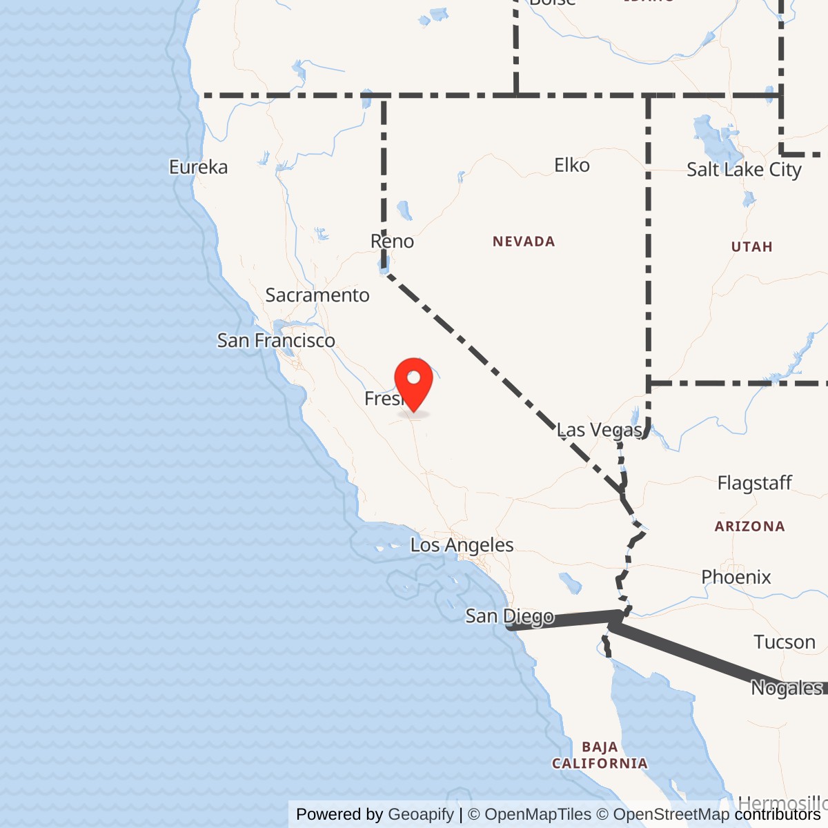
Longitude: -119.3187222
Official Base Website: Sequoia Field Airport (D86)
Current Role: County-owned public-use Sequoia Field Airport (D86); surrounding/former support area reused for county, correctional, agricultural, and general aviation purposes.
Sequoia Field was a World War II Army Air Forces contract flying school and later a short-lived radar-training subpost north of Visalia in California's southern San Joaquin Valley. It was not a large combat air base, depot, or bomber-training station. Its importance came from a more compressed but very real wartime mission: turning civilian flying-school capacity into primary military pilot training, then briefly reusing the same campus as Camp Sequoia for fighter-control and radar training after the flying-school mission shut down.
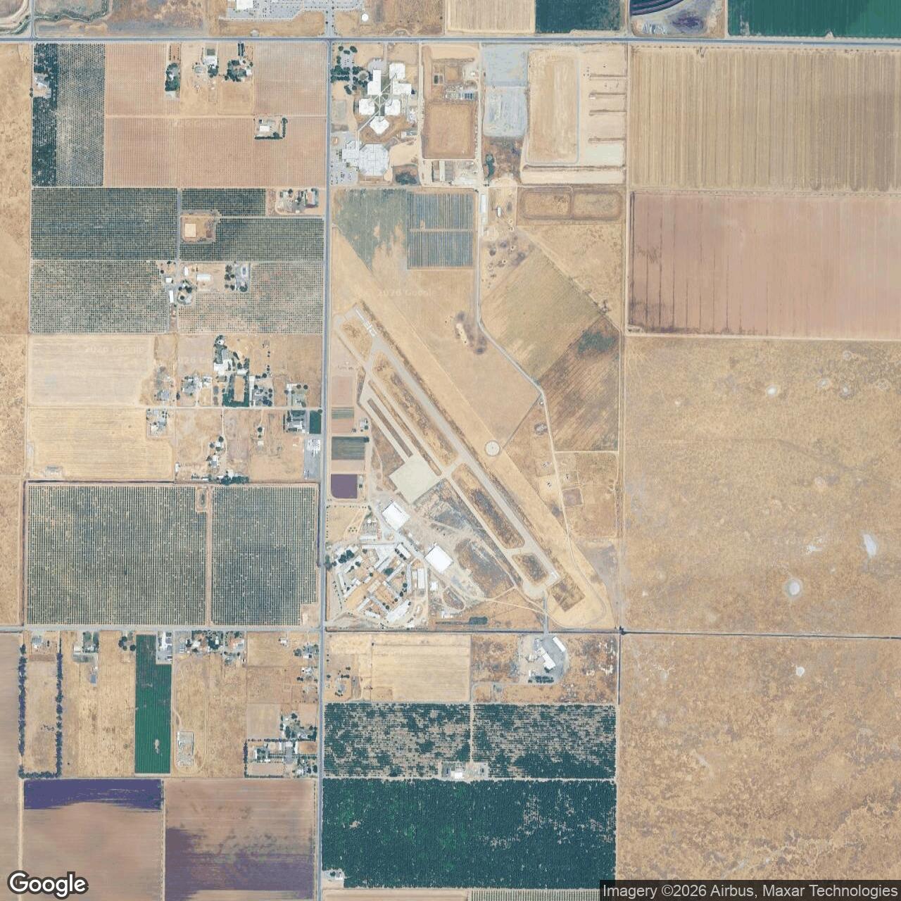
The present airport sits about eight miles north of Visalia in Tulare County. AirNav lists Sequoia Field Airport as FAA identifier D86, elevation 313 feet, public ownership by the County of Tulare, and a single asphalt runway, 13/31, measuring 3,012 by 60 feet. Tulare County describes the field as a historic airfield that first served as a World War II pilot-training site and now functions as a general aviation airport. Those current facts are important because they show that the military landscape did not disappear entirely. The old training field survived as a small public airport, while portions of the broader wartime support area passed into county, correctional, civic, agricultural, and general aviation reuse.
Sequoia Field's Army identity should be understood in two phases. From 1941 to 1944 it operated as a primary flying-training field under the Army Air Forces contract-school system, with the Visalia-Dinuba School of Aeronautics providing instruction under military supervision. In 1945, after the pilot-training mission had ended, the site was reused as Camp Sequoia by the Western Signal Aviation Training Center for radar and fighter-control training. The name therefore covers both a flying field and a short-lived technical-training post, and both phases belong in the installation history.
Mission Evolution
Sequoia Field grew out of the prewar and wartime expansion of Army pilot training. In the late 1930s and early 1940s, the Army Air Corps and then Army Air Forces faced a training problem that permanent military schools alone could not solve. The service needed tens of thousands of pilots, but the existing Randolph Field-centered system and other regular training stations could not absorb the required numbers quickly enough. The solution was the contract flying school: civilian operators supplied airfields, instructors, maintenance, and many day-to-day training functions, while the Army provided standards, cadets, military supervision, uniforms, discipline, and a pipeline that moved graduates onward to basic and advanced military schools.
Sequoia Field was part of that system. Its contract operator was the Visalia-Dinuba School of Aeronautics, and the Army unit most closely associated with the field was the 8th Flying Training Detachment. Secondary summaries based on Air Force Historical Research Agency and Air Training Command materials identify the field as assigned to the Western Flying Training Command and 35th Flying Training Wing, with military activation on 4 October 1941. AirNav's current airport record gives a civil-airport activation date of April 1942, but the military-training history clearly places Army use beginning in late 1941, before the United States had fully entered the war.
The flying-school mission was primary pilot training. This was the first practical flying phase for cadets who had already been selected and processed by the Army system. Primary training existed to determine whether a cadet could actually learn to fly, handle an aircraft safely, absorb ground-school subjects, and continue into the more demanding basic and advanced phases. At Sequoia Field, the training aircraft most often associated with the school were Ryan PT-22 trainers, with Stearman PT-17s and other training aircraft also appearing in historical summaries and photographs. The work was repetitive, disciplined, and personal: takeoffs, landings, stalls, turns, emergency procedures, formation basics, navigation fundamentals, classroom instruction, inspections, military routine, and the constant judgment of whether a cadet could move forward.
The pilot-training phase ended as the Army Air Forces reduced and reorganized its training pipeline in 1944. Historical summaries identify 8 September 1944 as the inactivation date for Sequoia Field's flying-training mission, with the final cadet class graduating on 30 September 1944. On 5 May 1945 the facility was declared surplus to the flying-training requirement and turned over to the Army Corps of Engineers on inactive status. That was not the absolute end of Army use, however. Later in 1945, the same physical plant received a second mission under the name Camp Sequoia.
The radar-training phase began in July 1945. Camp Sequoia became a subpost of the Western Signal Aviation Training Center at Camp Pinedale, replacing nearby Camp Visalia for a specialized technical mission. The garrison reportedly moved from Camp Visalia and included Squadron F, 462nd Army Air Forces Base Unit, under Major Hugh J. Roberts. The post trained fighter-control squadron personnel in the use of the AN/CPS-1 radar and provided training for maintenance and operating crews connected to controller assignments at Hammer Field. The Electronics School, formerly at Camp Wawona, also moved to Camp Sequoia to provide the theoretical and laboratory background for radar operations. By 1 December 1945 the site no longer appeared in station lists or airfield directories, and the property was eventually returned to civil control through the War Assets Administration in February 1947.
Operational Role
During its flying-school years, Sequoia Field was a filter and feeder in the Army Air Forces training pipeline. Its job was not to produce fully combat-ready fighter or bomber pilots by itself. It produced cadets who could move to the next stage. The primary-school system taught the fundamentals: aircraft handling, confidence in the air, basic airmanship, military habits, and a disciplined approach to flight. Cadets who succeeded at Sequoia could be sent onward to basic training and then to advanced single-engine or twin-engine schools. Cadets who failed or washed out were removed from the pilot pipeline before they consumed scarce advanced training capacity.
That filtering role was essential to the wider war effort. Every fighter pilot, bomber pilot, transport pilot, instructor pilot, and many specialized aviators had to pass through a sequence of training gates. Primary fields such as Sequoia Field carried the first major flying gate. They were not glamorous compared with combat air bases, but they were where the Army turned civilian enthusiasm, cadet potential, and industrial-scale training requirements into usable military aviation manpower.
The contract-school arrangement gave Sequoia Field a hybrid character. The Visalia-Dinuba School of Aeronautics operated the school under contract, but the students were Army cadets and the field functioned as an Army Air Forces training installation. Civilian instructors and mechanics worked inside a military training framework. Cadets marched, drilled, studied, flew, and lived under Army discipline even though the instruction was provided through a civilian operator. That blend of civilian and military labor was one of the defining features of the World War II pilot-training system.
The field's 1945 radar mission was different but equally tied to wartime air defense and command-and-control needs. Fighter-control organizations needed personnel who could operate, maintain, and interpret radar equipment. The AN/CPS-1 was an early microwave search radar, and training on that system reflected the Army Air Forces' wartime shift from visual warning networks toward electronic control of airspace. Camp Sequoia's radar role placed the former flying school inside the technical side of air operations: warning, tracking, interception, controller training, electronics instruction, and maintenance.
The radar-training phase was short-lived because the war was ending and the Army Air Forces were rapidly demobilizing. Still, it shows why the Sequoia property mattered beyond its runway. The campus had barracks, classrooms, open ground, utility systems, and enough existing military infrastructure to be reused quickly for a different mission. The Army did not build a new radar school from scratch; it converted a recently closed flying school into a temporary electronics and fighter-control training site.
Facilities and Physical Layout
Sequoia Field began as a relatively small airfield, with historical summaries describing the original runway as a 2,300-foot turf strip. The wartime contract-school campus expanded that basic flying field into a training post with administrative buildings, quarters, mess facilities, recreation areas, hangars, aircraft parking, and the support spaces needed to house and supervise cadets and enlisted personnel. It was not designed as a permanent monumental post. It was a practical training campus built for speed, repetition, and throughput.
The main formation and administrative area appears prominently in surviving wartime photographs. Those images show cadets in formation, administrative buildings, station-area structures, parking ramps, Ryan PT-22 trainers, and a compact campus organized around daily training routine. Historical summaries describe administrative buildings and officer and enlisted quarters arranged around a central area. A consolidated mess hall reportedly could accommodate about 1,000 enlisted men and a limited number of officers. Nearby were a post exchange, service club, and dance floor. Recreational facilities included a swimming pool, tennis and handball courts, and a softball diamond.
Those support features mattered operationally. Primary pilot training was physically and mentally demanding, but it also required a stable daily environment. Cadets needed barracks, classrooms, briefing rooms, medical support, mess facilities, recreation, and a disciplined campus where military identity could be built around the flying schedule. A small field could not simply be a runway and a hangar. It had to function as a military school.
Sequoia Field also had at least one documented auxiliary relationship. Secondary airfield listings associate the site with Three Rivers Auxiliary Field, described as an all-way open field with no visible remains. Auxiliary fields were common for primary and basic training because repetitive traffic patterns, emergency-landing practice, and student operations required more space than one main runway could safely provide. Even where the auxiliary record is thin, the existence of such fields shows how contract flying schools extended across a local training landscape rather than operating only from the main airport.
In the postwar and current landscape, Sequoia Field is much smaller and simpler than its wartime function. AirNav and SkyVector identify the current public airport as about 150 acres with one asphalt runway. Tulare County owns and manages the field, and county material emphasizes runway, taxiway, and apron improvements for continuing general aviation use. Portions of the former military support landscape are no longer airport property in the strict sense; some have been converted to county facilities, correctional use, agricultural land, and other local reuse. Surviving World War II-era buildings and hangars have been reported at the field, making Sequoia one of the more physically legible former contract flying schools in California.
Units, Organizations, and Systems
The Visalia-Dinuba School of Aeronautics was the contract operator that made Sequoia Field possible. The school provided the civilian instructional and aviation infrastructure through which the Army Air Forces expanded primary pilot training before and during World War II. Its role was not independent of the Army; it was part of a government-contract system in which civilian schools became military training nodes.
The 8th Flying Training Detachment was the principal Army training-detachment identity associated with Sequoia Field. The detachment placed the civilian school inside Army supervision and connected it to the Western Flying Training Command. Historical summaries identify Major L. D. Dreisbach as associated with command of the 8th Flying Training Detachment / Army Primary Flying School at Sequoia Field.
The Western Flying Training Command and 35th Flying Training Wing formed the larger command structure for the primary-training era. Sequoia was one of a cluster of western contract fields that included other California and southwestern schools. Cadets did not remain at Sequoia for their entire flight education. They passed through primary training and then entered the broader Army Air Forces Training Command system.
The 1945 radar phase introduced a different organizational structure. Camp Sequoia became a subpost of the Western Signal Aviation Training Center at Camp Pinedale. The garrison reportedly included Squadron F, 462nd Army Air Forces Base Unit. The Electronics School that moved from Camp Wawona supplied theoretical training and laboratory preparation for radar operations. These organizations connected Camp Sequoia to fighter-control and radar training rather than pilot instruction.
Hammer Field also appears in the radar-training story because Camp Sequoia personnel trained maintenance and operating crews assigned to controllers there. That connection shows that the 1945 mission was not local in a narrow sense. Camp Sequoia supported a regional air-defense and control-training network centered in the San Joaquin Valley and tied to larger Army Air Forces command-and-control requirements.
Current Status
Sequoia Field is no longer an Army installation. The present Sequoia Field Airport is a County of Tulare public-use general aviation airport, FAA identifier D86, located north of Visalia. AirNav lists the airport as open to the public, publicly owned by the County of Tulare, with runway 13/31 measuring 3,012 by 60 feet. Tulare County describes it as a historic airfield and states that the county continues to invest in the runway, taxiway, and apron facilities to keep the airport safe and functional.
The current airport preserves the aviation identity of the site, but not the full wartime installation footprint. Much of the former military support area has been altered, reused, or separated from the airport's modern boundaries. Public summaries and historic-image repositories identify surviving World War II-era hangars and other structures at or near the field, while other portions of the former cantonment landscape have gone into county, correctional, agricultural, or local reuse.
Chronology
- 1941-10-04 Sequoia Field's Army Air Forces contract flying-school era began according to secondary summaries based on Air Force historical records; the field was associated with the Western Flying Training Command, 35th Flying Training Wing, and 8th Flying Training Detachment.
- 1941-12-07 The Japanese attack on Pearl Harbor transformed the prewar pilot-training expansion into an urgent wartime production system.
- 1942-04 AirNav's current FAA-derived airport record gives April 1942 as the airport activation date, reflecting the field's early wartime aviation status.
- 1942-1944 The Visalia-Dinuba School of Aeronautics operated Sequoia Field as an Army Air Forces contract primary flying school.
- 1943 Surviving photographs show Sequoia Field cadets, administrative buildings, formation areas, and flight-line activity during the peak training period.
- 1944 Class books and wartime photographs document continuing Sequoia Field training activity.
- 1944-09-08 The flying-training mission at Sequoia Field was inactivated as the Army Air Forces reduced and reorganized its training program.
- 1944-09-30 The final cadet class at Sequoia Field graduated.
- 1945-05-05 The facility was declared surplus to flying-training needs and turned over to the Army Corps of Engineers on inactive status.
- 1945-07-14 The Electronics School formerly located at Camp Wawona was assigned to Camp Sequoia for radar-training support, according to secondary historical summaries.
- 1945-07-23 Camp Sequoia was taken over as a subpost of the Western Signal Aviation Training Center at Camp Pinedale for fighter-control and AN/CPS-1 radar training.
- 1945-12-01 Camp Sequoia no longer appeared in later station lists or airfield directories, indicating that the military training mission had effectively ended by this point.
- 1947-02 The property was returned to civil control through the War Assets Administration.
- Present Sequoia Field remains a County of Tulare public-use general aviation airport north of Visalia, with the county emphasizing its World War II training-site history and continuing airport improvements.
Information sources (4)
- WEBTulare County Resource Management Agency
Sequoia Field Airport
- WEBAirNav
D86 Sequoia Field Airport
- WEBSkyVector
D86 Sequoia Field Airport
- WEBRebecca Hancock Cameron, Training to Fly: Military Flight Training, 1907-1945
Air Force History and Museums Program, 1999, catalog/public-access records