Naval Auxiliary Air Facility Watsonville (LTA), California
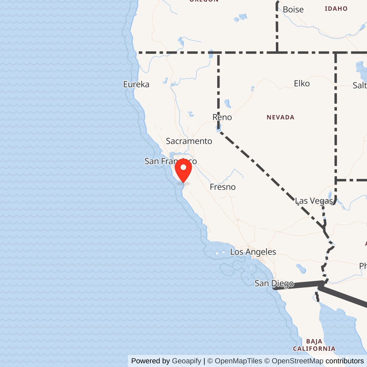
Longitude: -121.773
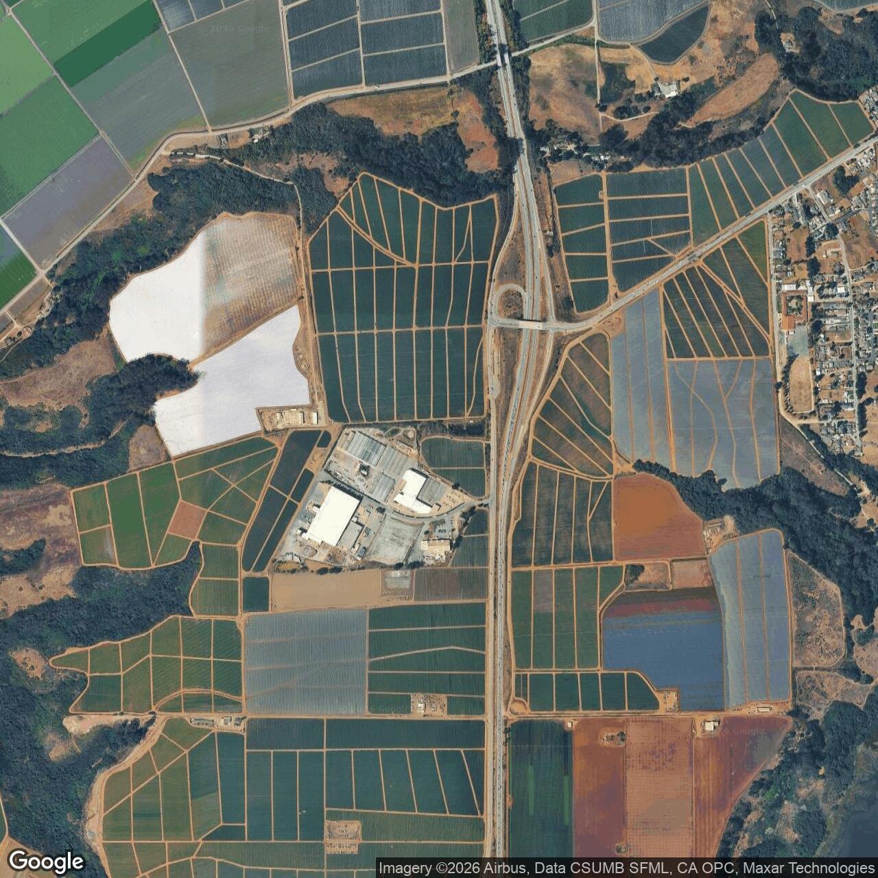
Current Role: Former 85-acre community airport adapted as a separate NAS Moffett Field airship auxiliary for rotating ZP-32 K-ship detachments, twelve-hour antisubmarine patrols, convoy escort, and air-sea rescue. The Navy returned approximately 87 acres after the war; the property became a cattle feed lot and later an agricultural and agricultural-industrial landscape near Salinas Road and Highway 1. The possible last hangar remnant was removed between 2019 and 2024.
Naval Auxiliary Air Facility Watsonville was the smaller and less visible of two separate World War II naval air installations serving the Watsonville area. It occupied the original community airport south of town near Salinas Road and Highway 1 and existed to support lighter-than-air patrol operations. The larger Naval Auxiliary Air Station Watsonville, built northwest of town near Freedom and preserved today as Watsonville Municipal Airport, handled carrier aircraft and heavier-than-air training. Contemporary Navy activity lists recorded both installations separately, confirming that they were not two missions conducted on one property.
The distinction matters because the two fields had different parent stations, physical requirements, aircraft, and operational purposes. The airship facility was an auxiliary of Naval Air Station Moffett Field and supported the West Coast lighter-than-air patrol system. The heavier-than-air station was an auxiliary of Naval Air Station Alameda and trained carrier air groups. Although both used Watsonville in their official names and some wartime maps labeled both simply as "Watsonville (Navy)," the airship field lay across the county line in Monterey County while the later station occupied a different tract in Santa Cruz County.
The installation's documented names include Naval Auxiliary Air Facility Watsonville, Naval Auxiliary Air Facility (LTA) Watsonville, Watsonville NAAF (LTA), Watsonville Naval Auxiliary Airfield, Watsonville Airship Base, and the original Watsonville Airport. "LTA" meant lighter than air and distinguished the facility from the nearby heavier-than-air station. The Navy's statewide activity inventory used the NAAF (LTA) designation, while local histories often used "Naval Auxiliary Airfield" or described the property more plainly as the blimp base.
The airship field was an operational outpost rather than a full maintenance and training center. Naval Air Station Moffett Field remained the squadron base, major repair center, training establishment, and command hub. Watsonville provided a forward coastal location where one or two airships, their flight crews, and enough ground personnel could remain for patrol duty without returning to Moffett after every sortie. That limited but practical role gave the small former municipal airport significance within the wider defense of the California coast.
Prewar Airport and Navy Acquisition
Watsonville's first airport was a community enterprise. Watsonville Airport Incorporated formed in 1930, issued 5,000 shares purchased largely by local residents, and acquired an 85-acre tract near Salinas Road and Highway 1 because the land was available at a manageable cost. The site lay about four miles south-southwest of Watsonville and just inside Monterey County. Governor James Rolph formally opened the airport on 1931-05-09 by flying low across the field and cutting a ribbon stretched above a runway.The prewar field was modest but useful. A 1938 airport directory described three dirt runways, the longest about 2,300 feet, and a hangar marked "WATSONVILLE" on its roof. Historical aerial imagery shows a compact rural airport surrounded by agricultural land, with several small buildings concentrated along the eastern side. Its location near Monterey Bay and the coastal transportation corridor later made the field suitable for naval patrol use even though it had been designed for light civilian aircraft rather than military airships.
The Navy leased the original airport in 1942 as it expanded lighter-than-air antisubmarine coverage along the Pacific coast. This acquisition did not convert the property into the heavier-than-air station later established northwest of town. Instead, the Navy adapted the existing airport for blimp operations while the separate carrier-aircraft field was being developed elsewhere. The reuse was economical because the Navy obtained an existing open aviation property, road access, a hangar, and cleared ground without building an entirely new outlying station from raw farmland.
A secondary naval-air-station history gives 1943-08-06 as the facility's formal opening date. That date follows the 1942 lease and appears to represent the opening of the organized NAAF rather than the first possible Navy use of the property. No public primary commissioning order with a more precise alternative date was located.
Mission Evolution
The facility's mission was coastal patrol support from beginning to end. Airship Patrol Squadron 32, commonly written ZP-32, operated from Moffett Field and maintained a rotating detachment at Watsonville. The field normally accommodated one or two K-class airships. Those aircraft extended surveillance over Monterey Bay and the adjoining Pacific approaches while remaining tied administratively, technically, and logistically to Moffett's much larger lighter-than-air establishment.Watsonville's patrol work belonged to the emergency coastal-defense expansion that followed the United States' entry into World War II. German and Japanese submarine threats, attacks on shipping, and uncertainty about enemy operations placed a premium on persistent surveillance near coastal sea lanes. Airships could remain aloft for long periods, move slowly enough to inspect vessels and surface contacts, and escort merchant traffic without consuming the runway, fuel, and maintenance resources required by heavier patrol aircraft.
The City of Watsonville's history describes typical flights as twelve-hour submarine patrols, convoy escorts, and air-sea rescue missions. Crews and airships generally remained at Watsonville for about a month before rotating back to Moffett or being replaced by another detachment. This pattern shows that the NAAF did not host an independent patrol squadron. It functioned as a forward operating location where ZP-32 could distribute aircraft and crews along the coast while retaining squadron-level administration and heavy support at the parent station.
The mission did not broaden into carrier-aircraft training after the nearby NAAS opened. The Navy generally avoided mixing airship and conventional-aircraft operations when separate fields were available, and the Watsonville arrangement followed that principle. The original airport remained the lighter-than-air facility, while fighters, torpedo bombers, dive bombers, carrier air groups, and combat-aircrew refresher organizations used the newer field northwest of town. This division reduced traffic conflicts and allowed each property to be configured for its own aircraft.
By 1945 the strategic need for the small outpost had diminished. The immediate submarine threat to the Pacific coast had receded, the war was approaching its conclusion, and the Navy was preparing to contract its enormous wartime shore establishment. ZP-32 was decommissioned in November 1945, and local records state that the airship field closed in late 1945. The closure was therefore part of the broader wartime drawdown of the Moffett lighter-than-air patrol network rather than a transfer of the airship mission to the heavier-than-air Watsonville station.
World War II Operations
Daily operations centered on launching, recovering, mooring, servicing, guarding, and supporting the rotating K-ships. Airship flight required extensive ground handling because a blimp's large envelope responded strongly to wind even at low speed. Ground crews had to control the aircraft during movement to and from the mooring mast, manage lines, fuel and inspect the control car, handle depth charges and machine-gun equipment when carried, and keep the mooring area clear. The broad paved or oiled mat and separated circles gave crews room to turn the ships with changing wind direction.The K-class airship was well suited to the mission. NASA's Moffett history describes K-ships as approximately 250 feet long, with crews of nine or ten, endurance approaching forty hours, and a range of about 2,000 miles. They could cruise at roughly sixty miles per hour and carry depth charges and .50-caliber machine guns. Watsonville patrols were normally much shorter than the aircraft's maximum endurance, but the K-ship's operating characteristics allowed a detachment to watch the Monterey Bay approaches for many hours with relatively little fuel consumption.
Patrol activity combined observation with deterrence. A blimp could investigate surface contacts, identify ships, report suspicious activity, and remain over a convoy or search area far longer than most conventional aircraft. Its presence also signaled that coastal waters were being watched. The field's location south of Watsonville shortened the distance between Moffett's airship force and patrol sectors around Monterey Bay, reducing transit time and preserving more of each sortie for station work.
Convoy escort connected the NAAF to merchant and naval shipping moving along the California coast. Airship crews could accompany vessels through assigned sectors, watch for submarine periscopes or wakes, and maintain visual contact with the ships below. The public record does not identify a specific convoy protected from Watsonville, and broad national statistics for Navy blimp escort operations cannot be assigned directly to this field. The documented mission nevertheless places Watsonville inside the wartime system that protected coastal shipping and supported the movement of military cargo.
Air-sea rescue was another practical duty. Airships could search slowly, remain over survivors, direct surface craft, and mark the location of downed aviators or distressed mariners. City history states that Watsonville crews flew rescue missions on many occasions, but the available public sources do not name a specific rescue, rescued person, or incident attributable solely to the field. The history therefore records the mission without inventing an event narrative that the surviving sources do not support.
No verified Watsonville-LTA combat engagement, submarine sighting, depth-charge attack, aircraft loss, fatal accident, major spill, protest, sabotage event, or domestic-response episode was located. A secondary history states that nothing unusual or notable was known to have occurred at the facility.
The installation's operational achievement was sustained routine rather than a dramatic single event. One or two airships, replaced at intervals, repeatedly flew long patrols over the same coastal waters. That persistence was the essential military effect. The field enabled ZP-32 to distribute its force farther south than Moffett, keep aircraft closer to Monterey Bay, and maintain a visible patrol presence during a period when the Navy could not assume that the Pacific coast was safe.
Units and Organizations
Airship Patrol Squadron 32 was the principal operational organization associated with Watsonville. The Navy commissioned ZP-32 at Moffett Field in 1942, initially operating transferred Army airships and later a growing force of K-class ships. Official lighter-than-air histories place Watsonville among the squadron's auxiliary operating locations. Public sources consistently describe the Watsonville detachment as one or two K-ships rather than a permanent squadron headquarters or a separate locally assigned patrol squadron.Fleet Airship Wing Three provided the larger West Coast command framework. Moffett became the headquarters for the wing and the center for lighter-than-air training and deployment, while other bases and auxiliaries extended coverage along the coast. Watsonville's personnel therefore participated in a layered organization in which wing-level direction and squadron administration remained at Moffett while the NAAF carried out localized patrol operations in its assigned sector.
The station also required its own command and support structure. A secondary station history calls the NAAF an officially separate command and gives a peak complement of nine officers and ninety-six enlisted personnel, with accommodations planned for fifteen officers and 101 enlisted men. Those figures indicate a substantial ground organization for such a small property, including airship handling crews, mechanics, fuel personnel, communications specialists, weather observers, medical and security support, cooks, clerks, and station administration.
The available sources do not identify every local department or the names and ranks of commanding officers. They do preserve several Watsonville-area men associated with the field, including Don Wilson, George Davis, Vern Dietz, and Ron Hill, but they do not establish that those four represented the complete local detachment. The absence of a full roster is important because it limits how precisely the station's manpower can be reconstructed from public material.
Facilities and Physical Layout
The Navy transformed the original three-runway civil airport into an open airship operating field. Historical descriptions indicate that the runway area was paved or treated to form a broad irregular mat, reducing the importance of narrow runway alignments and giving blimps room to maneuver into the wind. A 1943 aerial photograph shows a roughly triangular dark-surfaced field with circular mooring positions distributed across it and service buildings along the eastern edge.Sources disagree slightly about the number of mooring circles and the exact dimensions of the landing mat. A 1943 aerial image shows three circles. A 1944 Army-Navy directory reportedly listed two circles and a 2,300-foot hard-surface runway. A 1945 airfield directory described an 81-acre irregular property with a 1,650-foot east-west oiled mat and three circles with mobile masts. These differences likely reflect changing configuration, directory conventions, or the distinction between visible circles and active mooring positions.
A secondary installation history states that the Navy used the prewar 60-by-60-foot hangar. The 1945 directory reportedly described a privately owned 80-by-70-foot hangar operated by the Navy. The difference may reflect measurement error, remodeling, or reference to different buildings. Neither description supports the presence of a giant enclosed airship hangar at Watsonville. Major sheltered maintenance and assembly remained at Moffett's purpose-built lighter-than-air hangars, while Watsonville relied on outdoor mooring and smaller conventional structures.
Barracks and support facilities were added for the detachment. One reconstruction reports accommodations for 116 personnel, while the secondary station history gives capacity for fifteen officers and 101 enlisted men. The field also would have required fuel handling, communications, weather information, fire protection, security, food service, utilities, and vehicle access. Publicly available sources do not provide a complete building inventory, utility plan, ammunition layout, or station map detailed enough to assign individual functions to surviving foundations.
The acreage also varies by date and source. Watsonville Airport Incorporated initially acquired 85 acres. The 1945 directory reportedly measured 81 acres, while the Navy returned 87 acres after the war. Those figures are close enough to describe the same compact property but should not be treated as interchangeable surveyed totals.
Role in the Wider Military Network
Watsonville NAAF was one outlying point in a distributed West Coast lighter-than-air system. Moffett Field assembled and repaired airships, trained crews, housed ZP-32, and directed operations. Auxiliary locations such as Watsonville, Eureka, and other coastal fields allowed the squadron to disperse aircraft and cover a longer shoreline without concentrating every launch at the parent station. Watsonville extended the network southward toward Monterey Bay and the central California coast.The field also interacted with the maritime traffic network it protected. Convoys and individual vessels moving between California ports relied on overlapping naval patrol, harbor-defense, radio, surface-escort, and air-search systems. The blimps did not replace patrol aircraft or ships. They added endurance, slow-speed observation, and the ability to remain with a convoy or search area. Watsonville's value lay in placing that capability close to a sector that otherwise required additional transit from Moffett.
The two Watsonville naval fields formed a local military cluster without becoming a single installation. The LTA facility supported Moffett's patrol mission, while the NAAS supported Alameda's carrier-aircraft training mission. Their proximity may have allowed practical exchanges of supplies or services, but their official separation preserved different command chains and reduced incompatible air traffic. The arrangement shows how the Navy used two preexisting airport-development efforts to solve separate operational problems in the same community.
Fort Ord and other Monterey Bay military activities added to the regional wartime environment, but no evidence shows that they controlled the NAAF. The original airport had possible earlier associations with local Army maneuvers, and the surrounding region contained Army training, Navy radio, aviation, shipping, and coastal-defense activities. Watsonville's airship field contributed a specialized surveillance function within that larger concentration rather than serving as a general regional headquarters.
Closure, Disposal, and Current Status
Local and secondary histories agree that Navy airship operations ended in late 1945. The exact disestablishment day has not been found in a public commissioning or closure order. ZP-32's November 1945 decommissioning provides the broader organizational context, while the City of Watsonville specifically links the field's closure to the end of the airship requirement.The Navy returned approximately 87 acres to Watsonville Airport Incorporated after the war. A June 1946 civil air guide reportedly redesignated the property as Watsonville Airport No. 2 effective 1946-05-27, but the larger former Navy air station northwest of town became the community's permanent municipal airport. The original field therefore lost both its military mission and its civil-airport role during the postwar transition.
In 1947 the airport corporation sold the old property to Edwin and Flora Peterson, and it was used as a cattle feed lot. Agricultural and agricultural-industrial development subsequently covered much of the former landing mat. A 1948 aerial photograph still showed the three mooring circles, but later maps and imagery recorded their disappearance as the site was subdivided, built over, and returned to intensive civilian use.
Historical-airfield research identified a building that may have incorporated part of a former hangar. Photographs show that the structure deteriorated and was progressively removed between 2011 and 2019. A 2024 aerial image showed that the last portion had disappeared. Because the identification was based on location and visual comparison rather than a formal historic-building determination, it is safest to describe the structure as a possible remnant rather than a conclusively verified Navy building.
A 1993 aerial image annotated from Army Corps research outlines the former federal property, indicating that the site received federal historical review. No current publicly accessible Navy BRAC page, active environmental-restoration case, Superfund listing, or installation-specific cleanup program was located. That absence does not prove that no environmental work ever occurred. It means that no supported current cleanup status should be assigned without a direct agency record.
Chronology
- 1930 Watsonville Airport Incorporated formed to develop the community's first airport.
- 1931-05-09 Governor James Rolph formally opened Watsonville's original airport near Salinas Road and Highway 1.
- 1933-05 The original Watsonville Airport appeared on a San Francisco sectional chart as a commercial or municipal airport.
- 1938 An airfield directory described three dirt runways, a longest runway of about 2,300 feet, and a hangar marked "WATSONVILLE."
- 1940 A U.S. Geological Survey map depicted the three-runway airport and buildings along the eastern side.
- 1941-12 A sectional chart identified the original field as Intermediate Field Site 28.
- 1942 The Navy leased the original Watsonville Airport for use as an auxiliary airship facility supporting Naval Air Station Moffett Field.
- 1942-01-31 Airship Patrol Squadron 32 was established at Moffett Field, creating the parent operational organization for the Watsonville detachment.
- 1942-02 Moffett-based airships began monitoring the Pacific coast.
- 1943-08-06 A secondary naval-air-station history records the formal opening of Naval Auxiliary Air Facility Watsonville.
- 1943 Navy improvements produced a broad paved or oiled operating mat and multiple blimp mooring circles.
- 1943 A Navy aerial photograph recorded two airships moored at Watsonville and showed the field's wartime lighter-than-air configuration.
- 1943-10-23 The separate heavier-than-air Naval Auxiliary Air Station Watsonville was commissioned northwest of town.
- 1944 An Army-Navy directory listed NAAF (LTA) Watsonville with a 2,300-foot hard-surface runway and two mooring circles.
- 1944 Watsonville continued to host rotating one- or two-airship detachments of ZP-32 for patrol, escort, and rescue duty.
- 1945-03 A sectional chart depicted both Watsonville Navy airfields, illustrating the separate LTA and heavier-than-air properties.
- 1945 An airfield directory described the LTA field as an irregular 81-acre property with an oiled mat, mobile mooring masts, and a privately owned hangar under Navy operation.
- 1945-08-14 News of Japan's surrender marked the end of the wartime emergency that had sustained the airship patrol network.
- 1945-late Naval airship operations at the original Watsonville Airport ended and the NAAF closed.
- 1945-11 ZP-32 was decommissioned at Moffett Field.
- 1946-05-27 A civil air guide reportedly redesignated the former NAAF as Watsonville Airport No. 2.
- 1947-05 Watsonville Airport Incorporated sold the former field to Edwin and Flora Peterson for cattle-feed-lot use.
- 1948 Aerial imagery still showed the former airship mooring circles after military operations had ended.
- 1954 A U.S. Geological Survey map no longer depicted the former runways, although buildings and a beacon remained.
- 1993 An Army Corps-associated annotated aerial image reconstructed the former airport property boundary from historical and assessor records.
- 2006 Aerial imagery showed a deteriorated structure interpreted by historical-airfield researchers as a possible former hangar remnant.
- 2011-2019 The possible hangar remnant was progressively reduced as portions of the structure disappeared.
- 2024 Aerial imagery showed that the last visible portion of the possible hangar remnant had been removed.
- Present The former NAAF property is a non-aviation agricultural and agricultural-industrial landscape near Salinas Road and Highway 1.