
Naval Auxiliary Air Station Watsonville, California
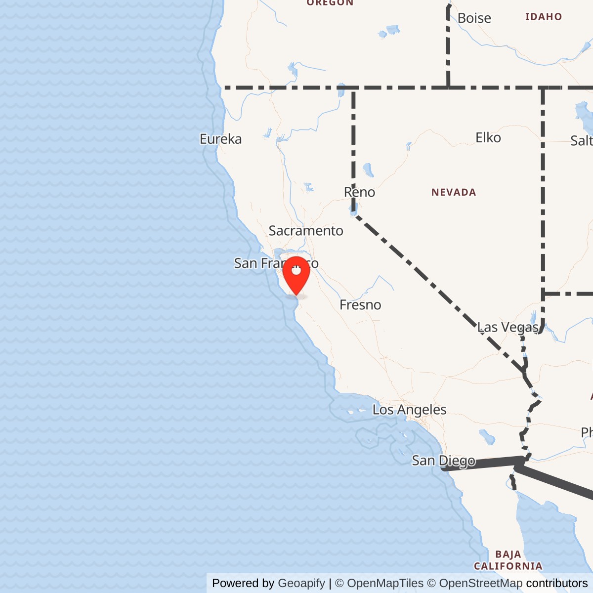
Longitude: -121.7896375
Airport ICAO ID: KWVI
Current Role: Former NAS Alameda satellite where carrier air groups organized and trained before Pacific carrier assignment; current site is Watsonville Municipal Airport with two public-use runways, aviation businesses, fuel/service facilities, and continuing civic aviation use. The history also notes the separate earlier Watsonville airship auxiliary field near Salinas Road and Highway 1.
Naval Auxiliary Air Station Watsonville was a small wartime airfield with an oversized role in the Pacific carrier war. It was not a great shipyard, a home port, or a permanent naval air station. It was a place where carrier air groups came together, shook out their aircraft, crews, maintenance routines, and squadron habits, then moved on toward Pacific carriers. That made Watsonville one of the many quiet inland and near-coastal fields that kept the Navy's carrier force supplied with trained, organized, flight-ready air groups at the exact moment when carriers had become the center of naval war.
The station occupied the site of today's Watsonville Municipal Airport, northwest of the city near Freedom, not the earlier prewar Watsonville Airport south of town near Salinas Road and Highway 1. That distinction matters because Watsonville had two Navy aviation landscapes during World War II. The older southern airport became a Navy lighter-than-air auxiliary field tied to Moffett Field and coastal patrol work. The newer northwest field became Naval Auxiliary Air Station Watsonville, a heavier-than-air satellite of Naval Air Station Alameda. Together they turned a small agricultural community on Monterey Bay into a wartime "Navy town," but they were not the same facility.
The present airport site originated in the Civil Aeronautics Administration's effort to create a modern civil airport for Santa Cruz County. In August 1942, Watsonville acquired a 287.58-acre parcel near Freedom for the new airport. The city had already entered into an agreement with the United States for airport operation and maintenance, and federal CAA funds helped build the field. On June 1, 1943, the city leased the airport to the United States for one dollar. The Navy took over in July 1943, purchased an additional 35 acres, built support buildings and a concrete ramp, and commissioned Naval Auxiliary Air Station Watsonville on October 23, 1943 as a satellite of Naval Air Station Alameda.
NAAS Watsonville should be understood as a wartime naval aviation installation rather than a civilian airport temporarily used by military aircraft. It had Navy control, Navy construction, a Navy mission, Navy personnel, Navy combat aircraft, and a place in the Alameda carrier-air-group training system. City history records as many as 75 combat aircraft and 1,200 men at the air station at one time. The aircraft types associated with the ramp included Avengers, Corsairs, Dauntless dive bombers, Hellcats, and other Navy combat aircraft. The same ramp is still part of Watsonville Municipal Airport's aviation landscape.
Mission Evolution
The Watsonville aviation story began before the Navy arrived. Local landing fields in the 1920s and early 1930s reflected the informal character of early California aviation, when open fields, barnstorming sites, and small private airfields could serve as community airports. Watsonville's first airport formally opened in 1931 at an 85-acre site southwest of the city, near Highway 1 and Salinas Road in Monterey County. By 1939 the Civil Aeronautics Administration concluded that Santa Cruz County needed a better civil airport, and after Santa Cruz declined the offer, Watsonville voters approved a municipal-airport bond issue in May 1942. That decision made the later Navy air station possible.The first military aviation use associated with Watsonville was lighter-than-air, not carrier aircraft. The original southern airport became a Navy auxiliary airfield for airships based at Moffett Field. Blimp crews used Watsonville for coastal anti-submarine patrols, convoy escort, and air-sea rescue work. Those airships flew long patrols off the Central Coast at a time when Japanese submarine operations and the fear of attack made coastal surveillance a real military requirement. When the heavier-than-air station northwest of town became operational and the airship requirement faded, the southern auxiliary field closed in late 1945.
The newer municipal airport near Freedom moved quickly from civic infrastructure project to Navy station. The city acquired the land in 1942; the federal government helped finance construction; the War Department became involved; and the airport was leased to the United States in June 1943. The Navy takeover in July 1943 changed the field's purpose. The Navy invested in support buildings and a concrete ramp, then commissioned NAAS Watsonville on October 23, 1943. From that point, the installation's mission was not general flight training but carrier-air-group organization and pre-deployment preparation.
This mission gave Watsonville a specific place in the carrier-air-power pipeline. Carrier Air Groups, made up of fighter, dive-bomber, and torpedo squadrons, came together at the field for roughly 90 to 120 days before assignment to Pacific Fleet carriers. The installation gave those squadrons an operating base outside the congestion of Alameda, but still close enough to the Bay Area naval aviation network to remain under the Alameda umbrella. Air groups could form, fly, maintain aircraft, sort out personnel and equipment, and build the group identity needed for carrier operations.
As the war ended, the mission disappeared quickly. Operations at NAAS Watsonville ended on November 1, 1945, when the station was closed and placed in caretaker status. The last official Navy flight departed in November 1945. After wartime deactivation, Watsonville reverted to civilian use and developed into a municipal airport. On December 2, 1946, a DC-3 in Southwest Airways livery landed to pick up the airport's first airline passenger and mail pouches, beginning commercial service that lasted into the 1950s. The station's mission therefore evolved through three phases: civil-airport project, Navy carrier-air-group auxiliary station, and postwar municipal airport.
Operational Role
The operational meaning of NAAS Watsonville lies in what it allowed the Navy to do away from the main air station at Alameda. Alameda was one of the Navy's major West Coast aviation installations. During World War II, it handled carrier aviation, maintenance, assembly and repair, seaplane and landplane activity, and a huge support burden. The Navy's own wartime construction history explains that major air stations needed auxiliary and satellite fields because the traffic and training load could not be absorbed at a single crowded base. Watsonville was part of that solution.At Watsonville, carrier aviation became practical in the daily details: aircraft parked on the ramp, mechanics worked the line, pilots trained, squadrons formed, and air groups learned to operate as deployable teams. The city history emphasizes that NAAS Watsonville was not a primary training base. Its value came later in the pipeline, after pilots and crews were already inside the naval aviation system and needed to become part of a carrier air group. The station handled the organizational and operational work that came before assignment to a ship.
The aircraft mix reflected that carrier mission. Avengers, Corsairs, Dauntlesses, Hellcats, and other combat aircraft represented the Navy's wartime carrier air arm. Torpedo, dive-bombing, and fighter squadrons had to function together, not simply as separate groups of airplanes. Carrier air groups required coordination, maintenance rhythms, personnel administration, operational discipline, and the ability to move as an integrated package. Watsonville's 90-to-120-day air-group cycle gave the Navy a place to accomplish that before the group went forward.
The installation also connected Watsonville directly to the human system of naval aviation. City history records as many as 1,200 men at the air station at one time, a major influx into a small Central Coast community. Aircraft noise, military traffic, local businesses, temporary housing demand, liberty, recreation, and civilian-military relationships all became part of the wartime experience. The presence of both the airship auxiliary field and NAAS Watsonville meant that Navy aviation was not a marginal episode in the town's wartime life. It was central enough that Watsonville remembered itself as a Navy town.
Composite Squadron Thirty-Three later became an important thread in local memory. A postwar reunion effort by former World War II VC-33 personnel helped preserve the Watsonville connection to naval aviation squadrons carrying the "33" numeral. That memory was not limited to one wartime unit. It linked World War II composite-squadron personnel to later Navy aviation communities, including airborne early warning, electronic attack, helicopter anti-submarine, and sea-control squadrons that used the number. Watsonville's station history therefore survived not only in buildings and runways but in squadron memory.
Facilities and Physical Layout
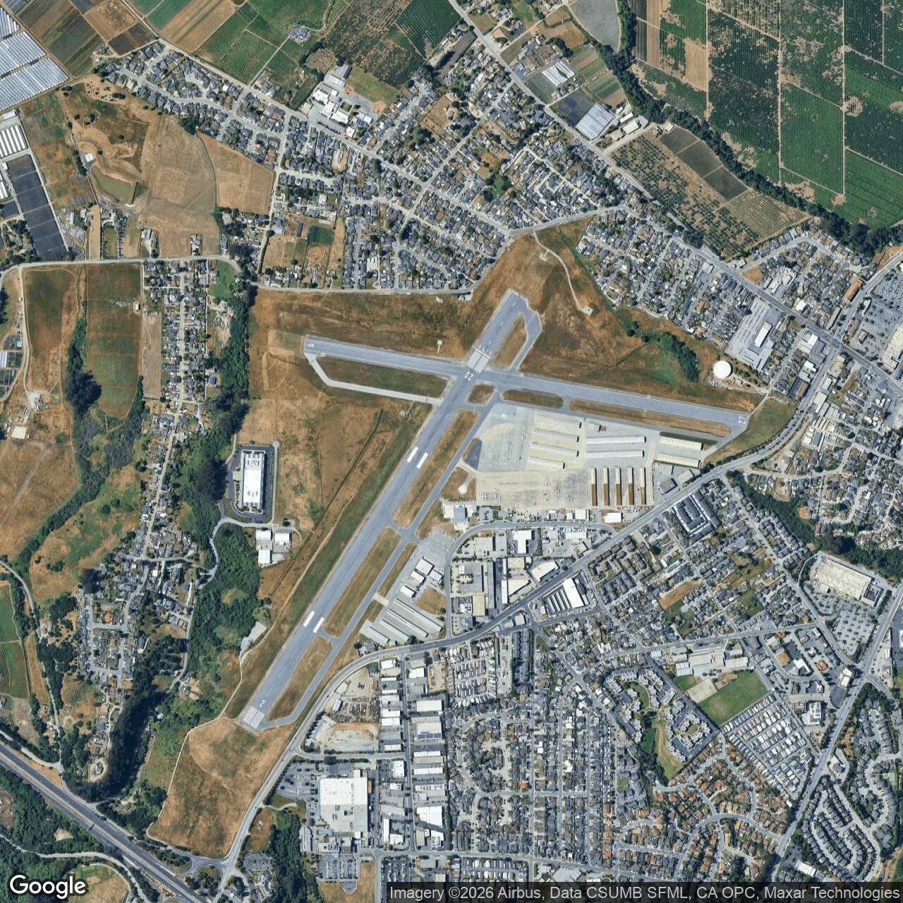
NAAS Watsonville's physical layout was shaped by the CAA-built municipal airport that the Navy inherited and expanded. The current airport sits northwest of Watsonville near Freedom. The city acquired 287.58 acres in August 1942, and the Navy later added 35 acres. The Navy built support structures and a concrete ramp, giving the field the aircraft-parking and service capacity needed for combat aircraft. Photographs and city historical material show the wartime ramp crowded with Navy aircraft, hangars, support buildings, and a built-up station area.The airfield's present runway geometry still reflects the wartime and postwar aviation landscape. Watsonville Municipal Airport now has two public-use runways: Runway 2/20, approximately 4,502 by 149 feet, and Runway 9/27, approximately 3,998 by 98 feet. These current runway dimensions should not be read as exact wartime dimensions without further engineering documentation, but they show why the site remained useful after the Navy left. It had a durable runway-and-ramp layout capable of supporting a continuing general-aviation airport.
The ramp is the most direct surviving physical link to the Navy mission. City history specifically notes that the wartime ramp used by Avengers, Corsairs, Dauntlesses, Hellcats, and other Navy aircraft is the same ramp that continues to support corporate, private, local, and visiting aircraft at the airport. That continuity is important. Many wartime auxiliary air stations disappeared into farmland or subdivision grids. Watsonville's Navy-built or Navy-improved aviation infrastructure remained part of an active airport.
The separate southern airship field had a different physical logic. Located near Salinas Road and Highway 1, it supported Navy airship patrol activity associated with Moffett Field. Blimps needed open landing and handling areas rather than the same ramp and combat-aircraft infrastructure required at the heavier-than-air station. Because that airship field closed after the heavier-than-air station became operational and after airship patrol demand faded, it is best treated as a related Watsonville Navy aviation site rather than the same installation as NAAS Watsonville.
Role in the Wider Military Network
NAAS Watsonville only makes full sense as part of a wider Navy network. The main node was Naval Air Station Alameda, a major Bay Area naval aviation base whose wartime mission included keeping aircraft flying from airfields and carriers. Alameda could support large-scale naval aviation activity, but it needed auxiliary fields to absorb the load. The Navy's official wartime base-construction history states that the major fields developed many auxiliary and satellite fields because the increased operational and training load could not be handled by the main bases alone. Alameda's auxiliary system included fields such as Hollister, Crows Landing, Santa Rosa, South San Francisco, and others, with later expansion at Fallon, Nevada.Watsonville sat within that same system even though it developed out of a city airport project. Its task was to serve the carrier pipeline rather than to act as an independent permanent air station. Carrier air groups organized there, trained together, then moved to Pacific carriers. The field therefore linked municipal infrastructure, the CAA wartime airport-building program, the Alameda auxiliary-airfield network, and the carrier war in the Pacific.
The airship field tied Watsonville to another network: Moffett Field and West Coast coastal patrol. Lighter-than-air patrols performed anti-submarine surveillance, convoy escort, and air-sea rescue. This is an important reminder that wartime naval aviation was not only about carriers. Along the California coast, the Navy also used airships, patrol aircraft, radar, observation posts, and auxiliary fields to guard sea lanes and protect coastal shipping. Watsonville's two Navy aviation sites connected the town to both the carrier-war system and the coastal-defense system.
The station's postwar transition also reflects a larger national pattern. Dozens of wartime auxiliary fields were closed, placed in caretaker status, transferred to local governments, or converted into municipal airports. Watsonville followed that pattern. The Navy's rapid deactivation after V-J Day left behind a field whose military urgency had passed but whose aviation value remained. Local government and civilian aviation then inherited the infrastructure.
Closure and Postwar Reuse
NAAS Watsonville closed and was placed on caretaker status on November 1, 1945. The last official Navy flight departed later that month. The speed of closure reflected the collapse of wartime demand. Carrier air groups no longer needed to be formed and pushed west at the same tempo, and the Navy began reducing its vast wartime shore establishment.The return to civilian use was not a slow disappearance but a rapid conversion. Watsonville Municipal Airport quickly became a civic aviation asset. On December 2, 1946, Southwest Airways began passenger and mail service at the field. The airport later supported local general aviation, businesses, fly-ins, fuel and maintenance services, and community aviation events. The West Coast Antique Fly-In and other aviation traditions helped make the former Navy field part of the region's civilian aviation identity.
Postwar reuse also preserved memory. The station's wartime photographs, newspaper material, reunion history, and surviving ramp kept the Navy period visible to the community. The airport's official history pages now make a clear distinction between the southern airship auxiliary field and the northwest heavier-than-air station, helping prevent the two sites from being collapsed into one inaccurate story.
Current Status
The former Naval Auxiliary Air Station Watsonville is now Watsonville Municipal Airport. AirNav lists the airport as KWVI / WVI, located three miles northwest of Watsonville, with the field open to the public. The city airport's pilot information page lists two primary runways: 2/20 and 9/27, with fuel, radio, airport office, and operational information for present-day users.The site is no longer a Navy installation. Its military status is former, but its aviation status remains active. That continuity makes Watsonville different from many wartime auxiliary fields whose runways were plowed under or absorbed into redevelopment. The basic purpose of the land-aircraft operations-survived the transition from carrier-war support to local civil aviation.
Because Watsonville had both an airship auxiliary field and a heavier-than-air naval auxiliary air station, histories must identify which site is being discussed. The current municipal airport is the former NAAS Watsonville site near Freedom. The earlier southern airport near Salinas Road and Highway 1 was the airship-related auxiliary field.
Chronology
- 1931-05-09 Watsonville's first airport opened southwest of the city near Highway 1 and Salinas Road.
- 1939 The Civil Aeronautics Administration concluded that Santa Cruz County needed a modern civil airport, eventually leading to the Watsonville municipal-airport project.
- 1942-05-12 Watsonville voters approved a municipal-airport bond issue, enabling the city to acquire land for the new airport.
- 1942-08 Watsonville purchased 287.58 acres near Freedom for the airport that later became NAAS Watsonville.
- 1942-08-12 The Watsonville Board of Aldermen entered into an agreement with the United States concerning airport operation and maintenance.
- 1943-06-01 Watsonville leased the new airport to the United States for one dollar.
- 1943-07 The Navy took over the new airport, purchased an additional 35 acres, and expanded the field with support buildings and a concrete ramp.
- 1943-10-23 The field was commissioned as Naval Auxiliary Air Station Watsonville, a satellite of Naval Air Station Alameda.
- 1943-1945 Carrier air groups organized and trained at Watsonville before assignment to Pacific carriers.
- 1943-1945 The separate southern Watsonville airship auxiliary field supported Moffett-based airship patrols, convoy escort, and air-sea rescue missions.
- 1945 City historical material records as many as 75 combat aircraft and 1,200 men at NAAS Watsonville.
- 1945-11-01 NAAS Watsonville closed and was placed on caretaker status.
- 1945-11 The last official Navy flight departed the field.
- 1945-late The southern airship auxiliary field closed as the Navy no longer required the airship mission.
- 1946-12-02 A Southwest Airways DC-3 landed at Watsonville Airport to pick up the airport's first airline passenger and mail, beginning postwar airline service.
- 1948-05 Vern Ackerman, a former Navy operations officer at the base and Watsonville native, became airport manager after a brief earlier co-management period.
- 1960s onward The airport became associated with antique-aircraft fly-ins and broader local aviation culture.
- 2012-2019 Watsonville Municipal Airport undertook major modern improvements, including fuel, terminal, taxiway, lighting, signage, markings, and runway rehabilitation projects.
- Present The former NAAS Watsonville remains in active civilian aviation use as Watsonville Municipal Airport.
Sources & References
- WEB City of Watsonville Naval Auxiliary Air Station, Watsonville
- WEB City of Watsonville World War II: Naval Auxiliary Airfield
- WEB City of Watsonville Pre-War History: Watsonville Airport Company
- WEB City of Watsonville Military to Municipal
- WEB City of Watsonville Pilot Information
- WEB AirNav KWVI Watsonville Municipal Airport
- WEB Naval History and Heritage Command / HyperWar, Building the Navy's Bases in World War II Chapter 10 The Air Stations
- WEB Naval History and Heritage Command NH 70204 Naval Auxiliary Air Station Watsonville, California
- WEB Former Naval Air Station Alameda Navy BRAC Program Management Office