
Cape Hooper DEW Line Station, Canada
FOX-4 watched the eastern Baffin Island coast from a steep rock knob, where radar crews depended on a distant airstrip, radio dishes and a long summer water haul.
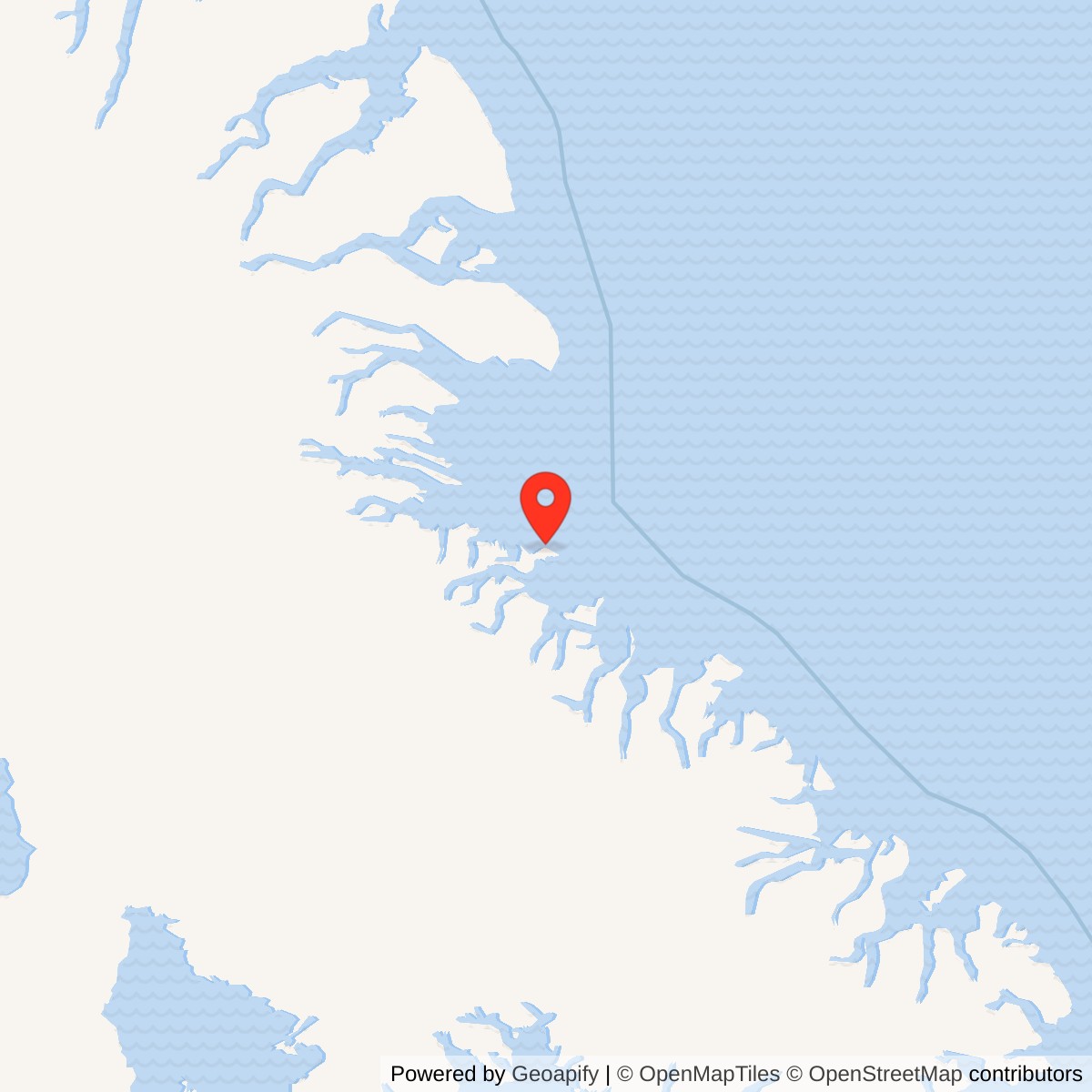
Longitude: -66.80028
Site Number: FOX-4
Current Role: North Warning System short-range radar location, documented in government station inventories.
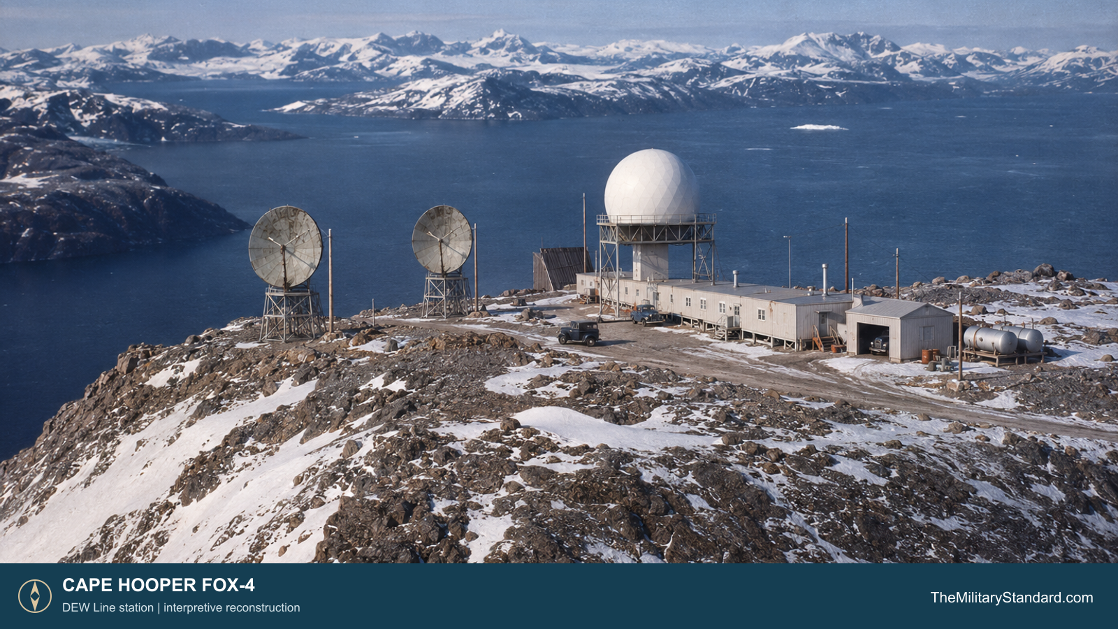
Cape Hooper, code FOX-4, was a Distant Early Warning Line auxiliary radar station on eastern Baffin Island. Its radar watch formed part of the eastern Canadian sector between Dewar Lakes FOX-3 and Broughton Island FOX-5. Aircraft approaching across the Arctic would be detected, tracked and reported through the line before they reached the more southerly defenses of North America. [1] [3] [5]
- DEW Line code
- FOX-4
- Station role
- Auxiliary radar station
- Radar equipment
- AN/FPS-19 and AN/FPS-23
- Communications
- Two 30-foot UHF lateral dishes and supporting radio antennas
- Original mission
- Arctic aircraft warning
- Later site
- North Warning System short-range radar
- Location
- Eastern Baffin Island, Nunavut
The FOX-4 Watch on Baffin Island
The station occupied a rock knob about 1,400 feet above sea level, on a narrow coastal peninsula between Nadlung Fjord and Home Bay. The exposed summit offered an open radar horizon over the water and surrounding highlands. Its remote airstrip and landing area lay down from the operating compound, so aircraft access still required a road haul to the hilltop. [3] [4]
Construction on the Rock Knob
Western Electric and its construction contractors built FOX-4 during the mid-1950s push to complete the Canadian DEW Line. Period aerial views from spring 1957 show the small compound perched above steep rocky slopes. The module train, raised radome and communications antennas were concentrated on the summit, where space was limited and the weather could change quickly. [1] [3]
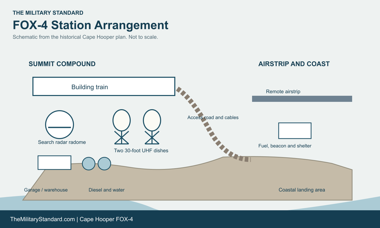
The historical site plan identifies a connected building train with dormitory rooms, a garage and a warehouse. It also records a pump house, a heated 65,000-gallon water tank, two 65,000-gallon diesel tanks, POL storage and a separate antenna field. Prefabricated modules allowed people to move between living and working rooms inside a heated enclosure. The fuel and water plant made the isolated watch possible through winter. [3] [4]
A winding access route connected the high station to the airstrip, apron and coastal staging area. The airstrip plan shows aviation-fuel storage, a beacon, a ceiling projector and shelter facilities. Aircraft brought personnel, mail and parts; bulk supplies and fuel also required staging and haulage from the coast. The steep separation between the runway and the radar compound made transport a regular part of station work. [3] [4]
Radars and Communications
Aerospace Defense Command records show that FOX-4 began manual operation in August 1957 with an AN/FPS-19 search radar and AN/FPS-23 gap-filler equipment. The FPS-19 scanned for aircraft from inside the elevated radome. The FPS-23 system helped cover low-altitude gaps between the main search radars. Its continuous-wave technique served a different purpose from the rotating search antenna. [1] [2]
Operators watched radar displays, identified significant returns and passed reports into the DEW Line communications system. Electronic technicians maintained the radar, radio and display equipment while power-plant crews kept the generators running. A warning was useful only when the station could transmit it, making the radio paths as important to daily operation as the radar itself. [1] [3] [4]
The attached August 1957 FOX-4 photograph shows two 30-foot circular UHF lateral antennas on separate supports. They were radio dishes, not the rectangular troposcatter billboards seen at some other northern stations. The site plan marks an antenna path toward FOX-5, as well as air-to-ground, beacon and emergency radio facilities. These supported interstation traffic, aircraft contact and backup communications. [3] [4]
The original network later withdrew the FPS-23 gap-filler system as the DEW Line changed its equipment and procedures. The station continued its search-radar and reporting role beyond that change. Its photographs from the 1960s and 1970s show the radome, dish antennas and long low building complex against the bare coastal rock. [1] [3]
Crews, Water and Daily Life
Civilian contract employees operated and maintained the station for the U.S. Air Force. The isolated posting joined radar operators and radio technicians with mechanics, power-plant staff, cooks and other support workers. Their shared building train contained both working rooms and dormitory space. A Christmas 1962 station photograph records the crew together outdoors, a rare human view of a workplace normally defined by instruments, engines and weather. [1] [3] [4]
Water supply was unusually labor intensive. The station account describes a seven-mile round trip to haul potable water in summer. Winter water was held in a heated 65,000-gallon steel tank and circulated through the building train. The plan also shows large diesel tanks near the occupied compound. Fuel powered the electrical generators and heating systems that kept the radar, radios and living quarters usable. [3] [4]
At roughly 1,400 feet on a coastal rock knob, crews faced strong wind, ice and long dark winters. Flights and road trips could be delayed by weather, while antennas, power equipment and water systems still needed attention. The connected modules and stored supplies were practical answers to those conditions, and the station's small size meant work and off-duty life remained close together. [3] [4]
From the DEW Line to the North Warning System
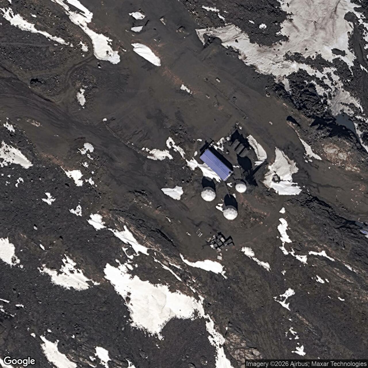
The original FOX-4 DEW Line operation ended in 1991 as Cape Hooper was incorporated into the North Warning System as a short-range radar location. The newer installation changed the equipment and staffing pattern while retaining a warning mission on the same prominent coast. The transition was part of a broader modernization that replaced many staffed DEW Line stations with remotely operated radar sites. [5] [6] [7]
Cape Hooper thus preserves two phases of northern air defense history: the original manned station with a raised FPS-19 radome, gap-filler radar, radio links and connected living modules, followed by the North Warning System site. The historic compound plan and period photographs show the physical effort behind the first phase, from the summit radar watch to the airstrip and water haul below. [3] [4] [5]
Chronology
- Mid-1950s Construction begins on the FOX-4 summit compound, road and supporting airstrip.
- Spring 1957 Period aerial photographs document the station as the DEW Line nears completion.
- August 1957 FOX-4 begins manual operations with AN/FPS-19 and AN/FPS-23 radar equipment.
- August 1957 A dated photograph records the two 30-foot UHF lateral radio dishes.
- 1962 A station photograph records personnel and the snowbound summit compound.
- 1991 The original DEW Line phase ends during the transition to a North Warning System short-range site.
Related Sites
Information sources (7)
- PDF[1] U.S. Air Defense Command, A History of the DEW Line, 1946-1964
DEW Line construction, operation, radar and contractor organization.
- PDF[2] Aerospace Defense Command, Historical Data, 1946-1973, station table, p. 153
FOX-4 manual operation beginning August 1957 and its AN/FPS-19 and AN/FPS-23 equipment.
- WEB[3] The DEWLine, FOX-4 Cape Hooper station history and photo gallery
Station topography, water supply, construction images and equipment views. Privately credited photographs used only as research references.
- WEB[4] The DEWLine, FOX-4 historical site plan
Summit compound, antenna, water, fuel, road, airstrip and beach facility layout.
- PDF[5] Arctic Institute of North America, The Distant Early Warning Line: A Bibliography and Documentary Resource List
FOX-4 classification and location, original DEW period and North Warning System short-range transition.
- WEB[6] Government of Canada, Exchange of Notes Concerning Environmental Issues, 1996
Lists Cape Hooper FOX-4 among the 21 former DEW Line sites returned to Canada between 1989 and 1993.
- WEB[7] Government of Canada, North Warning System in-service support backgrounder
Later North Warning System operation and maintenance framework.