
Dewar Lakes DEW Line Station, Canada
FOX-3 kept watch from an exposed Baffin Island hill, with a valley airstrip and crews who sustained its radar, radios, power and water supply.
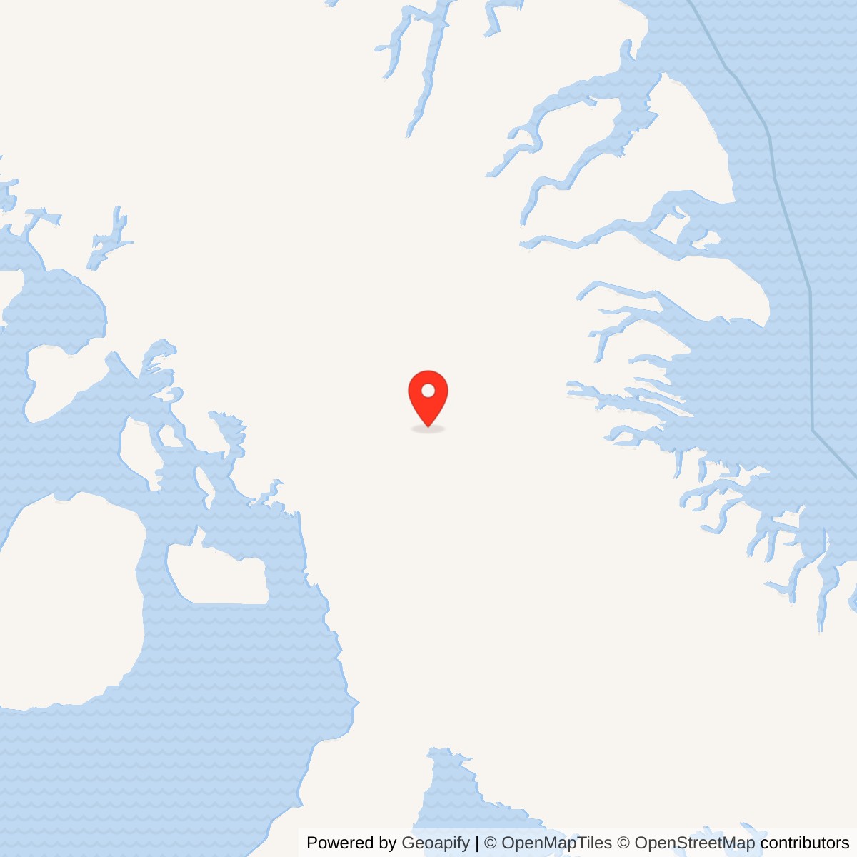
Longitude: -71.23472
Site Number: FOX-3
Current Role: Later North Warning System long-range radar site; a government project record described unmanned operation and maintenance support from Hall Beach.
Dewar Lakes, code FOX-3, was an auxiliary station of the Distant Early Warning Line on the eastern half of Baffin Island. From a hill north of the lakes, its crew watched the northern air approaches and passed warning information along the FOX sector. The station lay between Longstaff Bluff FOX-2 to the west and Cape Hooper FOX-4 to the east. In the Cold War, that continuous watch was meant to give continental defenders time to identify and respond to aircraft approaching over the Arctic. [1] [3] [5]
- DEW Line code
- FOX-3
- Station role
- Auxiliary radar station
- Radar equipment
- AN/FPS-19 and AN/FPS-23
- Original mission
- Arctic aircraft warning
- Later site
- North Warning System long-range radar
- Location
- Baffin Island, Nunavut
The Radar Watch at Dewar Lakes
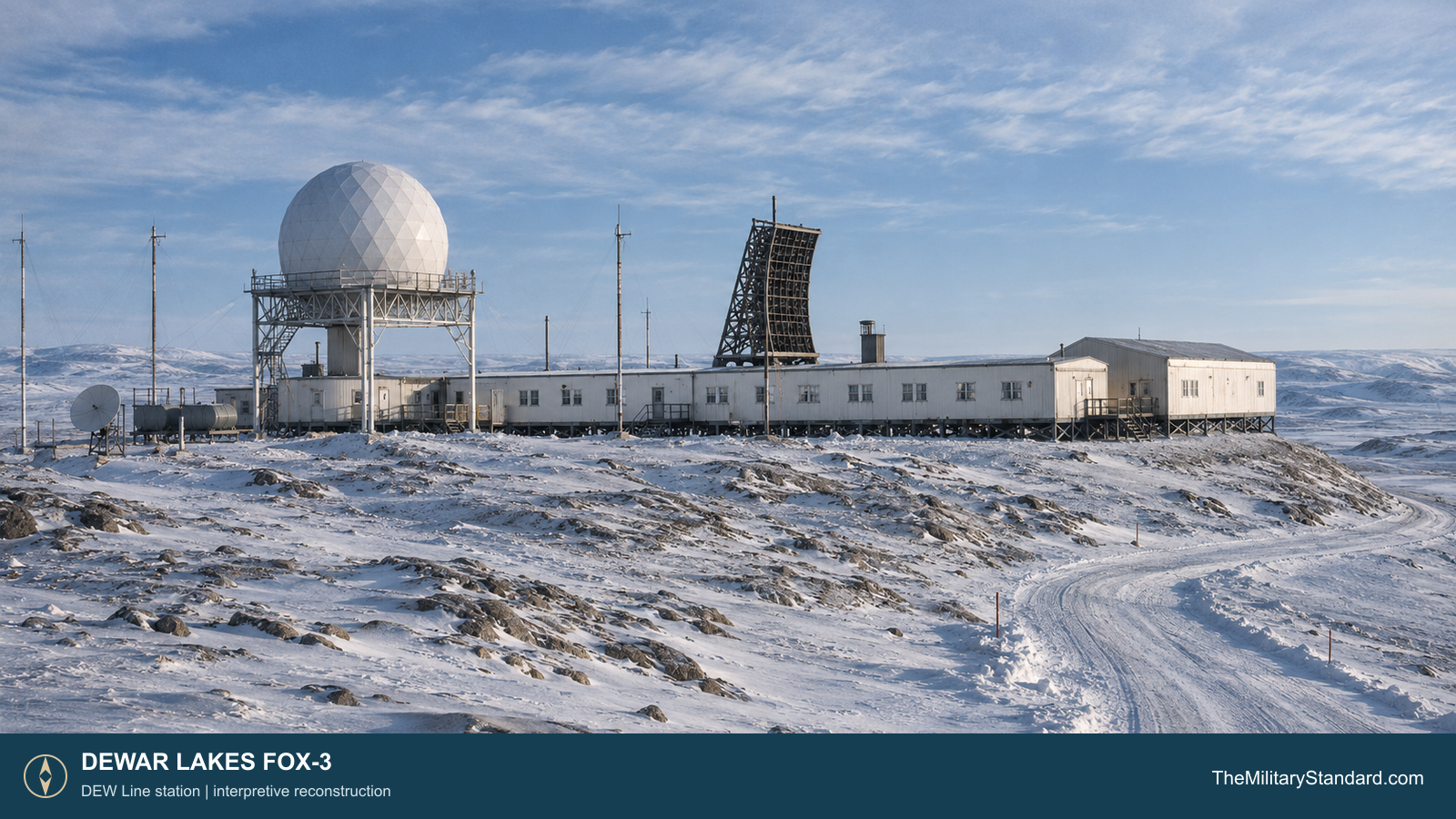
The station stood on glacially scoured high ground near a stream linking Ukala and Tuk-Tuk lakes. The historic account places the occupied hilltop at roughly 1,800 feet above sea level. Its runway lay down in the valley, several hundred feet lower. That separation made the station more than a radar dome: crews had to move people, fuel, water, mail and replacement parts between the airstrip and the remote working compound. [3] [4] [6]
Building a Station on the Baffin Hills
Construction began in the mid-1950s as Western Electric and its contractors built the Canadian DEW Line in a short Arctic shipping and building season. The March 1956 aerial shows an early construction camp and graded ground before the completed module train, radome and antennas dominated the hill. Prefabricated building modules were set on supports above the ground, giving the crew a connected, heated route between work and living areas. [1] [3] [4]
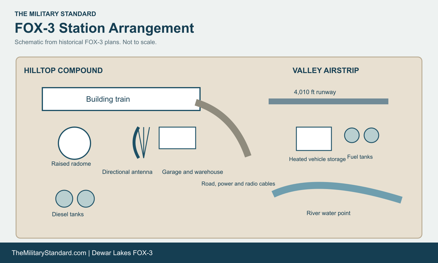
The compound plan identifies the building train, dormitory, warehouse, garage, hangar, pump house, fuel tanks, emergency shelter and several radio antennas. Two directional antenna groups carried links toward FOX-2 and FOX-4. Completed-site photographs show a raised white search-radar radome above the long low train and a dark curved communications reflector nearby. [3] [4]
The supporting airstrip was planned at about 4,010 by 125 feet. The runway area had heated vehicle storage, aviation-fuel tanks, gasoline tanks, a diesel day tank and a water point beside the river. Power and communications cables tied the airstrip back to the hill station. Freight and aircraft could reach the valley, but the radar watch depended on keeping the route and cable links between the two areas usable. [4]
Radars, Antennas and Warning Work
An Air Defense Command equipment table records manual FOX-3 radar operations beginning in August 1957. It lists an AN/FPS-19 search radar and AN/FPS-23 gap-filler equipment. The FPS-19 supplied the principal long-range aircraft search beneath the raised radome. The FPS-23 added low-altitude coverage between stations, where a plane might otherwise pass below the main radar horizon. [2]
Radar operators followed returns on cathode-ray displays, checked tracks and passed significant reports through the DEW Line communications network. Technicians maintained transmitter, receiver, display and power equipment through long shifts. Period FOX-3 photographs show personnel at a radar console and working among crowded racks of electronics. The two station-to-station antenna paths and aircraft radio facilities were essential because the value of a detection depended on moving the report quickly to the next station and the sector center. [1] [3] [4]

The station plan also marks an emergency multiband antenna, an HF air-to-ground antenna, an LF beacon and a disaster antenna. These supported routine aircraft contact, navigation and backup communications alongside the main interstation links. The distinct antenna field, radome and module train are visible in the period exterior views, giving a clear picture of how surveillance and communications shared one compact hilltop compound. [3] [4]
Crews, Supplies and Life at FOX-3
Contract personnel operated and maintained the station for the U.S. Air Force. Their work reached beyond the radar room: generators had to run continuously, vehicles and fuel systems had to survive cold weather, antennas and cables needed repair, and aircraft arrivals depended on a usable runway. The linked module train brought sleeping quarters and work rooms into one heated complex. A 1961 photograph of the station bar documents a small social space within that isolated routine. [1] [3] [4]
Water was a persistent logistical task. The station description says summer water came from a lake on a roughly 12-mile round trip and was held in two electrically heated 65,000-gallon rubber tanks. In winter, an emergency source about three miles from the station could be used. The plans also show large diesel tanks by the hill station and fuel stores at the airstrip. Diesel supported electricity and heat, while aviation fuel and gasoline served the aircraft and vehicles that kept FOX-3 supplied. [3] [4]
The exposed ridge offered the radar an unobstructed watch but also brought wind, drifting snow and a long winter. Workers lived far from settlements and relied on flights and seasonal cargo movement for food, spares and mail. The station photographs record the human scale of that duty: operators seated at screens, technicians inside equipment rooms, and colleagues taking time together after their shifts. [3]
The North Warning System Transition
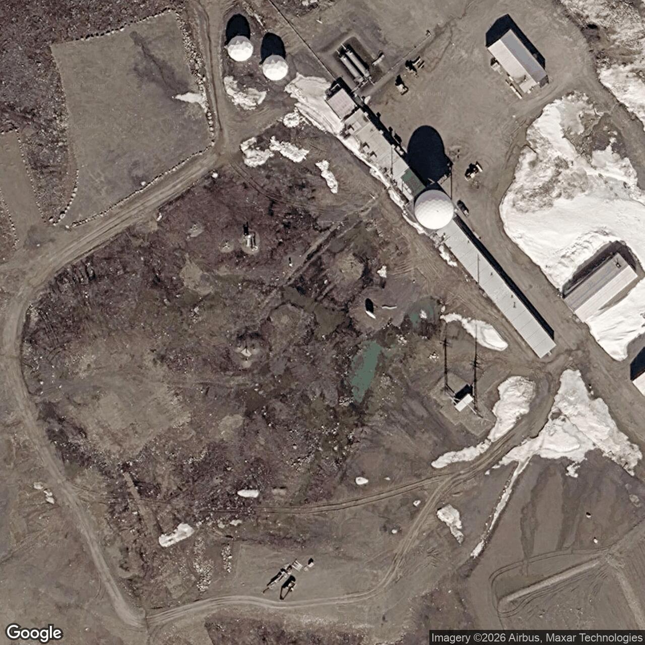
The original staffed DEW Line operation ended in July 1989, when a North Warning System long-range radar installation was established at FOX-3. The newer system retained the strategic air-surveillance mission at Dewar Lakes while changing the station's staffing and equipment. A later government project record describes FOX-3 as an unmanned long-range site supported by maintenance teams from Hall Beach FOX-Main, with surveillance data sent through the North Warning System. [5] [6]
The old compound and the later radar belong to successive phases of the same named warning site. The hilltop remains a useful place to understand the DEW Line's original architecture: a raised radome, connected living and work modules, interstation antennas, fuel and water systems, and a separate valley runway supporting a watch that lasted more than three decades. [3] [4] [5] [6]
Chronology
- Mid-1950s Construction begins at the Dewar Lakes hilltop and supporting airstrip.
- March 1956 A construction aerial records the early FOX-3 work area.
- August 1957 FOX-3 begins manual operations with AN/FPS-19 and AN/FPS-23 equipment.
- 1961 Station photographs document the radar console, equipment rooms and social spaces.
- July 1989 The original DEW operation ends and the North Warning System long-range site is established.
Related Sites
Information sources (6)
- PDF[1] U.S. Air Defense Command, A History of the DEW Line, 1946-1964
Development, construction and original DEW Line warning mission.
- PDF[2] Aerospace Defense Command, Historical Data, 1946-1973, DEW Line station table, p. 153
Station-specific August 1957 manual operation date and AN/FPS-19 and AN/FPS-23 equipment.
- WEB[3] The DEWLine, FOX-3 Dewar Lakes historical description and photo gallery
Topography, water haul, construction and completed-station photographs. Privately credited photos used only as research references.
- WEB[4] The DEWLine, FOX-3 station, compound and runway plans
Historical layout of the hilltop station and valley airstrip, including antenna paths, fuel tanks, service buildings and water route.
- PDF[5] Arctic Institute of North America, The Distant Early Warning Line: A Bibliography and Documentary Resource List, site-status table
FOX-3 classification, location, approximate coordinate and July 1989 North Warning System transition.
- WEB[6] Nunavut Impact Review Board, FOX-3 Dewar Lakes North Warning System project record
Later long-range radar role, hilltop and airstrip elevations, unmanned operation and support from Hall Beach.