
Matheson Point DEW Line Station, Canada
An inland station on King William Island kept a low-altitude warning path working until the DEW Line intermediate posts closed in 1963.
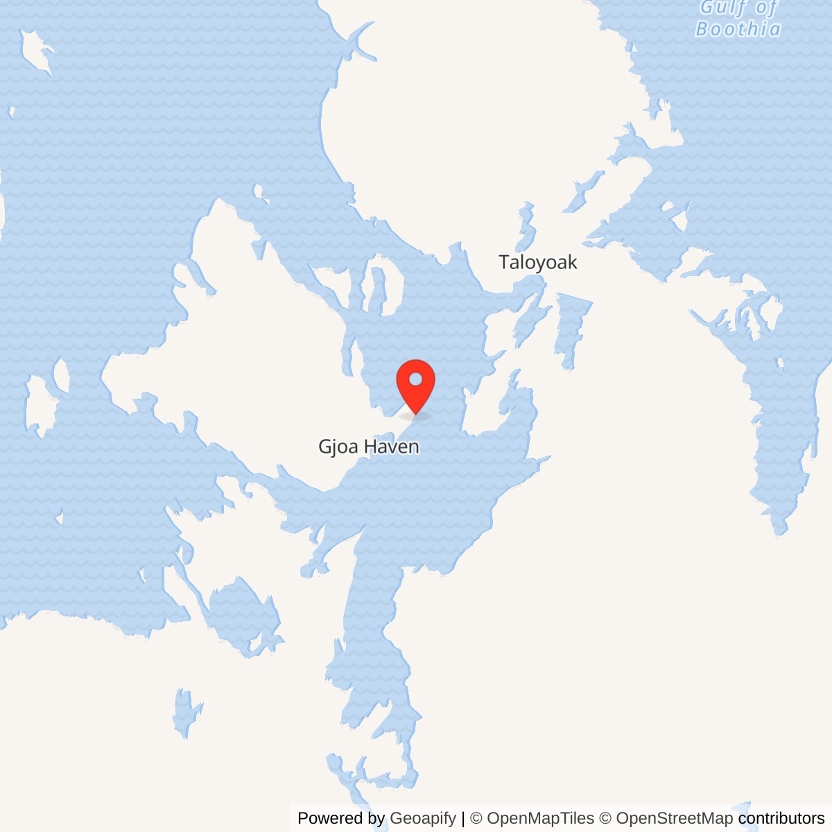
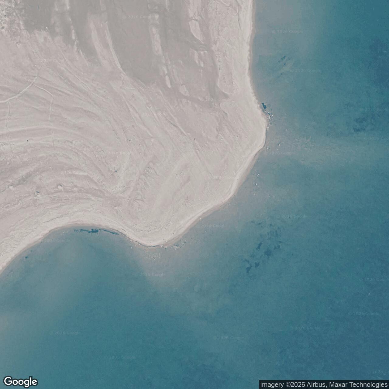
Longitude: -95.215406
Site Number: CAM-C
Current Role: Former station; original buildings were dismantled. Canada recorded concrete foundations at the site in 2012; subsequent cleanup was completed in 2018.
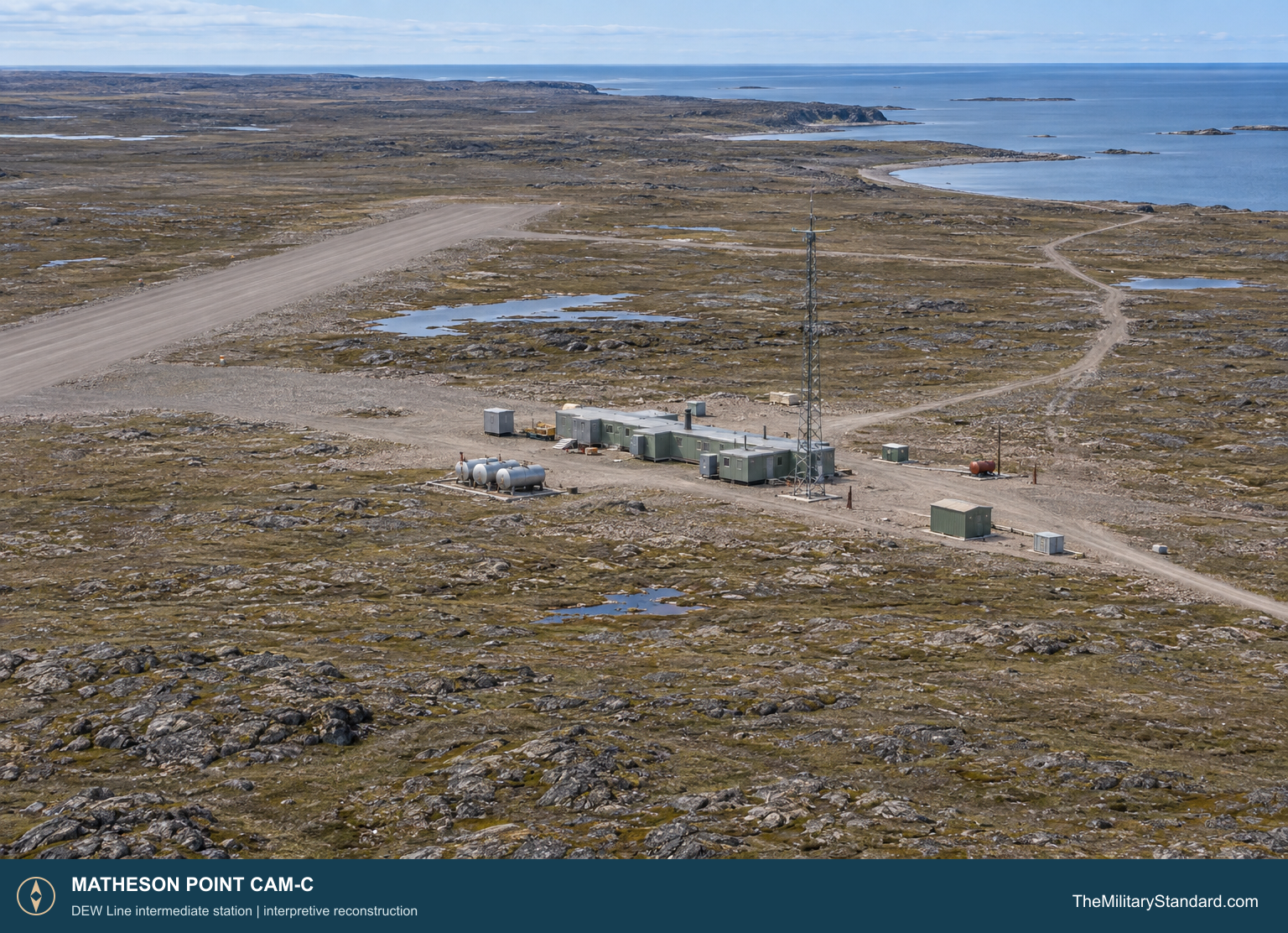
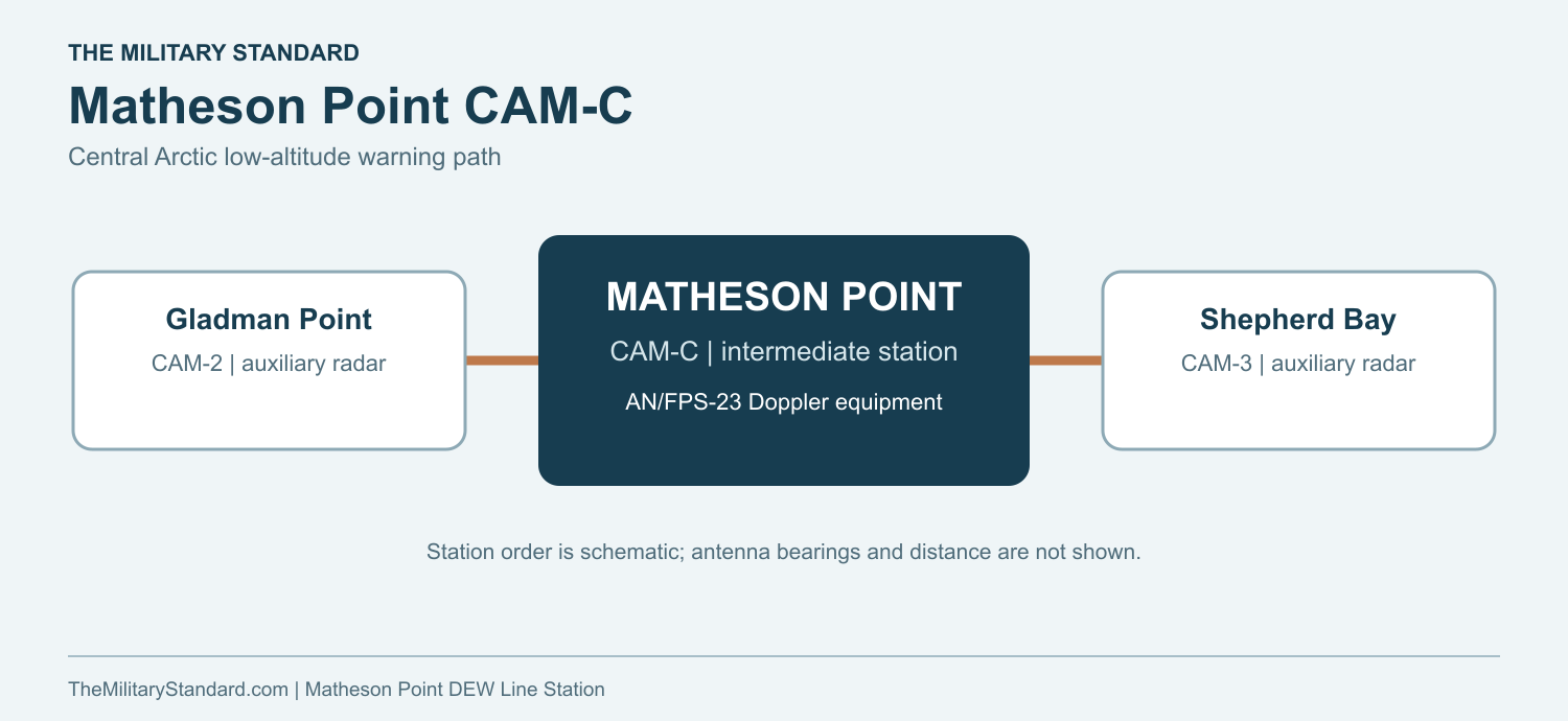
Matheson Point CAM-C stood about two kilometers inland from the southeast coast of King William Island, roughly 30 kilometers northeast of Gjoa Haven. It was one of the original Distant Early Warning Line intermediate stations that filled gaps between larger search-radar posts across the Arctic. On the central Canadian route, CAM-C lay between Gladman Point CAM-2 to the west and Shepherd Bay CAM-3 to the east. [1] [2] [4]
- DEW Line code
- CAM-C
- Role
- Intermediate low-altitude warning station
- Equipment
- AN/FPS-23 Fluttar
- Operating period
- 1956 to July 21, 1963
- Location
- King William Island, Nunavut
An Intermediate Post on King William Island
The station performed a narrow but important warning task. It did not direct fighters or serve as a sector headquarters. Its AN/FPS-23 Doppler equipment watched for low-flying aircraft crossing the interval between the larger stations. Cambridge Bay CAM-Main served as the sector center for this stretch of the line. [1] [4] [5]
Building and Supplying CAM-C
The original DEW Line building program had to place permanent posts where roads and ports were absent. Western Electric coordinated construction with ships, aircraft, prefabricated modules and heavy machinery. The short Arctic shipping season made fuel and material delivery a central part of the work. At Matheson Point, a beach landing area gave access from the coast while an airstrip connected the inland compound to aircraft supply. [2] [4]
Canada dates the Matheson Point installation from 1956. The documented site included buildings, a radar tower, fuel storage, an airstrip and the coastal landing area. These features gave a small crew the power, shelter, communications and access needed to keep warning equipment operating through winter. Aerospace Defense Command records CAM-C in manual operation with AN/FPS-23 equipment by August 1957. [1] [2]
The station sat back from the shoreline rather than directly on a beach. Cargo moving between the landing place and the compound needed a local access route; personnel and urgent parts could reach the station by air when weather permitted. The airstrip and fuel facilities were therefore working parts of the warning installation, not merely construction conveniences. [2] [4]
Federal Electric operated the completed DEW Line under military direction. The technicians at CAM-C were civilian contractor employees serving a joint continental defense mission. Their work depended on reliable generators, heating, fuel stores and communications as much as on the Doppler transmitter itself. [4] [5]
The AN/FPS-23 Low-Altitude Fence
The AN/FPS-23, also called Fluttar, was a continuous-wave Doppler system designed to register aircraft crossing a fixed radio path. Intermediate sites generally transmitted toward adjacent radar stations in both directions. Receiving equipment at the neighboring sites detected a shift in the signal caused by a crossing aircraft. This helped the DEW Line watch the low-altitude approaches that a rotating search radar could miss near the horizon. [1] [4] [5]
CAM-C formed the intervening low-altitude warning segment between Gladman Point CAM-2 and Shepherd Bay CAM-3. The larger stations handled radar search and reporting, while CAM-C maintained its part of the fence. An alarm from the line had to be evaluated and passed onward through the communications network before it could support a military response. [1] [4] [5]
The antenna tower, cables, transmitter and local power plant demanded repeated inspection and repair. Ice, drifting snow, wind and fuel delivery affected whether the equipment could stay on the air. At a post with a small crew, a failed generator or outdoor cable could become an immediate operational problem. [2] [4] [5]
Crew and Life at Matheson Point
Intermediate stations were much smaller than DEW Line main sites. A firsthand account of the line describes a typical complement of roughly four people, including radio and mechanical specialists and a cook, with one technical worker serving as station chief. A Matheson Point roster has not been located, so that figure describes the usual intermediate-station pattern rather than a confirmed CAM-C headcount. [5]
The crew lived beside the equipment it serviced. Its routine combined electronic checks, generator and heating maintenance, fuel handling, snow work, food preparation and communications with neighboring posts. A small staff had to solve technical and domestic problems locally, particularly when aircraft were delayed by weather. [4] [5]
The airstrip connected the isolated post to personnel rotations, mail and urgent supplies. Heavier deliveries came through the beach landing area during the navigable season. The station stored enough fuel and necessities to remain functional between those visits. [2] [4] [5]
Closure and the Later Gjoa Haven Radar
In 1963, NORAD and CONAD retired 28 intermediate stations as the larger radar network and the assessed bomber threat changed. The coordinated shutdown took effect at 0001Z on July 21, 1963. Aerospace Defense Command lists the same closure date for Matheson Point CAM-C. [1] [3]
After the shutdown, the Matheson Point buildings were dismantled. A Canadian government account in 2012 described concrete foundations as the principal remnants of the original facility. The documented airstrip and coastal landing area show how the 1950s post received people and supplies. [2]
A later North Warning System short-range radar was installed at Gjoa Haven under the separate code CAM-CB. Federal site inventories list Gjoa Haven CAM-CB and former Matheson Point CAM-C as distinct locations. The newer radar belongs to a later generation of Arctic warning, while the 1963 shutdown ended the original Matheson Point station. [6] [7]
Chronology
- 1956 Canada dates the construction and operation of the Matheson Point intermediate station from this year. [2]
- August 1957 Aerospace Defense Command records CAM-C in manual operation with AN/FPS-23 equipment. [1]
- July 21, 1963 CAM-C stops operating during the coordinated intermediate-station shutdown at 0001Z. [1] [3]
- After 1963 The station buildings are dismantled, leaving foundations at the former post. [2]
- 2012 A Canadian report describes the former installation and surviving concrete foundations. [2]
Related Sites
- DEW Line station directory
- DEW Line history
- Gladman Point CAM-2
- Shepherd Bay CAM-3
- Gjoa Haven CAM-CB
- AN/FPS-23 Fluttar
Information sources (7)
- PDFAerospace Defense Command, Historical Data of the Aerospace Defense Command, 1946-1973, DEW Line station table
Official identification of CAM-C, AN/FPS-23 equipment, operation by August 1957 and closure on July 21, 1963.
- PDFGovernment of Canada, The Big Picture: Contaminated Sites in Nunavut, 2012, Matheson Point, p. 11
Location, 1956-1963 period, buildings, radar tower, fuel storage, airstrip, beach landing area and dismantling of the station.
- PDFNORAD and CONAD, Historical Summary, January to June 1963
Contemporary account of the planned coordinated July 21, 1963 retirement of 28 intermediate DEW Line stations.
- PDFU.S. Air Force, A History of the DEW Line, 1946-1964
Construction program, Arctic logistics, contractor operation, warning mission and intermediate-site retirement.
- WEBThe DEWLine, A Brief Introduction
Firsthand line-wide account of intermediate-site Doppler equipment, typical small crews, maintenance and daily station work.
- PDFGovernment of Nunavut, Nunavut Lands and Resources Devolution Agreement, 2024, Schedule 7
Lists former CAM-C Matheson Point as a separate former military site and provides an approximate site-area coordinate.
- PDFNorth Warning System Airlift, Appendix 1, NWS Site Locations
Official separate listing of the Gjoa Haven CAM-CB short-range radar site and its approximate coordinate.