
Shepherd Bay DEW Line Station, Canada
A ridge-top Arctic watch station that became a North Warning System long-range radar site.
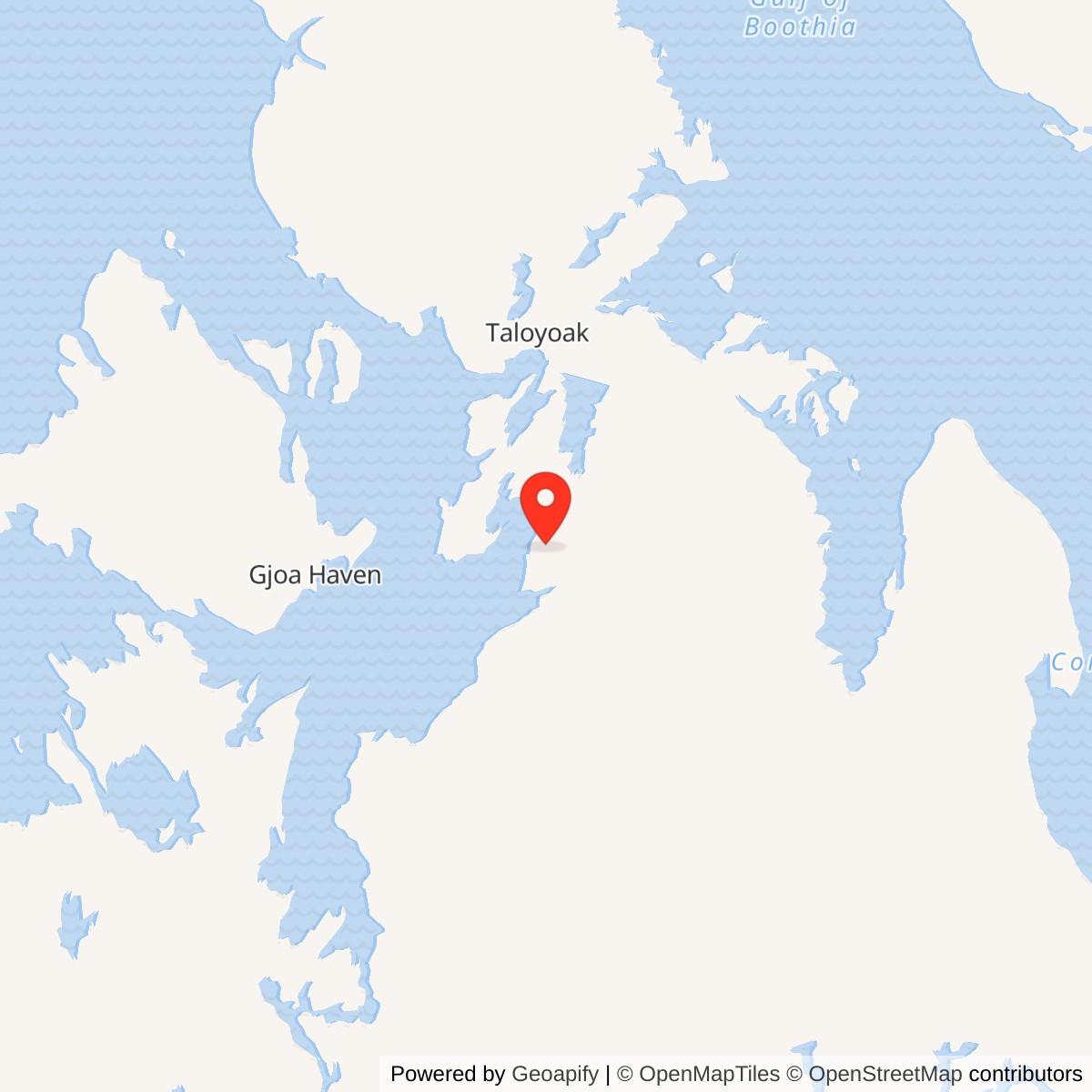
Longitude: -93.44028
Site Number: CAM-3
Current Role: North Warning System AN/FPS-117 long-range radar; year-round site staffing reported from 2024.
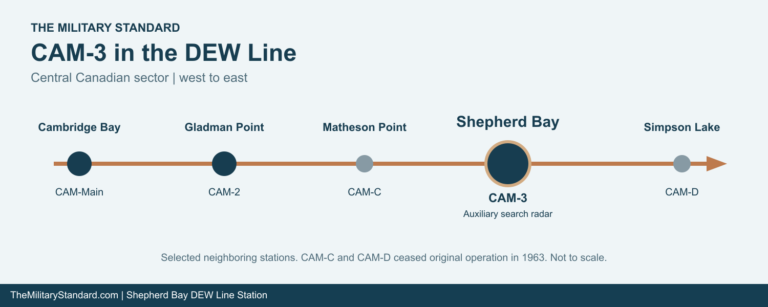
Shepherd Bay CAM-3 was a staffed auxiliary radar station on the central Canadian Distant Early Warning Line. From the southwest side of Boothia Peninsula, its crew watched the northern air approaches and passed aircraft reports through the line toward Cambridge Bay CAM-Main and North American air-defense commands. Matheson Point CAM-C lay to the west and Simpson Lake CAM-D to the east. [1] [2] [3]
- DEW Line code
- CAM-3
- Station role
- Auxiliary search-radar station
- Original radar
- AN/FPS-19
- Later radar
- AN/FPS-117
- Original DEW service
- 1957 to July 1989
- Location
- Boothia Peninsula, Nunavut
A Radar Watch Above Shepherd Bay
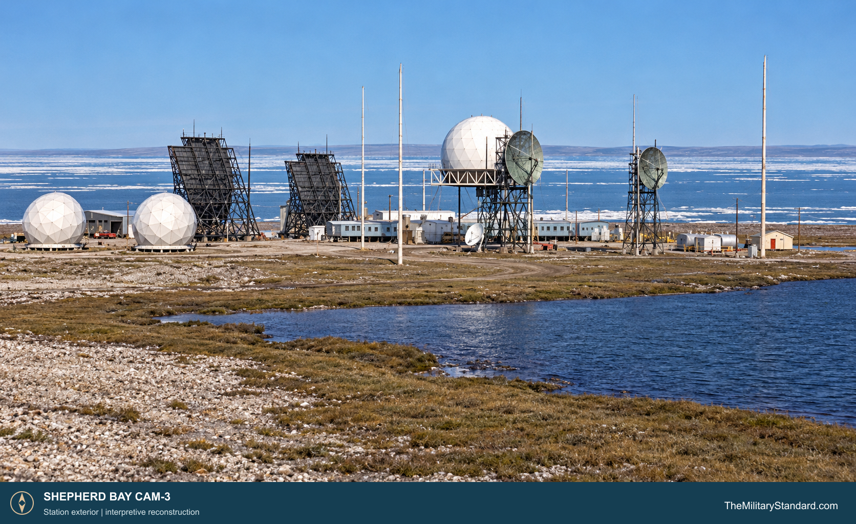
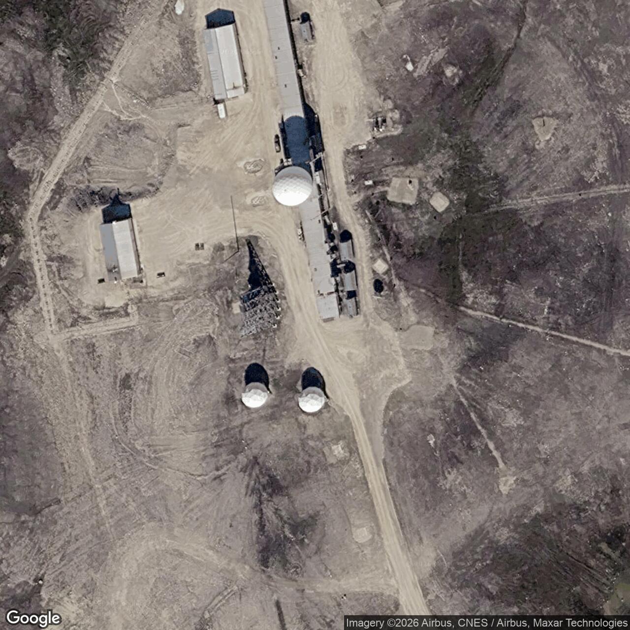
The selected installation covered about 5,470 acres of coastal plain roughly 10 kilometers north of Shepherd Bay. Its main building train stood on the crest of a U-shaped gravel ridge about 150 feet above sea level. Shallow lakes, ponds and marshy ground separated the ridge from the shore. The height gave the radar a useful horizon while leaving the station close enough to a beach supply area and a prepared airstrip. [4] [5] [6]
Survey and Construction
Spartan Air Services completed a CAM-3 siting report for Western Electric in October 1955. The survey addressed the radar and communications positions along with buildings, fuel, water, sewage, roads, the airstrip and local construction materials. The larger DEW Line construction program depended on prefabricated modules, air transport and a short seasonal supply window. At Shepherd Bay, crews established a camp and raised a continuous building train above the gravel ridge. [1] [7]
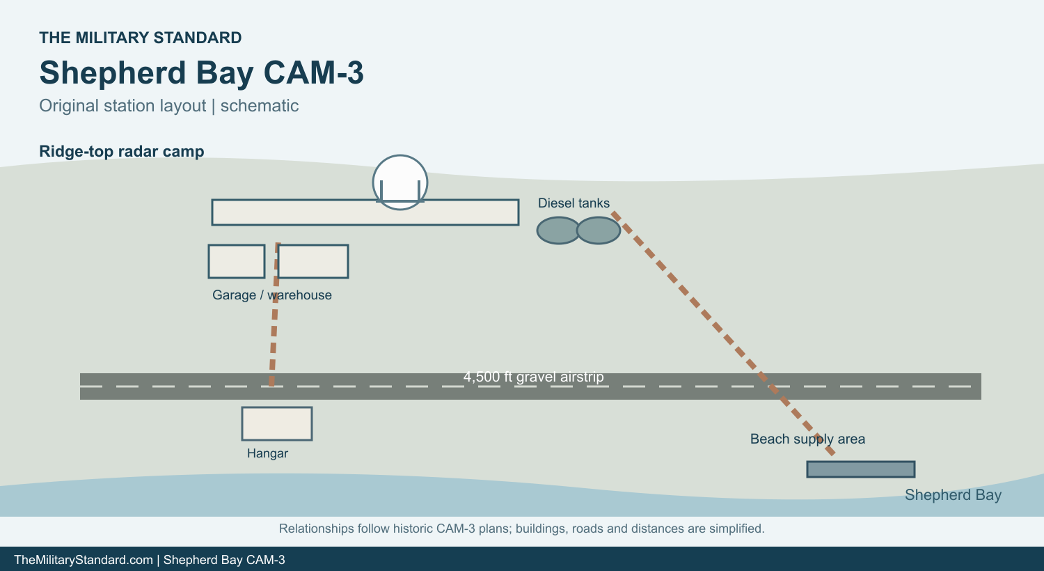
The original CAM-3 plan places the building train near a garage, warehouse, power house and dormitory. Two 65,000-gallon diesel tanks stood near the station, with separate drum and aviation-fuel storage pads. South of the train, a gravel runway measured about 4,500 by 100 feet; a hangar sat beside its western half. A power cable and roads linked the runway, camp and beach supply area. The plan also marks temporary housing and accommodation for local Inuit workers. [5]
The beach operation was a substantial part of the installation rather than a small landing point. A separate layout records fuel tanks, tank truck routes, cargo storage and an unloading area along the shore. Cargo arriving in the summer had to be moved inland to the ridge before winter isolated the station. Fuel, spare parts and food then supported the radar and crew through months when aircraft access could be difficult. [1] [5]
Radar and Communications
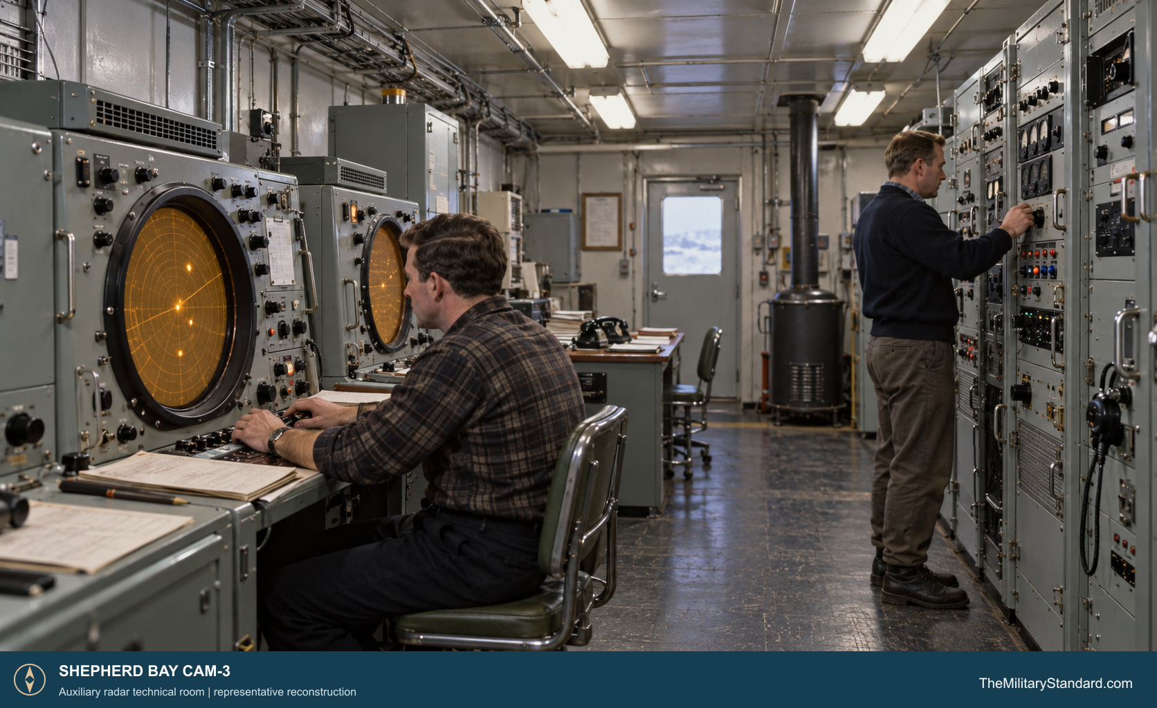
CAM-3 used an AN/FPS-19 search radar under a protective radome. Its rotating antennas supplied aircraft range and bearing to the watch crew. Operators studied the displays, checked uncertain returns and transmitted warning reports along the DEW Line. A second system, the AN/FPS-23 Fluttar, used continuous-wave Doppler equipment at intermediate stations to warn of low-flying aircraft between the larger radar posts. [1] [8]
The intermediate stations on either side of Shepherd Bay were Matheson Point CAM-C and Simpson Lake CAM-D. Their Doppler alarms could prompt CAM-3 and neighboring search-radar crews to examine a sector of sky more closely. The original intermediate stations closed in 1963, while Shepherd Bay continued its search-radar and communications work. [1] [2]
The station also carried long-distance tropospheric-scatter radio, air-ground radio and internal telephone circuits. Large curved billboard antennas stood near the building train, with smaller dish and mast antennas serving other radio paths. The communications equipment mattered as much as the radar display: aircraft information had to travel from an isolated Arctic site to other stations and control centers before it could be acted upon. [1] [5] [6]
Buildings, Staff and Daily Life
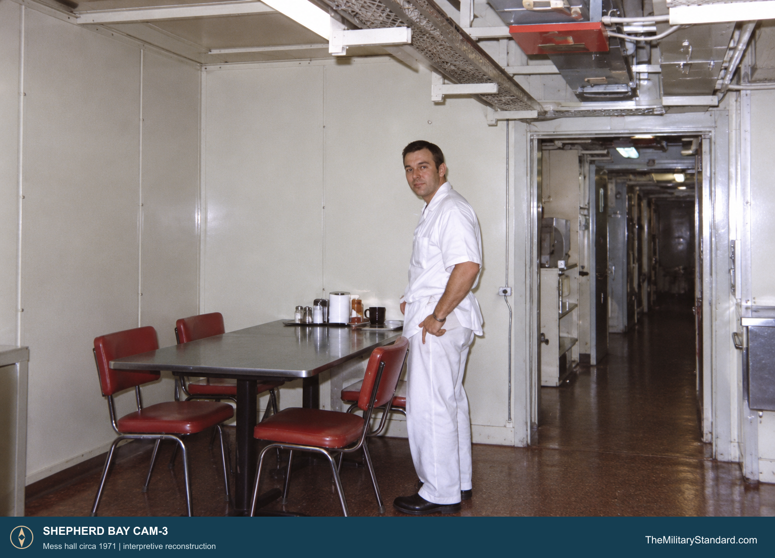
The heated module train brought technical rooms, power equipment, offices and living space together in one raised structure. Auxiliary stations used prefabricated modules for radar and communications rooms, a power plant, sleeping rooms, a kitchen, dining area and recreation space. The CAM-3 building layout also identifies a day tank, garage, warehouse and emergency antennas. Later additions included satellite-communications equipment. [5] [8]
Radar operators, radio technicians, generator mechanics, cooks and vehicle crews kept the watch running. A station gallery identifies Ambrose Aknavigak as a utility operator and Jim McEachern as chef in 1971. The station also employed local Inuit people. At a 2000 community meeting, Alex Aleekee recalled working as a heavy-equipment operator at CAM-3 in the 1960s; he and Alice Aleekee described first living in Air Force-provided wall tents and later in a duplex at the site. [4] [6]
The crew had to generate electricity, haul water, clear snow, maintain the airstrip and repair radios and radar in extreme weather. The period site description records a 4.5-mile round trip for potable water in both summer and winter. Its recorded temperatures ranged from about 65 degrees below zero to 74 degrees Fahrenheit, and yearly snowfall averaged about 56 inches. Housing, meals and recreation within the train gave workers a routine between watch shifts and maintenance calls. [4] [5] [8]
The station also became a landmark in local travel. Community members remembered using its telephone and receiving help from station workers when travelers were stranded. Nearby hunting routes passed the complex, so the fenced military installation remained part of a wider lived landscape. [6]
Transition to the North Warning System
Shepherd Bay remained in service after the 1963 withdrawal of intermediate Doppler posts. In the late 1980s, Canada and the United States replaced much of the staffed DEW network with the North Warning System. CAM-3 received an AN/FPS-117 three-dimensional long-range radar; the new Shepherd Bay site was established in July 1989, when the old DEW station ceased operations. [1] [3] [9]
The North Warning System radar continued to watch the Arctic air approaches from the Shepherd Bay complex. By 2018, Canadian project records described CAM-3 as a remotely monitored long-range station served by maintenance teams from Cambridge Bay CAM-Main. The record gave a normal helicopter flight time of about two hours and 40 minutes from Cambridge Bay and described scheduled quarterly maintenance visits, corrective trips and seasonal project crews. Radar information was relayed by satellite communications to the Canadian Air Defence Sector at North Bay. [9]
The staffing pattern changed again in 2024. A North Warning System contractor report says CAM-3 moved to year-round on-site staffing that year. Shepherd Bay thus remains a working radar location, although its equipment and operating arrangements differ markedly from the original DEW Line camp. [9] [10]
Chronology
- October 1955 The CAM-3 siting report is completed for Western Electric. [7]
- 1955 to 1957 Crews build the ridge-top station, airstrip and beach supply facilities. [1] [5]
- July 31, 1957 The completed DEW Line enters operation. [11]
- 1963 The original intermediate Doppler stations close; CAM-3 continues as an auxiliary radar station. [1] [2]
- July 1989 The North Warning System site is established and original DEW operations cease. [3]
- 2018 Canadian records describe CAM-3 as a remotely monitored long-range radar maintained from Cambridge Bay. [9]
- 2024 The North Warning System contractor reports a move to year-round on-site staffing. [10]
Related Sites
- DEW Line Station Directory
- DEW Line History
- AN/FPS-19 Search Radar
- AN/FPS-23 Fluttar Radar
- AN/FPS-117 Long-Range Radar
- Cambridge Bay CAM-Main
- Jenny Lind Island CAM-1
- Matheson Point CAM-C
- Simpson Lake CAM-D
Information sources (12)
- PDFU.S. Air Defense Command, A History of the DEW Line, 1946-1964
Contemporary account of construction, AN/FPS-19 search radar, AN/FPS-23 Doppler stations, operating arrangements and 1963 changes.
- WEBThe DEWLine, DEWLine Stations table
Places CAM-3 between Matheson Point CAM-C and Simpson Lake CAM-D.
- PDFP. W. Lackenbauer, M. J. Farish and J. Arthur-Lackenbauer, The Distant Early Warning Line: A Bibliography and Documentary Resource List, 2005
Identifies CAM-3 as a DEW auxiliary and later NWS long-range station; dates the July 1989 transition.
- WEBThe DEWLine, Shepherd Bay CAM-3 station page
Period description of the site, climate and water haul, with later photographs and recollections.
- WEBThe DEWLine, CAM-3 site and building layouts
Plans identify the station train, fuel plant, garage, runway, hangar, beach supply area and antennas.
- PDFNunavut Water Board, CAM-3 Shepherd Bay Community Consultation Report, 2000
Records local recollections of station employment, housing, travelers, telephone access and the two billboard antennas.
- WEBU.S. Army Corps of Engineers, Annotated Bibliography: Distant Early Warning System, Alaska, item 252
Identifies the original October 1955 Shepherd Bay siting report and its topics.
- WEBThe DEWLine, Auxiliary and Intermediate Site Layouts
Standard auxiliary station module plan and initial staffing target.
- WEBNunavut Impact Review Board, Shepherd Bay CAM-3 North Warning System file 03DN117
Describes the long-range radar, remote monitoring, CAM-M maintenance support and seasonal staffing as of 2018.
- PDFNunavut Water Board, CAM-3 2024 Annual Report, March 2025
Reports the 2024 move to year-round on-site staffing.
- WEBU.S. Space Force, Space Heritage: North America's Polar Shield, 2026
Summarizes the 1957 DEW Line opening and radar role.
- PDFGovernment of Nunavut, Nunavut Lands and Resources Devolution Agreement, 2024, Department of National Defence schedule
Lists the Shepherd Bay CAM-3 radar property and associated parcels.