
Rowley Island DEW Line Station, Canada
FOX-1 watched the Foxe Basin gap from a remote island plateau, then returned to radar service under the North Warning System.
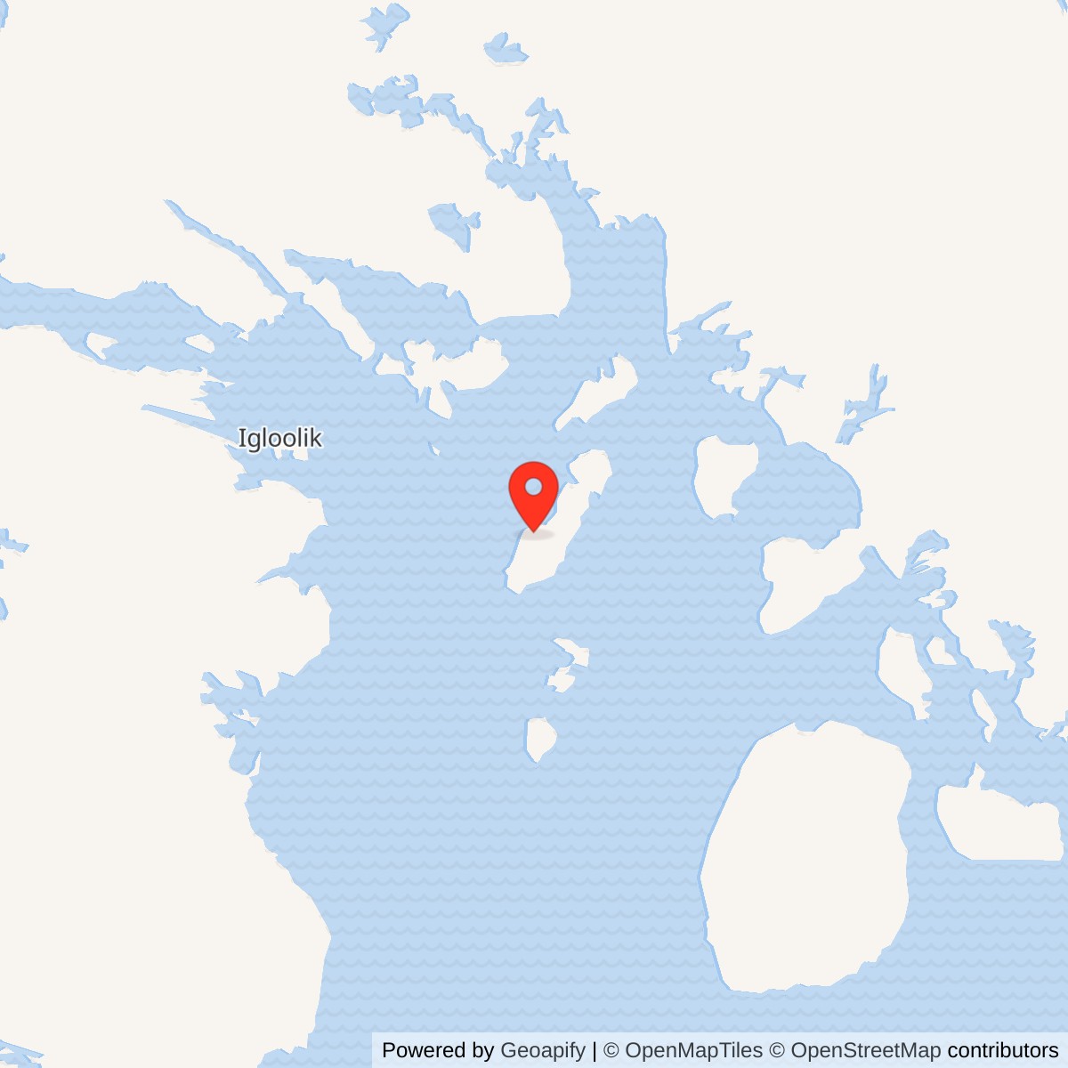
Longitude: -79.0653
Site Number: FOX-1
Current Role: North Warning System short-range radar site reported operational in 2012; present status requires confirmation.
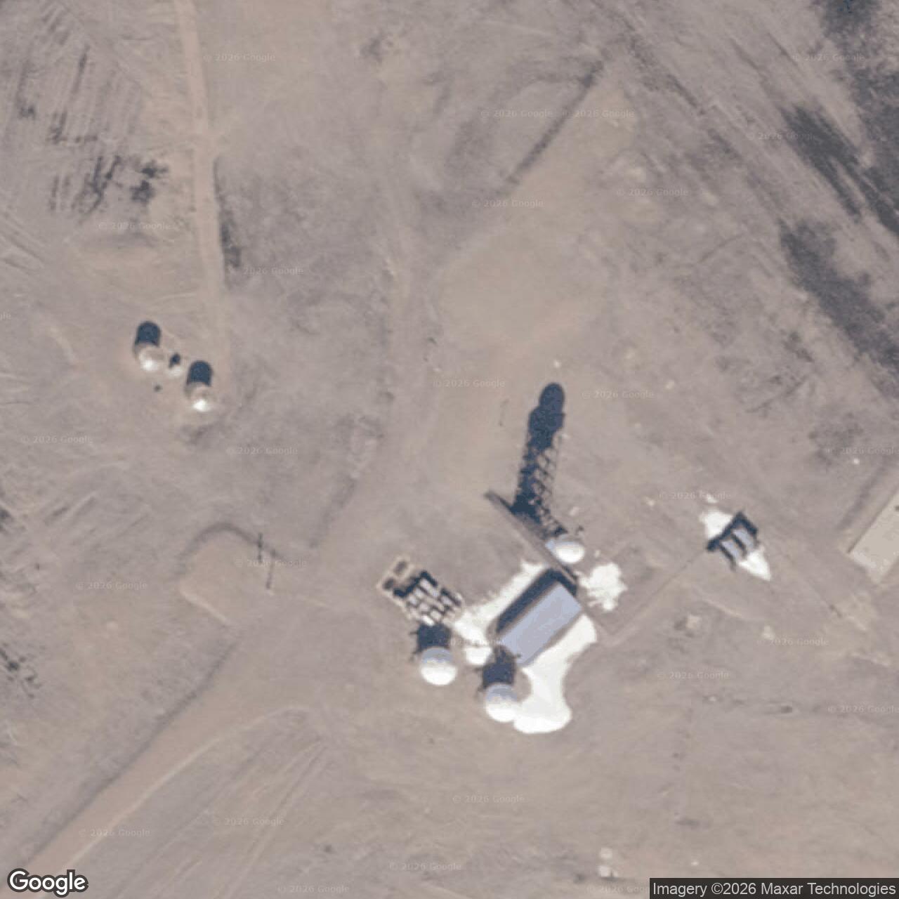
FOX-1 stood on Rowley Island in Foxe Basin, between the Melville Peninsula and Baffin Island. It was an auxiliary station of the Distant Early Warning Line, the network built to detect aircraft approaching North America across the Arctic. The station watched the gap east of Hall Beach FOX-Main and passed radar reports through the FOX sector communications chain. An Air Defense Command table records manual operations beginning in August 1957. [1] [3] [9] [10]
- DEW Line code
- FOX-1
- Station role
- Auxiliary search radar
- Original radar
- AN/FPS-124
- Location
- Rowley Island, Foxe Basin, Nunavut
An Auxiliary Radar Station on Rowley Island
The selected plateau rose about 180 feet above sea level. Shallow lakes and poor drainage surrounded it, while low shores and tidal flats complicated the movement of construction supplies. The station was remote from the nearest communities, Hall Beach and Igloolik. Its occupied compound was compact, but the associated airstrips, shore landing and service routes spread across a much larger island area. [3] [4] [5]
Building FOX-1
Construction crews were working at Rowley Island by 1955. A November photograph shows workers laying foundation sills for the prefabricated building train. The following spring, transport aircraft delivered material onto an early airstrip. In August 1956, crews unloaded supplies from landing craft at the beach. Fuel, modules, steel and equipment had to be moved inland before winter made shore delivery impossible. [4] [5] [6]
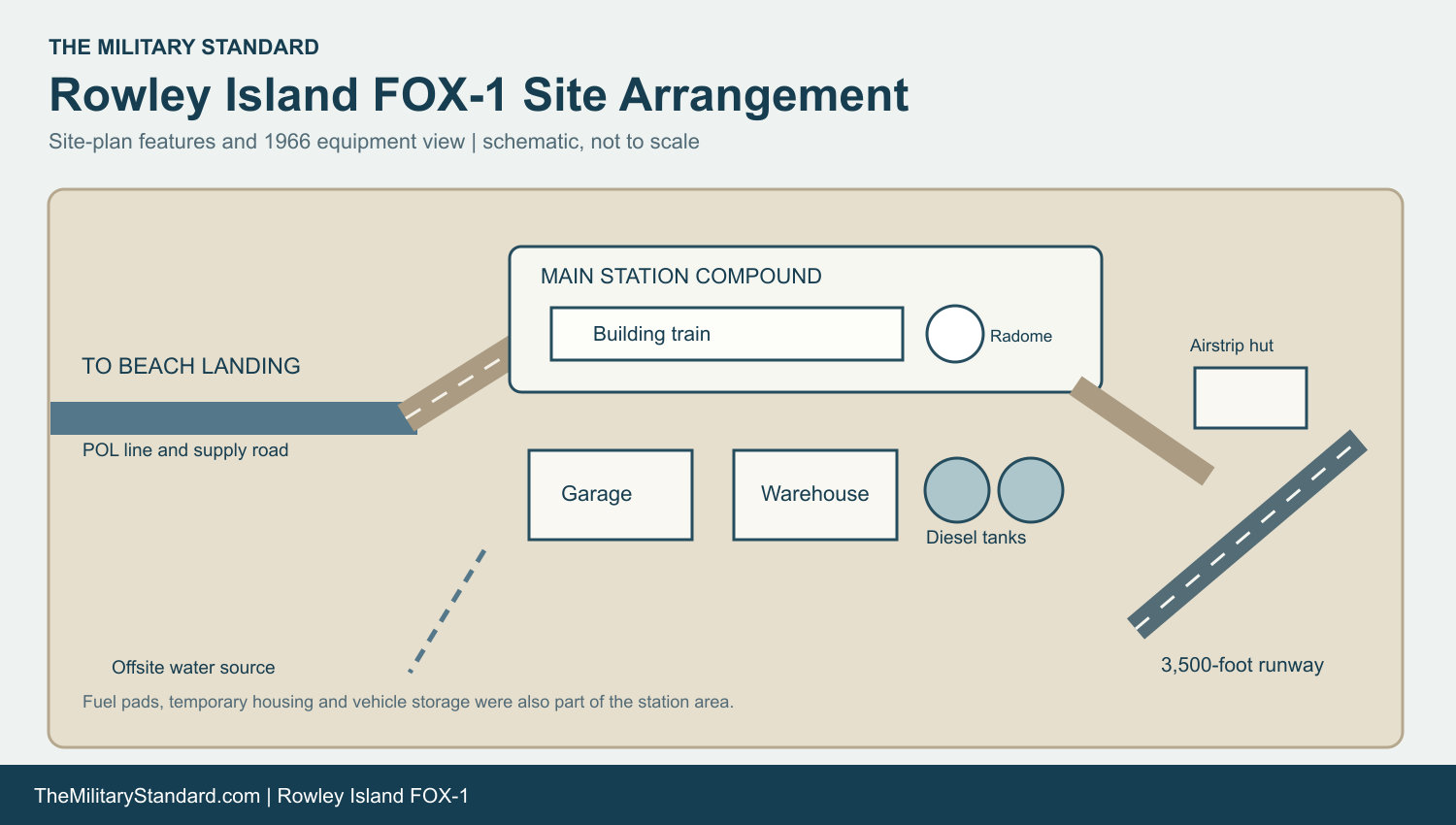
The permanent station plan placed the long module train beside the main radar and communications position. A warehouse and garage stood near the train, with two 65,000-gallon diesel tanks, a pumphouse, vehicle storage, and fuel pads nearby. A separate temporary construction camp, latrine and shower, and additional storage areas appear on the plan. A POL line connected the beach route with the station, while a power cable and access road tied the compound to the airstrip. [5]
The plan marks a 110 by 3,500-foot runway, with an airstrip hut, illuminated wind cone and overrun. A 1956 photograph records a DC-6 landing on the 3,500-foot strip. The later Canadian government inventory describes two airstrips at FOX-1. The shore landing, runway and vehicle routes gave the station its supply lifelines; none made resupply routine in poor Arctic weather. [4] [5] [3]
A construction chef, Matt Soroka, recalled waiting a week at Churchill before weather allowed the onward flight via Hall Beach to Rowley Island in 1956. He remembered that activity increased sharply when icebreakers and supply ships arrived in mid-July. His six-month account gives a rare glimpse of the workers who fed the crews while the station was still taking shape. [6]
Radar and Warning Work
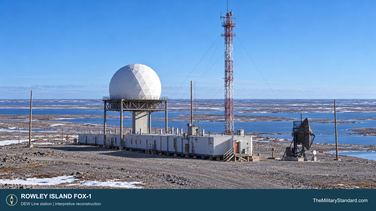
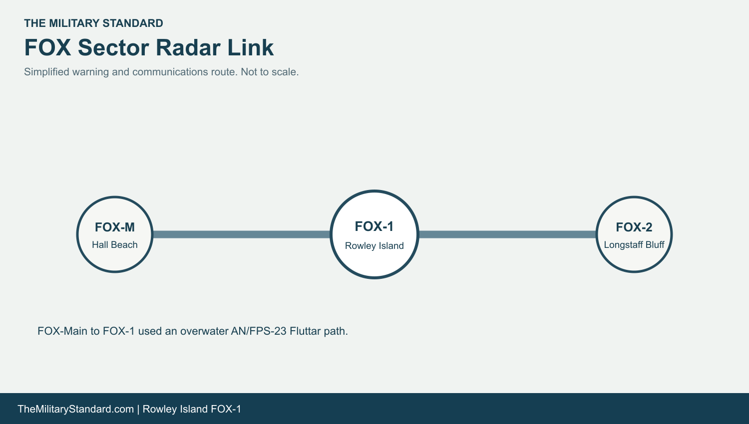
The original search radar was the AN/FPS-19. Its rotating antenna operated beneath the white geodesic radome, high enough to keep the beam clear of the building train and nearby terrain. Air Defense Command also listed AN/FPS-23 equipment at FOX-1. That equipment supported the Fluttar low-altitude gap-warning system, which used separated transmitters and receivers to detect an aircraft crossing the radio path between stations. [1] [7]
The FOX-Main to FOX-1 section was unusual because water lay between the two stations and there was no intermediate transmitter site on that span. A former DEW Line radar technician described a transmitter at Hall Beach sending the Fluttar signal east to a receiver at Rowley Island. FOX-1 also received reports over the network and sent its own observations back toward sector control at Hall Beach. [7]
Inside the station, operators monitored the radar scope, examined an alarm or unfamiliar track, and reported it through the warning chain. Radar surveillance and reporting were the mission; interceptor control took place elsewhere. The station plan also identifies a ceiling projector and communications-related antenna positions, while the 1966 station photograph shows the radome, tall lattice communications tower and a smaller dish near the module train. [7] [5] [4]
Life and Logistics on an Isolated Island
FOX-1 needed people to run the radar, maintain radio circuits, operate generators, repair vehicles, handle fuel and supplies, prepare meals and keep the airstrip serviceable. A surviving station plaque identifies ITT Arctic Services as the company that operated and maintained FOX-1 for the United States Air Force. The small module train brought work and living spaces close together, reducing outdoor travel when wind, snow or darkness made movement hazardous. [5] [10] [11]
Fresh water was a daily logistical task. The station description records a four-mile round-trip haul to a potable-water source in both summer and winter. Diesel storage and the power plant supplied the electricity and heat needed for radar, communications and occupied buildings. Vehicles and an airstrip connected the compound with its shore landing and the supply flights that could reach it. [4] [5]
Weather could interrupt both work and relief travel. Construction crews endured snow-covered foundations and polar bears approaching the living quarters. Once operational, the station depended on the same cycle of fuel delivery, equipment repair, food service and runway maintenance that sustained the radar watch. [4] [6] [5]
Closure and North Warning System Reuse
The U.S. Air Defense Command relieved FOX-1 of its air-defense mission on October 1, 1970, and inactivated the station on January 15, 1971. Those dates distinguish the end of the warning mission from the later administrative inactivation. The original DEW Line radar and staffed auxiliary role ended, although the island later regained a radar function. [2] [1] [3]
Between 1990 and 1994, the North Warning System built an automated short-range radar station on the FOX-1 property. A station table identifies the later equipment as AN/FPS-124 and gives August 1991 for its establishment. The 2012 Canadian government report described the automated radar as operating at that time. Much of the old DEW facility was removed or buried during construction, leaving the older station layout harder to read on the ground. [3] [8]
Chronology
- 1955 Crews begin permanent site work; a November photograph shows foundation sills for the building train.
- 1956 Aircraft and landing craft deliver material, while the runway and station take shape.
- August 1957 Air Defense Command records the start of manual operations at FOX-1.
- October 1, 1970 FOX-1 is relieved of its air-defense mission.
- January 15, 1971 Air Defense Command records the station as inactivated.
- 1990-1994 A North Warning System short-range radar facility is built on the former DEW property.
- August 1991 A North Warning System station table dates establishment of the FOX-1 short-range site to this month.
- 2012 The Canadian government reports that the automated short-range radar is operating.
Related Sites
Information sources (11)
- PDF[1] U.S. Aerospace Defense Command, Historical Data, 1946-1973, DEW Line site table
Station-specific August 1957 manual operations date, AN/FPS-19 and AN/FPS-23 equipment, and January 15, 1971 inactivation.
- PDF[2] U.S. Air Defense Command, A Chronology of Air Defense, 1914-1972
October 1, 1970 relief from the air-defense mission and January 15, 1971 inactivation.
- PDF[3] Aboriginal Affairs and Northern Development Canada, The Big Picture: Contaminated Sites in Nunavut, 2012, p. 31
FOX-1 location, original buildings, radar tower, two airstrips, DEW service to 1970, and the later North Warning System site.
- WEB[4] The DEWLine, FOX-1 Rowley Island historical description and station gallery
Topography, four-mile water haul, and 1955-1956 construction photographs. Privately credited images used as research references only.
- WEB[5] The DEWLine, FOX-1 station plan, courtesy Lynden T. Harris
Original building train, warehouse, garage, fuel tanks, construction camp, ceiling projector, access road, runway and water-source arrangement.
- WEB[6] Tony Eu, Six Months on Top of the World, Neepawa Press, October 4, 2016
Matt Soroka first-person account of 1956 construction travel, weather delays, kitchen work and summer resupply. Later closure claim is superseded by Air Defense Command records.
- WEB[7] Paul Kelley, North American Air Defence Systems, Canadian Air Defence Museum
First-person explanation of AN/FPS-19 surveillance, low-altitude gap coverage, FOX-Main to FOX-1 Fluttar exception, and operator reporting.
- WEB[8] The DEWLine, North Warning System site table
FOX-1 short-range AN/FPS-124 site and August 1991 establishment date.
- WEB[9] North Warning System Airlift, Appendix 1, fixed-wing site locations
Published approximate modern FOX-1 short-range radar coordinate.
- PDF[10] U.S. Air Defense Command, A History of the DEW Line, 1946-1964
DEW Line construction, auxiliary-station role, air-warning procedures and overall network design.
- WEB[11] FOX-1 station plaque, photograph courtesy Jim Hartwell
The station plaque identifies ITT Arctic Services as operating and maintaining FOX-1 for the United States Air Force. Privately credited photograph used as a research reference only.