
Tununuk Camp DEW Line Station, Canada
Designed for a five-person crew, this Doppler warning post watched the gap between Shingle Point and Tuktoyaktuk from 1957 to 1963.
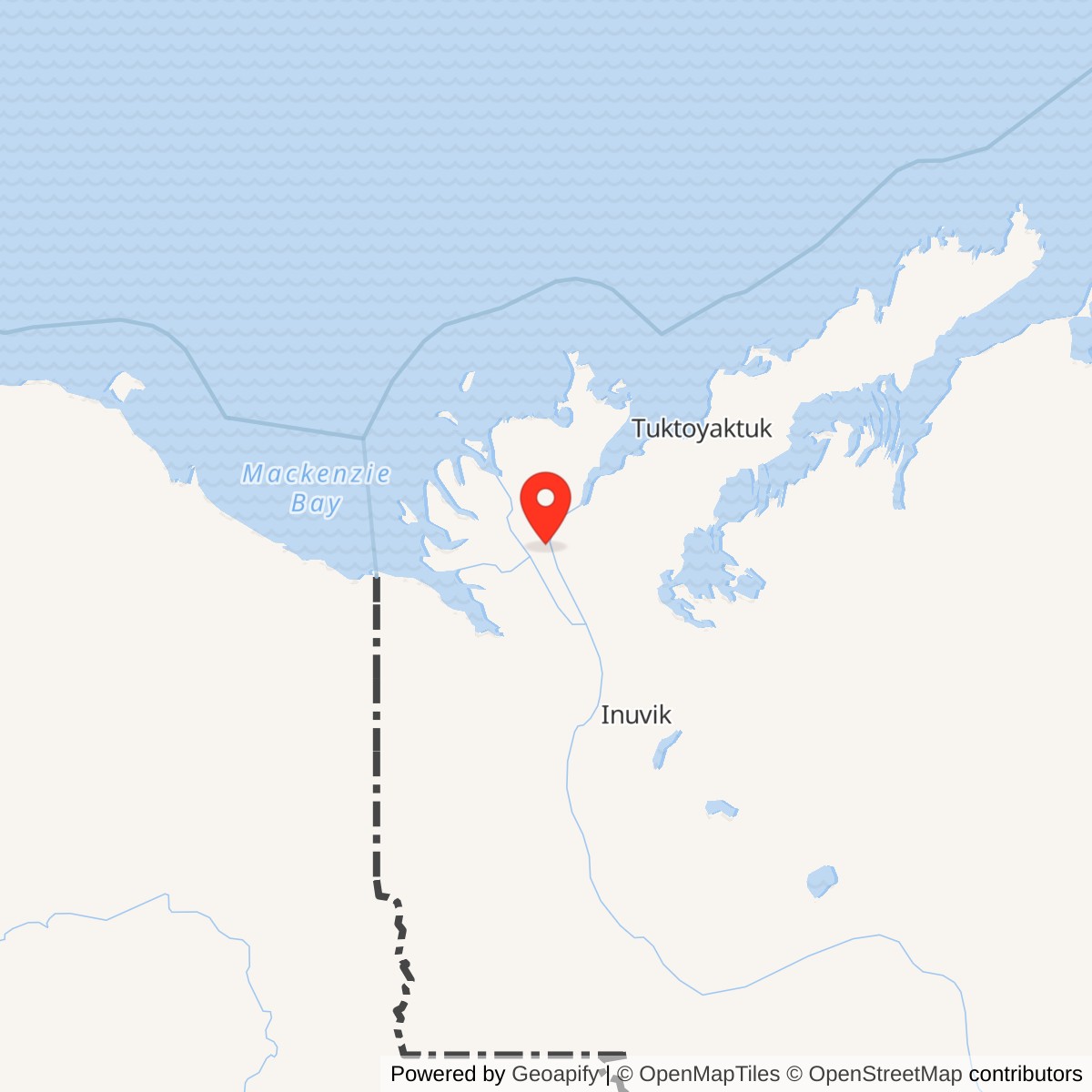
Longitude: -134.666667
Site Number: BAR-C
Current Role: Former DEW Line and later Imperial Oil logistics site; above-ground structures demolished in 2012.
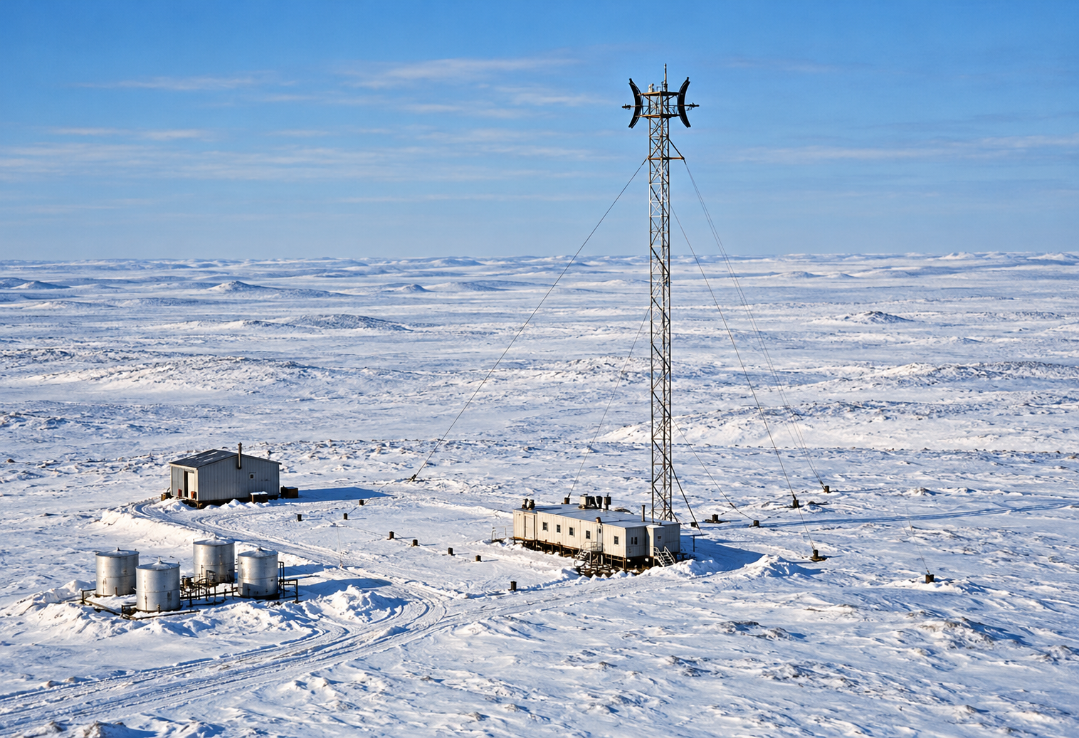
Tununuk Camp, code BAR-C, was a small intermediate station in the Distant Early Warning Line on the Mackenzie Delta in the Northwest Territories. Its AN/FPS-23 Doppler equipment watched a low-altitude gap between the larger radar stations at Shingle Point and Tuktoyaktuk. BAR-C began manual operation in August 1957 and closed on July 21, 1963. Its compact buildings and single tall tower made it very different from its larger neighbors. [1] [2] [3]
- DEW Line code
- BAR-C
- Historic role
- Intermediate low-altitude gap-warning station
- Historic equipment
- AN/FPS-23
- Manual operation
- August 1957
- Closed
- July 21, 1963
- Approximate location
- 69.0028, -134.6667
A Small Post on the Mackenzie Delta
The United States and Canada built the DEW Line to warn of aircraft approaching across the Arctic. Tununuk was one of the intermediate posts placed between the broad search radars. It stood on a low, open part of Richards Island near the Mackenzie River. A Canadian federal report places Tununuk Point within the Inuvialuit Settlement Region of the Northwest Territories. [2] [5] [6]
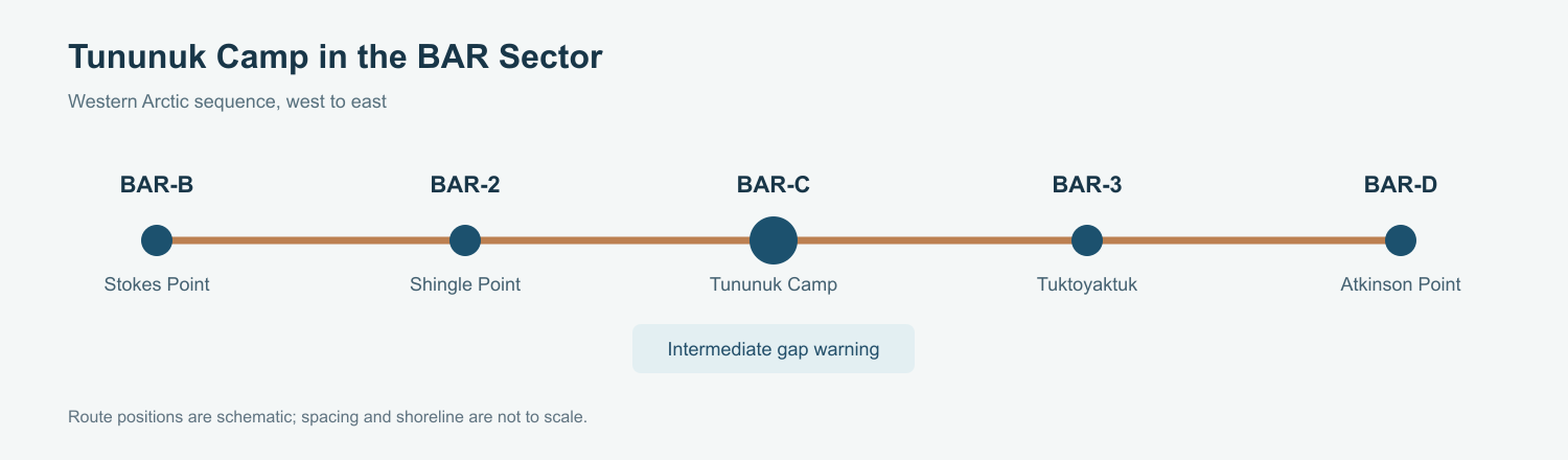
An April 1957 aerial photograph shows the station near completion: a short raised module train at the foot of one tall guyed tower, a separate low building, small tanks, and tracks crossing the snow. The archive identifies the tower as about 150 feet high. The station was much smaller than the adjacent auxiliary radar posts, and its equipment did not require a large search-radar dome. [1] [2] [4]
Tununuk was also a traditional Inuvialuit gathering place. Catherine Navaluk Cockney recalled that her parents, Winnie and Walter Cockney, maintained a summer cabin there. Her account places the new radar post in an already familiar landscape of family travel, fishing and berry gathering. [5]
The AN/FPS-23 Gap-Warning Mission
Air Defense Command listed AN/FPS-23 at BAR-C. This Doppler system was designed to detect aircraft crossing a narrow warning zone at low altitude, adding coverage between the main and auxiliary search radars. Operators at intermediate stations reported through their sector main station, which also provided supplies and more extensive maintenance support. [1] [2]
The western BAR-sector sequence ran from Stokes Point to Shingle Point, then through Tununuk to Tuktoyaktuk. Shingle Point and Tuktoyaktuk were auxiliary sites with broader search-radar duties. Tununuk filled a narrower gap in that chain. Keeping the tower, electronics, power and communications working was the daily task of the small crew. [1] [2] [3]
The 1957 aerial records the tower as the visual center of the installation. Its height gave the Doppler equipment a clear path above the flat delta terrain. The system depended on a working chain of equipment and communications; detection at this small post was useful only when an alert could move to the larger stations and the continental defense network. [2] [4]
Buildings, Crew, and Life at Tununuk
Intermediate DEW Line stations were designed around five connected modules and a civilian crew of five. The modules put essential working and living space inside one heated train, while separate utility structures supported the installation. The April 1957 photograph shows the compact train, service building and tanks rather than the sprawling layout of an auxiliary station. [2] [4]
A small complement had to cover radar operation, equipment repair, generators, heat, food and routine upkeep in severe weather. The sector main station supplied intermediate posts and handled larger repairs. In 2010, a federal site account still recorded an airstrip, although it was then unusable, and a serviceable barge dock. Air and river transport were practical links between this remote place and the rest of the Mackenzie Delta. [2] [5]
Catherine Navaluk Cockney was born at Tununuk. She remembered her mother preparing dry fish and collecting berries, and relatives reaching the family by boat in summer and Bombardier tracked vehicle in winter. Her father took a DEW Line job at Shingle Point in 1962, and the family lived there for two years before returning to Tununuk in 1964. Their experience shows how DEW Line employment and local family life met at these Arctic sites. [5]
The station itself remained a short-lived post. Its small staff and equipment served the military warning mission, while Inuvialuit families continued to use the area for living, travel and harvesting. Both histories belong to Tununuk. [1] [2] [5]
Closure and Later Use
Air Defense Command gives July 21, 1963 as the end of BAR-C operations. The closure was part of a wider withdrawal from intermediate DEW Line sites as the warning system changed. The Canadian site chronology records no North Warning System successor at Tununuk. [1] [2] [3]
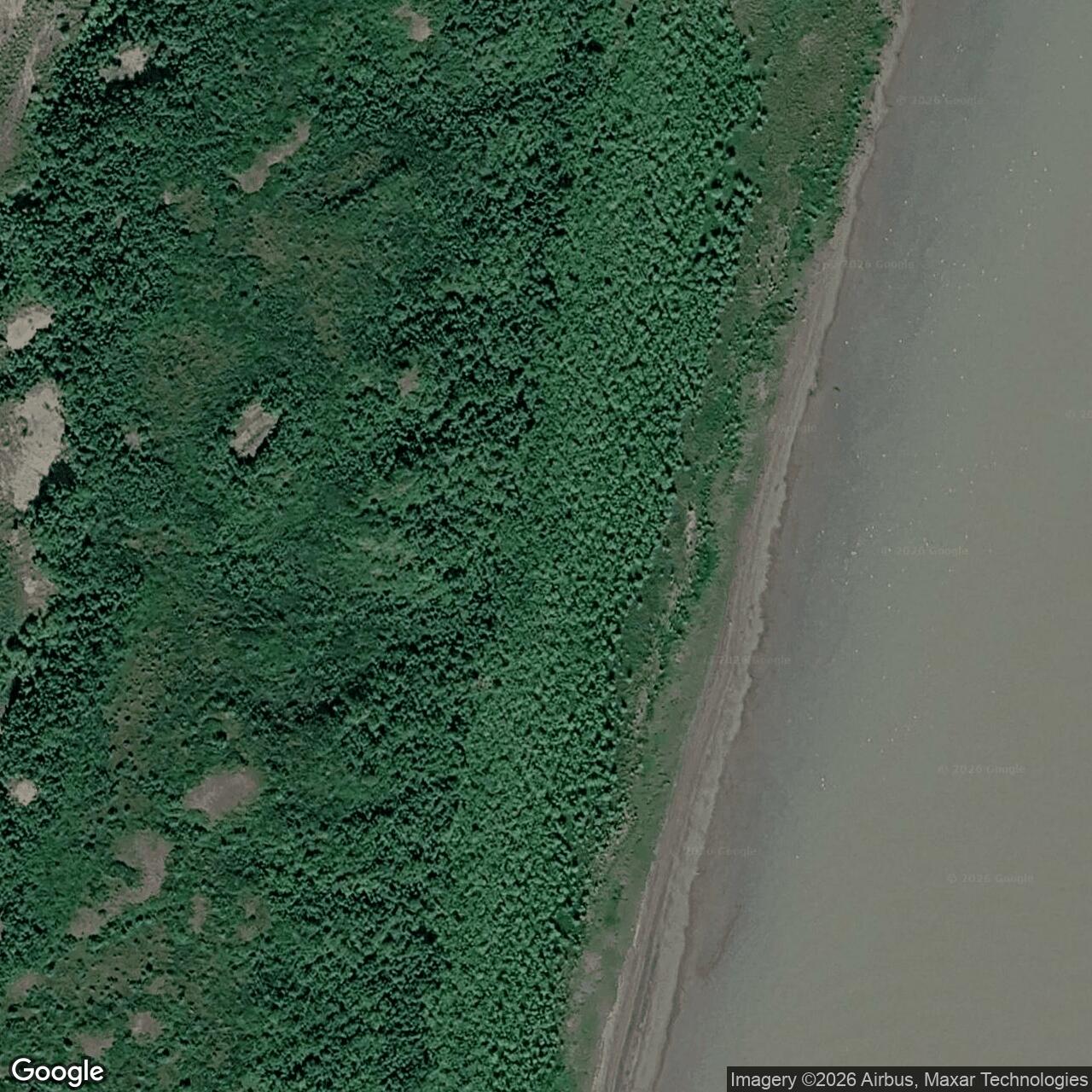
After the military period, Imperial Oil used the former station area as a Mackenzie Delta logistics base. A 2010 federal account recorded two remaining DEW Line modules beside an Imperial tank farm. Above-ground structures were later demolished. The large tanks visible in later aerial views belong to that oil-exploration phase, not to the original 1957 radar station. [4] [5] [6] [7]
Chronology
- April 1957: An aerial photograph shows the compact BAR-C compound and its 150-foot Doppler tower near completion. [4]
- August 1957: Air Defense Command records manual operation at Tununuk Camp with AN/FPS-23 equipment. [1]
- 1962: Walter Cockney takes a DEW Line job at Shingle Point, and his family moves there from Tununuk. [5]
- July 21, 1963: BAR-C closes as an operating DEW Line intermediate station. [1]
- 1971 to 1974: Imperial Oil leases the former station area for Mackenzie Delta exploration logistics. [6]
- 2010: A federal site account describes two remaining DEW modules, an Imperial tank farm, an airstrip and a barge dock. [5]
- 2012: Above-ground structures are demolished during later site work. [7]
Related Sites
Information sources (7)
- PDFAerospace Defense Command, Historical Data of the Aerospace Defense Command, 1946-1973, DEW Line station table
Station-specific BAR-C entry for Tununuk Camp, Northwest Territories, August 1957 manual operation, AN/FPS-23 equipment, and July 21, 1963 closure.
- PDFDavid Neufeld, BAR-1 Distant Early Warning Auxiliary Station, Komakuk Beach, Yukon Territory, Parks Canada historical study
Explains intermediate-station staffing, five-module design, main-station supply and reporting, and the 1963 intermediate-site closures.
- PDFDefence Research and Development Canada, DEW Line and North Warning System site chronology, CR 2012-076, BAR-C table
Identifies BAR-C as an intermediate site, supplies a published coordinate, and records its 1963 closure without an NWS successor.
- WEBThe DEWLine, BAR-C Tununuk Camp photo archive
The April 1957 completed-site aerial documents the 150-foot Doppler tower and compact station layout; later Imperial Oil tanks are identified separately.
- PDFIndian and Northern Affairs Canada, What Is Happening in the Inuvialuit Settlement Region?, 2010, Tununuk site and Catherine Navaluk Cockney account
Documents the former station, 2010 remains and transport features, and an Inuvialuit first-person account of family life and DEW Line work at Tununuk.
- PDFEnvironment Canada, Federal Contaminated Sites Action Plan Annual Report, 2014, BAR-C case study
Places Tununuk Point in the Northwest Territories on Inuvialuit private lands and documents the 1963 transfer and later Imperial Oil use.
- PDFSahtu Land and Water Board, Imperial Oil public hearing transcript, June 12, 2014, BAR-C discussion
Describes the 1957-1963 military period, later logistics use, and demolition of above-ground structures in 2012.