
Kulusuk Island DYE-4 DEW Line Station, Greenland
A coastal warning station on Kulusuk Island, linking Greenland radar reports toward Iceland and sustained through an exposed road, airfield and utility system.
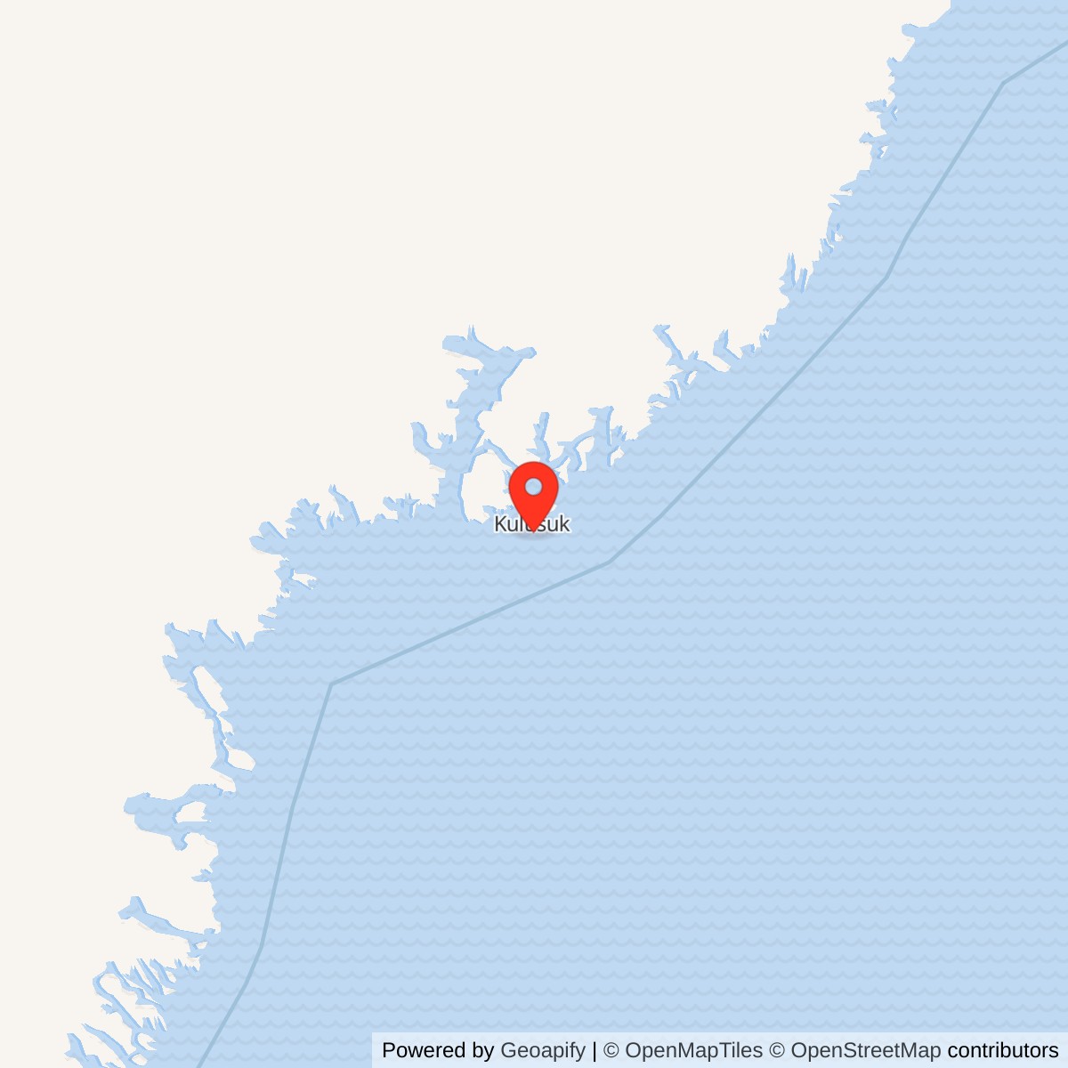
Longitude: -37.1596
Site Number: DYE-4
Current Role: Former summit DEW buildings removed; foundations and later antenna facilities documented in 2013 heritage report. Kulusuk Airfield continued under civilian responsibility; current summit condition not independently surveyed.
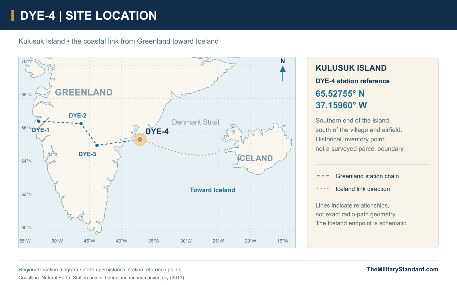
Historical station reference 65.52755, -37.15960. View map [6]
- DEW Line code
- DYE-4
- Call sign
- Big Gun
- Role
- Coastal auxiliary radar and communications station
- Search radar
- AN/FPS-30
- Operations console
- AN/FSA-26
- Operating period
- August 1, 1961 to September 1991
- Recorded site area
- 100 acres
- Location
- Southern Kulusuk Island, East Greenland
History
DYE-4 stood on a coastal summit at the southern end of Kulusuk Island, where the Greenland DEW Line met the Denmark Strait. Known by the call sign Big Gun, it was an auxiliary aircraft-warning station in the Cape Dyer sector. Its AN/FPS-30 radar watched the eastern end of the Greenland chain, while communications carried reports toward Iceland. The position made the station an important junction between an inland warning line and an ocean crossing, rather than an isolated radar overlooking an empty coast. [2] [12]
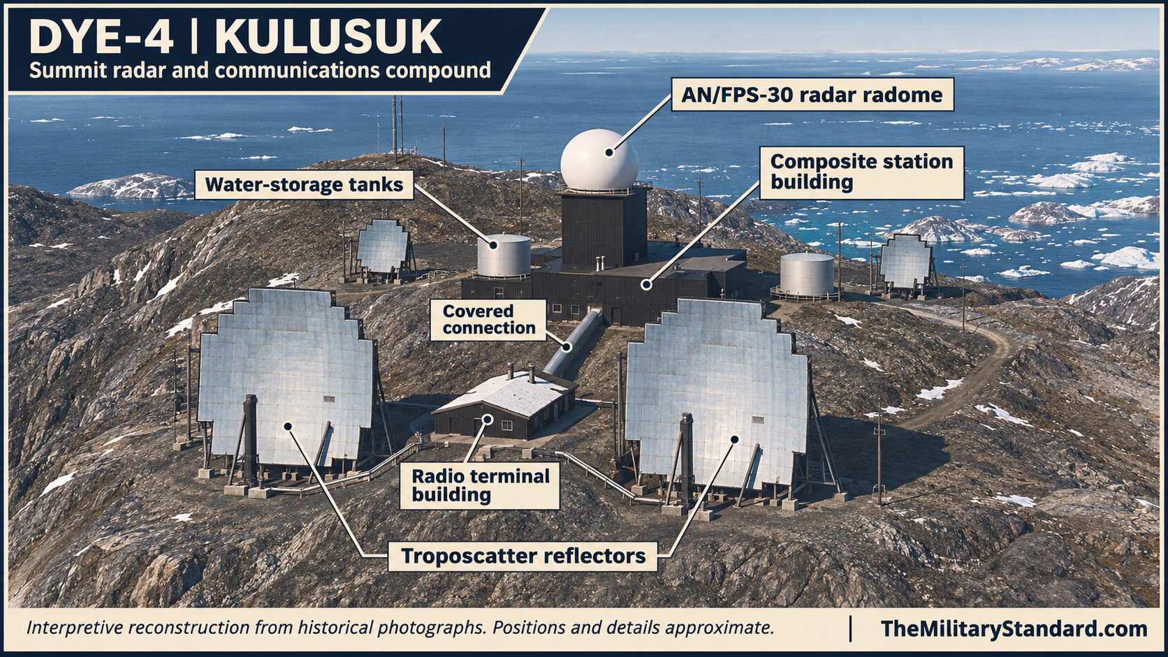
Unlike DYE-2 and DYE-3, Kulusuk was a bedrock site reached by road from a supporting airfield. A tall radome tower rose from a low composite building, and large communications reflectors occupied the surrounding ridge. This arrangement kept much of the working and living accommodation together, but exposed the equipment to North Atlantic weather. The same coastal access that made ships, road vehicles and conventional aircraft useful also placed the station in the path of storms capable of interrupting its watch. [6] [13] [18]
Survey, Construction and Opening
Survey work preceded permanent construction. Bob Wilder's photographs identify a coastal DEW East survey campaign in 1957, and Stan Tull's diary follows a separate Page Communications Engineers party in 1958. Page worked under Western Electric on radio-path tests, weather observations and geodetic positioning. Tull's party sailed aboard Theron and relied on helicopters to move people and equipment into difficult terrain. Establishing the site therefore meant proving a communications path as well as finding ground on which to build. [4] [19]
The temporary survey installation had its own communications problems. Tull described generator vibration, unreliable fuel-line connections and the difficulty of obtaining dependable HF contact with other parties. In July 1958 the crew used a 100-watt transmitter at about 1,000 MHz to test the path toward Iceland. These were survey measurements, distinct from the later AN/FPS-30 search radar. Terrain screening, alignment and reliable power all had to be resolved before a permanent reporting link could be treated as an operating service. [4]
The contemporary NORAD history records August 3, 1958 as the start of DYE-4 construction. Danish Arctic Contractors built the coastal stations, while separate contractors worked on the ice-cap sites. Roads, landing areas and support facilities were essential early works because the heavy station equipment could not be installed without a supply chain. Construction continued through the 1959 and 1960 seasons; completing the structures and installing electronics were successive stages, followed by the opening of the Greenland warning extension on August 1, 1961. [3] [5] [2]
The Island Road and the Summit Compound
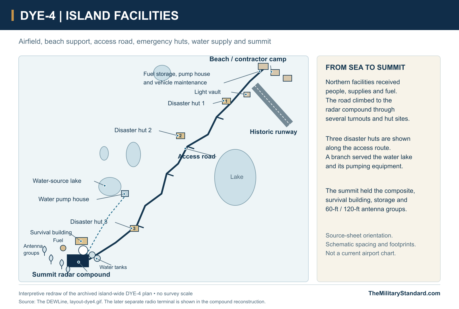
The archived plan shows an installation spread between a northern airstrip and beach-support area and the radar compound at the opposite end of the road. The beach area included contractor accommodation, fuel storage, a pump house and vehicle-maintenance facilities. Along the road were turnouts and three disaster huts, with water-supply facilities reached by a branch. These outlying places were part of the station's practical operation even though they did not all appear in a close view of the radome. [13]
The summit compound concentrated radar work, communications, power and accommodation on a confined rocky site. Period photographs show the central square tower, paired cylindrical water tanks, the low composite block and large curved reflector antennas standing outside it. The plan distinguishes 60-foot and 120-foot antenna groups and marks a separate survival building. Different facilities met different needs: the radome sheltered the search antenna, the external reflectors served radio links, and emergency shelter provided an alternative if the main building became unsafe. [13] [18]
By 1977 a separate Radio Terminal Building was connected to the main station by a covered passage. Fred Teeter identified the building in his photographs and described the difficulty of moving outdoors during high winds. The enclosed connection joined separated work areas while reducing exposure on the ridge. Keeping radio equipment away from the composite did not remove the need to reach it for maintenance, and the passage made that movement possible without crossing the open ground between the buildings. [1]
Radar, Communications and Console Duty
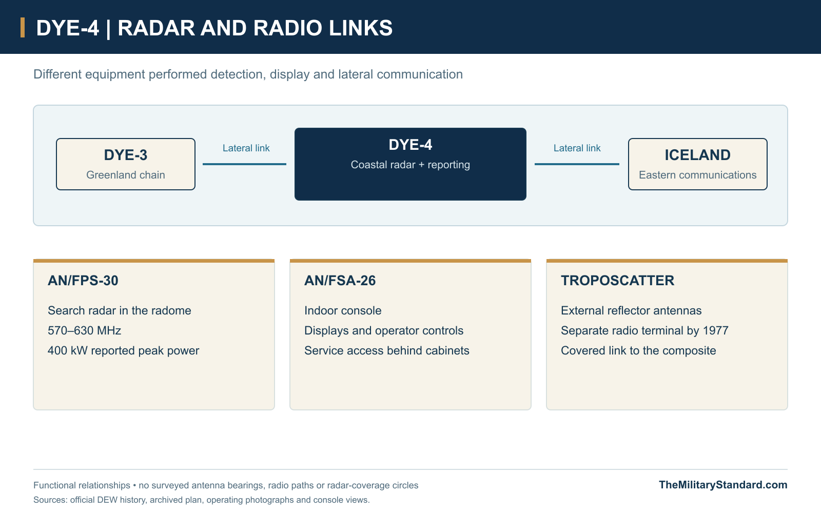
The Bendix AN/FPS-30 operated in the 570-630 MHz band at a reported peak power of 400 kilowatts. It combined search radar and identification functions, with an associated audible target alarm. The official DEW history described detection out to 200 nautical miles under the tested conditions. That figure expressed a capability of the equipment, rather than a guarantee for every target in every weather situation. At Kulusuk, useful warning depended on both the radar and the communications that carried its reports onward. [2]
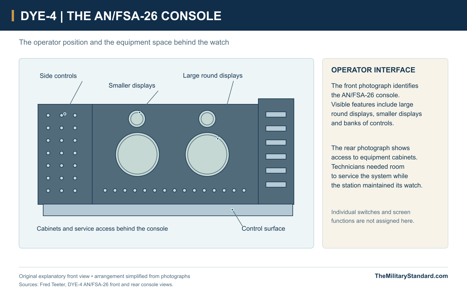
The summit's large reflector antennas belonged to the lateral communications system, distinct from the search antenna inside the radome. DYE-4 linked the Greenland stations with Iceland; the official history specifically records communications to the Naval Operations Control Center there. On the operator side, photographs identify an AN/FSA-26 console with two large round displays, smaller displays and banks of controls. The console was the working interface for the watch, while the outdoor radar and radio systems performed the sensing and transmission functions. [2] [15] [18]
The rear-console photograph reveals equipment cabinets and access behind the operator position. That service space matters because a continuous watch required fault finding and repair as well as attention to the displays. Fred Teeter's account distinguishes console operators from radicians, who combined technical and operating skills. His 1976 training included simulated console situations, weather observation and reporting, and first aid. The work therefore connected the aircraft picture with the practical responsibilities of a small, remote station community. [9] [16]
Power, Water and Supply
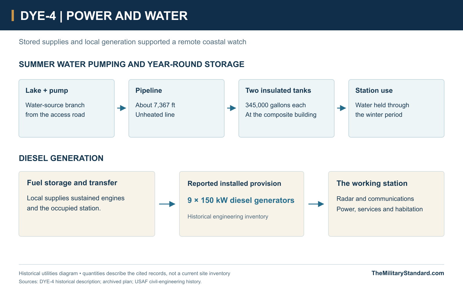
Fresh water was an annual storage problem rather than a simple connection to a nearby settlement. The historical description specifies a lake pump, an unheated pipeline approximately 7,367 feet long and two insulated tanks of 345,000 gallons each at the composite building. Water was pumped in summer to meet the station's needs through the year. The tanks and pipeline tied the summit to the surrounding terrain, while stored water reduced dependence on maintaining a vulnerable pumping route in winter. [1]
Electric power was equally central to the mission. The Air Force engineering history reports provision of nine 150-kilowatt diesel generators at DYE-4. Engines required fuel, maintenance and working air intakes, so the generating plant depended on services beyond the electrical equipment itself. Fuel storage, engines and distribution supported radar, communications and occupied rooms together. Loss of generation could therefore affect warning, heating and habitation at the same time, making the power plant a critical part of station endurance. [5]
Sondrestrom provided the wider logistics base. In 1983 the 4684th Air Base Group supported the Greenland DEW network, and Greenlandair supplied DYE-4 by de Havilland Dash 7. The New York Air National Guard's 109th Tactical Airlift Group, known as the Raven Gang, also moved supplies and oversized loads to DYE sites two through four, including heavy machinery and structural material. Kulusuk's airfield allowed conventional transport access, but the last road leg still had to remain usable. Air delivery and summit access were separate tasks, and a cleared runway alone did not reopen the whole supply chain. [7] [13]
The People Behind the Watch
Federal Electric received the initial operation and maintenance contract for the Greenland extension. In the 1970s FELEC Services, Inc., organized by Federal Electric, operated and supplied the Line. The resident technical workforce was civilian, while its warning mission and logistics served military requirements. Operators, radicians, mechanics and support staff shared a station whose services had to function continuously. The staff on console duty and visiting military aircrews worked within the same warning system, with different organizational responsibilities. [2] [9]
A contemporary mess-hall photograph shows personnel eating together around the station tables. Such shared rooms were part of the installation's working life, alongside maintenance spaces and the watch positions. The Greenland museum account describes routine shifts, recreation and, at the coastal stations, opportunities for fishing and walking outside. It also records restrictions on contact with local residents in the earlier period, later relaxed. Kulusuk was consequently less geographically sealed off than an ice-cap station, while remaining a restricted workplace within an inhabited island landscape. [17] [6]
Storm Damage and Recovery
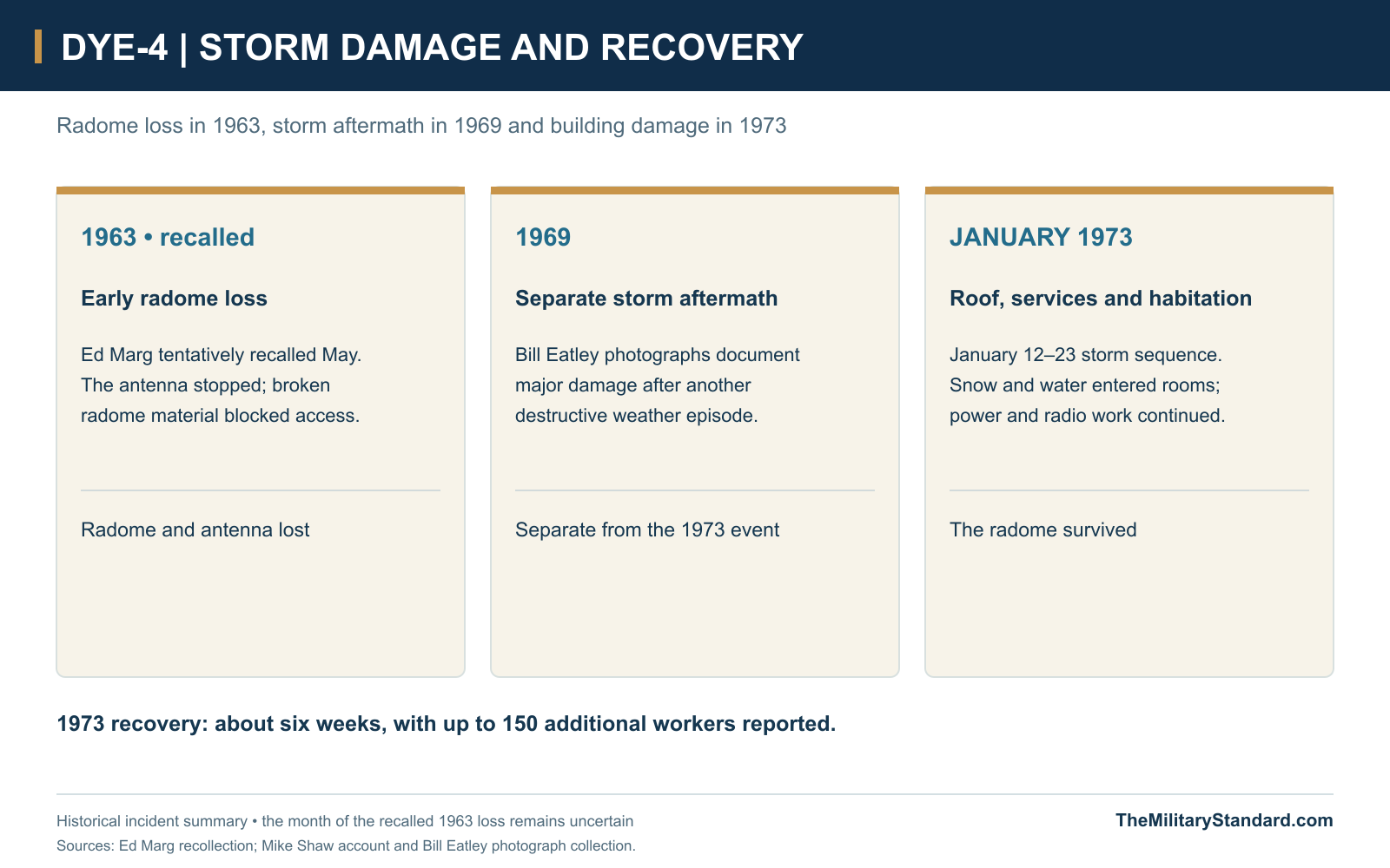
Ed Marg recalled a destructive radome loss in 1963, tentatively placing it in May. While he was on console duty, the antenna stopped and broken radome material blocked the access door above. The crew reported the loss to the sector controller. Photographs also document major damage in 1969. These incidents must be kept separate from the January 1973 emergency, when the radome survived but the station building was extensively damaged. The protective envelope around a radar was only one part of the station's weather vulnerability. [9] [8]
The 1973 storm sequence began on January 12 with sixteen people reported at DYE-4. The survival building and beacon were damaged; roof loss then admitted snow and meltwater into equipment spaces. Personnel sheltered electronics and kept generator air filters clear of debris, while the airfield and road prevented immediate relief. After winds subsided on January 23, a six-week effort involving up to 150 additional workers restored full operation. The radome retained its structural integrity, making the damaged roof, power and communications spaces central to the emergency. [8]
Withdrawal in 1991 and the Former Site
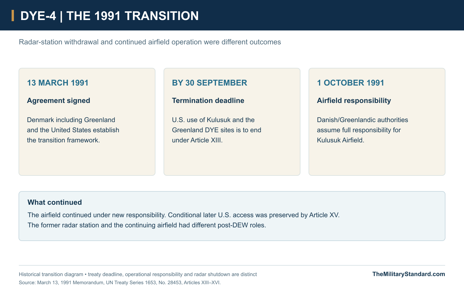
DYE-4 remained in service after the ice-cap stations closed. On March 13, 1991, Denmark, Greenland and the United States signed a memorandum covering the transition of Kulusuk and Sondrestrom. Article XIII required United States use of Kulusuk and the Greenland DYE sites to end by September 30, 1991, with Danish/Greenlandic responsibility for Kulusuk Airfield beginning October 1. A transition committee supervised the phased transfer, linking military withdrawal with arrangements for the continued operation of the airfield. [10] [11]
The agreement also preserved arrangements for later United States access to the airfield in specified circumstances, with consultation and responsibility for services. That continuing aviation relationship did not keep DYE-4's warning radar in operation. The airport could pass into a civilian role while the summit radar station closed, leaving two different legacies from one military support system. Kulusuk's airfield and the former hilltop compound must therefore be distinguished when describing what continued after the DEW mission ended. [10]
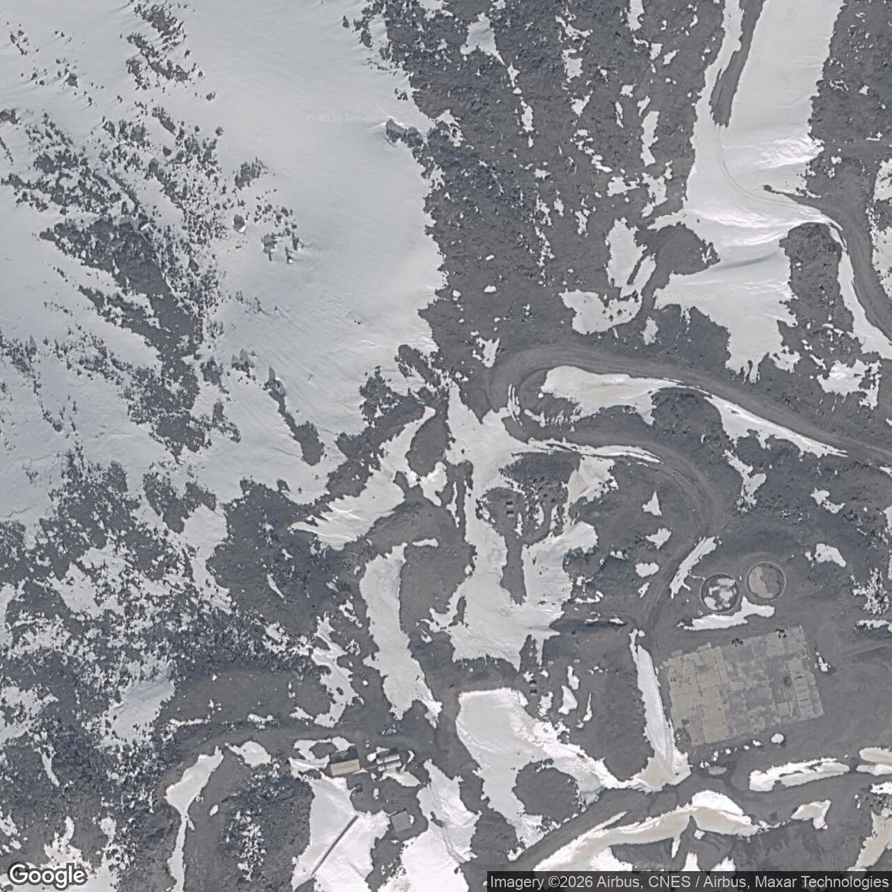
The coastal station buildings were subsequently dismantled, unlike the ice-cap structures left at DYE-2 and DYE-3. The Greenland museum report describes foundations and later antenna facilities on the coastal summits. Those remains preserve the setting of the warning station without reproducing its former working arrangement. DYE-4's history survives through its site, plans and photographs, as well as the accounts of people who kept a radar, its communications and an exposed station community functioning on the edge of the Denmark Strait. [6] [11]
Chronology
- 1957 Coastal DEW East survey photographs document early site investigation. [19]
- Summer 1958 Page Communications Engineers survey and radio-path testing at DYE-4. [4]
- August 3, 1958 Contemporary NORAD history records the start of DYE-4 construction. [3]
- 1960 Structures and installation work progress toward completion and acceptance. [2] [5]
- August 1, 1961 The Greenland DEW extension becomes operational. [2]
- 1963, recalled Ed Marg places an early destructive radome loss in this year; the month is tentative. [9]
- 1969 Photographs document a separate severe storm and its aftermath. [8]
- January 12-23, 1973 Storm sequence damages the buildings and services; recovery continues for about six weeks. [8]
- 1977 Fred Teeter photographs the compound, Radio Terminal Building and covered connection. [1] [18]
- 1983 Published logistics account identifies Dash 7 service and 109th oversize-cargo support. [7]
- March 13, 1991 United States-Denmark/Greenland transition memorandum is signed. [10]
- September 30, 1991 Treaty deadline for ending United States use of Kulusuk and the Greenland DYE sites. [10]
- October 1, 1991 Danish/Greenlandic authorities assume Kulusuk Airfield responsibility under the memorandum. [10]
- By 2013 Heritage report documents demolition of the coastal DEW buildings and surviving foundations. [6]
Related Sites
Information sources (19)
- WEBThe DEWLine, Site: DYE-4, historical description and Fred Teeter photographs
Historical site area, water storage, separate radio-terminal building and documented operating-era views.
- WEBThomas W. Ray, A History of the DEW Line 1946-1964, ADC Historical Study No. 31, June 1965
Greenland activation, AN/FPS-30 capabilities, initial contractor operation and the Iceland connection.
- PDFNORAD/CONAD Historical Summary, July-December 1958
DYE-4 construction start on August 3, 1958 and planned auxiliary status in the Cape Dyer sector.
- PDFStan Tull, Greenland Diary, DYE-4 survey expedition, 1958
Page Communications Engineers field party, ship/helicopter supply, survey work and temporary radio-path measurements.
- PDFUnited States Air Force, Leading the Way: A History of Air Force Civil Engineers, 1907-2012, pages 113-114
Coastal-station contractor, construction sequence and reported DYE-4 diesel-generator provision.
- PDFJens Fog Jensen, Inge Bisgaard and Jens Heinrich, Anlaeg fra Den Kolde Krig i Groenland, Field Report 34, 2013
Coastal versus ice-cap settings, daily life, demolition/remains and DYE-4 inventory reference coordinate.
- PDFCapt. Michael B. Perini, Ravens on the Ice Cap, AIR FORCE Magazine, August 1983, pages 68-71
4684th Air Base Group logistics, Greenlandair Dash 7 service to DYE-4 and 109th Tactical Airlift Group oversize-cargo support.
- WEBMike Shaw, The Big Storms of 1973 and 1969, with Bill Eatley photographs and Tim Vasquez weather review
January 1973 station emergency, reported crew, infrastructure failures and six-week recovery; separate 1969 storm evidence.
- WEBEd Marg and Fred Teeter Jr., DYE-4 recollections in DEWLine War Stories Volume 3
Recalled 1963 radome loss, civilian console-operator training and the distinction between radar operation and technical maintenance.
- PDFDenmark including Greenland and United States, Memorandum of Understanding, March 13, 1991, UN Treaty Series 1653, No. 28453, Articles XIII-XVI
September 30, 1991 termination deadline, October 1 Kulusuk airfield responsibility and continuing conditional access arrangements.
- WEBDanish Agency for Culture and Palaces, 3. Dye radarstationer, July 24, 2019
1991 DYE-4 closure and removal of the coastal stations, contrasted with surviving ice-cap buildings.
- WEBRadomes Air Defense Radar Museum, Kulusuk Island, Greenland
Big Gun call sign, AN/FPS-30 station identity, 1961-1991 service and an alternate historical coordinate.
- WEBThe DEWLine, archived DYE-4 site plan
Airstrip/beach support, access road, three disaster huts, water supply, summit compound and communications-antenna groupings.
- WEBNatural Earth, 1:50 million Admin 0 countries, vector dataset
Public-domain coastline geometry for the DYE-4 regional location diagram.
- WEBFred Teeter, DYE-4 AN/FSA-26 operations console, front view
Photographic identification and visible display/control arrangement of the console.
- WEBFred Teeter, DYE-4 AN/FSA-26 operations console, rear view
Rear access and equipment cabinets, illustrating the service space behind the operator position.
- WEBTorben Dahl, DYE-4 mess hall, circa 1960
Historical photograph of shared dining in the station community.
- WEBFred Teeter, DYE-4 summit compound, 1977, photograph 7
Operating-era relationship of the radome tower, low composite building, storage tanks and large communications reflectors.
- WEBThe DEWLine, DEW East Survey Photos, 1957, courtesy Bob Wilder
Evidence of an earlier Greenland coastal survey campaign, distinct from the 1958 construction start and Tull expedition.