
Rockville Air Station and DYE-5, Iceland
The radar watch at Rockville and the associated DYE-5 ocean communications terminal linked Iceland to the Greenland warning chain.
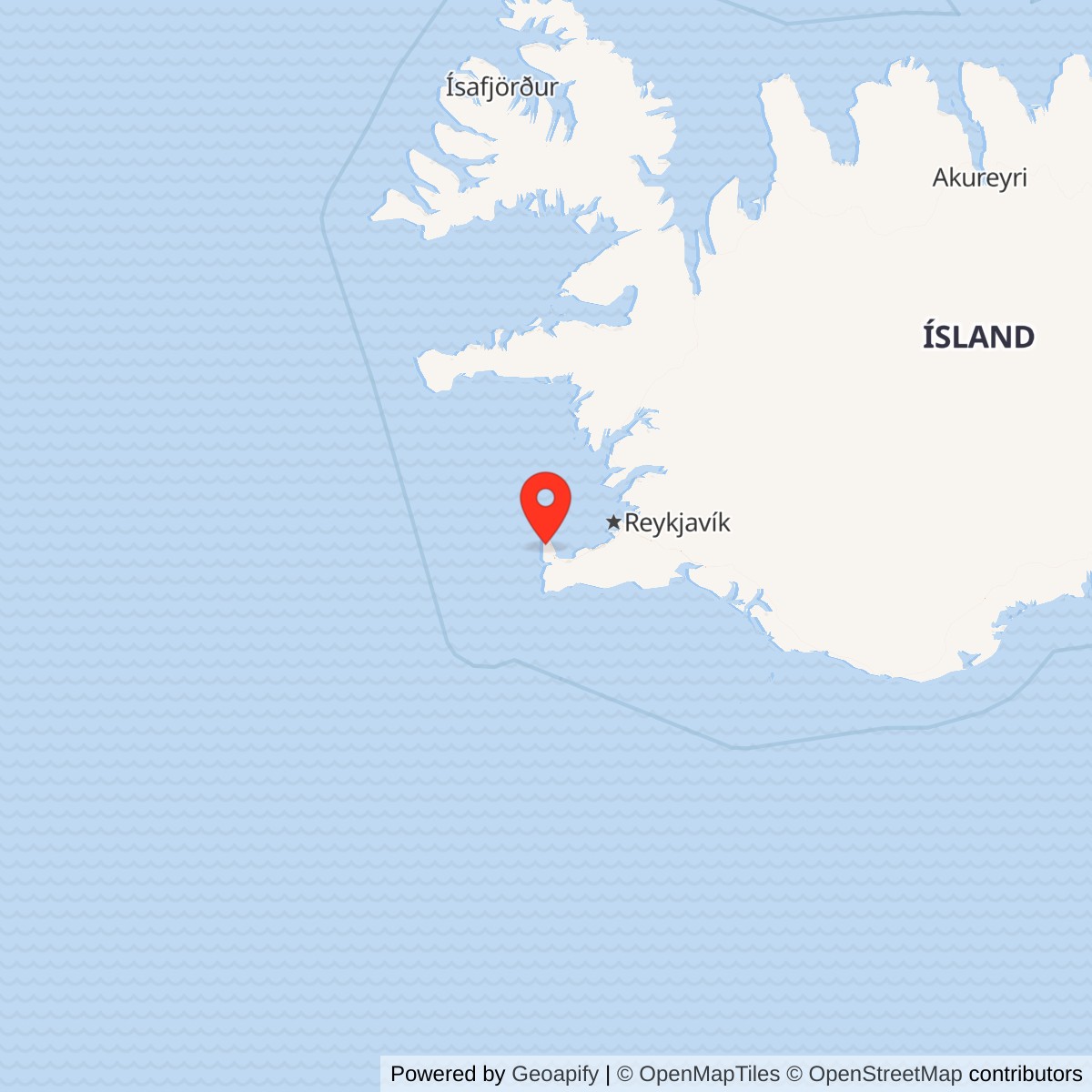
Longitude: -22.65444
Site Number: H-1; DYE-5 association
Current Role: Former Rockville compound; rehabilitation reuse and subsequent removal reported historically. Current parcel use not independently established; modern Icelandic air-defence operation is at replacement sites.
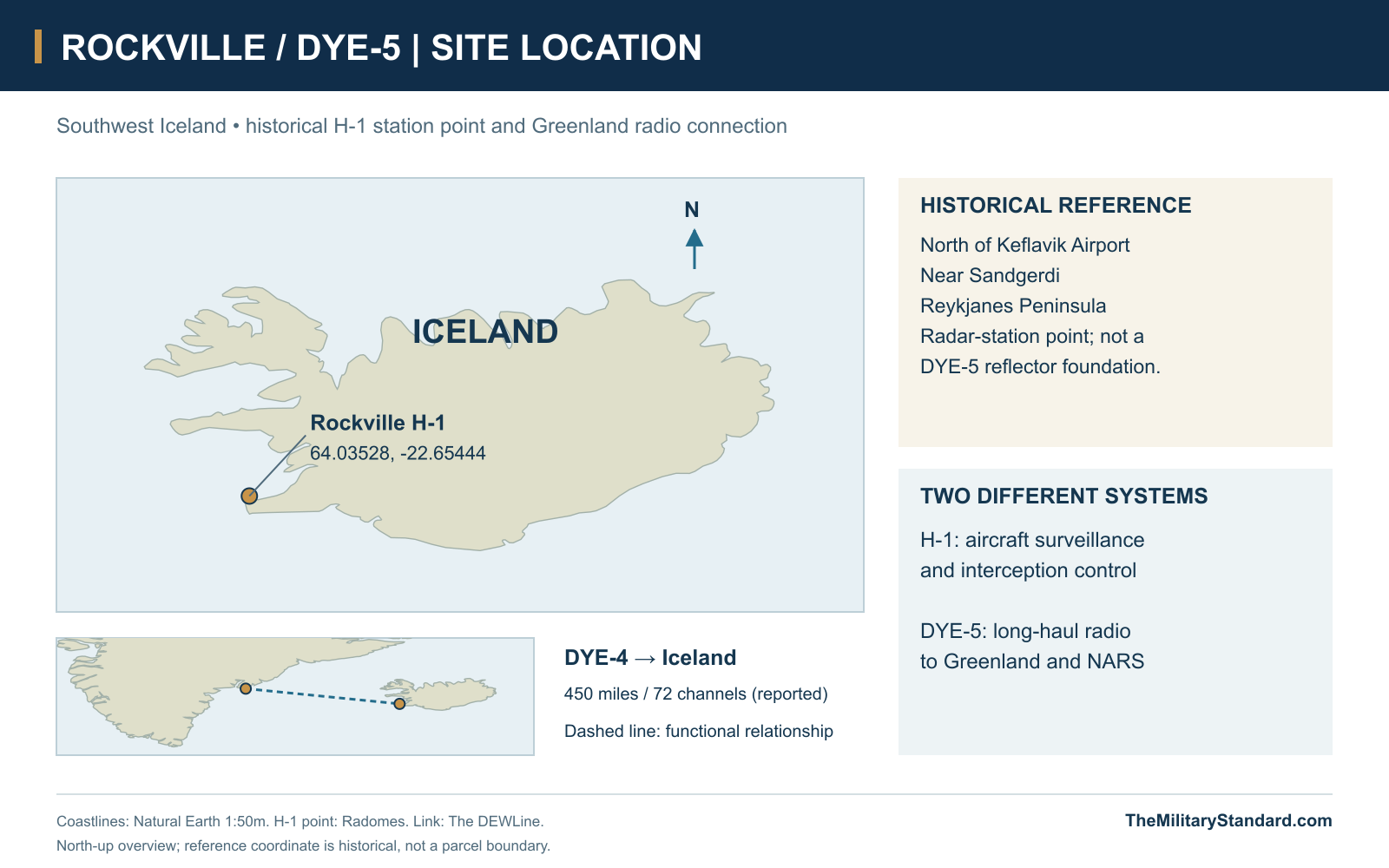
Historical H-1 radar-station reference 64.03528, -22.65444. View map The DYE-5 reflector terminal is a separate facility. [1]
- Codes
- H-1 radar station; associated DYE-5 radio terminal
- Resident unit
- 932nd AC&W, later Air Defense and Air Control Squadron
- Search radar sequence
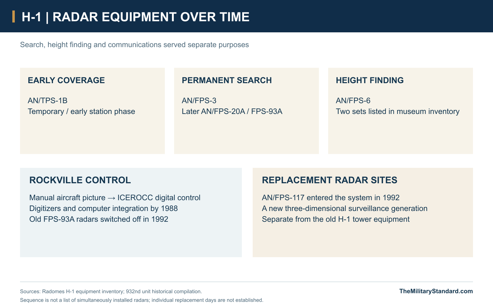
- AN/TPS-1B; AN/FPS-3; AN/FPS-20A / AN/FPS-93A
- Height finding
- AN/FPS-6
- DYE-5 radio equipment
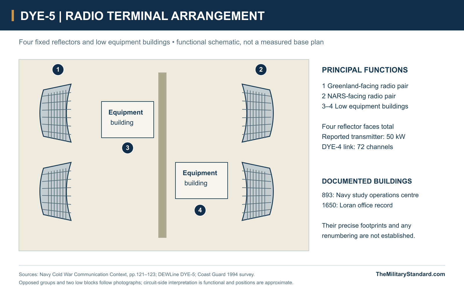
- Four fixed reflectors; reported 50-kW transmitter
- Greenland link
- Reported 450 miles; 72 channels
- H-1 permanent service
- October 28, 1953; old radar off 1992; control moved 1997; final equipment removed January 1998
- Location
- Near Keflavik and Sandgerdi, southwest Iceland
History
Rockville Air Station stood on the exposed heath north of Keflavik Airport in southwest Iceland. Its H-1 radar compound housed the 932nd Aircraft Control and Warning Squadron and Iceland's Master Direction Center. DYE-5 was the associated eastern communications terminal of the Greenland DEW chain, where reports crossed into Iceland and onward circuits. The radar station, the long-haul radio terminal and the later replacement radar were related installations with different equipment and service histories. Together they joined local aircraft surveillance to communications across the North Atlantic. [1] [2]
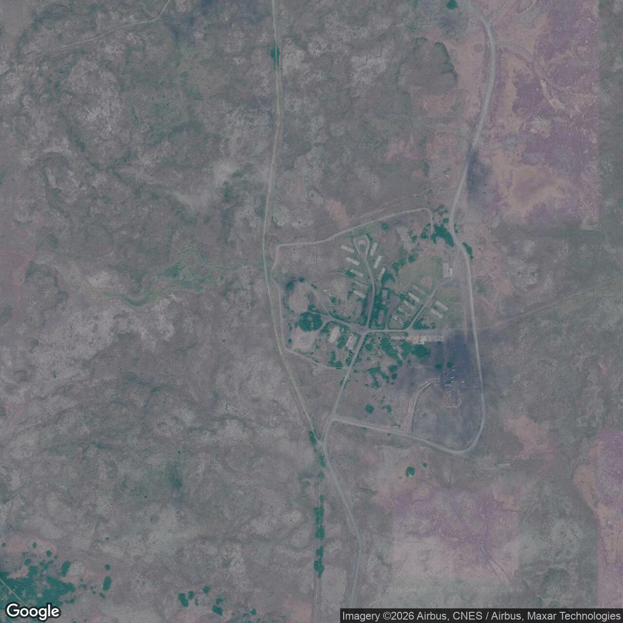
The historical Rockville reference point is 64.03528 north, 22.65444 west, converted from the radar museum's published seconds. This identifies H-1, not a surveyed DYE-5 reflector foundation. Rockville's low buildings and white radomes occupied a road-connected compound rather than a Greenland ice-cap structure. Period aerial views show separate radar and accommodation areas, while photographs of the communications terminal show four enormous open-air reflectors. Each appearance reflects a particular task: detecting aircraft, controlling the air picture or carrying information beyond the horizon. [1] [10] [5]
From the 1952 Deployment to Permanent H-1
The 932nd formed in Massachusetts in May 1952. Veteran Bob Fitzgerald recalled men drawn from the 103rd Aircraft Control and Warning Squadron, reinforced by the 101st and regular Air Force personnel. Training included exercises in cold and uncomfortable conditions before preparation for overseas movement. His account follows the squadron through Camp Kilmer and an eight-day voyage aboard General Stewart to Reykjavik. The men then established a temporary radar position near Keflavik, including semi-permanent buildings and telephone and radio connections. Fitzgerald remembered it operating within three weeks of arrival. [3]
An advance party had reached Iceland in July 1952. The permanent Sandgerdi station became operational on October 28, 1953, and was subsequently known as Rockville. This sequence separates the initial deployment and temporary coverage from the opening of the completed compound. The station's role was both surveillance and direction: its crews assembled the aircraft picture and passed instructions to aircraft. Being near Keflavik connected the watch to the airfield and its interceptors while leaving the radar equipment on its own exposed site. [7] [1] [8]
The Compound and Its Buildings
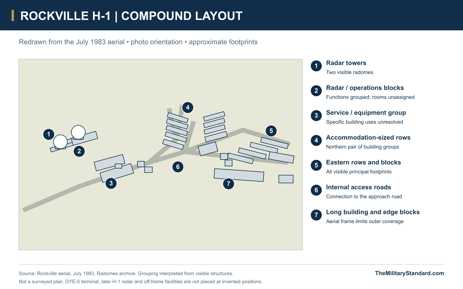
The July 1983 aerial shows the radar towers grouped at one end of the compound. Low equipment and operations buildings stand beside and between them, with further service blocks along the main access road. Beyond the working area are repeated accommodation-sized buildings arranged in rows around branching roads. The arrangement provided distinct places for the watch, technical work and living quarters without putting every activity inside one composite building. It also left outdoor connections between many structures, in contrast with the enclosed Greenland stations. [10]
Photographs from the 1968 series bring the community down to ground level. They show long single-storey accommodation buildings, a small entrance marked The DMZ, another building marked Cook's Haven and the squadron welcome sign. These are useful evidence of the occupied compound and its informal identity. The aerial establishes footprints and relationships more securely than individual room functions; the photographs identify particular signs and building types. The site diagrams therefore retain the visible blocks and distinguish confirmed radar facilities from buildings whose precise function remains unresolved. [11] [10]
Radar Watch and the 932nd Squadron
Rockville's equipment changed through the life of H-1. The museum lists an early AN/TPS-1B, followed by AN/FPS-3 and AN/FPS-20A search equipment, AN/FPS-93A and two AN/FPS-6 height finders. These were successive configurations rather than one simultaneous installation. Search radar supplied horizontal position, while height finding added altitude measurements to the aircraft picture. Fixed troposcatter reflectors performed a separate radio function; their prominent size should not be mistaken for a search-radar array. [1] [5]
The 932nd maintained the surveillance and interception mission through successive names: Aircraft Control and Warning Squadron, Air Defense Squadron from October 1987 and Air Control Squadron from May 1993. Crews tracked unidentified aircraft and directed interceptions as part of Iceland's air defence. The unit's mission continued after its move from Rockville, so the squadron's later Keflavik service belongs to the successor control centre. It does not extend the operating life of the old Rockville radar compound. [8] [4]
DYE-5 and the Ocean Radio Link
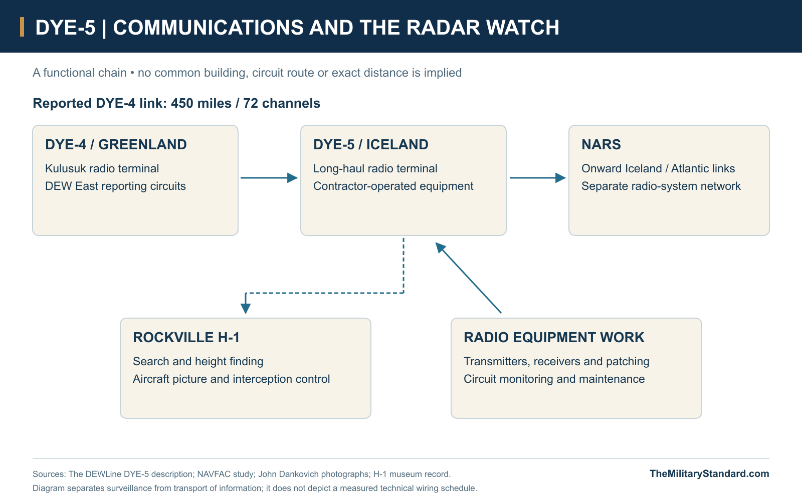
DYE-5 joined DYE-4 on Kulusuk Island by a reported 450-mile, 72-channel troposcatter link. At the Iceland end, the DEW circuits met the North Atlantic Radio System, whose links continued eastward. FEC/ITT personnel staffed the terminal under a contract separate from the rest of the DEW Line. This made DYE-5 an unusual member of the DYE sequence: it was a communications junction in an established military and civilian setting rather than another Greenland AN/FPS-30 auxiliary station. [2]
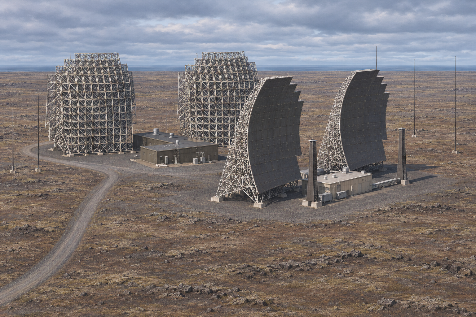
The Navy's 1997 historic-resource study describes the DYE-5 installation as four great reflector antennas, a 50-kilowatt transmitter and an operations centre identified as Building 893. Its photographs show curved billboard-like faces carried on deep steel frameworks, with low equipment buildings between the pairs. Troposcatter used a small part of the transmitted energy scattered back through the lower atmosphere to reach beyond direct line of sight. The large antenna structures and powerful transmitter compensated for a weak received signal across the ocean path. [5]
John Dankovich's 1967 photographs distinguish the H-1 troposcatter site from the Air Force radomes and from the Garrity receiver facility that later moved to the radio site. Other views show technicians, equipment racks, work surfaces and extensive patching. These make the operational chain tangible: an outdoor antenna group needed indoor transmitters, receivers, circuit connections and staff to maintain service. They also show why equipment from Grindavik or another Navy receiver station cannot automatically be assigned to the DYE-5 building. [9]
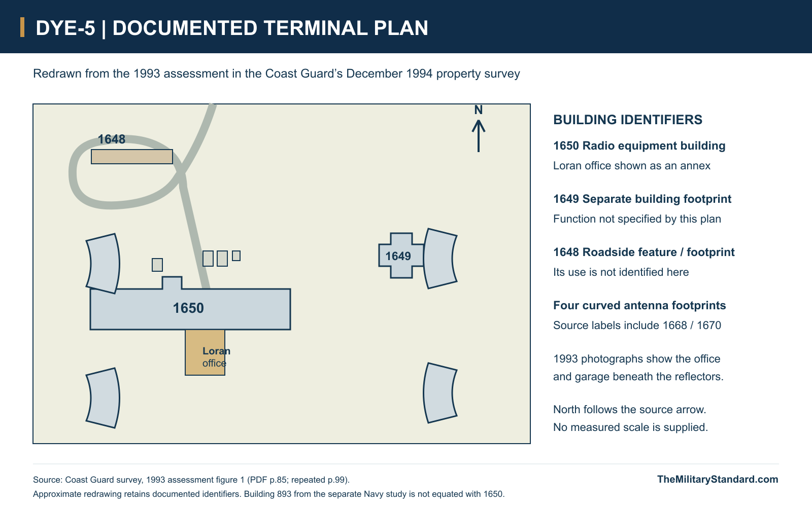
The terminal area also accommodated a separate navigation-support activity. A Coast Guard board of survey records office space for Loran Monitor Station Keflavik at DYE-5, in Building 1650, from 1973. An attached 1993 assessment includes a north-oriented site drawing: it marks the Loran office as an annex to Building 1650, a separate Building 1649, a roadside feature numbered 1648 and four curved antenna footprints. Its photographs show the office and garage under the steel reflector structures. The report gives its own property and support arrangements. Building 1650 and the Navy study's Building 893 must therefore be kept as their respective records identify them; the two numbers do not establish a single building or prove a renumbering. Communications and navigation personnel could share a named area while working under different administrative arrangements. [16]
A Power Failure During the Ferrying Watch
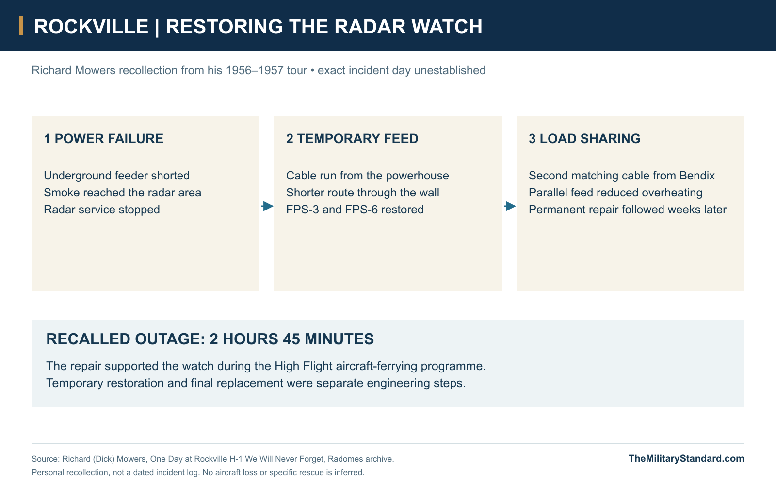
Richard Mowers recalled a serious electrical failure during his 1956-1957 tour, when Rockville supported the High Flight movement of F-86s westward and F-100s toward Europe. Smoke entered the radar area after an underground power feed shorted. He and General Electric field engineer Ray Keller ran temporary cable from the powerhouse, opened a more direct route through the building wall and restored the FPS-3 and FPS-6. A matching cable from the Bendix depot allowed parallel feeds to carry the load without overheating. Mowers remembered an outage of two hours and forty-five minutes, followed by several weeks on the temporary arrangement before replacement materials and specialists arrived. His account connects radar availability with practical electrical work and the needs of aircraft approaching Keflavik with limited fuel. [6]
Weather also affected the equipment outside the buildings. The 1968 photographic series records a torn radome and a radar antenna exposed above its tower. The images establish physical damage without supplying a precise storm date or a measured wind record. Their significance is operational: a radome was part of keeping a mechanical antenna serviceable in an exposed coastal environment. The damage belongs to the Rockville record and should not be confused with the separately documented storms at Greenland's DYE-4. [11]
Digital Control and the Move to Keflavik
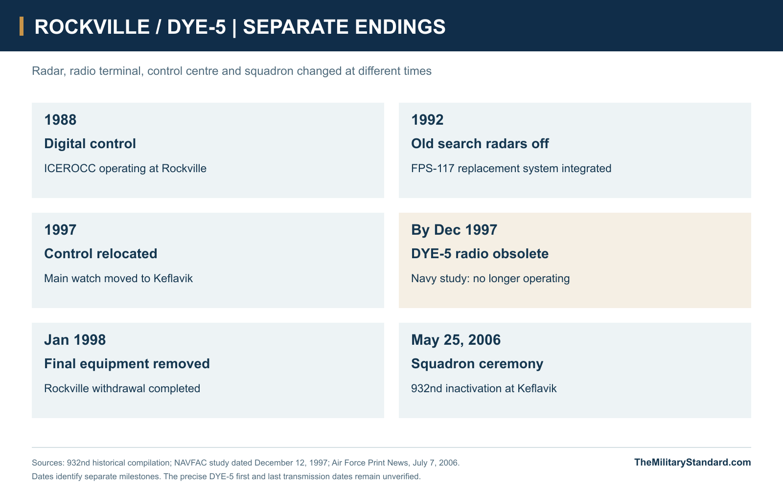
ICEROCC, the Iceland Regional Operations Control Center, brought digital integration to Rockville by mid-1988. AN/FYQ-47 digitizers and the AN/FYQ-93 computer system supported the transition from manual plotting. Icelandic personnel assumed operation and maintenance of the old FPS-93A radars by the end of fiscal 1989. New FPS-117 radars entered the system in 1992, when the old search radars were switched off. Rockville retained control functions after losing its old radar mission. Primary control moved to the new Keflavik centre by May 1997; formal system acceptance followed on October 2. Personnel departed in stages, and the final communications equipment was removed in January 1998. [4]
The Navy resource survey had already described DYE-5's troposcatter system as obsolete and out of operation by December 1997, with removal planned. Satellite communications had displaced the long-haul system. This was a separate change from the installation of new aircraft-surveillance radars. The radio link could end while air defence continued through other connections, just as the old search radar could stop while Rockville's control centre remained at work. The end of one component therefore did not amount to an immediate end of the entire Iceland mission. [5]
The Mission After Rockville
The 932nd continued at Naval Air Station Keflavik until its 2006 inactivation ceremony. Air Force reporting places the ceremony on May 25 and describes a watch covering more than 250,000 square miles. Its account notes that the last F-15 response to a Russian Tu-95 Bear had occurred in 1999, after the move from Rockville. That episode belongs to the unit's successor location. The Cold War work at Rockville was surveillance and interception support; the available evidence does not establish combat at the compound. [12]
The Icelandic Coast Guard now describes an air-defence system operating within NATO's integrated structure, with radar stations at Midnesheidi, Bolafjall, Gunnolfsvikurfjall and Stokksnes and a control centre at Keflavik. This is the continuing institutional mission, rather than continued use of Rockville's old radar towers. The historical station and its associated DYE-5 radio terminal preserve an earlier stage in which local operators, separate height finders, large fixed reflectors and dedicated equipment buildings sustained the aircraft picture across a difficult North Atlantic region. [13] [1]
Chronology
- May 1, 1952 The 932nd Aircraft Control and Warning Squadron activated in Massachusetts. [3]
- July 1952 An advance party arrived in Iceland. [7]
- Autumn 1952 Temporary radar coverage was established near Keflavik. [3]
- October 28, 1953 Permanent H-1 operations began at Sandgerdi, later Rockville. [1]
- 1956-1957 Mowers recalled a power-feed fire and temporary restoration of search and height-finder service during his tour. [6]
- 1964 Bob Gradisher photographed the DYE-5 troposcatter antennas. [2]
- 1967 Dankovich photographed the radio site, equipment and personnel. [9]
- 1968 The Rockville photograph series recorded radome damage and an exposed antenna. [11]
- 1973 Loran Monitor Station Keflavik received office space at DYE-5 in Building 1650. [16]
- July 1983 An aerial photograph recorded the radar and accommodation compound. [10]
- October 1, 1987 The 932nd became the Air Defense Squadron. [4]
- By mid-1988 ICEROCC was operating at Rockville. [4]
- 1992 New FPS-117 radars joined the system and the old FPS-93A radars stopped operating. [4]
- May 31, 1993 The 932nd became the Air Control Squadron. [4]
- 1997 The 932nd moved its principal control operation from Rockville to Keflavik. [8]
- By December 12, 1997 The Navy study described DYE-5 troposcatter as out of operation and scheduled for removal. [5]
- January 1998 The unit history records removal of the last communications equipment from Rockville. [4]
- May 25, 2006 The 932nd held its inactivation ceremony at Keflavik. [12]
Related Sites
Information sources (16)
- WEBRadomes Air Defense Radar Museum, Rockville AS, Iceland
Historical H-1 reference coordinate, radar sequence, opening and distinction from the successor site.
- WEBThe DEWLine, Site: DYE-5
DEW-to-NARS junction, 450-mile 72-channel Greenland link, separate FEC/ITT contract and dated antenna photographs.
- WEBBob Fitzgerald, 932nd AC&W Squadron history, preserved by Radomes
Firsthand formation, cold-weather training, overseas passage and temporary radar establishment in 1952.
- PDF932nd Air Control Squadron, unit lineage and historical compilation, preserved by U.S. Radar Sites in Iceland
Unit redesignations; ICEROCC digitization, Icelandic maintenance, 1992 radar change and 1997-1998 relocation sequence.
- PDFR. Christopher Goodwin and Associates for Atlantic Division NAVFAC, Navy Cold War Communication Context, December 12, 1997, pages 121-123
DYE-5 four-reflector equipment group, 50-kW transmitter, operations Building 893 and obsolete troposcatter status.
- WEBRichard Mowers, One Day at Rockville H-1 We Will Never Forget, 1956-1957 recollection
Power-cable fire, temporary restoration of FPS-3 and FPS-6, Bendix depot assistance and recalled outage duration.
- WEBU.S. Radar Sites in Iceland, H-1, the first USAF radar site in Iceland
1952 advance party and October 1953 permanent station; community and era-specific photographic collections.
- WEBU.S. Radar Sites in Iceland, H-1 1968 to the end of H-1 Rockville
Continuous surveillance and interception mission, squadron naming changes and 1997 move to Keflavik.
- WEBJohn Dankovich, 1967 Iceland photographs, preserved by Navy Radio
H-1 troposcatter site, radio equipment, technicians, barracks and separate Air Force radomes; original caption distinctions.
- WEBRadomes photographic archive, Rockville aerial, July 1983
Physical arrangement of the two radar towers, operations buildings, access roads and accommodation blocks.
- WEBRadomes photographic archive, Rockville, 1968 series
Damaged radome, exposed antenna, barracks and named community buildings in the operating period.
- WEBMaster Sgt. John Lasky, Iceland radar mission comes to close, Air Force Print News, July 7, 2006
May 25, 2006 squadron ceremony at Keflavik, surveillance responsibility and 1999 Bear interception reference.
- WEBLandhelgisgaesla Islands, Islenska loftvarnakerfid
Icelandic Coast Guard operation of the NATO air-defence system, Keflavik control centre and four modern radar locations.
- WEBACE High Journal, Keflavik Site 41 and DYE-5 geographic compilation
Separate radar and troposcatter locations, west/east circuit interpretation and dated imagery; conflicting text treated cautiously.
- WEBNatural Earth, 1:50 million Admin 0 countries
Public-domain coastline geometry for regional location context; historical station coordinate supplied by Radomes.
- PDFU.S. Coast Guard, Loran Monitor Station Keflavik Board of Survey, December 1994
Office space at DYE-5 in Building 1650 from 1973; 1993 terminal drawing, dated photographs, property inventory and support arrangements.