
Canyon Creek Radio Relay Station, Alaska
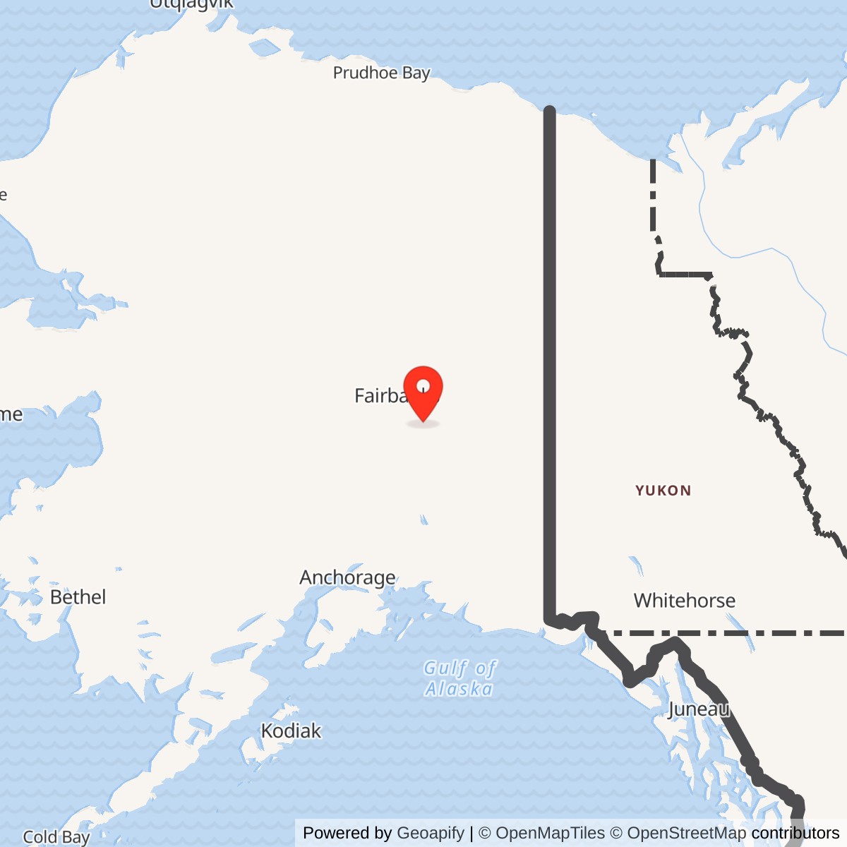
Longitude: -146.5507
A White Alice microwave repeater on the BMEWS interior route, closed to military service in 1982 and reused by Alascom after it acquired the site improvements in 1990.
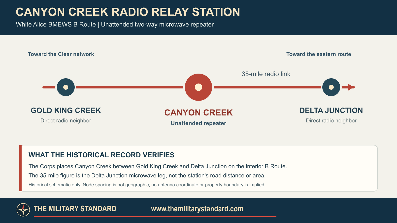
Canyon Creek Radio Relay Station was an unattended U.S. Air Force microwave repeater on the interior B Route of the White Alice Communications System's Ballistic Missile Early Warning System (BMEWS) expansion. It passed communications between Gold King Creek and Delta Junction. It was not a radar station. A Corps history dates construction to 1959; a 1983 Air Force study documents its function and 1982 deactivation. [1] [2] [3]
- Role
- Unattended two-way microwave repeater on White Alice's BMEWS interior B Route.
- Direct neighbors
- Gold King Creek and Delta Junction; the latter radio leg was 35 miles.
- Historic locality
- Near Richardson Highway Milepost 302, approximately 1.7 miles north of the Tanana River. No verified original tower coordinate or station-wide acreage.
- Documented dates
- Constructed in 1959; RCA Alascom lease from 1976; February 1982 deactivation notice; March 29, 1982 inventory and reported closure.
- Later use
- Excluded from the 1983 sale; improvements bought by Alascom in May 1990; state land lease began September 1, 1994.
- Historical property caution
- The later 1.056-acre Alascom lease is not the historic installation's proven full area.
Origins and BMEWS Mission
White Alice's first 31 stations addressed unreliable long-distance communications across Alaska. The later BMEWS rearward communications expansion added two paths from the warning network associated with Clear Air Force Station: a coastal A Route and an interior B Route. Canyon Creek was one of the B Route's microwave links. Its significance was carrying warning and command traffic through the chain, not detecting a missile or controlling an interceptor. Clear was the wider network hub, not Canyon Creek's direct radio neighbor. [1] [3]
The Corps' site-specific cultural record dates Canyon Creek construction to 1959. Its separate system inventory says BMEWS relays of this class were generally built in 1960 and opened in 1960 or 1961. The first date can describe early site work while the second summarizes the route's rollout. No station acceptance order or first-transmission day was found. [1] [3]
Location and Physical Plant
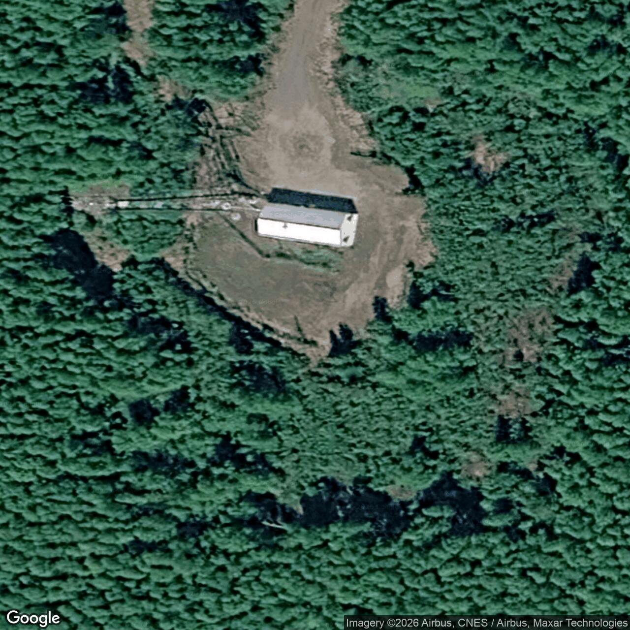
The Corps places the station near Milepost 302 of the Richardson Highway, about 1.7 miles north of the Tanana River and roughly 50 miles south of Fairbanks. Its 1994 cultural survey lists a radio-relay building, microwave tower, diesel generator, 300-gallon day tank, two steel underground storage tanks and two diesel tanks. Alaska Heritage Resources Survey number XBD-127 identifies the historical site. These details are more useful than borrowing an unrelated four-billboard White Alice layout. The record does not establish Canyon Creek's original antenna count or reflector dimensions. [2] [3]
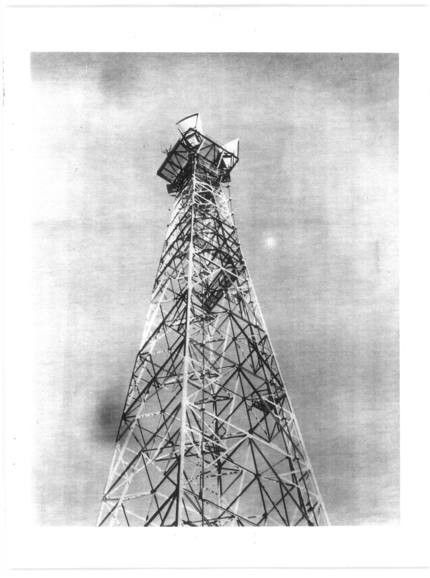
The 1983 Air Force study calls Canyon Creek an unattended two-way repeater. The Corps' network inventory describes a typical BMEWS microwave relay as having a building, fuel storage and TD-2 tower. Its typical description supports the technology class, but does not prove every structural detail at Canyon Creek. The original site occupied a physical station near the highway, not merely a radio component inside Gold King Creek or Delta Junction. [1] [2]
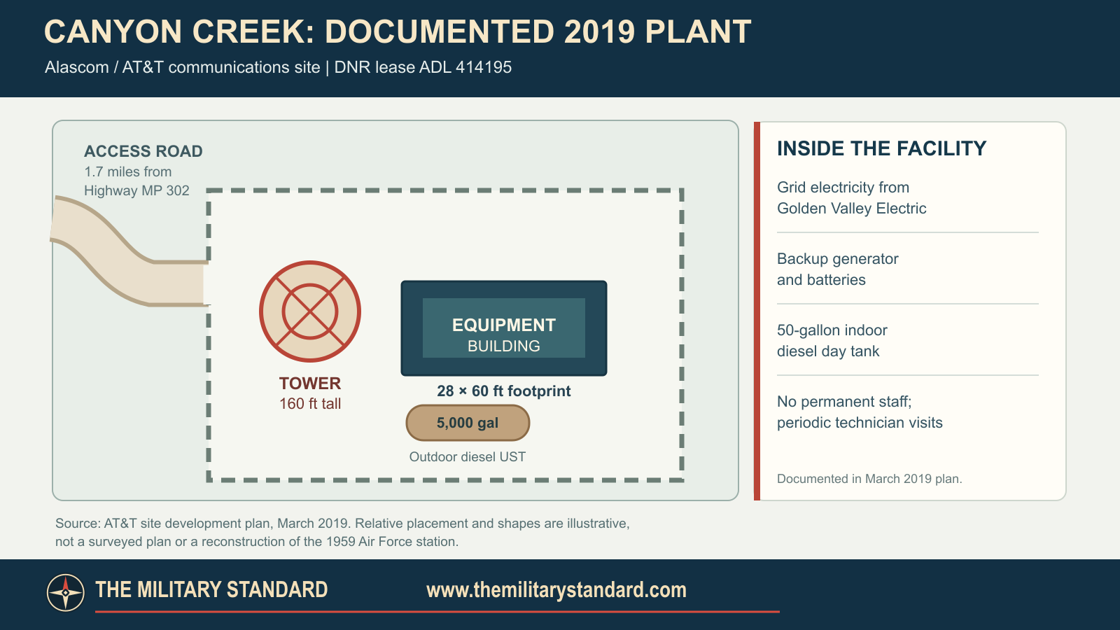
A 2019 AT&T development plan appended to the DNR lease decision documents a 160-foot self-supporting tower, one 28-by-60-foot equipment building, perimeter fence and driveway at the reused communications site. The plan describes a 1.7-mile winding access road from Highway Milepost 302 to the facility near Milepost 301, in Fairbanks North Star Borough. It says the plant was little changed from its original construction, but that operator statement is not proof that each standing structure dated to 1959. The plan also documents grid power, a backup generator, a double-walled 5,000-gallon outdoor diesel tank, a 50-gallon indoor day tank, batteries and periodic technician visits. These 2019 components must not be projected backward into the original Air Force inventory. [5]
Operation and Network Role
At an unattended relay, signals arrived from one direction and were passed onward toward the next station. Fuel and equipment still needed periodic servicing, but the records reviewed here do not identify a resident squadron, staff count or local radar unit. Gold King Creek and Delta Junction were Canyon Creek's direct documented radio neighbors. The Corps puts Delta Junction 35 radio miles away. This is a microwave-span figure, not a road distance or parcel dimension. [1] [2]
The Corps says Canyon Creek was leased to RCA Alascom in 1976 as White Alice operations moved toward civilian management. Leasing, ending a radio hop and later selling portions of the network were separate steps. In 1977 Alascom did not expect to buy Canyon Creek or Gold King Creek because it planned a Donnelly Dome to Delta Junction bypass. The planned bypass helps explain why a working relay could later become redundant even while the larger communications network remained in use. [2] [3]
Closure and Property History
Alascom gave notice in February 1982 that Gold King Creek and Canyon Creek would be deactivated. Both were inventoried March 29, 1982; the Corps' cultural plan treats that day as Canyon Creek's military closure. The 1983 Air Force study says the real property returned to Alaskan Air Command and that Canyon Creek, Gold King Creek and Pillar Mountain were excluded from the August 1983 White Alice sale. It would therefore be inaccurate to label 1983 an Alascom purchase date for Canyon Creek. Alaska received title to the underlying land in 1964, subject to a federal telephone-line and access-road reservation, and DNR says the federal site withdrawal ended in 1986. [2] [3] [5]
Alascom applied to reuse the station in 1990 as a Harding Lake to Donnelly Dome link while converting part of its Alaska Integrated Microwave System from analog to digital. Preliminary state and Air Force entry agreements enabled survey, rehabilitation and cleanup. AT&T's site plan dates its acquisition of the improvements from the Air Force to May 1990. The state land lease began September 1, 1994, and DNR says the carrier operated a communications site there thereafter. Thus Canyon Creek was not sold in the 1983 system-wide transaction, but its improvements were sold separately in 1990. The Corps' 1994 description of the former military site as inactive and deteriorating is a dated historical survey account, not proof of continuous abandonment after civilian rehabilitation. [3] [5]
DNR's 2019 decision approved a 25-year renewal of the 1.056-acre Alascom/AT&T leasehold; a February 2012 state inspection had found the site in good condition. Alaska DEC's 2026 UST financial-responsibility list still names an AT&T Canyon Creek Microwave Repeater. These records establish the later communications use, but not the precise age or present condition of each standing tower and building. The 1.056-acre modern lease is not a demonstrated station-wide Air Force acreage. [5] [6]
Environmental and Preservation Record
DNR reports asbestos in Air Force-era building materials and petroleum contamination associated with a 4,000-gallon underground tank at the relay site. Alascom agreed in 1990 to test and clean affected soil and remove the tank; according to DNR, a 1994 DEC final report required no further cleanup for that site's redevelopment. DNR also identifies a separate adjacent closed case called Canyon Creek Radio Site. The adjacent DEC record describes two tanks drained and cut open in 1987, excavation of a 4,000-gallon tank and soil in May 1990, and follow-up monitoring. DEC marked corrective action complete September 4, 1993 and approved closure the next day. The similar tank sizes and dates do not justify merging the two cleanup files without parcel-level documents. The adjacent case now shows Cleanup Complete, with no institutional controls required but advance approval listed for moving soil or groundwater off site. Its coordinate should not be used for the relay tower. [4] [5]
Separate federal records place the Air Force station on the non-National Priorities List federal-facility docket and report six installation-restoration sites reaching response complete before fiscal year 2017. Neither milestone proves that every parcel is unrestricted or every historic structure has been removed. The Corps assigned the former station AHRS number XBD-127 and recommended White Alice system-level documentation; it did not verify that Canyon Creek itself had an individual National Register listing. DNR's 2019 plan establishes that a tower and equipment building stood on the reused parcel then; their individual construction dates and 2026 condition remain unverified. No licensed Canyon Creek photograph was located for this review. [3] [5] [8] [9]
Coordinate and Acreage Cautions
Alaska DEC publishes 64.302880 N, 146.548120 W for the adjacent Canyon Creek Radio Site record, but provides no horizontal datum and warns that mapped GIS location data have not been entered. The DEC point is not presented here as a surveyed Air Force tower position. Similarly, DNR's 1.056 acres measures its modern Alascom lease, not the full historic Air Force installation. A 1995 federal docket gave the Air Force site as Section 15, Township 7 South, Range 6 East, consistent with DNR's 2019 lease survey and map; later federal docket versions gave Section 27, Township 7 South, Range 7 East. DNR's plan strengthens identification of the leased site but does not establish all historical Air Force boundaries. [4] [5] [7]
Chronology
- 1959 Corps cultural-resources record dates Canyon Creek construction to this year.
- 1960-1961 Corps inventory gives the general BMEWS microwave relay opening window; Canyon Creek's exact commissioning date remains unverified.
- 1964-10-14 Alaska received title to the land, subject to a federal lines-and-road reservation.
- 1976 Canyon Creek was leased to RCA Alascom under the White Alice system arrangement.
- 1977 Alascom did not expect to purchase Canyon Creek and Gold King Creek because of a planned bypass.
- 1982-02 Alascom notified the Air Force of its plan to deactivate both stations.
- 1982-03-29 The stations were inventoried; the Corps cultural plan calls this Canyon Creek's closure date.
- 1983-08-25 The White Alice sale was signed without Canyon Creek.
- 1986 DNR says BLM relinquished the former federal site.
- 1987 An adjacent DEC case records two underground tanks drained and cut open in place.
- 1990 Alascom applied to reuse Canyon Creek for a Harding Lake to Donnelly Dome digital link, with preliminary entry and cleanup agreements.
- 1990-05 Alascom acquired the site improvements from the Air Force, according to its 2019 development plan.
- 1990-05-22 A 4,000-gallon tank and soil were excavated in the adjacent Canyon Creek Radio Site case.
- 1993-09-04 DEC recorded corrective action complete for the adjacent case.
- 1993-09-05 DEC approved closure of the adjacent case.
- 1994 DNR reports no further cleanup required for the relay redevelopment; the Corps documented the former military station as XBD-127.
- 1994-09-01 Alascom's state lease began and the carrier operated a communications facility at the site thereafter.
- 2012-02 DNR inspected the communications facility and found it in good condition.
- 2019-03-27 AT&T documented the 160-foot tower, 28-by-60-foot building and modern fuel and power systems.
- 2019-08-27 DNR approved a 25-year renewal of the 1.056-acre Alascom lease.
- 2026 State UST list names an AT&T Canyon Creek Microwave Repeater; the exact age and present condition of standing structures remain unverified.
Information sources (9)
- PDFU.S. Army Corps of Engineers, Historical Overview and Inventory of the White Alice Communications System, 1988
Source for BMEWS B Route identity, Gold King Creek and Delta Junction links, 35-mile Delta Junction leg, and general TD-2 construction and opening context.
- PDFU.S. Air Force, Special Study of the White Alice Communications System Sale, October 1983
Source for unattended two-way repeater, planned bypass, February 1982 deactivation notice, March 29 inventory, and exclusion from the 1983 sale.
- PDFU.S. Army Corps of Engineers, The Cold War in Alaska: A Management Plan for Cultural Resources, 1994
Source for 1959 construction, Milepost 302 location, equipment inventory, 1976 lease, March 29, 1982 closure, 1994 condition and AHRS XBD-127.
- WEBAlaska Department of Environmental Conservation, Canyon Creek Radio Site, Hazard ID 24176
Source for nearby petroleum cleanup chronology, qualified database coordinates, 1993 closure, current cleanup status and listed soil/groundwater transport condition.
- WEBAlaska Department of Natural Resources, ADL 414195 Alascom Canyon Creek Lease Renewal Decision, 2019
Source for 1964 land patent, 1986 relinquishment, 1990 improvement purchase and rehabilitation, 1994 state lease, separate adjacent cleanup record, 2012 inspection, 2019 plant, site plan and 25-year renewal.
- WEBAlaska Department of Environmental Conservation, UST Facilities With Proof of Financial Responsibility
Source for 2026 listing of AT&T Canyon Creek Microwave Repeater, facility 2282; the list does not prove survival of the 1959 Air Force tower.
- PDFFederal Register, Federal Agency Hazardous Waste Compliance Docket, April 11, 1995
Source for Air Force Canyon Creek station identification in Township 7 South, Range 6 East, Section 15; later docket location variants remain unresolved.
- WEBU.S. Environmental Protection Agency, Non-NPL Site Listing
Source for Air Force Canyon Creek facility identifier AK2570028629 and non-NPL/NFRAP federal status, not a station-wide unrestricted-use finding.
- PDFU.S. Department of Defense, Restoration Table for Properties Achieving Final Response Complete Before Fiscal Year 2017
Source for six installation-restoration sites with response complete milestone; does not establish no future land-use limitations.