
Delta Junction Radio Relay Station, Alaska
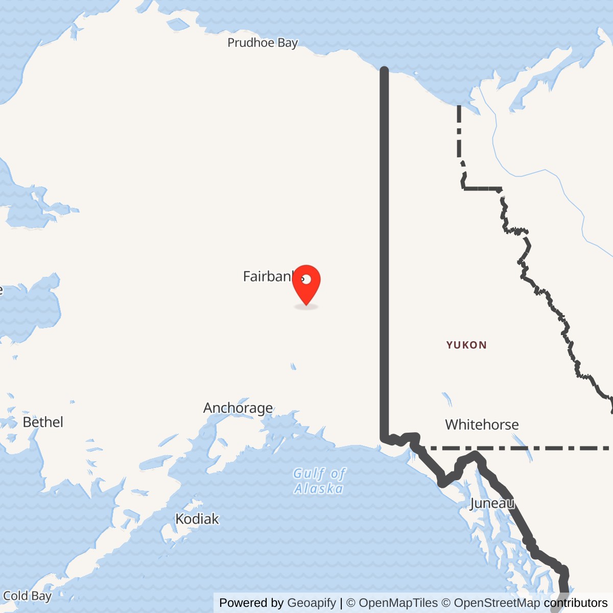
Longitude: -145.729666
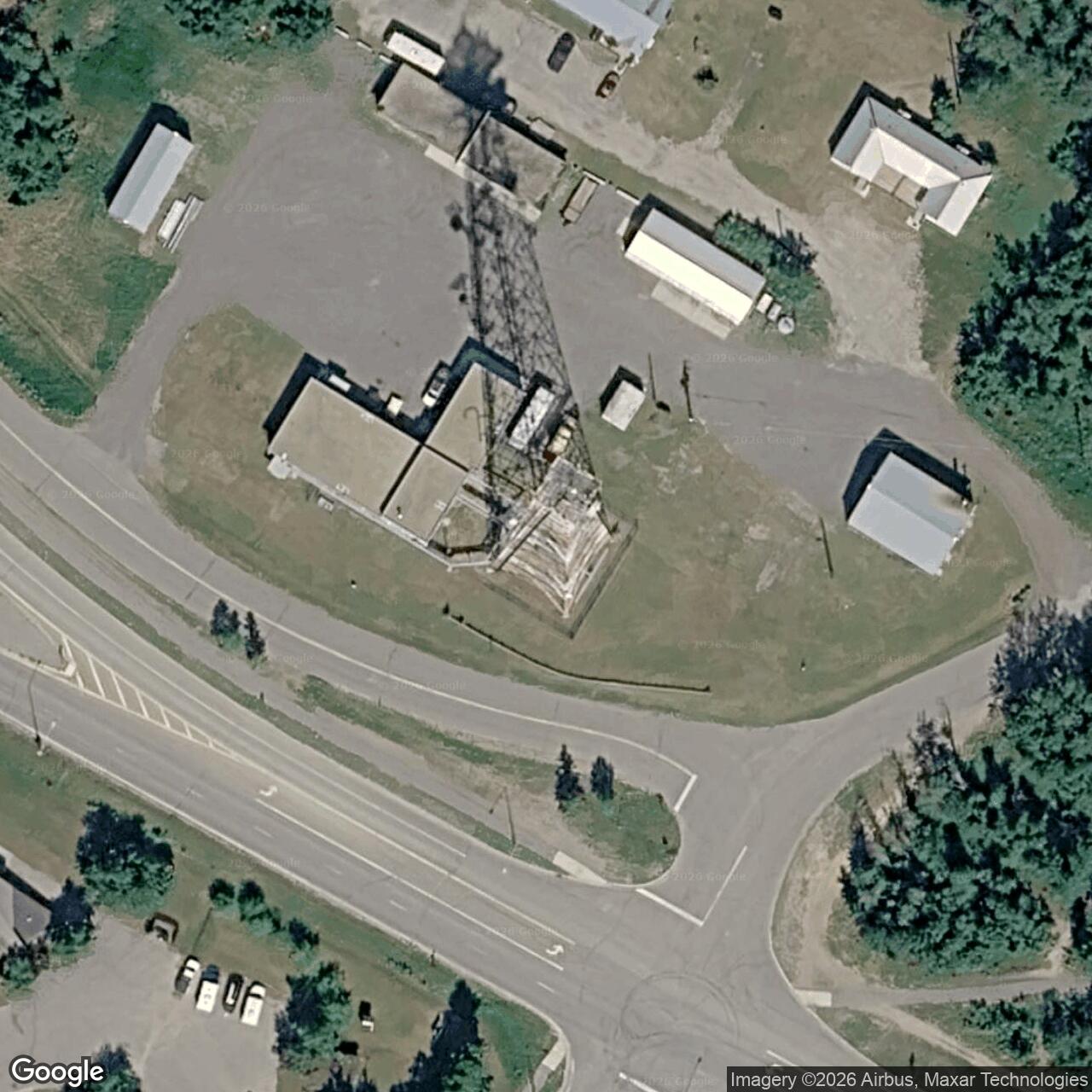
An attended microwave junction on White Alice's interior route, sharing a location with an older Alaska Communications System history.
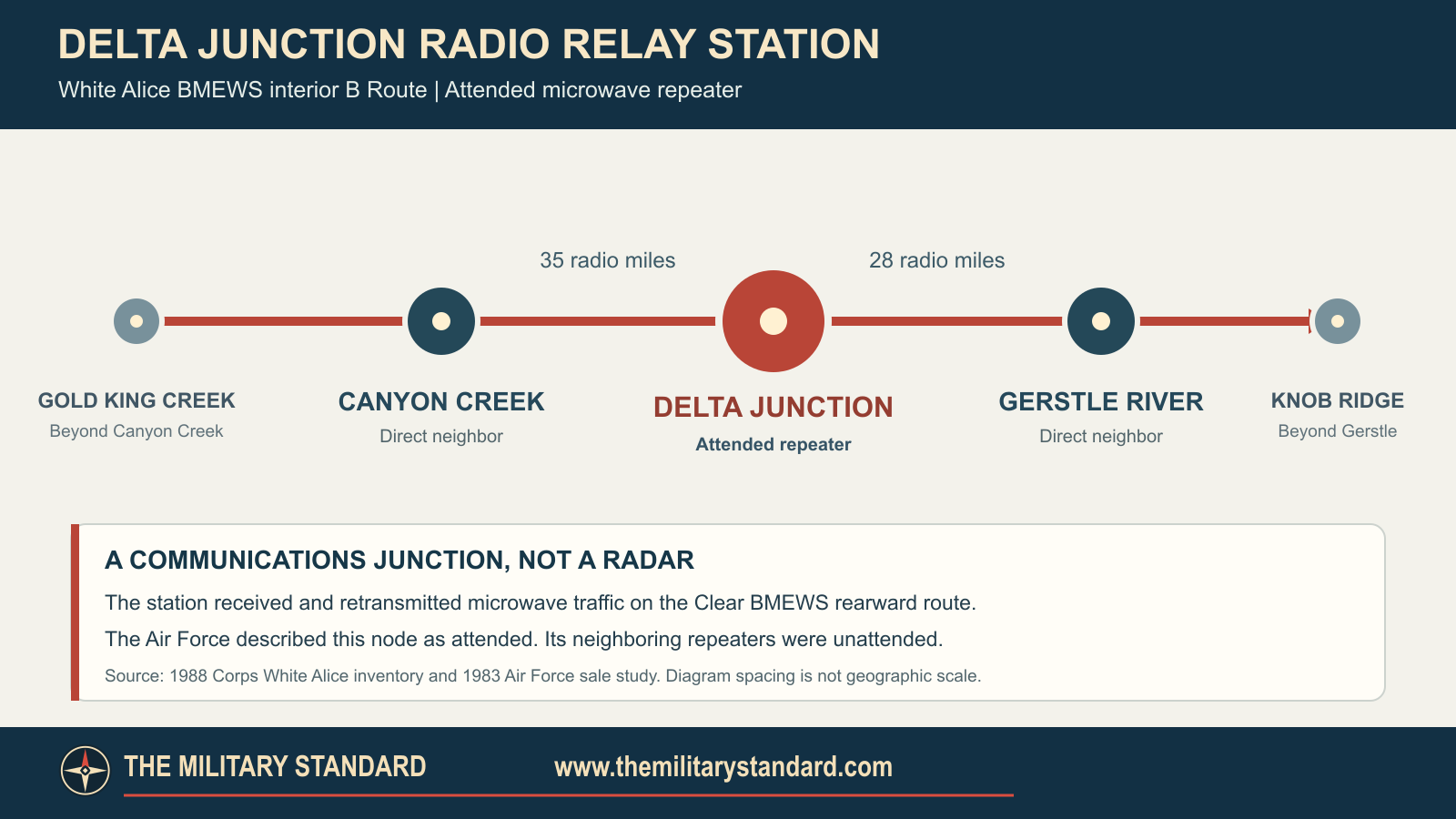
Delta Junction Radio Relay Station carried communications for the Clear missile-warning network, rather than operating a radar. Its two documented direct White Alice neighbors were Canyon Creek and Gerstle River. The Air Force described Delta Junction as an attended two-way microwave repeater, unlike those neighboring unattended stations. [1] [2]
- Role
- Attended White Alice TD-2 microwave repeater on the BMEWS interior B Route.
- Direct radio neighbors
- Canyon Creek, 35 radio miles; Gerstle River, 28 radio miles.
- Location point
- 64.037500 N, 145.726944 W is the 1975 and 1976 published radio-license point, not a surveyed tower or boundary.
- Property distinction
- An 8.57-acre Army ACS withdrawal was sold to RCA in 1971. That figure is not a proven full White Alice property area.
- Later status
- Commercial telecommunications reuse is documented. Original Air Force equipment survival and current operating status are unverified.
Two Systems, One Locality
The Army's Alaska Communications System, or ACS, served military and civilian users before the Air Force built White Alice. The Corps lists Delta Junction as a Cold War ACS station. A January 1961 land order reserved an 8.57-acre ACS repeater tract, later surveyed as Lot 82, section 23, Township 10 South, Range 10 East, Fairbanks Meridian. A 1974 land order says the tract was conveyed to RCA by a January 10, 1971 deed. The Air Force's White Alice sale study confirms that RCA Alascom already owned the Delta Junction real estate when later Air Force equipment was considered for sale. The ACS land and White Alice hardware have related but different title histories. [2] [3] [9]
White Alice's later expansion supplied rearward links for the Ballistic Missile Early Warning System at Donnelly Dome or nearby Fort Greely. [1] [8] [9]
Route and Equipment
The Corps records a 35-radio-mile TD-2 hop to Canyon Creek and a 28-radio-mile hop to Gerstle River. Those are direct radio legs, not road mileages or parcel dimensions. The Air Force called Delta Junction an attended two-way repeater near Richardson Highway mile 267. From Clear, traffic could pass through Gold King Creek and Canyon Creek to reach Delta Junction, then move east via Gerstle River. Gold King Creek was not a direct Delta Junction neighbor. [1] [2]
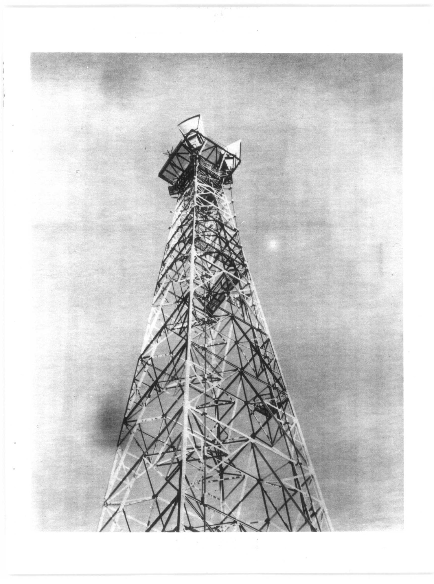
Corps records describe BMEWS relays of this class as usually having a radio building, a fuel tank and a TD-2 tower. The exact Delta Junction antenna count, tower height, generator specification, staff complement and building arrangement remain unverified. The historical image below shows a different TD-2 station, Soldotna, to illustrate the technology class; it is not a photograph of Delta Junction. [1] [2]
A May 1975 Federal Register notice proposed a new Delta Junction White Alice link toward Donnelly Dome at 2118.0 MHz. A December 1976 notice listed RCA Alascom applications toward Canyon Creek and Gerstle River. These are permit notices, not final proof that every proposed frequency entered service. In 1977, Air Force records also described an Alascom plan to connect Donnelly Dome directly to Delta Junction and bypass Gold King Creek and Canyon Creek. The sources do not establish the proposed bypass's exact construction or activation date. [2] [4] [5]
Alascom and the Sale
RCA Alascom leased White Alice operations in 1976. In the Air Force's 1983 sale study, Delta Junction is marked "Personal Property Only" because RCA already held the underlying ACS real estate. The wider White Alice sale proceeded in August 1983. Thus the statement that Delta Junction's White Alice hardware was offered for sale must not be misread as a 1983 sale of the older 8.57-acre ACS tract. The Alaska Office of History and Archaeology later classified Delta Junction as repurposed, consistent with commercial communications continuity, but did not document the survival of each Air Force-era structure or radio unit. [2] [3] [8]
Land and Cleanup
Alaska DEC's "Delta Jct. Micro Repeater" petroleum case, hazard ID 22860, explicitly identifies Government Lot 82, U.S. Survey 2770. A 1989 underground-tank release led to excavation of approximately 50 cubic yards of soil. The road-spreading proposal for the Donnelly Dome access road was canceled due to weather, and DEC approved on-site spreading in 1990. DEC recorded no further corrective action required in September 1993 and now labels this particular case Cleanup Complete. That status does not certify an entire former installation free of all contaminants. [3] [6]
DEC also has a distinct, nearby AT&T Alascom Delta Junction Station case, hazard ID 2944, marked Active. It concerns petroleum found in 1997 property due diligence, conditional closure in 2007, demolition of a power building in 2020, PCB- and petroleum-impacted material removed in 2021, and soil and groundwater studies in 2022. Three sampled monitoring wells showed no detectable groundwater contaminants in the reported sampling, but the case was reopened in 2023 and remains Active in DEC's public listing. Its point lies near Lot 82, yet the public record reviewed does not prove that its entire cleanup footprint equals the original White Alice equipment footprint or that the Air Force caused the later contamination. The two DEC case statuses must not be combined. [7]
Location and Photographs
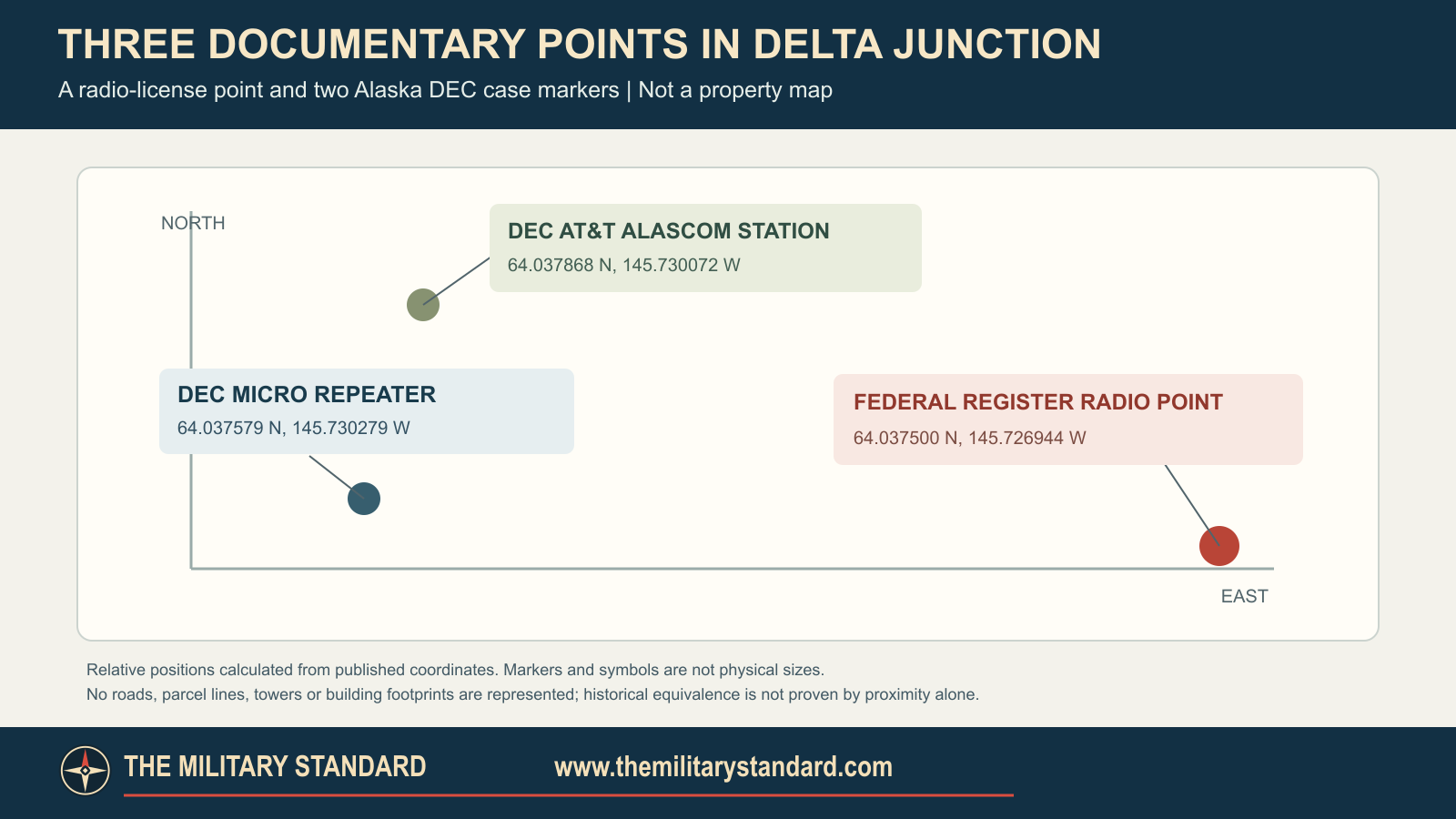
The Federal Register radio-license point converts to 64.037500 N, 145.726944 W. DEC gives separate WGS84 case points at 64.037579 N, 145.730279 W for the Lot 82 micro repeater and 64.037868 N, 145.730072 W for the AT&T station. They are nearby documentary markers with different purposes. None is a surveyed tower position, installation centroid or polygon. The ACS land order's 8.57 acres should not be assigned to an unverified White Alice boundary. Delta Junction lies in Southeast Fairbanks Census Area. [3] [4] [5] [6] [7] [11]
The Anchorage Museum's Bill Ray White Alice finding aid lists a photo captioned "Delta Junction site" as B1994.009.1384. The image has not been inspected for this page, and the collection includes both ACS and White Alice material. No recent site-specific photo or survey was available to establish whether the original TD-2 tower survives. [10]
Chronology
- 1960-1961 Corps gives the general construction and opening period for BMEWS microwave repeaters; Delta Junction's acceptance day is unverified.
- 1961-01-19 Army ACS land reservation establishes the 8.57-acre Delta Junction repeater tract.
- 1971-01-10 ACS tract is conveyed to RCA by quitclaim deed.
- 1974-12-20 Land order revokes the older ACS withdrawal and identifies Lot 82.
- 1975-05-20 Federal Register lists a proposed White Alice link toward Donnelly Dome.
- 1976 RCA Alascom takes over White Alice operation under lease.
- 1976-12-27 Federal Register lists Alascom channel proposals to Canyon Creek and Gerstle River.
- 1977 Air Force records an Alascom proposal for a Donnelly Dome to Delta Junction bypass.
- 1983-08 Air Force sale study treats Delta Junction as personal property only; RCA already owns the ACS land.
- 1989-08-12 DEC records a petroleum-tank release at the Lot 82 micro repeater.
- 1990-08-01 DEC approves on-site spreading of impacted soil.
- 1993-09-04 DEC records corrective action complete for the Lot 82 micro-repeater case.
- 1997 Separate Alascom terminal case begins after property due diligence finds petroleum-impacted soil.
- 2007-07-19 DEC conditionally closes the separate Alascom station case.
- 2020-09 Power building is removed at the separately tracked Alascom site.
- 2021-2022 Soil cleanup and groundwater characterization proceed at the Alascom site.
- 2023-03-17 DEC reopens the Alascom site case.
- 2024-08-27 DEC approves the monitoring-well decommissioning report.
- 2026 DEC lists the Lot 82 micro-repeater case Cleanup Complete and the separate Alascom station case Active.
Information sources (11)
- PDFU.S. Army Corps of Engineers, Historical Overview and Inventory of the White Alice Communications System, 1988
Source for interior B Route, TD-2 class, Delta Junction's Canyon Creek and Gerstle River radio hops, and general BMEWS construction and opening window.
- PDFU.S. Air Force, Special Study of the White Alice Communications System Sale, 1983
Source for attended Delta Junction relay, Richardson Highway mile 267, ACS real-estate ownership, Alascom lease and sale, and 1977 bypass proposal.
- PDFU.S. Department of the Interior, Public Land Order 5461, Federal Register, December 27, 1974
Source for 1961 Army ACS withdrawal, 8.57-acre Delta Junction tract, Lot 82 legal description and January 10, 1971 RCA deed.
- PDFFederal Communications Commission, Common Carrier Domestic Public Radio Services Notice, Federal Register, May 20, 1975
Source for Delta Junction White Alice license point and proposed Donnelly Dome radio link.
- PDFFederal Communications Commission, Common Carrier Domestic Public Radio Services Notice, Federal Register, December 27, 1976
Source for RCA Alascom Delta Junction license point and proposed Canyon Creek and Gerstle River frequencies.
- WEBAlaska Department of Environmental Conservation, Delta Jct. Micro Repeater Site Report, Hazard ID 22860
Source for Lot 82 identity, 1989 petroleum release and removal, 1990 on-site disposal, 1993 no-further-action finding and current Cleanup Complete status.
- WEBAlaska Department of Environmental Conservation, AT&T Alascom Delta Junction Station Site Report, Hazard ID 2944
Source for nearby successor terminal point and separately tracked 1997 to 2024 environmental work and Active case status; historic Air Force footprint equivalence is not established.
- PDFAlaska Office of History and Archaeology, The Coldest Front: Cold War Military Properties in Alaska
Source for interior B Route purpose and later repurposed classification for Delta Junction.
- PDFU.S. Army Corps of Engineers, The Cold War in Alaska: A Management Plan for Cultural Resources, 1994
Source for separate ACS and BMEWS historical contexts and Delta Junction listings.
- PDFAnchorage Museum, Bill Ray White Alice Collection Finding Aid, B1994.009
Source for identification of Delta Junction photograph B1994.009.1384; image appearance, date and publication rights still require verification.
- WEBAlaska Department of Labor and Workforce Development, Delta Junction City Profile
Source for Southeast Fairbanks Census Area placement.