
Gold King Creek Radio Relay Station, Alaska
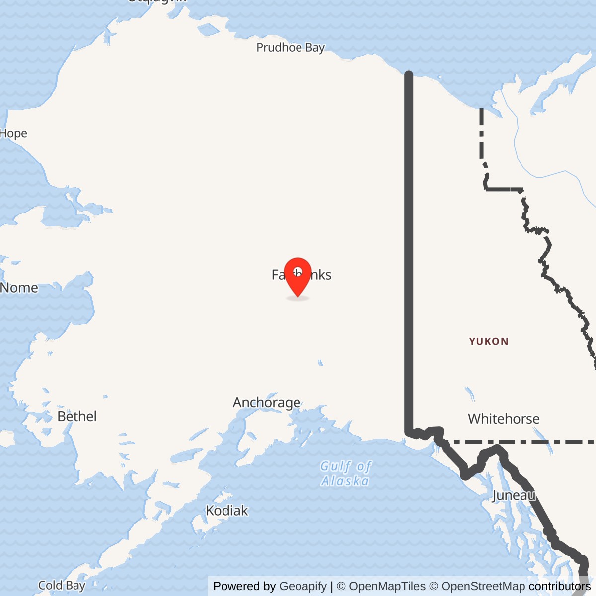
Longitude: -147.933985
A remote microwave link in Clear's BMEWS communications chain. The relay closed in 1982, but its associated airstrip remains a public airport.
Gold King Creek Radio Relay Station was an unattended Air Force microwave repeater on the interior B Route of the White Alice Communications System. It passed ballistic-missile-warning communications between Clear and Canyon Creek; it did not operate an aircraft or missile-detection radar. The Army Corps dates construction to 1959 and closure to March 30, 1982. [1] [2] [3]
- Role
- Unattended, two-way microwave repeater on White Alice's BMEWS interior B Route.
- Direct radio neighbors
- Clear, 60 radio miles away, and Canyon Creek.
- Historical plant
- Radio-relay building, microwave tower and a 2,050-foot runway documented by the Corps.
- Service dates
- Constructed in 1959; exact commissioning day unverified. Alascom leased it from 1976; closure recorded March 30, 1982.
- Location point
- 64.199748 N, 147.933985 W is the Alaska DEC WGS84 environmental-site marker, not a surveyed tower or property center.
- Present use
- The associated airstrip is a state-owned public airport; current operation of the former radio station is not established.
Network and Mission
White Alice's first 31 stations addressed unreliable long-distance communications in Alaska. The later BMEWS expansion provided rearward communications for the missile-warning complex at Clear. Gold King Creek was on its interior B Route, not one of the original 31 sites. The Corps identifies Clear and Canyon Creek as its direct links and gives the Clear leg as 60 radio miles. Delta Junction lay farther along the route, beyond Canyon Creek. [1] [3]
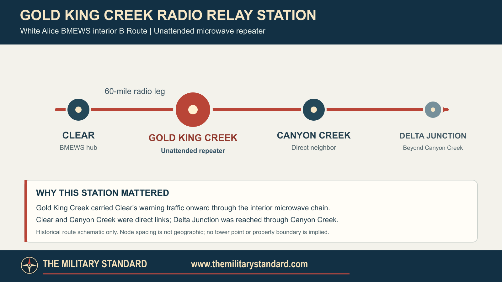
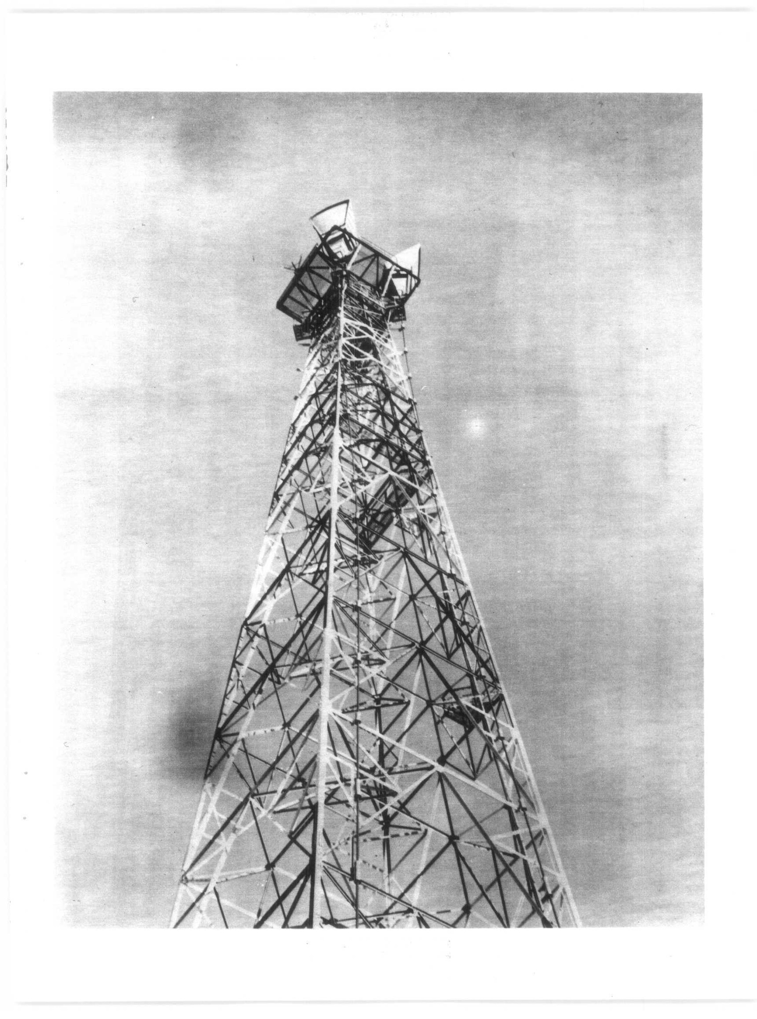
The Air Force described Gold King Creek as an unattended two-way microwave repeater. It received communications from one end of the route and retransmitted them to the other. The Corps documents a radio building and microwave tower at the station. The BMEWS relay route used TD-2 technology, although Gold King Creek's exact antenna arrangement, tower height and power equipment have not been established. [1] [2] [3]
Station and Airstrip
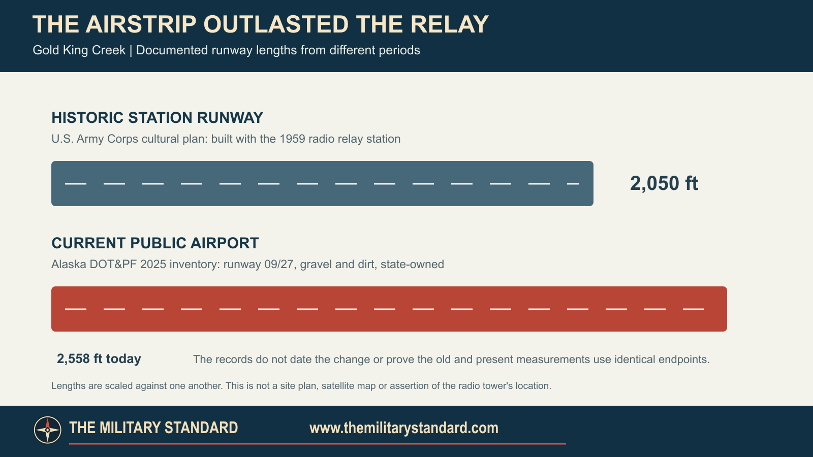
The Corps dates construction to 1959 and lists a relay building, microwave tower and 2,050-foot runway. Alaska DEC also reports operation beginning in 1959. The runway gave construction and maintenance crews access to this isolated station, even though no staff lived there. A precise first-transmission date is not recorded. [1] [3] [4]
The access strip survives as Gold King Creek Airport, AK7/PAAN, an active, unattended state-owned public field in Denali Borough. Alaska DOT&PF's 2025 inventory gives its gravel-and-dirt runway as 2,558 by 17 feet, aligned 09/27. That is 508 feet longer than the Corps' historical figure; the records do not date the change or show whether both measurements used the same endpoints. Continued airport use does not mean the military relay is still operating. [3] [5] [6]
Lease, Bypass and Closure
RCA Alascom leased the station from the Air Force in 1976. In 1977 the Air Force recorded Alascom's plan to bypass Gold King Creek and Canyon Creek with a Donnelly Dome to Delta Junction connection. The records do not date completion of that alternate link. Alascom notified the Air Force in February 1982 that it would deactivate the two repeaters. Property personnel inventoried them on March 29; the Corps records Gold King Creek's closure on March 30. [2] [3]
The wider White Alice sale was signed on August 25, 1983, but the Air Force sale study specifically excluded Gold King Creek, Canyon Creek and Pillar Mountain from Alascom's purchase. DEC says the former Gold King Creek station was declared excess in 1983 and identifies the underlying land as state-owned. Its later title and improvement-disposal history have not been fully established. [2] [4]
Later Site Record
The Corps' 1994 cultural plan described the former radio station as inactive and abandoned and assigned it Alaska Heritage Resources Survey number FAI-340. Its original tower and building have not been verified as surviving today. The nearby airport remains active in state records. [3] [5]
Alaska DEC maintains an Active environmental case for the former Gold King Creek RRS, hazard ID 561. Its records distinguish the White Alice facility from a nearby landfill on private property and describe 1987 removal of batteries and electrical wastes and work on former diesel tanks. A 1988 assessment recommended further investigation of the landfill. The Corps confirmed Formerly Used Defense Sites status in 2019. Defense Department reporting separately lists three restoration sites as response complete before fiscal year 2014; that program milestone does not close DEC's broader case. [4] [7]
Location and Coordinates
Alaska DEC publishes 64.199748 N, 147.933985 W, WGS84, for its Gold King Creek RRS case. This is an environmental-record point, not a surveyed tower position or installation boundary. The public airport has a separate reference point. The historic relay's full acreage has not been established. [4] [5]
Chronology
- 1959 Corps dates construction to this year; DEC reports operation beginning in 1959 without a first-transmission day.
- 1976 RCA Alascom leases the station from the Air Force.
- 1977 Air Force records an Alascom plan to bypass Gold King Creek and Canyon Creek.
- 1982-02 Alascom gives formal deactivation notice for both repeaters.
- 1982-03-29 Air Force inventories Gold King Creek and Canyon Creek.
- 1982-03-30 Corps cultural plan records Gold King Creek closure.
- 1983 DEC says the former station is declared excess.
- 1983-08-25 Gold King Creek is excluded from the signed White Alice sale to Alascom.
- 1987-06 DEC records waste removal and work on two 14,000-gallon diesel tanks.
- 1988-07-12 Preliminary assessment identifies an unlined landfill and recommends investigation.
- 1994 Corps describes the former station as inactive and abandoned under AHRS FAI-340.
- 2019-08-12 Corps confirms Formerly Used Defense Sites status to DEC.
- 2025 DOT&PF records the nearby Gold King Creek Airport as an active public field.
Information sources (7)
- PDFU.S. Army Corps of Engineers, Historical Overview and Inventory of the White Alice Communications System, 1988
Source for BMEWS B Route membership, Clear and Canyon Creek links, 60-mile Clear radio leg, and general TD-2 relay-class context.
- PDFU.S. Air Force, Special Study of the White Alice Communications System Sale, October 1983
Source for unattended two-way repeater function, 1976 lease context, planned bypass, February and March 1982 actions, and exclusion from the August 1983 sale.
- PDFU.S. Army Corps of Engineers, The Cold War in Alaska: A Management Plan for Cultural Resources, 1994
Source for 1959 construction, building, microwave tower, 2,050-foot runway, 1976 lease, March 30, 1982 closure, inactive 1994 status and AHRS FAI-340.
- WEBAlaska Department of Environmental Conservation, Gold King Creek RRS Site Report, Hazard ID 561
Source for the environmental-record coordinate, reported operation, land distinctions, 1987 removal, landfill assessment, 2019 FUDS finding and Active case status.
- PDFAlaska Department of Transportation and Public Facilities, Denali Area Airport Planning Study, Existing Conditions and Inventory
Source for current Gold King Creek Airport ownership, Denali Borough location, public use, runway dimensions, condition and unattended status; not evidence of radio-station current use.
- PDFAlaska Department of Transportation and Public Facilities, Denali Area Airport Planning Study, Aviation Forecast
Source for February 2025 airport inventory showing active status, runway 09/27 and October 2024 inspection.
- PDFU.S. Department of Defense, Defense Environmental Restoration Program Table 9, Properties Achieving Response Complete Before Fiscal Year 2014
Source for three Gold King Creek installation-restoration sites listed as response complete; the table does not establish DEC case closure.