
North River Radio Relay Station, Alaska
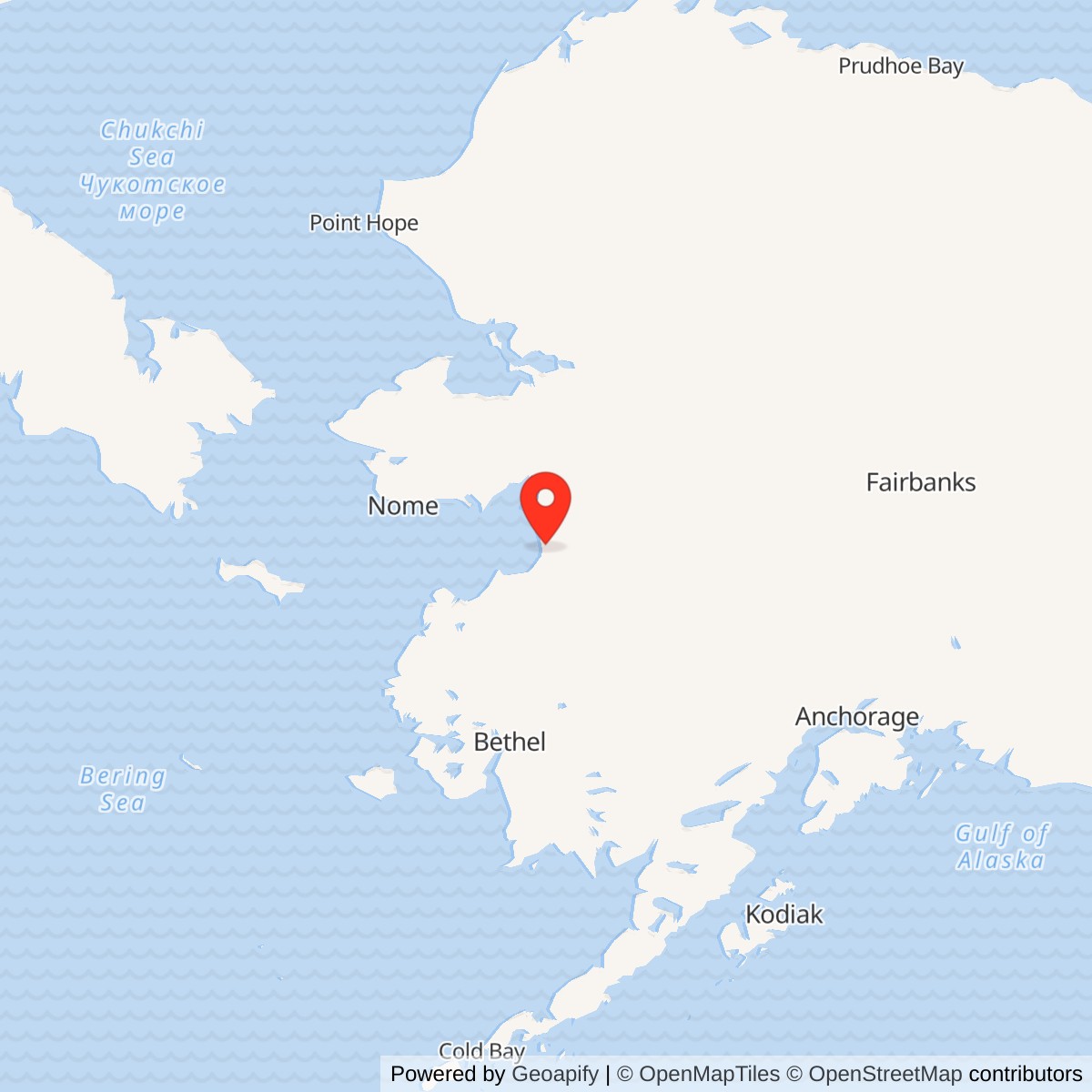
Longitude: -160.521717
Current Role: Former relay landscape with mixed Air Force and Native-corporation property interests. Radio structures are gone. SS001 and SS003 capped areas have land-use controls and continuing inspections; access and land title vary by parcel.
Approximate reference point: 63.886613 N, 160.521717 W. Alaska DEC identifies this as the former SO001 vehicle-maintenance area, not the antenna compound or a surveyed station boundary.
- Role
- White Alice troposcatter and microwave communications relay.
- Opened
- September 13, 1957.
- Original links
- Unalakleet Air Force Station.
- Deactivated
- June 16, 1978, in the Air Force communications history.
- Site today
- Aboveground radio structures removed; parts of the former property remain under environmental controls.
North River Radio Relay Station was a United States Air Force White Alice Communications System station in the Unalakleet region of western Alaska. Built in 1957 and opened on September 13 that year, it combined long-distance tropospheric-scatter radio with a microwave connection to the nearby aircraft-control-and-warning network. Its documented long paths reached Granite Mountain, about 108 miles away, and Kalakaket Creek, about 118 miles away. The station helped move air-defense information across a difficult regional network. A replacement satellite terminal at Unalakleet enabled North River to be deactivated on June 16, 1978. Its communications structures were later removed, while environmental remediation continued long after the military mission ended. [1] [2] [3] [15]
North River was a distinct communications installation associated with Unalakleet Air Force Station, not another name for the radar compound. It had its own equipment and power building, dormitory, billboard antennas, and access route. The two installations shared support, but their physical sites and missions differed. [1] [2] [3] [6]
Origins and Construction
Alaska's mid-century radar network was only as effective as its ability to communicate. An aircraft-control-and-warning station could detect and track a target, but its report had to move reliably to command and fighter-control users. Alaska's terrain, weather and immense distances made a conventional line-of-sight chain difficult. White Alice paired microwave links where line of sight was practical with tropospheric-scatter links that could span more than 100 miles. In the latter arrangement, a large directional antenna transmitted energy toward the lower atmosphere and a distant receiving station recovered the weak forward-scattered signal. The technique required substantial equipment, power and carefully aimed antennas. It was communications infrastructure, not a search radar or an airfield. [1]
The Army Corps of Engineers' historical overview describes the original system as an Air Force project undertaken by the Corps' Alaska District and Western Electric. The Corps selected and surveyed the original locations, handled contracting and built 11 of the original 31 stations. Western Electric built the other 20 and installed electronic equipment throughout the original system. The same study places North River among the first-phase stations and says its construction occurred in 1957. It opened on September 13, 1957, before the first-phase network as a whole was completed. [1]
The original White Alice plan included 31 installations of several kinds: long-distance troposcatter stations, line-of-sight microwave relays, and combined sites. Fourteen shared facilities with other military installations. North River belonged to the combined troposcatter/microwave group, with its microwave connection serving the adjacent aircraft-warning installation. This design let the network use one technology for the long hops across western Alaska and another for the short local connection to the radar system. The first-phase network eventually linked aircraft-control-and-warning and DEW Line stations to command and communications centers farther south. North River was one junction within that larger chain, not a radar station or command center of its own. [1]
North River illustrated the expense of building beyond-road communications infrastructure. The Corps' overview reports a negotiated construction price of about $3 million, which helped establish more realistic estimates after early bids for remote stations exceeded government expectations. Across the first phase, difficult access, severe winter weather, a possible steel strike, and tightening budgets contributed to delays and cost growth. North River opened in 1957, while completion of the original system slipped to March 1959. [1]
Surveying and construction were difficult before the system could transmit a single message. Across the White Alice program, the Corps took experimental towers and equipment weighing about 14 tons to prospective locations during winter surveys. North River was especially expensive because its hilltop radio plant needed its own power and equipment building, staffed dormitory, large fuel reserve, and access across a river. The network opened in segments, so North River began operating well before the entire original system was finished. [1]
Location, Property, and Built Station
North River stood on elevated ground in the Unalakleet area, connected by road to the community and to the nearby AC&W support system. A 2023 federal district-court order describes the site as a hilltop above the Unalakleet River at roughly 500 feet above sea level, on mostly gravel fill. Alaska DEC sources describe the antenna hill as roughly eight to 13 miles from Unalakleet, depending on the reference point used. [3] [10] [11]
The 1988 Corps inventory records a 6,720-square-foot equipment and power building and a 4,750-square-foot dormitory designed for 12 people. It gives a combined petroleum, oil, and lubricant storage capacity of 11,200 barrels. The 1994 Corps plan describes a one-story wood-frame operations building, dormitory, Butler-type steel hut, and four billboard antennas still standing. A 2006 site presentation also identifies barracks, a generator building, warehouse, pumphouses, and a maintenance building. The descriptions reflect different survey dates and naming conventions, but together show a staffed station with substantial power, fuel, housing, and maintenance facilities. [1] [2] [12]
The equipment/power building was the center of radio operations and electrical generation. A remote scatter circuit needed continuous transmitter power, receiver equipment, ventilation, and switching or interface equipment, while the dormitory housed people who could operate and repair those systems. The 11,200-barrel POL capacity shows the scale of the supply problem: fuel had to reach a hilltop installation over a route whose river bridge could fail during spring flooding. The separate maintenance and pumphouse features recorded in later site documents round out the picture of a working compound rather than an isolated antenna field. [1] [12]
The Corps' 1988 entry describes 60-foot antennas for the long-distance paths, while the 1994 plan records four billboard antennas before demolition. A later DEC account describes four 80-foot-high communications towers. The figures describe different dimensions, antenna aperture and tower height. [1] [2] [3]
Published acreage figures differ. A 2006 Air Force contractor presentation describes approximately 216 acres; a 2017 Defense Department inventory lists 144 site acres and no buildings; and the 2019 remedy amendment describes a 26-acre blufftop site. These appear to refer to different property or cleanup scopes, and no surveyed original installation boundary has been established from the available records. The later report identifies a patchwork of Air Force and Native-corporation interests across the former station landscape. [3] [8] [12] [13] [14]
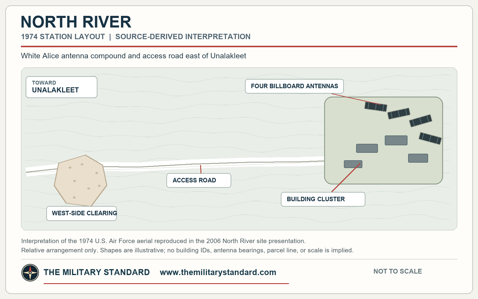
A 1974 U.S. Air Force aerial photograph shows an access road crossing the station landscape and the concentrated antenna-and-building compound near its eastern end. A later annotated aerial identifies the former operating compound and the maintenance and disposal areas along the road. These views document how the relay occupied a wider landscape than its four antennas alone. [12]
In that 1974 view, the principal road approaches the working compound from the west, with one cleared activity area separated from the main cluster. The four dark antenna faces and associated buildings form a compact group east of the road approach. The troposcatter installation was not a single dish beside the radar station: it was a separate developed place connected to the radar system by its local radio link and shared support. [12]
Communications Role and Network Relationships
North River was a combination troposcatter and microwave station. Its two long White Alice radio paths connected to Granite Mountain and Kalakaket Creek. The Corps gave the respective path lengths as 108 and 118 miles. A microwave link served the nearby Unalakleet AC&W station. The relay thus functioned as a communications junction between remote White Alice stations and the radar station's local communications requirements. Its importance was not in detecting aircraft itself, but in getting air-defense information through a difficult regional network. [1] [2]
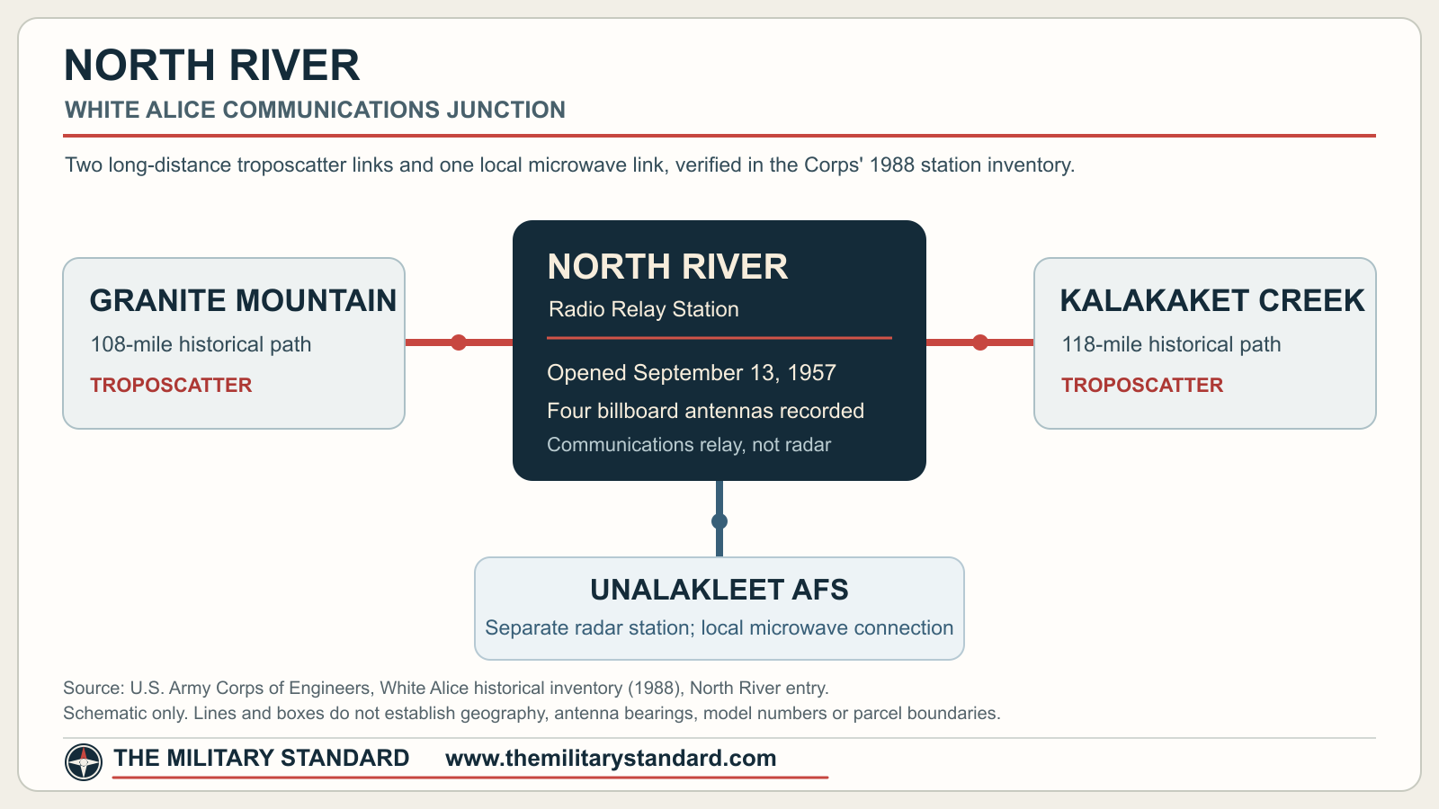
The long routes were not simply a pair of nearby towers. The Corps gives 108 miles from North River to Granite Mountain and 118 miles to Kalakaket Creek, distances far beyond ordinary ground-level line of sight in this terrain. Tropospheric scatter used large directional antenna pairs to collect a weak, scattered portion of a transmitted signal at the distant station. Its reliability depended on antenna alignment, transmitter output, receiver sensitivity, and uninterrupted on-site power. The short Unalakleet connection could instead use a microwave hop. In operational terms, the relay helped turn isolated radar reports into information that could move through the regional air-defense system. [1]
The Corps records that North River used many facilities of the nearby aircraft-control-and-warning station. It also describes a military-built bridge across the Unalakleet River that was prone to spring washouts. When the crossing failed, relay personnel could be isolated despite the road connection. This was a practical operating constraint for fuel delivery, maintenance, and staff movement. [1]
People and Everyday Conditions
The dormitory's 12-person design capacity is the clearest station-specific staffing figure in the Corps record. The Corps also describes how original White Alice planning underestimated staffing and electrical-generation needs at remote sites generally. North River's large fuel storage, on-site power plant, and dormitory indicate the support required to keep its long-distance circuits running, although a dated roster of individual operators has not been located. [1]
The station operated within the Air Force White Alice system, while Western Electric installed electronics across the original program. North River used nearby AC&W facilities, reducing duplication of support buildings while leaving the radio compound responsible for its own technical plant. Its operators maintained the relay links and power plant serving the aircraft-warning network; the radar squadron at Unalakleet had a different mission. [1] [2]
At North River, people maintained the antenna, radio, power, fuel, and building systems in a place where weather and river access could interrupt routine support. The bridge washouts recorded by the Corps made the relationship with Unalakleet more than a line on a network chart: local access was essential to the station's daily operation. [1]
Shutdown, Abandonment, and Removal
An Air Force communications history records North River's deactivation on June 16, 1978. The Corps' 1994 plan and a later Ninth Circuit account likewise place its closure in 1978. One 2023 court order says 1979, but the Air Force's contemporaneous cutover account gives the specific June 1978 day and describes the termination inventory conducted at the station. [2] [7] [11] [15]
The shutdown was part of a deliberate change in Alaska communications rather than an isolated failure of the North River plant. In 1974 the Air Force described a plan to retire White Alice tail extensions when RCA Alascom could provide equivalent service. North River was named among those extensions. By late 1977, the replacement program called for a satellite earth terminal at Unalakleet and phased retirement of the western troposcatter paths. A December 1977 schedule listed June 1978 for North River, but this was a planned date, not proof of actual shutdown. [15]
The Unalakleet satellite terminal became operational on May 12, 1978, according to the Air Force study. That turn-up let the government retire North River and nearby Granite Mountain as their old paths were superseded. The study gives June 16 as North River's deactivation date and says the North River to Granite Mountain and North River to Kalakaket Creek troposcatter links were eliminated. A joint 1931st Communications Group and RCA Alascom termination inventory ran June 12-16 at North River and the nearby Unalakleet relay site. The documented sequence therefore distinguishes the opening of replacement service, physical inventory, and final radio-station deactivation. [15]
The change also altered the wider network around North River. Granite Mountain had already been deactivated on May 1, 1978, while Kalakaket Creek remained in the broader transition plan. The Air Force study says Unalakleet's new terminal allowed turn-down of the North River to Kalakaket Creek path. These records show why the original 1957 network diagram must be read as an operating-era arrangement rather than a map of circuits still active after mid-1978. The retiring troposcatter sites then became a real-property and disposal problem for the Air Force and Corps. [15]
North River remained connected to the system's late-1970s property and service transition. A 1977 Air Force study records RCA Alascom's plan to move vehicles from North River and Neklasson Lake to Boswell Bay, along with disagreement over how equipment leased for White Alice service could be used on other routes. The episode shows that the relay's operational assets were being redistributed while replacement circuits were still being arranged. It does not establish that the North River radio plant itself had already closed in 1977. [15]
After deactivation, the Air Force faced the separate task of disposing of land, buildings, equipment, and support facilities at many White Alice sites. The 1983 communications study includes North River among stations left for Air Force disposition rather than among the TD-2 microwave facilities selected for commercial purchase. It also notes a 1980 inquiry about two gravel pits associated with North River and the respective roles of Air Force and Alascom personnel in their operation and maintenance. These post-service records help explain why the former station remained an active government property concern years after radio transmission ended. [15]
The 1978 cutover was only one stage in North River's retirement. Opening the Unalakleet satellite terminal did not instantly remove the billboard antennas or end all administrative work at the relay. The joint inventory, transfer of equipment, later condition surveys, and eventual demolition took place over many years after communications service ended on June 16, 1978. [1] [2] [15]
Following closure, maintenance and security were poor. The Ninth Circuit records that a caretaker made weekly inspections, but an early-1980s federal review criticized the protection of shuttered White Alice facilities. The Corps in 1988 described North River as abandoned and heavily vandalized. Its 1994 cultural-resources plan still listed the operations building, dormitory, hut and four antennas but characterized the place as deteriorated, unsafe and scheduled for demolition. These are descriptions from different points in the post-operating period, not simultaneous current conditions. [1] [2] [7]
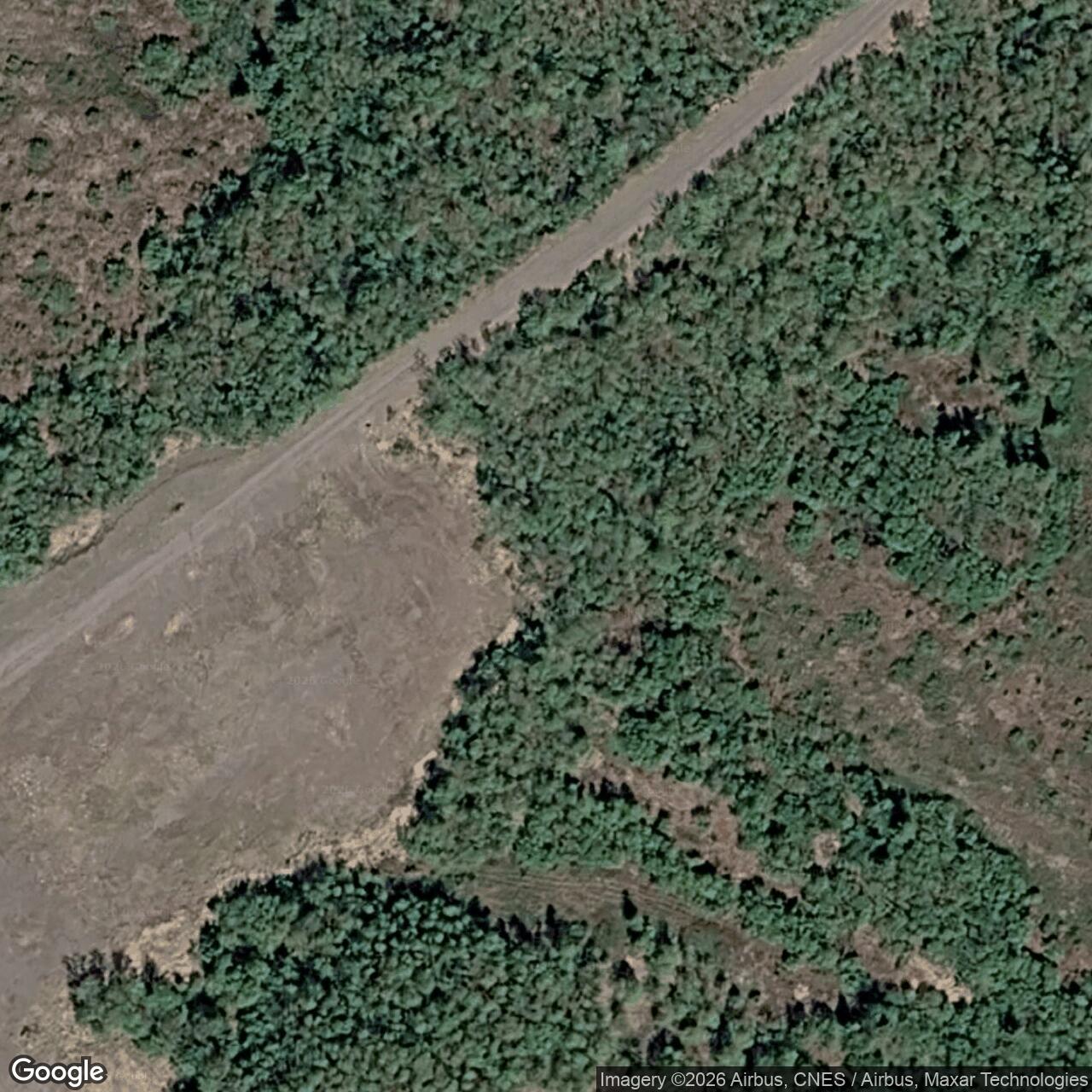
DEC records Corps demolition and soil work in 1993 and 1995, and its 2006 account says all aboveground structures had been removed by 1996. Later site photographs show a low, revegetating former operating area instead of the four billboard antennas visible in the 1974 aerial. A 2017 Defense Department inventory likewise reports no buildings. [3] [8] [10] [12]
Environmental Legacy and Community Effect
Fuel storage, electrical equipment, vehicle maintenance, and waste handling left separate cleanup areas across the former relay landscape. DEC tracks the operating compound as OT001, the vehicle-maintenance area as SO001, Area C as SS001, and Area A as SS003. The areas have different closure and land-use-control statuses. [3] [4] [5]
The most consequential off-site episode involved PCB-bearing soil tracked along a trail toward a neighboring Alaska Native allotment. The Ninth Circuit recounts discovery of a heavily contaminated hot spot after the landowner reported an odor in 2003 and removal work that reduced contamination on the allotment by 2005. The court also records the landowner's continuing concern about traditional use of the area. Its decision addressed the federal lawsuit's jurisdiction; it did not establish medical causation. [7]
The Air Force and Corps removed contaminated soil in several campaigns. Bedrock and groundwater limited complete excavation in parts of Areas A and C. A 2019 amended remedy provided for off-site disposal where practicable, clean-fill caps over residual material, land-use controls, inspection, and periodic review. The cleaned trail and cabin area were excluded from the land-use-control boundary. [4] [5] [13] [14]
DEC declared the former White Alice operating area OT001 cleanup complete in June 2015. It issued a separate cleanup-complete letter for the former vehicle-maintenance area SO001 in June 2025. SS001 and SS003 remained subject to controls or continuing review in the DEC records checked in October 2026. The Air Force reported maintained caps and signs during its July 2024 field inspection, although access-road erosion and mud complicated the visit. [3] [4] [5] [14]
Property and Present Landscape
Land around the former relay has been used for hunting, berry picking, and recreation, and the nearby Native allotment remains important to local residents. The old antenna compound is not an intact historic complex or an unrestricted public park. Air Force and Native-corporation interests, residual-contamination controls, and access conditions vary across the former station area. [3] [7] [10] [14]
The approximate point used in the installation index, 63.886613 N, 160.521717 W, is DEC's reference location for SO001, the former vehicle-maintenance area. It is not the antenna compound, a surveyed installation centroid, or a property boundary. DEC lists a separate point for Area A, 63.883470 N, 160.534180 W. [4] [5]
Historical Significance
North River joined two long troposcatter paths with a local microwave connection to Unalakleet, making it a useful example of how White Alice supported Alaska's aircraft-warning network. Its river-crossing problems and substantial housing, fuel, and power facilities also show the cost of maintaining remote communications. The Corps' 1994 preservation plan recorded Alaska Historic Resources Survey number UKT-043 and noted the station's severe deterioration before demolition. [1] [2]
Chronology
- 1955 Western Electric received the original White Alice construction contract; the Corps' later overview places North River's negotiated construction price in the early program's cost revisions. [1]
- 1957 North River's combined troposcatter and microwave station was constructed. [1] [2]
- 1957-09-13 The Corps records North River's opening. [1] [2]
- 1974 Air Force planning identified North River among White Alice tail extensions to close when equivalent replacement service became available. [15]
- 1977-12 The replacement schedule projected North River deactivation in June 1978. [15]
- 1978-05-12 RCA Alascom turned up the Unalakleet satellite terminal that enabled replacement of North River circuits. [15]
- 1978-06-12 to 1978-06-16 The 1931st Communications Group and RCA Alascom performed a joint termination inventory at North River and the nearby Unalakleet relay. [15]
- 1978-06-16 The Air Force communications history records North River deactivation. [15]
- 1980 Air Force and Corps officials reviewed disposition of gravel pits associated with the deactivated station. [15]
- 1981-05-28 A federal review cited by DEC documented vandalism and unsecured material at former White Alice sites, including North River. [3]
- 1993 A Corps contractor demolished structures and removed some contaminated soil before work was interrupted. [3] [7]
- 1994 The Corps cultural-resources plan documented four billboard antennas and remaining buildings, but found the site deteriorated and scheduled for demolition. [2]
- 1995 Additional Corps contractor work removed structures and soil; the project again did not fully settle the contamination record. [3] [7]
- 1996 DEC's later summary says all aboveground structures had been removed by this year. [9]
- 2003-07 PCB contamination was found along a trail toward a neighboring Native allotment, prompting further Air Force work. [3] [7]
- 2010-09-13 A Record of Decision selected excavation and off-site disposal for specified PCB-contaminated areas. [3] [4] [5]
- 2015-06-05 DEC issued cleanup complete for OT001, the former White Alice operating area, and removed its institutional controls. [3]
- 2019-11-18 DEC approved an amended remedy for Areas A and C that included caps and land-use controls because complete excavation was impracticable. [4] [5]
- 2025-06-27 DEC issued a cleanup-complete letter for SO001, the former vehicle-maintenance facility; SS001 remained open. [4]
- 2025-12-15 DEC approved the 2025 North River long-term monitoring report. [4] [5]
Information sources (15)
- PDFU.S. Army Corps of Engineers, Historical Overview and Inventory: White Alice Communications System (1988)
Source for: original-system construction, North River's negotiated price, September 1957 opening, direct Granite Mountain/Kalakaket Creek paths, Unalakleet microwave link, buildings, dormitory, fuel capacity, road and washout-prone bridge, and 1988 condition.
- PDFU.S. Army Corps of Engineers, The Cold War in Alaska: A Management Plan for Cultural Resources (1994)
Source for: 1978 abandonment, remaining North River buildings and four billboard antennas, deterioration, pending demolition, AHRS UKT-043 and preservation-status qualification.
- WEBAlaska Department of Environmental Conservation, North River RRS OT001 and Site Wide, hazard ID 845
Source for: property-interest summary, historical structures and demolition, environmental chronology, OT001 cleanup-complete determination, coordinate provenance, and distinction from other active areas.
- WEBAlaska Department of Environmental Conservation, North River RRS Area C SS001 and SO001, hazard ID 4367
Source for: Area C and vehicle-maintenance contamination, remedial actions, 2019 ROD amendment, SO001 2025 closure, SS001 continuing status and long-term monitoring.
- WEBAlaska Department of Environmental Conservation, North River RRS Area A SS003, hazard ID 4365
Source for: Area A identity, separate WGS84 environmental marker, residual contamination, land-use controls and continuing active status.
- WEBAlaska Department of Environmental Conservation, Unalakleet Air Warning Main Radar Site, hazard ID 849
Source for: distinct Unalakleet radar-site identity and reference coordinate, not a North River station centroid.
- PDFU.S. Court of Appeals for the Ninth Circuit, Nanouk v. United States, No. 19-35116 (2020)
Source for: closure-year corroboration, post-closure care, PCB migration to a neighboring Native allotment, cleanup history and carefully bounded description of the litigation.
- PDFDepartment of Defense, Base Structure Report FY2018 Baseline, as of September 30, 2017
Source for: 144 reported site acres and zero buildings in a late real-property inventory, not an original station boundary.
- PDFAlaska Community Action on Toxics and Norton Sound Health Corporation, Report on Formerly Used Defense Sites in the Norton Sound Region (2006)
Source for: regional descriptions of the separate radar and relay sites, reported June 1978 closure, maintenance-facility location, historic contaminants and the acreage misattribution warning.
- PDFAlaska Department of Environmental Conservation, U.S. Air Force Former North River Radio Relay Site, site summary (June 2006)
Source for: post-demolition conditions and local land use; its named direct relay neighbors conflict with the Corps' station-specific history and are not adopted here.
- PDFU.S. District Court for the District of Alaska, Nanouk v. United States, order denying motion to dismiss (March 15, 2023)
Source for: hilltop setting, contractor operation and a conflicting 1979 closure statement; the order is not treated as evidence that medical causation was proved.
- PDFMWH for the U.S. Air Force, North River RRS Conceptual Site Model Presentation (December 2006)
Source for: 1974 station aerial, post-demolition site photographs and annotated aerial, building-component inventory, approximate 216-acre description, and 2003-2006 source-area and sampling history. Slides 8-9 carry an apparent Driftwood Bay label error and are not used as North River ecological evidence.
- PDFU.S. Air Force and U.S. Army Corps of Engineers, Final Record of Decision Amendment, North River Radio Relay Station (2019)
Source for: changed remedy for SS001 and SS003, contaminants and cleanup criteria, residual contamination, community participation, cap and land-use controls, five-year reviews, and the conflicting 26-acre site description.
- PDFU.S. Air Force 611th Civil Engineer Squadron, 2024 Remedial Action-Operation and Long-Term Management Report, North River Radio Relay Site (July 2025)
Source for: site ownership, remedial area descriptions, 2012-2023 work history, July 2024 inspections and groundwater results, current signs and access condition, and recommended SO001 monitoring change.
- PDFOffice of Air Force History, 1931st Communications Wing, A Special Study of the Sale of the White Alice Communications System (October 1983)
Source for: 1974 closure policy, 1977 replacement schedule, Unalakleet satellite terminal activation, June 16, 1978 North River deactivation, joint termination inventory, and 1980 gravel-pit disposition.