
Pillar Mountain White Alice Communications Site, Alaska
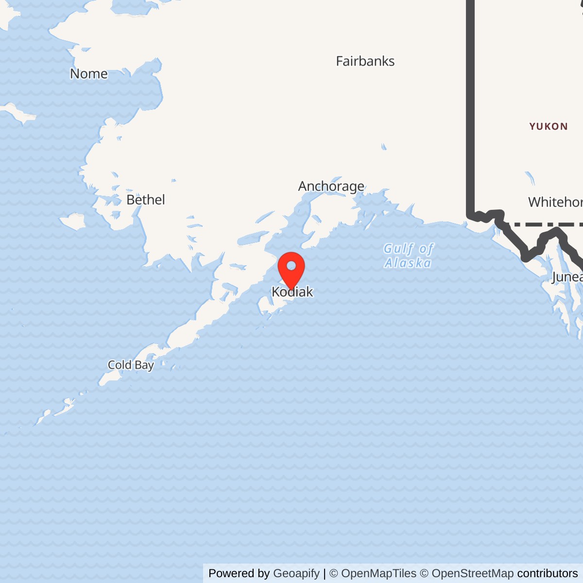
Longitude: -152.436667
Current Role: Former White Alice site on Pillar Mountain. Historic installation demolished in 1997; later Coast Guard and other communications facilities on the mountain must not be assumed to occupy the same parcel without a survey.
Pillar Mountain White Alice Communications Site
Coordinate note: 57.788611 N, 152.436667 W is an approximate HAER historic-site reference. DEC's separate WGS84 environmental marker is 57.788001 N, 152.439080 W. Neither is a surveyed antenna, property boundary or access point.
- Role
- Air Force White Alice tropospheric-scatter terminal above Kodiak, not an air-search radar.
- Opened
- April 26, 1957, according to the Corps of Engineers station inventory.
- Direct operational path
- Two 60-foot billboard reflectors to Diamond Ridge near Homer, approximately 135 miles.
- White Alice closure
- Long-distance link closed in late 1978; HAER gives a broader 1957-1979 service period. Local radio service continued.
- Present record
- Original plant demolished in 1997; some former-site land was reused for later FAA and Coast Guard communications. DEC lists cleanup complete with institutional controls.
Location and Identity
Pillar Mountain Sitkinak Island was never completed. Navy, Coast Guard, FAA, and commercial users nevertheless made the Kodiak terminal more than a single-purpose relay. [1] [3]
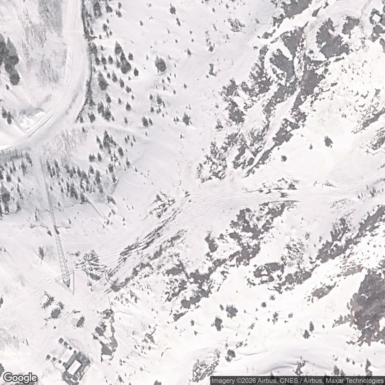
The Library of Congress Historic American Engineering Record (HAER) catalog gives an approximate historic-site reference at 57.788611 N, 152.436667 W. Alaska's Department of Environmental Conservation (DEC) records a different WGS84 environmental point at 57.788001 N, 152.439080 W for its Pillar Mountain RRS OT01 case. Neither is a surveyed antenna position or property boundary. The former station occupied part of a ridge that has carried several communications facilities. A 0.44-acre tract in a 2008 Coast Guard lease was a later leasehold, not the acreage of the original Air Force station. [5] [6] [7]
Why Kodiak Needed the Relay
The Air Force built White Alice to replace vulnerable long-distance radio paths in Alaska with higher-capacity, more dependable links. Aircraft warning reports, command traffic, telephone conversations, and administrative messages had to travel between isolated radar stations, air bases, and command centers across hundreds of miles. Direct line-of-sight microwave was often impractical over the Gulf of Alaska and the state's mountain ranges. Tropospheric scatter instead sent powerful ultrahigh-frequency signals toward the lower atmosphere, where a small fraction could be received beyond the normal horizon. Its large antennas and power-intensive equipment were expensive, but they connected places for which terrestrial microwave would have required many intermediate stations. [1]
Pillar Mountain was one of the original White Alice tropospheric-scatter stations. Diamond Ridge, about 135 miles to the north near Homer, formed the other end of its operational long-distance path. Diamond Ridge also connected to Big Mountain and to the Starisky Creek microwave route, tying Kodiak-area services into a broader Alaska communications system. The billboard-like structures on Pillar Mountain were communications reflectors, not search-radar antennas. [1]
Planning, Construction, and Opening
The Corps' cultural-resources plan says construction began in late 1956. Its station inventory dates construction to 1957 and gives April 26, 1957 as the opening date. The dates describe a project that began before the year of its formal opening. The inventory adds that some components were not finished until 1966, showing that expansion and completion work continued after the first Kodiak-Diamond Ridge service began. [1] [2]
Western Electric Company engineered and built the original White Alice system under Air Force contract, with the U.S. Army Corps of Engineers handling construction and real-property work. HAER identifies Western Electric and the Corps as builders of Pillar Mountain and records Air Force ownership when the engineering survey was compiled in June 1997. Their work created a purpose-built hilltop terminal with the antennas, equipment spaces, and support facilities needed for a continuous over-water radio path. [1] [4]
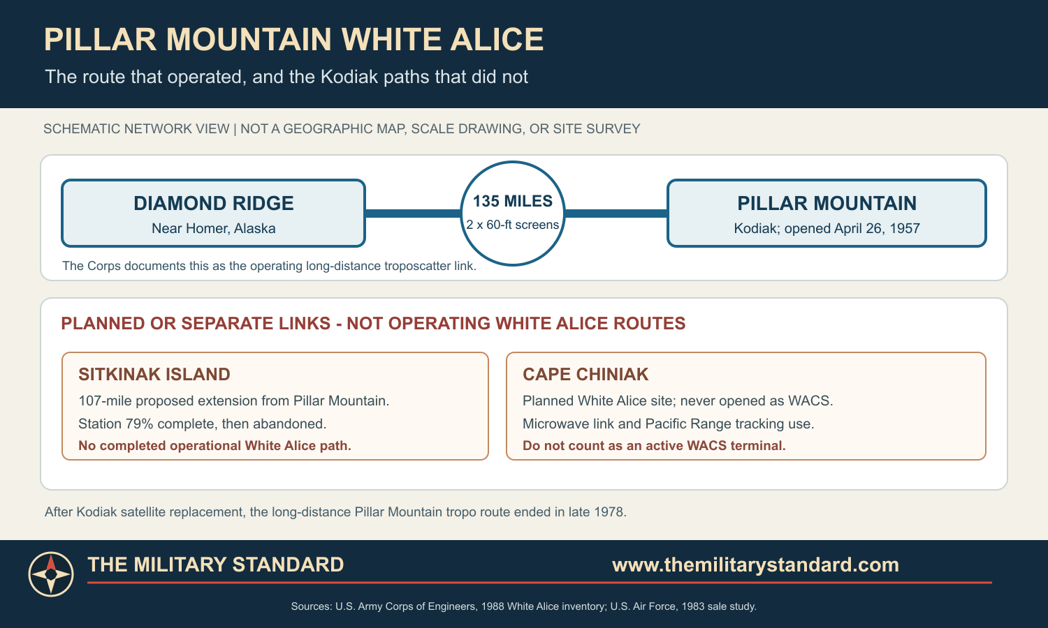
The planned Kodiak archipelago extension illustrates how quickly requirements changed. Western Electric intended a further 107-mile link south to Sitkinak Island, but Project Stretchout made it unnecessary. Sitkinak's own facility was 79 percent complete when abandoned, and the Pillar Mountain-Sitkinak radio path never operated. Cape Chiniak, planned as a combined tropospheric-scatter and microwave station, was virtually completed but likewise never opened as a White Alice terminal. It later served as a Pacific Range Tracking Site in 1958-1959. These separate built projects show that construction and operational network membership did not always coincide. [1]
Antennas, Buildings, and Power
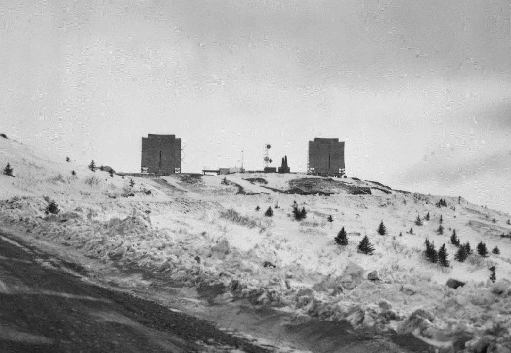
March 1997 HAER photographs show the Pillar Mountain plant immediately before demolition. It had two 60-foot parabolic billboard reflectors serving the Diamond Ridge path. HAER describes each galvanized-steel reflecting screen as approximately 1,000 square feet, with a feed horn directing high-power UHF energy toward its curved face. The paired antennas served one long-distance route, providing diversity across the difficult over-water hop. HAER describes 10-kilowatt scatter operation in general terms, but the precise Pillar Mountain transmitter model and operating frequency have not been established. [1] [4]
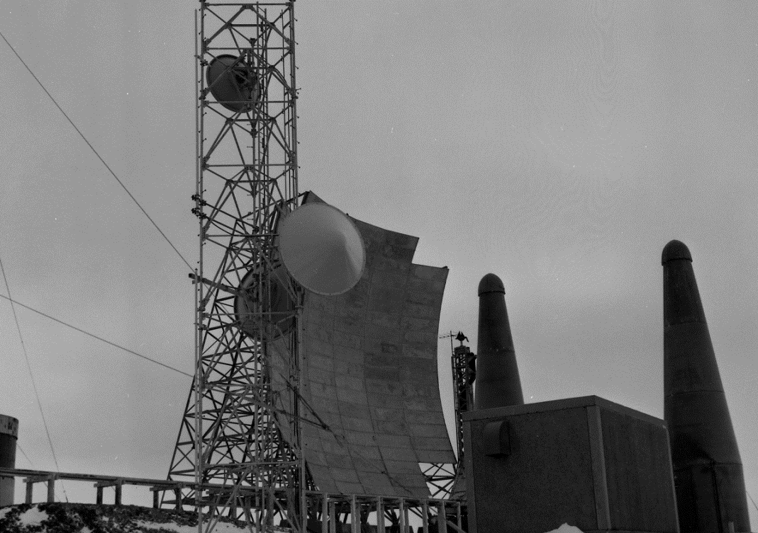
The Corps inventory identifies a 4,960-square-foot composite building, an automobile-maintenance building, a water and fire-pump building, a storage tank, and fuel facilities. The 1994 plan describes the one-story, wood-frame operations building and a steel garage. In the 1997 HAER record the communications building is Building 1001, the garage is Building 1003, and another field photograph documents Facility 1105. The available site records do not establish a separate permanent dormitory or a reliable station headcount. [1] [2] [4]
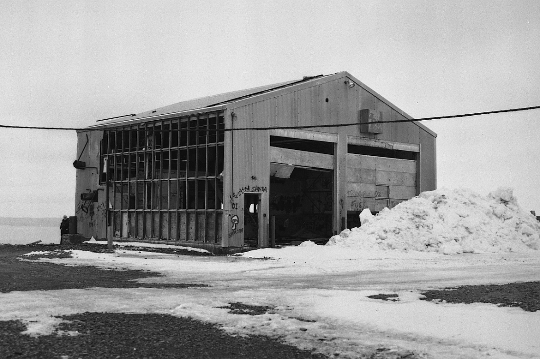
The radio equipment needed reliable electrical supply, standby generation, fuel, water, fire protection, and maintenance in Kodiak's wet and windy conditions. The 2008 environmental notice also describes office and storage space, standby power equipment, petroleum distribution, sewage disposal, a water cistern, and two antenna foundations where screens were never erected. Those unused foundations preserve evidence of a larger intended configuration; only the two Diamond Ridge antennas formed an operating long-distance path. [1] [7]
Traffic and Users
The Diamond Ridge path connected Kodiak to the original White Alice network. The Corps inventory says Pillar Mountain also served the U.S. Navy, Federal Aviation Administration, and RCA; Navy service involved Cape Chiniak through a local communications relationship. The 1983 Air Force study identifies Coast Guard VHF radio communications, an FAA single-frequency outlet, Alascom services, and fishing-fleet communications in the late network period. These users explain why the mountain continued to support local radio service after its principal long-distance White Alice path became obsolete. [1] [3]
The route served defense and civilian needs under changing operating arrangements. An Air Force lease to RCA Alascom began in 1976 as the system moved toward commercial operation; the lease did not transfer ownership of Pillar Mountain. Closing the long-distance troposcatter path required replacement circuits and coordination so that Navy, Coast Guard, FAA, and civilian local-radio services could continue. The distinction between the regional path and local services explains why deactivation was not the end of all communications activity on the mountain. [3]
Satellite Replacement and Continued Local Service
An Air Force replacement schedule prepared in December 1977 projected a Kodiak satellite earth terminal ready in May 1978 and Pillar Mountain troposcatter deactivation in July. The new equipment was to occupy an existing RCA Alascom building. Once the satellite circuit was available, the 135-mile Diamond Ridge link could be retired while Alascom retained microwave, VHF, and radiotelephone systems for the Coast Guard, FAA, and fishing fleet. Those May and July dates were planning targets, not documented completion dates. [3]
A later Air Force table places Pillar Mountain among stations closed between October 1 and December 30, 1978. The 1994 Corps plan likewise calls it abandoned in 1978, and a Coast Guard checklist says the White Alice equipment was turned off that year while local civilian radio use continued for a few more years. HAER gives a broader 1957-1979 operating period, possibly reflecting closeout or residual activity. Taken together, the records support late 1978 for the end of the long-distance White Alice mission without establishing a final transmission day or the end of every local service. [2] [3] [4] [7]
The end of the White Alice path did not empty or transfer the property immediately. An August 1980 inspection recorded a break-in that damaged about $4,000 in equipment. In June 1982 Alascom told the Air Force it intended to return Pillar Mountain because it no longer needed the leased site, but the station had not been returned by the end of that month. Coast Guard VHF and FAA single-frequency services remained practical concerns; Alascom planned to move the FAA outlet and preserve service. Local communications thus outlasted the original long-distance radio link. [3]
The broader White Alice property sale was signed August 25, 1983, but Alascom decided not to purchase Pillar Mountain. The Air Force still managed the abandoned property in 1994, and HAER described it as Air Force-owned in 1997. By 2008, the City of Kodiak owned the specific 0.44-acre tract it leased to the Coast Guard. The records reviewed here do not establish one deed chain or ownership boundary for the entire former White Alice footprint. [2] [3] [4] [7]
Decline, Recording, and Demolition
By the early 1990s the original relay was an abandoned Cold War landmark above Kodiak. A 1994 Corps plan described a vandalized operations building and standing troposcatter antennas under Air Force management, and recommended demolition. HAER photographed the site in March 1997, recording both reflector screens, the feed horn, communications building, garage, and the broader layout. The Air Force demolished the White Alice plant later that year, making the HAER views an unusually complete record of the installation just before removal. [2] [4] [7]
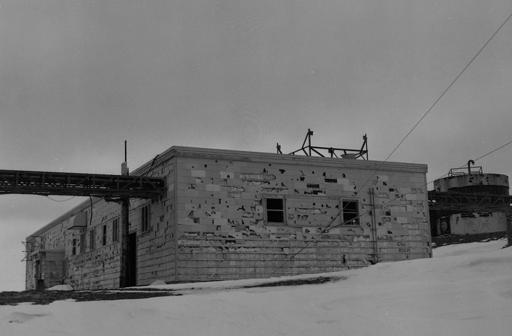
The 2008 Coast Guard lease recounts that demolition left one White Alice antenna foundation. Other debris was handled through on-site or Kodiak disposal, fuel tanks were removed or closed, and contaminated soil was excavated for off-site treatment or disposal. The buildings and screens shown in HAER's 1997 photographs no longer stand. Later towers and shelters represent new communications uses, though one old foundation supported a later FAA installation. [6] [7]
Environmental Legacy
Environmental investigation and demolition planning began in the mid-1990s. The 1997 Clean Sweep work addressed fuel tanks, PCB-contaminated soil, and contaminated concrete in parts of the former installation. DEC signed the cleanup decision document February 1, 2000, and the Air Force signed it March 24. DEC lists Pillar Mountain RRS OT01 as "Cleanup Complete - Institutional Controls," meaning the decision includes ongoing land-use restrictions rather than unrestricted release. [6] [7]
Some petroleum and PCB contamination remained in soil and fractured bedrock after excavation. A clean cover was placed over affected areas, and excavation in the landfill or capped areas is restricted. Movement of affected soil or groundwater requires regulatory review and, where specified, DEC approval. The controls apply to defined parts of the former station, not to every facility on Pillar Mountain. [6] [7]
The DEC environmental point identifies the case area but not the footprint of each restricted location. DEC recorded federal land transfer activity, while the 2008 Coast Guard lease identified the City of Kodiak as owner of its particular parcel and incorporated notice of residual contamination. The exact present ownership pattern and the bounds of individual restrictions require current land records. [6] [7]
Coast Guard and FAA Reuse
The City of Kodiak leased a 120-by-160-foot parcel, about 0.44 acre, to the Coast Guard beginning April 1, 2008. It replaced an earlier FAA lease for the same Site No. 5 premises. A Coast Guard checklist placed its existing communications facility on former Air Force White Alice land within a larger city-leased communications area. The agreement allowed annual renewals through no later than September 30, 2027; the reviewed documents establish renewals through the 2022-2023 fiscal year, but not the status of the lease in 2026. [7]
In 2008 the Coast Guard parcel held an equipment shelter, a 50-foot tower, microwave dishes, VHF and UHF antennas, radios, batteries, and commercial power. It served search-and-rescue communications for Kodiak and remote points including Marmot Island, Raspberry Island, and Cape Gull. The lease also reports that a former White Alice antenna foundation had supported a new FAA radio facility since 2004. This was reuse of land and one foundation, not continuation of the 1957 White Alice radio equipment. [7]
Other antennas and towers also occupy Pillar Mountain's ridge. The 2008 record places the Coast Guard parcel behind a summer scenic viewpoint and describes additional public and commercial facilities farther north. The original Air Force relay has been demolished, while documented FAA and Coast Guard uses occupied portions of its former land. The exact inventory of structures, lease status, and access arrangements today are not established by that older lease. [4] [7]
Historical Significance
Pillar Mountain's history traces the changing technology of Alaska defense communications. It opened in 1957 as Kodiak's long-distance White Alice terminal, while construction continued into the 1960s. The unfinished Sitkinak route shows how the network changed even during its buildout. Satellite service made the Diamond Ridge troposcatter hop expendable in 1978, although local VHF and microwave users still needed the mountain. HAER's 1997 photographs preserve the distinctive two-screen plant just before demolition, and later FAA and Coast Guard facilities show continued demand for the same strategic high ground. [1] [3] [4] [7]
The Corps photograph index names Airman 2nd Class Alfred J. Thurman on assignment at Pillar Mountain in a period image, a rare individual identification in the available station record. It does not supply a complete crew roster. The exact transmitter model and frequency, original military acreage, full property-transfer chain, and present communications inventory also remain unverified. [1] [4] [6] [7]
Chronology
- 1956 Construction began on Pillar Mountain in late 1956, according to the Corps cultural-resources plan.
- 1957-04-26 Corps inventory dates the opening of the Pillar Mountain White Alice station.
- 1958-1959 Cape Chiniak, never opened as White Alice, operated as a separate Pacific Range Tracking Site.
- 1966 Corps inventory says all Pillar Mountain components were complete by this year.
- 1976-07-01 Air Force lease period to RCA Alascom began under the WACS transition arrangements.
- 1977-12 The Air Force and Alascom scheduled satellite replacement of the Kodiak troposcatter path for 1978.
- Late 1978 Air Force records place Pillar Mountain among White Alice stations closed in the final quarter; local radio service continued.
- 1979 HAER gives this as the broad end of Pillar Mountain's operating period.
- 1980-08-27 Break-in damaged an estimated $4,000 in property at the still-leased site.
- 1982-06-03 Alascom advised the Air Force it intended to return Pillar Mountain; local VHF and FAA service issues remained.
- 1983-08-25 White Alice sale contract was signed; Pillar Mountain was not among the properties Alascom purchased.
- 1994 Corps found vandalized operations building and standing antennas and recommended demolition.
- 1997-03 HAER field photographs documented the original antennas, feed horn, buildings and site layout.
- 1997 Air Force demolished the White Alice facility and performed Clean Sweep environmental removal.
- 2000-02-01 Alaska DEC signed the Pillar Mountain cleanup decision document.
- 2000-03-24 The Air Force signed the cleanup decision document.
- 2004 FAA constructed a new radio facility on an old White Alice antenna foundation, according to the 2008 Coast Guard lease.
- 2005-09-15 DEC recorded institutional controls for the capped contamination areas.
- 2008-04-01 Coast Guard lease of a 0.44-acre former-site parcel from the City of Kodiak began.
Information sources (7)
- PDFHistorical Overview and Inventory: White Alice Communications System, U.S. Army Corps of Engineers, Alaska District, 1988
Source for: Original network membership; Pillar Mountain-Diamond Ridge distance and equipment; Sitkinak and Cape Chiniak plans; 1957 opening; building inventory; 1966 completion; related station profiles.
- PDFThe Cold War in Alaska: A Management Plan for Cultural Resources, U.S. Army Corps of Engineers, 1994
Source for: Late-1956 construction start; 1957 opening; wood-frame building and steel garage; 1978 abandonment; 1994 condition, Air Force management and demolition recommendation.
- PDFA Special Study of the Sale of the White Alice Communications System, Office of Air Force History, 1931st Communications Wing, 1983
Source for: 1976 lease; 1977-1978 satellite replacement plan; late-1978 site closure table; continued Coast Guard/FAA/fishing-fleet service; 1980 break-in; 1982 return proposal; exclusion from 1983 sale.
- PDFPillar Mountain White Alice Site, Historic American Engineering Record AK-75, National Park Service and U.S. Air Force, 1997
Source for: Site identity; equipment description; broad 1957-1979 period; Air Force ownership at recordation; six March 1997 field photographs and facility labels.
- WEBPillar Mountain White Alice Site, Library of Congress HAER catalog
Source for: Official HAER identification, photo provenance, approximate location and rights record.
- WEBPillar Mountain RRS OT01, Hazard ID 2843, Alaska Department of Environmental Conservation
Source for: Distinct WGS84 environmental marker; assessment, demolition and cleanup chronology; 2000 decision; current Cleanup Complete - Institutional Controls status and residual-contamination controls.
- WEBPillar Mountain Communication Site Lease HSCG89-08-L-J-DL-006, City of Kodiak and U.S. Coast Guard, 2008 with later amendments
Source for: 0.44-acre Coast Guard leasehold and city ownership of that parcel; prior FAA lease; 1978/1997/2004 historic-site account; later SAR equipment, missions, environmental notice and renewal documents.