
Big Mountain Radio Relay Station, Alaska
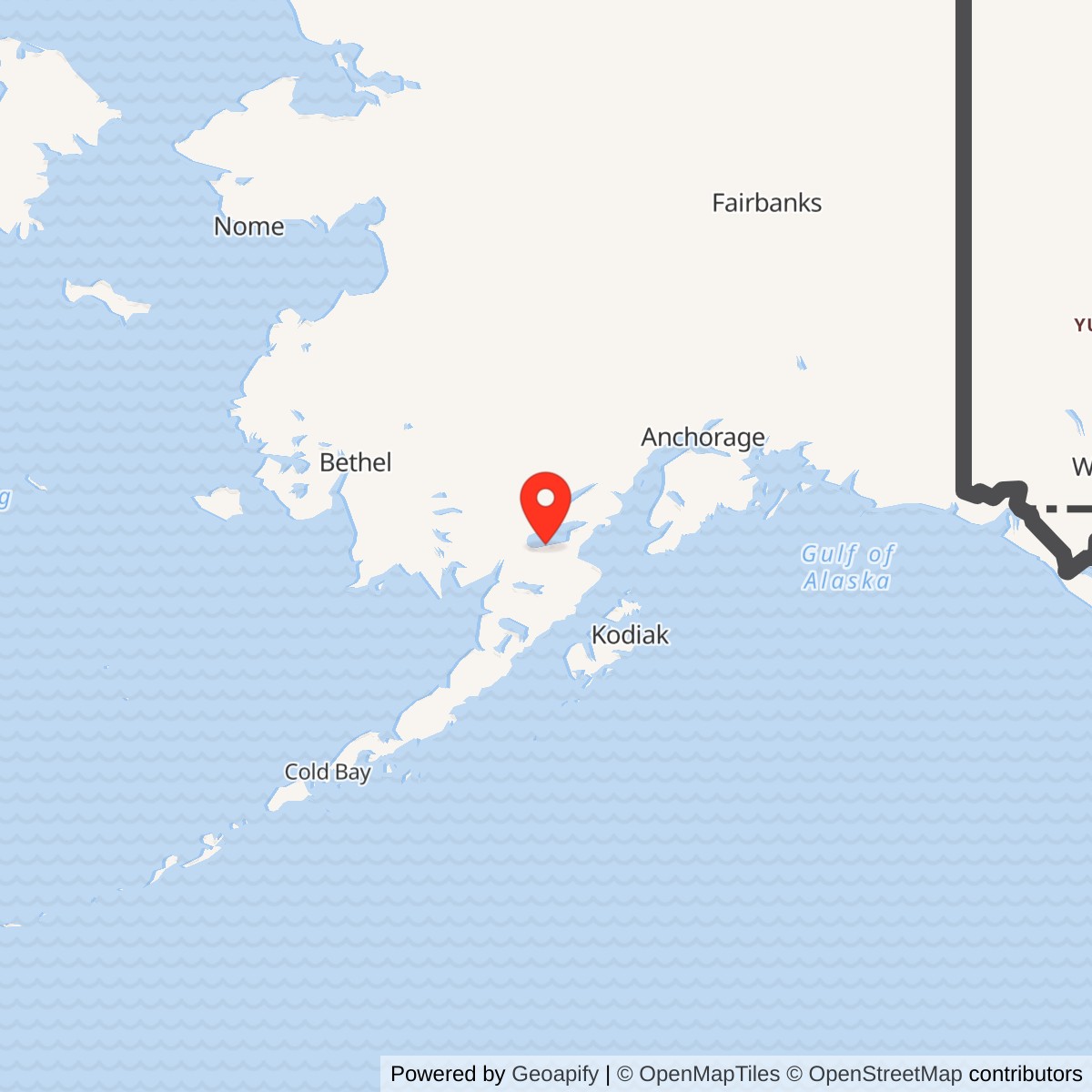
Longitude: -155.2588
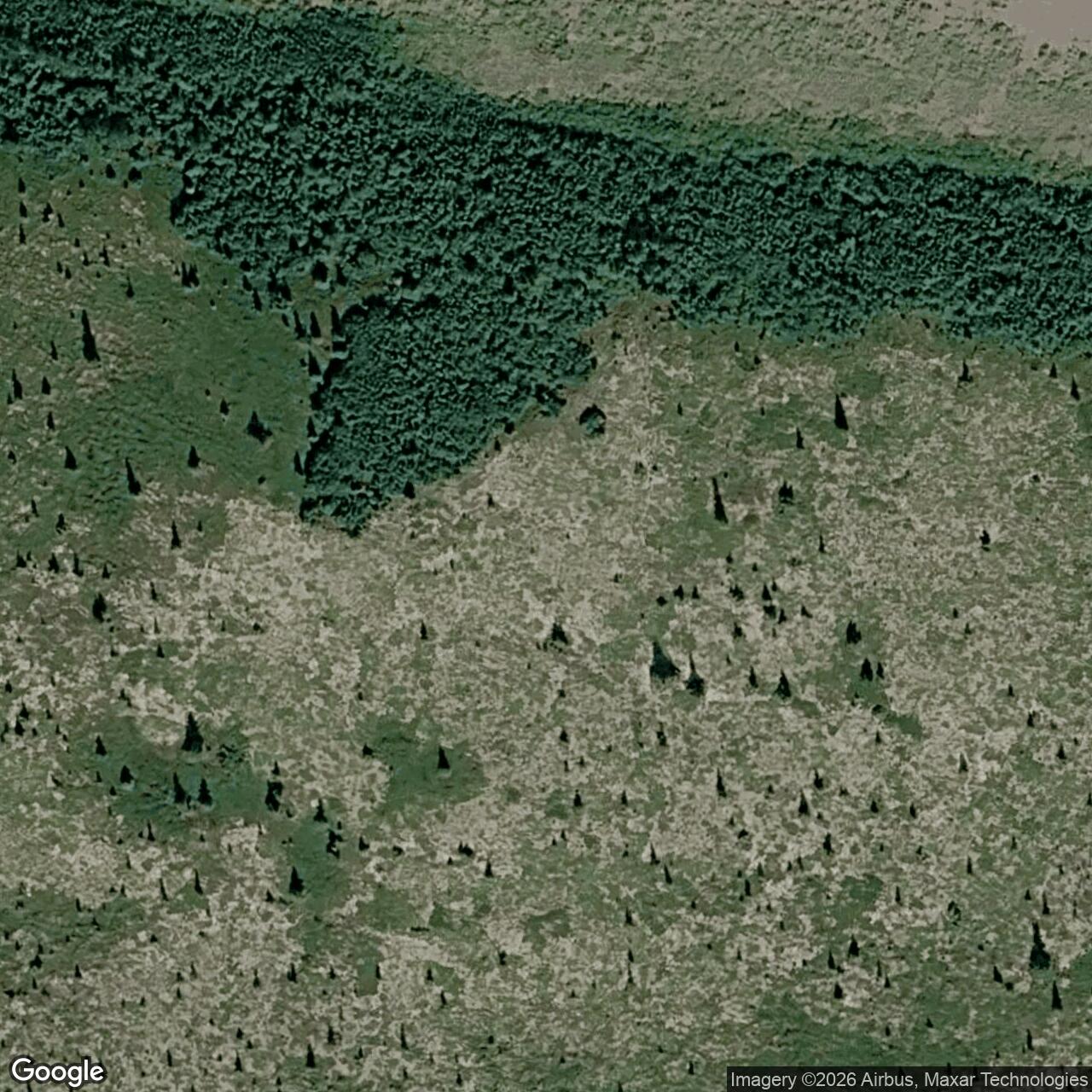
Current Role: Former 402-acre relay installation with Upper Camp communications area and Lower Camp airstrip/support area. Alaska DEC approved continued monitoring and land-use-control work in 2026.
Coordinate note: 59.3612 N, 155.2588 W is the 2008 Air Force decision's facility locator near the lower operating area. It is not a surveyed summit antenna center, property centroid or boundary.
- Role
- White Alice tropospheric-scatter relay and 1969 switching junction, not a search radar.
- Service
- Opened September 7, 1957; closed April 27, 1979.
- Direct paths
- Diamond Ridge, Sparrevohn and King Salmon.
- Layout
- Summit radio camp, lower support camp and airstrip, separate Reindeer Bay barge landing.
- Present condition
- Operating structures removed; component-specific cleanup controls and inspections continue.
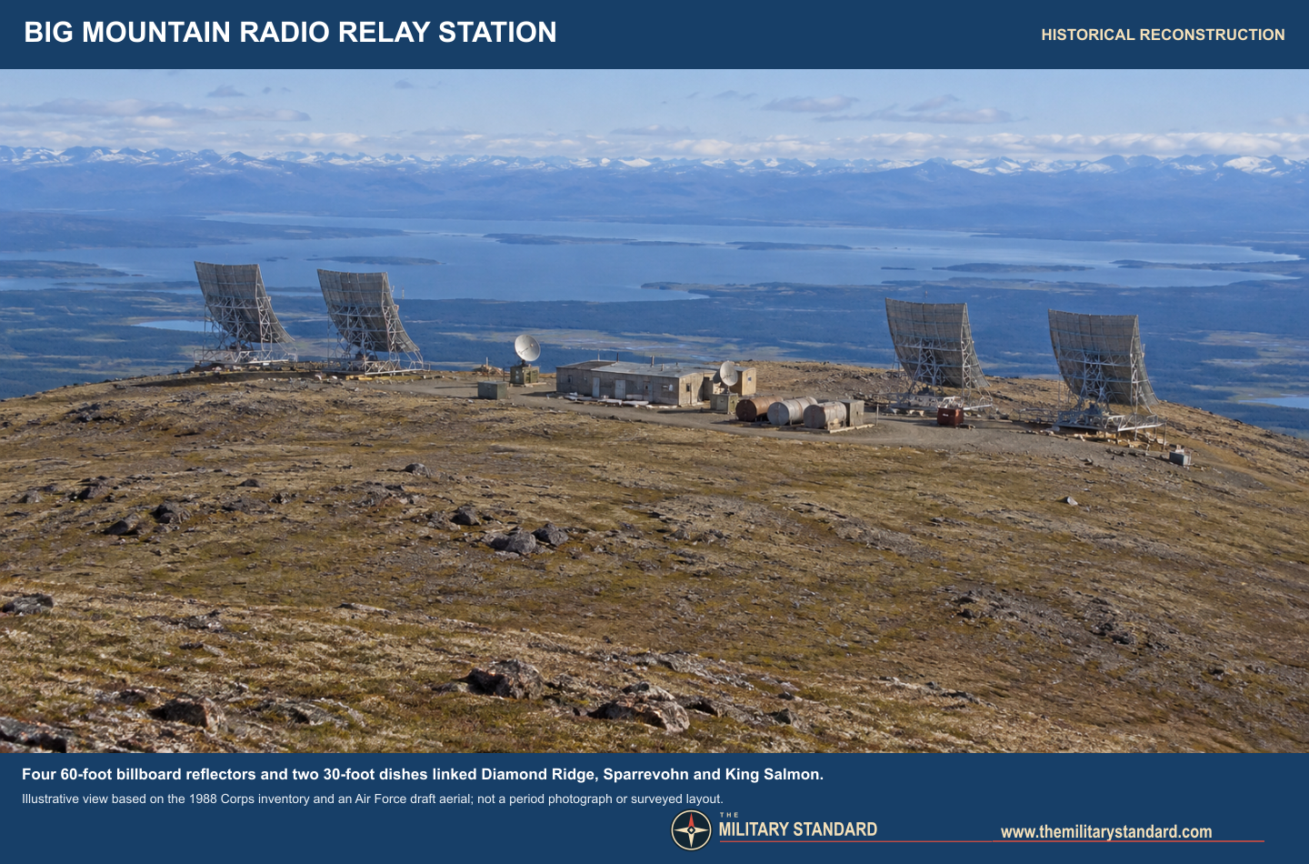
Big Mountain Radio Relay Station was a staffed White Alice communications junction on the south side of Iliamna Lake, about 220 miles southwest of Anchorage. From its summit antenna camp, radio circuits reached Diamond Ridge, Sparrevohn and King Salmon. The installation also required a lower camp with an airstrip and a separate barge landing at Reindeer Bay. The system opened in September 1957 and its relay mission ended in April 1979. Although the antennas and buildings were subsequently removed, the former installation remains an environmental-management property with component-specific land-use controls. Big Mountain was a radio relay, not an aircraft-search radar or a fighter air base. 1235
Origins and network purpose
Alaska's radar and command network had to move messages across mountainous, sparsely settled territory where conventional line-of-sight microwave would require many intermediate towers. The Air Force's White Alice Communications System used tropospheric scatter for long hops: powerful radio signals were aimed toward the horizon, and the distant station received a small portion scattered forward through the lower atmosphere. Local circuits could use other radio techniques where shorter paths permitted. Big Mountain occupied a useful position between Cook Inlet, Bristol Bay and interior Alaska. Its job was to relay communications for the air-defense network, not to detect aircraft itself. The original White Alice program was built as a government communications system, with the Army Corps of Engineers managing construction and Western Electric supplying much of the radio plant. 127
The Corps' 1988 inventory dates Big Mountain's construction to 1956 and 1957, opening to September 7, 1957, and closure to April 27, 1979. The 1994 Corps management plan supports that sequence. A later Air Force draft says the site was first called Big Mountain Communications Station, then Elmendorf/Iliamna Radio Relay Station Annex, Big Mountain Air Force Station in 1958, and Big Mountain Radio Relay Station in 1961. These successive names describe one communications property, not separate installations. An original order establishing each name was not located. The later draft says RCA Alaska Communications began operating the site in 1967, while a DEC retrospective says 1968, one year after the Alaska Communications Disposal Act. Without the local handover agreement, the precise changeover date remains unresolved. 1258
Site geography and construction
The historical facility had three geographically separated components. The Upper Camp stood near the top of Big Mountain, about 2,150 feet above mean sea level, and carried the antennas, equipment and power plant, dormitory, water supply and major fuel storage. The Lower Camp near lake level supported the gravel airstrip, storage, fuel handling and disposal areas. A road of roughly 2.5 miles joined the camps, while another route reached the Reindeer Bay barge landing. Aircraft, barges, trucks and fuel systems were therefore as necessary to the relay as the radio antennas. The village of Kokhanok lies about 16 miles east of the property, according to the 2024 field report. 135
The original equipment and power building measured approximately 40 by 180 feet, or 7,200 square feet. The 1988 Corps inventory describes a 16-person dormitory of about 5,200 square feet, whereas the 1994 management-plan summary gives 7,200 square feet for the dormitory. The latter may be a transcription or building-area discrepancy; neither figure is a verified staffing count. A contemporary 1978 federal report describes living quarters, diesel generation, fuel and water tanks, hangar and support buildings, and an approximately 4,200-foot gravel airstrip capable of receiving large transport aircraft. Modern restoration reports round the strip to 4,000 feet. Those are different levels of precision, not evidence that the strip was rebuilt to a different length. 1237
Published acreage figures also measure different scopes. The signed 2008 decision and the August 2026 monitoring report call the original three-parcel installation approximately 402 acres. A 2019 Air Force natural-resources draft treats a larger 446-acre study area including the barge landing. An Alaska DEC component record mentions 451 acres. None is a surveyed current property polygon, and the barge-landing surface interest was transferred to the University of Alaska. 358
Antennas, circuits and switching
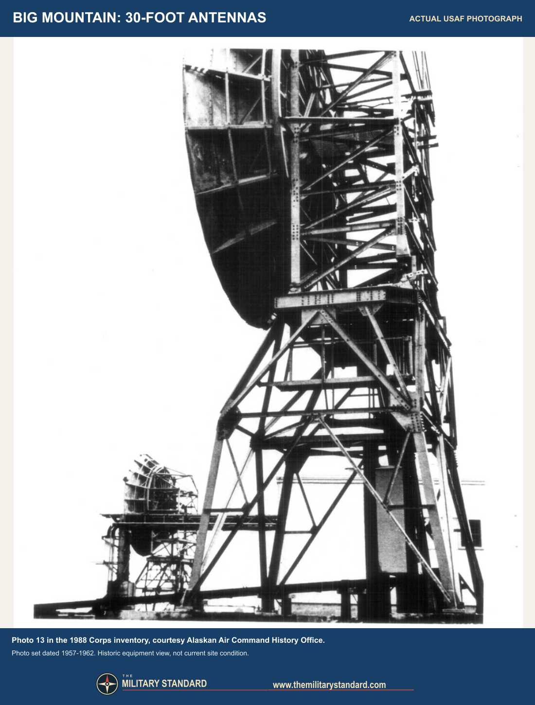
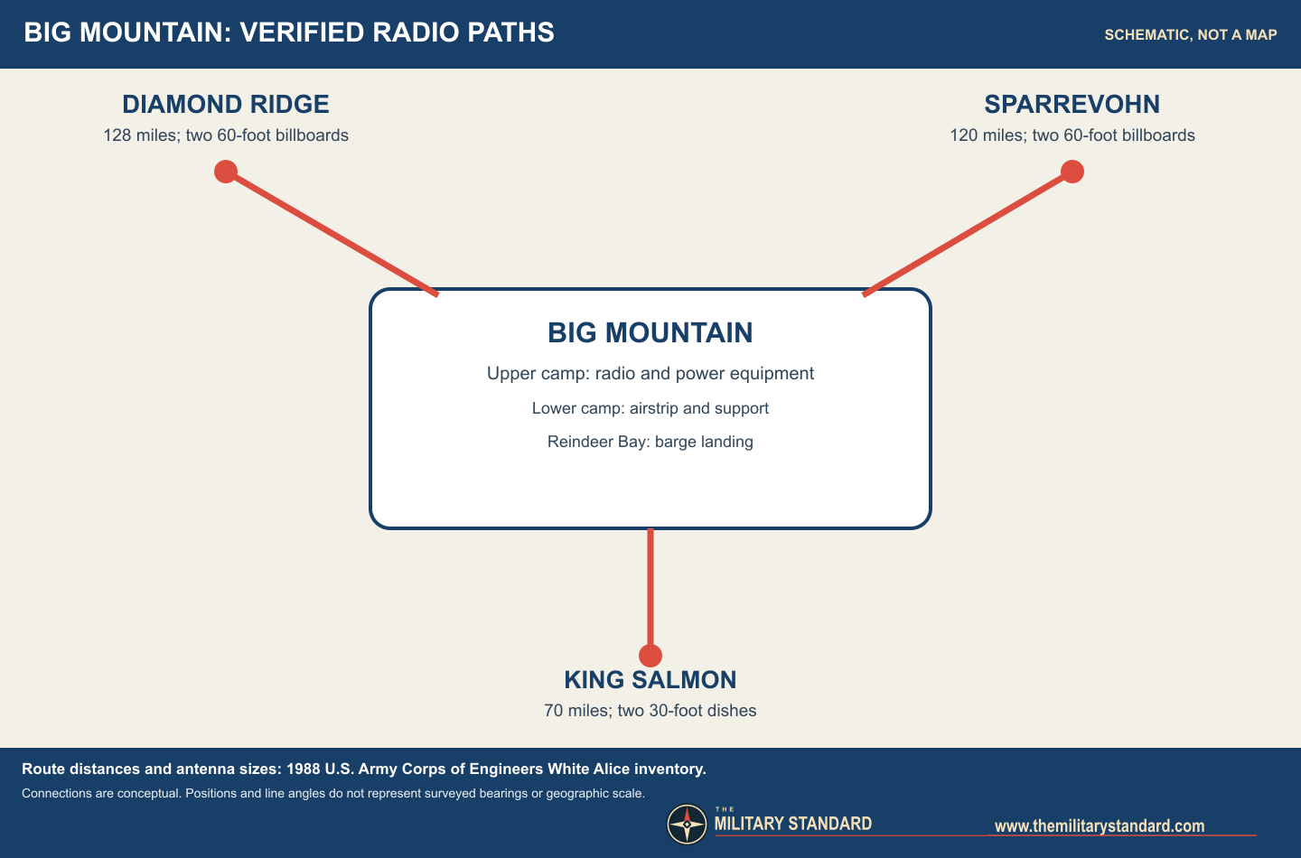
Big Mountain had a route-specific six-antenna arrangement in the Corps inventory. One pair of 60-foot billboard reflectors served Diamond Ridge, about 128 miles away. A second 60-foot pair served Sparrevohn, about 120 miles away. A pair of 30-foot parabolic dishes served King Salmon, about 70 miles away. These sizes and route lengths are historical specifications, not dimensions measured from a surviving antenna or GIS bearings derived from modern points. A later Air Force draft shorthand mentions four tropospheric antennas and two dishes, consistent with the four large billboards plus the smaller pair. 15
The remote station needed radio operators and maintainers, diesel power, antenna deicing and a year-round logistical chain. The 1978 EPA report found it active, with the antenna field, fuel systems and airstrip still present. It is a useful contemporary checkpoint between the initial construction account and the later cleanup files. The reviewed sources do not establish the exact transmitter model and frequency for each Big Mountain route, or a complete crew roster; assigning equipment from a neighboring White Alice station would create false precision. 17
Big Mountain became more than a three-way relay when Alaska Telephone Switching Station capability was added in 1969. The Corps groups it with Neklasson Lake, Pedro Dome and Kalakaket Creek as switching points that allowed traffic to be rerouted if a route failed. The addition reflected a network-wide move toward more resilient, centrally switched communications, while the underlying radio paths still depended on power and maintenance at very remote stations. The connection to King Salmon served the air-defense and forward-operating-base area there. Diamond Ridge, Sparrevohn and King Salmon were distinct facilities, not components of Big Mountain's property. 12
Transition, closure and land change
During the 1970s satellite and commercial telecommunications offered alternatives to maintaining expensive troposcatter compounds. Big Mountain's relay function closed on April 27, 1979 in the Corps inventory. The 2008 decision uses the broader phrase decommissioned in 1979. These are compatible descriptions of operating shutdown; neither proves that all buildings were removed that year. The airstrip and access routes continued to matter for later survey, demolition and cleanup work. A 2003 project repaired the strip after years without regular maintenance. The latest official FAA listing describes Big Mountain Airport, PABM/37AK, as an official-use gravel strip with landing restrictions, not as a public air base. Its airport identifiers apply to the lower-camp airfield, not to the summit radio site. 139
The post-operational property did not simply revert to untouched tundra. The Air Force investigated contaminated component areas beginning in the early 1990s, while Alaska DEC and residents of nearby communities followed the work. DEC recorded community meetings in Iliamna/Newhalen and Kokhanok in 1998 and again during later field planning. Clean Sweep demolition took place in phases during 2003 through 2005. Buildings, antennas, tanks, pipelines, vehicles and other debris were removed; hazardous waste was shipped offsite, while some approved inert construction and demolition material was buried in an onsite landfill. A later draft describes the demolition broadly as 2004 to 2005, but the DEC chronology documents planning and Phase I work in 2003. The absence of operating structures after demolition should not be described as absence of all buried wastes or restrictions. 358
Environmental history
Big Mountain's environmental history is divided into named restoration areas, not a single sitewide cleanup status. The former Lower Camp landfill, LF005, held domestic, shop and construction wastes. Its soil, sediment and groundwater investigations identified PCB and petroleum-related concerns. It was capped and later monitored. ST001 covered a 42,400-gallon fuel-oil tank, truck-fill area and roughly 600-foot pipeline at the Lower Camp. SS002 was a smaller fuel tank and former flight-control-building area beside the airstrip. SS014, at the Upper Camp, had two 126,000-gallon fuel-oil tanks; a later controlled monofill received PCB-affected soil excavated elsewhere on the installation. The landfill cap, the fuel areas and the monofill cannot be represented by one environmental marker or one remedy. 346
The signed 2008 record of decision addressed seven component areas. It found no further action necessary at SS003, SS004, SS011, SS016 and SS017, but required institutional controls at SS002 and SS014 because residual diesel-range organics remained in soil. The decision did not close every Big Mountain restoration area. A separate 2011 decision governs LF005 and ST001. Alaska DEC later issued Cleanup Complete with Institutional Controls determinations for LF005 and ST001 in November 2014. The phrase means the selected remedy and controls were judged protective for defined uses, not that the former landfill was dug out or the entire installation certified unrestricted. 346
The 2022 second five-year review examined the four controlled areas and identified practical follow-up work, including replacement of missing signs, clearing vegetation that obscured access or warnings, continued monitoring, and checking whether some older contaminant targets remained protective under newer state standards. The August 2026 report presents inspections actually made on September 30, 2024. It found the four areas and landfill caps in good visible condition, with no observed signs of unauthorized use, erosion or containment failure. Alaska DEC recorded its approval of the report on September 15, 2026. Its recommendation that SS002 be considered for unrestricted closure after a 2023 subsurface investigation was a recommendation, not a documented new closure decision. The report called for continued inspections and a 2028 long-term monitoring event. Current status must therefore be reported as controlled and monitored by component, not as a blanket cleanup-complete statement. 4612
Historic evidence and present interpretation
Historic photographs survive. The 1988 Corps inventory reproduces an Alaskan Air Command History Office photograph of Big Mountain from the air and a close view of its 30-foot antennas; its index dates the photo set broadly to 1957 through 1962, not to a particular day. Anchorage Museum's William C. and Frances P. Ray slide collection separately lists an August 2, 1957 airstrip view and multiple upper-camp building and antenna views. A separate museum Ray print collection includes a December 1957 icing photograph identified as a Diamond Ridge-facing antenna. 1 51011
Big Mountain's significance is not that it housed a radar. It was a purpose-built, staffed communications junction that let separated radar and command installations exchange information despite Alaska's terrain and weather. Its summit reflectors, lower airfield and lakeside supply route illustrate the physical scale behind an apparently invisible network function. Its surviving record also shows how a two-decade Cold War mission could leave decades of environmental oversight after technical obsolescence. Strong evidence establishes the main routes, component layout, closure and selected cleanup remedies. 1345
Chronology
- 1956-1957 The Air Force constructed Big Mountain's original White Alice compound, lower-camp support area and supply access. 12
- 1957-08-02 Anchorage Museum's Ray slide guide dates views of the airstrip and upper-camp buildings and antennas to this day. 10
- 1957-09-07 The Corps inventory gives this as the station's opening date. 1
- 1958 A later Air Force draft says the name Big Mountain Air Force Station came into use; the original order was not found. 5
- 1961 The same draft says the name Big Mountain Radio Relay Station came into use. 5
- 1969 Alaska Telephone Switching Station capability was added, according to the Corps inventory. 1
- 1978 A federal solid-waste survey described the still-operating antenna and support compound. 7
- 1979-04-27 The Corps inventory gives this as the station's closure date. 1
- 1993 A preliminary environmental assessment identified petroleum, lead and PCB concerns. 6
- 1998 Alaska DEC recorded public meetings during remedial-investigation planning in Iliamna/Newhalen and Kokhanok. 8
- 2003-2005 Air Force Clean Sweep phases demolished station structures, removed equipment and tanks, and managed debris and hazardous wastes separately. 368
- 2008-07 A signed decision addressed seven component areas, with controls retained at SS002 and SS014. 3
- 2011-2012 PCB-affected soil was excavated and a controlled Upper Camp monofill was established. 6
- 2014-11 Alaska DEC designated LF005 and ST001 Cleanup Complete with Institutional Controls. 6
- 2022-06 The second five-year review assessed protectiveness and identified follow-up inspection and monitoring work. 4
- 2024-09-30 The latest cited field inspection observed the four controlled areas and caps in generally good condition. 6
- 2026-08 The report of that 2024 inspection was issued, recommending continuing controls and monitoring. 6
- 2026-09-15 Alaska DEC recorded approval of the 2024 fieldwork report, while the next five-year monitoring event remained planned for 2028. 12
Information sources (12)
- PDF[1] Georgeanne Lewis Reynolds, Historical Overview and Inventory: White Alice Communications System, U.S. Army Corps of Engineers, April 1988
Source for: exact opening and closure dates, route-specific antenna inventory and distances, building dimensions, 1969 switching addition, and Alaskan Air Command History Office photographs 5 and 13.
- PDF[2] D. Colt Denfeld, The Cold War in Alaska: A Management Plan for Cultural Resources, U.S. Army Corps of Engineers, August 1994
Source for: White Alice historical setting, construction and dormitory-area discrepancy.
- PDF[3] U.S. Air Force, Big Mountain Radio Relay Station Record of Decision for SS002, SS003, SS004, SS011, SS014, SS016 and SS017, June 2008
Source for: three-component site geography, 402-acre decision scope, facility locator, 1979 decommissioning, 2003-2005 removal and component-specific remedies.
- PDF[4] Air Force Civil Engineer Center, Second Five-Year Review, Big Mountain Radio Relay Station, June 2022
Source for: thirteen restoration areas, four active controlled areas, history of LF005 and ST001, protectiveness review and recommended corrections.
- PDF[5] U.S. Air Force, Pacific Air Forces Regional Support Center and 611 Civil Engineer Squadron, Integrated Natural Resources Management Plan Update, Draft Edition 1, Appendix H, Big Mountain RRS section, November 2019
Source for: successive site names, 446-acre draft study scope, major structures, former upper-camp aerial and later demolition summary; identified as a draft where it differs from signed decisions.
- PDF[6] Air Force Civil Engineer Center, Big Mountain RRS 2024 Report: Long Term Monitoring and Land Use Control Inspections, issued August 2026
Source for: 2024 inspection results, LF005/ST001/SS002/SS014 descriptions, environmental chronology, continuing controls and 2028 monitoring recommendation.
- WEB[7] U.S. Environmental Protection Agency and Alaska Department of Environmental Conservation, Solid Waste on Federal Lands in Alaska: Second Report to Congress, May 1978
Source for: contemporary active-station description, support facilities, antenna field, fuel and water systems, and approximate airstrip length.
- WEB[8] Alaska Department of Environmental Conservation, Big Mountain RRS SS011 site report, hazard ID 80
Source for: 1968 RCA summary, public meetings, Clean Sweep phases, 2008 component closure and varying total-acreage description.
- PDF[9] Federal Aviation Administration, Alaska Chart Supplement, Big Mountain Airport entry, September 3, 2026 edition
Source for: current PABM/37AK airport designation, official-use landing restrictions and published gravel-runway dimensions; this airport is the former lower-camp support strip, not the summit antenna compound.
- WEB[10] Anchorage Museum, William C. and Frances P. Ray Slides, B2016.006 collection guide
Source for: identification and dates of 1957 Big Mountain airstrip, building and upper-camp antenna images; image permission remains separate from catalog access.
- WEB[11] Anchorage Museum, William C. and Frances P. Ray White Alice image catalog
Source for: separate Big Mountain antenna and icing photo identifications; no commercial reuse license inferred.
- WEB[12] Alaska Department of Environmental Conservation, Big Mountain RRS LF005 site report, hazard ID 77
Source for: August 2022 five-year-review approval, September 2026 monitoring-report approval, current site-control summary and linked full decision documents.