
Starisky Creek Radio Relay Station, Alaska
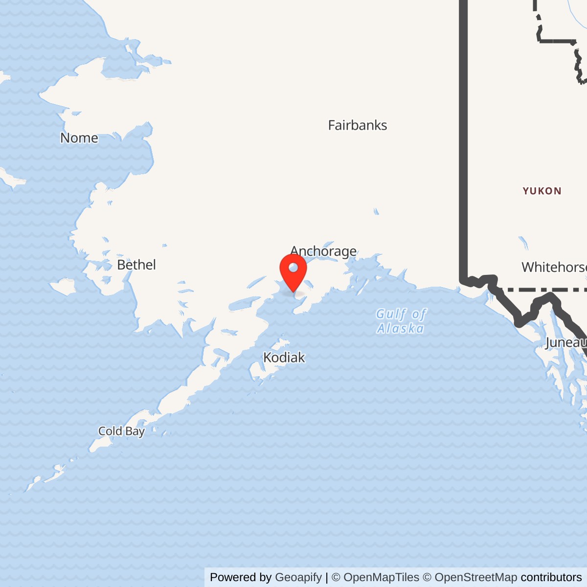
Longitude: -151.786321
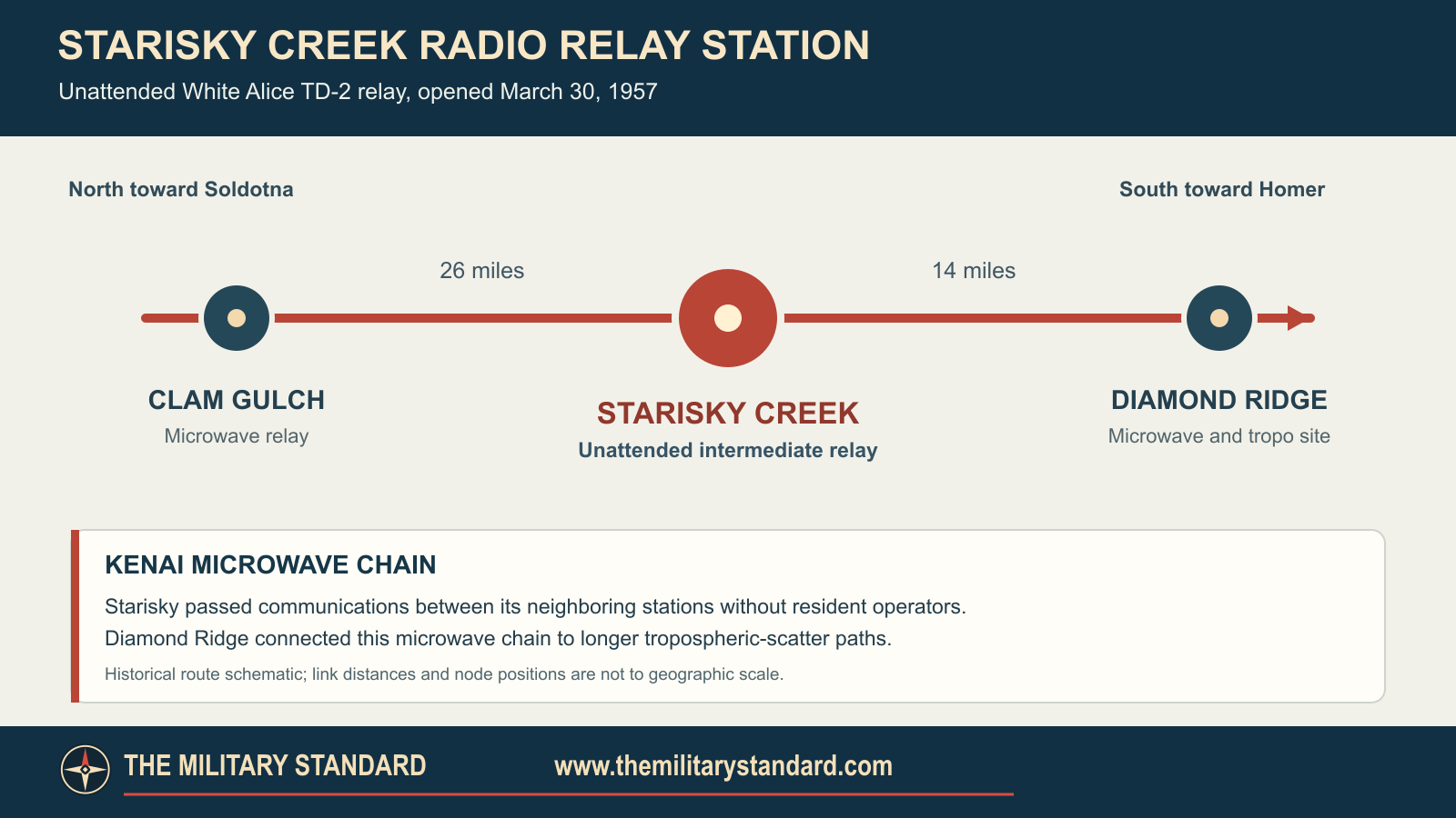
Starisky Creek was one of the original White Alice Communications System's small, unattended TD-2 microwave relays. It connected Clam Gulch, approximately 26 miles north, with Diamond Ridge, approximately 14 miles south, on the Kenai Peninsula's main communications route. Built in 1955-1956, it opened on March 30, 1957. Its compact plant contrasted with the staffed Soldotna relay farther north and the combined microwave and tropospheric-scatter installation at Diamond Ridge. The relay passed into Alascom use after the military declared it excess in 1979; surveys still found it carrying its original function in 1988 and active in 1994. [1] [3]
- Role
- Unattended original White Alice TD-2 microwave relay, not a radar station.
- Opening
- March 30, 1957, according to the 1988 U.S. Army Corps inventory.
- Verified links
- Clam Gulch, about 26 miles north; Diamond Ridge, about 14 miles south.
- Original plant
- 1,200-square-foot equipment building, outhouse, 100-barrel fuel tank; historic tower height unverified.
- Approximate point
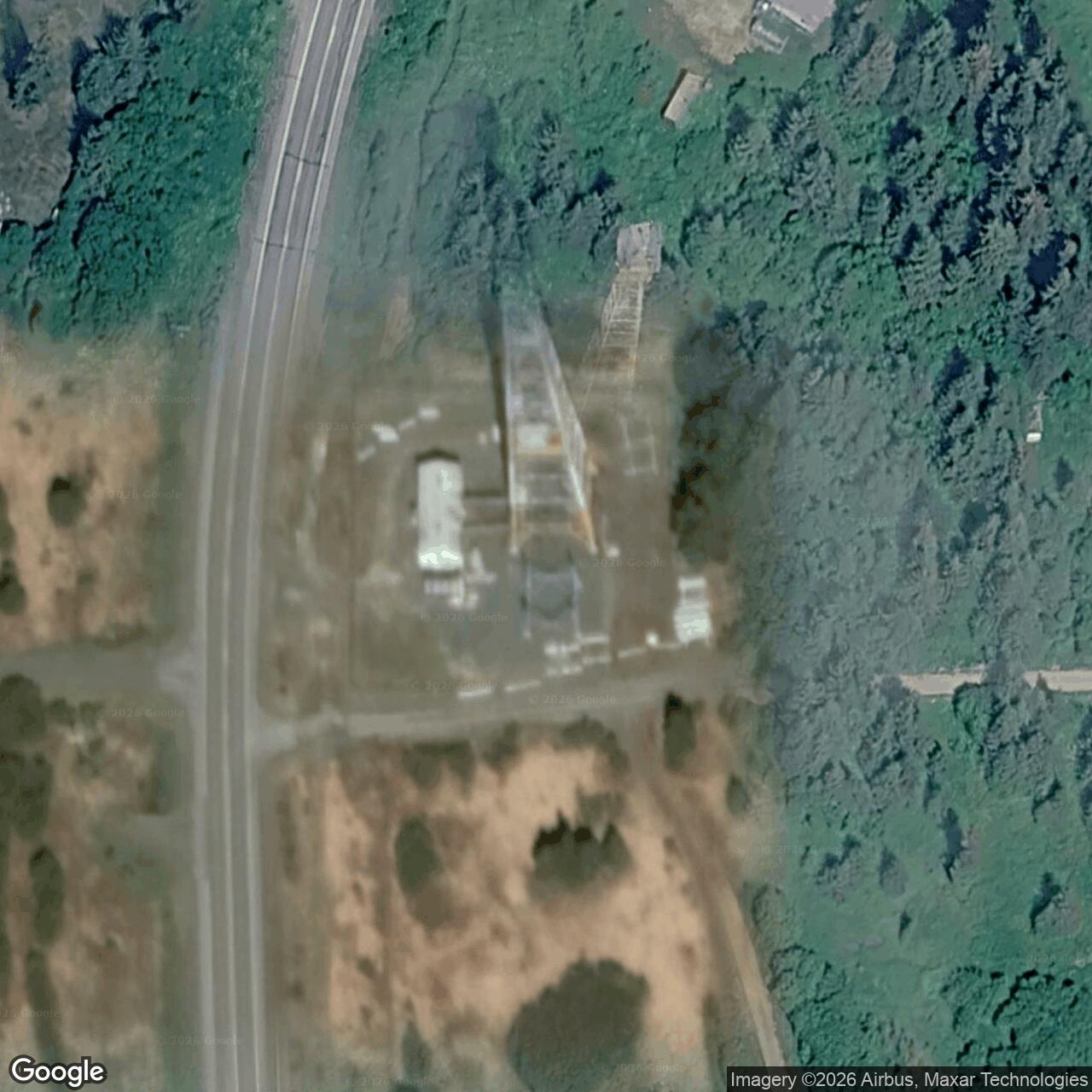
- 59.881000 N, 151.786222 W, later 2016 FCC WBA915 licensed radio point. Datum unstated; not an original tower survey or parcel boundary.
- Documented later use
- Alascom relay function in 1988; active maintained microwave in 1994. Current operation and original tower survival unverified.
Identity and Location
The 1988 Corps inventory calls the station "Starisky Creek (Homer R1-N)," and the 1994 Corps plan calls it "Starisky Creek, Homer." The Homer designation identified its position on the northern side of that area's microwave route. The site stood near Anchor Point along the Sterling Highway, about 190 road miles south of Anchorage in the 1983 Air Force description. Its Alaska Heritage Resources Survey identifier is SEL-163. [1] [2] [3]
An Alascom FCC modification notice dated August 16, 2016 lists WBA915 at approximately 59.881000 N, 151.786222 W. The notice does not state a horizontal datum. This is a later licensed microwave point associated with the Starisky Creek location, not a surveyed coordinate for the original White Alice tower or the boundary of its property. The historical parcel acreage remains unknown. [4]
Why the Relay Existed
White Alice supplied long-distance communications across Alaska for the Cold War defense network and other users. Its original phase combined over-the-horizon tropospheric-scatter stations with line-of-sight microwave relays. The 1988 Corps inventory counts six microwave-only installations among the original 31; Starisky Creek was one of them. Directional TD-2 equipment received signals from an adjacent station and retransmitted them toward the next. Starisky was a communications link, not an aircraft-search or missile-warning radar station. [1] [3]
The immediate chain ran from Clam Gulch through Starisky Creek to Diamond Ridge. Continuing north, Clam Gulch connected to staffed Soldotna and the Kenai-Anchorage route. Southward, Diamond Ridge combined its TD-2 microwave link with tropospheric-scatter paths toward Pillar Mountain and Big Mountain. The Corps gives 26 miles for the Clam Gulch leg and 14 miles for the Diamond Ridge leg. Starisky thus carried traffic between the northern microwave chain and a relay with longer over-the-horizon connections. [1] [2]
Construction and Original Plant
Construction at Starisky Creek took place during 1955 and 1956 as the first White Alice network was being built across Alaska. The Corps records the relay opening on March 30, 1957. Unlike large, staffed tropospheric-scatter stations, this road-accessible Kenai site was designed to operate without resident staff. [1]
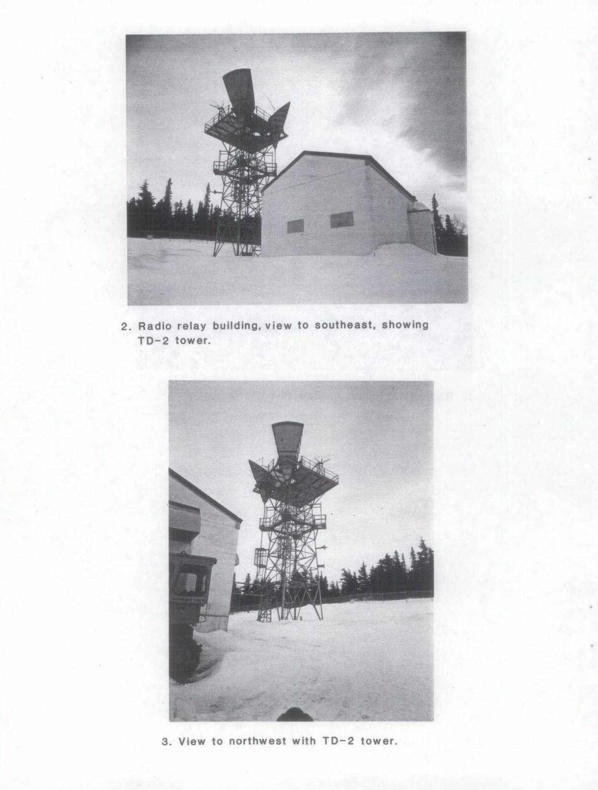
The original plant included a 1,200-square-foot equipment building, an outhouse, and a petroleum, oil, and lubricant tank with 100-barrel storage capacity. The 1994 Corps plan identifies Starisky as one of four standardized concrete-block microwave stations on the Kenai route, alongside Clam Gulch, Naptowne, and Rabbit Creek. This was a compact equipment compound rather than a large staffed base. The published 1,200 square feet describes the building, not the acreage of the site. [1] [3]
Unattended did not mean maintenance-free. The relay still needed electrical power, fuel deliveries, inspections, and repairs to keep its microwave path operating. Its standardized building stood near the directional antenna tower, with the tower and antenna arrangement shaped by the terrain and the two adjacent stations. The University of Alaska Anchorage's William F. McDowell collection catalogs historical Starisky site and diesel-generator photographs, although those images have not been digitized. The representative Rabbit Creek photographs accompanying this history show the same Kenai design family, not Starisky itself. [1] [7] [8]
Operation and Network Traffic
The 1983 Air Force study describes Starisky as an "unattended two-way repeater" between Diamond Ridge and Clam Gulch. Technicians could visit for service, but the station did not have Soldotna's resident operating staff. In 1988 the Corps found much of Starisky's original equipment still present and the station still performing the relay function for which it had been built. [1] [2]
The Kenai route also served civilian communications. A 1975 Kenai Peninsula hearing examined inadequate long-distance trunk capacity on the Diamond Ridge-to-Anchorage TD-2 route, which passed through Starisky. This shows that the chain mattered beyond its original military purpose as demand for telephone circuits grew. The hearing addressed route capacity rather than a documented failure of the Starisky relay. [2]
Excess, Alascom Use, and Later Evidence
The Corps reports that Starisky was declared excess in 1979 and acquired by Alascom as the military White Alice network passed into commercial use. The 1983 Air Force sale study includes Starisky in the transfer inventory. By 1988 Alascom was operating the relay, and in 1994 the Corps described it as an active, maintained, unattended microwave facility. Its military-built communications function had thus continued into the civilian era. [1] [2] [3]
Later FCC public notices record Alascom WBA915 fixed-microwave modifications at the Anchor Point/Starisky Creek location in 2010 and 2016. They show a later licensed radio point in the vicinity, but do not establish whether the original TD-2 equipment or 1950s antenna tower survived into that period. The site's present operating configuration remains unknown. [4] [5]
Historic Designation and Environmental Record
The 1994 Corps management plan identifies Starisky as AHRS SEL-163 within its study of the White Alice system's historic value. Because the site was still operating, the plan gave it a low immediate preservation priority while recommending that its owner be told of its potential significance. This recognized Starisky's place in the network without making it an individually listed National Register property. [3]
A federal Formerly Used Defense Sites inventory lists "Starisky Creek RR" as F10AK0772 in the Kenai Peninsula Borough. Its 2001 summary has no hazard flag, but gives no detailed Starisky environmental assessment or cleanup history. The former 100-barrel fuel tank documents how the relay was supplied; there is no verified Starisky-specific release or cleanup conclusion in the available record. [6]
Historical Significance and Survival
Starisky Creek illustrates a less conspicuous but essential part of White Alice. Its compact, unattended plant carried the signal between neighboring Kenai relays, linking the northward microwave chain with Diamond Ridge's longer connections. Unlike the larger tropospheric-scatter sites, it did not require a resident crew or enormous billboard antennas. It was still performing its original relay function when the Corps inspected it in 1988 and remained in use at the time of the 1994 survey. [1] [2] [3]
The 2010 and 2016 FCC records point to later microwave activity at the Starisky Creek location, but the surviving 1950s fabric has not been established by a recent site survey. Historical photographs cataloged at the University of Alaska Anchorage may eventually show the original compound and generator arrangement in greater detail. For now, the later licensed coordinate is a useful approximate location point, while the original building, tower, and parcel require a field or archival property record to describe their present condition confidently. [4] [5] [7]
Chronology
- 1955-1956 The Corps says the Starisky Creek TD-2 relay was constructed.
- 1957-03-30 The Corps records the station's opening.
- 1975-10-03 A Kenai Peninsula public hearing examines long-distance capacity on the Diamond Ridge-to-Anchorage route that passed through Starisky.
- 1979 The Corps says Starisky Creek was declared excess.
- 1983 The Air Force sale study lists the unattended Starisky relay in the White Alice system transfer inventory.
- 1988 The Corps documents Alascom operation, original relay function, and much original equipment remaining.
- 1994 The Corps calls Starisky an active, maintained, unattended microwave facility and records AHRS SEL-163.
- 2001 The federal Formerly Used Defense Sites inventory lists Starisky Creek RR as F10AK0772.
- 2010 An FCC public notice records an Alascom WBA915 modification at the Anchor Point location.
- 2016-08-16 An FCC public notice lists a later Alascom WBA915 licensed microwave point near Starisky Creek.
Information sources (8)
- PDFThe White Alice Communications System: A Historic Overview and Inventory, U.S. Army Corps of Engineers, Alaska District, April 1988
Source for: construction and opening dates, immediate microwave links and distances, original building and fuel tank, 1979 excess status, Alascom operation and 1988 physical observations.
- PDFA Special Study of the Sale of the White Alice Communications System, 1931st Communications Wing and Office of Air Force History, October 1983
Source for: Starisky's unattended two-way relay identity, Sterling Highway context, route and 1975 traffic-capacity context, and system sale inventory.
- PDFThe Cold War in Alaska: A Management Plan for Cultural Resources, U.S. Army Corps of Engineers, Alaska District, August 1994
Source for: standardized Kenai microwave-station design, 1994 operating status, AHRS SEL-163, and system-level preservation discussion.
- PDFWireless Telecommunications Bureau Public Notice DOC-340907A1, Federal Communications Commission, 2016
Source for: 2016 Alascom WBA915 modification and the later licensed microwave coordinate.
- PDFWireless Telecommunications Bureau Public Notice DOC-303067A1, Federal Communications Commission, 2010
Source for: 2010 Alascom WBA915 modification at the Anchor Point location.
- WEBFormerly Used Defense Sites, Alaska Inventory, U.S. Government Accountability Office, 2001
Source for: Starisky Creek RR F10AK0772 entry and the 2001 federal inventory status.
- WEBWilliam F. McDowell Photograph Collection, University of Alaska Anchorage Archives and Special Collections
Source for: Cataloged historical Starisky Creek site and diesel-generator photographs.
- PDFRabbit Creek White Alice Site, Historic American Engineering Record AK-23-A, Library of Congress
Source for: Representative historical photographs of the standardized Kenai TD-2 station type at Rabbit Creek.