
Tin City Air Force Station / Tin City Long Range Radar Site, Alaska
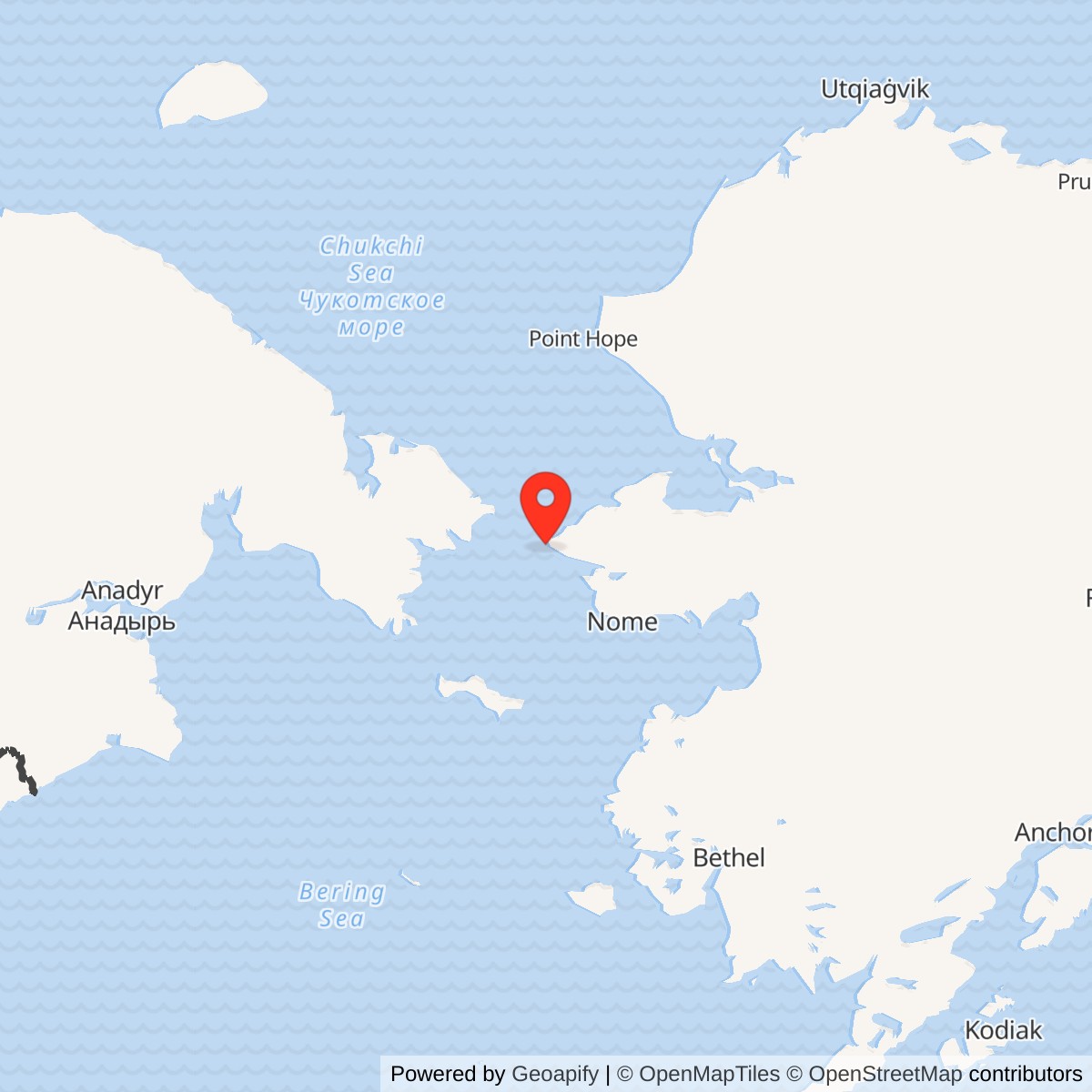
Longitude: -168.010052
Current Role: Alaska Radar System radar.
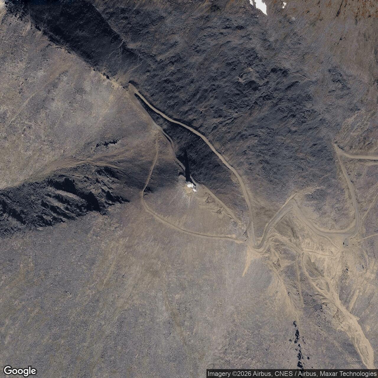
Coordinate label: Approximate upper-radar-area reference point, not a surveyed property centroid, runway coordinate, or White Alice location. 65.57556 N, 168.010560 W.
- Mission
- Active Bering Strait long-range air surveillance; former staffed aircraft-control-and-warning station.
- Site identifiers
- F-04; later A-11.
- Principal unit
- 710th Aircraft Control and Warning Squadron, 1952-1983.
- Radar succession
- AN/FPS-3, AN/FPS-20A, AN/FPS-93A, and AN/FPS-117; AN/FYQ-9 data processing from 1965.
- Historic property
- 748-acre installation total, including Upper Camp, Lower Camp, airfield, and at one time the separate White Alice area.
Overview
Tin City Air Force Station occupies one of the most consequential positions in Alaska's Cold War aircraft-warning network. Its radar looked across the Bering Strait toward the Soviet Far East from Cape Mountain on the western Seward Peninsula. The installation began as Cape Prince of Wales Air Force Station, became Tin City Air Force Station in 1957, and continues as Tin City Long Range Radar Site. It is an active Air Force surveillance installation, not an abandoned Cold War ruin. The former Tin City White Alice Communications Site nearby was a separate relay installation with its own identity, antenna field, operating chronology, and cleanup record. [1] [2] [5] [8]
The 710th Aircraft Control and Warning Squadron operated the staffed radar station from December 1952 until November 1983. The station reached full operation in April 1953. Its original AN/FPS-93A configurations, AN/FYQ-9 semiautomatic processing, and 1980s AN/FPS-117 modernization show how Alaska's warning system moved from local operators and voice reports to remotely managed, three-dimensional radar. Tin City remained useful because the geography that made it difficult to build also made it valuable for early detection. [1] [2] [5]
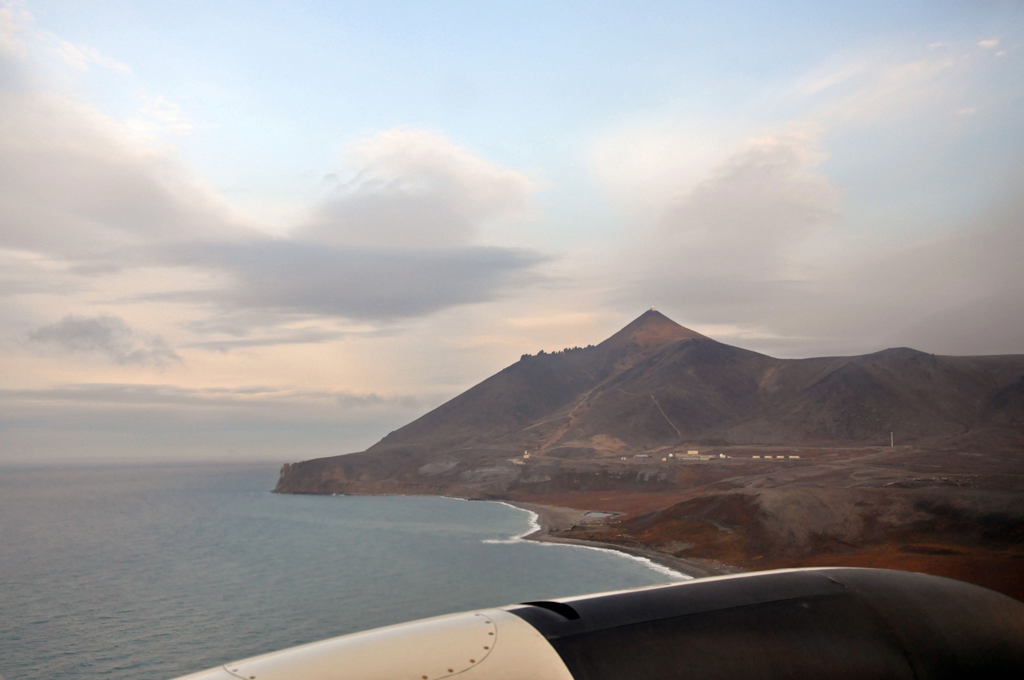
The installation's historical 748-acre total included an upper radar camp, lower support camp, airfield, connecting routes, and, at one time, the White Alice area. This is an installation-wide historic figure, not a newly surveyed present-day boundary. The site remains tied to airlift, coastal resupply, fuel, power, telecommunications, and a small support workforce. A 2014 Air Force account described round-the-clock air surveillance and the continuing need to move people and cargo by aircraft and boat. [1] [6] [8]
Location, Name, and Landscape
Tin City lies near the village of Wales and Cape Prince of Wales, at the western edge of mainland North America. The Soviet coast across the Bering Strait was approximately 50 to 60 miles away, and the Soviet airfield at Provideniya was about 150 miles from the radar station. The exact distances depend on the chosen endpoints; their historical meaning is that Tin City faced a likely approach corridor rather than a distant interior route. Wales is roughly five miles northwest of the station area. [1]
The approximate published radar-station reference is 65.57556 N, 168.01056 W. This represents the upper radar area, not a surveyed parcel centroid, runway threshold, lower-camp entrance, or antenna survey monument. Alaska DEC also publishes regulatory case points farther east for contaminated areas. Those case points serve environmental records and should not silently replace the radar reference. The separate White Alice case point is 65.583583 N, 167.943020 W, NAD83, and identifies its former relay area rather than this radar. [5] [6] [7]
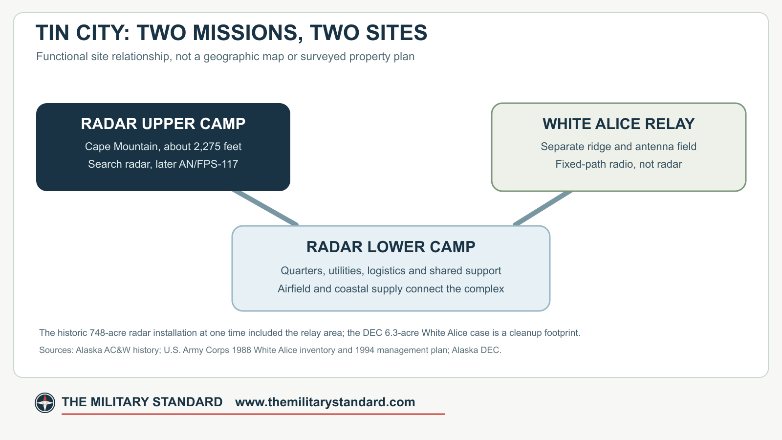
Upper Camp was built on Cape Mountain, approximately 2,275 feet above sea level, where the elevation improved the radar horizon. Lower Camp occupied the coastal slopes and supported living quarters, administration, utilities, maintenance, storage, and transportation. An airstrip and access routes completed the installation. This vertical separation created a distinctive operational problem: every gallon of fuel, piece of radar equipment, repair part, and person bound for the summit had to negotiate the mountain in severe wind, snow, and icing. [1] [2]
The locality was originally identified in Air Force records as Cape Prince of Wales. The name Tin City came from a nearby mining settlement and became the Air Force station name in 1957. It did not signify that the military installation was the former tin mine itself. The names Cape Prince of Wales Air Force Station, Tin City Air Force Station, Tin City Air Force Site, and Tin City Long Range Radar Site describe successive periods or variants of the same radar installation. [1] [2] [5]
Building the Western Warning Post
The early Cold War forced Alaskan Air Command to turn a sparse wartime warning system into a chain of permanent stations. Radar at Tin City would observe aircraft approaching the Bering Strait, provide warning, and help direct interceptors. It formed part of an overlapping regional system, not a stand-alone barrier capable of identifying every aircraft without other stations, communications, and command centers. Campion Air Force Station was among the Alaska direction-center facilities associated with the early network. [1] [2]
Gaasland & Company received the Tin City construction contract in June 1950. Work began that September and was completed in December 1952 at a reported cost of approximately $4,738,946 for the early project. The installation became fully operational in April 1953. That construction figure does not include every later antenna, communications upgrade, replacement tramway, contracted-support agreement, or remediation project. The December 1952 completion and April 1953 full operation are different milestones, not competing opening dates. [1]
The initial project erected Upper and Lower Camps, a road, and a tramway to connect them. Workers also had to make the airfield, utilities, fuel handling, communications, accommodations, and emergency support function in an area without an ordinary road connection to the Alaska highway system. Seasonal coastal delivery and aviation supplied the station. These were integral parts of a functioning radar installation, not incidental additions to an antenna on a hill. [1] [2]
The station's geography shaped its defenses against weather. The upper technical plant needed shelter and power in high winds and freezing conditions. The lower camp needed protected living and working space, warehouses, shops, food service, and arrangements for incoming cargo. Every closed road or failed tram component could delay repairs to a radar whose strategic value lay in continuous coverage. The complicated physical plant explains why Alaska radar stations were expensive to build and maintain even after their radar electronics became smaller. [1] [2]
Early Personnel and the 710th Squadron
Before the permanent radar organization took over, a detachment of the 532nd Aircraft Control and Warning Group staffed the developing site. In mid-1951 Detachment F-4 of the 160th Aircraft Control and Warning Group, an Air National Guard organization, replaced it. The 710th Aircraft Control and Warning Squadron was constituted on November 3, 1952 and activated on December 8. The official lineage places the squadron at Cape Prince of Wales, later Tin City, from that date to November 1, 1983. The installation history says it assumed Tin City's operation and maintenance in December 1953. Thus activation, station assignment, and full assumption of maintenance were not necessarily one event. [1] [5]
The 710th belonged in succession to the 160th Aircraft Control and Warning Group, 548th Group, 11th Air Division, 5060th Group, 5070th Air Defense Wing, Alaskan Air Command, and 531st Aircraft Control and Warning Group, later 11th Tactical Control Group. These changes reflected shifts in command organization while the radar and its local mission remained at Tin City. The 710th's later lineage as a combat operations squadron elsewhere should not be read as continuous operation of the old radar squadron after its 1983 inactivation. [5]
In the manual era, operators examined radar returns, established tracks, determined whether aircraft were known or unidentified, and passed reports to the appropriate control organization. Search radar supplied range and bearing; identification, altitude, plotting, and communications turned the return into an actionable warning. Controllers could then direct fighters toward a contact. Tin City's proximity to Soviet aviation gave such reports immediate importance. A 2012 Alaska historical survey specifically notes the station's monitoring of aircraft flying out of Provideniya. [1]
Radar Sets and Data Processing
The official Alaska aircraft-control-and-warning history identifies AN/FPS-93A arriving in the 1960s. [1] [5]
An AN/FYQ-9 semiautomatic data system was installed in 1965. It processed and displayed radar information for more efficient regional reporting. Tin City was part of Alaska's own semiautomatic air-defense architecture, not simply a transplanted lower-48 SAGE station. Radar operators and technicians remained essential to evaluate returns, maintain sensors, resolve ambiguities, and keep communications working. The data system was not a replacement for the radar; it was the means of carrying its observations into a faster control network. [1]
A complete Tin City height-finder roster has not been confirmed, although interception required altitude information. The station-specific search and processing sequence is AN/FPS-3, the AN/FPS-20A conversion delayed in 1958, AN/FPS-93A in the 1960s, AN/FYQ-9 in 1965, and AN/FPS-117 in the 1980s. The AN/FPS-93A's introduction should not be assigned a precise day or presumed to require an entirely new tower. [1] [5]
Communications and the Separate White Alice Site
Early high-frequency radio was unreliable in the Arctic. The White Alice Communications System supplied more dependable long-distance transmission through a mixture of tropospheric-scatter and microwave links. Tin City's separate White Alice terminal was built in 1957 and began service on February 18, 1958. Its original long path to Northeast Cape on St. Lawrence Island spanned approximately 161 miles and used 60-foot antennas. The terminal supplied a communications route for the radar station but was not radar equipment and did not detect aircraft. [1] [2] [3]
The Tin City relay occupied its own hilltop area and had a 4,960-square-foot composite building, fuel storage, and, from 1963, a passenger tramway between base camp and the relay's upper camp. The Corps describes the relay as approximately 1.5 miles from the AC&W facilities; DEC uses a roughly one-mile description from another reference. These are approximate separations, not surveyed boundary measurements. The radar station furnished living and messing support, but the two sites had different antenna purposes and later different property and cleanup histories. [2] [3] [7]
The communications route evolved before the Tin City White Alice plant finally closed. A direct temporary tropospheric-scatter path from Anvil Mountain to Tin City was placed in service on August 8, 1974, bypassing Northeast Cape. Transmission over the Northeast Cape path ceased early on August 9. White Alice personnel departed the former Northeast Cape route operation on September 18. The temporary direct path used smaller, approximately 30-foot-class antennas rather than the original 60-foot Northeast Cape reflectors. [3] [4]
The official Alaska history dates Tin City's White Alice deactivation to February 1975 and describes a succeeding ALASCOM-owned microwave route via Anvil Mountain and Nome. The broader 1931st Communications Group records show that the communications transition continued after 1975: an ALASCOM line-of-sight route, earth-terminal planning, and the eventual Tin City satellite terminal were separate steps. A Tin City earth terminal was completed and available in December 1979, although service transfer was delayed; Anvil Mountain White Alice finally closed in June 1980. The radar station never stopped its warning mission during this telecommunications transition. The full separate relay history treats these changes in detail. [1] [4]
Logistics, Airfield, and Daily Life
Critical cargo and perishable supplies arrived by air. Nonperishable supplies came by annual barge, an operation first called Mona Lisa and later Cool Barge. Fuel storage, transportation equipment, aircraft availability, weather forecasts, and the ability to get goods from coast to camp were part of the warning mission. A functioning radar could still be compromised if a replacement component could not reach the upper site. [1]
An early tramway linked the radar's lower and upper camps. The historical record also describes a separate 1963 tramway for the White Alice facility and a new radar tramway constructed in 1989. A 1994 Corps survey noted that the radar station's later tramway connected with the steep approach to the mountain operations area. Roads and vehicle access remained important as the facility was modernized. [1] [2] [3]
The airstrip remained essential well into the long-range-radar period. A 2013 Air Force account documents a C-12 visit carrying personnel and cargo for a quality-control inspection. A 2014 feature describes a small permanently stationed contractor workforce and demanding rotations in a place accessible by aircraft or boat. It describes the radar's 24-hour surveillance and the practical burden of maintaining machinery in darkness, cold, high winds, and isolation. Those are dated snapshots, not a fixed present-day head count or a claim that every winter flight lands in all conditions. [8] [13]
The Federal Aviation Administration's 2026 Alaska directory identifies the Tin City LRRS airfield as TNC/PATC and gives its gravel runway 17/35 as 4,702 by 100 feet. It lists the field as an Air Force facility closed to the public, with prior permission required for operations. The directory warns of severe turbulence under some winds, a high-bluff runway whose center is higher than its ends, and limited line of sight. These operational cautions put the historic air-supply problem in present-day perspective: air access remains indispensable but is not routine civilian travel. The FAA airport coordinate refers to the runway facility, not the Upper Camp radar coordinate used in this history. [14]
Contract Support and the End of Staffed AC&W Operation
Alaskan Air Command awarded a broad radar-support contract to RCA Services in 1977. At Tin City, the shift removed 81 military positions and left 14, mainly in operational roles, according to the official Alaska history. Civilian maintenance and support did not mean the station ceased to be an Air Force installation. It changed the division of labor between the military command mission and on-site technical work. [1]
The next step was Joint Surveillance System conversion. New equipment completed in 1982 sent radar and beacon information by satellite to the Regional Operations Control Center at Elmendorf. The regional center became fully operational in 1983. The 710th Aircraft Control and Warning Squadron was inactivated on November 1, 1983; military personnel were withdrawn from the site, and Tin City became a contractor-staffed Long Range Radar Site. The later A-11 code distinguishes its long-range-radar phase from the original F-04 designation. Centralized control changed where data were analyzed, not where the radar had to operate. [1] [5] [15]
The 1984 Seek Igloo modernization replaced the older surveillance plant with a minimally attended AN/FPS-117 three-dimensional radar. The historical survey contains an isolated AN/FSP-117 transposition, but Air Force and radar-program records use AN/FPS-117. The upgrade modified the composite building and led to demolition of redundant Cold War facilities. The radar's radar dome protected the antenna against the Arctic environment; the current radome's visible shape must not be used to infer the shapes of all earlier radar antennas. [1] [5] [8]
The AN/FPS-117 combined long-range search with altitude determination in one modernized system and sent digital surveillance data to the regional control architecture. That reduced the need for a large upper-camp operating complement and multiple separately staffed early-generation sets. It did not eliminate local maintenance, power generation, fuel logistics, runway support, or the risks of a remote coastal mountain. [1] [8]
Modern Operations and Power
The Air Force's 2014 account calls Tin City one of fifteen long-range sites scanning Alaska's airspace continuously. A handful of permanent workers, supported by the Pacific Air Forces Regional Support Center and periodic visiting specialists, kept the radar functioning. Its October 2014 photographs show the active mountain radar setting. The account describes transportation from Joint Base Elmendorf-Richardson and the unusually demanding climate. The 2025 Army Corps public notice still identifies Tin City LRRS as an Air Force-operated facility, supporting its continuing status. [8] [10] [12]
Power has always been a central cost. The Air Force reported a wind-generator project at Tin City in 2008. The turbine, more than 110 feet tall with 44-foot blades, was intended to supplement diesel generation and lower fuel consumption. That project is best understood as an operational response to the high cost of bringing fuel to a remote radar station. It does not establish that diesel generation disappeared or that wind power always met the full load. [9]
The Coast Guard, civilian aviation, and other communications users may have equipment in the broader region, but their presence should not be mistaken for control of the Air Force radar installation. Tin City's mission remained aircraft surveillance and the delivery of usable data into the Alaska air-defense network. The separate White Alice terminal's Air Force communications mission ended in the 1970s, even though radio or satellite circuits continued to serve the radar by new means. [1] [4] [8]
Surviving Fabric and Land History
A 2012 survey of Alaska AC&W sites listed seven Tin City structures or features surviving from the early warning era at the time of its fieldwork: storage building 119, disposal building 142, operations building 150, radar tower 201, a road segment, the tramway, and the airfield. It also identified a MAR-era water-supply building. This dated inventory gives the site historical texture, but it is not a 2026 condition report. The Corps' 1994 survey had already described large-scale 1980s modification of the original composite operations building and removal of obsolete fabric. [1] [2]
In 1997, an agreement among preservation agencies provided for Historic American Buildings Survey Level III documentation of significant Cold War resources. Such documentation recognizes that modernization can remove or alter structures even while the radar mission continues. It is important to distinguish the 1950s installation footprint, surviving Cold War fabric, 1980s radar plant, and contemporary operational site rather than calling all of them one unchanged base. [1] [2]
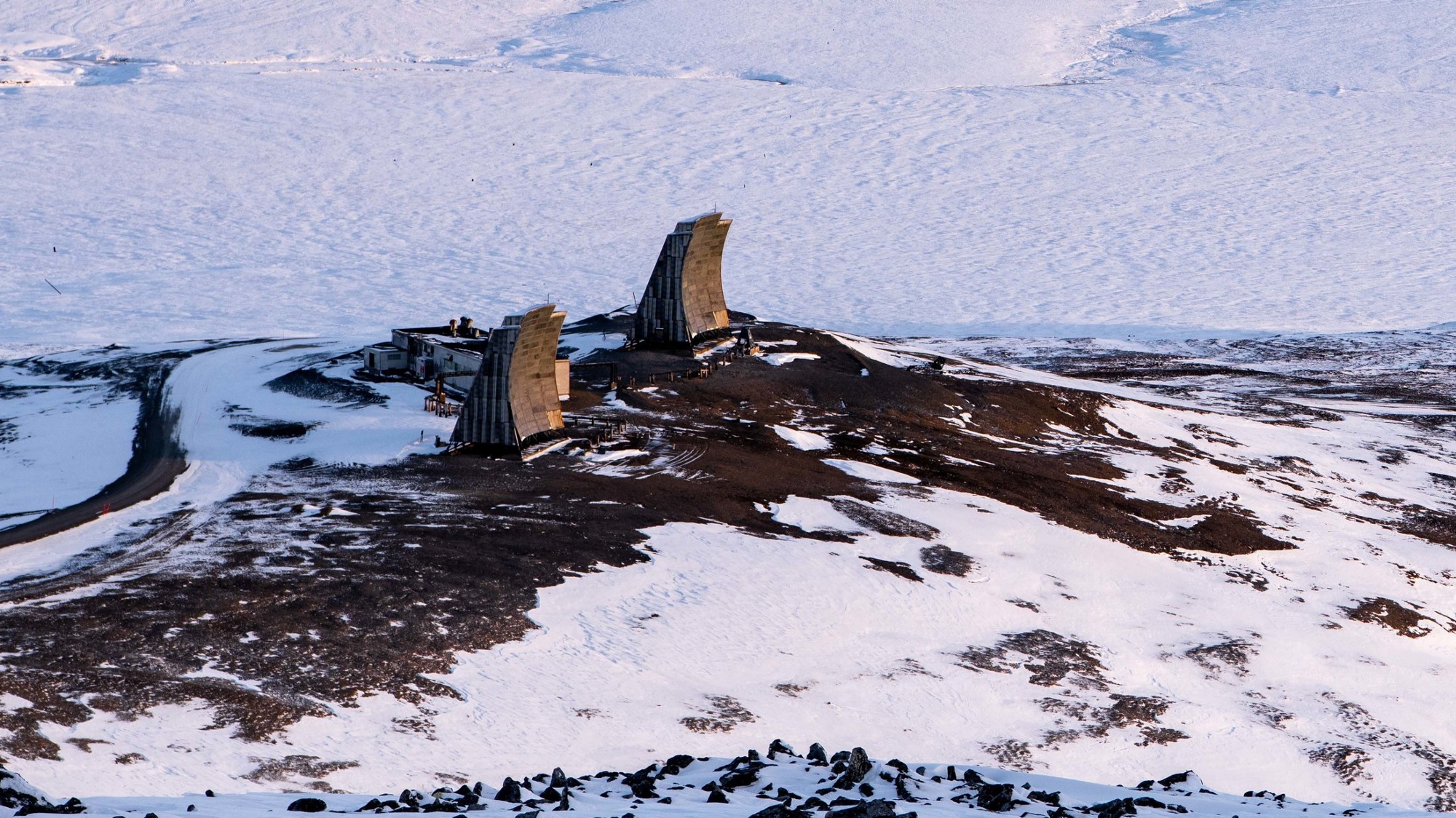
The Tin City White Alice antennas have their own preservation story. A 2018 Defense Department photograph still shows two conspicuous curved reflectors at the former relay area. They are not the current Tin City air-surveillance radar. The image documents visible survivors in 2018 only; it does not survey their 2026 condition or identify which original or later circuit each reflector served. The 1994 Corps text itself contains contradictory statements about demolition and survival of the relay, making dated photographic evidence particularly helpful. [2] [11]
Environmental Legacy
Long-term radar operations depended on fuel, generators, transformers, vehicles, waste handling, and roads. Alaska DEC's separate Tin City LRRS case records fuel and other contamination investigations across the historic 748-acre installation. Its case is distinct from the former White Alice terminal's 6.3-acre cleanup case. These different figures cannot be treated as two surveyed polygons to add together, because the larger historic total at one time included the relay and the DEC figures describe different administrative purposes. [1] [6] [7]
Investigation and cleanup have occurred while the radar mission continues. The DEC file records numerous source areas and multi-year remedial work. A later site-specific petroleum case also exists near lower-camp facilities. [6]
Historical Significance
Tin City illustrates why a radar station is a system rather than a lone antenna. Cape Mountain supplied the horizon; Lower Camp and the airstrip made permanent staffing possible; the 710th supplied operators and technicians; Campion and later regional centers turned tracks into commands; White Alice and its successors moved information out of the isolated post. The station's evolution from AN/FPS-117 also spans most of Alaska's postwar warning technology. [1] [2] [3] [5]
Its continuing Air Force mission sets it apart from closed AC&W stations. Even as the large squadron left, the radar remained strategically placed at the Bering Strait. The site today should be understood as an active Long Range Radar Site built upon, but not identical to, the staffed Cold War Tin City Air Force Station. [1] [7] [8] [10]
Chronology
- 1950-06 Gaasland & Company receives the construction contract for the Tin City radar installation.
- 1950-09 Construction begins on the upper and lower camps and their connections.
- 1951 Detachment F-4 of the 160th Aircraft Control and Warning Group replaces the earlier 532nd Group detachment.
- 1952-11-03 The 710th Aircraft Control and Warning Squadron is constituted.
- 1952-12-08 The 710th activates and is assigned to Cape Prince of Wales Air Force Station.
- 1952-12 The principal early construction project is completed.
- 1953-04 The Tin City radar station reaches full operational status.
- 1953-12 The 710th assumes operation and maintenance according to the Alaska AC&W history.
- 1957 Cape Prince of Wales Air Force Station is renamed Tin City Air Force Station.
- 1958-02-18 The separate Tin City White Alice terminal begins service to Northeast Cape.
- 1958 An AN/FPS-20A installation is delayed by upper-camp tramway weight limitations; the precise acceptance date is not established.
- 1960s The radar station receives an AN/FPS-93A search configuration.
- 1965 Tin City receives AN/FYQ-9 semiautomatic data-processing capability.
- 1974-08-08 A direct temporary Anvil Mountain to Tin City White Alice path enters service.
- 1974-08-09 Northeast Cape relay transmission on the former Tin City route ends.
- 1975-02 The separate Tin City White Alice station is deactivated as commercial communications replace its service.
- 1977 RCA support contracting sharply reduces the Tin City military complement.
- 1979-12 A satellite earth terminal at Tin City is completed and available, with transfer delayed.
- 1982 Joint Surveillance System equipment enables satellite delivery of radar and beacon data to Elmendorf.
- 1983 The Regional Operations Control Center becomes fully operational.
- 1983-11-01 The 710th is inactivated and the radar station becomes a contractor-staffed Long Range Radar Site.
- 1984 Seek Igloo AN/FPS-117 radar installation and related building changes proceed.
- 1989 A new radar-site tramway is built according to the Corps cultural-resources history.
- 1997 Preservation-agency agreement provides for documentation of significant Cold War resources.
- 2008 The Air Force reports a wind-generator project intended to reduce diesel consumption.
- 2014-10-01 Air Force photographs document the active radar, Upper and Lower Camps, and airlift-supported mission.
- 2025 An Army Corps public notice identifies Tin City LRRS as an Air Force-operated facility.
Information sources (15)
- PDF1. History of the Aircraft Control and Warning System in Alaska, Alaska Office of History and Archaeology, PDF pp. 61-63, printed pp. 49-51
Source for: Tin City construction, geography, 710th operations, early radar, AN/FYQ-9, White Alice context, RCA transition, ROCC, Seek Igloo, and surviving structures
- PDF2. The Cold War in Alaska: A Management Plan for Cultural Resources, U.S. Army Corps of Engineers, 1994, PDF pp. 177-178 and 255
Source for: Tin City radar and White Alice layout, lower and upper camps, radar tramway, building change, and preservation context
- PDF3. Historic Overview and Inventory: White Alice Communications System, U.S. Army Corps of Engineers, 1988, PDF p. 66, printed p. 59
Source for: Tin City White Alice opening, original Northeast Cape path, building, fuel storage, later direct antennas, and separate tramway
- PDF4. Special Study of the Sale of the White Alice Communications System, 1931st Communications Group, 1983
Source for: August 1974 Anvil Mountain bypass, termination of Northeast Cape route, ALASCOM microwave, Tin City satellite terminal, and Anvil Mountain closure
- PDF5. 710th Combat Operations Squadron Lineage and Honors, Air Force Historical Research Agency compilation, 2020, pp. 1-2 and 6
Source for: 710th constitution, activation, station assignment, parent units, inactivation, approximate upper-camp reference, FPS-20A delay, and FPS-117 installation
- WEB6. Tin City LRRS, Hazard ID 296, Alaska Department of Environmental Conservation
Source for: historic 748-acre installation case, environmental areas, and continuing radar-property cleanup
- WEB7. Tin City White Alice Site, Hazard ID 857, Alaska Department of Environmental Conservation
Source for: separate relay case location, 6.3-acre cleanup footprint, and 1975 deactivation
- WEB8. Radar Site Techs: First Line of Defense 24/7, 365, Pacific Air Forces, 2014-10-23
Source for: dated account of active LRRS mission, Air Force staff and contractor logistics, and 2014 photographs
- WEB9. Alaskan Long Range Radar Station Goes Green, U.S. Air Force, 2008
Source for: Tin City wind-generator project and relationship to diesel power
- WEB10. POA-2025-00140 Boulder Creek Public Notice, U.S. Army Corps of Engineers, 2025
Source for: recent identification of Tin City LRRS as an Air Force-operated facility
- WEB11. Tin City Long Range Radar Site, DVIDS image 4914767, Senior Chief Petty Officer Brandon Raile, 2018-11-15
Source for: public-domain dated photograph of visible former White Alice reflectors
- WEB12. Tin City Long Range Radar Site, U.S. Air Force photograph 141001-F-FC540-009, 2014-10-01
Source for: public-domain dated photograph of Upper Camp radar and site setting
- WEB13. Fly Softly, Carry a Big Mission, Joint Base Elmendorf-Richardson, 2013
Source for: C-12 delivery and quality-control visit at Tin City
- PDF14. Alaska Airport/Facility Directory, Tin City LRRS entry, Federal Aviation Administration, 2026-01-22, p. 242
Source for: PATC/TNC airport identity, gravel runway dimensions, Air Force control, access rules, and turbulence and high-bluff cautions
- WEB15. Tin City AFS, AK Station Entry, Air Defense Radar Museum (Radomes.org)
Source for: cataloged F-04 and later A-11 site identifiers, with code chronology corroborated by the JSS/LRRS transition