
Eglin Air Force Base Site C-6 / AN/FPS-85 Radar Facility, Florida
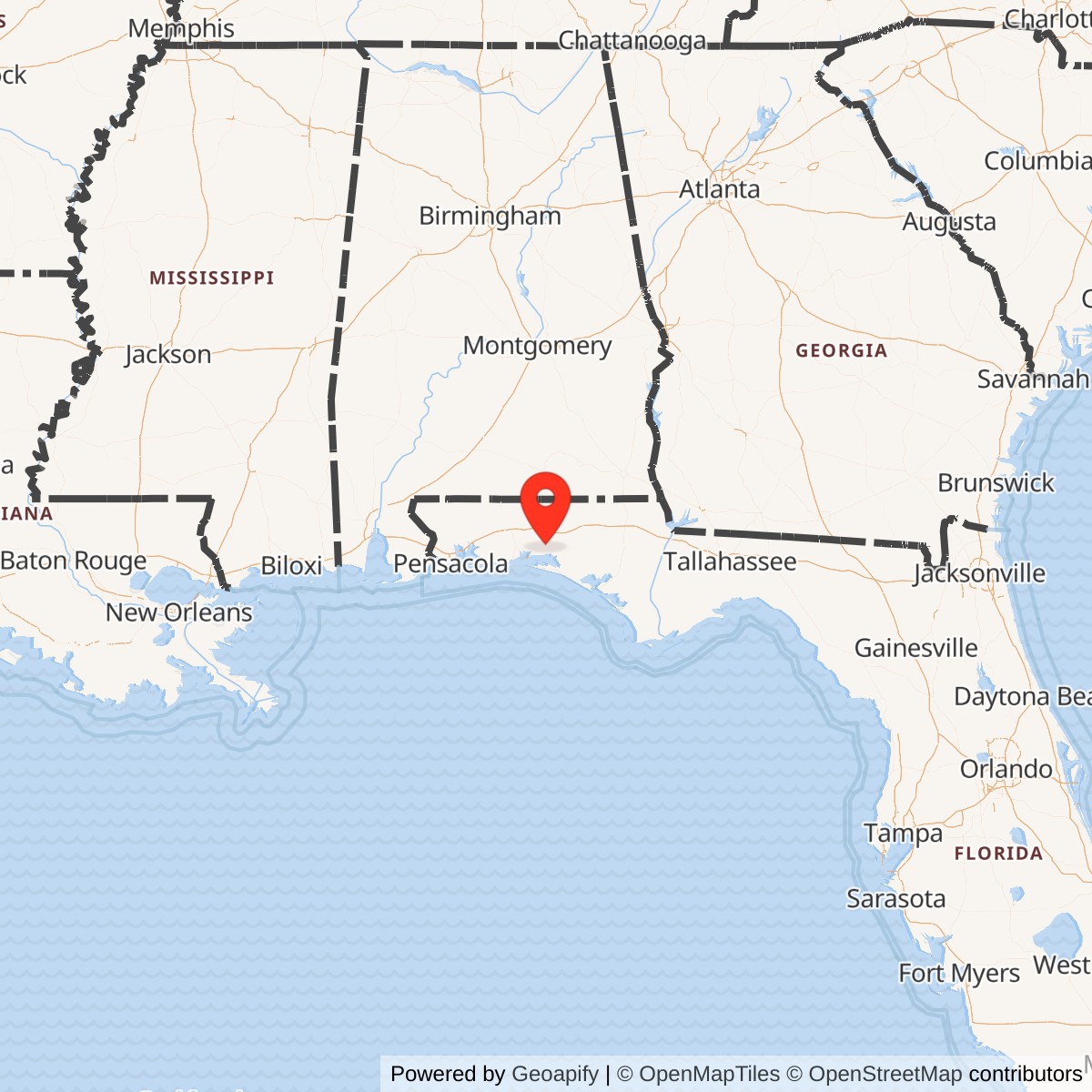
Longitude: -86.214692
Official Base Website: Eglin Air Force Base Site C-6
Current Role: Active 20th Space Surveillance Squadron / Mission Delta 2 operating site: local AN/FPS-85 phased-array radar, around-the-clock space-domain-awareness work, and remote operation of AN/FSY-3 Space Fence at Kwajalein; part of Eglin reservation.
Location: Eglin East, near Freeport, Walton County, Florida
Role: AN/FPS-85 space-surveillance radar; former southern missile-warning and alternate space-surveillance center
Status: Active U.S. Space Force operating site within the Eglin reservation
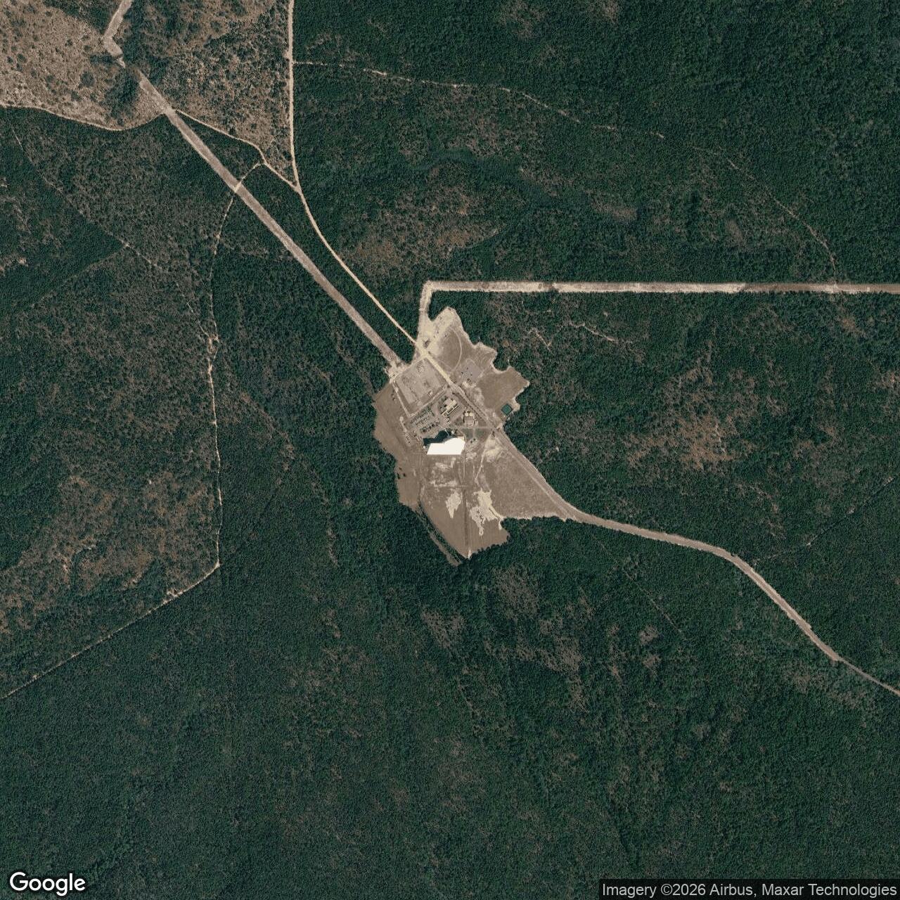
Coordinate: Approximately 30.572394 N, 86.214692 W, a published radar-model point, not a surveyed compound center or boundary
Acreage: Not verified
Overview and Installation Identity
Site C-6 is a separate radar cantonment within the much larger Eglin Air Force Base reservation near Freeport in Walton County, Florida. It is not Eglin's main airfield, an independent civilian radar station, or the geographically distant Space Fence at Kwajalein. The installation was built around a single very large, fixed, electronically steered AN/FPS-85 radar for the military space-surveillance network. Its continuing mission has kept a 1960s defense site active through changes in radar hardware, computer systems, military commands, and even the service responsible for the mission. The radar is the site's defining equipment, but the installation also includes the people, working spaces, utilities, protective arrangements, and support relationships needed to operate a major national sensor around the clock.
The site's history differs from the technical history of AN/FPS-85. C-6 was chosen as a physical location, developed as a construction project, lost in a catastrophic fire before its first acceptance, and rebuilt as a military operating compound. Its unit also housed an alternate national space-surveillance center, acquired and later relinquished a primary southern missile-warning responsibility, and now controls a second radar that stands on another continent. Those changes altered activity inside the site even when the most recognizable exterior landmark remained in place. Current Space Force material identifies the 20th Space Surveillance Squadron at C-6 as the operator of the AN/FPS-85 Phased Array Deep Space Radar and the remote operator of AN/FSY-3 Space Fence.
Why Eglin and This Site Were Selected
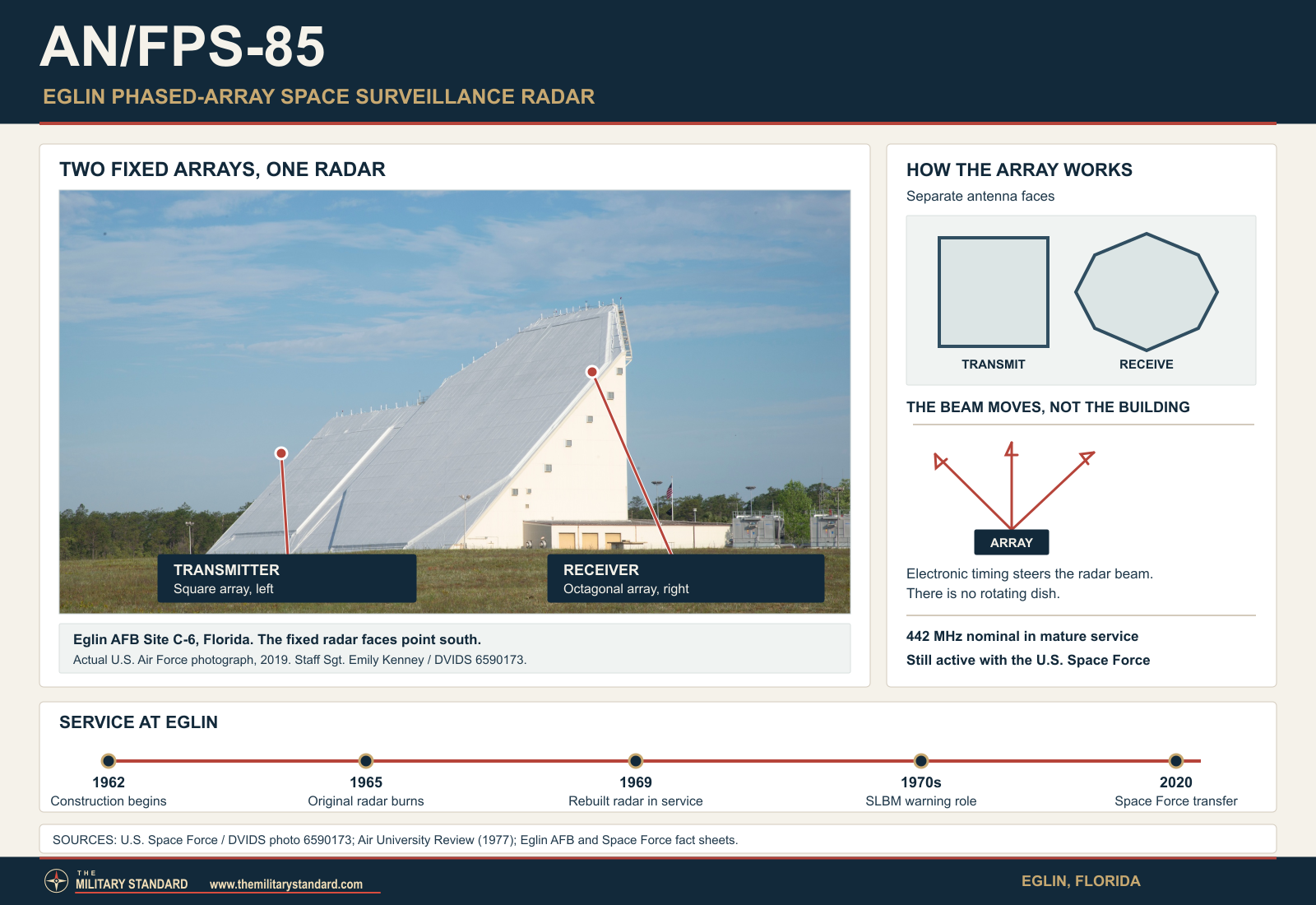
The Air Force announced on April 2, 1962 that Eglin Site C-6, about 35 miles east of Eglin's main area in its historical description, had been selected to develop and test a phased-array radar for detecting and tracking satellites. The site offered a southern viewing sector across the Gulf of Mexico and toward equatorial orbital paths, while the surrounding federal reservation offered room for a large, high-power, security-sensitive facility. The radar's fixed transmitting and receiving faces were oriented generally south rather than placed on a rotating tower. This geography later proved useful for looking for submarine-launched ballistic missiles approaching from southern ocean areas, although satellite surveillance was the original enduring requirement.
The designation C-6 is one Eglin site code, not a claim that all similarly coded test areas are the same installation. The site sits in Eglin East, separated from the main base and its airfield by extensive range lands. Public Air Force accounts give about 35 miles between C-6 and the main area in historical or command-visit descriptions; a 2017 emergency-response article describes a 25-mile separation in its response context. These are differently framed approximate distances, not rival surveys of a single property line. The site is associated with Walton County, while the Air Force has described Freeport as the nearby community. No reviewed deed, survey, or complete real-property inventory establishes a defensible stand-alone acreage for the C-6 compound.
The only numerical point is 30.572394 N, 86.214692 W from a 2011 space-surveillance network modeling paper by David Vallado and Jacob Griesbach. The authors explicitly describe sensor positions as approximate and mostly derived from Google Earth. It is useful for locating the radar generally, but its precision in decimal places must not be mistaken for land-survey precision. The 2025 Air Force cantonment environmental assessment supplies a different kind of location evidence: it maps the existing C-6 cantonment boundary and its industrial land use.
Construction, Original Design, and the 1965 Fire
Construction began in October 1962 under a developmental program for which Rome Air Development Center held engineering responsibility and Bendix was the radar's principal contractor. Unlike the many radar stations built around a separate search antenna on a pedestal, C-6 required a building that was part of the radar itself. Contemporary reports described a thirteen-story complex carrying the fixed transmitter and receiver faces, computer rooms, power and cooling facilities, and extensive cabling. Computers had to schedule where the electronic beams pointed, interpret returns, and exchange observations with the national surveillance system. Establishing C-6 therefore meant constructing an integrated operating plant rather than simply installing a radar set in an existing air-defense station.
Before the site could enter planned operational testing in May 1965, an electrical fire on January 5, 1965 destroyed the nearly completed radar building and much of its equipment. Contemporary Electronics reporting put the loss near $30 million and described a complex scheduled for Air Force takeover that spring. Later Air Force accounts attribute the fire to arcing electrical equipment. The event interrupted the creation of a southern space sensor at a time when the number of objects in orbit and concern about Soviet missiles were both increasing.
The Air Force and Bendix used reconstruction to revise the installation instead of replicating every original component. A 1966 report described improved target capacity, resolution, Doppler measurement, and fire protection in the rebuilt system. These were not only electronic changes: they affected compartmentation, cooling, maintenance access, and how the enormous building could be operated safely. Accounts of the 1965 destruction and the 1968 completed site should therefore not be flattened into a single unchanging facility description. The interruption also explains why sources list construction in 1962 but do not list ordinary radar operations until late 1968 or early 1969.
Acceptance and the First Space-Surveillance Mission
Air Force histories state that the service accepted the rebuilt C-6 installation in September 1968, with the 20th Surveillance Squadron as the principal operating unit. Aerospace Defense Command's own SPACETRACK facilities table lists Eglin C6, the 20th Surveillance Squadron, AN/FPS-85, December 1968, and both tracking and detection. Historian Rick Sturdevant dates the beginning of SPACETRACK operations to January 29, 1969, while other Eglin summaries use February 1969 for space operations. These statements mark acceptance, command accounting, and operating milestones rather than proving that one exact date covers every part of the opening.
The new site supplied the network with a capability that earlier optical cameras and mechanically aimed radars could not reproduce quickly. Instead of turning a large dish from one predicted target to another, AN/FPS-85 could steer beams electronically within its southern field of regard and interleave search with individual tracking tasks. C-6 crews still had to allocate finite radar time, power, computer capacity, and communications bandwidth among those tasks. Observations only became useful after they were identified, correlated, and sent to the broader catalog and command system. That operational chain explains why C-6 needed control rooms and reliable links as much as a visible antenna building.
The principal unit had a lineage before the radar was accepted. Air Force Historical Research Agency lineage material records the 20th Surveillance Squadron as constituted and activated on November 9, 1966, and organized on January 1, 1967, with Eglin as its station. It was later redesignated the 20th Missile Warning Squadron on July 1, 1979; the 20th Surveillance Squadron on May 31, 1987; the 20th Space Surveillance Squadron on May 15, 1992; and the 20th Space Control Squadron on March 1, 2003.
The Site as a Working Facility
The radar building remains the dominant element of C-6. Its south-facing array surfaces, large interior spaces, and substantial cooling and electrical needs distinguish it from a conventional airfield radar shelter. A reproduced Air Force fact sheet describes a power plant, standby electrical capability, water supply, chilling equipment, computer and communications rooms, and an operating crew. It assigns the two-sided radar structure 250,000 square feet of total floor space, which is not the compound acreage or a present-day surveyed footprint. The sheet is undated and cannot be treated as an exact 2026 building census. Official accounts independently establish a dedicated C-6 fire department, a dining facility visited by Air Force Space Command leadership in 2008, and site-specific emergency planning. These smaller functions matter because continuous radar operation depends on sustainment and people at a remote compound, not just the transmitter and receiver faces.
An Air Force fiscal-year 2017 facilities list included construction of a new Site C-6 water well for fire flow. The listing establishes a planned or programmed infrastructure project, not proof that the new well was finished or that older wells were abandoned. Florida's Department of Environmental Protection separately lists "EGLIN SITE C-6 (RADAR)" as a public water system in its Walton County monitoring schedule, with Building 8633 named as a sampling location. That is stronger evidence for a distinct on-site water-service function than undated secondary claims about a particular historic well count.
The 2025 Air Force cantonment assessment describes C-6 as one of five secure, access-controlled developed areas considered in its programmatic planning. It states that the cantonments are served by paved access, electrical service, communications and data systems, water, and sewer infrastructure. This description is consistent with an operating radar whose high electrical demand and data connectivity cannot be improvised. The same assessment places C-6 on a northwest-to-southeast ridgeline about 130 to 140 feet above mean sea level, with Hurricane and Foxworth sands. Its Figure 3.7-5 maps the existing industrial land-use footprint.
Because C-6 is remote from Eglin's main security forces, local response has been an explicit part of site operation. On June 27, 2017, 20th Space Control Squadron personnel conducted an active-shooter exercise with the Walton County Sheriff's Office and Eglin first responders. The Air Force said its 96th Security Forces Squadron had an agreement with the sheriff's office for a C-6 emergency, and the exercise also involved the site's fire department and Eglin's Base Defense Operations Center.
Alternate Space Surveillance Center, 1971 to 1984
From 1971 through 1984 the 20th's C-6 location also functioned as the Alternate Space Surveillance Center. Air Force anniversary histories say the site provided computational support to the primary Space Surveillance Center at Cheyenne Mountain and could perform an alternate command role. This was an institutional expansion beyond making radar observations: C-6 needed to receive and process information from a wider network and support continuity if the primary center was unavailable.
The alternate-center assignment helps explain the site's long association with national command and control. In a distributed surveillance network, detecting an object is only the first step. Measurements must be associated with known objects or recognized as new, trajectories must be calculated, and warnings or catalog updates must reach decision-makers. During the alternate-center years, C-6 was part of that processing architecture as well as one of its sensor nodes. The assignment ended in 1984, but the radar and its space-surveillance work did not close; the termination of one organizational function is not the closure of the installation.
Southern Missile Warning and a Return to Space Surveillance
The possibility of using the radar for submarine-launched ballistic-missile warning was considered even before C-6 opened. Air Defense Command studies in 1962-1964 weighed the Eglin FPS-85 against other sensors and recognized the value of looking south toward Caribbean approaches. The command also worried that urgent missile searches would consume radar and computer resources needed to find and catalog space objects. That tension was inherent in a site where one large array could perform several missions but could not devote the same beam time to all of them simultaneously.
After opening, missile-warning work grew. Air Force histories report that a portion of C-6 surveillance capacity was allocated to southern SLBM search in the early 1970s, with additional modifications in 1973-1974 and new software in 1975. The latter gave the unit a mature missile-tracking role and shifted missile warning ahead of routine space surveillance in the local mission balance. The unit acquired the 20th Missile Warning Squadron designation during this period. Its work was part of the larger NORAD and U.S. strategic warning system, not a local base-defense task or an interceptor battery. Tracking an approaching missile and cataloging an orbiting satellite used the same physical site but served different command decisions and timing demands.
The principal southern missile-warning load later moved to purpose-built PAVE PAWS sensors. Air Force historical accounts describe a return to a primary space-surveillance mission by 1987. The unit was redesignated the 20th Surveillance Squadron on May 31 of that year; the more specific 20th Space Surveillance Squadron name followed in 1992. The transition did not make the Eglin radar obsolete. Instead, it freed an unusually powerful fixed aperture to do more of the orbital work for which the site had originally been built. In November 1988, improved processing allowed successful deep-space tracking in official accounts. Thus C-6's succession was a redistribution of tasks within a changing national network, not a closure followed by reuse as an unrelated property.
Computing, Sustainment, and Space-Control Work
Radar performance at C-6 has depended on repeated replacement of equipment inside the original site framework. Air Force historical work records a new radar-control computer in 1994 and software changes in 1999 that improved detection of smaller debris in human-spaceflight orbital regimes. A 2000 debris-observation campaign demonstrated how the fixed array could be retasked to study dense populations of small objects. Later service-life extension work addressed obsolete processors, beam steering, and other electronics. The visible building could remain recognizable while the operating system that used it changed substantially. No reviewed source establishes that every proposed transmitter-module upgrade was installed across the entire array by a particular date.
The AFHRA lineage dates the 20th Space Control Squadron redesignation to March 1, 2003, while an Air Force anniversary article describes it as occurring in February. The new name reflected a mission that increasingly included identification and understanding of potentially important spacecraft rather than catalog maintenance alone. In 2004 the unit assumed responsibility for a geographically separate detachment at Dahlgren and the former Navy surveillance fence. The Air Force credited C-6 crews with developing special search patterns for newly launched foreign satellites in the late 2000s. Those activities show how a site originally built around one large radar came to manage more distributed capabilities and specialized intelligence tasks.
The site's location also required ordinary base services that are easily missed in radar-centered narratives. A 2007 Air Force Space Command visit ended with lunch in C-6's dining facility, and unit leaders explicitly praised Eglin's 96th Air Base Wing for enabling the geographically separated mission. Eglin weather personnel identified the C-6 squadron as a tenant receiving site-specific watches and warnings for thunderstorms and other dangerous conditions in the eastern range area. A separate Air Force environmental compliance inspection in 2009 included C-6 among the dispersed Eglin areas to be reviewed. The AFHRA-based unit history also records a less visible organizational change: the 2159th Communications Squadron eventually inactivated and its mission was incorporated into the 20th Missile Warning Squadron. It describes a later staffing arrangement in which Defense Department civilians performed most support and maintenance functions while military personnel staffed the command, administrative, and operations sections; the excerpt does not date every step in that transition. Together these accounts make the operational relationship concrete: C-6 was autonomous enough to function continuously at a distance, but it was never detached from the parent base's security, services, weather, and environmental systems.
Transfer to the U.S. Space Force and Current Work
The U.S. Space Force was established in December 2019. On September 3, 2020, more than thirty members of the 20th Space Control Squadron transferred from the Air Force to the new service in a ceremony at Eglin. The AFHRA lineage record gives October 21, 2020 as the formal change of the unit's armed-force status, a distinct administrative milestone. This personnel and command transition did not involve abandoning C-6 or replacing the radar building. A March 25, 2022 local renaming ceremony is documented photographically, while the lineage record gives April 13, 2022 as the formal redesignation to 20th Space Surveillance Squadron. Current Mission Delta 2 material calls the Eglin AN/FPS-85 a Phased Array Deep Space Radar and identifies the site as the squadron's Florida operating location. The property remains part of Eglin's military reservation while its principal radar mission is performed by Space Force personnel and their civilian and contractor partners.
Current Eglin and Mission Delta 2 fact sheets assign the squadron two systems: the AN/FPS-85 at C-6 and the AN/FSY-3 Space Fence on Kwajalein Atoll, which is remotely operated from an Eglin integrated operations center. The two radars differ in location and technical design; Space Fence is not another name for the C-6 array. The squadron's intelligence personnel combine sensor data for space-object characterization and mission planning. A 2025 visit by Japan Air Self-Defense Force space leaders to C-6 showed the site also functioning as a place for allied operational exchange.
An Eglin fact sheet describes approximately 250 Guardians, civilians, and contractors in the squadron and continuous command-and-control operations. That figure is for the organization, not a verified headcount residing or working inside the C-6 fence at all times.
Land, Environment, and Physical Survival
The 2025 Air Force environmental assessment treats C-6 as a developed cantonment whose secure perimeter and industrial use persist within the Eglin installation. It reports no mapped surface water or wetlands inside the cantonment and no active Installation Restoration Program site within C-6 at the time of that programmatic review. It also provides a mapped boundary for planning and describes soils and the site's ridgeline. None of these statements is a declaration that every part of the property is contamination-free. They do not address every past spill or every environmental medium, and a programmatic assessment cannot replace project-specific investigation where one is required.
The Air Force's January 2026 finding of no significant impact allows for a defined range of possible future development in several Eglin cantonments. Under the preferred alternative, C-6 has an allowance of five acres of potential new disturbance, 12,605 square feet of facilities construction, 1.3 acres of parking or other impervious area, and 630 square feet of demolition. These are ceilings in a planning scenario over several years, not an inventory of completed projects and emphatically not the size of the compound. The decision also says site-specific projects require their own appropriate review. No reviewed source supports entering the five acres in the installation acreage field or treating the proposed demolition figure as evidence that a particular historic radar structure was removed.
The greatest surviving physical feature is the functioning post-fire radar building and its fixed arrays. Other active infrastructure includes the utility, control, emergency-response, and support functions documented above, but exact present building counts and construction dates require a current Air Force real-property inventory. A monument unveiled at Site C-6 on April 18, 2019 commemorates fifty years of radar operations and the people who sustained them. That marker adds a visible historical layer to an installation that has not become a museum or surplus property. The 1965 original was destroyed, while its reconstructed successor continued to change internally through successive electronics and mission upgrades.
Role in the Wider Military Network
C-6's distinct contribution has been to give successive national systems a powerful southern-looking sensor and a staffed place to turn its observations into usable information. Under Aerospace Defense Command it fed SPACETRACK and the broader space-detection and tracking architecture; during the missile-warning period it supplemented southern warning; during the alternate-center years it offered processing and continuity support to the primary center at Cheyenne Mountain. Today the 20th Space Surveillance Squadron combines the local AN/FPS-85 with remote Space Fence operations and other space-domain-awareness data under Mission Delta 2. Those relationships are why a remote Walton County cantonment has mattered far beyond Eglin's range and airfield operations.
Chronology
- 1962-04-02 The Air Force announces selection of Eglin Site C-6 for development and testing of a satellite-detection phased-array radar.
- 1962-10 Construction of the radar complex begins with Bendix as principal radar contractor.
- 1963-1964 Air-defense planners examine whether the unfinished radar might support southern SLBM warning without displacing its space mission.
- 1964-07-17 ADC again proposes Eglin FPS-85 as one possible sensor for interim Caribbean-area SLBM coverage.
- 1965-01-05 An electrical fire destroys the nearly completed original radar building and much of its equipment before planned Air Force takeover.
- 1966 Reconstruction proceeds with reported improvements in fire protection, target capacity, resolution, and Doppler measurement.
- 1968-09 The Air Force accepts the rebuilt C-6 site; the 20th Surveillance Squadron becomes the primary operator.
- 1968-12 ADC's SPACETRACK table records Eglin C6 with the 20th Surveillance Squadron and FPS-85 performing detection and tracking.
- 1969-01-29 Air Force historian Rick Sturdevant dates the start of FPS-85 SPACETRACK operations to this day.
- 1969-02 Other Eglin accounts describe space operations beginning in February.
- 1971 C-6 begins its Alternate Space Surveillance Center role in addition to the radar mission.
- 1972 Increasing radar resources are assigned to southern SLBM search in Air Force historical accounts.
- 1973-1974 The radar receives modifications associated with improved SLBM-warning work.
- 1975 New software enables a mature missile-tracking mission, which becomes the unit's primary duty while space surveillance continues.
- 1979-07-01 The operating unit is formally redesignated the 20th Missile Warning Squadron.
- 1983 The Eglin space and missile-warning organization enters the Air Force's developing space-command structure.
- 1984 C-6's Alternate Space Surveillance Center assignment ends; the radar installation remains active.
- 1987-05-31 The unit is formally redesignated the 20th Surveillance Squadron as its principal emphasis returns to space surveillance.
- 1988-11 Improved processing supports the first successful deep-space satellite track reported in Air Force histories.
- 1992-05-15 The unit is formally redesignated the 20th Space Surveillance Squadron.
- 1994 A new radar-control computer is installed, according to Air Force space-surveillance history.
- 1999 Software changes improve small-debris detection in orbital regimes relevant to human spaceflight.
- 2000-05 A special debris-observation campaign demonstrates the radar's scientific and operational flexibility.
- 2003-03-01 The unit is formally redesignated the 20th Space Control Squadron; one Air Force anniversary account gives February, a distinction retained as a source conflict.
- 2004 The squadron assumes responsibility for a Dahlgren detachment and the former Navy space-surveillance fence.
- 2007-04-24 Air Force Space Command leadership visits C-6, including its operating spaces and dining facility.
- 2008 The squadron is credited with specialized reconnaissance fences for newly launched foreign satellites.
- 2009 An Eglin environmental compliance inspection includes Site C-6 among dispersed base areas.
- 2017 An Air Force facilities list programs a new C-6 water well for fire-flow support; project completion is not established here.
- 2017-06-27 C-6 personnel, Walton County deputies, and Eglin first responders conduct a joint active-shooter response exercise.
- 2019-04-18 A monument is unveiled at C-6 for the radar's fiftieth operational anniversary.
- 2020-09-03 More than thirty squadron members transfer from the Air Force to the U.S. Space Force at Eglin.
- 2020-10-21 The formal unit lineage changes armed-force status to the U.S. Space Force.
- 2022-03-25 A documented local ceremony presents the 20th Space Surveillance Squadron name at C-6.
- 2022-04-13 The formal unit lineage dates the redesignation to 20th Space Surveillance Squadron.
- 2025-06-26 Japanese space-operations leaders visit the active C-6 squadron for an allied exchange.
- 2025-09 The Air Force issues a draft cantonment assessment mapping C-6 as a distinct developed area.
- 2026-01 A final Air Force environmental decision sets programmatic limits for possible new work at C-6; the five-acre disturbance allowance is not site acreage.
- 2026 Official Eglin and Mission Delta 2 material continues to identify C-6 as an active Space Force radar and remote-operations location.
Historical Photographs and Maps
The following official photographs and planning maps provide visual context. The Air Force's 2025 cantonment map is a planning depiction, not a surveyed boundary or permission to infer installation acreage.
- Official Air Force C-6 selection photograph in the Eglin chronology, printed page 24
- Official Air Force radar anniversary photograph and monument gallery
- Official Air Force public-domain monument photograph, April 18, 2019
- Official Air Force public-domain monument unveiling photograph, April 18, 2019
- Official DVIDS photograph of the radar building, April 18, 2019, image 6590173
- Official Air Force photograph of Walton County and Eglin emergency exercise at C-6, June 27, 2017
- Official Air Force Site C-6 existing land-use and cantonment boundary map, 2025 assessment, Figure 3.7-5
- Official Air Force 2008 weather article with a C-6 site map image
Information sources (25)
- PDFHistorical Data of the Aerospace Defense Command, 1946-1973
SOURCE FOR: original SPACETRACK table entry for Eglin C6, 20th Surveillance Squadron, December 1968, AN/FPS-85, and both detection and tracking.
- PDFAir Armament Center, Eglin Air Force Base historical chronology, 2007
SOURCE FOR: Air Force announcement of C-6 selection on April 2, 1962 and location about 35 miles from the main base.
- WEBAir Armament Center, Eglin Air Force Base historical overview
SOURCE FOR: historic C-6 construction and rebuilding context with a period installation photograph.
- PDFRichard F. McMullen, Radar Programs for Air Defense, 1946-1966, ADC Historical Study No. 34
SOURCE FOR: C-6's consideration in early southern SLBM-warning planning and the competition for space-surveillance resources.
- PDFElectronics, January 25, 1965, Air Force's $30-million ash heap
SOURCE FOR: the January 5, 1965 fire, planned takeover, and contemporary account of the original facility loss.
- PDFElectronics, June 27, 1966, AN/FPS-85 reconstruction report
SOURCE FOR: Bendix reconstruction and improvements in protection and radar performance after the fire.
- WEB20th Space Control Squadron Program Celebrates Ruby Anniversary, U.S. Air Force, January 28, 2009
SOURCE FOR: construction, fire, September 1968 acceptance, 1971-1984 alternate center, 1975 SLBM software, and 1988 deep-space track.
- WEBRick W. Sturdevant, From Satellite Tracking to Space Situational Awareness: The USAF and Space Surveillance, 1957-2007
SOURCE FOR: January 29, 1969 operating date, later computer and software changes, and evolving space-surveillance organization.
- PDFAir Force Historical Research Agency, 20th Space Surveillance Squadron lineage and honors record
SOURCE FOR: constitution, activation, Eglin station, formal unit redesignation dates, and 2020 change in armed-force status; archival copy of AFHRA-based record.
- WEB20 SPSS Renaming Ceremony, contemporary photograph and description, March 25, 2022
SOURCE FOR: date and visible local renaming ceremony; it does not supersede the formal April 13 lineage date.
- WEBEglin Air Force Base Cantonment Areas, Draft Environmental Assessment, September 2025
SOURCE FOR: mapped C-6 cantonment and existing industrial use, ridgeline, soils, utilities, secure developed-area context, and no active IRP listing in this programmatic assessment.
- WEBEglin AFB Cantonment Areas, Final Environmental Assessment and Finding of No Significant Impact, January 2026
SOURCE FOR: preferred-alternative future disturbance, facilities construction, parking, and demolition allowances, not current acreage or completed projects.
- PDFVallado and Griesbach, Simulating Space Surveillance Networks, AAS 11-580, 2011
SOURCE FOR: approximate AN/FPS-85 sensor coordinate, with source authors' explicit accuracy qualification.
- PDFFlorida Department of Environmental Protection, Walton County Public Water System Monitoring Schedule
SOURCE FOR: separately identified EGLIN SITE C-6 (RADAR) public water system and Building 8633 sample location; not a contaminant-clearance finding.
- WEBAir Force Civil Engineer Center, FY17 Air Force FSRM Projects
SOURCE FOR: listed construction project for a new Site C-6 fire-flow water well; listing alone does not verify completion.
- WEBAFSPC Commander Gets to Know Eglin-Based Space Mission, U.S. Air Force, 2007
SOURCE FOR: C-6 dining facility, geographically separated unit relationship to Eglin support, and round-the-clock work.
- WEBWeather Squadron Strives to Keep Agencies Alerted to Conditions, U.S. Air Force, 2008
SOURCE FOR: C-6 in Eglin East and site-specific weather support to the 20th Space Control Squadron.
- WEB20th Space Control Squadron Wins First General Lance W. Lord Award, U.S. Air Force, 2008
SOURCE FOR: specialized reconnaissance fences, unit's space-identification mission, and contemporary Dahlgren detachment relationship.
- WEBEOHCAMPs Ensure Environmental Problems Are Detected, Corrected Early, U.S. Air Force, 2009
SOURCE FOR: inclusion of C-6 in Eglin's environmental and occupational-health compliance inspection program.
- WEBBase, Civilian Agencies Respond in Remote Active Shooter Training, U.S. Air Force, July 3, 2017
SOURCE FOR: exercise date, participating site, county and Eglin responders, and remote-site emergency-response relationship.
- WEBSpace Control Radar Celebrates Golden Anniversary, U.S. Air Force, April 2019
SOURCE FOR: C-6 monument, fifty-year commemoration, continuing operations, and official photographs.
- WEBEglin Squadron Joins Space Force, U.S. Air Force, October 2020
SOURCE FOR: September 3, 2020 personnel transfer and service transition without site closure.
- WEB20th Space Surveillance Squadron, Eglin Air Force Base Fact Sheet
SOURCE FOR: current 24-hour C-6 operations, approximately 250-member organizational size, FPS-85 mission, and remote Space Fence mission.
- WEBMission Delta 2 - Space Domain Awareness, U.S. Space Force Fact Sheet
SOURCE FOR: current C-6 squadron assignment, AN/FPS-85 radar identity, Space Fence remote control, and network mission.
- WEBJapan Space Operations Group Leadership Visits Guardians in Florida, U.S. Space Force, July 2025
SOURCE FOR: June 26, 2025 allied visit to the operating C-6 squadron.