Campbell Auxiliary Field / Chico Auxiliary Field No. 4, California
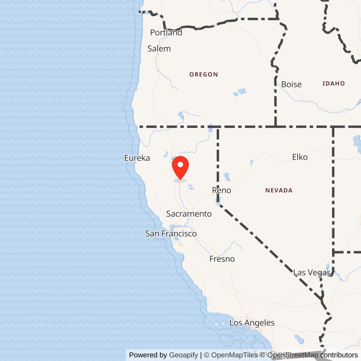
Longitude: -121.92861
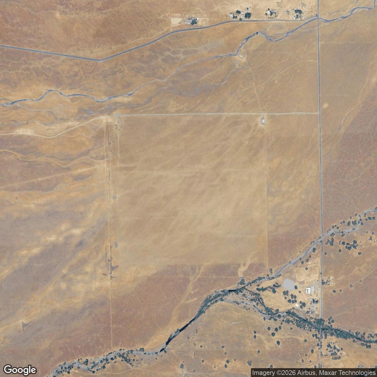
Current Role: Former auxiliary landing-field site; no active airport; rural/open/agricultural land with light visible traces of the former landing pad north of Zimmershed Creek and Pin Creek.
Campbell Auxiliary Field was a World War II Army Air Forces auxiliary landing field built in the northern Sacramento Valley to support Chico Army Air Field. Its alternate military names included Campbell Auxiliary Field No. 4, Chico Auxiliary Field No. 4, and Chico Auxiliary Army Airfield No. 4. Unlike Orland or Vina, it did not survive as a named public or private airport. The appropriate present-day facility name is therefore the former Campbell Auxiliary Field site, an abandoned wartime landing-field location on rural land in Tehama County.
The field sat roughly twelve miles northwest of Chico, close enough to the parent airfield to be useful for student flying but far enough away to remove some training traffic from the main base. That separation was the point. Chico Army Air Field was a flying-school installation, and the pace of wartime instruction required a network of outlying fields where students and instructors could repeat takeoffs, landings, approaches, and emergency procedures without overloading the main runways. Campbell was one of those auxiliary surfaces.
Campbell was never a full Army air base. The public record does not support treating it as a cantonment, depot, air-defense station, bombardment base, or postwar Air Force installation. It was a satellite landing field on about 470 acres of former livestock grazing land. Its central physical feature was a 3,000-by-3,000-foot landing mat. That type of field was intentionally simple. It gave training aircraft a large paved surface and allowed pilots to land into the wind from multiple directions, which was especially useful for student pilots in basic training aircraft.
The field's current status is closed. There is no active airport identifier, no ICAO identifier, and no evidence of a surviving public aviation facility. The site is now open rural or agricultural land with only light visible traces of the former landing pad. The U.S. Army Corps of Engineers Formerly Used Defense Sites inventory identifies Campbell Auxiliary Field No. 4 in Tehama County as a former defense property with hazardous, toxic, or radioactive waste related project categories, confirming that the federal government still recognizes the wartime site as a former military property even though the airfield itself is gone.
Mission and Military Role
Campbell's mission was auxiliary flight training and emergency landing support for Chico Army Air Field. Chico itself opened on April 14, 1942, and closed on December 31, 1945. The Chico Army Air Field collection at California State University, Chico describes the parent installation as a wartime Army flying school five miles north of Chico where more than 5,000 cadets and officers received basic and advanced flight training. Campbell belonged inside that parent system. It was not a separate school with its own independent mission.
The Army Air Forces built auxiliary fields because flight training was traffic-intensive. A student pilot did not become safe or useful after one landing. He needed repeated approaches, pattern work, instructor supervision, emergency drills, crosswind practice, and confidence-building repetition. A single main field could not safely absorb all of that work, especially when dozens or hundreds of students were moving through a training pipeline. Auxiliary landing fields distributed that risk and workload across a broader landscape.
Campbell's square landing mat directly reflected this training problem. A conventional runway fixes aircraft to one or two landing directions. A square mat gave instructors much more flexibility. Aircraft could use the surface in whichever direction best suited the wind, which reduced the crosswind burden on students and made the field useful as an emergency surface for aircraft that could not return to Chico. The design was plain, but it solved an urgent wartime problem.
The field appears to have supported the same kinds of basic flying tasks as the other Chico auxiliaries. Published summaries of the Chico auxiliary network associate those fields with basic trainers such as the Vultee BT-13 and BT-15. Those aircraft were rugged training airplanes, but they still required disciplined landing practice and safe overflow fields. Campbell's military role was therefore practical and repetitive: receive training aircraft from Chico, support landing and takeoff practice, provide a safer recovery option, and return the aircraft and crews to the parent field.
No separate combat unit is documented as being assigned to Campbell itself. Its unit identity flowed through Chico Army Air Field and the Army Air Forces training organization operating there. Chico's parent missions included Army Air Forces flying-school operations and later fighter combat-crew training. Public summaries of Chico's wartime aviation role identify the 10th Base Headquarters and Air Base Squadron and the 433rd Army Air Force Base Unit in the parent-base story. Campbell should be read as part of that training and support network, not as a station that hosted an autonomous tactical unit.
Site Design and Facilities
Campbell's physical plant was simple. The Army acquired approximately 470 acres of livestock grazing pasture in 1942 and built a 3,000-by-3,000-foot landing mat. That is the essential site description. The field did not need the heavy infrastructure of a main air base because Chico supplied the command structure, the scheduling system, the instructional mission, the maintenance backbone, and the student-pilot population.
The landing mat was the installation's principal facility. It gave student pilots a large paved surface and reduced the runway-direction problem. Square or rectangular all-way mats were common solutions at training fields because they allowed operation into the prevailing wind without building multiple long runways. Campbell's mat was sized to the basic-training mission rather than to heavy bombers or large transports.
The surrounding landscape also shaped the site. The field was placed on open grazing land in Tehama County, north of Zimmershed Creek and Pin Creek according to published historical summaries. That kind of land was well suited to a wartime auxiliary field because it offered openness, relatively low surrounding development, and enough space for a square landing mat with safety margins. The same rural quality that made the site useful during the war also made it easy to return to non-military use after disposal.
Campbell's later physical survival appears limited. Some Chico auxiliaries retained their landing mats for decades, and Vina's mat remains exceptionally legible as Deer Creek Ranch Airport. Campbell did not follow that path. Modern references describe only light traces of the former landing pad. The most important physical evidence today is therefore aerial and documentary rather than a maintained aviation facility.
Role in the Wider Military Network
Campbell was part of the Chico Army Air Field auxiliary network. That network was itself one small part of the national Army Air Forces training system created during World War II. The United States did not only need aircraft. It needed trained pilots in enormous numbers, and training those pilots required a web of main fields, auxiliary fields, practice ranges, emergency landing sites, maintenance shops, classrooms, barracks, and instructors.
Chico's role in that system was to train cadets and officers in the northern Sacramento Valley. Campbell helped make that mission possible by adding one more off-site landing surface. The field did not need to be famous or heavily built to matter. Its value was network value. It relieved congestion, reduced risk, and increased the number of aircraft movements the Chico system could safely support.
The Chico auxiliary group had different postwar outcomes. Orland became Haigh Field Airport. Vina became Deer Creek Ranch Airport after periods of civilian and private reuse. Kirkwood served Glenn County as a civilian airport before returning to farmland. Campbell appears to have closed quickly, with the land sold in July 1946 and the site returning to rural use. Those different outcomes illustrate a pattern common to World War II auxiliary fields. Their wartime purpose was standardized, but their postwar lives depended on county needs, ownership, aviation demand, land economics, and the survival of usable pavement.
Campbell also connects to the wider Formerly Used Defense Sites landscape. The USACE FUDS inventory lists Campbell Auxiliary Field No. 4 as a former defense site in Tehama County. That listing does not mean the field remains military property, but it does show that the federal defense-site legacy did not vanish with the sale of the land. Even small auxiliary fields can leave disposal, environmental, or documentation responsibilities that outlast their operational use by many decades.
World War II Activity
Campbell's wartime activity was probably routine by design. Student pilots and instructors from Chico used the field for takeoffs, landings, traffic patterns, and emergency landing practice. The same qualities that make Campbell hard to dramatize are the qualities that made it useful. It was a place where repetition could happen safely away from the parent field.
This kind of auxiliary work was essential to the Army Air Forces training program. A flying school needed to produce pilots quickly, but it could not simply compress training into a crowded main airfield without increasing risk. Student pilots were learning judgment, sight picture, speed control, flare timing, radio discipline, and emergency response. Fields like Campbell gave them room to practice those skills.
The field's routine mission still mattered. Every successfully completed training flight was part of the larger wartime production of airpower. The Army Air Forces' overseas combat capability depended on a domestic training system that could generate pilots at scale. Campbell was one small, local piece of that system.
Closure, Disposal, and Postwar Reuse
Campbell's Army use ended quickly after the wartime training requirement disappeared. Chico Army Air Field closed on December 31, 1945. Campbell's land was sold on July 12, 1946, and the field closed. That disposal date makes Campbell different from some other auxiliary fields that had longer county or private aviation afterlives.
The postwar record does not show Campbell developing into a lasting airport. Unlike Orland, it did not become an enduring public field. Unlike Vina, it does not appear to have retained an active private-airport identity. Published summaries describe the site today as open land with light traces of the former landing pad. The likely reason is simple: once Chico no longer needed the field, and once no strong local civil aviation demand emerged, the economic value of the rural land outweighed the value of maintaining a small former military mat.
Current Status
Campbell Auxiliary Field is closed and abandoned as an airfield. The site has no active FAA airport listing, no ICAO identifier, and no known public access role.
The current land use is rural/open/agricultural. Published summaries state that only light traces of the former landing pad remain. The USACE FUDS inventory identifies Campbell Auxiliary Field No. 4 in Tehama County under the former defense site property number J09CA0775, with two listed project entries. Those entries are categorized as CON/HTRW and HTRW, using the inventory's categories for containerized hazardous, toxic, or radioactive waste and hazardous, toxic, or radioactive waste. That record is important for status purposes because it gives the former auxiliary field a continuing federal environmental-history footprint.
Chronology
- 1942 The Army acquired approximately 470 acres of livestock grazing pasture in Tehama County for Campbell Auxiliary Field No. 4.
- 1942 A 3,000-by-3,000-foot landing mat was built for use as a Chico Army Air Field auxiliary training and emergency landing surface.
- 1942-04-14 Chico Army Air Field, the parent installation, opened north of Chico.
- 1942-1945 Campbell supported Chico Army Air Field as one of its auxiliary landing fields, providing training and emergency landing support for student pilots and other aircraft operating in the area.
- 1945-12-31 Chico Army Air Field closed, removing the parent-base mission that had justified the auxiliary field network.
- 1946-07-12 The Campbell field land was sold, and the airfield closed.
- 2015-09-30 The USACE Formerly Used Defense Sites inventory listed Campbell Auxiliary Field No. 4 in Tehama County as property number J09CA0775, with CON/HTRW and HTRW project entries.
- Present The former field site is closed as an airfield and is now rural/open or agricultural land with only light visible traces of the former landing pad.