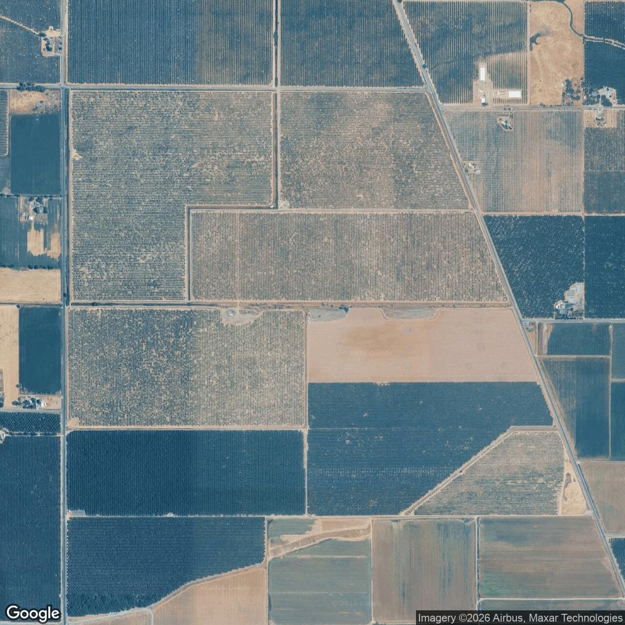
Kirkwood Auxiliary Field / Chico Auxiliary Field No. 2, California
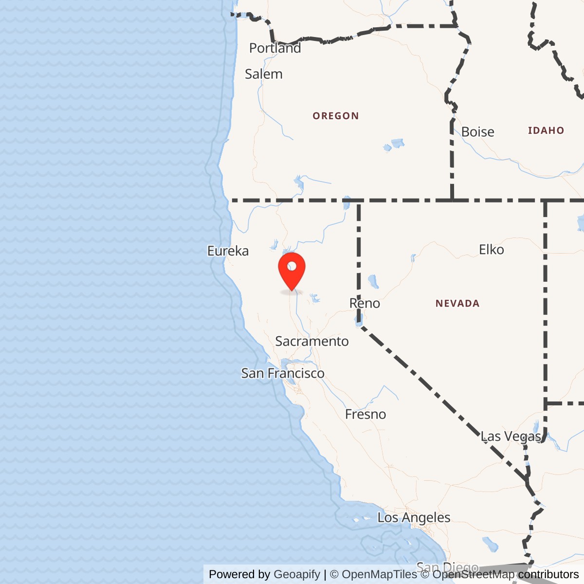
Longitude: -122.13000
Current Role: Agricultural/orchard use; former landing mat removed, with published airfield-history sources noting pavement rubble piles remaining by 1998-2008.
Kirkwood Auxiliary Field was built to solve one of the least visible problems in America's wartime pilot-training system: a primary airfield could not safely absorb every takeoff, landing, emergency, and practice approach generated by a rapidly expanding flying school. The answer was a network of simple outlying fields where cadets could practice away from crowded traffic patterns and where a student in trouble could put an airplane down without trying to reach the main base.
The War Department acquired 359.62 acres of Glenn County farmland on October 8, 1942, and developed the property as Auxiliary Field No. 2 for Chico Army Air Field. The installation appeared under numerous related names, including Kirkwood Auxiliary Field No. 2, Kirkwood Auxiliary Army Airfield No. 2, Chico Auxiliary Field No. 2, Chico Flying School Satellite Field No. A-2, Chico Air Base Auxiliary Field A-2, Chico Basic Flying School Auxiliary Landing Field A-2, Basic Flying School Chico Kirkwood A-2 Satellite Field, Orland Auxiliary Airport No. 2, and Kirkwood Airport.
These names describe one site. Kirkwood was not a separate training base with its own permanent flying school, troop cantonment, fuel farm, maintenance organization, or assigned combat unit. It was a subordinate operating location controlled through Chico Army Air Field and used principally by the Army Air Forces Basic Flying School. Its military identity rested on a large square asphalt landing mat, a very small group of support buildings, access roads, fencing, utilities, and the emergency and training function assigned to it.
The field's unusual physical form distinguished it from a conventional airport. Instead of several narrow runways laid out in fixed directions, Kirkwood had a paved square measuring 3,000 feet on each side. A pilot could select a landing or takeoff direction that best matched the wind, reducing the crosswind problem for inexperienced cadets. The square also gave a distressed aircraft several possible approaches. It was a practical design for intensive basic training, when repetition, student error, changing winds, and emergency landings were expected parts of the system.
Kirkwood's significance therefore does not come from a resident unit or a famous combat sortie. It comes from the training network it supported. Thousands of wartime pilots passed through Chico's flying program, and auxiliary fields such as Kirkwood gave that program the airspace and pavement needed to operate at scale. The field was a small installation with a narrow mission, but that mission was essential to the production of military pilots.
Relationship to Chico Army Air Field
Chico Army Air Field began as a municipal airport north of Chico. The City of Chico leased the property to the War Department in 1941, and the Army expanded it into the Chico Army Flying School. The main base opened in April 1942. Basic flying instruction began during the summer, and the school trained cadets who had already completed primary instruction and were preparing for advanced flying.
The Chico program became part of the Army Air Forces' western training establishment. The field and school instructed more than 5,000 cadets and officers during the war according to the Chico Army Air Field archival collection at California State University, Chico. Basic students generally trained in aircraft such as the Vultee BT-13 Valiant, a heavier and more demanding airplane than the primary trainers they had previously flown.
Basic training required repeated takeoffs, landings, traffic-pattern work, emergency procedures, navigation, instrument familiarization, formation work, and increasingly independent flying. Conducting every exercise at Chico would have congested the main field. Students of different skill levels would have shared the pattern with instructors, administrative aircraft, maintenance test flights, transient traffic, and later fighter-training operations.
Chico therefore depended on a dispersed auxiliary-field system. The numbered fields commonly associated with the school included Orland Auxiliary Field No. 1, Kirkwood No. 2, Vina No. 3, Campbell No. 4, and Oroville No. 5. Other regional fields also supported Chico or related Northern California military aviation at different times.
Each field relieved pressure on the parent base. Cadets could fly a short distance from Chico, enter a less congested pattern, practice landings, and return. Instructors could distribute aircraft among several locations rather than placing an entire class over one runway system. An aircraft with engine trouble, fuel concern, weather difficulty, or student-control problems had additional places to land.
Kirkwood's location west-northwest of Chico placed it across the Sacramento Valley from the parent field. It lay close enough for routine training sorties but far enough to create a separate operating area. The route exposed cadets to navigation over agricultural terrain while keeping them within the school's regional support network.
Acquisition and Construction
The War Department acquired the property by direct purchase on October 8, 1942. The documented 359.62-acre figure represents fee-owned wartime land rather than a later estimate based on the visible pavement. The property consisted of farmland in the Capay and Orland area of Glenn County.
The acquisition date came after Chico Army Flying School had already begun operations. Kirkwood was therefore part of the rapid expansion that followed the school's opening. The Army was building the training system while cadets were already arriving, a pattern repeated across the country during the emergency mobilization.
The principal improvement was the 3,000-by-3,000-foot asphalt landing mat. The square covered more than 200 acres if measured as a complete 9,000,000-square-foot surface, leaving the remainder of the reservation for clear zones, roads, drainage, support structures, fencing, and safety margins.
A square landing mat could be used in many directions. Its corner-to-corner diagonal measured approximately 4,243 feet. This geometry likely explains why later aeronautical charts sometimes described Kirkwood as having a 4,200-foot runway even though Army records identified a 3,000-foot square mat. The later chart figure was not necessarily evidence that Glenn County built a new 4,200-foot runway. It may have represented the maximum usable diagonal distance across the existing square.
War Assets Administration records and later U.S. Army Corps of Engineers research identify a very limited building inventory:
- T-201, Double Gate, wood frame
- T-202, Crash Truck and Crew Shelter, wood frame
- T-203, Stage House, wood frame
- T-204, Latrine, wood frame
The field also had roads, a mesh fence, and utilities. The building list confirms the installation's limited purpose. The double gate controlled access. The crash-truck shelter provided a place for emergency equipment and a small crew. The stage house supported field operations, communications, or local control functions. The latrine served personnel temporarily working at the site.
No evidence was found for permanent fuel tanks, a fueling system, ammunition storage, aircraft-maintenance shops, troop barracks, mess halls, or a full administrative headquarters. Aircraft normally departed Chico with fuel and maintenance support already provided. Kirkwood existed to receive and launch airplanes, not to sustain an independent organization.
The buildings were described as Theater of Operations types, meaning inexpensive, rapidly constructed wood-frame structures intended for temporary wartime service. They would not have offered the comfort or durability of permanent post construction. The field was a working extension of the flying school, not a miniature version of Chico Army Air Field.
Training Mission
Kirkwood had two closely connected military missions: off-site basic-flight training and emergency landing support.
The off-site mission gave cadets a place to practice landing and takeoff techniques away from Chico's primary traffic pattern. Basic students were learning to manage a more powerful aircraft, judge approaches, control airspeed, compensate for wind, recover from mistakes, and make decisions without constant intervention from an instructor.
The square mat was especially valuable for this purpose. Northern Sacramento Valley winds could change during the day. A conventional single runway might force inexperienced pilots to accept a crosswind. At Kirkwood, operations could shift to another side or diagonal of the paved surface.
The site also supported emergency landings by cadets and transient military aircraft. Emergency use was not an incidental benefit. Training aircraft experienced engine failures, mechanical problems, hard landings, navigational errors, fuel concerns, and weather difficulties. Student pilots also made mistakes that could turn a normal flight into an urgent recovery.
A chain of auxiliary fields reduced the distance between safe landing options. The entire system acted as a safety net spread across Northern California. A cadet who could not return to Chico might still reach Kirkwood, Orland, Vina, Campbell, Oroville, Willows, or another military or civil field.
U.S. Army Corps of Engineers records indicated that Kirkwood could support approximately 40 aircraft per day. That figure does not mean 40 airplanes were permanently assigned there. It describes operating capacity, the number of aircraft movements or users the site could accommodate as part of the training schedule.
The Vultee BT-13 Valiant was the aircraft most strongly associated with Kirkwood's basic-training mission. The BT-13 was commonly called the "Vibrator" because of its noise and vibration. It introduced cadets to a heavier airplane with more power, higher landing speed, flaps, a two-position propeller, and more complex systems than most primary trainers.
A BT-13 student had to become comfortable with a more demanding traffic pattern and approach. Repeated practice at an auxiliary field turned procedures into habit. The airplanes that later carried graduates into advanced school, fighter transition, transport assignments, or bomber crews were different, but the discipline of judging an approach and controlling an aircraft near the ground began at places like Kirkwood.
The field could also accept other training, liaison, support, and transient aircraft operating in the region. Its large paved surface and open approaches offered flexibility. No evidence, however, establishes that Kirkwood became a permanent fighter, bomber, transport, or combat-crew base.
Daily Operations
A training day at Kirkwood would have been shaped by activity at Chico. Aircraft and instructors began at the parent field. Flights were scheduled, dispatched, fueled, inspected, and briefed there. Kirkwood received the airplanes as an outlying practice location.
A small field crew could open the site, check the landing surface, monitor conditions, operate communications, maintain access control, and stand by with crash equipment. The crash truck and crew shelter were the most important emergency facilities. If an aircraft ground-looped, caught fire, damaged its landing gear, or left the pavement, the local crew could respond before assistance arrived from Chico or nearby communities.
The stage house likely provided the basic working space needed to coordinate operations. Auxiliary fields often used stage houses for instructors, dispatch functions, records, communications, weather information, or local supervision. The exact use of Kirkwood's T-203 building is not fully described in surviving records, so it should not be called a control tower without qualification.
Students probably flew repeated circuits, landed, taxied or repositioned across the broad mat, and departed for another exercise or the parent base. Because no permanent fuel or maintenance system is documented, an aircraft with a significant mechanical problem might remain temporarily until a maintenance team arrived from Chico.
The absence of barracks and mess facilities indicates that Kirkwood did not host a resident troop population. Personnel working there would have traveled from the parent base or surrounding area. The site's military population changed with the flying schedule and may have been very small when weather or training requirements reduced operations.
Assigned Units and Organizations
No independently assigned permanent military unit has been verified for Kirkwood Auxiliary Field.
The responsible parent organization was the Army Air Forces Basic Flying School at Chico Army Air Field. Chico's training command, base headquarters, flying-training groups, instructors, maintenance personnel, communications specialists, crash crews, engineers, and support organizations made Kirkwood operational.
The 97th Basic Flying Training Group is associated in published Army Air Forces training histories with Chico's BT-13 program. Other base organizations at Chico changed as the installation moved from basic flying to fighter replacement training and later staging work. Those parent-base units should not be presented as permanently stationed at Kirkwood unless a specific record confirms such an assignment.
The field's few local facilities suggest a rotating detachment or duty crew rather than an independent garrison. A crash-truck crew, communications or stage-house personnel, instructors, and maintenance responders may have worked at the site as required.
The War Department owned the property during military use. The War Assets Administration controlled disposal after November 20, 1946. Glenn County then became the postwar airport owner after the June 19, 1947 quitclaim.
The lack of a resident unit is historically important. Auxiliary fields were military installations even when they had no full-time squadron. Their purpose was to distribute the operational load of a larger school.
The 1944 Mission Change
Chico's original basic-flight mission ended in 1944. The parent installation shifted from cadet basic training to fighter replacement and combat-crew training under a different command structure.
That change reduced the need for Kirkwood. Fighter training used different aircraft, speeds, runway requirements, maintenance systems, and tactical areas. Kirkwood's 3,000-foot square mat had been designed for large numbers of basic trainers rather than sustained P-38, P-63, P-51, or jet operations.
Published airfield research notes that Kirkwood was not listed in the 1945 Army Air Forces Airfield Directory. Chico itself was inactive as a basic-training installation by that point, although the parent field continued through other missions before final deactivation at the end of 1945.
Kirkwood may still have served occasional emergency or transient use after basic training ended, but the central reason for its construction had disappeared. The field entered a period of declining military activity before formal disposal.
Role in World War II Kirkwood did not send a unit into combat, manufacture aircraft, or serve as an overseas staging base. Its wartime contribution was embedded in the pilot-production system.
Every cadet needed safe places to practice. A flying school could not graduate large classes if its students spent too much time waiting for runway access or if every emergency required a return to the main base. Auxiliary fields expanded capacity without the cost of building full secondary bases.
Kirkwood supported the Army Air Forces at the point where individual ability was being created. Cadets arrived with primary-flight experience but still needed to master heavier trainers and more advanced procedures. Some eventually flew fighters, bombers, transports, reconnaissance aircraft, or trainers. Others became instructors or staff pilots.
The field's contribution is difficult to measure by unit honors because it was infrastructure rather than a deployable organization. Its value appeared in reduced congestion, increased training repetitions, additional emergency options, and the number of students Chico could move through its program.
Role in the Wider Military Network
Kirkwood belonged to several overlapping systems.
The first was Chico Army Air Field's local auxiliary network. Orland, Kirkwood, Vina, Campbell, and Oroville distributed training across the Sacramento Valley. Each field gave Chico another operating surface and another emergency option.
The second was the Western Flying Training Command system. Primary schools introduced cadets to flight. Basic schools such as Chico advanced them to heavier trainers. Advanced schools prepared them for single-engine or multi-engine assignments. Replacement and transition units then trained pilots for particular combat aircraft and missions.
The third was Northern California's broader military aviation network. Hamilton Field, Mather Field, Sacramento-area installations, Redding, Willows, Siskiyou County, and numerous civil airports supported training, air defense, ferrying, maintenance, and emergency operations. Aircraft could move among these fields depending on mission and need.
Kirkwood was near the bottom of this hierarchy in size, but it was not outside the system. A small auxiliary field existed because the larger bases needed it. Its simplicity was deliberate. The Army invested in pavement and minimum support rather than duplicating facilities already available at Chico.
The square-mat design also linked Kirkwood to a recognizable wartime training-field type. Similar all-direction landing mats appeared at nearby Chico auxiliaries. Together they formed a physical signature of the Army Air Forces' rapid training expansion.
Transfer to the War Assets Administration
On November 20, 1946, control of the 359.62-acre site transferred to the War Assets Administration.
The WAA had been created to dispose of enormous quantities of federal property left after World War II. Airfields presented a special challenge. Some were valuable public assets. Others were too small, remote, or specialized for long-term commercial use. Many had been built on agricultural land that local governments or former owners wanted returned to production.
Kirkwood had several qualities that favored civilian airport reuse. It already had a large paved surface, open approaches, road access, and no large military cantonment requiring demolition. Glenn County could operate it without maintaining an entire former air base.
The absence of fuel, maintenance, housing, and major terminal facilities was also a weakness. A civilian operator would have to add services if the airport were to attract substantial traffic. Kirkwood was usable, but it was austere.
Glenn County Airport Era
The War Assets Administration quitclaimed Kirkwood to Glenn County on June 19, 1947.
A U.S. Geological Survey aerial photograph dated July 10, 1947 provides the earliest published image located by later airfield researchers. It shows the square paved mat and a small building along the east side. The image captures the site at the transition between military ownership and county operation.
The field did not appear on some earlier aeronautical charts, even during military use. Its absence may reflect restricted military status, incomplete charting, rapid wartime changes, or its subordinate role. The earliest located civil chart depiction appeared on the September 1949 Sacramento Sectional Chart.
That chart identified Kirkwood Airport with a 3,000-foot paved runway. The 1950 U.S. Geological Survey map labeled the property Orland Auxiliary Airport No. 2 and depicted the square outline. The 1954 Sacramento Sectional continued to describe a 3,000-foot hard-surface runway.
The county airport preserved the military field's physical form. Instead of replacing the square with a conventional runway immediately, civilian aviation used the existing pavement. The field could support local private flying, agricultural activity, emergency use, and other general aviation, although the surviving published record does not establish a large commercial or scheduled airline operation.
The name varied after transfer. Kirkwood Airport became the most common civil name, while Orland Auxiliary Airport No. 2 survived on government maps. The latter name preserved the field's wartime relationship to the Orland area even though it had been Chico Auxiliary Field No. 2.
By 1967, the Sacramento Sectional Chart depicted Kirkwood's square runway arrangement and described the usable length as 4,200 feet. As noted earlier, that length closely matches the diagonal across a 3,000-foot square. The chart may therefore have measured the longest possible paved landing path rather than a newly constructed linear runway.
Closure
Glenn County operated Kirkwood as an airfield until approximately 1970.
The exact reason for closure has not been established. Several practical factors may have contributed, including limited traffic, the cost of maintenance, lack of full airport services, competition from Haigh Field and Willows-Glenn County Airport, agricultural land value, and the aging square pavement.
Kirkwood was depicted as abandoned on the 1970 San Francisco Sectional Chart. A 1971 U.S. Geological Survey map still labeled the site Kirkwood Airport, showing how map names often remained after aviation activity ended.
A pilot who flew from nearby Haigh Field in 1971 and 1972 later recalled seeing the large pad without realizing it had been an active airport only a few years earlier. His memory captures the speed with which a functioning field could become an unexplained square of pavement in farmland.
The 1985 Sacramento Sectional still depicted Kirkwood as an abandoned airfield. By the 1990 chart, it had disappeared completely, no longer shown even as an abandoned landing site. The 1991 U.S. Geological Survey map nevertheless continued to depict the square landing mat and label Kirkwood Airport.
Removal of the Landing Mat
At some point after the airport closed, the asphalt landing mat was demolished and the property returned to cultivation.
Removing a 3,000-foot square mat was a major undertaking. The surface covered millions of square feet. Rather than hauling every piece far away, the demolished pavement was placed in three piles on the property according to U.S. Army Corps of Engineers records.
A 1998 U.S. Geological Survey aerial photograph showed the mat completely removed and the site reused for farming. Later airfield researchers identified three shapes along the south side of the road as the reported pavement piles.
In 2008, aviation historian Dann Shively photographed two of the three piles amid orchards. He noted that at least one appeared to be diminishing and that trash had accumulated around another. The images gave Kirkwood an unusual archaeological signature. The airport had disappeared as a surface, but much of the asphalt apparently remained on-site in concentrated mounds.
Most abandoned airfields leave runway scars, foundations, road alignments, or hangars. Kirkwood's most visible published remnants were piles made from the runway itself.
Current Status
Kirkwood is closed as both a military and civilian airfield. No active airport remains at the site.
The former reservation returned principally to agricultural and orchard use. Published aerial and ground observations from 1998 through 2008 showed the landing mat removed. The exact visibility of the reported rubble piles may continue to change as land is cultivated and materials are moved.
The pavement piles, if still present, are artifacts of both construction and demolition. Asphalt was brought to the site to create a wartime training surface, used for almost three decades of military and civilian aviation, broken apart, and left in the agricultural landscape.
Chronology
- 1941-09-11 The City of Chico leased the municipal-airport property to the War Department for expansion into a military flying school.
- 1942-04 Chico Army Flying School opened north of Chico.
- 1942-07 Basic flying instruction began at Chico during the summer of 1942.
- 1942-10-08 The War Department acquired 359.62 acres of Glenn County farmland by direct purchase for Kirkwood Auxiliary Field No. 2.
- 1942-1943 The Army constructed a 3,000-by-3,000-foot asphalt landing mat, roads, fencing, utilities, and a small group of wood-frame support buildings.
- 1942-1944 Kirkwood supported the Chico Army Air Field basic-flying program, principally as an off-site landing-practice and emergency field for cadets flying BT-13 trainers.
- 1944 Basic pilot training ended at Chico, reducing Kirkwood's principal military use.
- 1945 Kirkwood was no longer listed in the Army Air Forces Airfield Directory reviewed by later aviation historians.
- 1945-12-31 Chico Army Air Field completed its wartime operating period and was deactivated.
- 1946-11-20 Control of Kirkwood's 359.62 acres transferred to the War Assets Administration.
- 1947-06-19 The War Assets Administration quitclaimed the site to Glenn County.
- 1947-07-10 A U.S. Geological Survey aerial photograph showed the intact square landing mat and a small building on the east side.
- 1949-09 The earliest located civil aeronautical-chart depiction identified Kirkwood Airport with a 3,000-foot paved runway.
- 1950 A U.S. Geological Survey map labeled the site Orland Auxiliary Airport No. 2 and depicted the square landing area.
- 1954 The Sacramento Sectional Chart described Kirkwood as an active airport with a 3,000-foot hard-surface runway.
- 1967 The Sacramento Sectional depicted the unusual square layout and listed a 4,200-foot usable length, approximately the diagonal distance across the original 3,000-foot square mat.
- 1968 A U.S. Geological Survey map continued to label the property Orland Auxiliary Airport No. 2.
- 1967-1970 Kirkwood Airport ceased operations during this period.
- 1970 The San Francisco Sectional Chart depicted Kirkwood as an abandoned airfield.
- 1971 A U.S. Geological Survey map still labeled the property Kirkwood Airport.
- 1985 The Sacramento Sectional continued to show Kirkwood as abandoned.
- 1990 Kirkwood was no longer depicted on the Sacramento Sectional Chart, even as an abandoned field.
- 1991 A U.S. Geological Survey map still showed the square landing mat and Kirkwood Airport label.
- 1998 A U.S. Geological Survey aerial photograph showed the landing mat removed and the land returned to farming; three reported piles of pavement rubble remained visible.
- 2008 Ground photographs documented at least two piles of former landing-mat pavement among the orchards.
- 2016 The California Military Department historical site summary continued to identify the property as a former 359.62-acre Army auxiliary field returned to cultivation.
- Present The former Kirkwood Auxiliary Field is closed, the paved landing mat has been removed, and the property is used principally for agriculture and orchards.